Items Similar to Pair of Prints Depicting Antique World Maps Framed in Burl Wood


Want more images or videos?
Request additional images or videos from the seller
1 of 9
Pair of Prints Depicting Antique World Maps Framed in Burl Wood
About the Item
A pair of prints depicting antique world maps framed in burl wood. One picture contains a depiction of Africa, Europe, and Oceania. The other picture is of North and South America. Touches of paint have been used to add some interest and artistic flare. Colorful floral flourishes have been printed on the outer sections to frame the globe. The outer matte is in a navy blue with a crackle effect. The outer frame is burl wood with a light reddish-brown stain. Some hints of golden yellow and light yellow ocre sit inner mat and the trim of the outer frame.
This was based on the second edition of Hondius' world map, which was initially released in 1630 as part of the revisions made to the Mercator-Hondius Atlas It was developed in response to the rivalry with Blaeu. The fundamental cartographic design of this map was made with John Speed's world map in mind.
Below the frame a phrase is included that reads: “Nova totivis terrarvm orbis geographica ac hy” The phrase is cut off at hy. This phrase roughly translates to The new geographical terrarvm of the world. The second image has the phrase “Geographica hydrographica Tabvla” (translates to Geographical hydrographic Tabla” with a smaller phrase “Auct Henr Hondio.” These phrases come from the originally sourced maps.
In good condition. Gentle wear consistent with age and use.
These fascinating pieces would make a great conversation starter in any office space or home study.
Measurements:
Width: 32.5" / 82.55 cm
Depth: 1" / 2.54 cm
Height: 32.75" / 83.185 cm
- Dimensions:Height: 32.75 in (83.19 cm)Width: 32.5 in (82.55 cm)Depth: 1 in (2.54 cm)
- Materials and Techniques:
- Place of Origin:
- Period:
- Date of Manufacture:UNKNOWN
- Condition:Wear consistent with age and use.
- Seller Location:Dallas, TX
- Reference Number:1stDibs: LU1977338752842
About the Seller
5.0
Vetted Professional Seller
Every seller passes strict standards for authenticity and reliability
1stDibs seller since 2016
42 sales on 1stDibs
Typical response time: 1 to 2 days
- ShippingRetrieving quote...Shipping from: Dallas, TX
- Return Policy
Authenticity Guarantee
In the unlikely event there’s an issue with an item’s authenticity, contact us within 1 year for a full refund. DetailsMoney-Back Guarantee
If your item is not as described, is damaged in transit, or does not arrive, contact us within 7 days for a full refund. Details24-Hour Cancellation
You have a 24-hour grace period in which to reconsider your purchase, with no questions asked.Vetted Professional Sellers
Our world-class sellers must adhere to strict standards for service and quality, maintaining the integrity of our listings.Price-Match Guarantee
If you find that a seller listed the same item for a lower price elsewhere, we’ll match it.Trusted Global Delivery
Our best-in-class carrier network provides specialized shipping options worldwide, including custom delivery.More From This Seller
View AllFramed "Hearts" lithograph print by artist Jim Dine
By Jim Dine
Located in Dallas, TX
A mesmerizing abstract by artist Jim Dine from 1970 that incorporates elements of pop art and abstract expressionism. Offset lithograph on metallic paper. “Hearts'' shows off a patt...
Category
Mid-20th Century American Prints
Materials
Paint, Paper
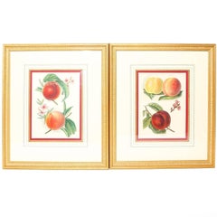
Pair of 19th Century Belgian Botanical Lithographs
Located in Dallas, TX
A pair of framed prints of 19th century lithographs, Belgium, circa 1870. The two prints depict five different peaches; the first Alexander and R...
Category
Antique Late 19th Century Belgian Prints
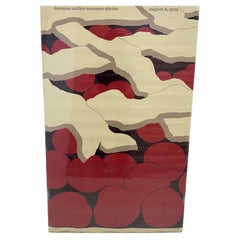
"Miller Summer Picnic August 8, 1975” Screen Print by Artist Stephen Frykholm
Located in Dallas, TX
An entertaining, vibrant, and large Herman Miller screen print by artist Steve Frykholm. Screen printed with lacquer ink with a lacquer finish.” This individual print is of a detailed frame of a pop art style cherry pie that reads “Herman Miller Summer Picnic August 8, 1975.”
Frykholm was at one point acting as the vice president of creative design at Herman Miller. In 1970 he created a series of graphic posters referred to as ‘The Picnic Posters...
Category
20th Century American Prints
Materials
Lacquer
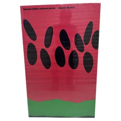
"Herman Miller Summer Picnic August 20, 1971" Lacquer Screen Print by Frykholm
Located in Dallas, TX
An entertaining, vibrant, and large Herman Miller screen print by artist Steve Frykholm. Screen printed with lacquer ink with a lacquer finish. Th...
Category
Vintage 1970s American Prints
Materials
Lacquer, Paper
Pair of Antique 19th Century Chinese Fretted and Carved Wood Screen Panels
Located in Dallas, TX
A handsome pair of fretted and carved wood Screen panels. Screens like these were often made as window decoration in Buddhist temples. They are traditionally handcrafted and structur...
Category
Antique 19th Century Paintings and Screens
Materials
Wood

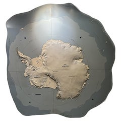
Topographic Three-Dimensional Relief Map of Antarctica
Located in Dallas, TX
An amazing topographic wall mounted three-dimensional map of Antarctica. Midcentury. This incredible map shows off elevation, ice shelves, and scale of the continent. Some texts show...
Category
20th Century Wall-mounted Sculptures
Materials
Plaster, Wood
You May Also Like
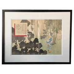
Antique Japanese Framed Woodblock Print Depicting a Woman in the Woods
Located in Yonkers, NY
An antique Japanese woodblock print from the 19th century depicting a woman in the woods. Created in Japan during the 19th century, this woodblock print showcases an outdoor scene de...
Category
Antique 19th Century Japanese Prints
Materials
Glass, Paint, Paper
Antique Map of the World in two sheets, 1852
Located in Langweer, NL
Antique map titled 'The World on Mercator's Projection'. Two individual sheets of the world. This map originates from 'Lowry's table Atlas constructed and engraved from the most rece...
Category
Antique Mid-19th Century Maps
Materials
Paper

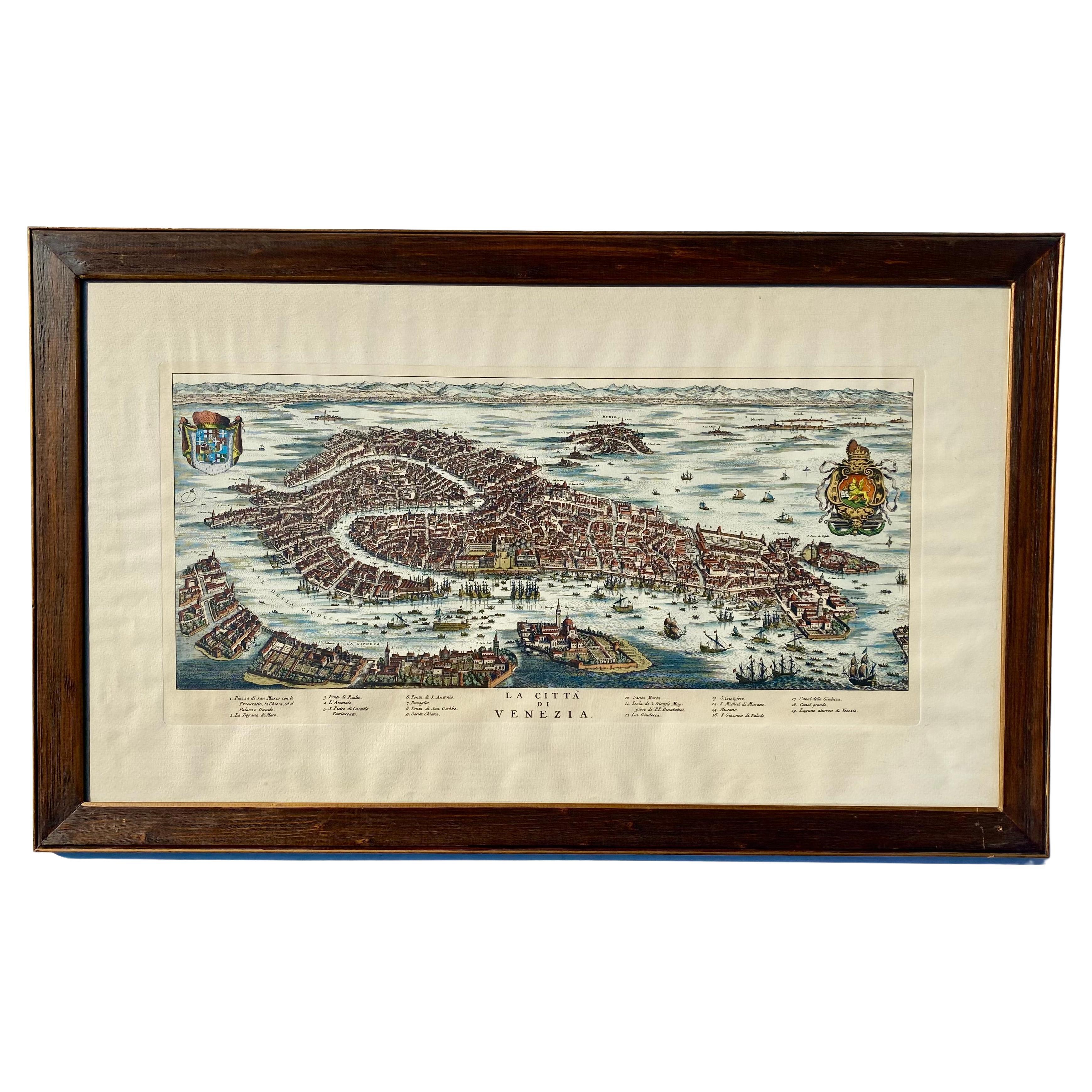
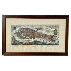
Vintage Italian Print Map of Venice in Freijo Wood Frame with Rosettes
Located in Miami, FL
Vintage Italian Print Map of Venice in Freijo Wood Frame with Rosettes
Offered for sale is a print of the Venetian map of 16th-century Venice. ...
Category
20th Century Prints
Materials
Wood, Paper
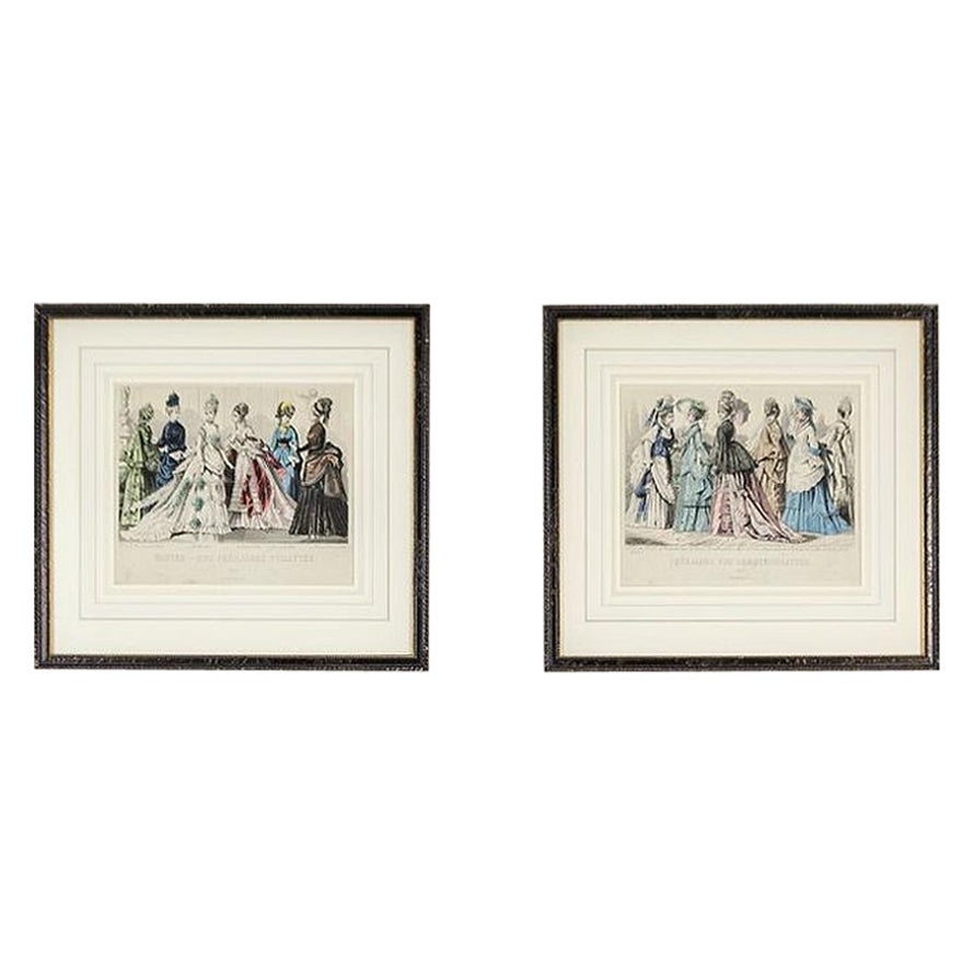
Two Prints Depicting Late-19th Century Fashion Framed in Wood
Located in Opole, PL
Two Prints Depicting Late-19th Century Fashion Framed in Wood
We present you these two German prints depicting the 19th-century women’s fashion for different seasons.
The prints hav...
Category
Antique Late 19th Century European Prints
Materials
Wood, Paper
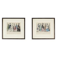
$362 Sale Price / set
20% Off
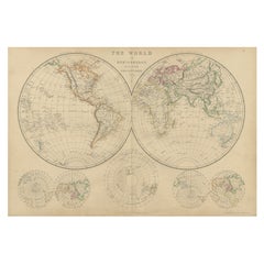
Antique Map of the World in Hemispheres by Johnson, '1872'
Located in Langweer, NL
Antique map titled 'Johnson's Globular World. Original world map depicting the Eastern Hemisphere and the Western Hemisphere. This map originates fr...
Category
Antique Late 19th Century Maps
Materials
Paper

$406 Sale Price
30% Off
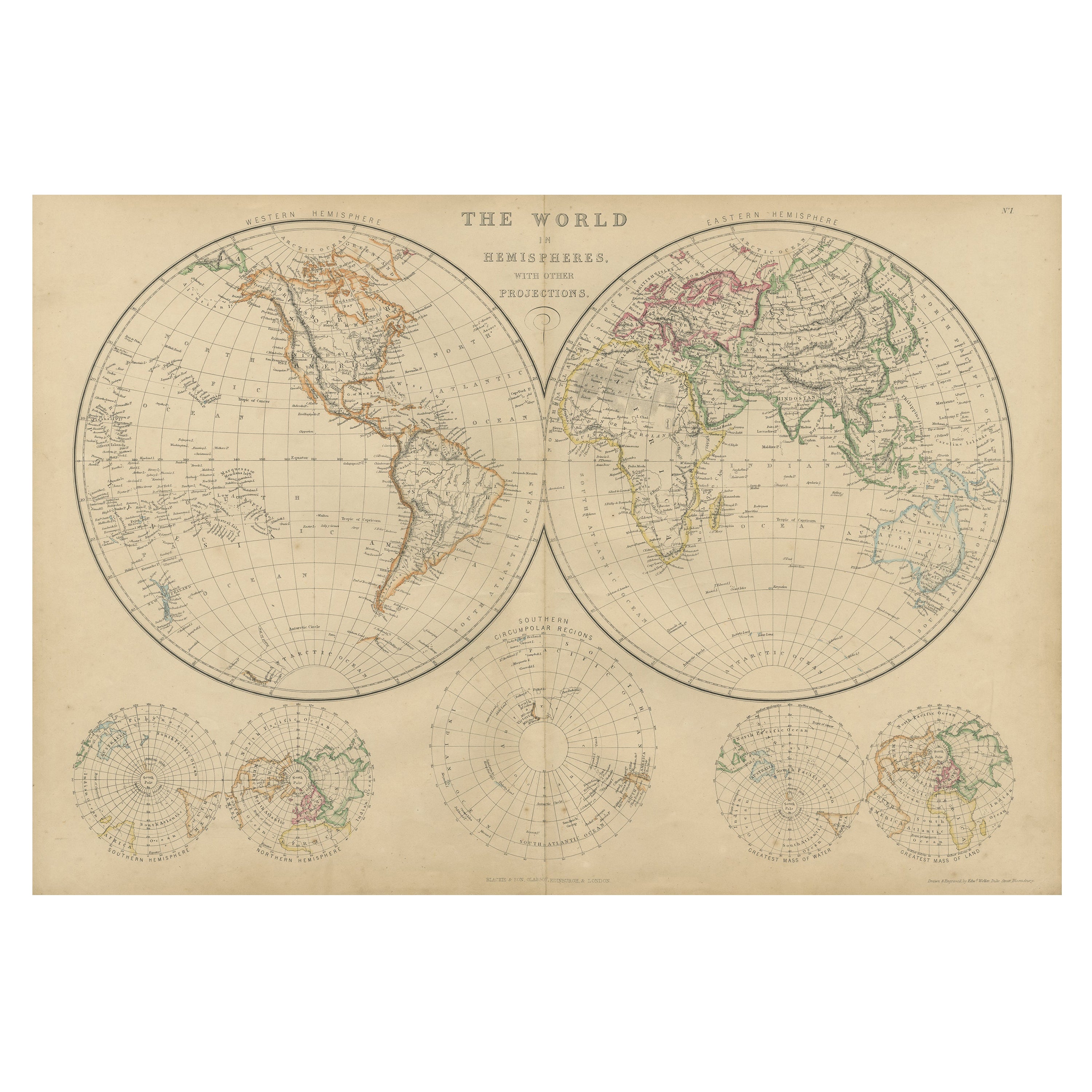
Antique Map of The World in Hemispheres by W. G. Blackie, 1859
Located in Langweer, NL
Antique map titled 'The World in Hemispheres with other projections'. Original antique map of The World. This map originates from ‘The Imperial Atlas of Modern Geography’. Published ...
Category
Antique Mid-19th Century Maps
Materials
Paper
$283 Sale Price
30% Off