Items Similar to The NOLLI MAP of ROME of 1748 in FACSIMILE Custom Framed

Want more images or videos?
Request additional images or videos from the seller
1 of 17
The NOLLI MAP of ROME of 1748 in FACSIMILE Custom Framed
About the Item
This is a representation of NOLLI MAP of ROME of 1748 in FACSIMILE in 12 sheets, custom framed. Additionally there are 2 small maps, custom framed. The composite is an exact facsimile of the suite as published by Giambattista Nolli in 1748. Printed in line-offset at Morgan Press on archival acid-free 65 lb. Mohawk cover paper with a sheet size of 32" x 22". The entire series has been handsomely framed to create a stunning and unique presentation of wall art. See framed prints in situ in secondary pictures.
- Dimensions:Height: 17.5 in (44.45 cm)Width: 28 in (71.12 cm)Depth: 1 in (2.54 cm)
- Style:Other (In the Style Of)
- Materials and Techniques:
- Place of Origin:
- Period:
- Date of Manufacture:20th Century
- Condition:Wear consistent with age and use. The two smaller maps are custom framed and measure 1” D; 34”W; 25.5”H.
- Seller Location:WEST PALM BEACH, FL
- Reference Number:1stDibs: LU2204340313082
About the Seller
5.0
Vetted Professional Seller
Every seller passes strict standards for authenticity and reliability
Established in 1883
1stDibs seller since 2016
250 sales on 1stDibs
Typical response time: <1 hour
- ShippingRetrieving quote...Shipping from: WEST PALM BEACH, FL
- Return Policy
Authenticity Guarantee
In the unlikely event there’s an issue with an item’s authenticity, contact us within 1 year for a full refund. DetailsMoney-Back Guarantee
If your item is not as described, is damaged in transit, or does not arrive, contact us within 7 days for a full refund. Details24-Hour Cancellation
You have a 24-hour grace period in which to reconsider your purchase, with no questions asked.Vetted Professional Sellers
Our world-class sellers must adhere to strict standards for service and quality, maintaining the integrity of our listings.Price-Match Guarantee
If you find that a seller listed the same item for a lower price elsewhere, we’ll match it.Trusted Global Delivery
Our best-in-class carrier network provides specialized shipping options worldwide, including custom delivery.More From This Seller
View AllNorman Rockwell Limited Edition Collotype 'Saturday People'
By Norman Rockwell
Located in WEST PALM BEACH, FL
Limited edition and certified collotype of 'Saturday People' by Norman Rockwell. Signed in pencil by Rockwell and numbered 82 of 100.
Category
Vintage 1960s American Other Prints
Materials
Paper
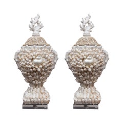
Pair of Custom Shell-Encrusted Lamps
Located in WEST PALM BEACH, FL
This is a stunning pair of custom lamps heavily encrusted with a variety of shells, situated on a brass base.
11" diameter, 24" high to top of socket
Category
2010s American Other Table Lamps
Materials
Shell

$3,800 / set
Pair of Large Custom Architectural Painted Obelisks
Located in WEST PALM BEACH, FL
This is a pair of large custom-painted architectural obelisks, situated on a double-step plinth raised on ball feet.,
Category
Vintage 1960s Italian Other Obelisks
Materials
Wood
Pair of Custom Shell-Encrusted Porcelain Lidded Urns
Located in WEST PALM BEACH, FL
This is a lovely pair of porcelain lidded urns, encrusted overall with a variety of organic shells, situated on a detached lucite base.
Category
Late 20th Century American Other Urns
Materials
Shell, Porcelain
Custom Hanging Wall Bracket / Console
Located in WEST PALM BEACH, FL
This is one of a set of four hand carved hanging consoles, lightly white-washed to highlight carved details of fruit and ornamental features. The top of each console has an etched mirrored-inset top containing a gilded central ornamental design, supported by large carved brackets...
Category
Vintage 1980s Italian Other Console Tables
Materials
Wood, Mirror
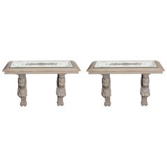
$2,650 / item
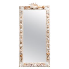
Custom Organic Shell-Encrusted Mirror
Located in WEST PALM BEACH, FL
This is a lovely organic shell-encrusted wall mirror with a scorpion spider conch shell prominently displayed on the top center of the frame. The remainder of the frame features str...
Category
20th Century American Other Wall Mirrors
Materials
Shell
You May Also Like
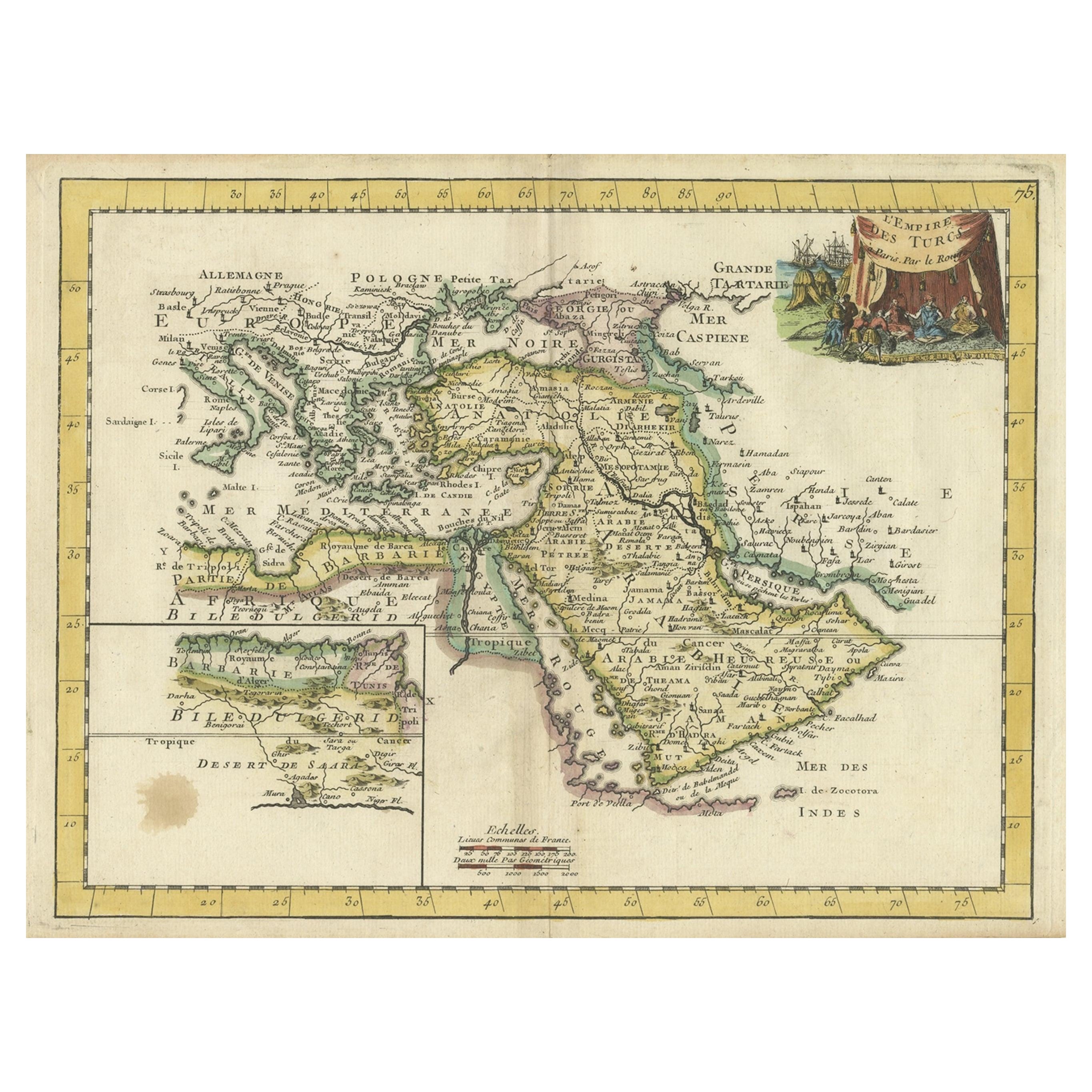
Orginal Antique Handcolored Map of the Turkish Empire, 1748
Located in Langweer, NL
Antique map titled 'L'Empire des Turcs'. Old map of the Turkish Empire with an inset of the North African regions. Originates from 'Atlas Nouveau Portatif' by G.L. le Rouge.
Artis...
Category
Antique 18th Century Maps
Materials
Paper
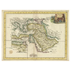
$332 Sale Price
35% Off
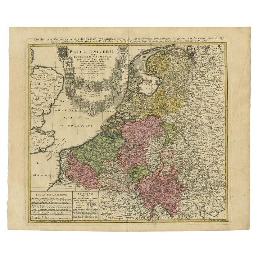
Antique Map of the Seventeen Provinces by Homann Heirs, 1748
By Homann Heirs
Located in Langweer, NL
Antique map titled 'Belgii Universi seu Inferioris Germaniae quam XVII Provinciae (..)'. Map of the Seventeen Provinces after Tobias Meier, published by Homann's Heirs in 1748. The S...
Category
Antique 18th Century Maps
Materials
Paper

Antique Map of the Seventeen Provinces of Netherlands, Belgium, Luxembourg, 1748
By Homann Heirs
Located in Langweer, NL
Antique map titled 'Belgii Universi seu Inferioris Germaniae quam XVII Provinciae (..)'.
Map of the Seventeen Provinces after Tobias Meier, published by Homann's Heirs in 1748. The...
Category
Antique 18th Century Maps
Materials
Paper

$426 Sale Price
20% Off
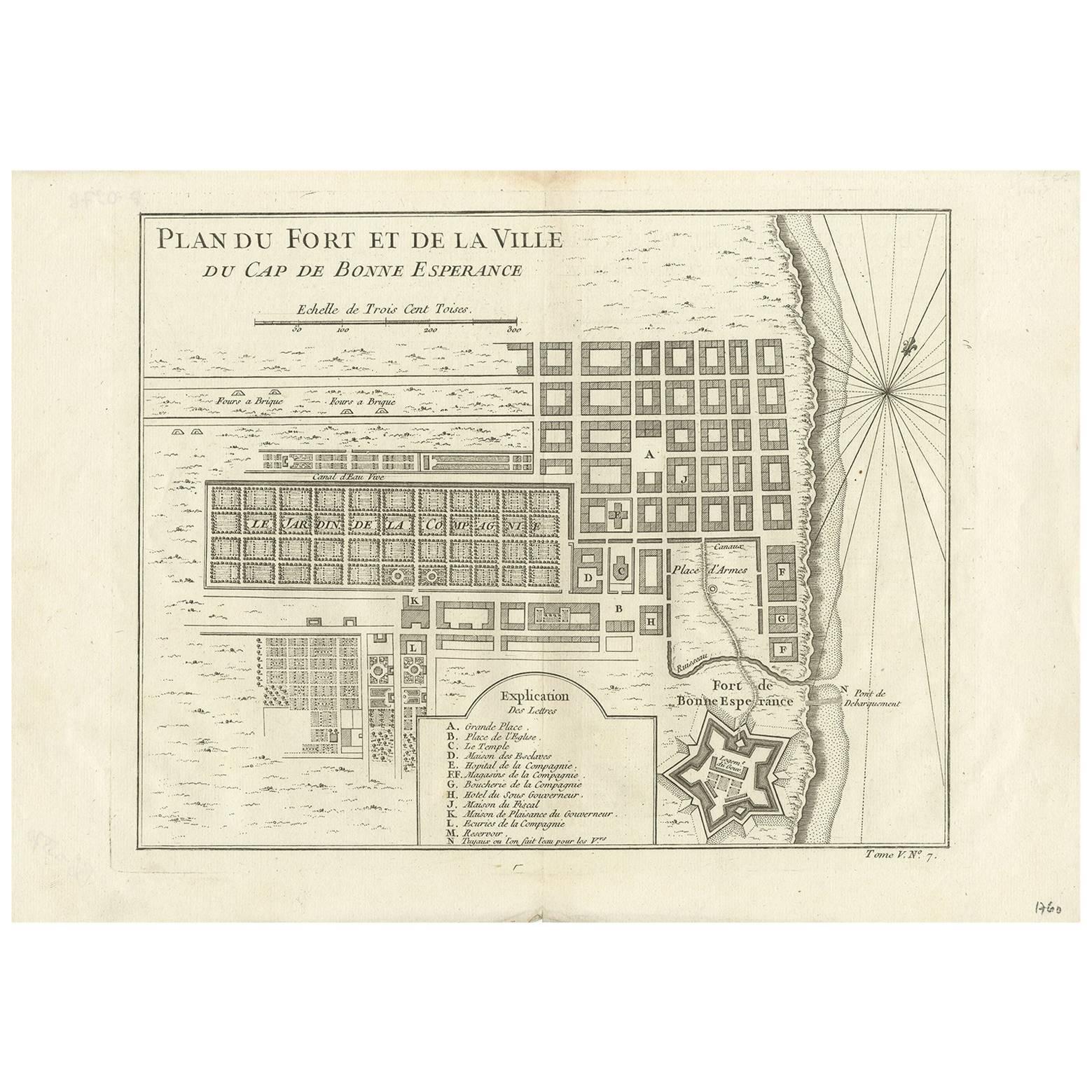
Antique Map of the Cape of Good Hope by J.N. Bellin, 1748
Located in Langweer, NL
Early plan of the Cape of Good Hope, includng a town plan and illustrations of the fortificatons. This map originates from Tome V of Abbe Prevost's Histoire generale du voyages.
Category
Antique Mid-18th Century Maps
Materials
Paper
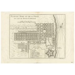
$290 Sale Price
27% Off
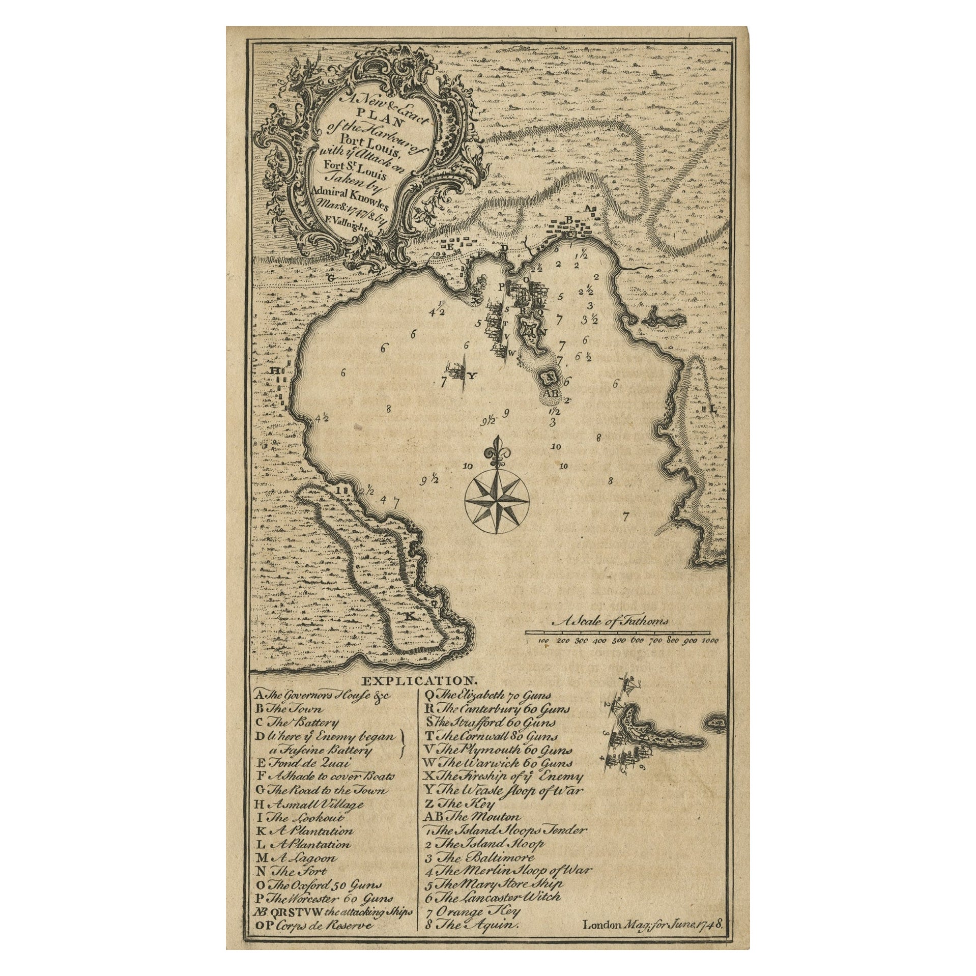
Rare Map of St. Louis on the Island of Hispaniola 'Santa Domingo', 1748
Located in Langweer, NL
Description: Antique map titled 'A New & Exact Planof the Harbour of Port Louis (..)'.
Scarce early plan of the Harbor of St. Louis on the Island of Hispaniola (Santa Domingo), showing the the harbor at the time it was taken by Admiral Knowles in March 1748. Charles Knowles (1704 – 1777) was an officer of the Royal Navy, who saw service during the War of Jenkins' Ear, the War of the Austrian Succession, and the Seven Years War. He also briefly served with the Imperial Russian Navy...
Category
Antique 1740s Maps
Materials
Paper
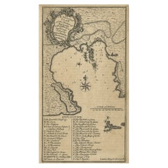
$325 Sale Price
20% Off
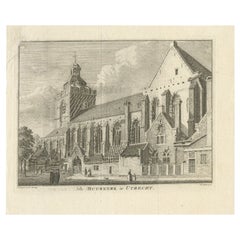
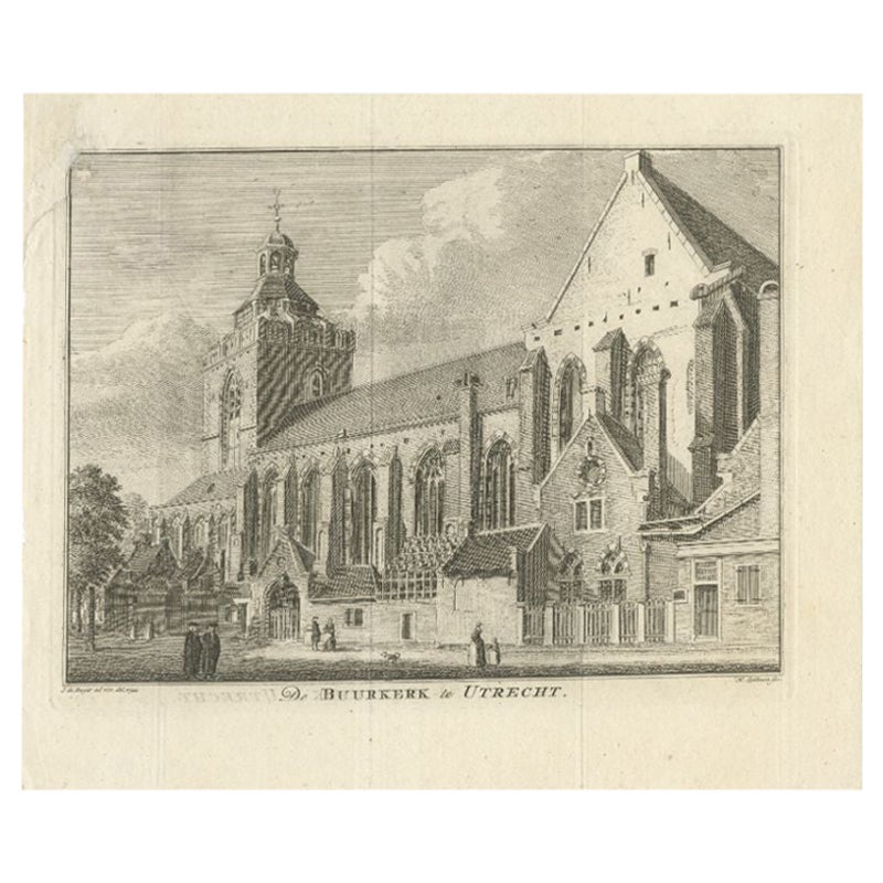
Antique Print of the Buurkerk in Utrecht, the Netherlands, circa 1748
Located in Langweer, NL
Antique print titled 'De Buurkerk te Utrecht. Original antique print of the Buurkerk in Utrecht, the Netherlands. Published c.1748.
Artists and Engravers: Engraved by H. Spilman a...
Category
Antique 18th Century Prints
Materials
Paper