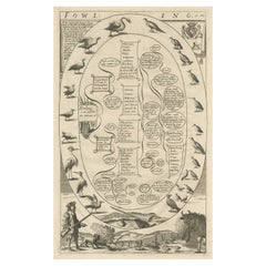
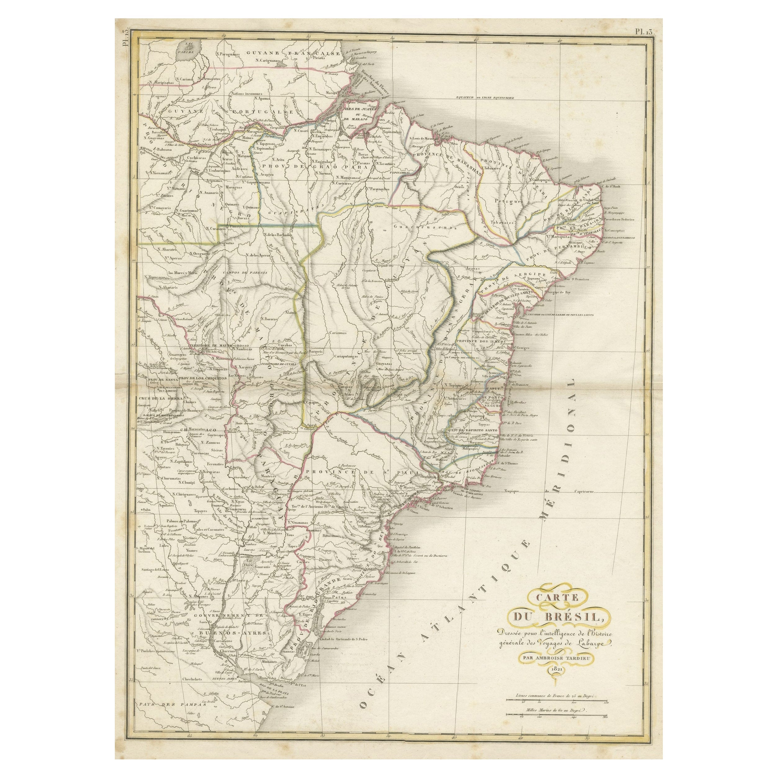
Guide to Fowling, The Art of Catching Birds for Meat & Feathers for Profit, 1686
View Similar Items
Want more images or videos?
Request additional images or videos from the seller
1 of 5
Guide to Fowling, The Art of Catching Birds for Meat & Feathers for Profit, 1686
About the Item
- Dimensions:Height: 16.54 in (42 cm)Width: 10.24 in (26 cm)Depth: 0 in (0.02 mm)
- Materials and Techniques:
- Period:1680-1689
- Date of Manufacture:1686
- Condition:Wear consistent with age and use. Condition: Very good, minor wear. Please study image carefully.
- Seller Location:Langweer, NL
- Reference Number:Seller: BG-10555 1stDibs: LU3054326838132
About the Seller
5.0
Recognized Seller
These prestigious sellers are industry leaders and represent the highest echelon for item quality and design.
Platinum Seller
Premium sellers with a 4.7+ rating and 24-hour response times
Established in 2009
1stDibs seller since 2017
2,417 sales on 1stDibs
Authenticity Guarantee
In the unlikely event there’s an issue with an item’s authenticity, contact us within 1 year for a full refund. DetailsMoney-Back Guarantee
If your item is not as described, is damaged in transit, or does not arrive, contact us within 7 days for a full refund. Details24-Hour Cancellation
You have a 24-hour grace period in which to reconsider your purchase, with no questions asked.Vetted Professional Sellers
Our world-class sellers must adhere to strict standards for service and quality, maintaining the integrity of our listings.Price-Match Guarantee
If you find that a seller listed the same item for a lower price elsewhere, we’ll match it.Trusted Global Delivery
Our best-in-class carrier network provides specialized shipping options worldwide, including custom delivery.More From This Seller
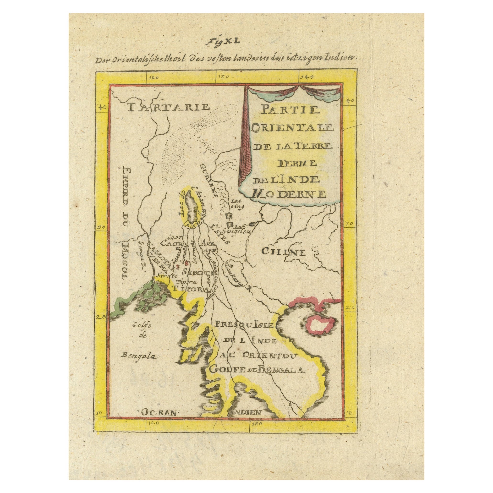
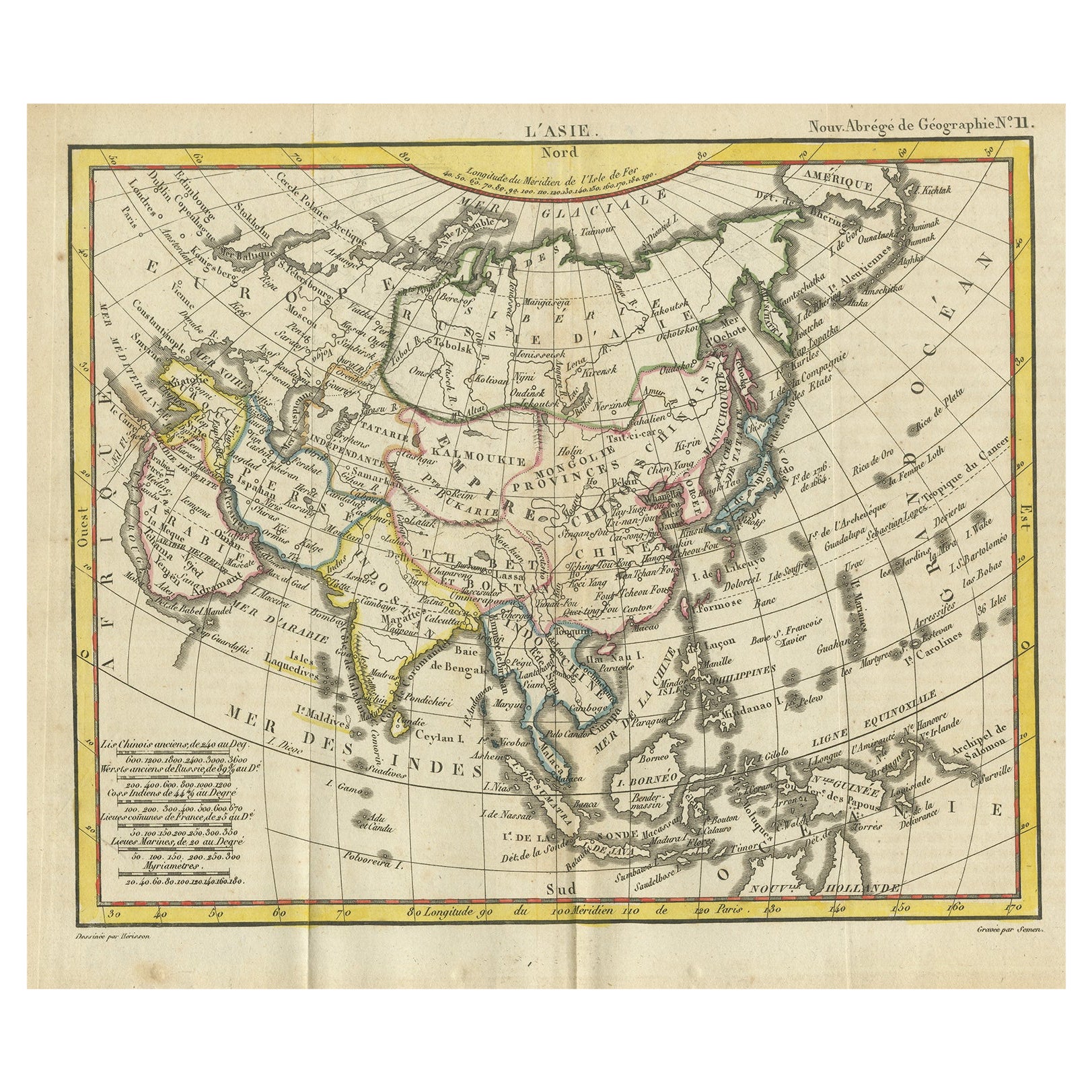
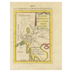
View AllAntique Map of India and the Gulf of Bengal by Mallet, c.1686
Located in Langweer, NL
Antique map titled ?Partie Orientale de la Terre Ferme de l'Inde Moderne. Small map of India and the Gulf of Bengal. This map originates from a German edition of 'Description de l' Univers'.
Artists and Engravers: Alain Manesson Mallet (1630-1706) was a French cartographer and engineer. He started his career as a soldier in the army of Louis XIV, became a Sergeant-Major in the artillery and an Inspector of Fortifications. He also served under the King of Portugal, before returning to France, and his appointment to the court of Louis XIV. His military engineering and mathematical background led to his position teaching mathematics at court. His 'Description de L'Universe' contains a wide variety of information, including star maps...
Category
Antique 17th Century Maps
Materials
Paper
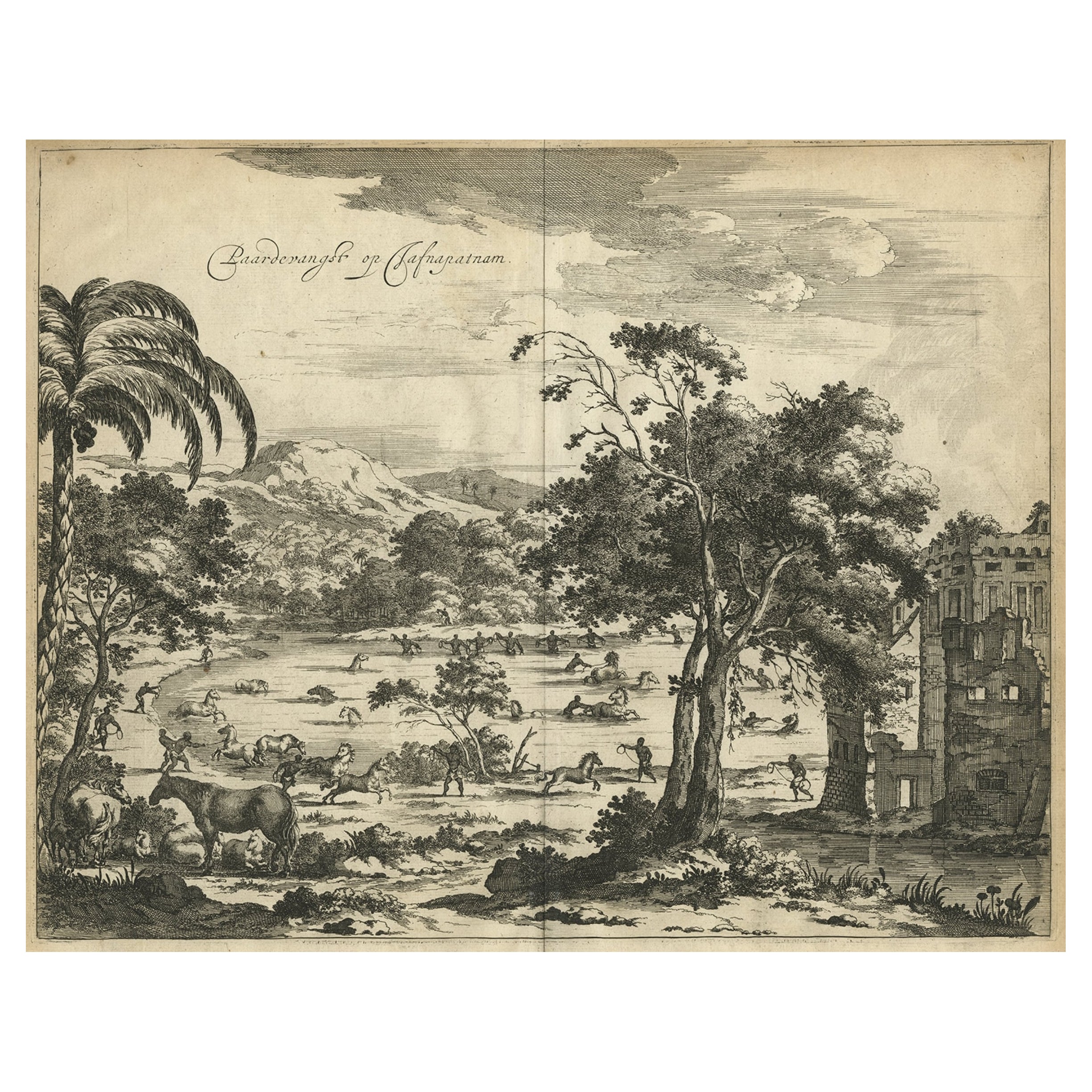
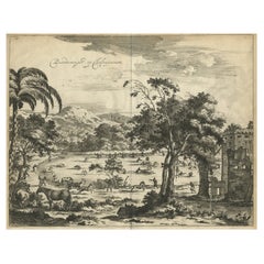
Old Engraving of The Catching of Horses on Jafnapatnam, Ceylon 'Sri Lanka', 1672
Located in Langweer, NL
Antique print, titled: 'Paardevangst op Jafnapatnam' - This plate shows the catching of horses on Jafnapatnam. The province of Jaffna , and specially the fort at Jaffnapatnam were th...
Category
Antique 1670s Prints
Materials
Paper
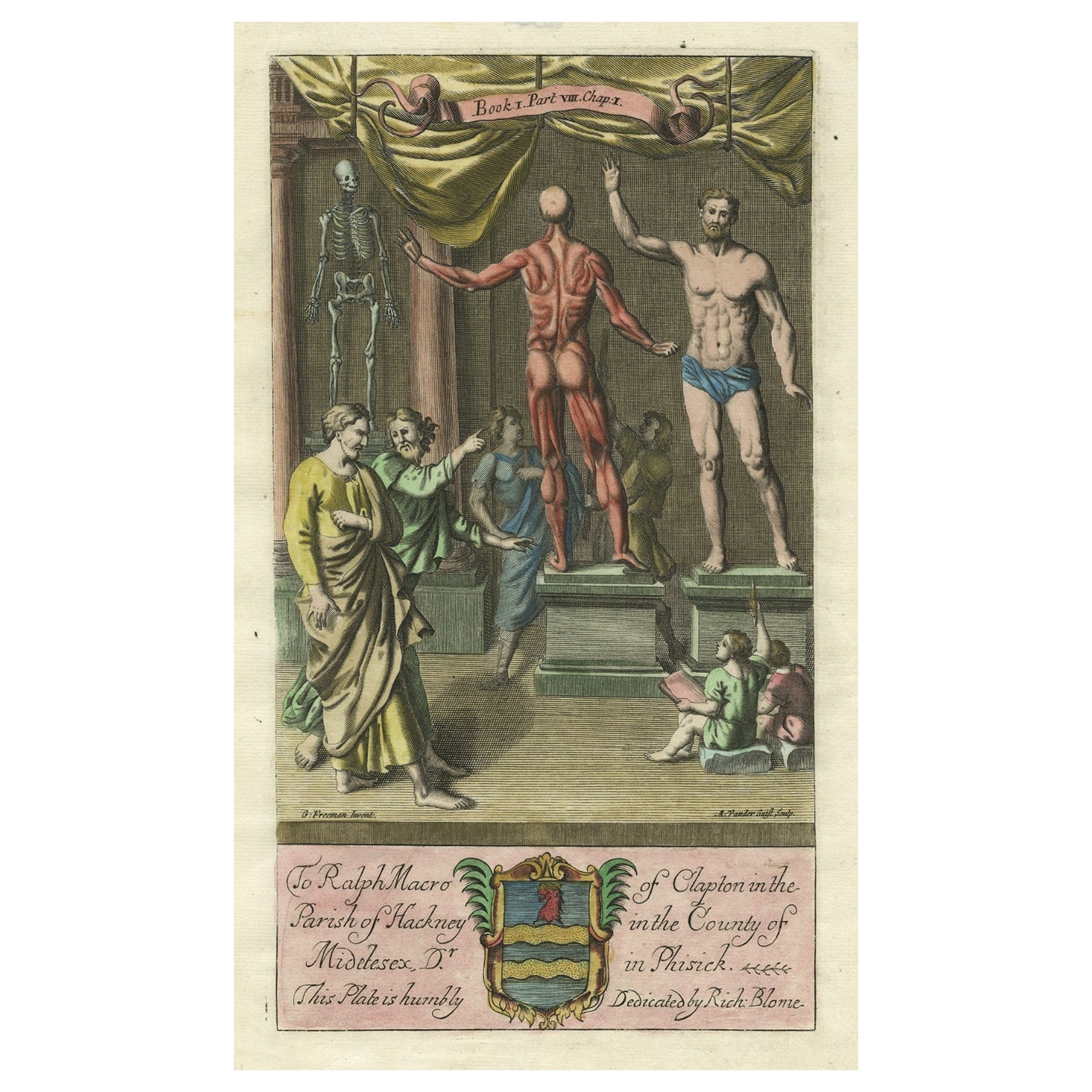
Antique Print of an Anatomy Display with a Human Skeleton, 1686
Located in Langweer, NL
Description: Antique print, titled: 'To Ralph Macro of Clapton (…)'
This original old antique print shows people at an anatomy display with a human skeleton, ecorche, male body. ...
Category
Antique 1680s Prints
Materials
Paper

$603 Sale Price
20% Off
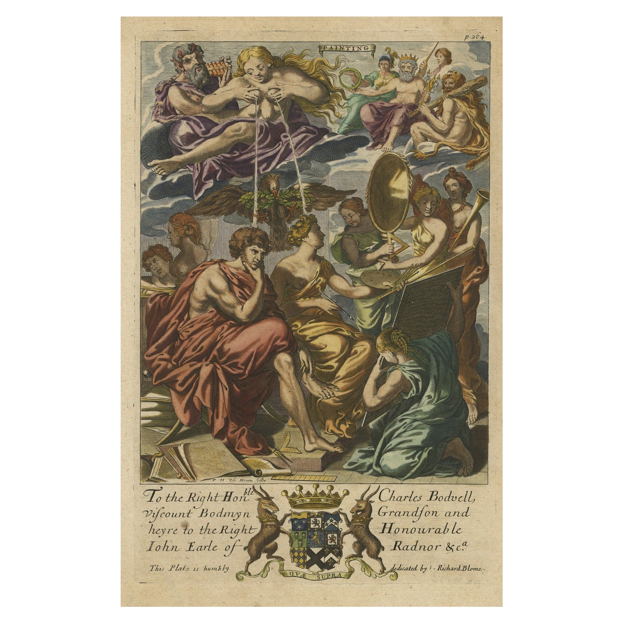
Rare Copper Engraving of Female with Five Breasts Lactating onto Others, 1686
Located in Langweer, NL
Antique print titled 'Painting'.
Rare antique print showing painters and various figures including: a female figure holding palette and brushes in centre, with another female figur...
Category
Antique 1680s Religious Items
Materials
Paper

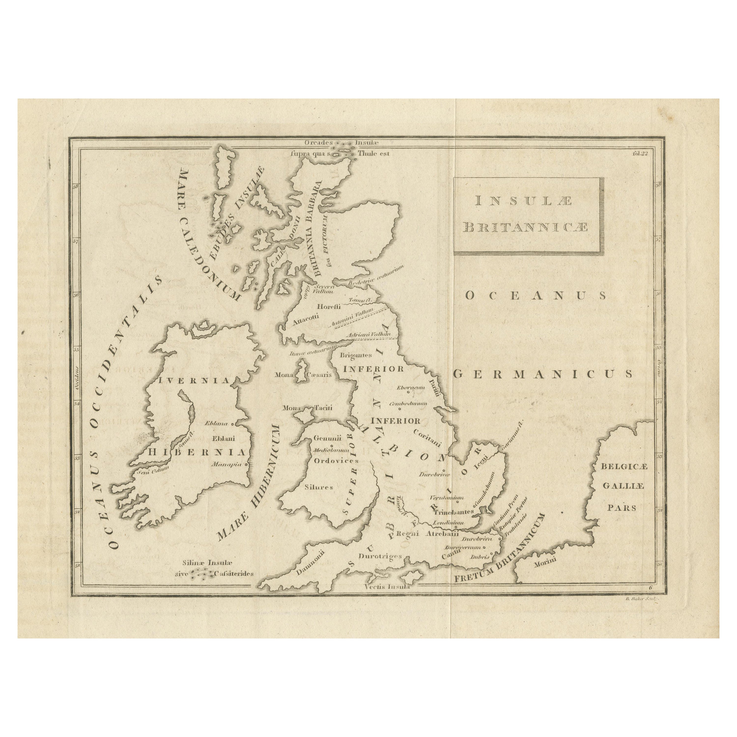
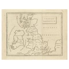
Antique Map of the British Isles According to the Geography of the Roman Empire
Located in Langweer, NL
Antique map titled 'Insulae Britannicae'. Interesting map of Britain, Scotland, and Ireland. It shows a rudimentary outline of the islands according to the geography of the Roman Emp...
Category
Antique Late 18th Century Maps
Materials
Paper
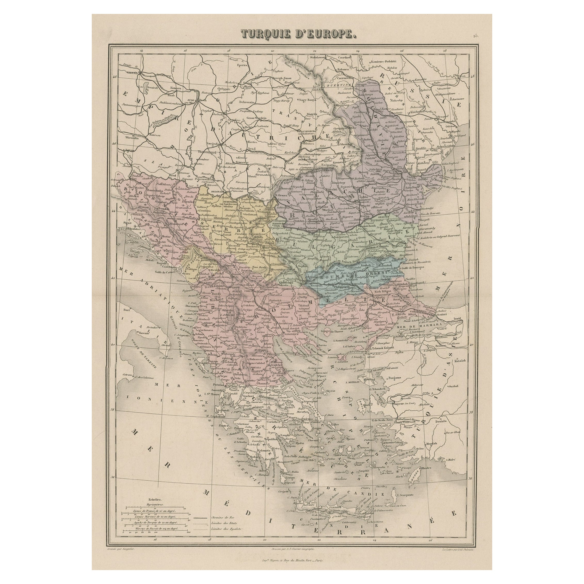
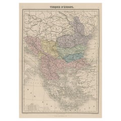
Antique Map of Moldova to Thessaly and from the Adriatic to the Black Sea, 1880
Located in Langweer, NL
Antique map titled 'Turquie d'Europe'.
Map of the european parts of Turkey. The map covers from Moldova to Thessaly and from the Adriatic to the Black Sea. Greece and the island ...
Category
Antique 1880s Maps
Materials
Paper
$130 Sale Price
20% Off
You May Also Like
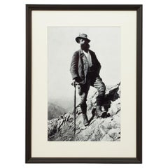
Vintage Style Photography, Framed Alpine Ski Photograph, Bavarian Guide
Located in Oxfordshire, GB
Vintage Style Photography, Framed Alpine Ski Photograph, Bavarian Guide.
'BAVARIAN GUIDE', a modern framed and mounted black and white photograph after an original 1930's skiing pho...
Category
Vintage 1930s British Sporting Art Sports Equipment and Memorabilia
Materials
Paper, Wood
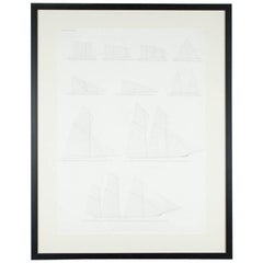
"Balance of Sail" Print by Day & Son, Lithographers to the Queen, Dated 1864
By Vincent Brooks, Day and Sons
Located in London, GB
A Victorian framed print of "Balance of Sail" by Day and Son, lithographers to the Queen.
The bottom of the print is inscribed: LONDON. PUBL...
Category
Antique Mid-19th Century European Prints
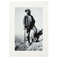
Alpine Ski Photograph, 'Bavarian Guide' Taken from Original 1930s Photograph
Located in Oxfordshire, GB
Alpine Ski Photograph.
'Bavarian Guide', a new mounted black and white photographic image after an original 1930's mountaineering photograph. Black & white alpine photos are the perfect addition to any home or ski lodge, so please do check out our other ski photos...
Category
Vintage 1930s British Sporting Art Sports Equipment and Memorabilia
Materials
Paper
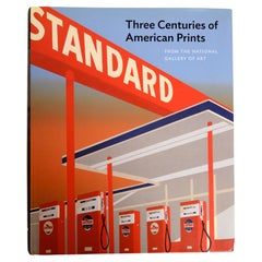
Three Centuries of American Prints: from the National Gallery of Art, Exhib. Cat
Located in valatie, NY
Three Centuries of American Prints: From the National Gallery of Art
by Judith Brodie, Amy Johnston and Michael J. Lewis. Publisher Thames & Hudson Lt...
Category
21st Century and Contemporary American Books
Materials
Paper
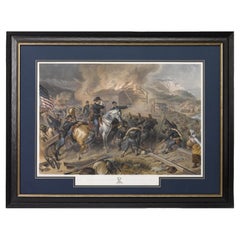
"On the March to the Sea" Print by Alexander Hay Ritchie, after F.O.C Darley
By Alexander Hay Ritchie
Located in Colorado Springs, CO
This color print of On The March to the Sea by Felix O.C. Darley, and engraved by A.H. Ritchie, is a stunning portrayal of William T. Sherman’s notorious Georgia Campaign. Originally...
Category
Antique 1860s American Prints
Materials
Paper
Map of the Republic of Genoa
Located in New York, NY
Framed antique hand-coloured map of the Republic of Genoa including the duchies of Mantua, Modena, and Parma.
Europe, late 18th century.
Dimension: 25...
Category
