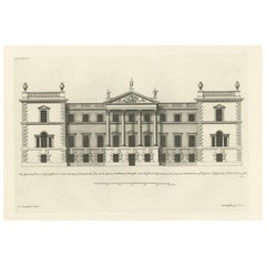
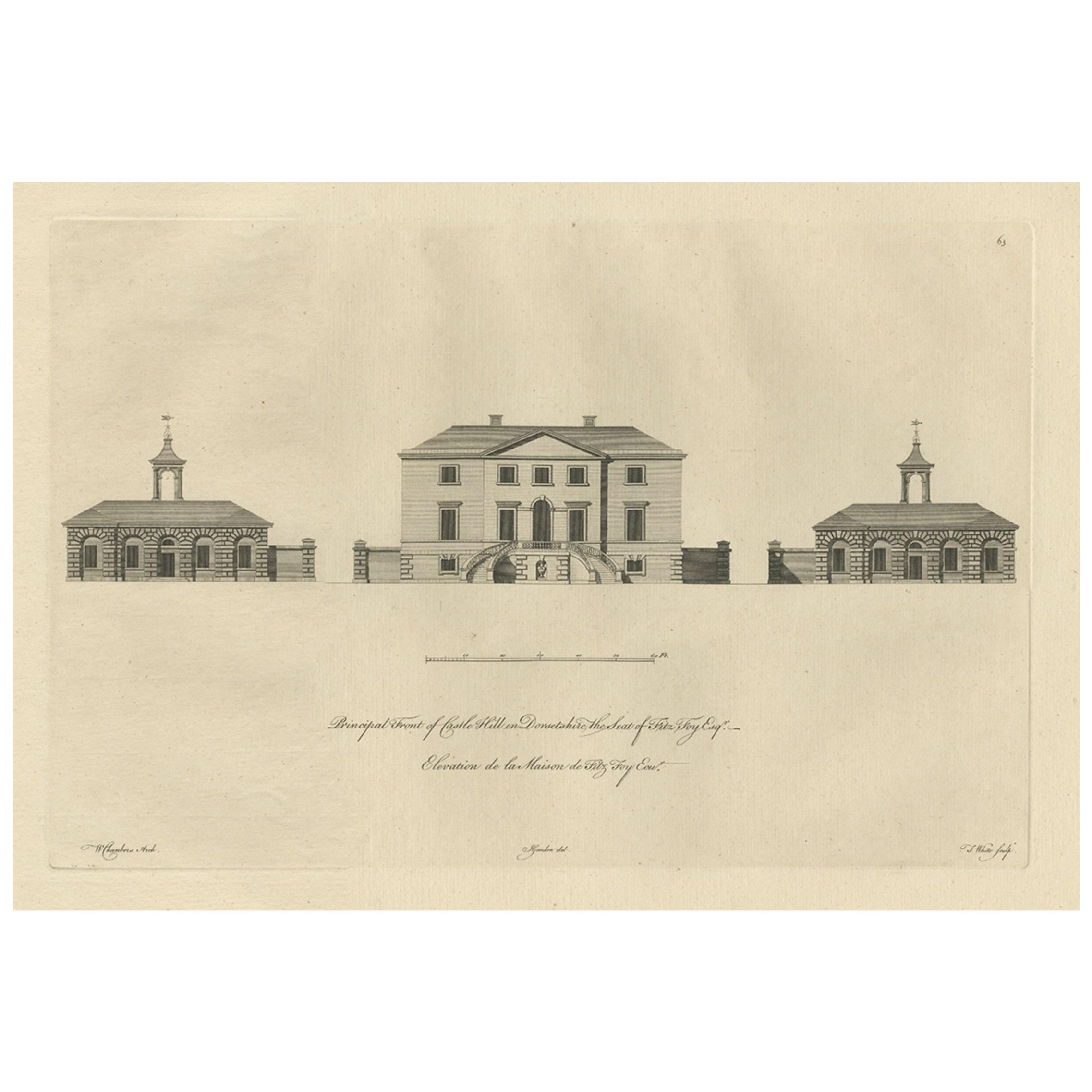
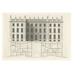
Engraving of the Garden Front of Grimsthorpe Castle, Lincolnshire, England, 1714
View Similar Items
Want more images or videos?
Request additional images or videos from the seller
1 of 7
Engraving of the Garden Front of Grimsthorpe Castle, Lincolnshire, England, 1714
About the Item
- Dimensions:Height: 13.59 in (34.5 cm)Width: 19.89 in (50.5 cm)Depth: 0 in (0.01 mm)
- Materials and Techniques:
- Period:
- Date of Manufacture:1714
- Condition:Wear consistent with age and use. Condition: Very good, general age-related toning. Blank verso, please study image carefully.
- Seller Location:Langweer, NL
- Reference Number:Seller: BG-12208-2271stDibs: LU3054326893462
About the Seller
5.0
Recognized Seller
These prestigious sellers are industry leaders and represent the highest echelon for item quality and design.
Platinum Seller
Premium sellers with a 4.7+ rating and 24-hour response times
Established in 2009
1stDibs seller since 2017
2,415 sales on 1stDibs
Typical response time: 1 hour
Authenticity Guarantee
In the unlikely event there’s an issue with an item’s authenticity, contact us within 1 year for a full refund. DetailsMoney-Back Guarantee
If your item is not as described, is damaged in transit, or does not arrive, contact us within 7 days for a full refund. Details24-Hour Cancellation
You have a 24-hour grace period in which to reconsider your purchase, with no questions asked.Vetted Professional Sellers
Our world-class sellers must adhere to strict standards for service and quality, maintaining the integrity of our listings.Price-Match Guarantee
If you find that a seller listed the same item for a lower price elsewhere, we’ll match it.Trusted Global Delivery
Our best-in-class carrier network provides specialized shipping options worldwide, including custom delivery.More From This Seller
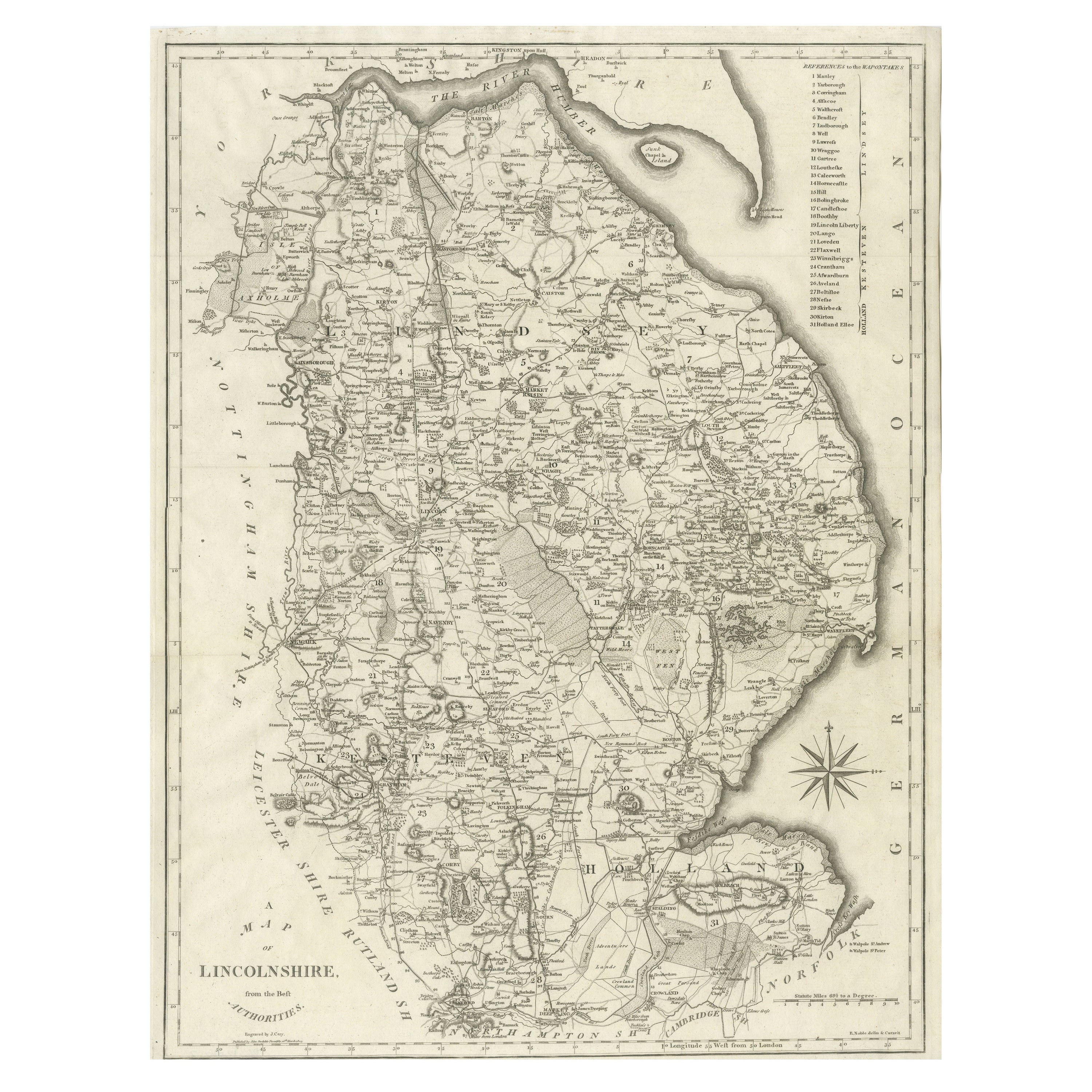
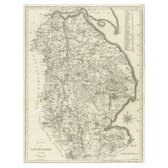
View AllLarge Antique County Map of Lincolnshire, England
Located in Langweer, NL
Antique map titled 'A Map of Lincolnshire from the best Authorities'. Original old county map of Lincolnshire, England. Engraved by John Cary. Originates from 'New British Atlas' by ...
Category
Antique Early 19th Century Maps
Materials
Paper
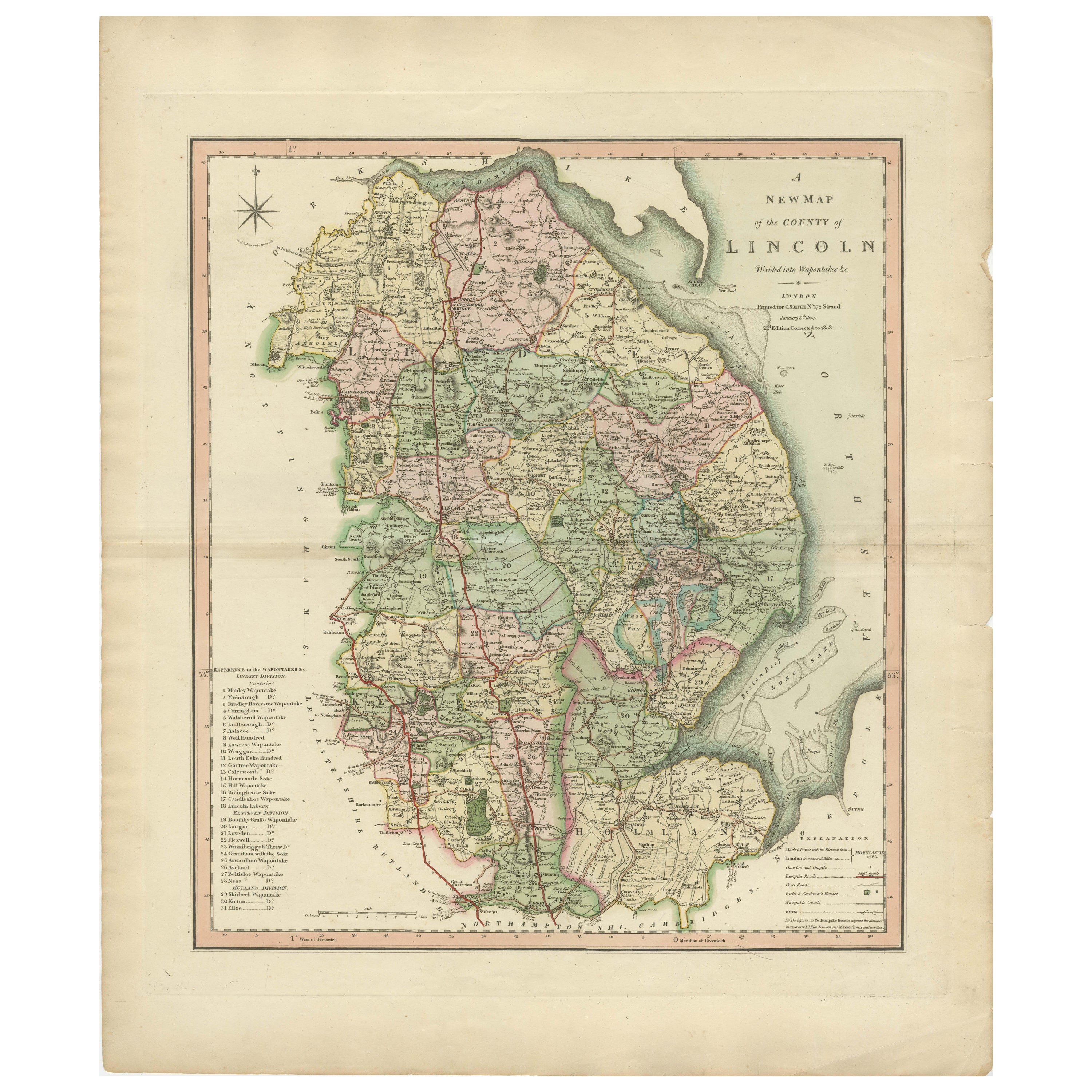
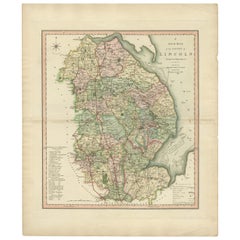
Antique Decorative County Map of Lincolnshire, England, 1804
Located in Langweer, NL
Antique county map of Lincolnshire first published circa 1800 Cities illustrated include Grantham, Spalding, Boston, and Market Raisin.
Charles Smith was a cartographer working in...
Category
Antique Early 1800s Maps
Materials
Paper
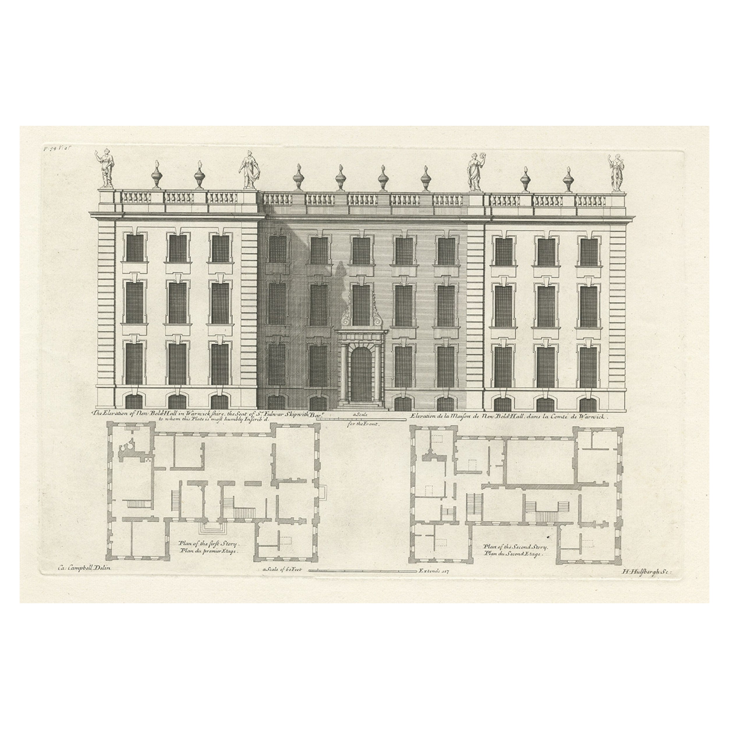
Antique Print of the Bold Hall in Warwickshire in England, 1714
Located in Langweer, NL
Antique print titled 'The Elevation of Nen Bold-Hall in Warwickshire (..)'.
View of the Bold Hall in Warwickshire, England. This print originates from 'Vitruvius Britannicus' by ...
Category
Antique 18th Century Prints
Materials
Paper
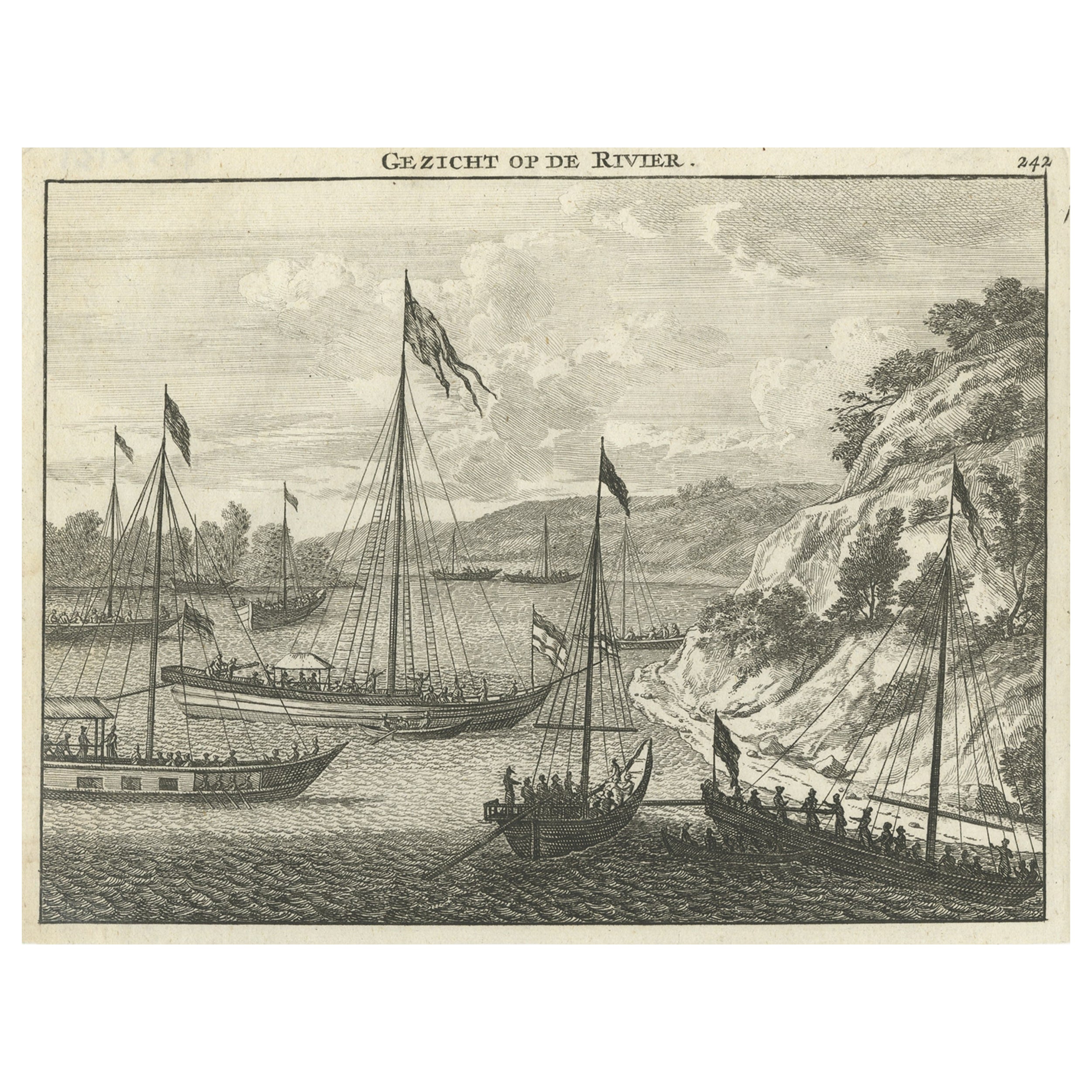
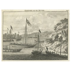
Copper Engraving with a View on the Volga River in Russia, 1714
Located in Langweer, NL
Antique print titled 'Gezicht op de Rivier'.
Copper engraving with a view on the Volga river. This print originates from 'Reizen over Moskovie, door Persie en Indie (..)' by C. d...
Category
Antique 1710s Maps
Materials
Paper
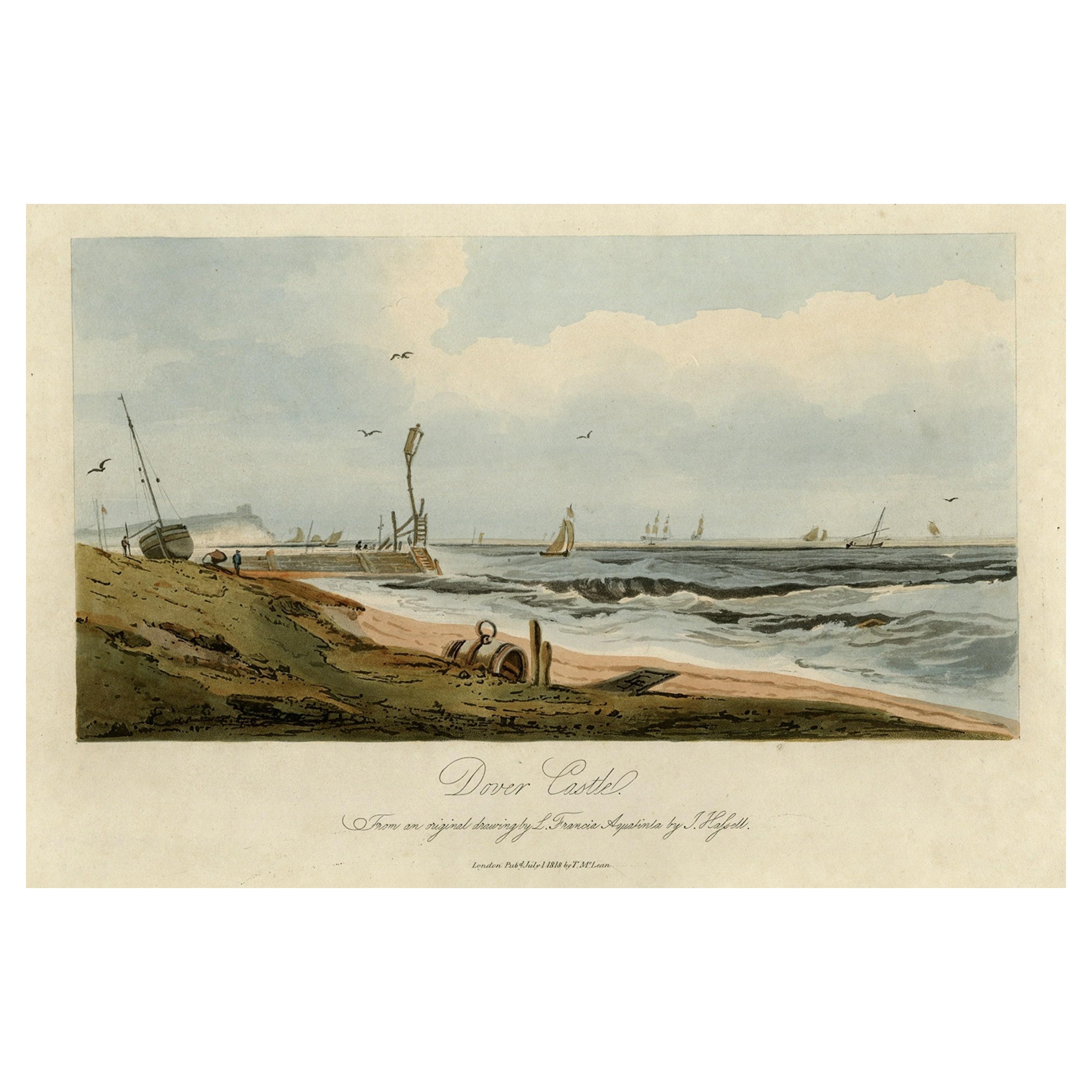
View of Dover Castle Atop the Cliffs in the Background, England, 1818
Located in Langweer, NL
Antique print, titled: 'Dover Castle.'
A view of the beach and sea with Dover Castle atop the cliffs in the background. Published by T. McLean in 1818.
Artists and Engravers: ...
Category
Antique 1810s Maps
Materials
Paper

$304 Sale Price
20% Off
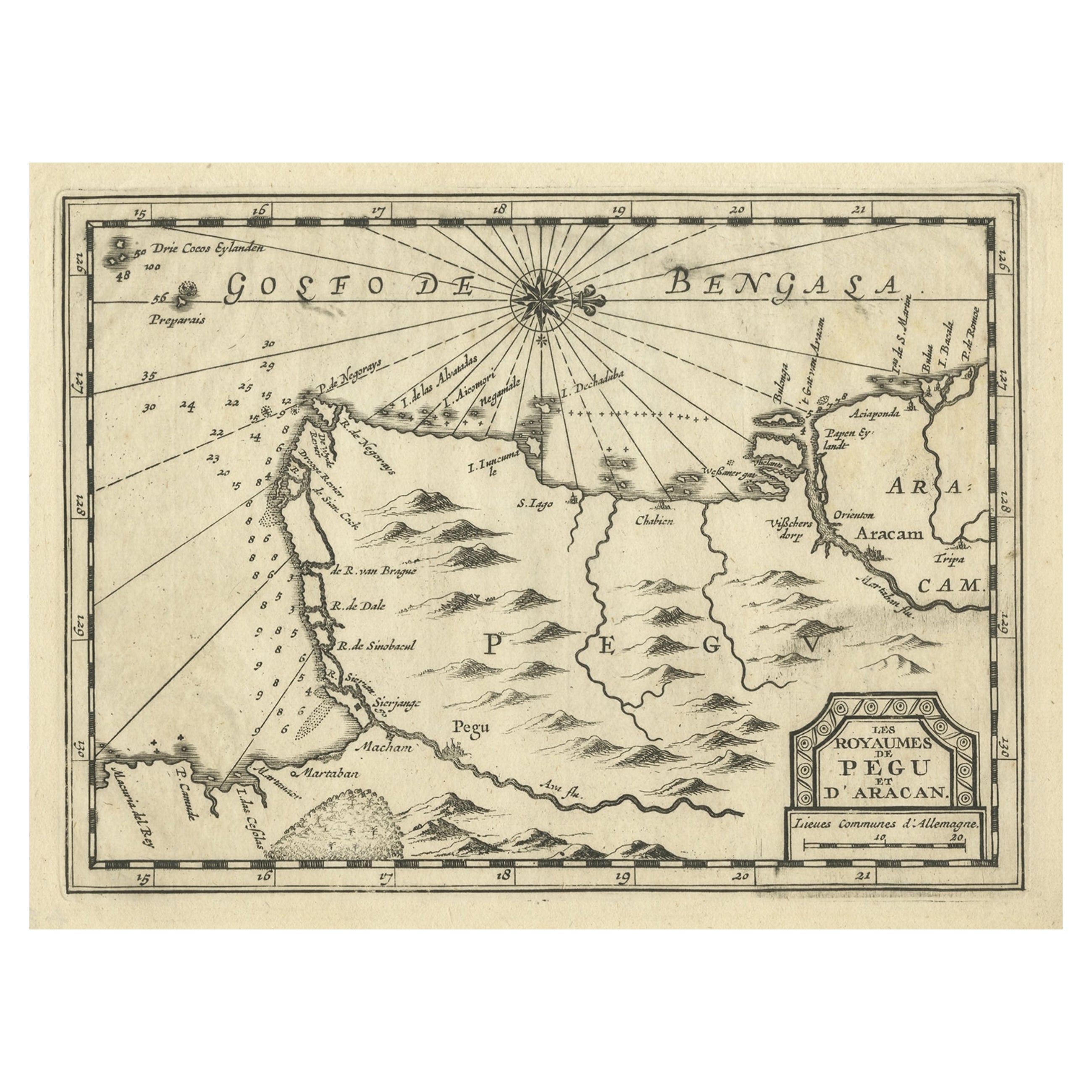
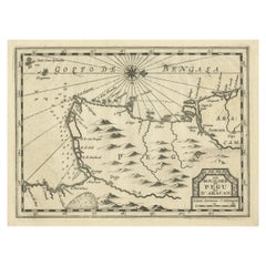
Rare Antique Copper Engraving of a Map of Pegu and Arakan, Burma (Myanmar), 1714
Located in Langweer, NL
Antique map Myanmar (Birma) titled 'Les Royaumes de Pegu et d'Aracan'.
Rare map of Pegu and Arakan made after a map engraved by Pieter van den Keere and published in the 1628 edi...
Category
Antique 1710s Maps
Materials
Paper
You May Also Like
“A Football Match, Scotland v. England” Antique Engraving, Proof Edition of 100
By Overend and Smythe
Located in Colorado Springs, CO
This is the 1889 William H. Overend (1851-1898) and Lionel Smythe (1839-1918) first edition, photogravure of the Calcutta Cup – a Rugby match between Scotland and England, that has been played over 100 times, the first match...
Category
Antique 19th Century English Prints
Materials
Paper

“The Restaurant of the House of Representatives” Engraving by Harper's Weekly
Located in Colorado Springs, CO
This original wood engraving is titled “The Restaurant of the House of Representatives, Washington, DC.” It was published as a double-page image, in the August 12, 1893 issue of the famous 19th century newspaper Harper’s Weekly. The print was illustrated by Charles Stanley Reinhardt.
The House Restaurant, a unique part of life in the Capitol, has been in the same location since the 1857 Capitol Expansion. Congressional members’ busy work schedule made the availability of food on site a necessity. But the restaurant also served as an informal meeting spot for members to continue conversations and deal making.
This 1893 print illustrates the convivial atmosphere. Details including elegantly dressed tables...
Category
Antique 1890s American Prints
Materials
Paper

1876 "Gettysburg, The Repulse of Longstreet's Assault." Engraving
Located in Colorado Springs, CO
Presented here is an 1876 engraving of John B. Bachelder and James Walker’s Gettysburg. The Repulse of Longstreet’s Assault. The engraved scene depicts the decisive battle on the final day of the Battle of Gettysburg. Researched by the photographer and topographer John B. Bachelder and painted by James Walker, the original painting was created in 1870. This detailed engraving was done by H. B. Hall Jr. and published by James Drummond Ball.
Otherwise called Pickett’s Charge, the battle occurred on July 3, 1863. Pickett’s corp commander, Lieutenant General James Longstreet was placed in charge of the attack despite his hesitations. Longstreet’s central role led to the title of the work, Repulse of Longstreet’s Assault. In an attempt to gain control of an important supply route, nine Confederate brigades charged across three-quarters of a mile of open ground against cannon fire to take Cemetery Ridge from the defending Union Army. Despite their overwhelming numbers, the Confederate forces were repelled with considerable casualties marking not only a decisive victory for the Union, but also the beginning of the slow defeat of Lee’s Army. The furthest the charging forces advanced before being repulsed would forever be known as the “High Water Mark of the Confederacy.” The Confederate army never recovered from the losses at Gettysburg and it effectively ended Lee’s campaign into Pennsylvania.
The engraving gives the perspective from the Union rear, one that encompasses most of the battlefield, from Big Round Top on the left to the northern reaches of Cemetery Ridge on the right. The Confederate lines at Seminary Ridge are in the far distance, partially obscured by bursting shells. The image centers on the main Confederate assault, in the vicinity of what today are known as "The Copse" and "The Bloody Angle." The composition has elemen...
Category
Antique 1870s American Prints
Materials
Paper

Old Horizontal Map of England
By Tasso
Located in Alessandria, Piemonte
ST/520 - Old rare Italian map of England, dated 1826-1827 - by Girolamo Tasso, editor in Venise, for the atlas of M.r Le-Sage.
Category
Antique Early 19th Century Italian Other Prints
Materials
Paper

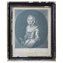
Sarah Porter, "Queen of the Touters at Tunbridge Wells" Engraving, circa 1770
Located in Lowestoft, GB
After Vander Smissen 'Mrs Sarah Porter, Queen of the Touters at Tunbridge Wells', a mezzotint, engraved by William Pether circa 1770, glazed in ebonised, ...
Category
Antique Late 18th Century English Prints
Materials
Glass, Pine, Paper
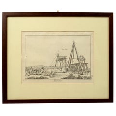
Engraving Print from the Panckoucke Encyclopédie Nautical Subject 1782-1832
Located in Milan, IT
Print by engraving on copper plate from the Panckoucke Encyclopédie méthodique, end of the 18th century,volume Marine Planches (more than 1,500 figures dealing with all subjects on the marina: planes, construction, carpentry, tree trunks, armaments of maneuvers, ropes, sails, artillery, ship maneuvers and combat tactics). This is the plate no. n. 24, pag. 69 fig. 341 ; with frame cm 38.3 x 31.5. Ship ropes are depicted. The Print has the "Benard direxit...
Category
Antique 1790s French Nautical Objects
Materials
Paper