Items Similar to The Citadel of Spice: Fort Hollandais on the Banda Islands, 1750


Want more images or videos?
Request additional images or videos from the seller
1 of 6
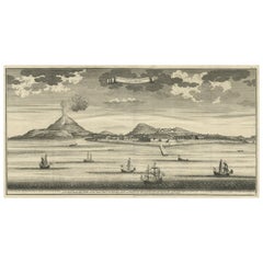
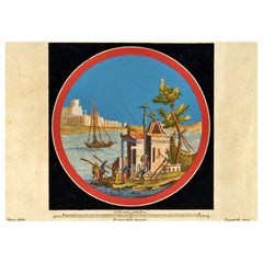
The Citadel of Spice: Fort Hollandais on the Banda Islands, 1750
About the Item
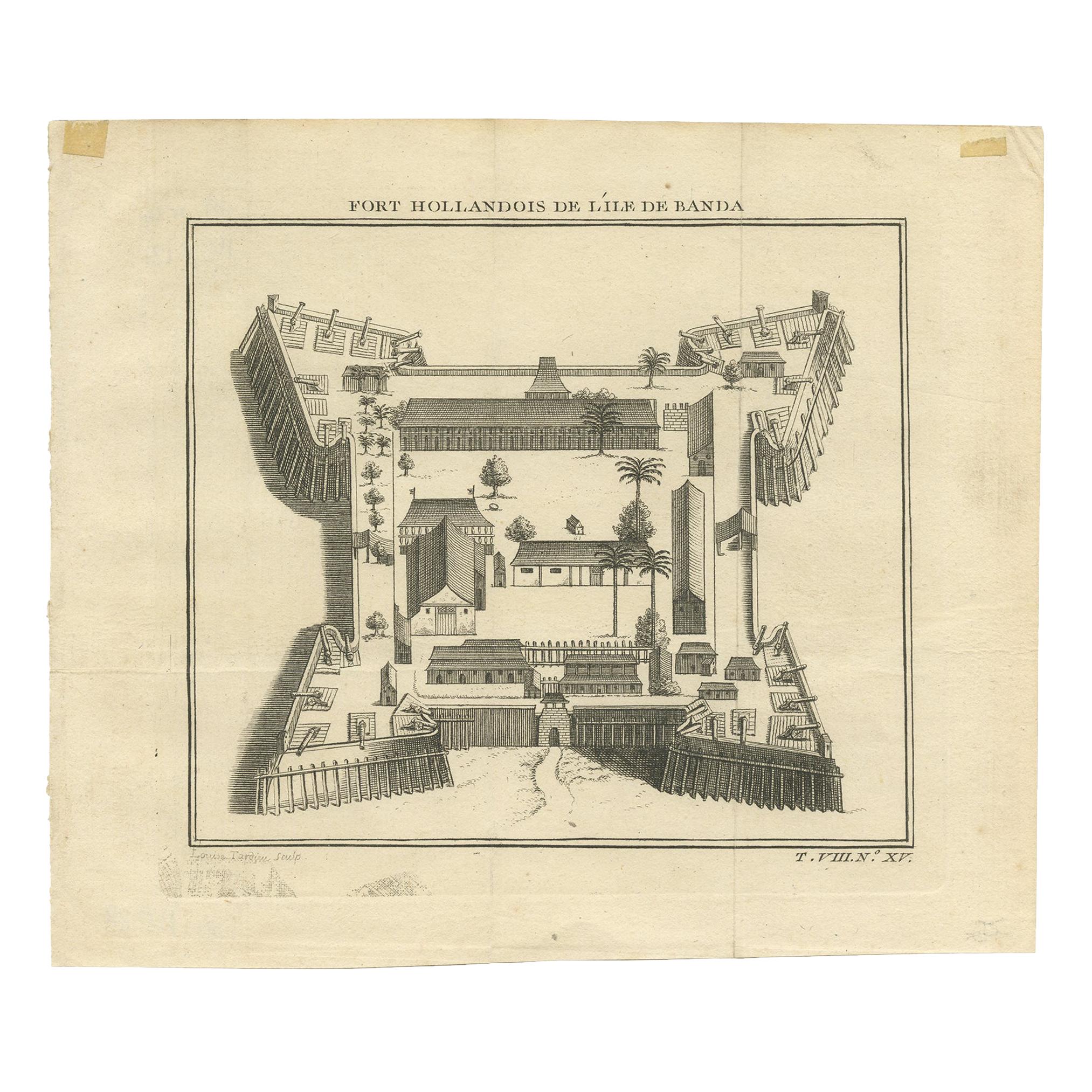
Title: Fort Hollandais de l'Ile de Banda (Dutch Fort of Banda Island)
Date published: 1750
Publisher: Jacques-Nicolas Bellin (1703-1772)
The original antique print depicts an 18th-century engraving of the Dutch Fort on Banda Island. This print would serve not only as a cartographic document but also as a visual assertion of Dutch power in the region, emphasizing their control over the highly lucrative spice trade of the era.
The artwork captures the strategic and robust architecture of Fort Hollandais, a testament to the Dutch colonial military prowess. It would feature the geometric precision of the fort's layout, with its formidable bastions and protective walls standing prominently. The fort's purpose, to oversee and protect the nutmeg trade, which was a cornerstone of the colonial economy, is subtly implied through the detailed rendering of its defensive structures.
The fort, known as Fort Hollandais, is one of the several forts constructed by the Dutch in the Banda Islands during their colonial period. Today, the heritage of Dutch presence in Banda is still visible, with several forts still standing. Fort Nassau, which was the first Dutch fort built in the Banda Islands in 1609, is currently in a state of disrepair, with some bastions and substantial walls still visible. This fort served as the principal administrative and military base for the Dutch during their control of the nutmeg trade in the region. Fort Nassau is overshadowed by the more impressive Fort Belgica, which is pentagon-shaped and located on a hill, dominating the view.
Additionally, other forts from that era like Fort Belgica, Fort Concordia, and Fort Revenge still exist. These forts, along with Fort Nassau, played a critical role in guarding the nutmeg trading in the town of Naira. Other remnants of the Dutch colonial era, such as the first church with a registry in Asia, the old church lined by the tombs of the Dutch Governor Generals and VOC Directors, the first VOC Headquarters, and the governor’s palace, still stand. The nutmeg plantations, some old plantation smokehouses, and the mansions of the Perkeniers (nutmeg plantation owners) are also part of the surviving heritage, with some of them functioning as museums..
For the current state of Fort Hollandais specifically, there is no detailed information immediately available from the sources consulted. However, given the historical significance of these structures and the efforts to preserve them, it is possible that it may still exist in some form.
- Dimensions:Height: 10.04 in (25.5 cm)Width: 13.78 in (35 cm)Depth: 0 in (0.02 mm)
- Materials and Techniques:Paper,Engraved
- Period:1750-1759
- Date of Manufacture:1750
- Condition:Very Good. Later hand-coloring. A vertical flattened folding line in the middle.
- Seller Location:Langweer, NL
- Reference Number:Seller: BG-13454-31stDibs: LU3054337747672
About the Seller
5.0
Recognized Seller
These prestigious sellers are industry leaders and represent the highest echelon for item quality and design.
Platinum Seller
Premium sellers with a 4.7+ rating and 24-hour response times
Established in 2009
1stDibs seller since 2017
2,417 sales on 1stDibs
Typical response time: <1 hour
- ShippingRetrieving quote...Shipping from: Langweer, Netherlands
- Return Policy
Authenticity Guarantee
In the unlikely event there’s an issue with an item’s authenticity, contact us within 1 year for a full refund. DetailsMoney-Back Guarantee
If your item is not as described, is damaged in transit, or does not arrive, contact us within 7 days for a full refund. Details24-Hour Cancellation
You have a 24-hour grace period in which to reconsider your purchase, with no questions asked.Vetted Professional Sellers
Our world-class sellers must adhere to strict standards for service and quality, maintaining the integrity of our listings.Price-Match Guarantee
If you find that a seller listed the same item for a lower price elsewhere, we’ll match it.Trusted Global Delivery
Our best-in-class carrier network provides specialized shipping options worldwide, including custom delivery.More From This Seller
View AllAntique Print of the Dutch Fort on Banda by Tardieu 'circa 1750'
Located in Langweer, NL
Antique print titled 'Fort Hollandois de l'Ile de Banda'. Engraving of the Dutch VOC fortress Nassau, on Banda Neira, Indonesia. This print originates from '...
Category
Antique Mid-18th Century Prints
Materials
Paper
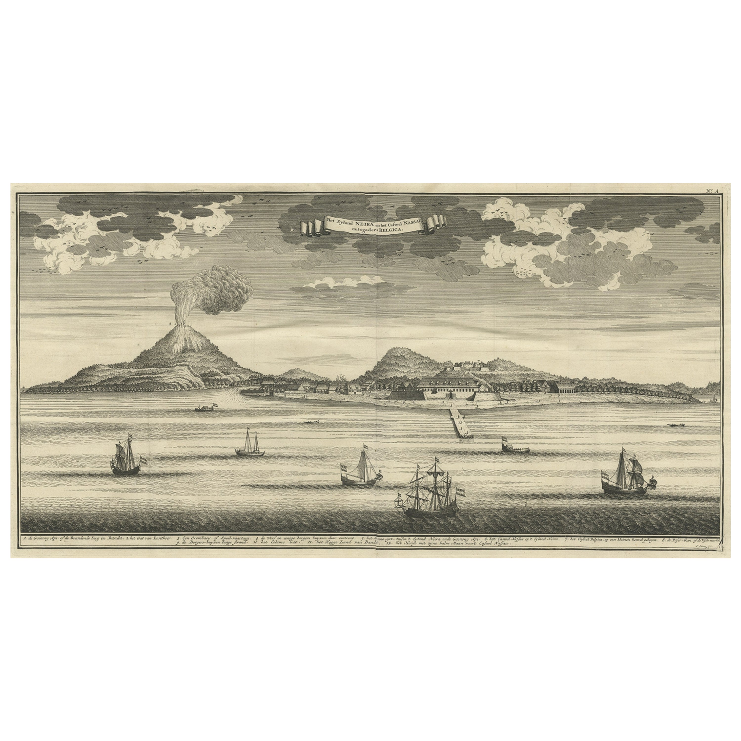
Beautiful Old View of Spice Island Banda Neira with Fort Nassau, Indonesia, 1726
Located in Langweer, NL
Antique print titled 'Het Eyland Neira, en het Casteel Nassau mitsgaders Belgica'.
Beautiful view of Banda Neira with Fort Nassau, Indonesia. This print originates from 'Oud en Nie...
Category
Antique 1720s Maps
Materials
Paper
$717 Sale Price
34% Off
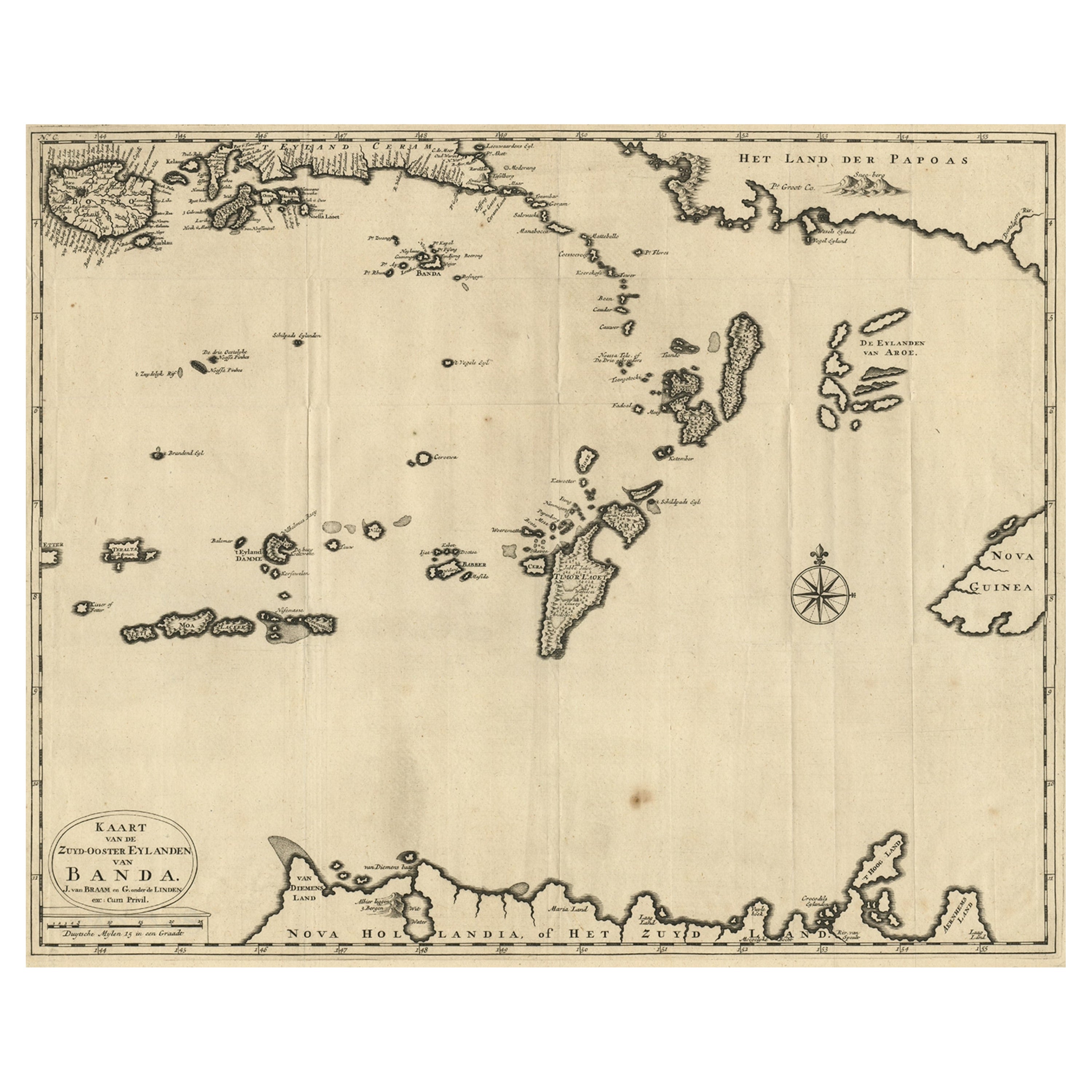
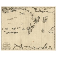
Original Antique Map Southeast of the Banda or Spice Islands, Indonesia, 1726
Located in Langweer, NL
Antique map titled 'Kaart van de Zuyd-Ooster Eylanden van Banda'.
Map of the southeastern part of the Banda islands. This map originates from 'Oud en Nieuw Oost-Indiën' by F. Valen...
Category
Antique 1720s Maps
Materials
Paper

$670 Sale Price
24% Off
Map of the Southeastern Part of the Banda Islands, Incl Northern Australia, 1726
Located in Langweer, NL
Antique map titled 'Kaart van de Zuyd-Ooster Eylanden van Banda.'
Map of the southeastern part of the Banda islands. This map originates from 'Oud en Nieuw Oost-Indiën' by Franço...
Category
Antique 1720s Maps
Materials
Paper
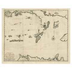
Old Antique Map of the Banda Islands (Southeast), Indonesia & Northern Australia
By F. Valentijn
Located in Langweer, NL
Original antique map titled 'Kaart van de Zuyd-Ooster Eylanden van Banda'. Important map of the seas and islands surrounding the Banda Islands, Indonesia, extending south to northern Australia, east to Papua New Guinea and north to Ceram. Published 1724-1726 by Joannes van Braam...
Category
Antique Early 18th Century Maps
Materials
Paper
$715 Sale Price
20% Off
Antique Map of the Banda Islands in Indonesia by Valentijn, 1726
Located in Langweer, NL
Antique map Indonesia titled 'Kaart der Zuyd-Wester Eylanden van Banda'. Map of the islands in the southwestern part of the Banda Sea including ...
Category
Antique Mid-18th Century Maps
Materials
Paper

$464 Sale Price
20% Off
You May Also Like
Print on paper depicting a dummy, Italy 1750-1800.
Located in Milan, IT
Engraving on paper of an articulated mannequin by F. Fambrini. (active in Lucca, 1764 – 1780), Italy, second half of the 18th century.
Category
Antique 1760s Italian Prints
Materials
Paper

The State of Rhode Island Map - Caleb Harris & Harding Harris, 1818
Located in Savannah, GA
Mathew Carey
(American/Philadelphia, 1760-1839)
The State of Rhode Island compiled from the surveys and observations of Caleb Harris by Harding Harris. Engraving with hand-coloring...
Category
Antique 1810s American Other Prints
Materials
Glass, Wood, Paper
F. CEPPARULI (*1750) after VANNI (*1750), "Temple on an Island in the Water"
By Europa
Located in Madrid, ES
F. CEPPARULI (*1750) after VANNI (*1750), Temple on an Island in the Water, circa 1780
Copper engraving Francesco Cepparuli (before 1750 - after 1767 ) after Niccolo Vanni (before 1...
Category
Antique 18th Century Italian Baroque Drawings
Materials
Paint
Barry Flanagan, Herring Drifter at Fort Augustus
Located in London, GB
1976
Linocut on paper
Edition 96/100
Category
Mid-20th Century Prints
Materials
Glass, Paper
"Adam and Eve on Island of Peace, " Remarkable WPA-Era Print of Peace Amidst War
Located in Philadelphia, PA
This print depicts a nude Adam and Eve in a small island of peace and plenty, surrounded by the ravages and storms of World War II. The placid scene at the center, full of innocence ...
Category
Vintage 1940s American Art Deco Prints
Materials
Paper
Man of the Sandwich Islands, with His Helmet J. Webber del. J.K. Sherwin Sc.
By John Webber
Located in Vancouver, British Columbia
An English 18 century engraving titled "Man of the Sandwich Islands, with his helmet " signed .J. Webber del. J.K. Sherwin sc. The subject was sk...
Category
Antique Late 18th Century English British Colonial Prints
Materials
Paper

$1,200 Sale Price
20% Off