Antique 1901 National Publishing Company's Road Map of New Jersey Geological
View Similar Items


Want more images or videos?
Request additional images or videos from the seller
1 of 14
Antique 1901 National Publishing Company's Road Map of New Jersey Geological
About the Item
- Dimensions:Height: 42.25 in (107.32 cm)Width: 0.75 in (1.91 cm)Depth: 30.5 in (77.47 cm)
- Style:Victorian (In the Style Of)
- Materials and Techniques:
- Period:1900-1909
- Date of Manufacture:1901
- Condition:Wear consistent with age and use. Fair condition, wear and distressing, alligatoring / crazing, pin hole see pictures.
- Seller Location:Dayton, OH
- Reference Number:Seller: 290171stDibs: LU5343222884132

About the Seller
5.0
Platinum Seller
Premium sellers with a 4.7+ rating and 24-hour response times
Established in 2010
1stDibs seller since 2020
1,527 sales on 1stDibs
Authenticity Guarantee
In the unlikely event there’s an issue with an item’s authenticity, contact us within 1 year for a full refund. DetailsMoney-Back Guarantee
If your item is not as described, is damaged in transit, or does not arrive, contact us within 7 days for a full refund. Details24-Hour Cancellation
You have a 24-hour grace period in which to reconsider your purchase, with no questions asked.Vetted Professional Sellers
Our world-class sellers must adhere to strict standards for service and quality, maintaining the integrity of our listings.Price-Match Guarantee
If you find that a seller listed the same item for a lower price elsewhere, we’ll match it.Trusted Global Delivery
Our best-in-class carrier network provides specialized shipping options worldwide, including custom delivery.More From This Seller
View AllAntique Chicago Illinois National Map Commercial Rollup Classroom Census Map 47"
Located in Dayton, OH
Antique early to mid 20th century double sided hanging map titled the New Commercial and Census Map of Illinois, Edition 1073. Verso shows the National Map of Chicago and Suburbs - O...
Category
Early 20th Century North American Maps
Materials
Paper

$940 Sale Price
20% Off
Vintage Oversized New York City Lower Manhattan 1840s Map Print
Located in Dayton, OH
Vintage late 20th century reproduction print of New York City featuring lower Manhattan in 1840.
Category
Late 20th Century Victorian Maps
Materials
Paper

$800 Sale Price
20% Off
Vincenzo Coronelli's Colored Map of the New World Western Hemisphere Framed 47"
By Vincenzo Coronelli
Located in Dayton, OH
A Framed Reproduction of Coronelli's Map of the New World, Attributed to Trevor James Company. The map shows the Western Hemisphere including the discoveries made by Abel Tasman in A...
Category
20th Century Maps
Materials
Paper

$1,080 Sale Price
20% Off
Rare Antique 1901 Steinway Model B Rosewood Grand Piano Louis XV Rococo Restored
By Steinway & Sons
Located in Dayton, OH
Fully Restored 1901 Steinway & Sons Model B Louis XV Baroque Rococo Grand Piano – Serial Number 99151, Full 88 key keyboard.
The most exquisitely d...
Category
Early 20th Century American Louis XV Musical Instruments
Materials
Fruitwood, Rosewood

$400,000 Sale Price
20% Off
Antique 1915 Mahogany Chicago Cable Company Carolina Inner Player Upright Piano
Located in Dayton, OH
Antique Victorian player piano by The Cable Company of Chicago which features a Carolina Inner-player. Circa 1915.
Includes: I Love Paris and Oh Lady Be Good by Max Kortlander, He...
Category
Vintage 1910s American Edwardian Musical Instruments
Materials
Mahogany

$2,800 Sale Price
20% Off
Antique Colored Belgium Map Flandria Gallica Flanders Henricus Hondius
Located in Dayton, OH
Antique hand colored map of Flanders, Belgium, engraved by Henricus Hondius.
Sans frame - 21.25” x 18”.
Category
Antique 19th Century Renaissance Maps
Materials
Paper

$280 Sale Price
20% Off
You May Also Like
Antique Map of New Jersey
Located in Langweer, NL
Antique map titled 'Colton's New Jersey'. This rare hand colored map of New Jersey is a copper plate engraving dating to 1855. Produced by the import...
Category
Antique Mid-19th Century Maps
Materials
Paper

Antique Map of Wisconsin with Inset Geological Map of Wisconsin
Located in Langweer, NL
Antique map titled 'Wisconsin'. Original antique map of Wisconsin, United States. With inset geological map of Wisconsin. This print originates from '...
Category
Antique Late 19th Century Maps
Materials
Paper

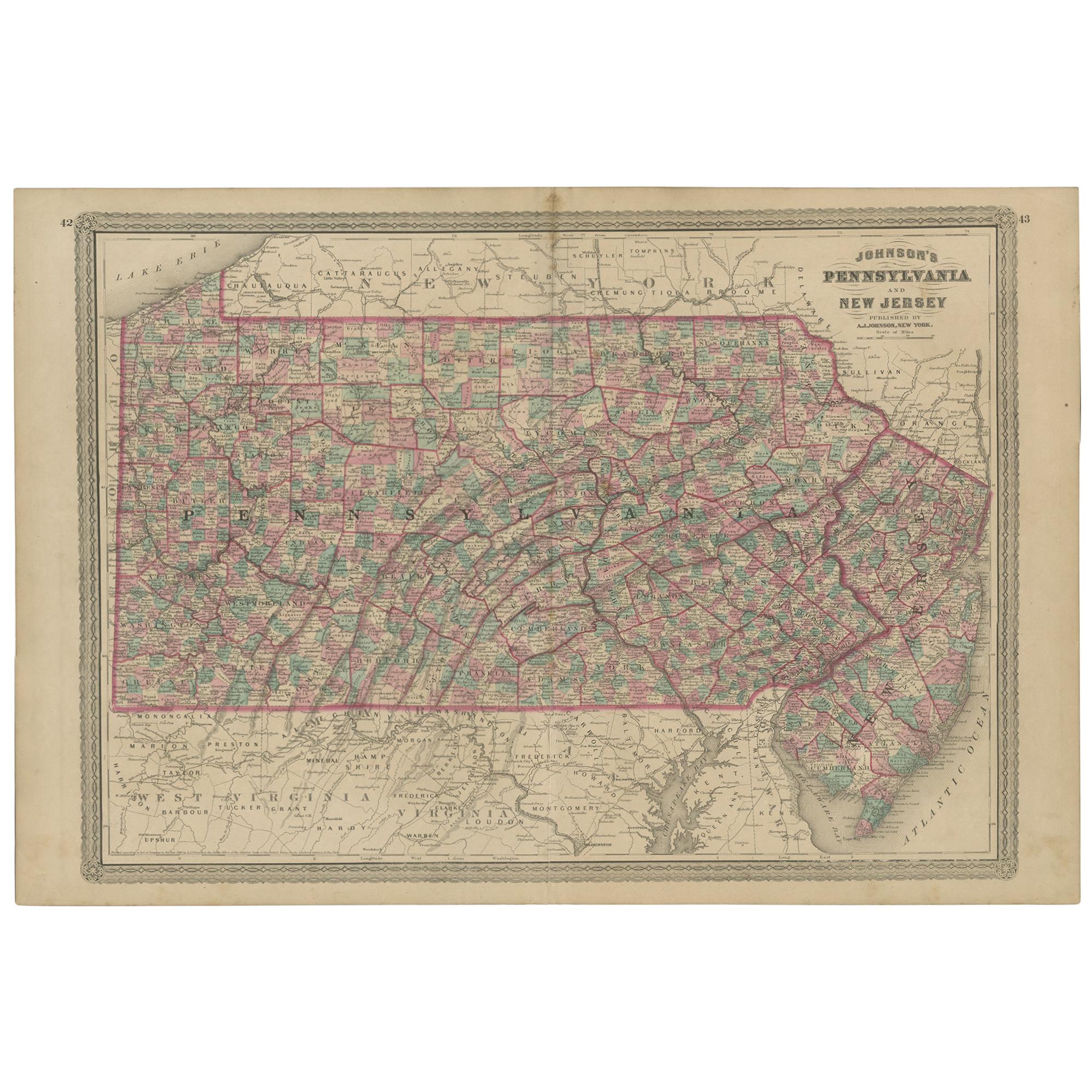
Antique Map of Pennsylvania and New Jersey by Johnson, 1872
Located in Langweer, NL
Antique map titled 'Johnson's Pennsylvania and New Jersey'. Original map showing Pennsylvania and New Jersey. This map originates from 'Johnson's New Illustrated Family Atlas of the ...
Category
Antique Late 19th Century Maps
Materials
Paper

Antique Geological Map of the World by Johnston '1850'
Located in Langweer, NL
Antique map titled 'The Geological Structure of the Globe'. Original antique geological map of the world. This map originates from 'The Physica...
Category
Antique Mid-19th Century Maps
Materials
Paper

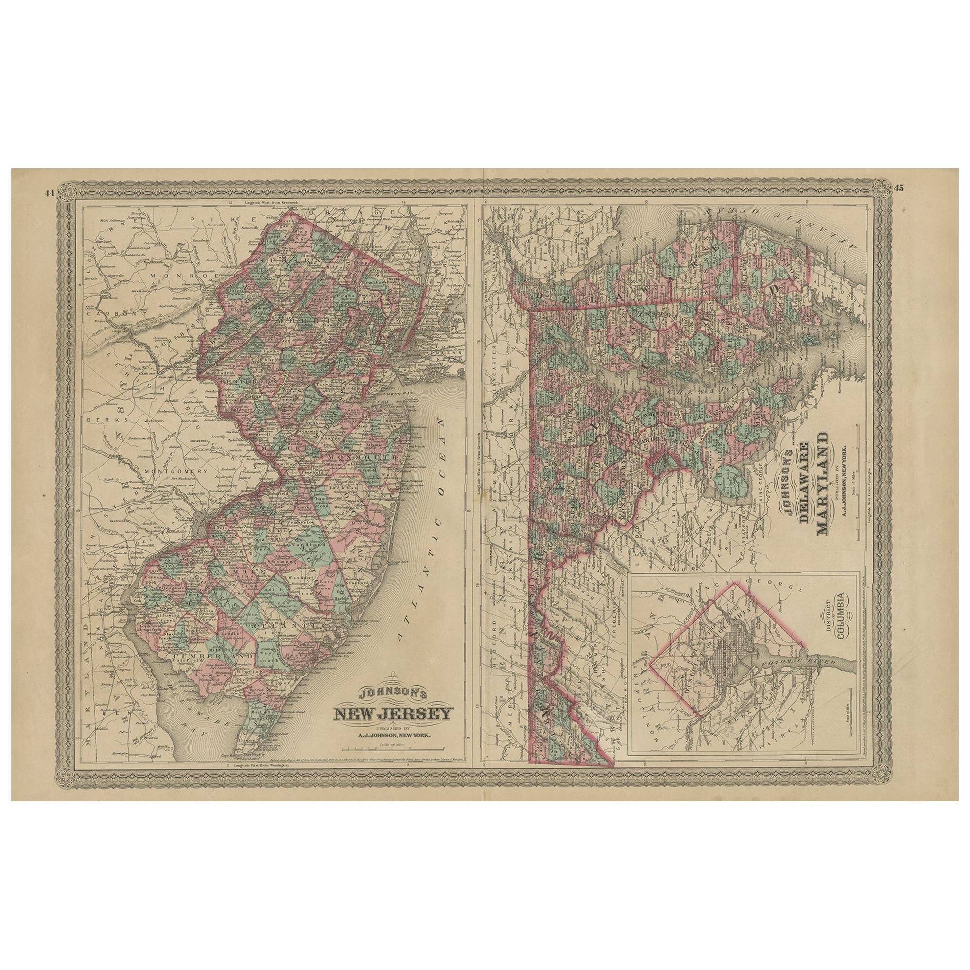
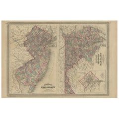
Antique Map of New Jersey, Delaware and Maryland by Johnson, 1872
Located in Langweer, NL
Antique map titled 'Johnson's New Jersey (..). Two maps on one sheet showing New Jersey, Delaware and Maryland. With inset map of the district of Columbia...
Category
Antique Late 19th Century Maps
Materials
Paper
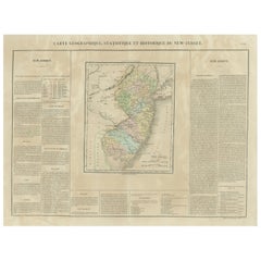
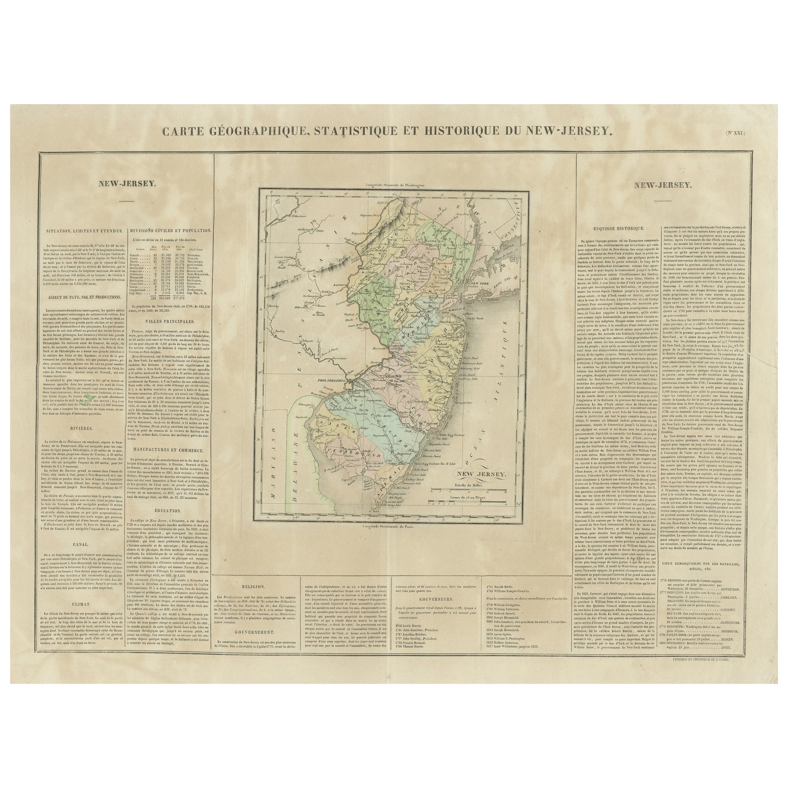
Original Antique Map of the State of New Jersey Published in France
Located in Langweer, NL
Original antique map titled 'Carte Géographique Statistique et Historique du New-Jersey'. One of the earliest obtainable maps of the State of New Jersey published outside of the Unit...
Category
Antique Early 19th Century Maps
Materials
Paper