Items Similar to Late 20th Century Educational Geographic Map - Australasia


Want more images or videos?
Request additional images or videos from the seller
1 of 8
Late 20th Century Educational Geographic Map - Australasia
About the Item
Late 20th Century Educational Geographic Map – Australasia
Late 20th Century Educational Geographic Map – Australasia. Good quality roll up school educational geographic map from the Czech republic. The map is printed on a cotton canvas that has been sealed with a clear lacquer.
WORKSHOP REPORT
Our workshop team inspect every product and carry out any needed repairs to ensure that everything leaves us serviced and maintained ready for many more years of life. All of our vintage products show the rich beauty and history of their life with the knocks and bumps of many years of use and we try to minimise restoration to keep every piece as original as possible.
Date: Late 20th Century
Maker: Industrial Production - Czech
Dimensions: L 1 x W 212 x H 161 cm
- Dimensions:Height: 63.39 in (161 cm)Width: 83.47 in (212 cm)Depth: 0.4 in (1 cm)
- Materials and Techniques:
- Place of Origin:
- Period:
- Date of Manufacture:Late 20th Century
- Condition:Refinished. Wear consistent with age and use.
- Seller Location:Hook, GB
- Reference Number:Seller: 1728.191stDibs: LU4494237887162
About the Seller
4.7
Vetted Professional Seller
Every seller passes strict standards for authenticity and reliability
Established in 2017
1stDibs seller since 2019
477 sales on 1stDibs
Typical response time: 18 hours
- ShippingRetrieving quote...Shipping from: Hook, United Kingdom
- Return Policy
Authenticity Guarantee
In the unlikely event there’s an issue with an item’s authenticity, contact us within 1 year for a full refund. DetailsMoney-Back Guarantee
If your item is not as described, is damaged in transit, or does not arrive, contact us within 7 days for a full refund. Details24-Hour Cancellation
You have a 24-hour grace period in which to reconsider your purchase, with no questions asked.Vetted Professional Sellers
Our world-class sellers must adhere to strict standards for service and quality, maintaining the integrity of our listings.Price-Match Guarantee
If you find that a seller listed the same item for a lower price elsewhere, we’ll match it.Trusted Global Delivery
Our best-in-class carrier network provides specialized shipping options worldwide, including custom delivery.More From This Seller
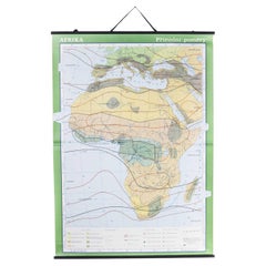
View AllLate 20th Century Educational Geographic Map - African Climate
Located in Hook, Hampshire
Late 20th Century Educational Geographic Map – African Climate
Late 20th Century Educational Geographic Map – African Climate. Good quality roll up school educational geographic map ...
Category
Late 20th Century Czech Posters
Materials
Cotton
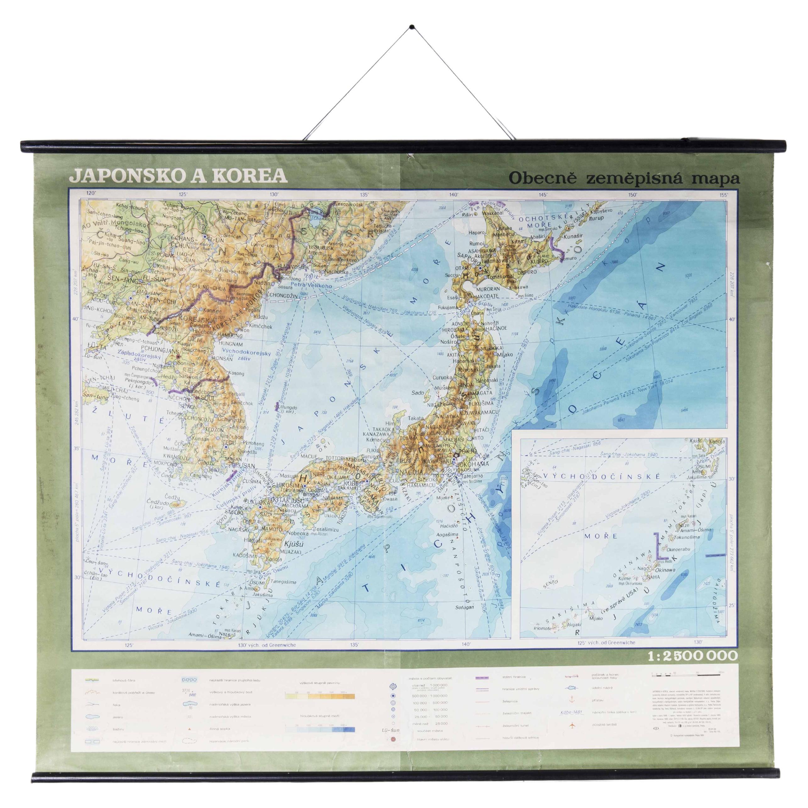
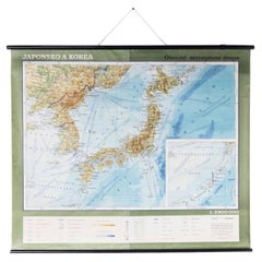
Late 20th Century Educational Geographic Map - Japan - Korea
Located in Hook, Hampshire
Late 20th Century Educational Geographic Map – Japan – Korea
Late 20th Century Educational Geographic Map – Japan – Korea. Good quality roll up school educat...
Category
Late 20th Century Czech Posters
Materials
Cotton
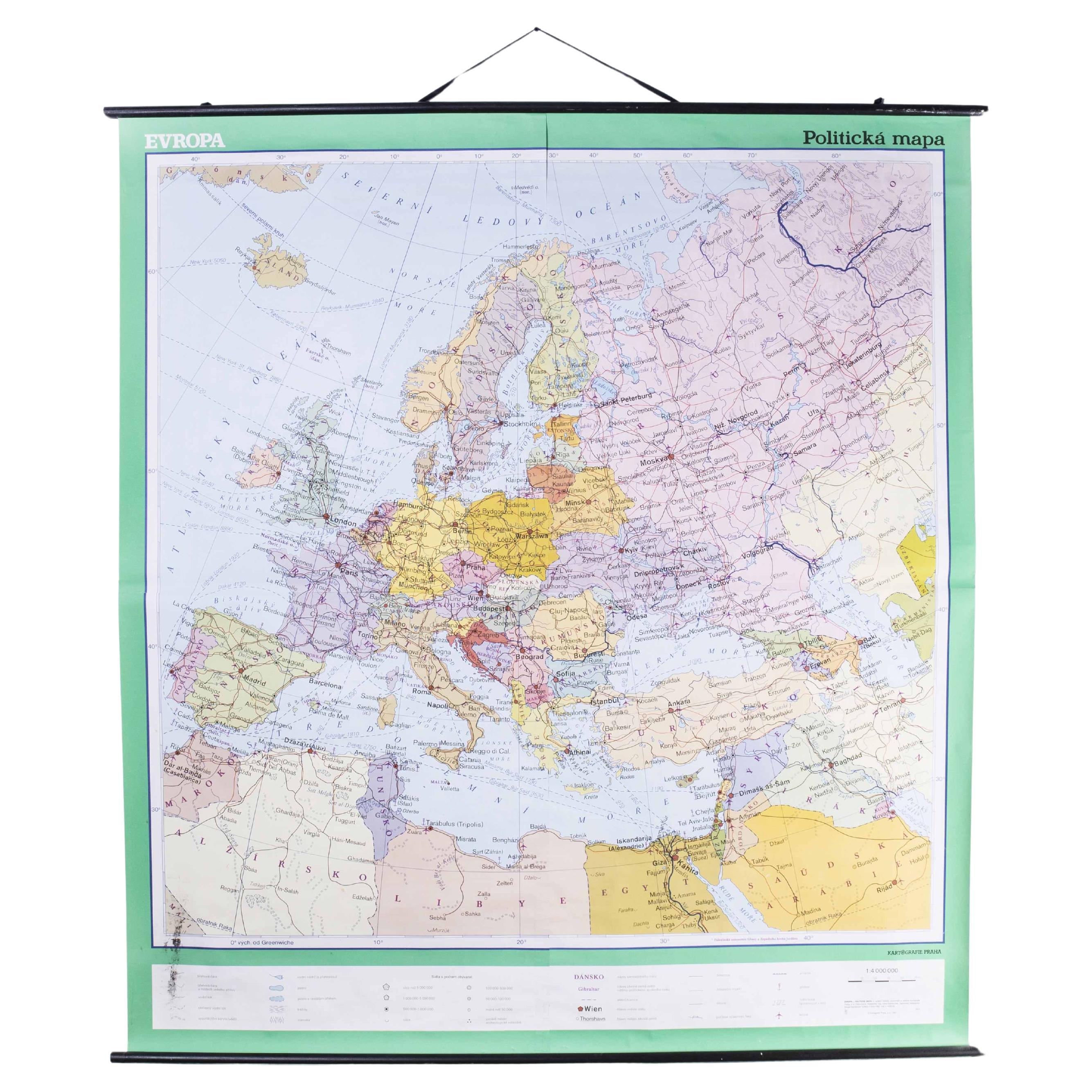
Late 20th Century Educational Geographic Map - European Countries
Located in Hook, Hampshire
Late 20th Century Educational Geographic Map – European Countries
Late 20th Century Educational Geographic Map – European Countries. Good quality roll up s...
Category
Late 20th Century Czech Posters
Materials
Cotton

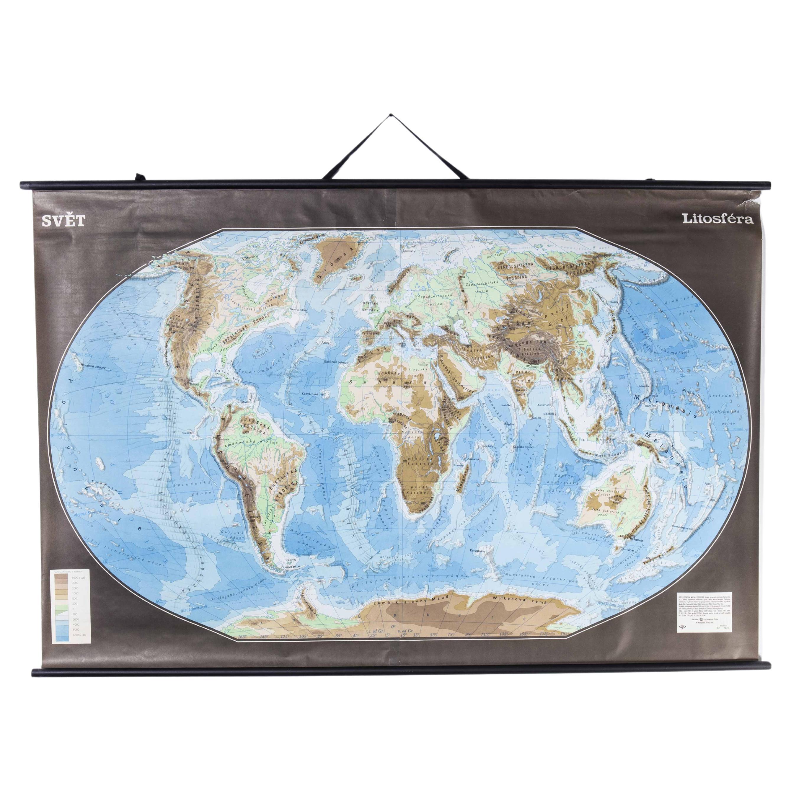
Late 20th Century Educational Geographic Map - Earths Lithosphere
Located in Hook, Hampshire
Late 20th Century Educational Geographic Map – Earths Lithosphere
Late 20th Century Educational Geographic Map – Earths Lithosphere. Good quality roll up school educational geographi...
Category
Late 20th Century Czech Posters
Materials
Cotton

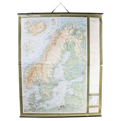
Late 20th Century Educational Geographic Map - Scandinavian Topography
Located in Hook, Hampshire
Late 20th Century Educational Geographic Map – Scandinavian Topography
Late 20th Century Educational Geographic Map – Scandinavian Topography. Good quality roll up school educational...
Category
Late 20th Century Czech Posters
Materials
Cotton
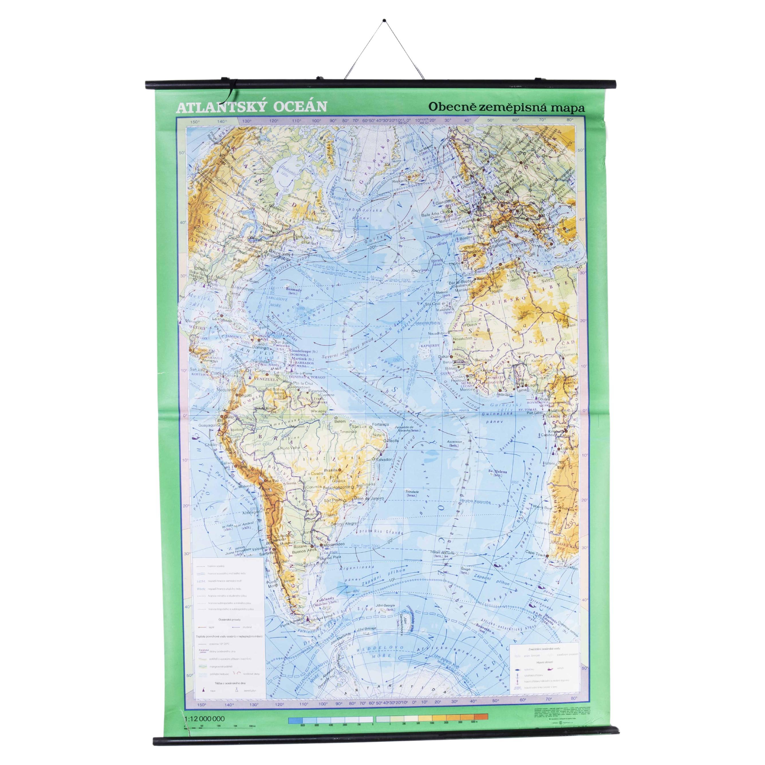
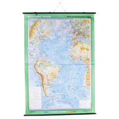
Late 20th Century Educational Geographic Map - Atlantic Currents
Located in Hook, Hampshire
Late 20th Century Educational Geographic Map – Atlantic Currents
Late 20th Century Educational Geographic Map – Atlantic Currents. Good quality roll up school educational geographic ...
Category
Late 20th Century Czech Posters
Materials
Cotton
You May Also Like
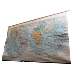
Vintage Geographical Map of the World Map, Vallardi Milan, Early 20th Century
Located in Cuneo, Italy (CN)
Vintage geographical map or planisphere, published by Vallardi publisher for the municipality of Milan, printed at the beginning of the 20th century,...
Category
20th Century Italian Prints
Materials
Paper
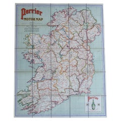
Early 20th c. Ireland Perrier Motor Map c.1910
Located in San Francisco, CA
ABOUT
Large bright vivid color-printed Perrier Motor Map, featuring the motoring roads of Ireland. Mounted to original linen back, folded into a cloth waterproof slipcase. Manufactu...
Category
Early 20th Century British Victorian Globes
Materials
Linen, Paper
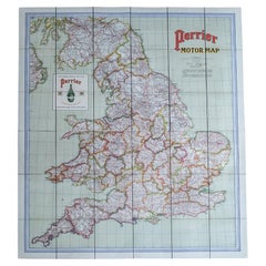
Early 20th c. England and Wales Perrier Motor Map c.1910
Located in San Francisco, CA
ABOUT
Large bright vivid color-printed Perrier Motor Map, featuring the motoring roads of England and Wales. Segmented in two sections and mounted to original linen back, folded int...
Category
Early 20th Century British Victorian Globes
Materials
Paper, Linen
Vintage Wall Chart of a Landscape and Geographic Map, circa 1955
Located in Langweer, NL
Vintage wall chart titled 'Kaart en Landschap'. This wall chart shows a mountain range and geographic map. Published by J.B. Wolters, circa 1955.
Category
Mid-20th Century Prints
Materials
Paper

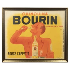
Original 20th Century French Bourin Poster
Located in Tetbury, Gloucestershire
Jacques and Pierre Bellenger designed this original vintage poster in 1936.
This clever image shows that Bourin Quinquina is the perfect versatile bev...
Category
Early 20th Century Swedish Posters
Materials
Paper
Early 20th Century Butlins Lithograph Advertising Poster
Located in London, GB
Early 20th century Butlins lithograph advertising poster
A charming, fun, and rare example of a 1940s lithograph advertising poster for Butlins fair. Produced by Willsons, Printers of Leicester. The advert is written in the form of a £5 reward for a lost grey parrot...
Category
Vintage 1940s British Mid-Century Modern Posters
Materials
Paper
