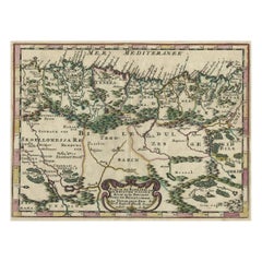
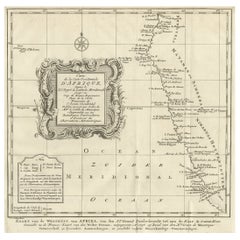
1747 British Map Showing the Kingdom of Judah on the West Coast of Africa
View Similar Items


Want more images or videos?
Request additional images or videos from the seller
1 of 21
1747 British Map Showing the Kingdom of Judah on the West Coast of Africa
About the Item
- Dimensions:Height: 17.33 in (44 cm)Width: 20.87 in (53 cm)Depth: 1.38 in (3.5 cm)
- Style:Other (In the Style Of)
- Materials and Techniques:
- Place of Origin:
- Period:
- Date of Manufacture:20th Century
- Condition:Wear consistent with age and use. Minor fading.
- Seller Location:West Sussex, GB
- Reference Number:1stDibs: LU2823330681922
About the Seller
4.7
Platinum Seller
Premium sellers with a 4.7+ rating and 24-hour response times
Established in 2012
1stDibs seller since 2017
1,955 sales on 1stDibs
Typical response time: 1 hour
Authenticity Guarantee
In the unlikely event there’s an issue with an item’s authenticity, contact us within 1 year for a full refund. DetailsMoney-Back Guarantee
If your item is not as described, is damaged in transit, or does not arrive, contact us within 7 days for a full refund. Details24-Hour Cancellation
You have a 24-hour grace period in which to reconsider your purchase, with no questions asked.Vetted Professional Sellers
Our world-class sellers must adhere to strict standards for service and quality, maintaining the integrity of our listings.Price-Match Guarantee
If you find that a seller listed the same item for a lower price elsewhere, we’ll match it.Trusted Global Delivery
Our best-in-class carrier network provides specialized shipping options worldwide, including custom delivery.More From This Seller
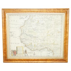
View AllGold Leaf Foil Pictorial Plan Map of the West Country of England Antique Style
Located in West Sussex, Pulborough
We are delighted to offer for sale this lovely Antique style pictorial plan map of the West Country of England etched in gold leaf foil
This is a very interesting and decorative p...
Category
20th Century English Adam Style Maps
Materials
Gold Leaf

$298 Sale Price
20% Off
Massive Pair Tall Prints on Canvas Italian Trajan & Roman Column Pillars
Located in West Sussex, Pulborough
We are delighted to offer for sale this stunning pair of absolutely massive Engravings on Canvas of the Italian Trajan column and one other Roman column, circa 1860
These are monu...
Category
Antique 1860s European Victorian Decorative Art
Materials
Canvas, Oak
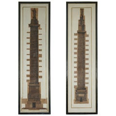
$4,888 Sale Price / set
20% Off
London 1744 Published Watercolour Antique Map of East Africa by Eman Bowen
Located in West Sussex, Pulborough
We are delighted to offer for sale this New and Accurate Map of Nubia & Abissinia, together with all the Kingdoms Tributary Thereto, and bordering upon them published in 1744 by Emanuel Bowen
This is a decorative antique engraved map of East Africa...
Category
Antique 1740s English George III Maps
Materials
Paper

$1,032 Sale Price
20% Off
Antique Original Robert Dodd 1748-1816 Copper Plate Print of Pheasant Shooting
Located in West Sussex, Pulborough
We are delighted to offer for sale this Robert Dodd 1748-1816 Copper Plate print published by The British Sportsman 1792 titled Pheasant hunting
An...
Category
Antique 1740s English Georgian Prints
Materials
Paper
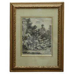
$814 Sale Price
20% Off
Pair of Bernard De Montfaucon Paris 1719 L'antiquite Original Grand Tour Prints
By Bernard de Montfaucaon
Located in West Sussex, Pulborough
We are delighted to offer for sale this lovely pair of original copper plate prints dating to 1719 by Bernard De Montfauucon of Paris.
Dom Bernard de Montfaucon, O.S.B. (French: [d? m?~fok?~]; 13 January 1655 – 21 December 1741) was a French Benedictine monk of the Congregation of Saint Maur. He was an astute scholar who founded the discipline of palaeography, as well as being an editor of works of the Fathers of the Church. He is regarded as one of the founders of the modern discipline of archaeology
Montfaucon was born on 13 January 1655 in the Castle of Soulatgé, a small village in the southern town of Corbières, then in the ancient Province of Languedoc, now in the modern Department of Aude. Other sources claimed his birth date is in 16 January, the most accepted date. After one year he was moved to the Castle of Roquetaillade, residence of his family. When he was seven, he was sent to Limoux, to the college run by the Fathers of Christian Doctrine
Montfaucon served in the French army as a volunteer and participated in the Franco-Dutch War of 1673. He was a captain of grenadiers and made two campaigns under the command of Marshall Turenne, participated in the Battle of Herbsthausen and fell ill in Saverne in Alsace. Because of his infectious illness he made a vow to Our Lady of Marceille to give one hundred livres to her sanctuary in Limoux and to become a monk, if he was able to return to his country as a result of her intervention.
After the death of Montfaucon's father at the Château de Roquetaillade, in 1675 he entered the novitiate of the Benedictine monastery of Bream in Toulouse. There he learned several ancient languages: Greek, Hebrew, Chaldean, Syriac, and Coptic.
In 1687 Montfaucon was called to the Abbey of Saint-Germain-des-Prés and he started to work on an edition of the works of the Greek Church...
Category
Antique 1710s French Grand Tour Prints
Materials
Wood, Paper
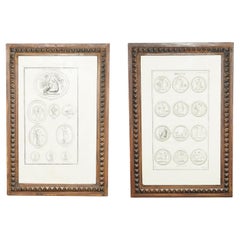
$651 Sale Price / set
20% Off
Exquisite Suite of Four 1800 Bouillon Copper Plate Engraved Roman Statue Prints
Located in West Sussex, Pulborough
We are delighted to offer for sale this very rare and highly collectable suite of four original 1800 dated copper plate prints by the genius that was Bouillon
These are sublime qu...
Category
Antique Early 1800s English George III Prints
Materials
Paper

$5,431 Sale Price / set
20% Off
You May Also Like
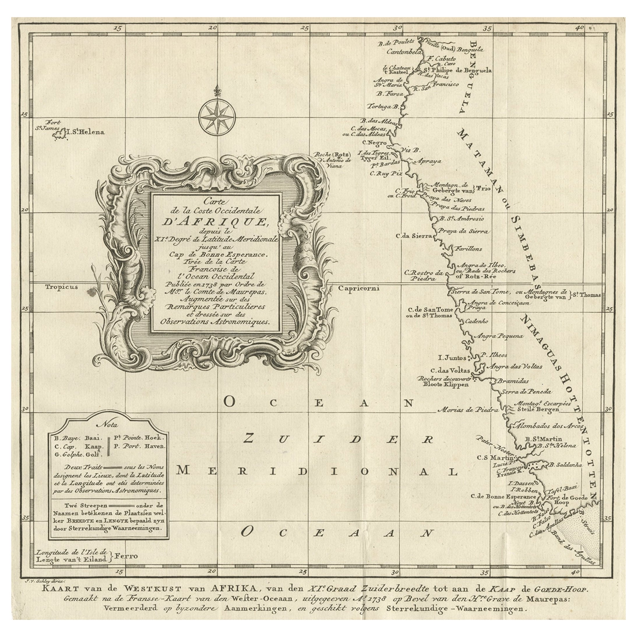
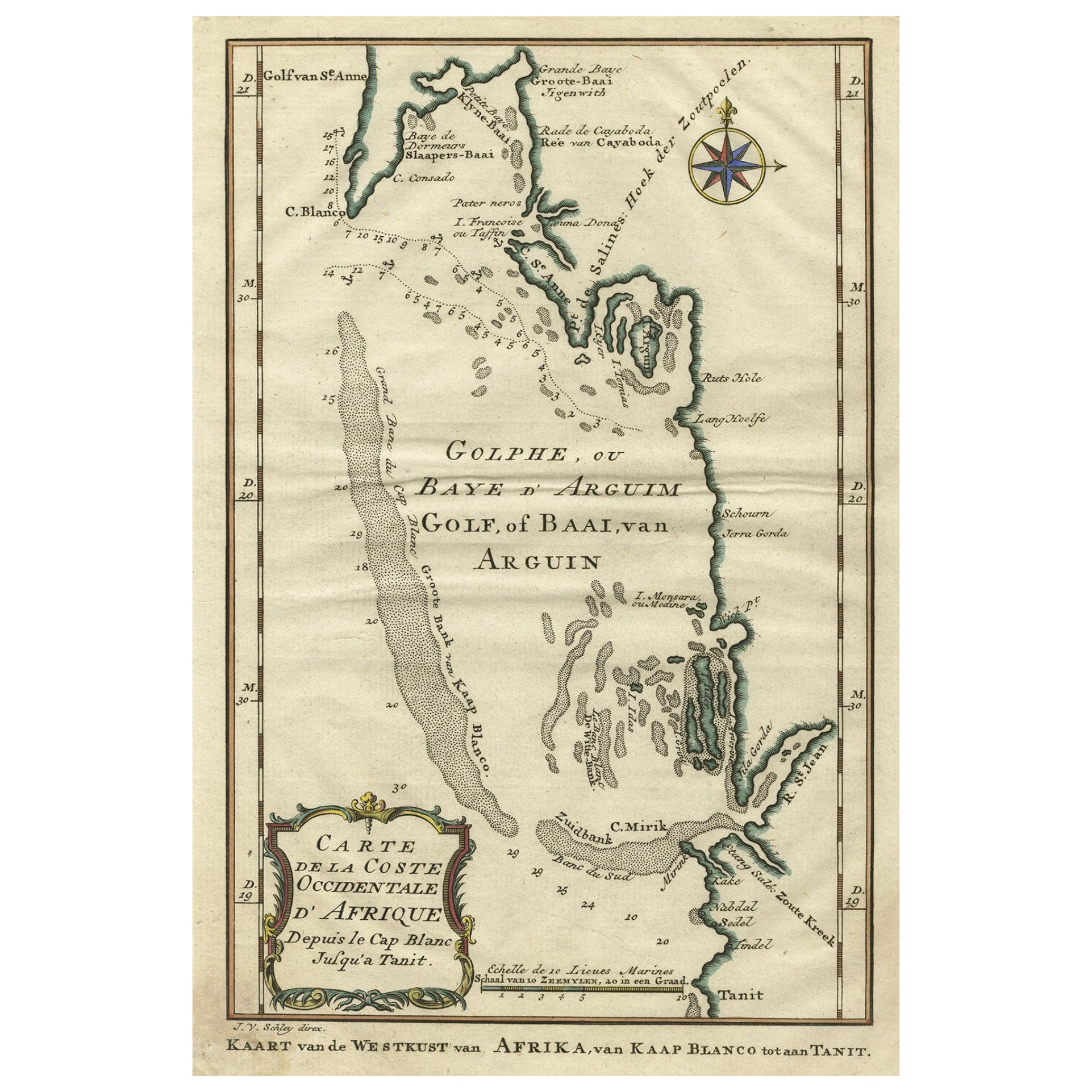
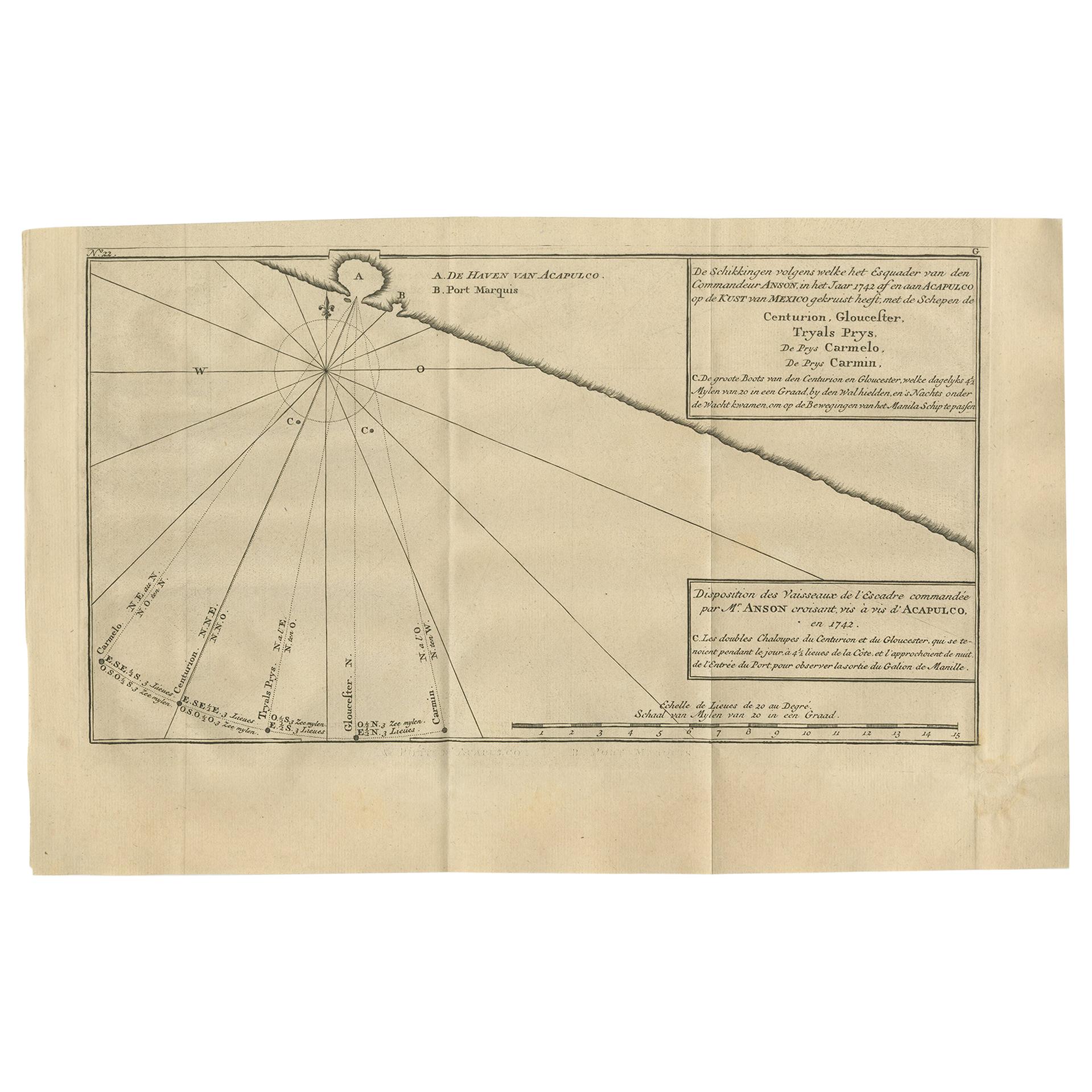
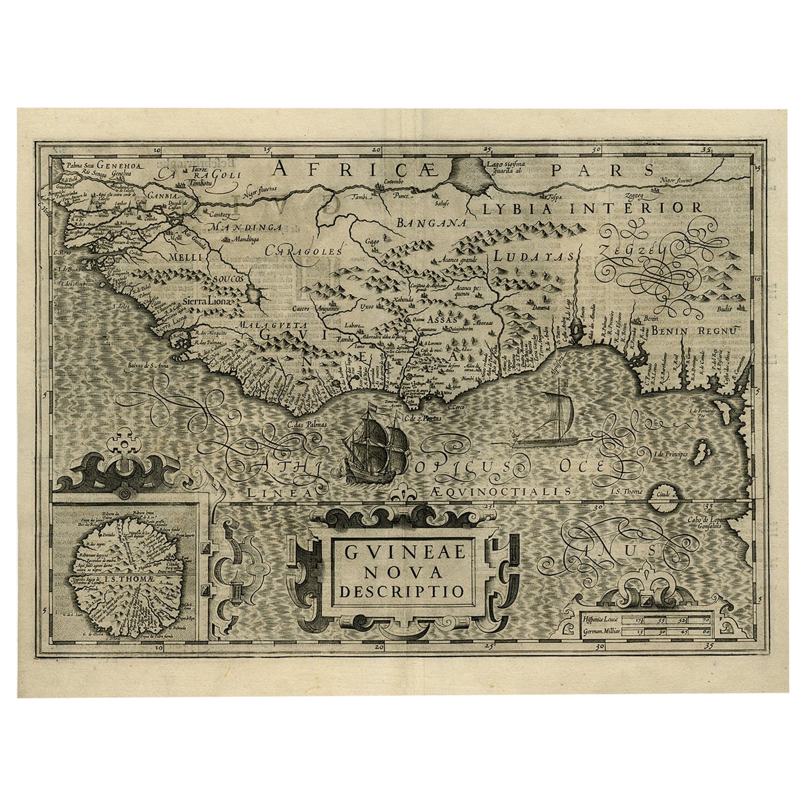
Dutch Antique Map of the West Coast of Africa, to the Cape of Good Hope, 1747
Located in Langweer, NL
Antique map of the Coast of Africa titled 'Kaart van de West Kust van Afrika (..)'.
Map of the west coast of Africa, from 11 degrees south latitude to the Cape of Good Hope. This...
Category
Antique 1740s Maps
Materials
Paper
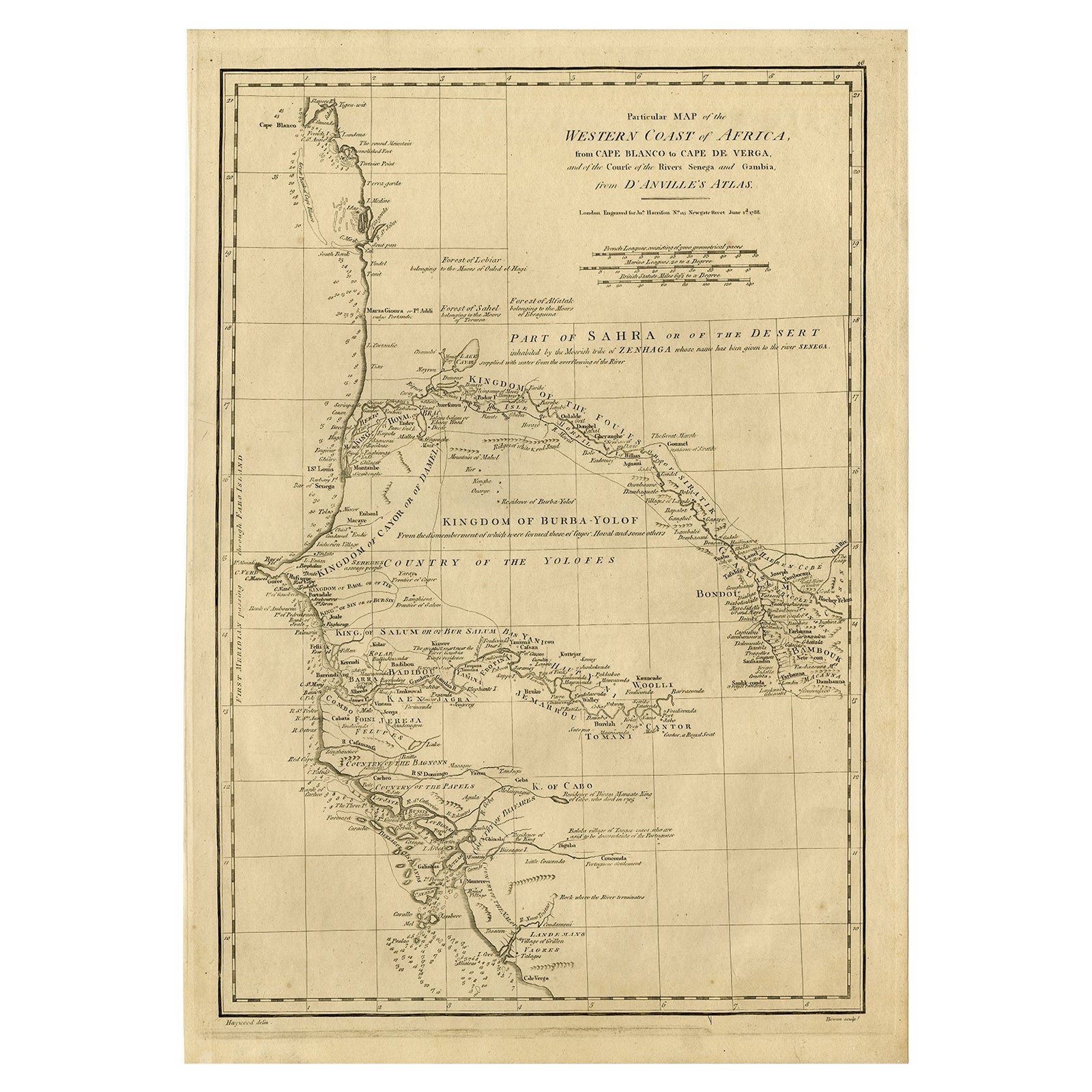
Original Detailed Antique Map of the East Coast of Africa, 1747
Located in Langweer, NL
Antique map titled 'Carte de la coste Orientale d'Afrique - Kaart van de Oostkust van Afrika'.
Original antique map of the east coast of Africa. Reaches from Cape of Good Hope an...
Category
Antique 1740s Maps
Materials
Paper

$176 Sale Price
20% Off
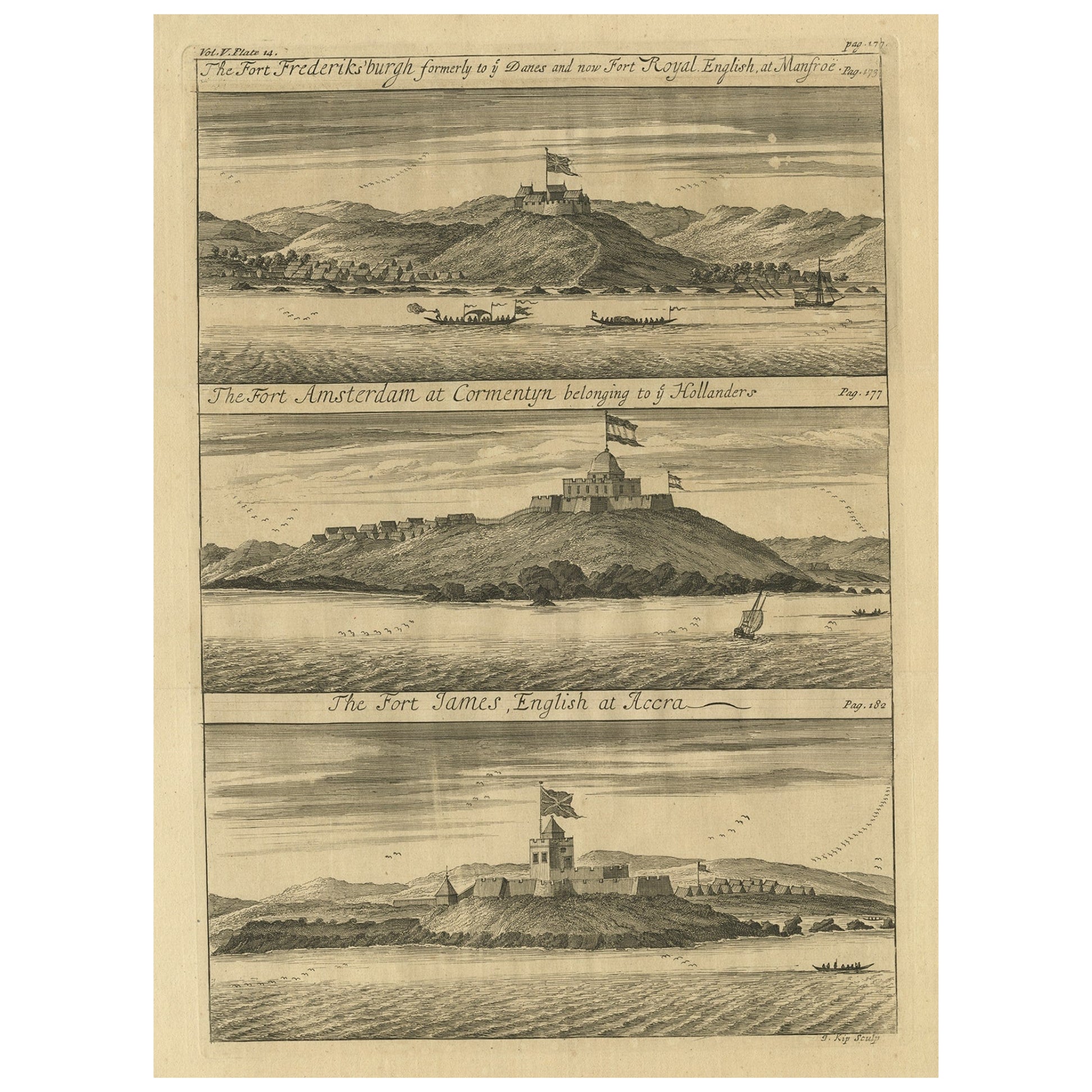
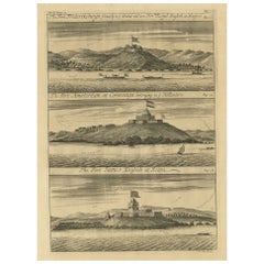
Copperplate Engraving Showing Forts on the West African Gold Coast, Ghana, 1744
Located in Langweer, NL
Antique print, titled: 'The Fort Fredricksburg formerly to ye Danes and now Fort Royal (…).' - A three panel copperplate engraving showing three forts on the West African Gold Coast, Ghana; a) The Fort Fredricksburgh formerly to ye Danes and now Fort Royal. English at Manfroe, b) The Fort Amsterdam at Cormentyn belonging to ye Hollanders, c) The Fort James, English at Accra. From: "A Collection of Voyages and Travels" published by John and Awnsham Churchill in London in 1744.
Artists and Engravers: Made by 'Johannes Kip' after 'A. Churchill'. Johannes Kip (b Amsterdam, 1653; d London, 1722). Dutch draughtsman, engraver and dealer, active in England. He was a pupil of Bastiaen Stopendaal (1636–1707) from 1668 to 1670. His earliest dated engravings are of 1672 (e.g. the Siege of Groningen , Hollstein, no. 4), and he supplied numerous plates for books published from that date onwards. His work brought him into contact with the court of William of Orange and in 1686 he produced six plates depicting William of Orange, his Wife and Attendants near The Hague (Hollstein, no. 5). Shortly after the Glorious Revolution of 1688 Kip followed the court to England. After settling in Westminster, he worked extensively for London publishers, engraving works after Francis Barlow, Caius Gabriel Cibber (e.g. Interior of the Danish Church in London , 1697; Hollstein, no. 6) and other London-based artists. His engravings were principally destined for book illustrations. The work for which Kip is best remembered is his large corpus...
Category
Antique 1740s Prints
Materials
Paper
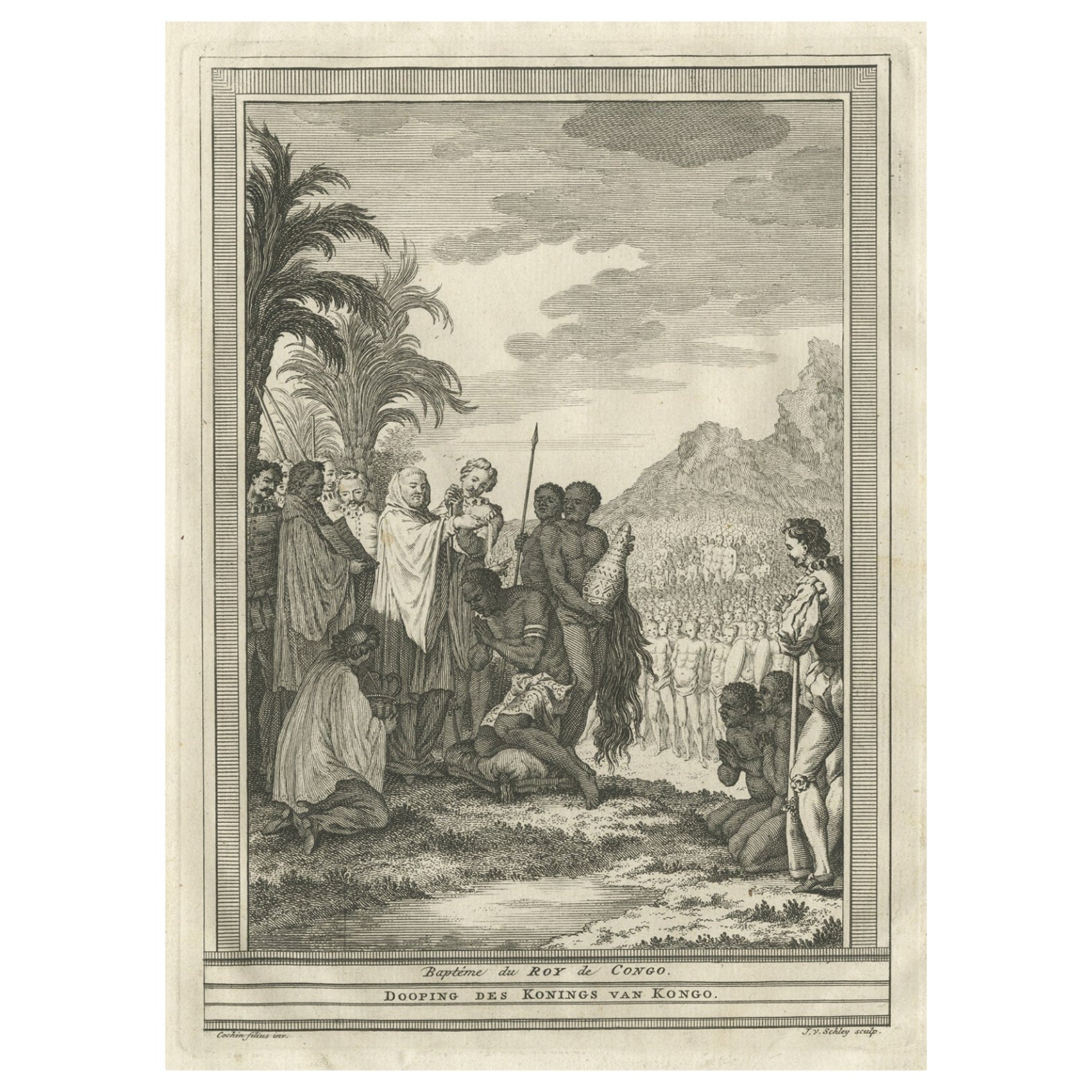
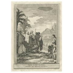
Antique Print of the Baptism of the King of Congo in Africa, 1747
By Jakob van der Schley
Located in Langweer, NL
Antique print titled 'Dooping des Konings van Kongo'. Print of the baptism of the King of Congo. This print originates from Prévost's 'Histoire générale des Voyages'.
Artists and ...
Category
Antique 18th Century Prints
Materials
Paper
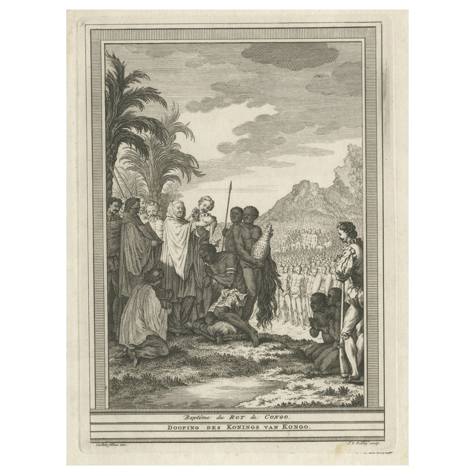
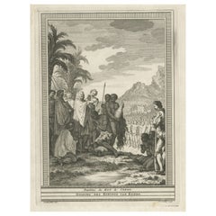
Antique Print of the Baptism of the King of Congo in Africa, 1747
By Jakob van der Schley
Located in Langweer, NL
Antique print titled 'Dooping des Konings van Kongo'. Print of the baptism of the King of Congo. This print originates from Prévost's 'Histoire générale des Voyages'.
Artists and En...
Category
Antique 18th Century Prints
Materials
Paper
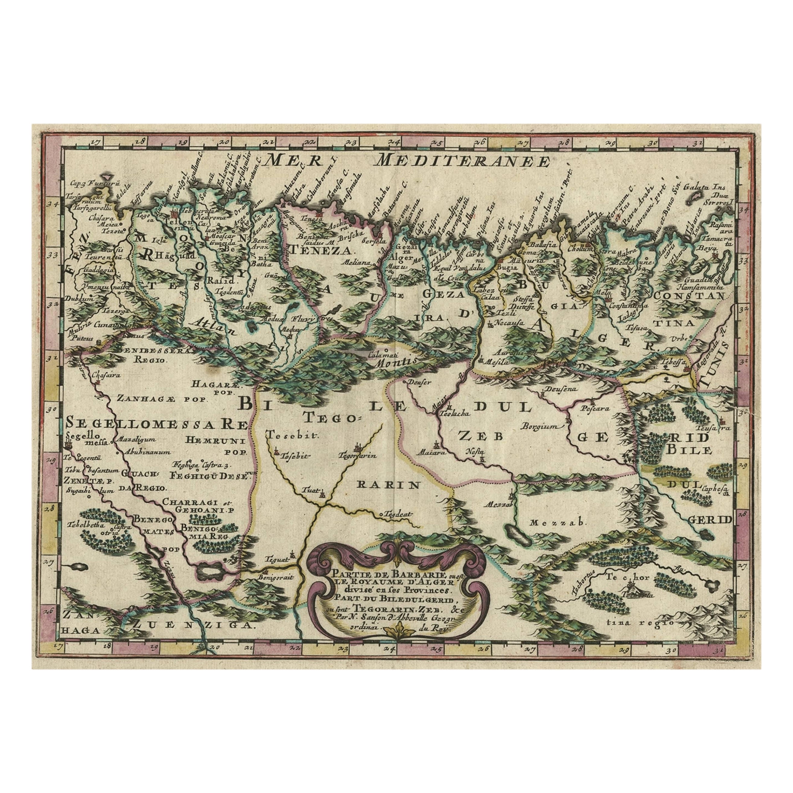
Copper-Engraved Map Showing the Algerian Coast of North Africa, Published 1683
Located in Langweer, NL
Antique map titled 'Partie de Barbarie, ou est le Royaume d'Alger (..)'.
Copper-engraved map showing the Algerian coast of North Africa. Published 1683.
Artists and Engravers:...
Category
Antique 1680s Maps
Materials
Paper