Items Similar to Very Old Antique Map of the Persian Empire by Magini, c.1597


Want more images or videos?
Request additional images or videos from the seller
1 of 5
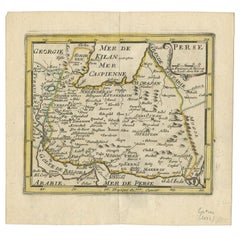
Very Old Antique Map of the Persian Empire by Magini, c.1597
About the Item
Antique map titled 'Persiae Regnum sive Sophorum Imperium'. Old map of the Persian Empire. This map originates from 'Geografia cioe Descrittione Universale della Terra' by G.A. Magini. Published by Giovanni Battista Galignani and Giorgio Galignani, Venice.
Artists and Engravers: Giovanni Antonio Magini (Padua; 1555-1617) was an Italian astronomer, cartographer, matematician and astrologer.
Condition: Good, general age-related toning. Latin text on verso, minor wear. Please study image carefully.
Date: c.1597
Overall size: 20.5 x 29.5 cm.
Image size: 17 x 12 cm.
We sell original antique maps to collectors, historians, educators and interior decorators all over the world. Our collection includes a wide range of authentic antique maps from the 16th to the 20th centuries. Buying and collecting antique maps is a tradition that goes back hundreds of years. Antique maps have proved a richly rewarding investment over the past decade, thanks to a growing appreciation of their unique historical appeal. Today the decorative qualities of antique maps are widely recognized by interior designers who appreciate their beauty and design flexibility. Depending on the individual map, presentation, and context, a rare or antique map can be modern, traditional, abstract, figurative, serious or whimsical. We offer a wide range of authentic antique maps for any budget.
- Dimensions:Height: 11.62 in (29.5 cm)Width: 8.08 in (20.5 cm)Depth: 0 in (0.01 mm)
- Materials and Techniques:
- Period:
- Date of Manufacture:circa 1597
- Condition:Condition: Good, general age-related toning. Latin text on verso, minor wear. Please study image carefully.
- Seller Location:Langweer, NL
- Reference Number:Seller: BG-12278-71stDibs: LU3054327872412
About the Seller
5.0
Recognized Seller
These prestigious sellers are industry leaders and represent the highest echelon for item quality and design.
Platinum Seller
Premium sellers with a 4.7+ rating and 24-hour response times
Established in 2009
1stDibs seller since 2017
2,412 sales on 1stDibs
Typical response time: 1 hour
- ShippingRetrieving quote...Shipping from: Langweer, Netherlands
- Return Policy
Authenticity Guarantee
In the unlikely event there’s an issue with an item’s authenticity, contact us within 1 year for a full refund. DetailsMoney-Back Guarantee
If your item is not as described, is damaged in transit, or does not arrive, contact us within 7 days for a full refund. Details24-Hour Cancellation
You have a 24-hour grace period in which to reconsider your purchase, with no questions asked.Vetted Professional Sellers
Our world-class sellers must adhere to strict standards for service and quality, maintaining the integrity of our listings.Price-Match Guarantee
If you find that a seller listed the same item for a lower price elsewhere, we’ll match it.Trusted Global Delivery
Our best-in-class carrier network provides specialized shipping options worldwide, including custom delivery.More From This Seller
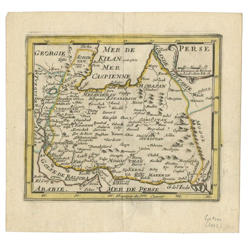
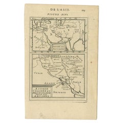
View AllRare Small Antique Map of the Persian Empire, 1692
Located in Langweer, NL
Antique map titled 'Perse'. Small engraved map of the Persian Empire, decorated with a simple cartouche and armorial shield. This map originates from 'L'Atlas en Abrege, ou Nouvelle ...
Category
Antique 17th Century Maps
Materials
Paper
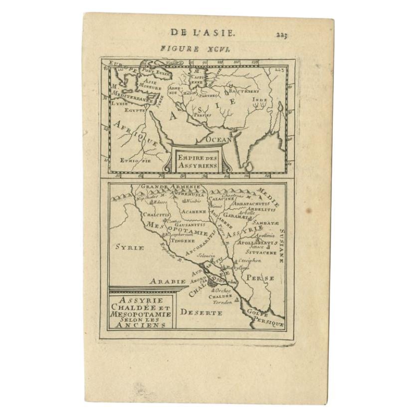
Antique Map of the Empire of the Assyriens by Mallet, 1683
By Alain Manesson Mallet
Located in Langweer, NL
Antique map titled 'Empire des Assyriens' and 'Assyrie Chaldee et Mesopotamie selon les Anciens'. Two maps on one sheet, the upper sheet showing the Empire of the Assyriens and the second showing the region of the Tigres and Euphrates Rivers. This map originates from Alain Manesson Mallet's 'Description de l 'Univers'.
Artists and Engravers: Alain Manesson Mallet (1630–1706) was a French cartographer and engineer. He started his career as a soldier in the army of Louis XIV, became a Sergeant-Major in the artillery and an Inspector of Fortifications. He also served under the King of Portugal, before returning to France, and his appointment to the court of Louis XIV. His military engineering and mathematical background led to his position teaching mathematics at court. His major publications were Description de L'Univers (1683) in 5 volumes, and Les Travaux de Mars ou l'Art de la Guerre (1684) in 3 volumes. His Description de L'Universe contains a wide variety of information, including star maps...
Category
Antique 17th Century Maps
Materials
Paper
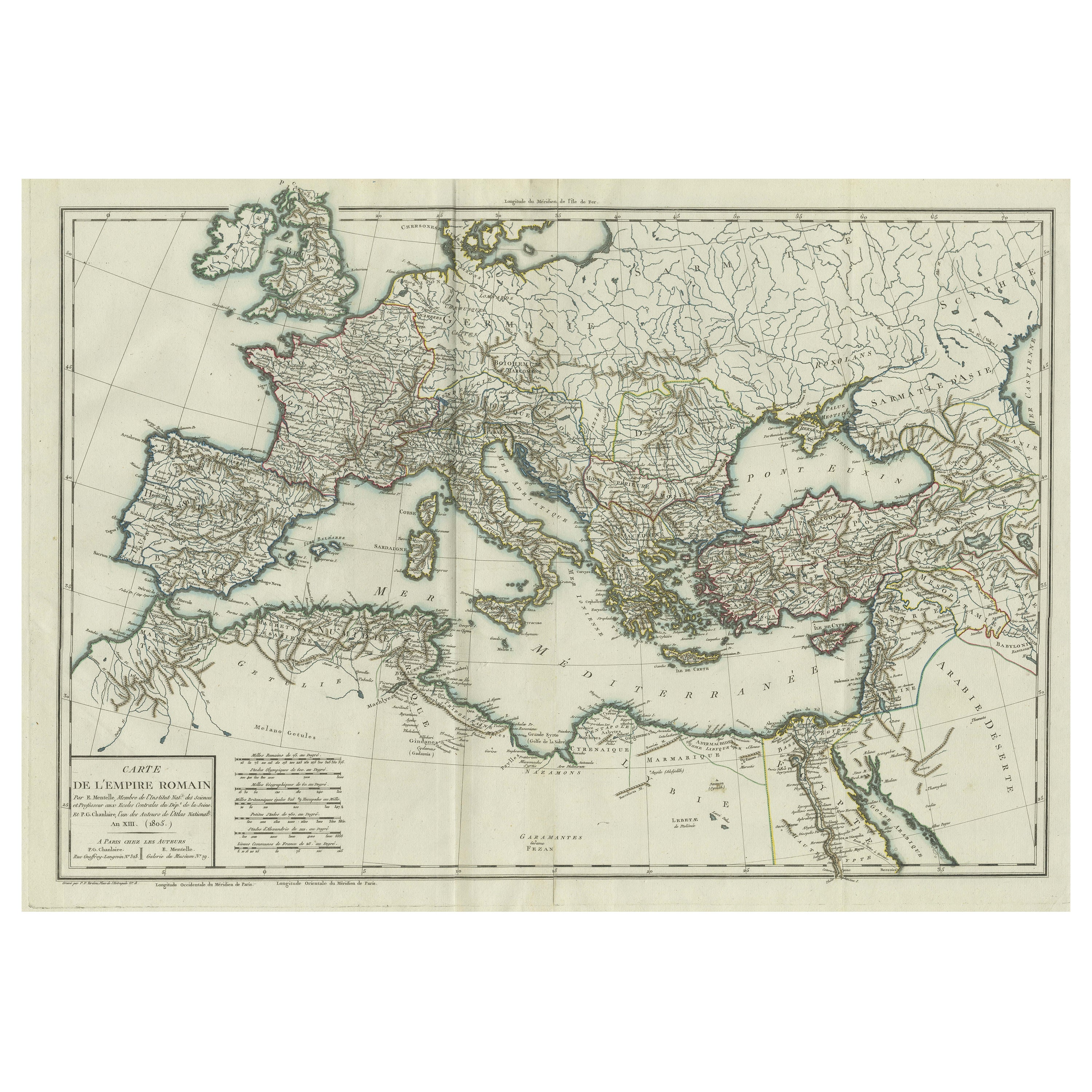
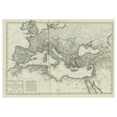
Original Antique Map of the Roman Empire
Located in Langweer, NL
Antique map titled 'Carte de l'Empire Romain'. Original antique map of the Roman Empire, two sheets joined. Engraved by Pierre Francois Tardieu and published by Edme Mentelle, circa ...
Category
Antique Late 18th Century Maps
Materials
Paper
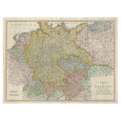
Large Antique Map of the German Empire
Located in Langweer, NL
Antique map titled 'A Map of Germany (..)'. Large antique map of the German Empire, highly detailed. Engraved by T. Kitchin. Published J. Blair, cir...
Category
Antique Late 18th Century Maps
Materials
Paper
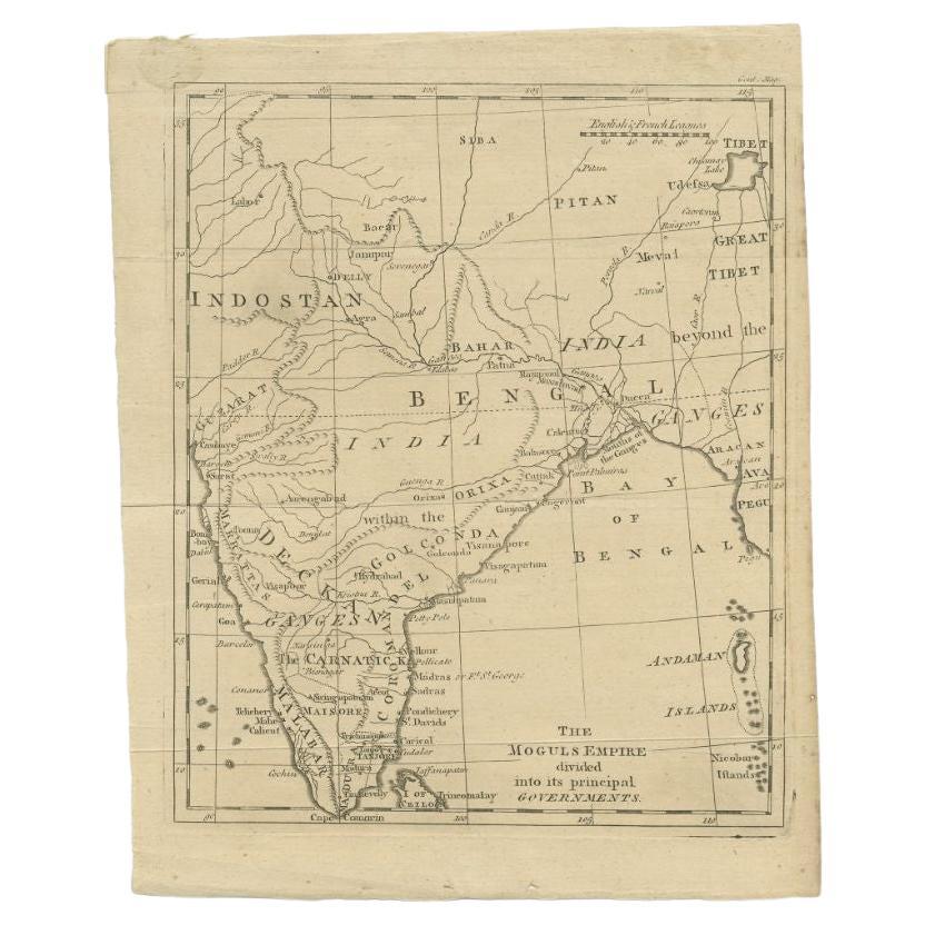
Antique Map of the Mongol Empire, 1767
Located in Langweer, NL
Antique map titled 'The Moguls Empire divided into its principal governments'. Old map of India, Bangladesh, and parts of eastern China.
Artists and Engravers: Published in the G...
Category
Antique 18th Century Maps
Materials
Paper

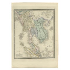
Antique Map of the Burmese Empire by Wyld, '1845'
Located in Langweer, NL
Antique map titled 'Map of Burman Empire, Siam, Cochin China and Ton-King'. Original antique map of the Burmese Empire. This map originates from 'An Atlas of the World, Comprehending...
Category
Antique Mid-19th Century Maps
Materials
Paper
$232 Sale Price
20% Off
You May Also Like
1597 German Map of Alexandria by Georg Braun and Frans Hogenberg
By Georg Braun and Frans Hogenberg
Located in Chapel Hill, NC
1597 Map of Alexandria by Georg Braun and Frans Hogenberg, Germany. From "Civitas Orbis Terrarum", part 2, published in Cologne by Bertram Buchholz. Printed in 2 parts. Title: "Alexa...
Category
Antique 16th Century German Renaissance Maps
Materials
Paper

Super Rare Antique French Map of Chine and the Chinese Empire, 1780
Located in Amsterdam, Noord Holland
Super Rare Antique French Map of Chine and the Chinese Empire, 1780
Very nice map of Asia. 1780 Made by Bonne.
Additional information:
Type: Map
...
Category
Antique 18th Century European Maps
Materials
Paper

$584 Sale Price
31% Off
Old Horizontal Map of England
By Tasso
Located in Alessandria, Piemonte
ST/520 - Old rare Italian map of England, dated 1826-1827 - by Girolamo Tasso, editor in Venise, for the atlas of M.r Le-Sage.
Category
Antique Early 19th Century Italian Other Prints
Materials
Paper

1597 Abraham Ortelius Map Burgundy, France Entitled "Bvrgvndiae dvcatvs Ric.a010
Located in Norton, MA
1597 Abraham Ortelius map of Burgundy, France entitled
"Bvrgvndiae dvcatvs
Ric.a010
Description: Ortelius is best known for producing the atla...
Category
Antique 16th Century Dutch Maps
Materials
Paper

Original Antique Map of The Philippines. C.1900
Located in St Annes, Lancashire
Fabulous map of The Philippines
Original color.
Engraved and printed by the George F. Cram Company, Indianapolis.
Published, C.1900.
Unframed.
Free shipping.
Category
Antique 1890s American Maps
Materials
Paper

Original Antique Map of The World by Thomas Clerk, 1817
Located in St Annes, Lancashire
Great map of The Eastern and Western Hemispheres
On 2 sheets
Copper-plate engraving
Drawn and engraved by Thomas Clerk, Edinburgh.
Published by Mackenzie And Dent, 1817
...
Category
Antique 1810s English Maps
Materials
Paper

Recently Viewed
View AllMore Ways To Browse
Vintage Tuareg Rug
Walter Nichols Rug
Wavy Table Legs
White Plastic Coffee Table
Will Coggin
Wooden Bar Cart
18 Oak Side Table
18th Century Swedish Chairs
1970s Lucite Chairs
19th Century Italian Straw Chairs
90s Desk
Adrian Pearsall Couch
Antique Hand Painted Tapestry
Antique Mixing Table
Antique Pull Out Dining Table
Antique Silver Salvers
Antique Walnut Dressing Table
Baroque Silk Rug