Items Similar to Two Sheet Map of the Principality of Wales Divided into Counties, 1804


Want more images or videos?
Request additional images or videos from the seller
1 of 5
Two Sheet Map of the Principality of Wales Divided into Counties, 1804
About the Item
A well engraved and detailed large-scale map of Wales, printed on two sheets .
The map is thoroughly detailed and includes good information regarding the turnpike and mail roads as well as distances between market towns and also the canal network. Details shown include the canals, distances between market towns, "gentlemen's houses", and the sandbanks and hidden rocks in Cardigan Bay.
Original outline and wash colour defines the county's hundreds which are also listed in a numbered key.
The map first appeared in Smith's "New English Atlas Being A Complete Set of County Maps". Smith was a stationer and mapseller working in the Strand, London, from about 1800 onwards and continued the standard set by John Cary for precise, detailed maps, finely produced and without the embellishments of the previous century.
The maps from his county atlas set a new standard for their presentation and execution with the skilful fashion in which the wealth of cartographic detail has been compressed into the folio sheet. These maps justly met with great commercial success, being re-issued in atlas form and as folding maps into the 1860's.
With attractive colour the map has light, but negligible, centrefold discolouration.
- Dimensions:Height: 21.26 in (54 cm)Width: 25.2 in (64 cm)Depth: 0.02 in (0.5 mm)
- Sold As:Set of 2
- Materials and Techniques:Paper,Engraved
- Period:
- Date of Manufacture:1804
- Condition:Wear consistent with age and use. General age-related toning. Two small brown spots on the top sheet and light offset on the second, but overall a stunning set in original colors, perfectly fine for framing. Please study image carefully.
- Seller Location:Langweer, NL
- Reference Number:Seller: BG-12924-4 & 51stDibs: LU3054326992402
About the Seller
5.0
Recognized Seller
These prestigious sellers are industry leaders and represent the highest echelon for item quality and design.
Platinum Seller
Premium sellers with a 4.7+ rating and 24-hour response times
Established in 2009
1stDibs seller since 2017
2,415 sales on 1stDibs
Typical response time: 1 hour
- ShippingRetrieving quote...Shipping from: Langweer, Netherlands
- Return Policy
Authenticity Guarantee
In the unlikely event there’s an issue with an item’s authenticity, contact us within 1 year for a full refund. DetailsMoney-Back Guarantee
If your item is not as described, is damaged in transit, or does not arrive, contact us within 7 days for a full refund. Details24-Hour Cancellation
You have a 24-hour grace period in which to reconsider your purchase, with no questions asked.Vetted Professional Sellers
Our world-class sellers must adhere to strict standards for service and quality, maintaining the integrity of our listings.Price-Match Guarantee
If you find that a seller listed the same item for a lower price elsewhere, we’ll match it.Trusted Global Delivery
Our best-in-class carrier network provides specialized shipping options worldwide, including custom delivery.More From This Seller
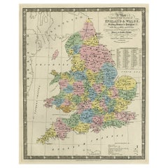
View AllColourful Antique Map of England and Wales Divided in Counties, 1854
Located in Langweer, NL
Antique map titled 'A Map Shewing the Places in England & Wales Sending Members to Parliament with the numbers returned, divisions of counties and population, places of county electi...
Category
Antique 19th Century Maps
Materials
Paper
$600 Sale Price
20% Off
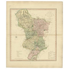
Antique County Map of Derbyshire, England, 1804
Located in Langweer, NL
Antique county map of Derbyshire first published, circa 1800. Villages, towns, and cities illustrated include Chesterfield, Wirksworth, Derby, and ...
Category
Antique Early 1800s Maps
Materials
Paper
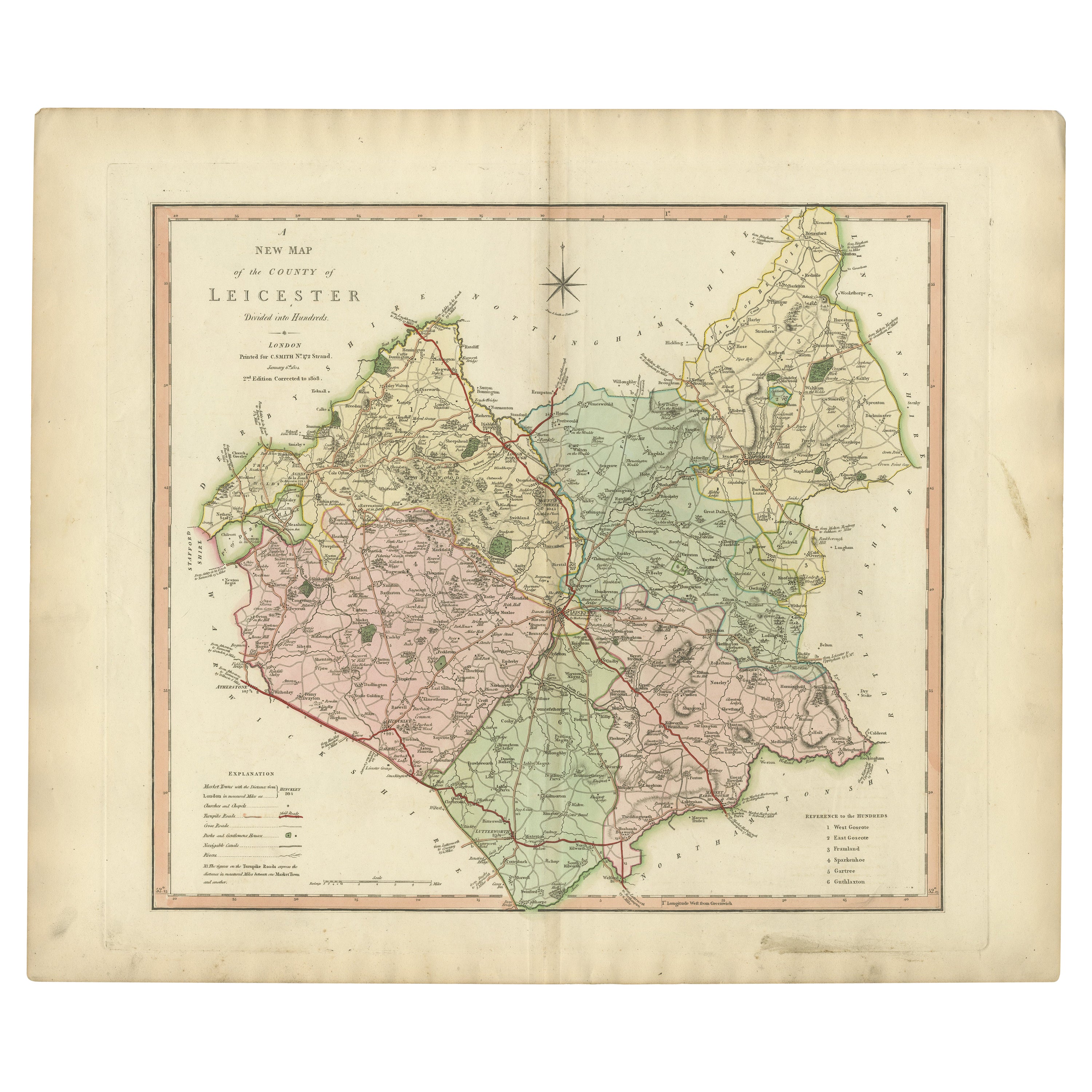
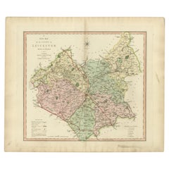
Antique County Map of Leicestershire, England, 1804
Located in Langweer, NL
Antique county map of Leicestershire first published c.1800. Villages, towns, and cities illustrated include Lutterworth, Ashby, Hinkley, and Marke...
Category
Antique Early 1800s Maps
Materials
Paper
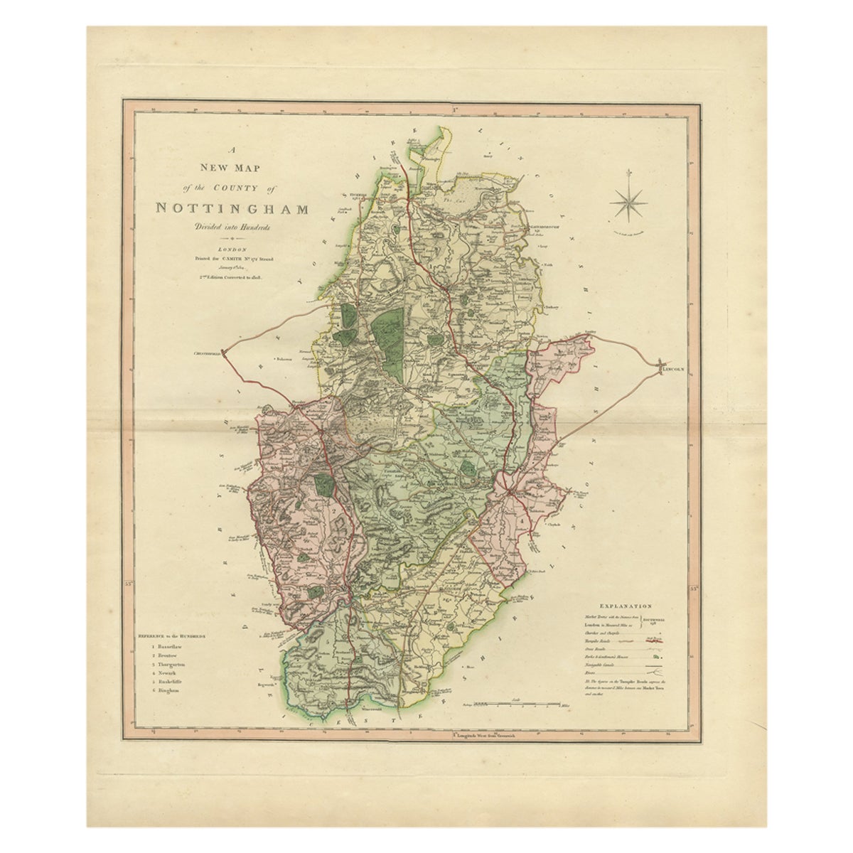
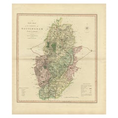
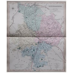
Antique Decorative Map of The County of Nottinghamshire, England, 1804
Located in Langweer, NL
Antique county map of Nottinghamshire first published c.1800. Villages, towns, and cities illustrated include Worksop, Neware, Tuxford, and Maplebe...
Category
Antique Early 1800s Maps
Materials
Paper
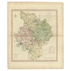
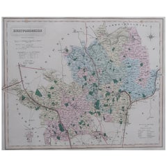
Antique Decorative County Map of Huntingdonshire, England, 1804
Located in Langweer, NL
Antique county map of Huntingdonshire first published c.1800. Cities illustrated include Kimbolton, Chesterton, Folkesworth, and Great Stewkeley.
Charles Smith was a cartographer ...
Category
Antique Early 1800s Maps
Materials
Paper
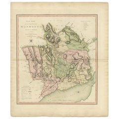
Antique County Map of Monmouthshire, England, circa 1804
Located in Langweer, NL
Antique county map of Monmouthshire first published circa 1800. Villages, towns, and cities illustrated include Newport, Chepstow, Rockfield, and P...
Category
Antique Early 1800s Maps
Materials
Paper
You May Also Like
Antique Map of Principality of Monaco
By Antonio Vallardi Editore
Located in Alessandria, Piemonte
ST/619 - "Old Geographical Atlas of Italy - Topographic map of ex-Principality of Monaco" -
ediz Vallardi - Milano -
A somewhat special edition ---
Category
Antique Late 19th Century Italian Other Prints
Materials
Paper

Original Antique English County Map, Huntingdonshire, J & C Walker, 1851
Located in St Annes, Lancashire
Great map of Huntingdonshire
Original colour
By J & C Walker
Published by Longman, Rees, Orme, Brown & Co. 1851
Unframed.
Category
Antique 1850s English Other Maps
Materials
Paper
Original Antique English County Map, Durham, J & C Walker, 1851
Located in St Annes, Lancashire
Great map of Durham
Original colour
By J & C Walker
Published by Longman, Rees, Orme, Brown & Co. 1851
Unframed.
Category
Antique 1850s English Other Maps
Materials
Paper

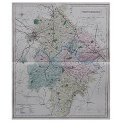
Original Antique English County Map, Warwickshire, J & C Walker, 1851
Located in St Annes, Lancashire
Great map of Warwickshire
Original colour
By J & C Walker
Published by Longman, Rees, Orme, Brown & Co. 1851
Unframed.
Category
Antique 1850s English Other Maps
Materials
Paper
Original Antique English County Map, Hertfordshire. J & C Walker, 1851
Located in St Annes, Lancashire
Great map of Hertfordshire
Original colour
By J & C Walker
Published by Longman, Rees, Orme, Brown & Co. 1851
Unframed.
Category
Antique 1850s English Other Maps
Materials
Paper
Original Antique English County Map, Rutland, J & C Walker, 1851
Located in St Annes, Lancashire
Great map of Rutland
Original colour
By J & C Walker
Published by Longman, Rees, Orme, Brown & Co. 1851
Unframed.
Category
Antique 1850s English Other Maps
Materials
Paper

Recently Viewed
View AllMore Ways To Browse
English Gentlemen
English Prints 1800s
Schumacher Pillows Black
Short Bench
Silver Mustard Spoons
Smooth Stone Coffee Table
Spindle Windsor
Step Stool
Swing Leg Table
Tapered Wood Pedestal
Thayer Coggin Chair Chrome
The Couch Navone
Three Footed Bowl
Throne Cover
Travertine Italian Pedestal
Tubular Steel Coffee Table
United Wilson
Velvet Club Lounge Chairs