Items Similar to Two Antique Maps of Europe '1789 and in 1813' on One Sheet, Published in 1842


Want more images or videos?
Request additional images or videos from the seller
1 of 5
Two Antique Maps of Europe '1789 and in 1813' on One Sheet, Published in 1842
About the Item
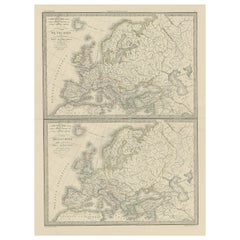
Antique map titled 'Carte de l'Europe'. Two maps of Europe. The upper map depicts Europe in 1789, the lower map depicts Europe in 1813. This map originates from 'Atlas universel de géographie ancienne et moderne (..)' by Pierre M. Lapie and Alexandre E. Lapie.
Artists and Engravers: Pierre M. Lapie was a French cartographer and engraver. He was the father of cartographer Alexandre Emile Lapie.
Condition: Very good, general age-related toning. Original folding line, blank verso. Please study image carefully.
Date: 1842
Overall size: 50.5 x 68 cm.
Image size: 40 x 54.5 cm.
We sell original antique maps to collectors, historians, educators and interior decorators all over the world. Our collection includes a wide range of authentic antique maps from the 16th to the 20th centuries. Buying and collecting antique maps is a tradition that goes back hundreds of years. Antique maps have proved a richly rewarding investment over the past decade, thanks to a growing appreciation of their unique historical appeal. Today the decorative qualities of antique maps are widely recognized by interior designers who appreciate their beauty and design flexibility. Depending on the individual map, presentation, and context, a rare or antique map can be modern, traditional, abstract, figurative, serious or whimsical. We offer a wide range of authentic antique maps for any budget.
- Dimensions:Height: 26.78 in (68 cm)Width: 19.89 in (50.5 cm)Depth: 0 in (0.01 mm)
- Materials and Techniques:
- Period:
- Date of Manufacture:1842
- Condition:
- Seller Location:Langweer, NL
- Reference Number:Seller: BG-12338-191stDibs: LU3054326173382
About the Seller
5.0
Recognized Seller
These prestigious sellers are industry leaders and represent the highest echelon for item quality and design.
Platinum Seller
Premium sellers with a 4.7+ rating and 24-hour response times
Established in 2009
1stDibs seller since 2017
2,419 sales on 1stDibs
Typical response time: <1 hour
- ShippingRetrieving quote...Shipping from: Langweer, Netherlands
- Return Policy
Authenticity Guarantee
In the unlikely event there’s an issue with an item’s authenticity, contact us within 1 year for a full refund. DetailsMoney-Back Guarantee
If your item is not as described, is damaged in transit, or does not arrive, contact us within 7 days for a full refund. Details24-Hour Cancellation
You have a 24-hour grace period in which to reconsider your purchase, with no questions asked.Vetted Professional Sellers
Our world-class sellers must adhere to strict standards for service and quality, maintaining the integrity of our listings.Price-Match Guarantee
If you find that a seller listed the same item for a lower price elsewhere, we’ll match it.Trusted Global Delivery
Our best-in-class carrier network provides specialized shipping options worldwide, including custom delivery.More From This Seller
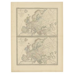
View AllTwo Antique Maps of Europe on One Sheet in Different Time Periods, 1842
Located in Langweer, NL
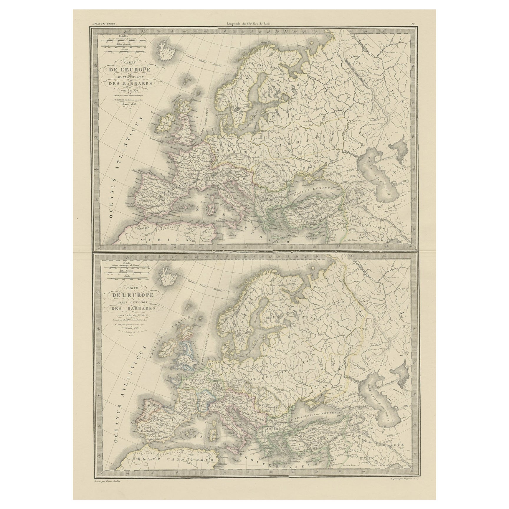
Antique map titled 'Carte de l'Europe'. Two maps of Europe. The upper map depicts Europe in the year 350, the lower map depicts Europe in the 5th century. This map originates from 'A...
Category
Antique 19th Century Maps
Materials
Paper
Antique Map of Europe in the Year 800 and 1500, Published in 1842
Located in Langweer, NL
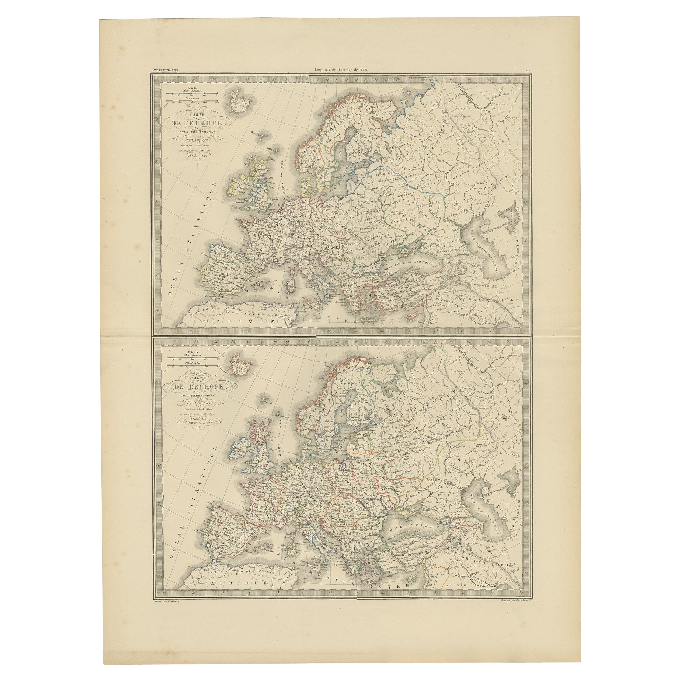
Antique map titled 'Carte de l'Europe'. Two maps of Europe. The upper map depicts Europe in the year 800, the lower map depicts Europe in 1500. This map originates from 'Atlas univer...
Category
Antique 19th Century Maps
Materials
Paper
Antique Map of Russia in Europe, 1842
Located in Langweer, NL
Antique map titled 'Carte de la Russie d'Europe'. Map of Russia in Europe. This map originates from 'Atlas universel de géographie ancienne et moderne (....
Category
Antique 19th Century Maps
Materials
Paper

$221 Sale Price
20% Off
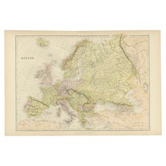
Antique Map of Europe by Lapie, 1842
Located in Langweer, NL
Antique map titled 'Carte de l'Europe'. Map of Europe. This map originates from 'Atlas universel de géographie ancienne et moderne (..)' by Pierre M. Lapie and Alexandre E. Lapie. Pi...
Category
Antique Mid-19th Century Maps
Materials
Paper

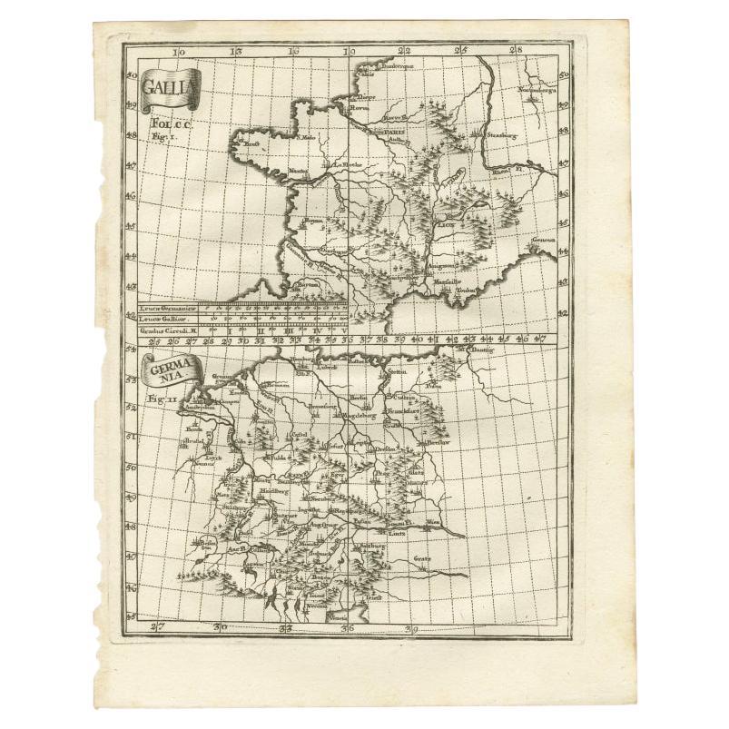
Antique Map of Gallia and Germania on one Sheet, c.1703
Located in Langweer, NL
Antique map depicting France (Gallia) and Germany (Germania). Printed for Scherer's 'Atlas Novus' (1702-1710).
Artists and Engravers: Heinrich Scherer (1628-1704) was a Professor...
Category
Antique 18th Century Maps
Materials
Paper
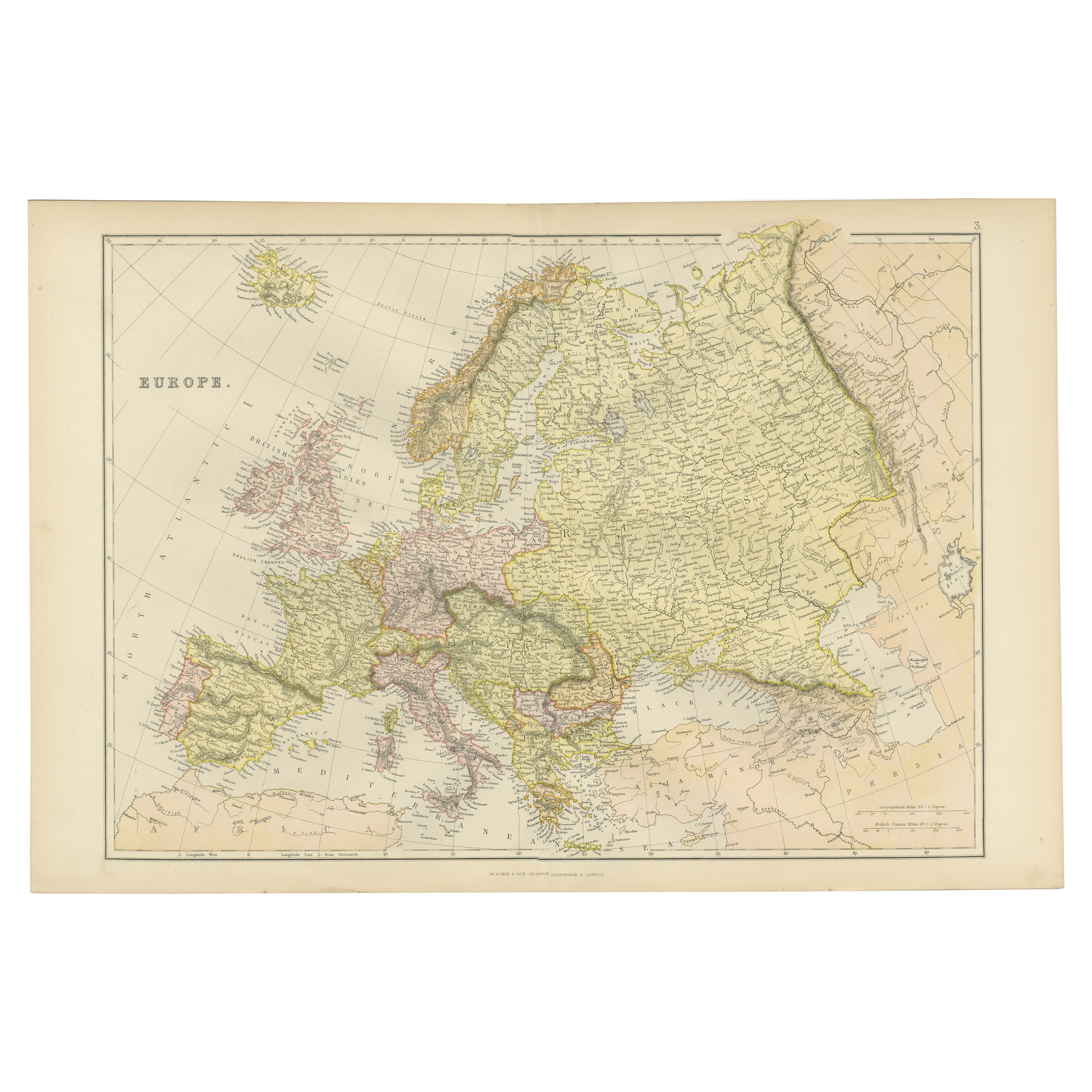
Colorful Detailed Antique Map of Europe, Published in 1882
Located in Langweer, NL
"The Antique Map of Europe from 'The Comprehensive Atlas and Geography of the World,' published in 1882 by Blackie & Son, is a testament to meticulous cartography and scholarly preci...
Category
Antique 1880s Maps
Materials
Paper
You May Also Like
1842 Wall Map of the United States by J. H. Young, Published by S. A. Mitchell
Located in Colorado Springs, CO
Presented is an 1842 hanging “Map of the United States,” engraved by J. H. Young and published by Samuel Augustus Mitchell, Philadelphia. This is a beautiful example of the rare 1842...
Category
Antique 1840s American Maps
Materials
Paper

Original Antique Map of Europe, Arrowsmith, 1820
Located in St Annes, Lancashire
Great map of Europe
Drawn under the direction of Arrowsmith.
Copper-plate engraving.
Published by Longman, Hurst, Rees, Orme and Brown, 1820
...
Category
Antique 1820s English Maps
Materials
Paper

Antique Oarsman's Map of the River Thames, English, Cartography, Published 1912
Located in Hele, Devon, GB
This is an antique copy of The Oarsman's and Angler's Map of the River Thames - New Edition. An English, bound map book, published in English by Edward Stanford, London, this new edi...
Category
Early 20th Century British Other Books
Materials
Paper

London 1744 Published Watercolour Antique Map of East Africa by Eman Bowen
Located in West Sussex, Pulborough
We are delighted to offer for sale this New and Accurate Map of Nubia & Abissinia, together with all the Kingdoms Tributary Thereto, and bordering upon them published in 1744 by Emanuel Bowen
This is a decorative antique engraved map of East Africa...
Category
Antique 1740s English George III Maps
Materials
Paper

$1,039 Sale Price
20% Off
Antique Paterson's Guide to Britain, English, Maps, Georgian, Published 1811
Located in Hele, Devon, GB
This is an antique copy of Paterson's New and Accurate guide to Direct & Principal Crossroads. An English, bound book of maps and descriptive tables, published in English by Longman,...
Category
Antique Early 19th Century British Georgian Books
Materials
Paper

Large Original Antique Map of Europe by Sidney Hall, 1847
Located in St Annes, Lancashire
Great map of Europe
Drawn and engraved by Sidney Hall
Steel engraving
Original colour outline
Published by A & C Black. 1847
Unframed
Free shipping.
Category
Antique 1840s Scottish Maps
Materials
Paper

Recently Viewed
View AllMore Ways To Browse
Bench Leather Seat Cushion
Black Aluminum Outdoor Sofa
Borge Mogensen Dining Chairs
Bottle Pourer
Brown Velvet Accent Chairs
Brutalist Oak Console
Cantilever Office Chair
Chair With Table Attached
Charles Hollis Jones Lucite Dining Table
Charlotte Perriand Les Arcs
Chrome Craft Sofa
Chrome Dining Chairs Post Modern
Country French Table With Drawer
Custom Trunk
Cut Crystal Decanters
Danish Drop Leaf Table
Danish Modern Pitcher
Danish Pepper