American Empire Maps
to
2
2
81
35
19
12
9
6
4
4
4
3
1
1
1
2
2
2
2
2
2
2
Style: American Empire
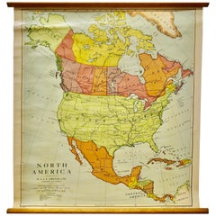
Large University Chart “Political Map of North America” by Bacon
Located in Chillerton, Isle of Wight
Large University Chart “Political Map of North America” by Bacon
W&A K Johnston’s Charts of Physical Maps By G W Bacon,
This is colourful Physical map ...
Category
Early 20th Century American Empire Maps
Materials
Linen
Large University Chart “Political Map of North America” by Bacon
Located in Chillerton, Isle of Wight
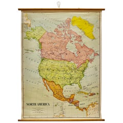
Large University chart “Political Map of North America” by Bacon
W&A K Johnston’s Charts of Political Maps by G W Bacon,
This is colorful Physical ...
Category
Early 20th Century American Empire Maps
Materials
Linen
Related Items
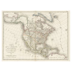
Antique Map of North America, 1821
Located in Langweer, NL
Antique map of America titled 'Carte de l'Amerique septentrionale'. Scarce map of North America, shortly after the Louisiana Purchase and the first ...
Category
19th Century Antique American Empire Maps
Materials
Paper
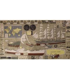
Mariner's Chart Poster
Located in Hamilton, Ontario
Mariner's chart poster (nautical).
Category
20th Century American Empire Maps
Antique Map of North America by Levasseur '1875'
Located in Langweer, NL
Antique map titled 'Carte générale de l'Amérique Septentrionale'. Large map of North America. This map originates from 'Atlas de Géographie Modern...
Category
Late 19th Century Antique American Empire Maps
Materials
Paper
Medical Anatomy Chart Titled 'Thin Man'
Located in Hamilton, Ontario
This is a fantastic double-sided anatomy chart with four separate overlays showing the human body in various layers. Titled the Thin Man this piece was p...
Category
Mid-20th Century American American Empire Maps
Antique Map of North America by Lowry '1852'
Located in Langweer, NL
Antique map titled 'North America'. Original map of North America. This map originates from 'Lowry's Table Atlas constructed and engraved from the...
Category
Mid-19th Century Antique American Empire Maps
Materials
Paper
North America Vintage Map Pull-Down Wall Chart Poster Countrycore Print
Located in Berghuelen, DE
A traditional vintage pull-down school map illustrating North America, published by Westermann. Colorful print on paper reinforced with canvas.
Measurements:
Width 156 cm (61.42 inc...
Category
Late 20th Century German American Empire Maps
Materials
Canvas, Wood, Paper
H 66.54 in W 61.42 in D 0.79 in
Large Original Vintage Map of North America, circa 1920
Located in St Annes, Lancashire
Great map of North America
Original color. Good condition
Published by Alexander Gross
Unframed.
Category
1920s English Vintage American Empire Maps
Materials
Paper
North by Northwest
Located in London, GB
Original Japanese film poster from the first release of this Classic Hitchcock in Japan in 1959. This film starred Cary Grant, Eva Marie Saint and James Mason. The art work on this p...
Category
1950s Japanese Vintage American Empire Maps
Materials
Paper
North by Northwest
Located in London, GB
Original US film poster for Alfred Hitchcock great 1959 thriller starring Cary Grant, Eva Marie Saint and James Mason.
This poster is conservation paper backed and it would be shippe...
Category
1950s American Vintage American Empire Maps
Materials
Paper
Vintage Mural Map of North Africa Countrycore African Wall Chart Decoration
Located in Berghuelen, DE
The wall map shows North Africa. It was published by Westermann-Schulwandkarten. Used as teaching material in German schools. Colorful print on paper reinforced with canvas,
Measurem...
Category
Late 20th Century German American Empire Maps
Materials
Canvas, Wood, Paper
H 61.42 in W 100.01 in D 0.79 in
Vintage Mural Map Pull Down Wall Chart North America Economy Finances
Located in Berghuelen, DE
A classical rollable wall chart showing the economy of North America. Publishd by the Paul List Verlag. Used as teaching material in German schools. Colorful print on paper reinforce...
Category
Mid-20th Century German American Empire Maps
Materials
Canvas, Wood, Paper
H 53.55 in W 39.38 in D 0.79 in
Land Use and Livestock North America Picture Map Wall Chart Poster Mural
Located in Berghuelen, DE
The vintage rollable picture map of North- and Middle America shows land use and livestock. Published by JRO. Colorful print on paper reinforced with ca...
Category
Late 20th Century German American Empire Maps
Materials
Canvas, Wood, Paper
H 47.25 in W 35.44 in D 0.79 in
American Empire maps for sale on 1stDibs.
Find a broad range of unique American Empire maps for sale on 1stDibs. Many of these items were first offered in the Early 20th Century, but contemporary artisans have continued to produce works inspired by this style. If you’re looking to add vintage maps created in this style to your space, the works available on 1stDibs include more furniture and collectibles, wall decorations and other home furnishings, frequently crafted with fabric, linen and other materials. It’s true that these talented designers have at times inspired knockoffs, but our experienced specialists have partnered with only top vetted sellers to offer authentic pieces that come with a buyer protection guarantee. Prices for maps differ depending upon multiple factors, including designer, materials, construction methods, condition and provenance. On 1stDibs, the price for these items starts at $1,084 and tops out at $1,115 while the average work can sell for $1,099.


