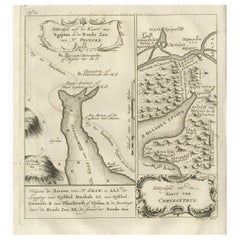
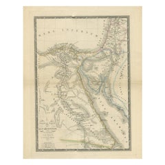
Rare Antique Map of Yam Suph, Egypt and Red Sea, 1773
View Similar Items


Want more images or videos?
Request additional images or videos from the seller
1 of 7
Rare Antique Map of Yam Suph, Egypt and Red Sea, 1773
About the Item
- Dimensions:Height: 10.24 in (26 cm)Width: 8.27 in (21 cm)Depth: 0 in (0.01 mm)
- Materials and Techniques:
- Period:
- Date of Manufacture:1773
- Condition:Condition: Very good, general age-related toning. Please study image carefully.
- Seller Location:Langweer, NL
- Reference Number:Seller: BG-11797-151stDibs: LU3054329257782
About the Seller
5.0
Recognized Seller
These prestigious sellers are industry leaders and represent the highest echelon for item quality and design.
Platinum Seller
Premium sellers with a 4.7+ rating and 24-hour response times
Established in 2009
1stDibs seller since 2017
2,412 sales on 1stDibs
Typical response time: 1 hour
Authenticity Guarantee
In the unlikely event there’s an issue with an item’s authenticity, contact us within 1 year for a full refund. DetailsMoney-Back Guarantee
If your item is not as described, is damaged in transit, or does not arrive, contact us within 7 days for a full refund. Details24-Hour Cancellation
You have a 24-hour grace period in which to reconsider your purchase, with no questions asked.Vetted Professional Sellers
Our world-class sellers must adhere to strict standards for service and quality, maintaining the integrity of our listings.Price-Match Guarantee
If you find that a seller listed the same item for a lower price elsewhere, we’ll match it.Trusted Global Delivery
Our best-in-class carrier network provides specialized shipping options worldwide, including custom delivery.More From This Seller
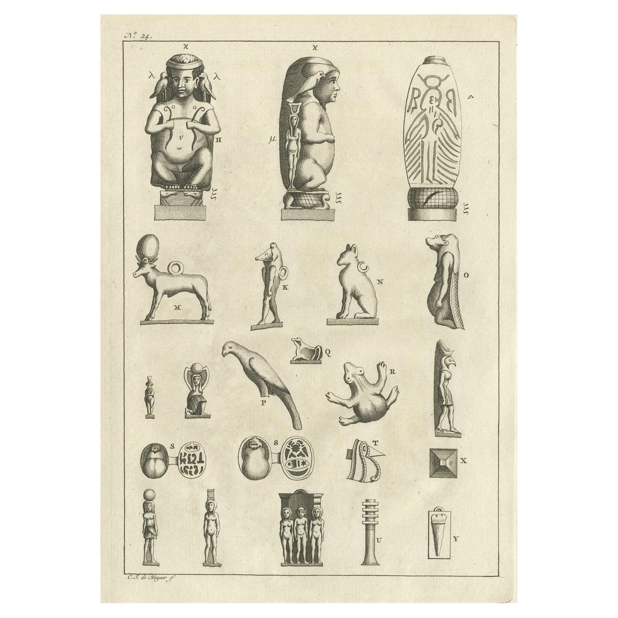
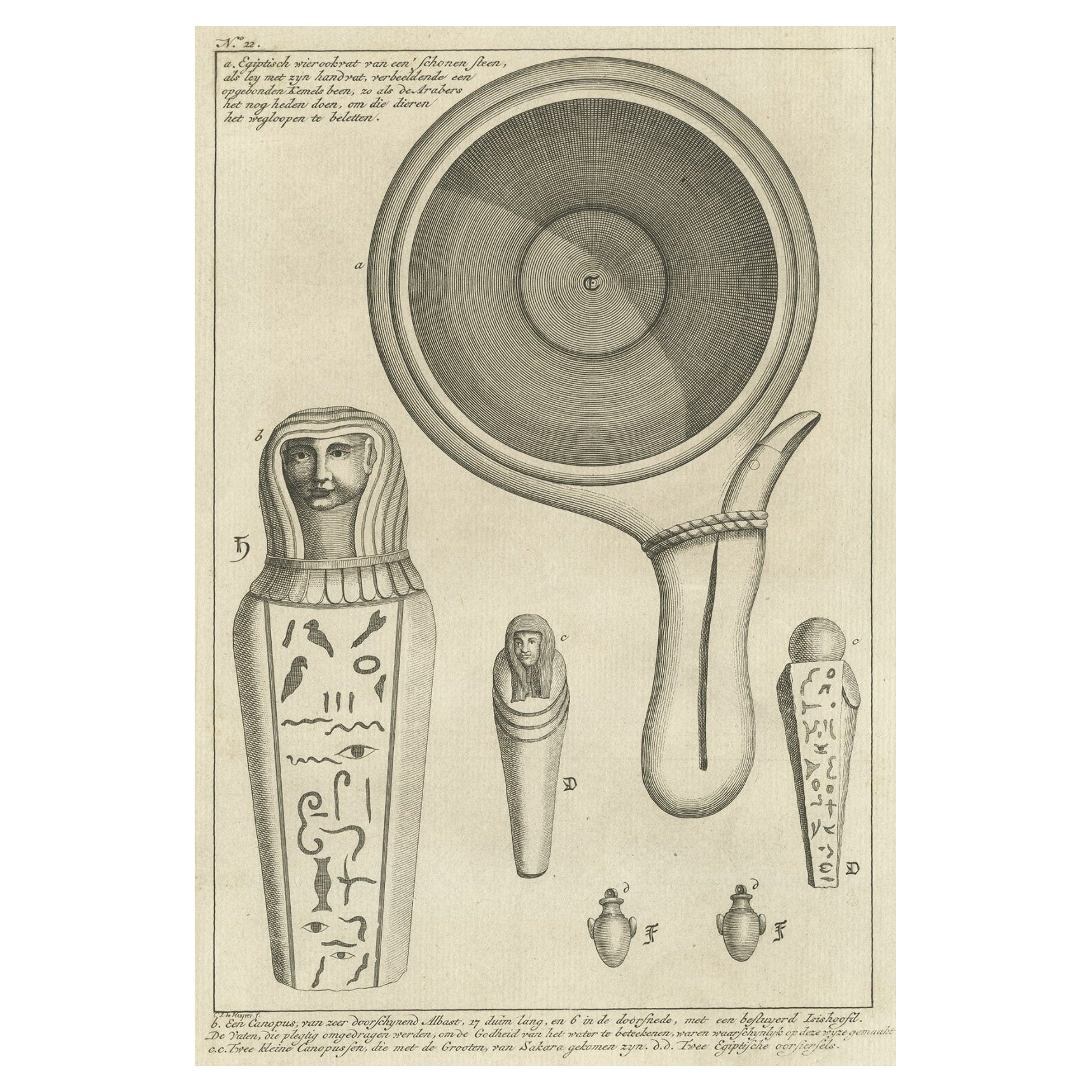
View AllAntique Print of Egyptian Objects, 1773
Located in Langweer, NL
Untitled print depicting various Egyptian objects including statues. Originates from the first Dutch editon of an interesting travel account of Northern Africa titled 'Reizen en Aanm...
Category
Antique 18th Century Prints
Materials
Paper
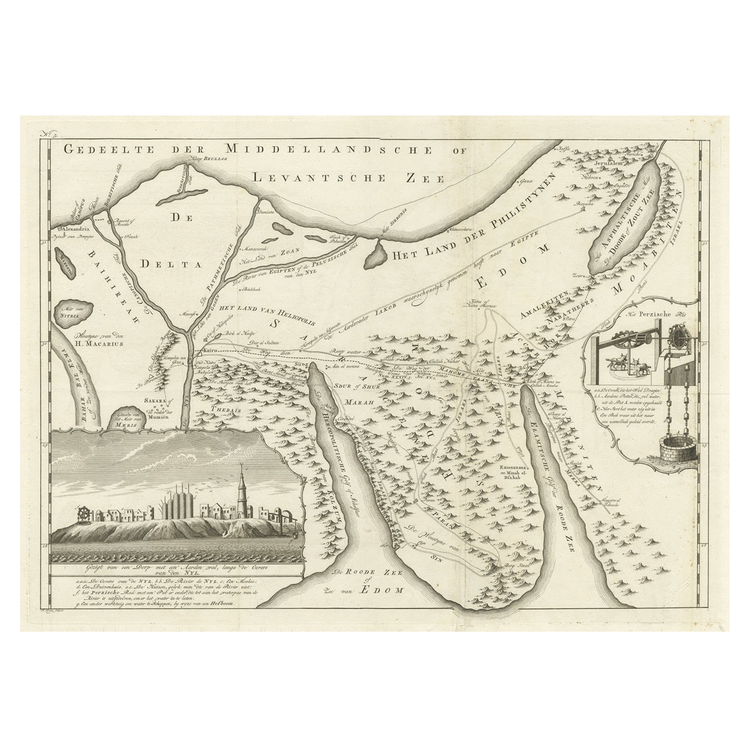
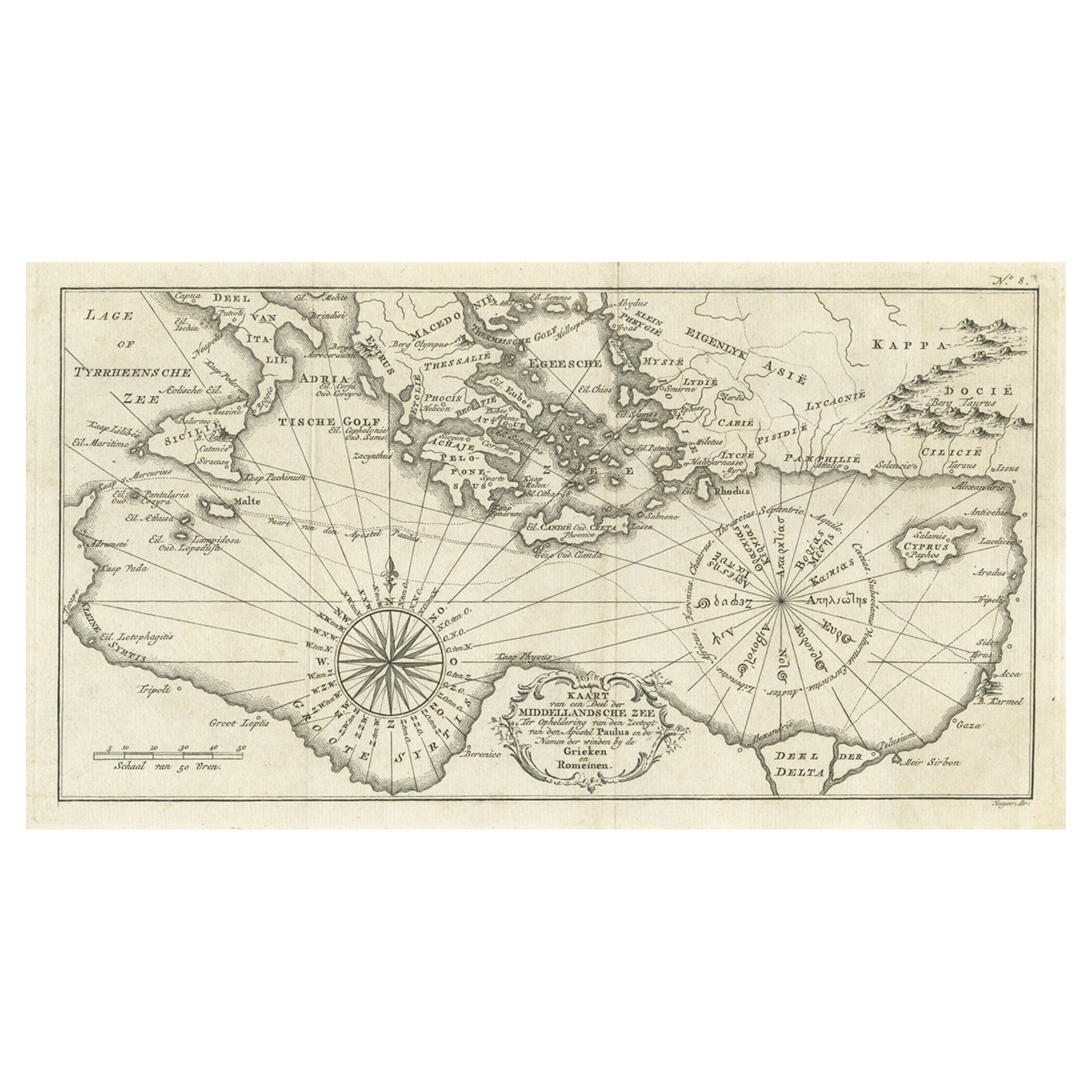
Old Map of the Sinai Peninsula Showing the Mediterranean and the Red Sea, 1773
Located in Langweer, NL
Antique map of the Sinai Peninsula showing the Mediterranean Sea to the north and the Red Sea to the south.
The map is decorated with images of a Persian wheel and a view of a vi...
Category
Antique 1770s Maps
Materials
Paper
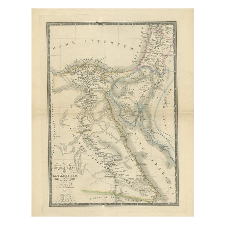
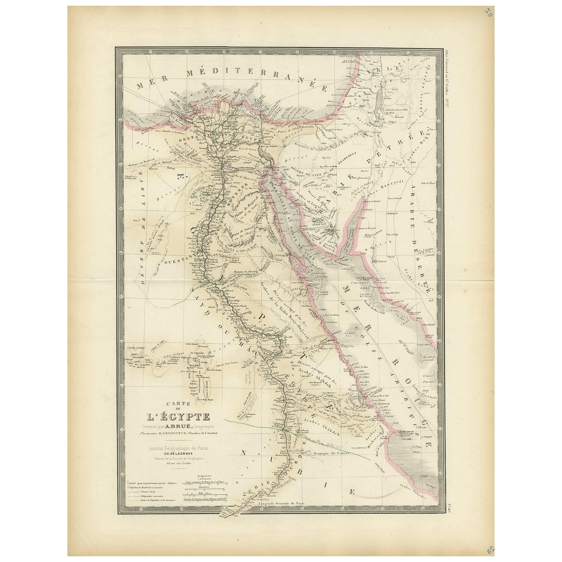
Antique Map of Ancient Egypt Also Depicting the Nile River and Red Sea, 1845
Located in Langweer, NL
Antique map Egypt titled 'General Karte von Alt Aegypten von A.H. Brué'. Large map of Egypt also depicting the Nile river and Red Sea. Source unknown...
Category
Antique 19th Century Maps
Materials
Paper
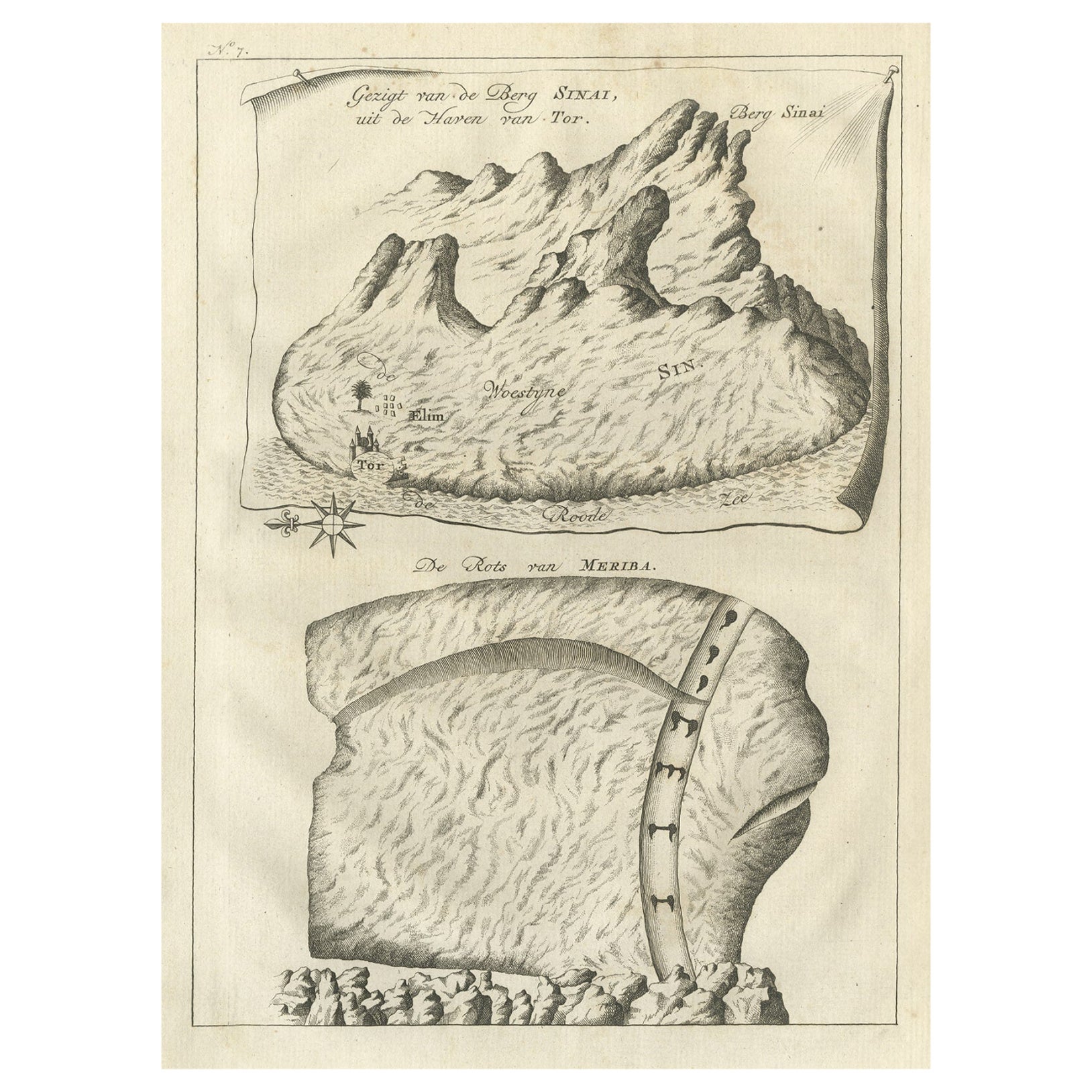
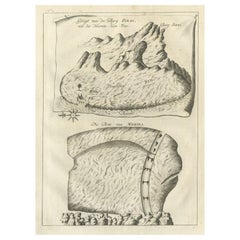
Antique Print of Mount Sinai in Egypt, 1773
Located in Langweer, NL
Antique print titled 'Gezigt van de Berg Sinai uit de haven van Tor'. Old print depicting Mount Sinai and the rock of Meriba. Originates from the first Dut...
Category
Antique 18th Century Prints
Materials
Paper
Original Antique Map of Arabia and the Red Sea
Located in Langweer, NL
Antique map titled 'Carte de la Coste d'Arabie (..) - Kaart van de Kust van Arabië (..)'. This is a Dutch version, engraved by J. van Schley, of Bellin's map of Arabia and the Red Sea...
Category
Antique Mid-18th Century Maps
Materials
Paper

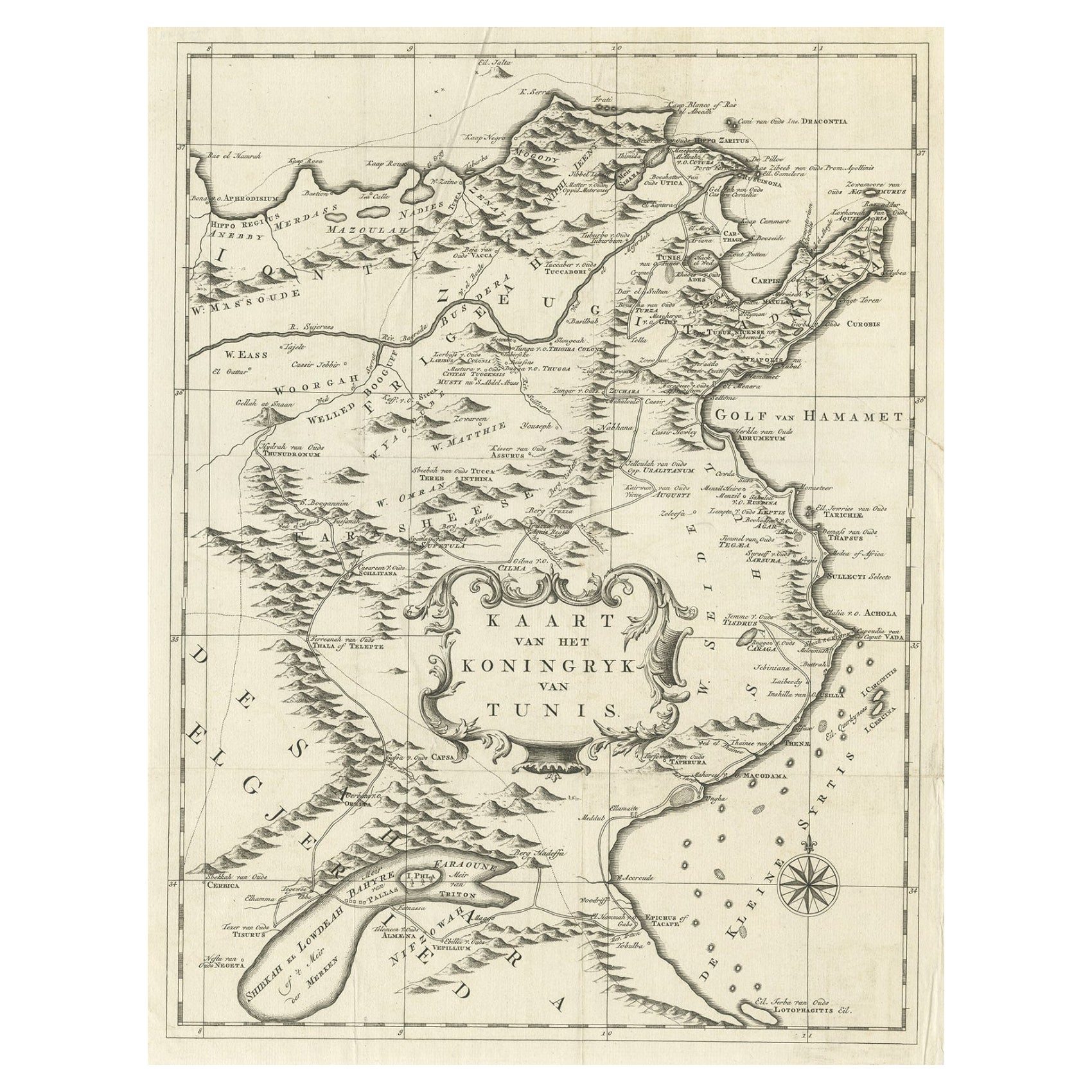
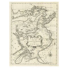
Antique Map of the Kingdom of Tunisia, Africa, 1773
Located in Langweer, NL
Antique map titled 'Kaart van het Koningryk van Tunis'. Old map of the Kingdom of Tunisia. Originates from the first Dutch editon of an interesting travel account of Northern Africa ...
Category
Antique 18th Century Maps
Materials
Paper
You May Also Like
Antique Map of Principality of Monaco
By Antonio Vallardi Editore
Located in Alessandria, Piemonte
ST/619 - "Old Geographical Atlas of Italy - Topographic map of ex-Principality of Monaco" -
ediz Vallardi - Milano -
A somewhat special edition ---
Category
Antique Late 19th Century Italian Other Prints
Materials
Paper

Original Antique Map of Spain and Portugal, circa 1790
Located in St Annes, Lancashire
Super map of Spain and Portugal
Copper plate engraving by A. Bell
Published, circa 1790.
Unframed.
Category
Antique 1790s English Other Maps
Materials
Paper

Original Antique Map of Ireland- Tipperary and Waterford. C.1840
Located in St Annes, Lancashire
Great map of Tipperary and Waterford
Steel engraving
Drawn under the direction of A.Adlard
Published by How and Parsons, C.1840
Unframed.
Category
Antique 1840s English Maps
Materials
Paper

Original Antique Map of United States, Grattan and Gilbert, 1843
Located in St Annes, Lancashire
Great map of United States
Drawn and engraved by Archer
Published by Grattan and Gilbert. 1843
Original colour
Unframed.
Category
Antique 1840s English Maps
Materials
Paper

Hand-Colored 18th Century Homann Map of the Black Sea, Turkey and Asia Minor
By Johann Baptist Homann
Located in Alamo, CA
An attractive original early 18th century hand-colored map of the Black Sea and Turkey entitled "Carte de L'Asie Minevre ou de la Natolie et du Pont Evxin Tiree des Voyages et des Ob...
Category
Antique Early 18th Century German Maps
Materials
Paper

Hand-Colored 18th Century Homann Map of Denmark and Islands in the Baltic Sea
By Johann Baptist Homann
Located in Alamo, CA
An 18th century copper plate hand-colored map entitled "Insulae Danicae in Mari Balthico Sitae utpote Zeelandia, Fionia, Langelandia, Lalandia, Falstria, Fembria Mona" created by Joh...
Category
Antique Early 18th Century German Maps
Materials
Paper

Recently Viewed
View AllMore Ways To Browse
Antique African Door
English Estate Table
English Hardwood Chairs
Expandable Mahogany Table
Fin Coffee Table
Finnish Oak Chairs
Floral Area Rug 9x10
Folding Aluminium Chair
Folding Iron Table
French Leather Ottoman
Garden Tabriz
German Silver Cutlery
Glass Dessert Bowls
Gold Rimmed Dinner Sets
Green Bookends
Green Curtains
Green Glass Decanter
Hand Carved Panels