16th Century Maps
to
20
91
11
102
1
2,907
2,145
429
3
242
34
10
126
7
36
9
2
5
3
4
2
102
1
12
8
1
1
1
102
102
102
3
2
1
1
1
Period: 16th Century
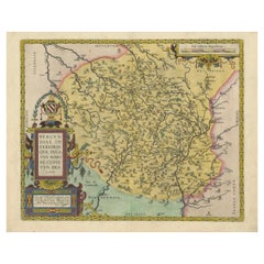
1584 Abraham Ortelius Map of Lower Burgundy, France
Located in Langweer, NL
1584 Abraham Ortelius Map of Lower Burgundy, France
Description of the Map:
This antique map by Abraham Ortelius, titled "Bvrgvndiae Inferioris Qvae Dvcatvs Nomine Censetur Des," w...
Category
Antique 16th Century Maps
Materials
Paper
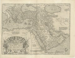
16th-Century Map of the Ottoman Empire and Near East: Turcici Imperii Descriptio
Located in Langweer, NL
Title: Original 16th-Century Map of the Ottoman Empire and Near East: *Turcici Imperii Descriptio* by Ortelius, 1571
This rare copperplate engraving, Turcici Imperii Descriptio, i...
Category
Antique 16th Century Maps
Materials
Paper
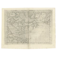
16th Century Map of Saudi Arabia, the Persian Gulf and Red Sea, ca. 1574
Located in Langweer, NL
Ptolemaic map of the Arabian Peninsula based on the 1548 map of Giacomo Gastaldi. It covers nearly all of the peninsula, but does not include the head of the Red Sea. The coastlines ...
Category
Antique 16th Century Maps
Materials
Paper
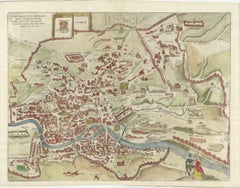
Rare 1572 Map of Ancient Rome with Monuments by Ligorio, Braun & Hogenberg
Located in Langweer, NL
Rare 1572 Map of Ancient Rome with Monuments by Ligorio, Braun & Hogenberg
This remarkable 16th-century map, *Urbis Romae Situs cum ils quae adhuc Conspiciuntur Veter. Monumet Rel...
Category
Antique 16th Century Maps
Materials
Paper
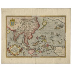
Antique Map of Southeast Asia by Ortelius '1587'
Located in Langweer, NL
Antique map titled 'Indiae Orientalis Insularumque Adiacientium Typus'. Ortelius includes early European depictions of both Japan and China and is the first to name Formosa (Taiwan). The Philippines and East Indies or Spice Islands are shown based upon Portuguese and Spanish sources, and before their penetration by the Dutch. Japan is shown in kite form, as a large oval island...
Category
Antique 16th Century Maps
Materials
Paper
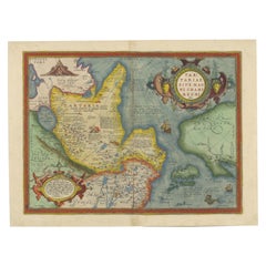
1573 Ortelius Map: First to Name California, Spanning Tartary to North America
Located in Langweer, NL
"1573 Abraham Ortelius Map of Tartary, Japan, and Western North America"
Description of the Map:
This is an outstanding example of Abraham Ortelius' map titled "Tartariae Sive Magn...
Category
Antique 16th Century Maps
Materials
Paper
Antique Print of the City of Rome, Italy by Münster, C.1580
Located in Langweer, NL
Antique print titled 'Abbildung der Statt Rom/wie sie under Keyser Vespasiano und zu Plinii zeiten gewesen'. Woodcut of ancient Rome. This print originates from Munster's Cosmographi...
Category
Antique 16th Century Maps
Materials
Paper
Engraving of St. Gallen and its Monastery, from Civitates Orbis Terrarum (1575)
Located in Langweer, NL
Description of the Engraving: Braun & Hogenberg’s "S. Galli Opp. et Monasterium Heluetiorum" from Civitates Orbis Terrarum (1575)
This is an original, hand-colored copper engraving ...
Category
Antique 16th Century Maps
Materials
Paper
Renaissance Mapping of Sumatra: Featuring Singapore in Münster’s Woodcut, c.1590
Located in Langweer, NL
Description: Antique map titled 'Sumatra ein grosse Insel / so von den alten Geographen Taprobana genennt worden'. Beautiful map of Sumatra and the southern part of Malaysia, with Si...
Category
Antique 16th Century Maps
Materials
Paper
Northern Scotland: A 16th Century Hand-colored Map by Mercator
Located in Alamo, CA
A framed hand-colored 16th century map of Northern Scotland by Gerard Mercator entitled "Scotiae pars Septentrionalis", published in Amsterdam in 1636. It is a highly detailed map of the northern part of Scotland, with the northwest Highlands and the cities Inverness and Aberdeen, as well as the Orkney Islands and the Hebrides. There is a decorative title cartouche in the upper left corner.
The map is presented in an antiqued brown wood...
Category
Dutch Antique 16th Century Maps
Materials
Paper
Original Antique Plan of the Harbor of Nettuno, Near Rome, by Munster, c.1580
Located in Langweer, NL
Antique map titled 'Der Statt Neptun (.).' Detailed plan of the Harbor of Nettuno, near Rome, from Munster's Cosmographia, one of the most influential cartographic works of the 16th century.
The antique map titled 'Der Statt Neptun (.),' originating from Munster's renowned Cosmographia, unveils a detailed plan of the Harbor of Nettuno, situated near Rome. This influential cartographic work, crafted in the 16th century, stands as a testament to Munster's mastery in cartography and geographic depiction.
The map meticulously portrays the Harbor of Nettuno, capturing its coastal features, the layout of the harbor, and possibly key landmarks or structures in the vicinity. Munster's expertise in cartography shines through in this intricate representation, offering a visual insight into the strategic maritime site near Rome.
Being part of the Cosmographia, one of the era's most influential cartographic compilations, this map holds historical significance. Munster's work was esteemed for its accuracy and influence in shaping geographic knowledge during the 16th century.
Adorned with Munster's characteristic artistic touches and possibly embellishments, this antique print not only serves as a navigational aid but also stands as a testament to the era's cartographic expertise, preserving the Harbor of Nettuno's significance in the maritime landscape near Rome.
Artists and Engravers: Made by 'Sebastian Munster...
Category
Antique 16th Century Maps
Materials
Paper
Bird's-Eye View of Blâmont in Lorraine by Braun and Hogenberg, 1597
Located in Langweer, NL
Title: Bird's-Eye View of Blâmont in Lorraine by Braun and Hogenberg, 1597
This copperplate engraving, published in 1597 by Braun and Hogenberg, depicts a bird's-eye view of the t...
Category
Antique 16th Century Maps
Materials
Paper
16th-Century Panoramic View of Worms: A Woodcut from Sebastian Münster's
Located in Langweer, NL
This is a woodcut city view of Worms, published in Sebastian Münster's *Cosmographia* around 1578. The image depicts a bird's-eye view of the city of Worms, located in Rheinland-Pfal...
Category
Antique 16th Century Maps
Materials
Paper
Early Woodcut Bird's Eye View of Rouffach, France, by Sebastian Münster, 1554
Located in Langweer, NL
Early Woodcut Bird's Eye View of Rouffach, France, by Sebastian Münster, 1554
Description: This rare 1554 woodcut is a bird's eye view of Rouffach, a town in the Haut-Rhin departmen...
Category
Antique 16th Century Maps
Materials
Paper
Bird's-Eye Views of Dunkerque, Gravelines, and Bourbourg by Braun and Hogenberg
Located in Langweer, NL
Bird's-Eye Views of Dunkerque, Gravelines, and Bourbourg by Braun and Hogenberg, 1597
This antique print, published in 1597 by Braun and Hogenberg, showcases three detailed bird's...
Category
Antique 16th Century Maps
Materials
Paper
1579 Ornate Map of Burgundy County by Ferdinand de Lannoy
Located in Langweer, NL
1579 Ornate Map of Burgundy County by Ferdinand de Lannoy
Description of the Map:
This is a beautifully detailed map of the Burgundy region, titled "Bvrgvndiae Comitatus Recentiss....
Category
Antique 16th Century Maps
Materials
Paper
Antique Map of Greece from Ortelius's Theatrum Orbis Terrarum, 1595
Located in Langweer, NL
Original antique map titled "Graecia Sophiani." This is a very detailed and decorative engraved map, with two decorative cartouches and a hand-colored initial on the verso, from Abra...
Category
Antique 16th Century Maps
Materials
Paper
Mercator's Ptolemaic Map of Ancient Assyria, Media, and Persia
Located in Langweer, NL
This map, "Asiae I Tab:", features the region corresponding to modern-day Iran and Iraq, intricately depicted in Gerard Mercator's edition of Claudius Ptolemy's "Tabulae Geographicae...
Category
Antique 16th Century Maps
Materials
Paper
Huy (Huum) Cityscape 1574: Historical Copper Engraving by Braun & Hogenberg
Located in Langweer, NL
Title: Huum opp. condrusorum caput (...) Anno partae salutis 1574.
**Type:** Print (Colored Copper Engraving)
**Year:** Circa 1580
**Technique:** Colored Copper Engraving
**Medium:...
Category
Antique 16th Century Maps
Materials
Paper
Original Antique Woodcut Map of Persia
Located in Langweer, NL
Antique map titled 'Tabula V Asiae'. Important early woodcut map of Persia, depicting the area of Mesopotamia, Armenia and the Gulf, to the Caspian and Carmania (Iran). Includes name...
Category
Antique 16th Century Maps
Materials
Paper
Original Antique Ptolemaic Map of the Region of Thailand and Malaysia
Located in Langweer, NL
Antique map titled 'Tabula Asiae XI'. Based on the interpretations of Solinus and Munster, this Ptolemaic map covers the region roughly of Thailand and Malaysia. An oddly shaped (Mal...
Category
Antique 16th Century Maps
Materials
Paper
Bird’s-Eye View of Basel from Braun & Hogenberg’s Civitates Orbis Terrarum, 1575
Located in Langweer, NL
Bird’s-Eye View of Basel from Braun & Hogenberg’s "Civitates Orbis Terrarum" (Circa 1572-1617)
This highly detailed map of Basel is a bird's-eye view, originally based on Sebastian Münster’s map...
Category
Antique 16th Century Maps
Materials
Paper
Antique Print of Liège / Luik in Belgium by Braun & Hogenberg, 1575
Located in Langweer, NL
Antique print titled 'Leodium'. View of Liège / Luik, Belgium with surrounding hills and the city wall. With text explaining the origins of Liège, a cartouche expressing thanks to th...
Category
Antique 16th Century Maps
Materials
Paper
Duchy of Brunswick-Lüneburg, 1595: A Renaissance Cartographic Masterpiece
Located in Langweer, NL
Title: "Braunschweig and Lüneburg Duchies: Authentic Depiction by Abraham Ortelius"
This is an exquisite example of Abraham Ortelius’s cartographic craftsmanship: an original antiqu...
Category
Antique 16th Century Maps
Materials
Paper
Antique Map of the Low Countries by Ortelius, 1584
Located in Langweer, NL
Antique map titled 'Belgii Veteris Typus'. Beautiful map of the Low Countries, extending to the English Channel and part of Britain. This map originates from Ortelius' 'Theatrum Orbi...
Category
Antique 16th Century Maps
Materials
Paper
Antique Map of the Balkans with Coat of Arms
Located in Langweer, NL
Antique map titled 'Tavola Nuova di Schiavonia'. Ruscelli's map of the Balkans, with a coat of arms. The mountains are represented, river systems are shown in detail, and cities, towns and ports denoted throughout this 16th century map. A number of islands in the Adriatic Sea are also shown. This map originates from 'Espositione & introduttioni universali di Gir. Ruscelli sopra tutta la Geografia di Tolomeo (..)' published by Girolamo Ruscelli, 1561.
Girolamo Ruscelli (1500-1566) was a cartographer, humanist, and scholar from Tuscany. Ruscelli was a prominent writer and editor in his time, writing about a wide variety of topics including the works of Giovanni Boccaccio and Francesco Petrarch, Italian language, Italian poetry, medicine, alchemy, and militia. One of his most notable works was a translation of Ptolemy...
Category
Antique 16th Century Maps
Materials
Paper
Exquisite 1580 Ortelius Map of the Narbonne Coastal Region, France
Located in Langweer, NL
"Exquisite 1580 Ortelius Map of the Narbonne Coastal Region, France"
Description of the Map:
This map is an intricate copper etching from Abraham Ortelius's esteemed "Theatrum Orbi...
Category
Antique 16th Century Maps
Materials
Paper
1597 German Map of Alexandria by Georg Braun and Frans Hogenberg
Located in Chapel Hill, NC
1597 Map of Alexandria by Georg Braun and Frans Hogenberg, Germany. From "Civitas Orbis Terrarum", part 2, published in Cologne by Bertram Buchholz. Printed in 2 parts. Title: "Alexa...
Category
German Renaissance Antique 16th Century Maps
Materials
Paper
Rare Original 16th Century Antique Map of Greece, 1598
Located in Langweer, NL
Beautiful and rare antique map of Greece with Albania, Mecedonia, Romania, Dalmatia and the peninsula of Salento to the Golf of Taranto. Also clearly shown the islands of the Aegaian...
Category
Antique 16th Century Maps
Materials
Paper
Austria by Wolfgang Lazius – A Magnificent 16th-Century Map from Ortelius
Located in Langweer, NL
Title:
Avstriae Descrip – Wolfgang Lazius’ Map of Austria, 16th Century
Description:
This extraordinary map of Austria pays homage to the Austrian humanist and cartographer Wo...
Category
Antique 16th Century Maps
Materials
Paper
Sebastian Münster's 16th Century Map of the British Isles, ca.1590
Located in Langweer, NL
GREAT BRITAIN -- "ENGELLANDT mit dem anstossenden Reich Schottlandt so vorzeiten Albion und Britannia haben geheissen". (Basel, c. 1590).
Partly handcolored woodcut double-page map from S. Munster's 'Cosmographey'. 330 x 408 mm. (Lower margin cut short (touching the line), tiny hole in upper margin, sl. foxed/browned, lower right corner a bit thumbed).
Sebastian Münster's 16th Century Map of the British Isles from 'Cosmographia Universalis...
Category
Antique 16th Century Maps
Materials
Paper
Coloured Antique Map of Sicily, Sardinia, Corfu, Elba, Malta and Zerbi (Jerba)
Located in Langweer, NL
Antique map titled 'Insularum Aliquot Maris Mediterranei Descriptio'. A very attractive example of Ortelius' map combining, on one page, maps of the islands of Sicily, Sardinia, Corfu, Elba, Malta and Zerbi (Jerba, off the coast of Tunisia.) The maps detail fortifications on the islands and other major features. (Jerba, for instance, is shown connected to the mainland by a causeway.) The waters are attractively engraved and are sailed by ships. A shipwreck, north of Malta, indicates the point at which St. Paul is thought to have shipwrecked. Volcanoes are indicated in the Sicily map...
Category
Antique 16th Century Maps
Materials
Paper
1584 Ortelius Map of Switzerland: A Cartographic Reversal
Located in Langweer, NL
This is a fine example of Ortelius' map of Switzerland from his *Theatrum Orbis Terrarum*, recognized as the first modern atlas of the world. The map is oriented with south at the top, which reverses the typical north-up orientation seen in most modern maps. It highlights significant geographical features such as Lake Geneva (Lemanus Lacus) to the right of the map and the Rhine river entering Switzerland near the center.
The *Theatrum Orbis Terrarum*, first published in 1570 by Abraham Ortelius in Antwerp, was groundbreaking as it compiled uniform maps with supporting text in a single volume, marking a departure from earlier collections of maps that were custom-assembled on demand. This atlas included a wealth of sixteenth-century cartographic knowledge, reflecting the extensive global explorations occurring after the discovery of America...
Category
Antique 16th Century Maps
Materials
Paper
1574 Sebastian Münster Woodcut Map of Europe: Early View of the Continent
Located in Langweer, NL
Title: Early Woodcut Map of Europe from Münster's Cosmographia, 1574
This is an original early woodcut map of Europe by the famed cartographer Sebastian Münster, printed in 1574 by ...
Category
Antique 16th Century Maps
Materials
Paper
Mercator's Ptolemaic map of Taprobana, (Ceylon) Sri Lanka
Located in Langweer, NL
Antique map titled 'Asiae XII Tab'. Mercator's Ptolemaic map of Taprobana. The map shows Ptolemy's erroneous location of the island of Sri Lanka near the equator, with a bit of India...
Category
Antique 16th Century Maps
Materials
Paper
Ancient Course of the Ganges: A First Ptolemaic Map of India by Mercator, c.1584
Located in Langweer, NL
This remarkable map, titled "Asiae X Tab:", is a significant historical artifact that represents the convergence of knowledge and craftsmanship from two of the most esteemed figures in the history of geography and cartography.
Created by Gerard Mercator and based on the geographical insights of Claudius Ptolemy, this map is part of the rare first issue published in Brussels in 1578.
The map itself meticulously delineates the region between the Indus and Ganges rivers, an area of immense historical and geographical importance. It is an excellent representation of Ptolemy's second-century geographical data, which was fundamental in shaping the modern principles of mapmaking. Mercator, renowned for his precision and dedication to adhering closely to Ptolemy's original intentions, showcases this commitment through the detailed depiction of this significant Asian landscape.
This edition stands out not only for its historical accuracy but also for its artistic execution. Gerard Mercator, who was also an innovator in the use of the italic hand for map lettering, first introduced this style in his "Literarum latinarum" in 1540. The use of italics in this map enhances its legibility and aesthetic appeal, which became a hallmark of the finest sixteenth and seventeenth-century Dutch maps, largely attributed to Mercator’s influence.
The map measures 13 ½ x 18 inches and features fine hand coloring, which has been preserved in almost excellent condition alttough there some browning due to age. As a splendid example of the first issue from Mercator’s definitive edition of Ptolemy’s "Geographia", it not only serves as a testament to the rich history of geographical exploration but also stands as a beacon of the enduring legacy of its makers, shaping the future of cartographic design and precision.
The map "Asiae X Tab:", focusing on the region between the Indus and Ganges rivers, highlights several areas and cities of historical and geographical importance that are likely of interest to scholars, historians, and collectors. Here are key locations depicted on the map:
1. **Indus River**: As one of the major rivers of Asia and a cradle of ancient civilizations like the Indus Valley Civilization, the Indus River holds significant historical importance.
2. **Ganges River**: Another crucial river not just for its cultural and religious significance in India, but also as a vital geographic feature in ancient and medieval maps...
Category
Antique 16th Century Maps
Materials
Paper
16th Century Antique Map of Ven Framed in Gold
Located in Haddonfield, NJ
Ven (older Swedish spelling Hven), is a Swedish island in the Öresund strait laying between Skåne, Sweden and Zealand and Denmark. The island was historically under Danish rule. Dani...
Category
Danish Baroque Antique 16th Century Maps
Materials
Wood, Paper
Friesland, Groningen, Drenthe, Overijssel – Antique Map by Seb. Münster, 1574
Located in Langweer, NL
Friesland, Groningen, Drenthe, Overijssel – Antique Map by Sebastian Münster, 1574
This rare and finely colored woodcut map of Northern Netherlands depicts the provinces of Friesl...
Category
Antique 16th Century Maps
Materials
Paper
Antique Map of Westfalia, Germany by Mercator/Hondius, circa '1620'
Located in Langweer, NL
Antique map titled 'Westfalia cum dioecelsi Bremensi'. Original antique map of Germany. Published by Mercator/Hondius, circa '1620'
17th Century antique detailled map of Westphali...
Category
Antique 16th Century Maps
Materials
Paper
Antique Map of the City of Bolsward, Friesland in The Netherlands, c.1598
Located in Langweer, NL
Antique map titled ‘Bolzvardia vetus in Frisia Foederis (..)’. Old map of the city of Bolsward, Friesland. Originally part of a sheet together with the cities of Stavoren, Harlingen ...
Category
Antique 16th Century Maps
Materials
Paper
Limburg Cityscape 1580: Historical Copper Engraving by Braun and Hogenberg
Located in Langweer, NL
Title: Limburgum Oppidum Galliae Belgicae, vulgo Lympurch, gallicè, Lembor Dr.
Type: Print (Copper Engraving)
Circa 1580
Technique: Colored Copper Engraving
Medium: Handmade Paper
S...
Category
Antique 16th Century Maps
Materials
Paper
Antique Map of Spain including the Balearic Islands
Located in Langweer, NL
Antique map titled 'Hispania Nova Tabula'. Ruscelli's map of Spain, including the Balearic Islands. This map originates from 'Espositione & introduttioni universali di Gir. Ruscelli sopra tutta la Geografia di Tolomeo (..)' published by Girolamo Ruscelli, 1561.
Girolamo Ruscelli (1500-1566) was a cartographer, humanist, and scholar from Tuscany. Ruscelli was a prominent writer and editor in his time, writing about a wide variety of topics including the works of Giovanni Boccaccio and Francesco Petrarch, Italian language, Italian poetry, medicine, alchemy, and militia. One of his most notable works was a translation of Ptolemy’s Geographia...
Category
Antique 16th Century Maps
Materials
Paper
Antique Map of the Region Around the Nile and the City of Carthage
Located in Langweer, NL
Antique map titled 'Aegypti recentior descriptio - Carthaginis Celeberrimi sinus typus'. Two detailed regional maps by Ortelius. One map shows the region around the Nile, as far as A...
Category
Antique 16th Century Maps
Materials
Paper
Rare Early Plate of a Woman from Venice, Italy in 16th Century Costume, 1577
Located in Langweer, NL
Antique print, titled: 'CXXII. Veneta Mulier'
This rare early plate shows a woman from Venice, Italy in 16th century costume. From: 'Habitus praecipuorum populorum tam virorum qu...
Category
Antique 16th Century Maps
Materials
Paper
Antique Map of The Frisian Cities Leeuwarden and Franeker in Friesland, 1580
Located in Langweer, NL
Antique map titled 'Lewardum Occidentlis Frisiae Opp: 1580, Franicher Nobiliu hominum, in Frisia Occidentali, ut plurimum saedes'.
This sheet contains two very detailed bird?s-ey...
Category
Antique 16th Century Maps
Materials
Paper
Antique Plan of Grave, The Netherlands, Showing the Siege of Grave in 1602
Located in Langweer, NL
Antique map titled 'Die Stat Grave' Bird's eye view plan of Grave, The Netherlands, Holland. Showing the siege of Grave in the year 1602 by Prince Maurits of The Netherlands. Source ...
Category
Antique 16th Century Maps
Materials
Paper
Antique Map of North Africa by Ortelius, c.1580
Located in Langweer, NL
Antique map titled 'Barbariae et Biledulgerid Nova Descriptio'. Original antique map of North Africa. The map covers the regions of Barbaria and Biledulgerid, essentially the territo...
Category
Antique 16th Century Maps
Materials
Paper
Very Old Original Antique Map of The City of Douai in France, ca.1575
Located in Langweer, NL
Antique Map of Douai (France) titled 'Duacum, Catuacorum Urbs, tam situ, quam incolis, et litterarum studijs elegantissime ornata'.
This map depicts the city of Douai (France) an...
Category
Antique 16th Century Maps
Materials
Paper
Three Antique Maps on One Folio: Turkey, Northern Egypt, and Ancient Carthage
Located in Langweer, NL
The map consists of three distinct sections on a single folio sheet:
1. **Map of Turkey**:
- Orientation: The map is oriented with the east at the top, which is a common practic...
Category
Antique 16th Century Maps
Materials
Paper
Mercator's Ptolemaic Map of the Holy Land, Cyprus and Syria, circa 1580
Located in Langweer, NL
Antique map titled 'Asiae IIII Tab'. Beautiful map of Mercator's Ptolemaic map of the Holy Land, Cyprus, Syria, etc. Originates from Mercator's 'Geograph...
Category
Antique 16th Century Maps
Materials
Paper
Beautiful Decorative Antique Map of the City of Dordrecht, the Netherlands, 1581
Located in Langweer, NL
Antique map titled 'Dordrecht'.
Map of the city of Dordrecht, the Netherlands. Bird's-eye plan view of the city, with many ships and two coats of arms in upper corners. This map ...
Category
Antique 16th Century Maps
Materials
Paper
Rare Attractive Antique Map of Asia, India, Sri Lanka, Maldives, 1599
Located in Langweer, NL
Original Antique map of Asia, India, Ceylon (Sri Lanka), Maldives by Rosaccio / Ruscelli in attractive coloring.
Title: Calecut Nuova Tavola
Year: 1599
Relief shown pictorially.
...
Category
European Antique 16th Century Maps
Materials
Paper
Antique Map of the City of Dordrecht by Braun & Hogenberg, c.1581
Located in Langweer, NL
Antique map titled 'Dordrecht'. Map of the city of Dordrecht, the Netherlands. Bird's-eye plan view of the city, with many ships and two coats of arms in upper corners. This map orig...
Category
Antique 16th Century Maps
Materials
Paper
Antique Map of the Region of Boulogne and Peronne, France 'C.1590'
Located in Langweer, NL
Antique map titled 'Caletensium et Bononiensium (..)'.
Two detailed regional maps on one sheet. The first map shows Belgian and French Coastal region, from Estaples to Gruerlinge...
Category
Antique 16th Century Maps
Materials
Paper
Rare and Interesting Small Antique Woodcut Map of the Mediterranean, 1568
Located in Langweer, NL
Very rare untitled antique woodcut map showing the region of the missionary journeys of Apostle Paul. It shows the Mediterranean with Greece, Asia Minor (Turkey), Northern Africa, So...
Category
Antique 16th Century Maps
Materials
Paper
Rare 16th Century Original Handcolored Miniature Map of China, Published in 1593
Located in Langweer, NL
Very handsome original old coloured copper engraving of China. The northern part of Japan is projected as well. Many cities and areas are mentioned in the old spelling, incl Malacca,...
Category
Antique 16th Century Maps
Materials
Paper
Antique Map of France, based on the work of Ptolemy
Located in Langweer, NL
Antique map titled 'Gallia Nova Tabula'. Ruscelli's map of France. This map originates from 'Espositione & introduttioni universali di Gir. Ruscelli sopra tutta la Geografia di Tolomeo (..)' published by Girolamo Ruscelli, 1561.
Girolamo Ruscelli (1500-1566) was a cartographer, humanist, and scholar from Tuscany. Ruscelli was a prominent writer and editor in his time, writing about a wide variety of topics including the works of Giovanni Boccaccio and Francesco Petrarch, Italian language, Italian poetry, medicine, alchemy, and militia. One of his most notable works was a translation of Ptolemy’s Geographia...
Category
Antique 16th Century Maps
Materials
Paper
Very Old Original Hand-Colored Map of the Basel Region, Switzerland, Ca.1578
Located in Langweer, NL
Antique print titled 'Basiliensis territorii descriptio nova'.
Old map of the Basel region, Switzerland. Originates from 'Theatrum Orbis Terrarum' by A. Ortelius.
Artists and...
Category
Antique 16th Century Maps
Materials
Paper
