Items Similar to Map Shropshire Joseph Ellis Robert Sayer Carington Bowles Framed
Want more images or videos?
Request additional images or videos from the seller
1 of 6
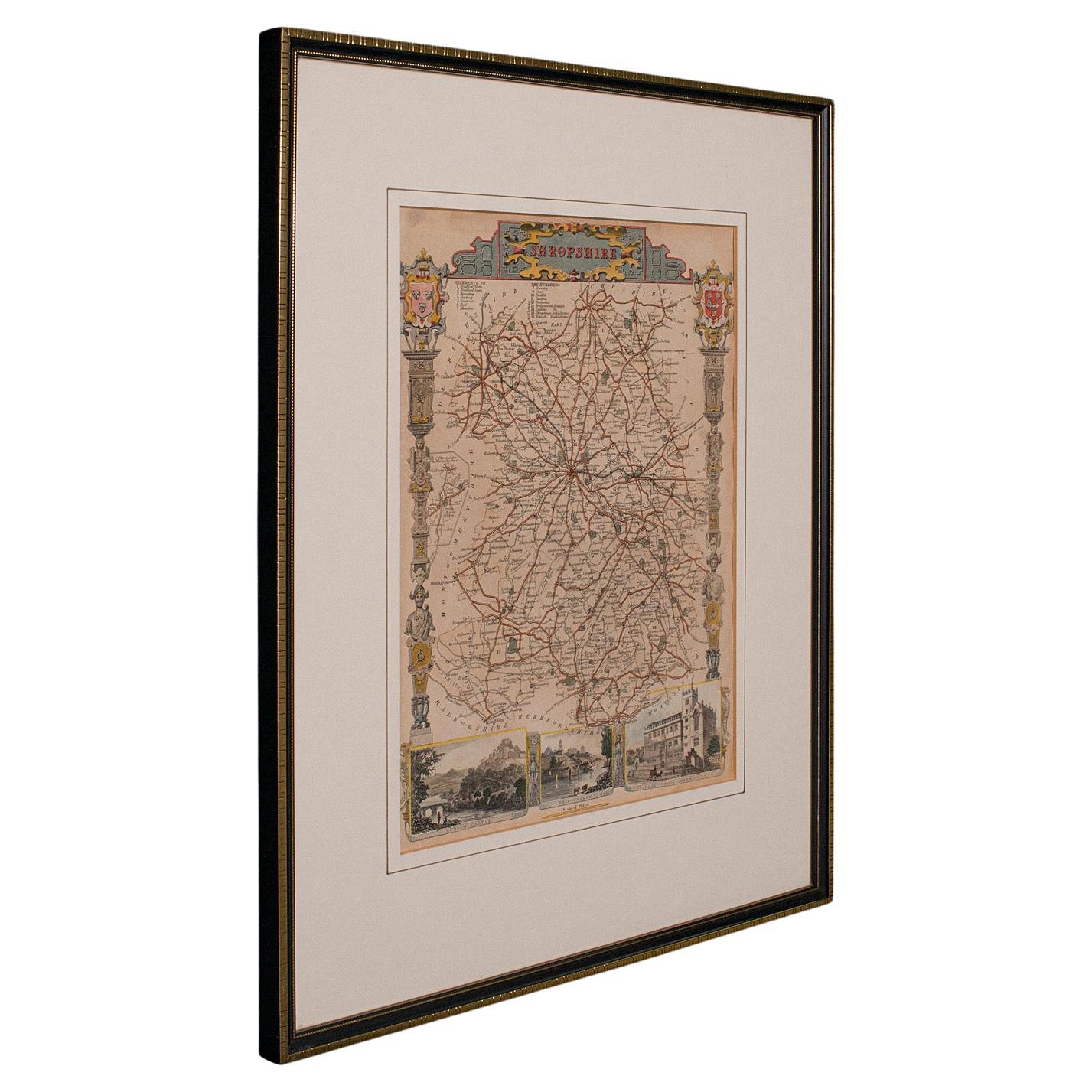
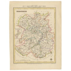
Map Shropshire Joseph Ellis Robert Sayer Carington Bowles Framed
About the Item
A modern map of Shropshire Drawn from the latest surveys corrected and improved by the best authorities.
Artist Joseph Ellis sculptor.
Joseph Ellis was an engraver and publisher from Clerkenwell in London and was apprenticed to Richard William Seale in 1749. He is best know to county map collectors for The New English Atlas published in 1765 which was later reissued as Ellis's English Atlas in 1766, 1768 1777, 1786, 1790 and 1796.
Maker carington bowles 1724 - 1793.
Carington Bowles worked in London as a publisher in partnership with his father John Bowles from about 1752 until 1763. Carington Bowles worked as a publisher in partnership with his father John Bowles from about 1752 until 1763 before taking over his uncle's business. His address was 69 St. Pauls Church Yard, London. He worked with a number of well known cartographers of the day including Emanuel Bowen, Thomas Kitchin, Robert Sayer and John Ellis.
Bibliography Printed for Robert Sayer in Fleet Street & Carington Bowles in St Pauls Church Yard
- Dimensions:Height: 15.36 in (39 cm)Width: 13 in (33 cm)Depth: 1.19 in (3 cm)
- Style:Georgian (Of the Period)
- Materials and Techniques:
- Place of Origin:
- Period:
- Date of Manufacture:circa 1766
- Condition:Wear consistent with age and use.
- Seller Location:BUNGAY, GB
- Reference Number:1stDibs: LU3867332642102
About the Seller
5.0
Vetted Professional Seller
Every seller passes strict standards for authenticity and reliability
Established in 1985
1stDibs seller since 2018
97 sales on 1stDibs
Typical response time: 5 hours
- ShippingRetrieving quote...Shipping from: BUNGAY, United Kingdom
- Return Policy
Authenticity Guarantee
In the unlikely event there’s an issue with an item’s authenticity, contact us within 1 year for a full refund. DetailsMoney-Back Guarantee
If your item is not as described, is damaged in transit, or does not arrive, contact us within 7 days for a full refund. Details24-Hour Cancellation
You have a 24-hour grace period in which to reconsider your purchase, with no questions asked.Vetted Professional Sellers
Our world-class sellers must adhere to strict standards for service and quality, maintaining the integrity of our listings.Price-Match Guarantee
If you find that a seller listed the same item for a lower price elsewhere, we’ll match it.Trusted Global Delivery
Our best-in-class carrier network provides specialized shipping options worldwide, including custom delivery.More From This Seller
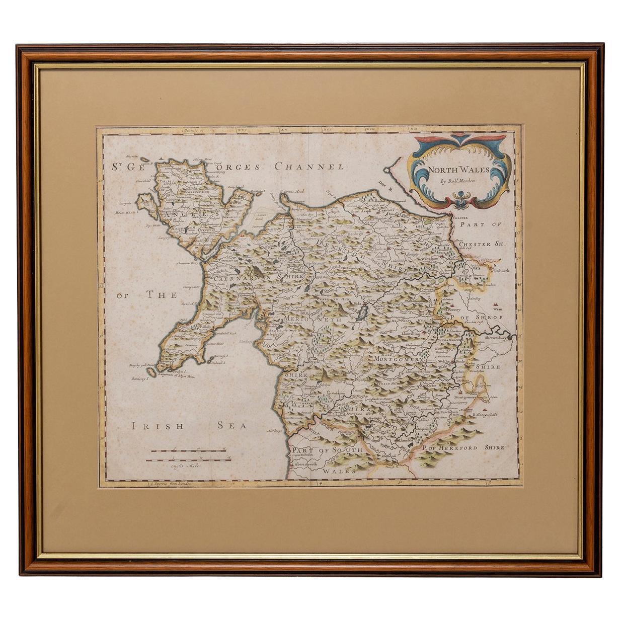
View AllMap North Wales Robert Marsden Anglesey
Located in BUNGAY, SUFFOLK
Map of North Wales by Robert Marsden
Including Anglesey
Charming topography and detail and colouring
just purchased more information to follow.
Category
Antique 18th Century English Georgian Maps
Materials
Paper

Map Bedfordshire General Framed
Located in BUNGAY, SUFFOLK
A general map of Bedfordshire with its hundreds
A scale of 5 miles
in the original green mount and traditional black and gold frame. Measures: 36cm 14" high.
Category
Antique 18th Century English Georgian Maps
Materials
Paper

Map Bedfordshire No 3 General Framed
Located in BUNGAY, SUFFOLK
A general map of Bedfordshire with its hundreds. Measure: 37cm 14 1/2" high
A scale of 5 miles.
in the original green mount and traditional black and gold frame.
charming map with...
Category
Antique 18th Century English Georgian Maps
Materials
Paper

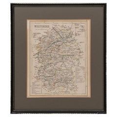
Map Wiltshire Joshua Archer Pentonville London framed 35cm 14" high
Located in BUNGAY, SUFFOLK
Map of Wiltshire Drawn & Engraved by Joshua Archer Pentonville London
Window Parts of Wiltshire in Berkshire
Explanation of Salisbury
County Divisions
Category
Antique 19th Century English Georgian Maps
Materials
Paper
Map Holy Promise Land Canaan Richard Palmer Richard Blome 1687 Joseph Moxon
Located in BUNGAY, SUFFOLK
Canaan comonly called the Holy Land or the Land of Promise, being the Possesion of the Israelites & travelled through by Our Lord & Saviour Iesus Christ and his Apostles. Engraven by Richard Palmer for Richard Blome. 1687
Blome, Richard, 1641-1705. London. 283 x 452 mm. Copperplate.
Probably from an English Bible...
Category
Antique 17th Century British Baroque Maps
Materials
Paper

Map Jersey Guernsey Scilly Islands Alderney
Located in BUNGAY, SUFFOLK
Rare map of The Islands of Guernsey and Jersey, including Alderney & the Scilly Islands
just purchased more information to follow
In the original cream mount and gilded frame.
Category
Antique 18th Century English Georgian Maps
Materials
Paper

You May Also Like
Antique Lithography Map, Shropshire, English, Framed, Cartography, Victorian
Located in Hele, Devon, GB
This is an antique lithography map of Shropshire. An English, framed atlas engraving of cartographic interest, dating to the mid 19th century and later.
Superb lithography of Shrop...
Category
Antique Mid-19th Century British Victorian Maps
Materials
Wood

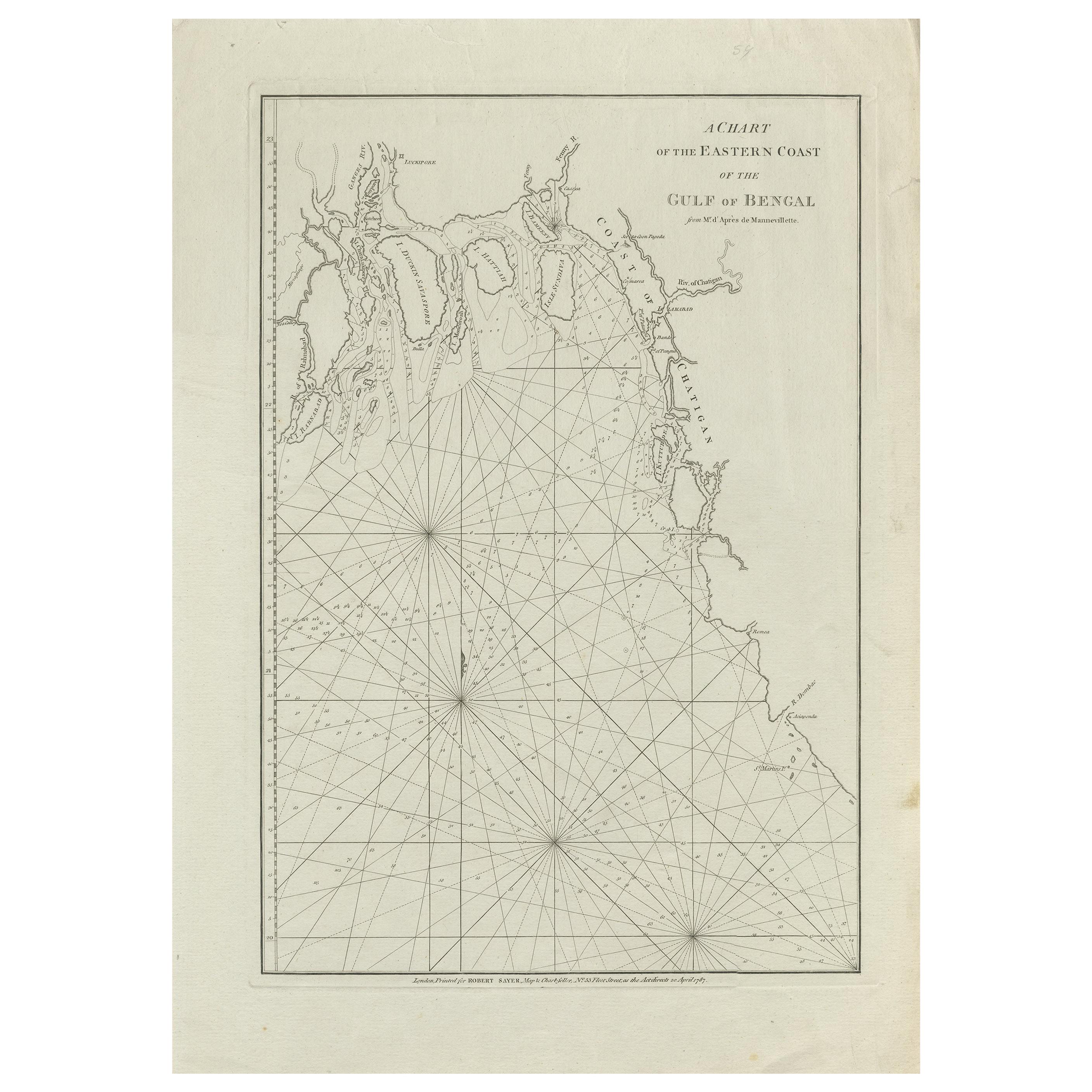
Antique Map of the Bay of Bengal Printed for Robert Sayer, 1787
Located in Langweer, NL
Antique map titled 'A Chart of the Eastern Coast of the Gulf of Bengal'. Original antique map of the Bay of Bengal. The Bay of Bengal is the northeastern...
Category
Antique Late 18th Century Maps
Materials
Paper
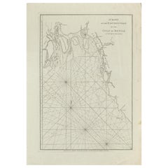
$464 Sale Price
20% Off
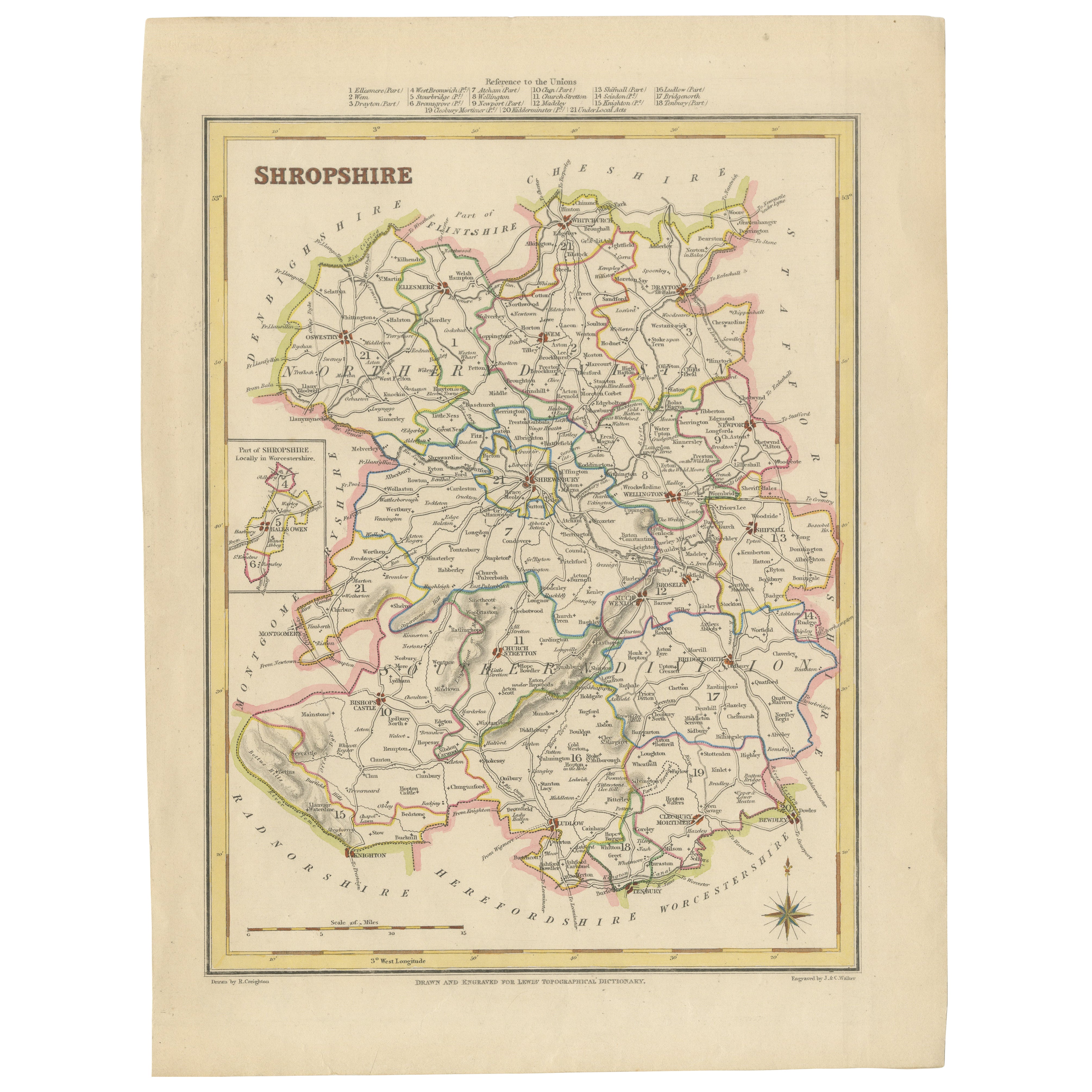
Map of Shropshire, 1844: Telford, Shrewsbury, Oswestry, Bridgnorth & Wellington
Located in Langweer, NL
Old Map of Shropshire by Samuel Lewis, 1844: Telford, Shrewsbury, Oswestry, Bridgnorth, and Wellington
This 1844 map of Shropshire is an antique engraving from Samuel Lewis' Topogr...
Category
Antique 1840s Maps
Materials
Paper
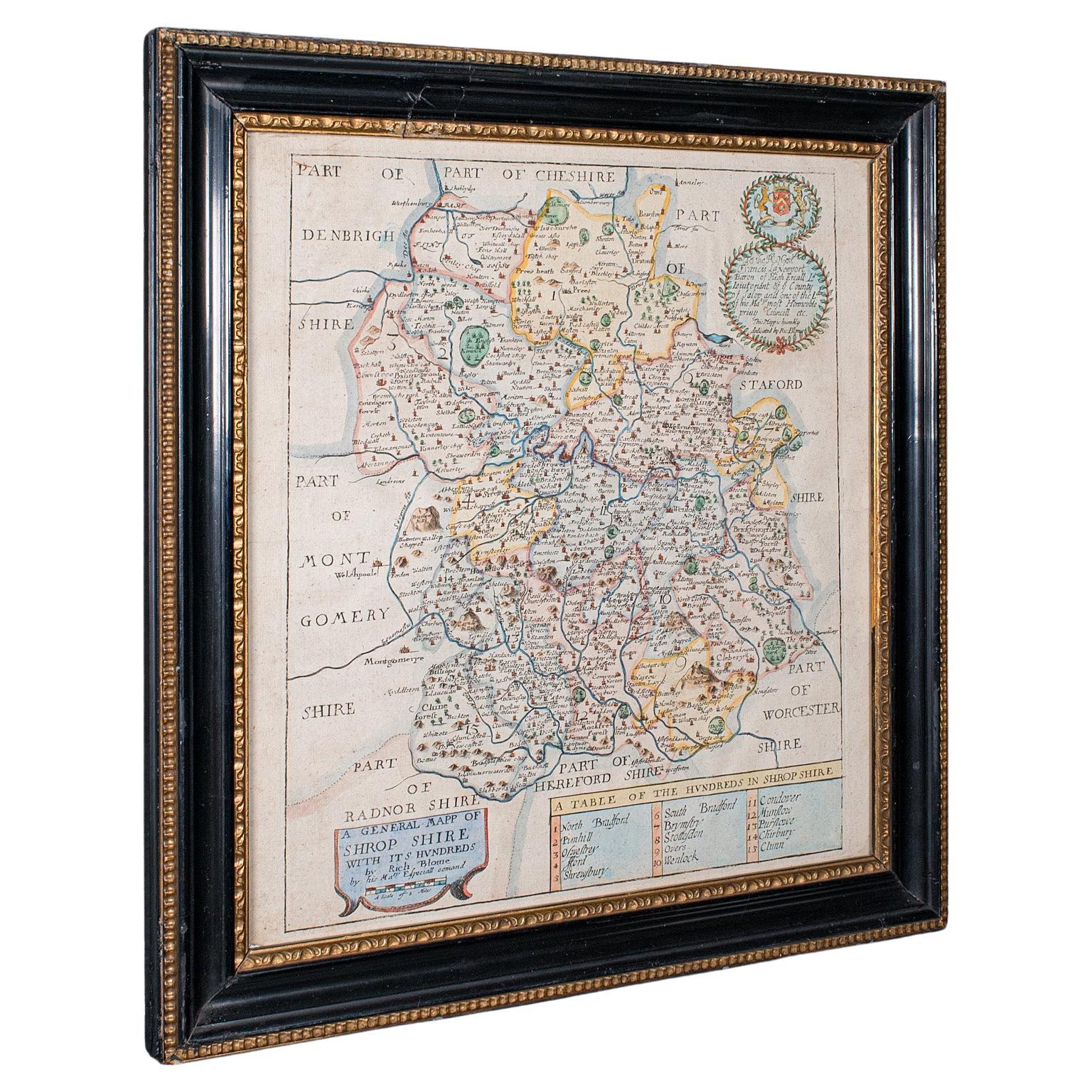
Antique County Map, Shropshire, English, Atlas Engraving, Richard Blome, C.1673
Located in Hele, Devon, GB
This is an antique county map of Shropshire. An English, framed atlas engraving by Richard Blome, dating to the 17th century and later.
A treat for the collector or county native, ...
Category
Antique 17th Century British Restauration Maps
Materials
Glass, Wood, Paper

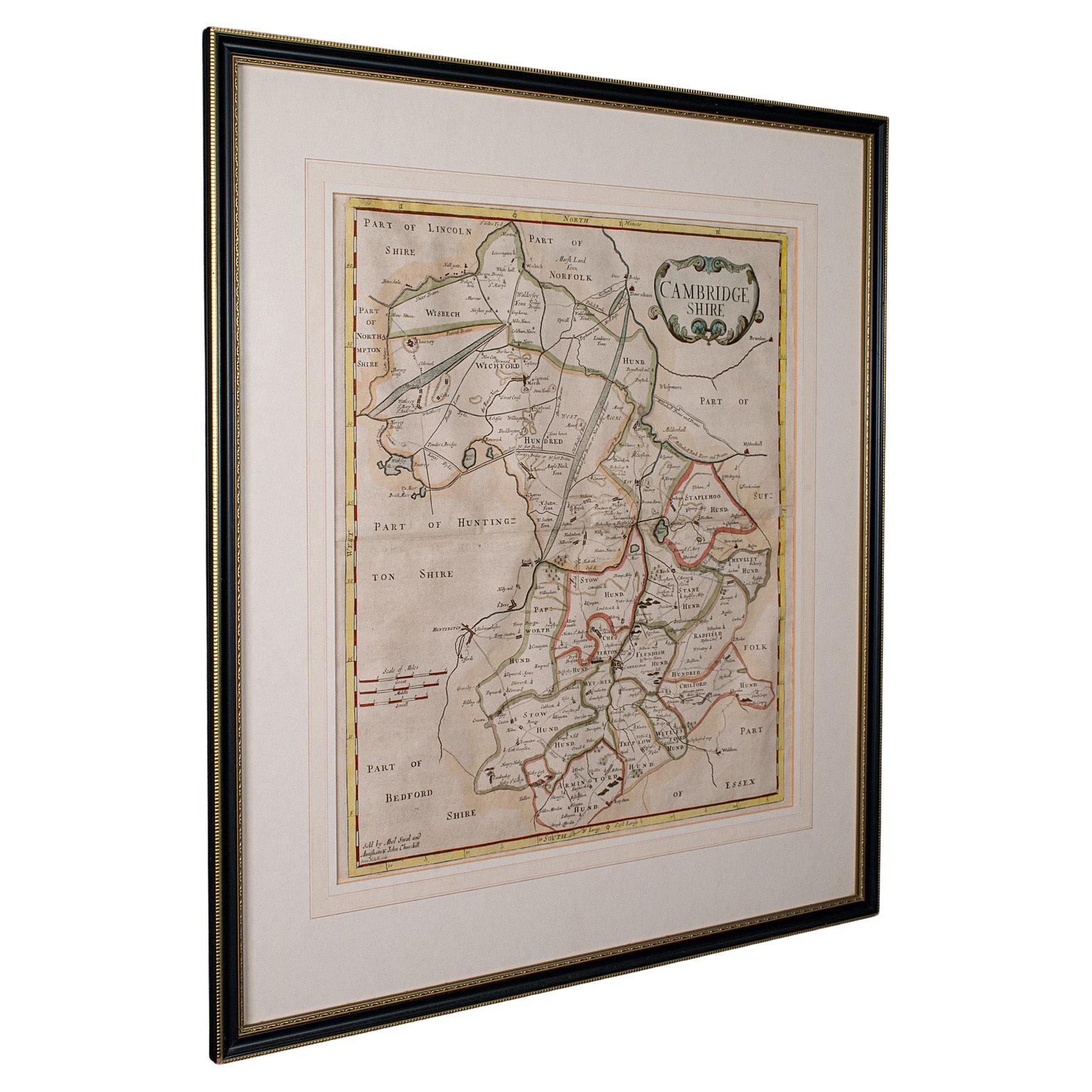
Antique County Map, Cambridgeshire, English, Framed Cartography, Robert Morden
Located in Hele, Devon, GB
This is an antique county map of Cambridgeshire. An English, framed atlas engraving of cartographic interest By Robert Morden, dating to the late 17th century and later.
Superb lit...
Category
Antique Early 18th Century British Other Maps
Materials
Glass, Wood, Paper
Antique Lithography Map, Oxfordshire, English, Framed Cartography, Robert Morden
Located in Hele, Devon, GB
This is an antique lithography map of Oxfordshire. An English, framed atlas engraving of cartographic interest by Robert Morden, dating to the late 17th century and later.
Superb l...
Category
Antique Late 17th Century British William and Mary Maps
Materials
Paper
Recently Viewed
View AllMore Ways To Browse
18th Century English Bowl
Rectangular Coffee Tables Chinese
Round Armchair Art Deco
Round Dining Table 180 Cm
Rounded Rosewood Dining Table
Safari Directors Chairs
Sculptural Barstool
Set Of 10 Mahogany Dining Chairs
Set Of 6 Woven Dining Chairs
Set Of Panton Chairs
Set Of Three Glass Nesting Tables
Settee Bench Antique
Sevres Table With Bronze
Silver Wall Plaque
Slat Stool
Slatted Stool
Square Side Table Brass Pair
Swedish Neoclassical Table