Items Similar to Map of the Holy Land Divided into 12 Tribes, the Travels of Jesus Christ, 1700

Want more images or videos?
Request additional images or videos from the seller
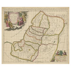
1 of 5
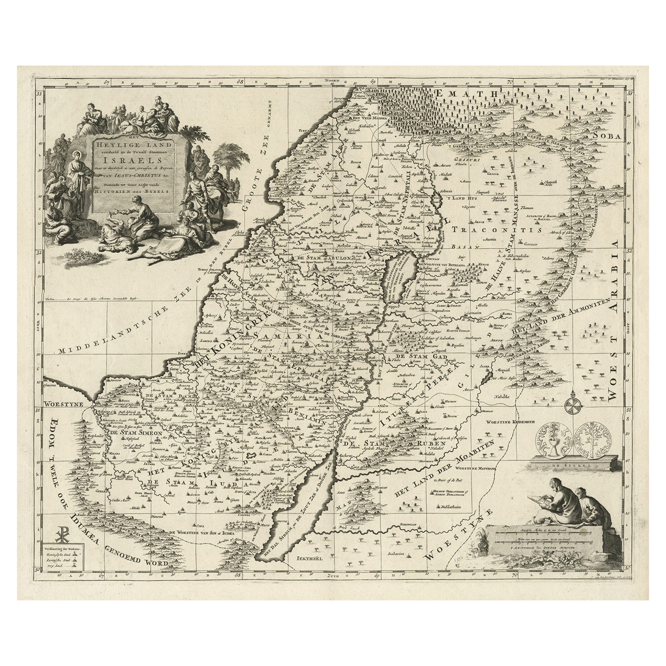
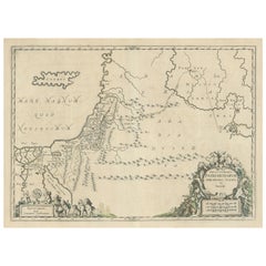
Map of the Holy Land Divided into 12 Tribes, the Travels of Jesus Christ, 1700
About the Item
Antique map titled 'Het Heylige Land verdeeld in de Twaalf Stammen Israels (..)'.
Decorative and detailed map of the Holy Land divided into 12 Tribes, showing the travels of Jesus Christ. Fully engraved with mountains, towns, forests and notations of important Biblical sites. Pictorial title cartouche depicting Jesus healing the sick and a scale of miles with two scholars. This map originates from 'Historie des Ouden en Nieuwen Testaments' by P. Mortier.
Artists and Engravers: Pierre, or Pieter, Mortier (1661-1711) was a Dutch engraver, son of a French refugee. He was born in Leiden. In 1690 he was granted a privilege to publish French maps in Dutch lands. In 1693 he released the first and accompanying volume of the Neptune Francois. The third followed in 1700. His son, Cornelis (1699-1783), would partner with Johannes Covens I, creating one of the most important map publishing companies of the eighteenth century.
Condition: Good, general age-related toning. Few repairs in lower margin, also affecting image. Please study image carefully.
- Dimensions:Height: 17.72 in (45 cm)Width: 20.28 in (51.5 cm)Depth: 0 in (0.02 mm)
- Materials and Techniques:
- Period:1700-1709
- Date of Manufacture:1700
- Condition:Wear consistent with age and use. Condition: Good, general age-related toning. Few repairs in lower margin, also affecting image. Please study image carefully.
- Seller Location:Langweer, NL
- Reference Number:Seller: BG-12063-5 1stDibs: LU3054326887162
About the Seller
5.0
Recognized Seller
These prestigious sellers are industry leaders and represent the highest echelon for item quality and design.
Platinum Seller
Premium sellers with a 4.7+ rating and 24-hour response times
Established in 2009
1stDibs seller since 2017
2,415 sales on 1stDibs
Typical response time: 1 hour
- ShippingRetrieving quote...Shipping from: Langweer, Netherlands
- Return Policy
Authenticity Guarantee
In the unlikely event there’s an issue with an item’s authenticity, contact us within 1 year for a full refund. DetailsMoney-Back Guarantee
If your item is not as described, is damaged in transit, or does not arrive, contact us within 7 days for a full refund. Details24-Hour Cancellation
You have a 24-hour grace period in which to reconsider your purchase, with no questions asked.Vetted Professional Sellers
Our world-class sellers must adhere to strict standards for service and quality, maintaining the integrity of our listings.Price-Match Guarantee
If you find that a seller listed the same item for a lower price elsewhere, we’ll match it.Trusted Global Delivery
Our best-in-class carrier network provides specialized shipping options worldwide, including custom delivery.More From This Seller
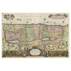
View AllDetailed Map of the Holy Land, Showing the Travels of Christ & Apostles, ca.1650
Located in Langweer, NL
Antique map titled 'Het Beloofde Landt Canaan door wandelt van onsen Salichmaeker Jesu Christo neffens syne Apostelen.'
Detailed map of the Holy Land, showing the travels of Christ and the Apostles, including Paul's travel's at sea and numerous sailing vessels. Below bible scenes such as the nativity and crucifiction of Christ. An excellent example of a Duch Bible map...
Category
Antique 1650s Maps
Materials
Paper
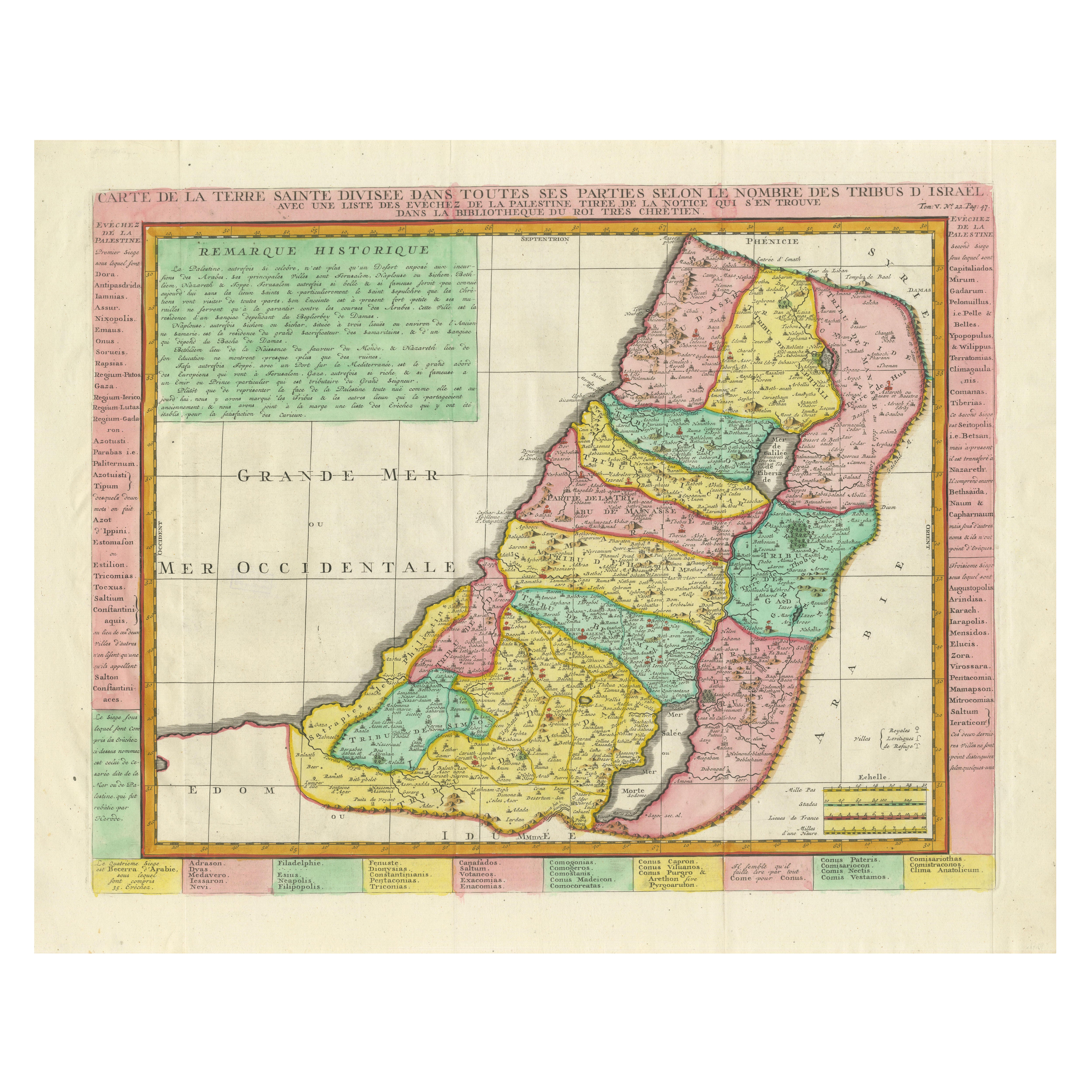
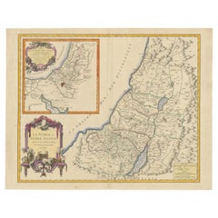
1732 Henri Chatelain Map of the Holy Land Divided Among the Tribes of Israel
Located in Langweer, NL
Title: 1732 Henri Chatelain Map of the Holy Land Divided Among the Tribes of Israel
This exquisite 18th-century map by Henri Chatelain, published in 1732, offers a detailed depict...
Category
Antique 1710s Maps
Materials
Paper

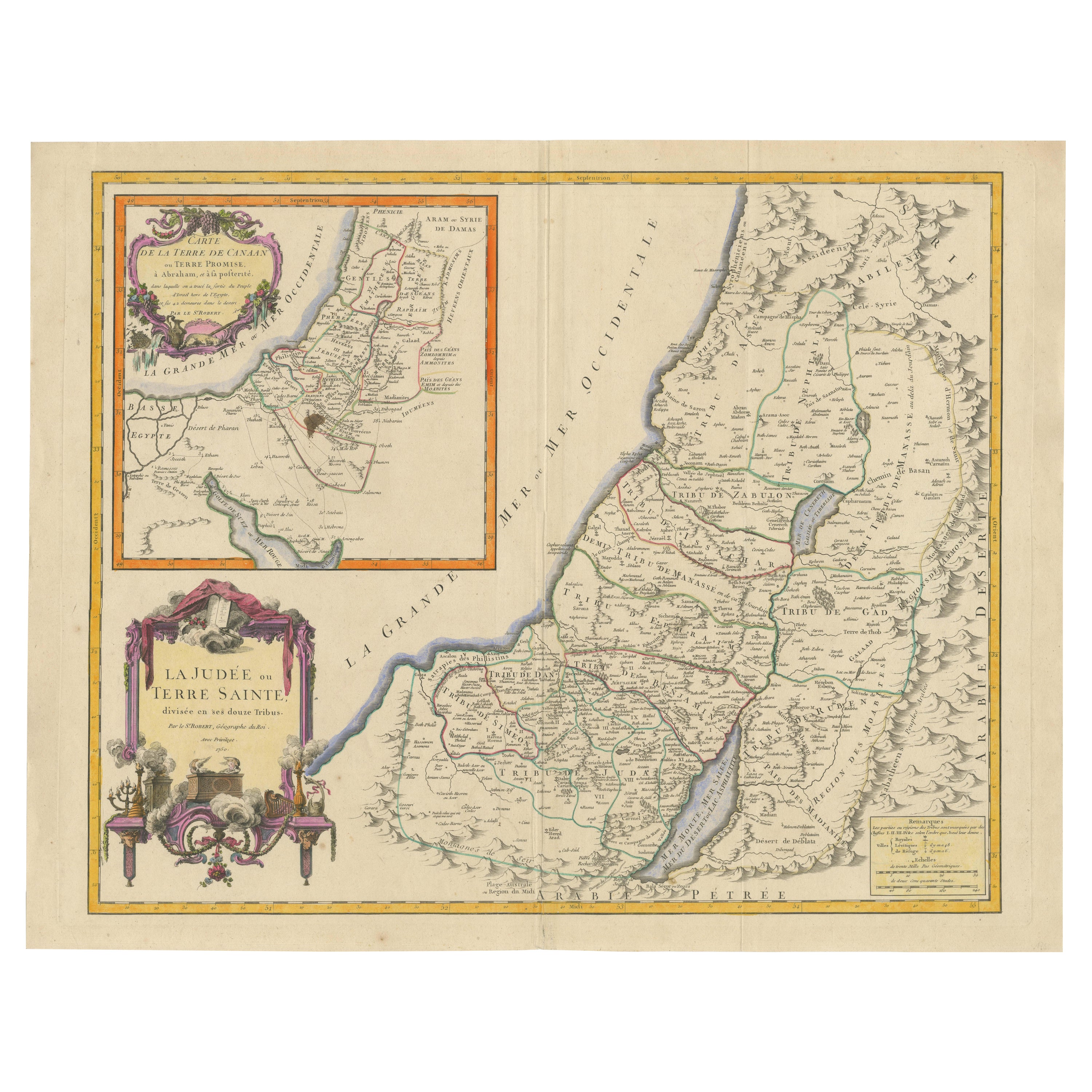
1750 Map of the Holy Land: The Land of Canaan and the Twelve Tribes
Located in Langweer, NL
Carte de la Terre de Canaan ou Terre Promise
Cartographer: Le St. Robert
Date of Publication: 1750
This exquisite 18th-century map, 'Carte de la Terre de Canaan ou Terre Promise', w...
Category
Antique 1750s Maps
Materials
Paper
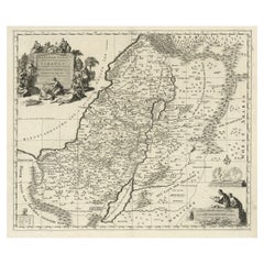
Highly Detailed Antique Map of the Holy Land Showing 12 Tribes of Israel, c.1720
Located in Langweer, NL
Antique map titled 'Heylige Land verdeeld in de Twaalf Stammen Israels (..).'
Highly detailed map of the Holy Land divided into 12 tribes of Israel...
Category
Antique 1720s Maps
Materials
Paper
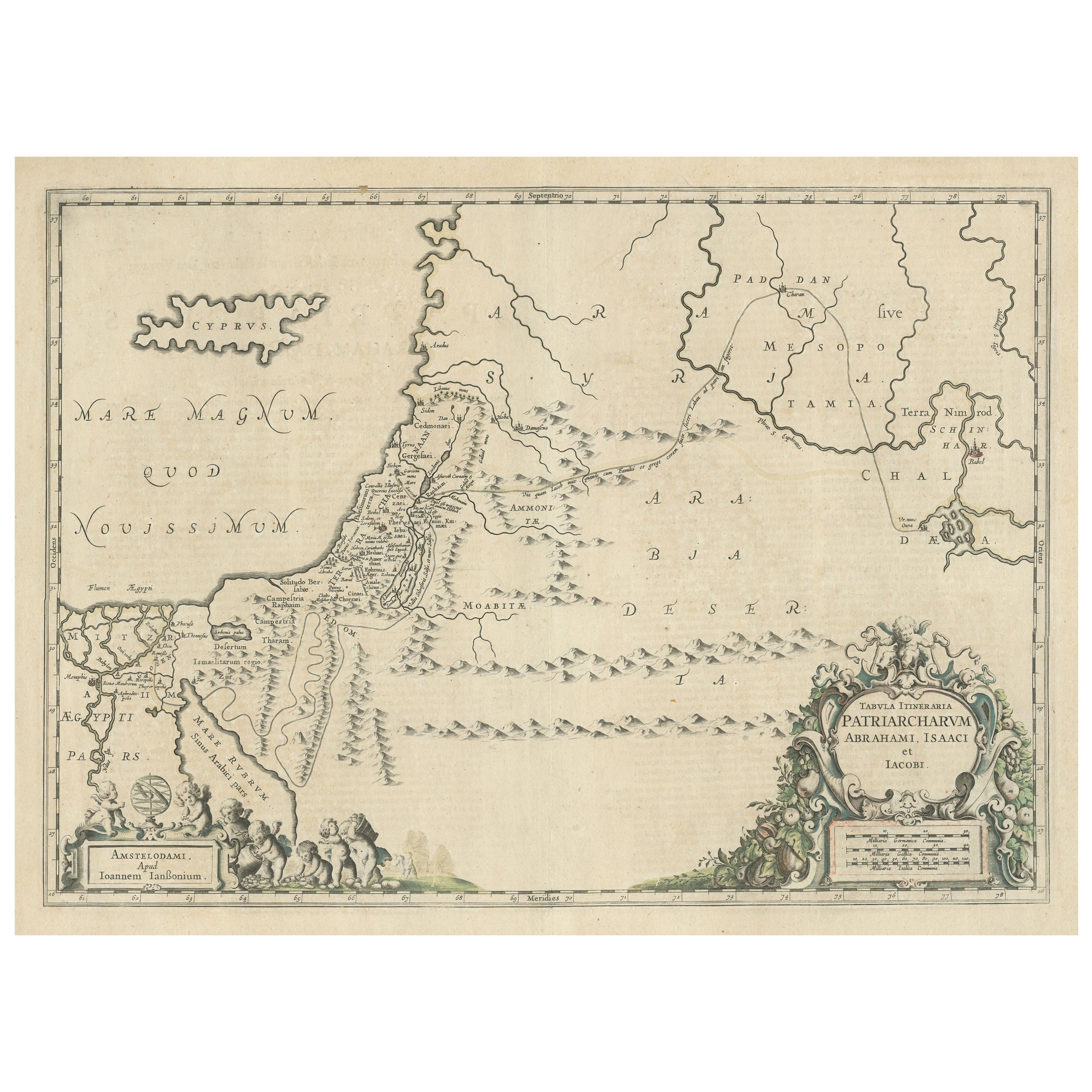
Antique Map of the Holy Land, showing the travels of Abraham, Isaac and Jacob
Located in Langweer, NL
Antique map titled 'Tabula Itineraria Patriarcharum Abrahami, Isaaci et Iacobi'. Decorative regional map of the Holy Land, showing the travels of Abraham, Isaac and Jacob. Published ...
Category
Antique Mid-17th Century Maps
Materials
Paper
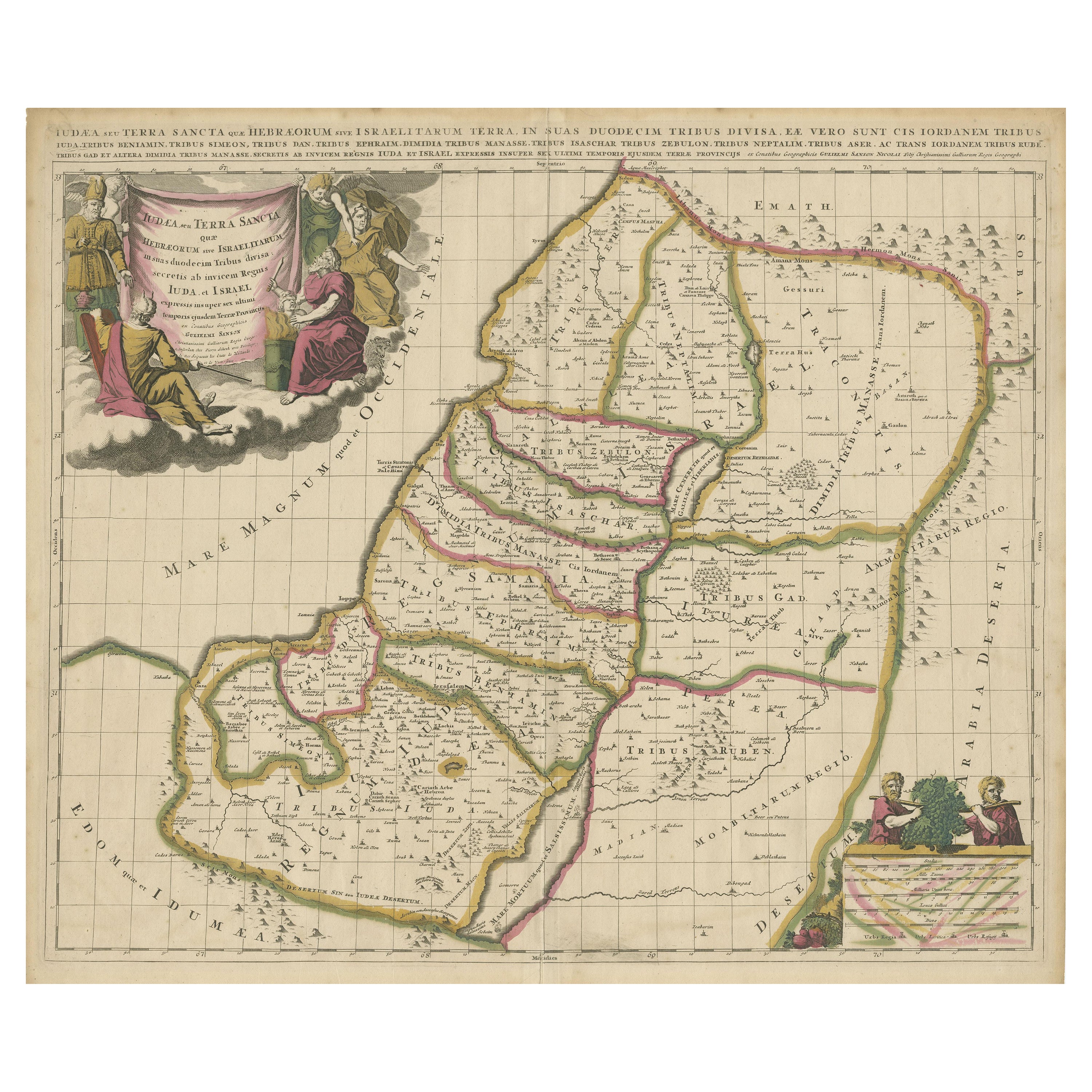
Antique Map of the Holy Land, Showing the Location of the Various Tribes
Located in Langweer, NL
Antique map titled 'Judaea seu Terra Sancta quae Hebraeorum sive Israelitarum (..)'. Map of The Holy Land, showing the location of the various tribes, in two kingdoms, Judah and Isra...
Category
Antique Early 18th Century Maps
Materials
Paper
$1,109 Sale Price
20% Off
Free Shipping
You May Also Like
The Holy Land at the Time of Jesus: A 17th Century Dutch Map by Visscher
By Nicolaes Visscher II
Located in Alamo, CA
This detailed Dutch map entitled "Het Beloofe de Landt Canaan door wandelt van onsen Salichmaecker Iesu Christo, nessens syne Apostelen" by Nicolaes Visscher was published in Amsterd...
Category
Antique Mid-17th Century Dutch Maps
Materials
Paper

French Statue of Jesus Christ
Located in Atlanta, GA
An absolutely stunning 15th century statue of Christ from the Provenance region of France. Masterly hand carved from polychromed wood. Wonderful patin...
Category
Antique 15th Century and Earlier French Religious Items
Materials
Wood
Rare Antique Bronze Holy Heart Sculpture / Bust of Our Lord Jesus Christ 1920
Located in Lisse, NL
Rare and large antique bronze sculpture of our Lord Jesus.
This gorgeous and sizeable bronze sculpture is another one of our recent great finds. We have never seen a bronze holy hea...
Category
Early 20th Century European Arts and Crafts Religious Items
Materials
Bronze
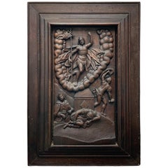
Flemish Embossed Wood Plaque of the Resurrection of Jesus Christ
Located in Guaynabo, PR
This is a heavy large carved wood plaque depicting an embossed scene of the Resurrection of Jesus Christ. He is standing victorious and elevated over a U shaped cluster of clouds wit...
Category
Antique 17th Century Belgian Baroque Decorative Art
Materials
Wood
$2,962 Sale Price
25% Off
Map of the Holy Land "Carte de la Syrie et de l'Egypte" by Pierre M. Lapie
By Pierre M. Lapie
Located in Alamo, CA
An early 19th century map of ancient Syria and Egypt entitled "Carte de la Syrie et de l'Egypte anciennes/dressée par M. Lapie, Colonel d'Etat Major, et...
Category
Antique Early 19th Century French Maps
Materials
Paper

The History of the Crusades for the Recovery and Possession of the Holy Land
Located in Middletown, NY
Charles Baudelaire: Souvenirs, Correspondances, Bibliographie, suivie de pièces inédites
Paris: René Pincebourde, 1872.
FIRST LIMITED EDITION - EXTRA ILLUSTRATED
Small 8vo 8 12 x 5...
Category
Antique Early 19th Century French Books
Materials
Gold Leaf
Recently Viewed
View AllMore Ways To Browse
Heal And Son
Heal And Son Antique Furniture
Jesus Healing
Pedestal Table With Lion Feet
Pretzel Rattan
Qum Wool And Silk Carpet
Rationalist Chair
Red Dhurrie
Rococo Figurine
Rococo Style Marble Tables
Roulette Table
Round Bamboo Table Base
Round Pink Chair
Rug Pink Red Blue Rust
Sauce Tureen
Scandinavian Flatware
Schumacher Pillows Black
Sexual Furniture