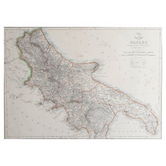
Items Similar to Large Original Antique Map of South Italy and Malta by Sidney Hall, 1847

Want more images or videos?
Request additional images or videos from the seller
1 of 5
Large Original Antique Map of South Italy and Malta by Sidney Hall, 1847
About the Item
Great map of South Italy and Malta
Drawn by Sidney Hall
Steel engraving by G.Aikman
Original color outline
Published by A & C Black. 1847
Unframed
Free shipping.
- Dimensions:Height: 12.25 in (31.12 cm)Width: 17.25 in (43.82 cm)Depth: 0.07 in (1.78 mm)
- Materials and Techniques:Paper,Other
- Place of Origin:
- Period:
- Date of Manufacture:1847
- Condition:Wear consistent with age and use.
- Seller Location:St Annes, GB
- Reference Number:1stDibs: LU1836332996362
About the Seller
4.9
Platinum Seller
Premium sellers with a 4.7+ rating and 24-hour response times
1stDibs seller since 2016
3,047 sales on 1stDibs
Typical response time: <1 hour
Associations
International Confederation of Art and Antique Dealers' Associations
- ShippingRetrieving quote...Shipping from: St Annes, United Kingdom
- Return Policy
Authenticity Guarantee
In the unlikely event there’s an issue with an item’s authenticity, contact us within 1 year for a full refund. DetailsMoney-Back Guarantee
If your item is not as described, is damaged in transit, or does not arrive, contact us within 7 days for a full refund. Details24-Hour Cancellation
You have a 24-hour grace period in which to reconsider your purchase, with no questions asked.Vetted Professional Sellers
Our world-class sellers must adhere to strict standards for service and quality, maintaining the integrity of our listings.Price-Match Guarantee
If you find that a seller listed the same item for a lower price elsewhere, we’ll match it.Trusted Global Delivery
Our best-in-class carrier network provides specialized shipping options worldwide, including custom delivery.More From This Seller
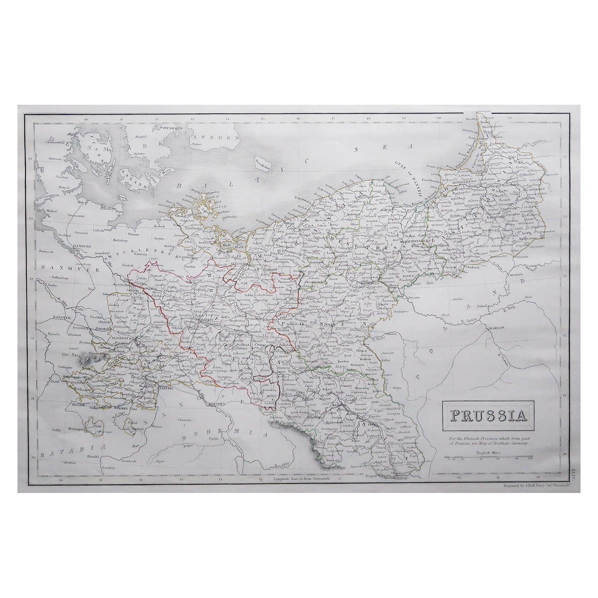
View AllLarge Original Antique Map of Poland by Sidney Hall, 1847
Located in St Annes, Lancashire
Great map of Poland
Drawn and engraved by Sidney Hall
Steel engraving
Original colour outline
Published by A & C Black. 1847
Unframed
...
Category
Antique 1840s Scottish Maps
Materials
Paper

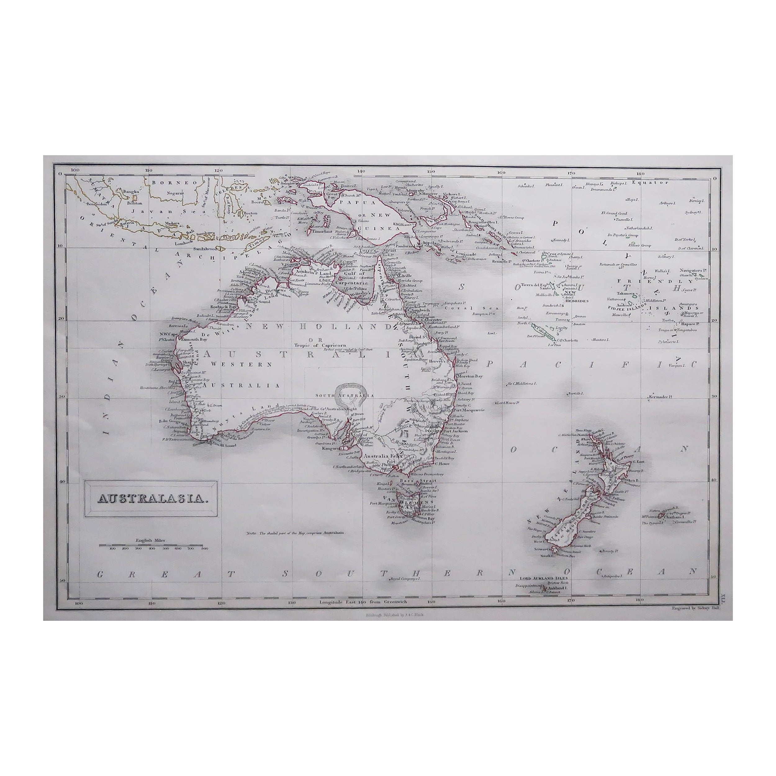
Large Original Antique Map of Australia by Sidney Hall, 1847
Located in St Annes, Lancashire
Great map of Australia
Drawn and engraved by Sidney Hall
Steel engraving
Original colour outline
Published by A & C Black. 1847
Unframed
Free shipping.
Category
Antique 1840s Scottish Maps
Materials
Paper

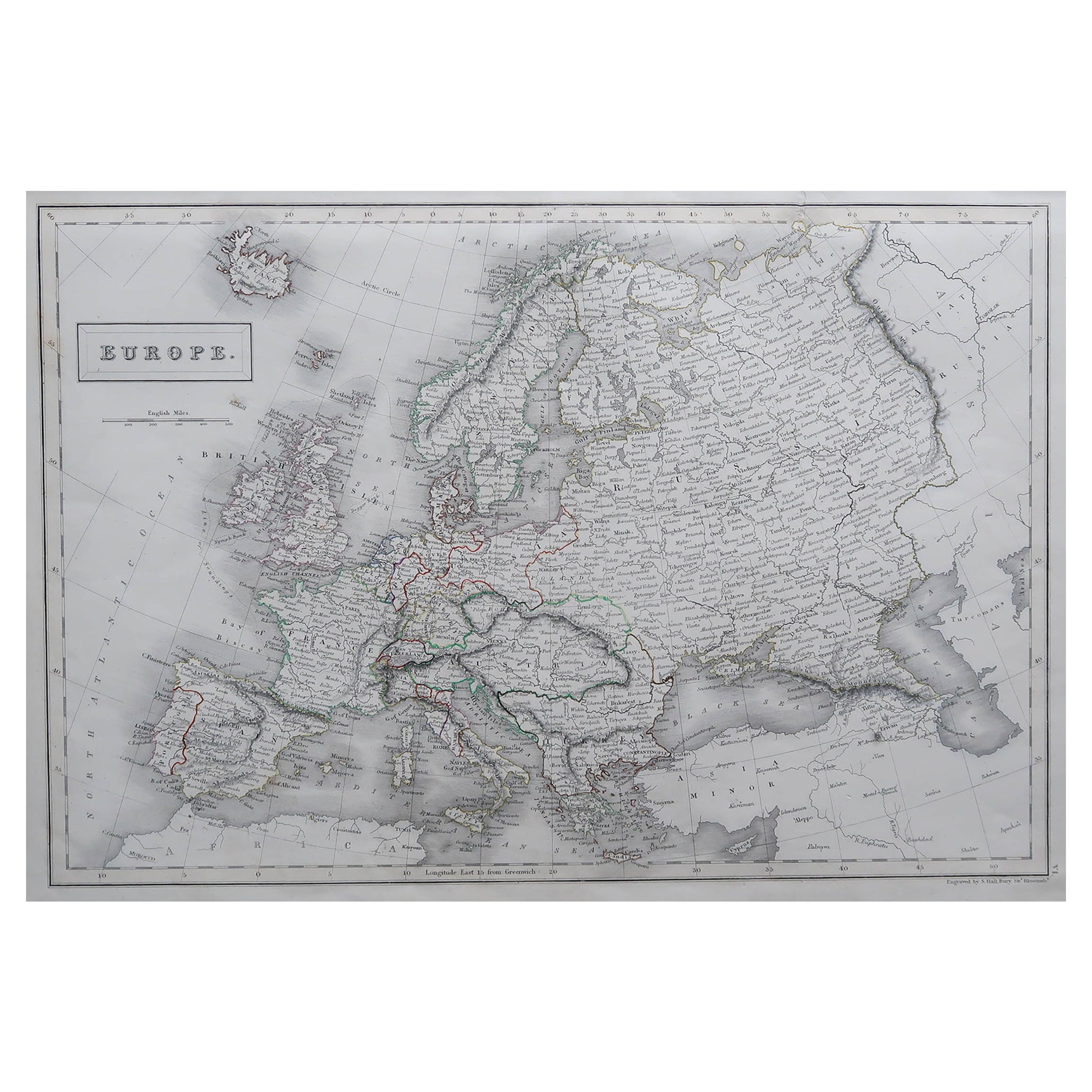
Large Original Antique Map of Europe by Sidney Hall, 1847
Located in St Annes, Lancashire
Great map of Europe
Drawn and engraved by Sidney Hall
Steel engraving
Original colour outline
Published by A & C Black. 1847
Unframed
Free shipping.
Category
Antique 1840s Scottish Maps
Materials
Paper

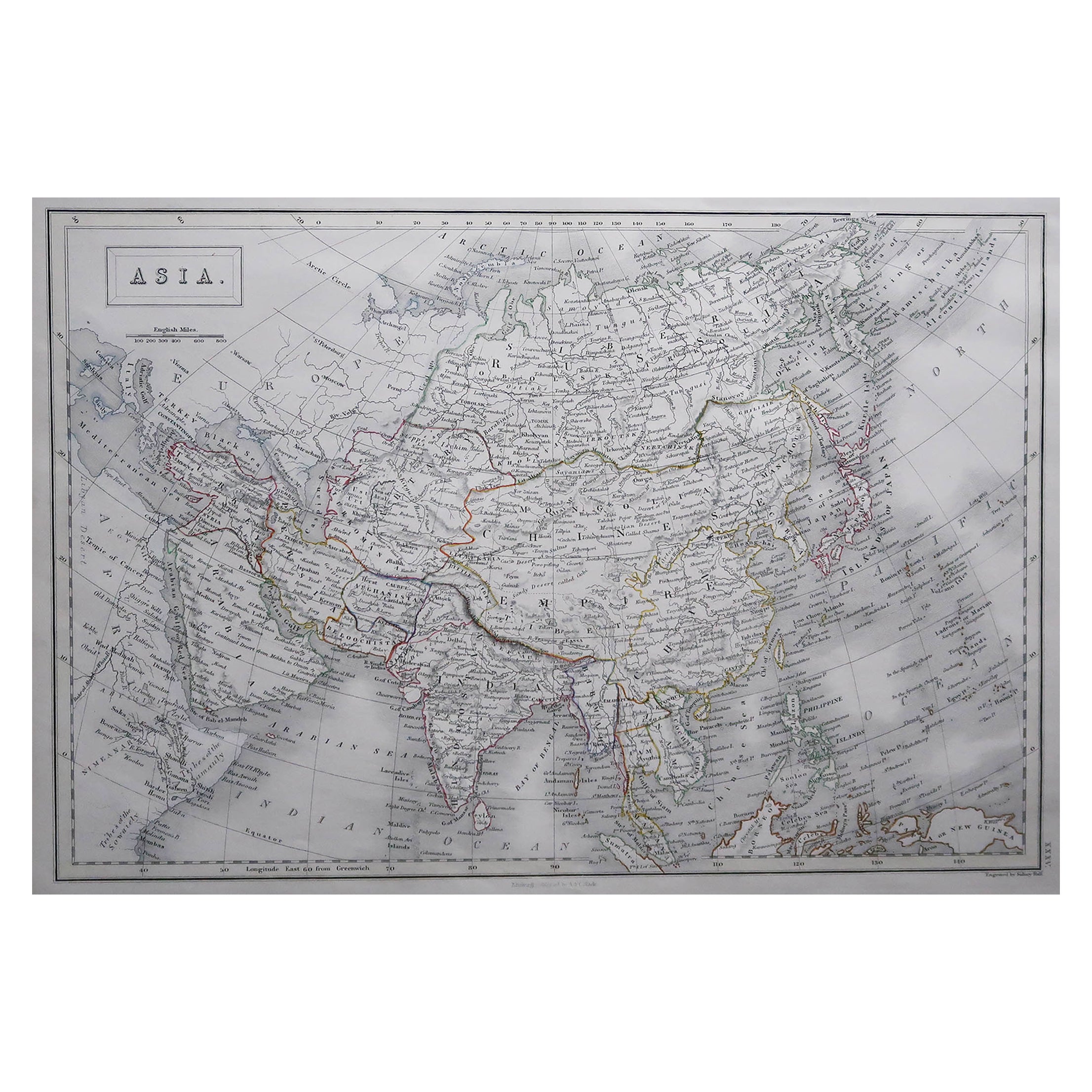
Large Original Antique Map of Asia by Sidney Hall, 1847
Located in St Annes, Lancashire
Great map of Asia
Drawn and engraved by Sidney Hall
Steel engraving
Original colour outline
Published by A & C Black. 1847
Unframed
Free shipping
Category
Antique 1840s Scottish Maps
Materials
Paper

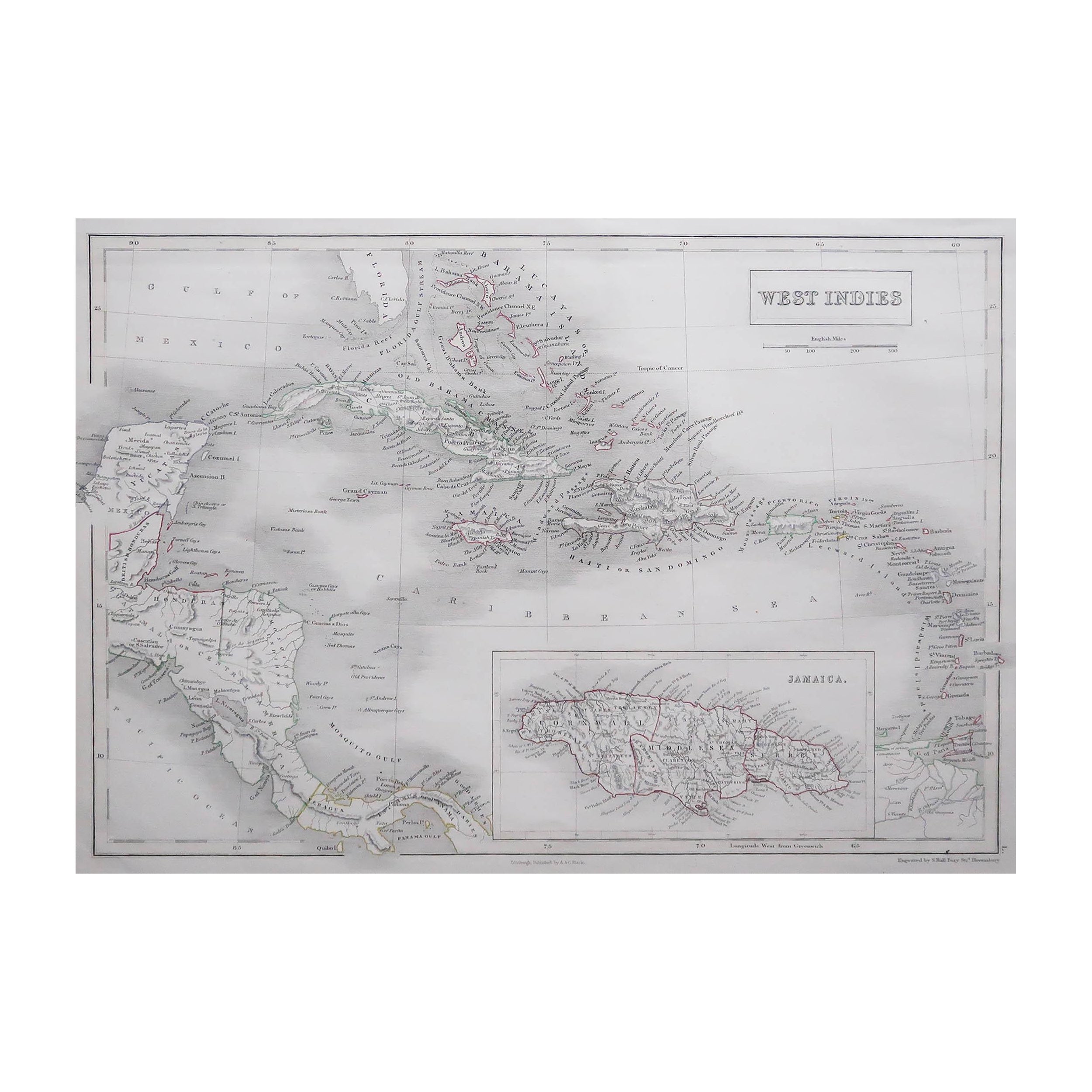
Large Original Antique Map of The West Indies by Sidney Hall, 1847
Located in St Annes, Lancashire
Great map of The West Indies
Drawn and engraved by Sidney Hall
Steel engraving
Original colour outline
Published by A & C Black. 1847
Unframed
Free shipping.
Category
Antique 1840s Scottish Maps
Materials
Paper

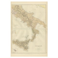
Large Original Antique Map of The South of Italy. John Dower, 1861
Located in St Annes, Lancashire
Great map of the South of Italy
Lithograph engraving by John Dower
Original colour
Published, 1861
Unframed
Good condition
Free shipping
Category
Antique 1860s English Victorian Maps
Materials
Paper
You May Also Like
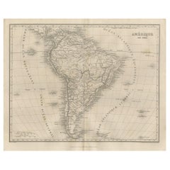
Antique Map of South America by Wyld, circa 1850
By J. Wyld
Located in Langweer, NL
Beautiful folding map of South America titled 'Colombia Prima or South America Drawn from the Large Map in Eight Sheets by Louis Stanislas D ' Arcy Delarochette'. Three insets in the...
Category
Antique Mid-19th Century British Maps
Materials
Paper

$1,340 Sale Price
20% Off
Antique Map of South America by Balbi '1847'
Located in Langweer, NL
Antique map titled 'Amérique du sud'. Original antique map of South America. This map originates from 'Abrégé de Géographie (..)' by Adrie...
Category
Antique Mid-19th Century Maps
Materials
Paper
Antique Map of Coiba Island, Panama, South America, C.1740
Located in Langweer, NL
Antique map titled 'Plan de la partie orientale de l'Isle de Quibo'. Map of the eastside of Coiba Island (Quibo), Panama, showing the shoreline around Port de Dames indicating soft s...
Category
Antique 18th Century Maps
Materials
Paper

$314 Sale Price
20% Off
Antique Map of South East Asia, Australia and the Indian Ocean, 1726
By F. Valentijn
Located in Langweer, NL
Antique map titled 'Tabula Indiae Orientalis'.
Beautiful detailed map of Australia, Southeast Asia and the Indian Ocean. The map features a fine depiction of the outlines of the western two-thirds of Australia, based on the discoveries of explorers working for the Dutch East India Company (the VOC). These include Willem Jansz's discoveries in the Gulf of Carpentaria in 1606; the encounters of Dirk...
Category
Antique Mid-18th Century Dutch Maps
Materials
Paper

$5,406 Sale Price
35% Off
Free Shipping
Original Antique Map of the South Part of Italy with an Inset of Malta, 1882
Located in Langweer, NL
Embark on a captivating journey through the southern part of Italy with an original Antique Map from the esteemed 'Comprehensive Atlas and Geography of the World,' meticulously craft...
Category
Antique 1880s Maps
Materials
Paper
Original Engraved Antique Map of the World, Colorful and Decorative, C.1780
By Pierre François Tardieu
Located in Langweer, NL
Antique map titled 'Mappemonde en Deux Hemispheres ou l'on a Indique les Nouvelles Decouvertes' - This handsome double hemisphere map presents a ...
Category
Antique 18th Century Maps
Materials
Paper

Recently Viewed
View AllMore Ways To Browse
Antique Maltese
Antique Maltese Furniture
Malta Antique
Rectangular Coffee Tables Chinese
Round Armchair Art Deco
Round Dining Table 180 Cm
Rounded Rosewood Dining Table
Safari Directors Chairs
Sculptural Barstool
Set Of 10 Mahogany Dining Chairs
Set Of 6 Woven Dining Chairs
Set Of Panton Chairs
Set Of Three Glass Nesting Tables
Settee Bench Antique
Sevres Table With Bronze
Silver Wall Plaque
Slat Stool
Slatted Stool