Items Similar to Large Chart of the island and sea of Java, Indonesia


Want more images or videos?
Request additional images or videos from the seller
1 of 6
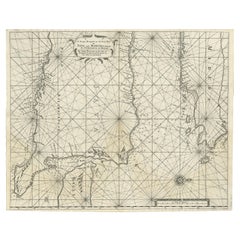
Large Chart of the island and sea of Java, Indonesia
About the Item
Antique map titled 'Carte Esférica de la Isla Y Mar de Java'. Large chart of the island and sea of Java, Indonesia. Beautiful nautical chart, published 1863 in Spain.
- Dimensions:Height: 27.25 in (69.2 cm)Width: 40.56 in (103 cm)Depth: 0.02 in (0.5 mm)
- Materials and Techniques:
- Period:
- Date of Manufacture:1863
- Condition:Wear consistent with age and use. General age-related toning. Few small weak spots. Stamp near title. Blank verso. Please study image carefully.
- Seller Location:Langweer, NL
- Reference Number:Seller: BG-13369-21stDibs: LU3054331885432
About the Seller
5.0
Recognized Seller
These prestigious sellers are industry leaders and represent the highest echelon for item quality and design.
Platinum Seller
Premium sellers with a 4.7+ rating and 24-hour response times
Established in 2009
1stDibs seller since 2017
2,415 sales on 1stDibs
Typical response time: 1 hour
- ShippingRetrieving quote...Shipping from: Langweer, Netherlands
- Return Policy
Authenticity Guarantee
In the unlikely event there’s an issue with an item’s authenticity, contact us within 1 year for a full refund. DetailsMoney-Back Guarantee
If your item is not as described, is damaged in transit, or does not arrive, contact us within 7 days for a full refund. Details24-Hour Cancellation
You have a 24-hour grace period in which to reconsider your purchase, with no questions asked.Vetted Professional Sellers
Our world-class sellers must adhere to strict standards for service and quality, maintaining the integrity of our listings.Price-Match Guarantee
If you find that a seller listed the same item for a lower price elsewhere, we’ll match it.Trusted Global Delivery
Our best-in-class carrier network provides specialized shipping options worldwide, including custom delivery.More From This Seller
View AllLarge Sea Chart of the British Islands, 1918
Located in Langweer, NL
Antique map titled 'The British Islands'.
Large sea chart of the British Islands. It shows Ireland, Scotland, England, the Shetland Islands and part of Fra...
Category
Vintage 1910s Maps
Materials
Paper

$517 Sale Price
20% Off
Antique Map of the Island Java, Indonesia, c.1650
Located in Langweer, NL
Antique map titled 'Insulae Iavae cum parte insularum Boreno Sumatrae (..)'.
Beautiful map of the island of Java and part of Borneo, Bali, Madura and Sumatra. With decorative carto...
Category
Antique 17th Century Maps
Materials
Paper

$2,816 Sale Price
24% Off
Scarce Antique Map of the Island of Java, Indonesia
Located in Langweer, NL
Title: "Kaart van 't Eyland Groot Java: Antique Map of Java, Indonesia"
Description: This antique map, titled "Kaart van 't Eyland Groot Java," offers a rare and valuable depiction ...
Category
Antique Late 18th Century Maps
Materials
Paper

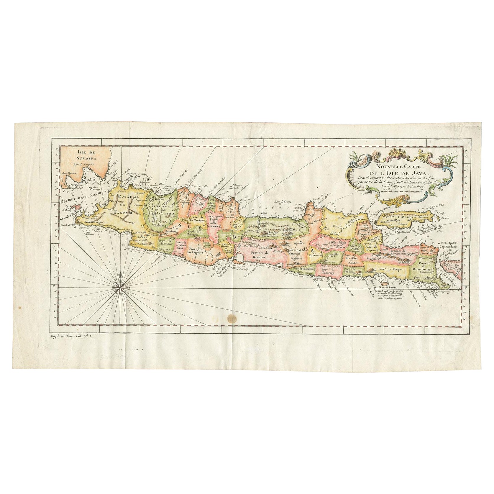
Antique Colourful Map of the Island of Java and Madura, Indonesia, C.1760
Located in Langweer, NL
Antique map titled 'Nouvelle Carte de l'Isle de Java'.
Chart of the island of Java, depicting soundings around the coast, all principal harbors, rivers and elevations, bays and p...
Category
Antique 18th Century Maps
Materials
Paper
$415 Sale Price
20% Off
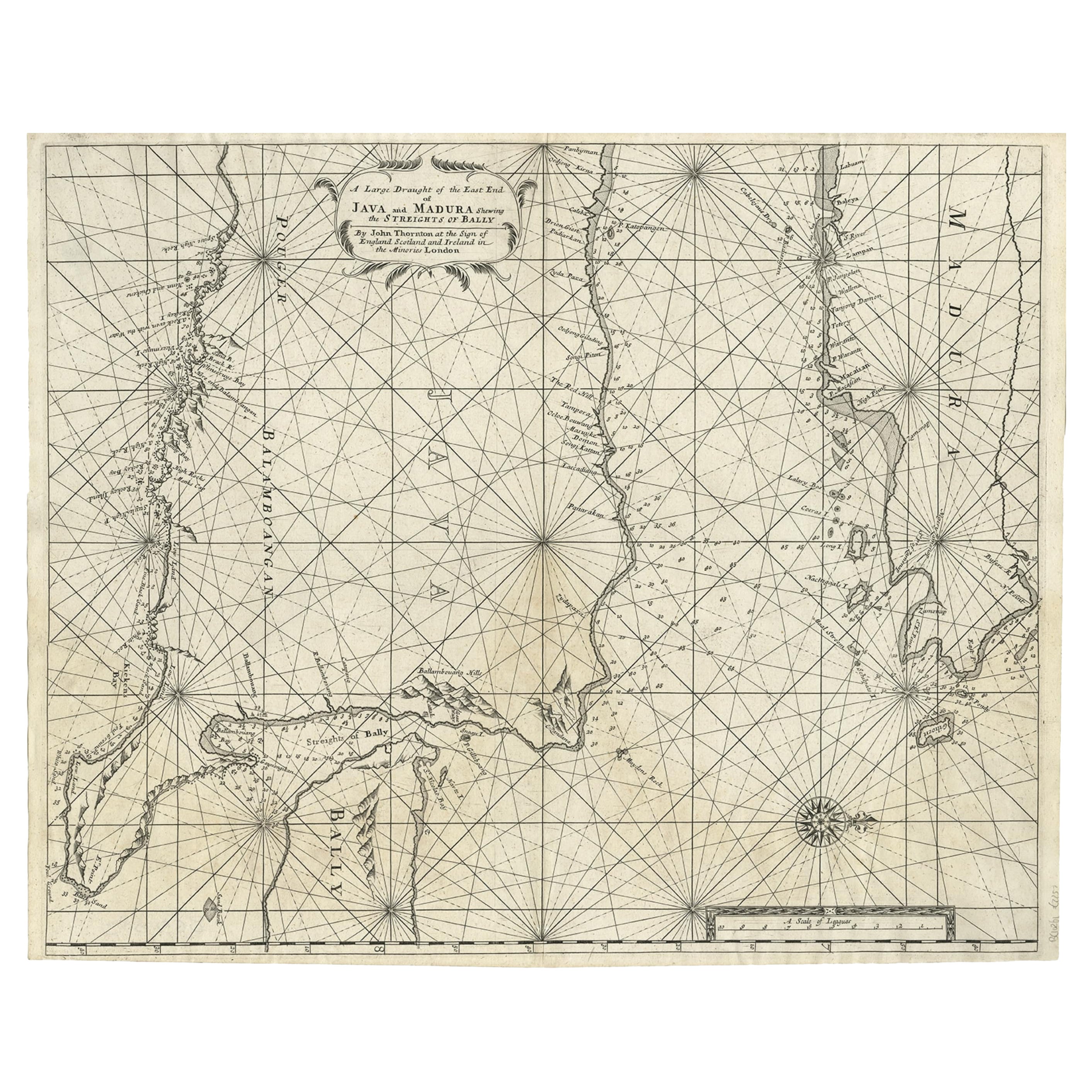
Rare Old English Sea Chart of Part of Indonesia with Java, Madura and Bali, 1711
Located in Langweer, NL
Antique map titled 'A Large Draught of the East End of Java and Madura shewing the Streights of Bally.'
Rare early example of this working English Sea Chart of part of Indonesia ...
Category
Antique 1710s Maps
Materials
Paper
$1,524 Sale Price
20% Off
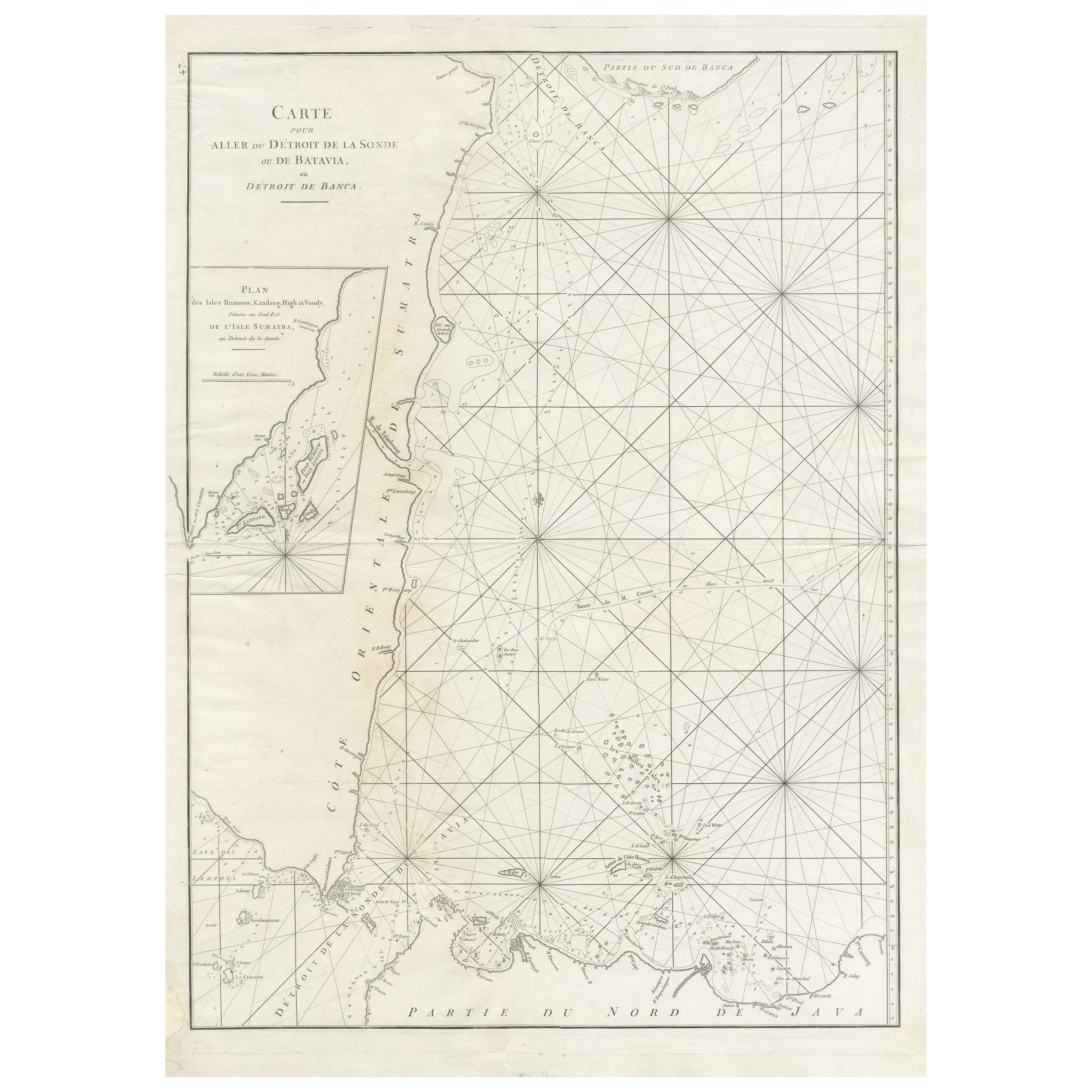
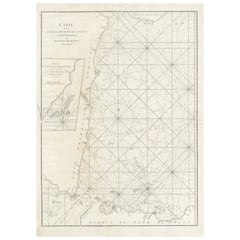
Large Antique Sea Chart of the South-Eastern Coast of Sumatra, Indonesia
Located in Langweer, NL
Antique map titled 'Carte pour aller du Détroit de la Sonde ou de Batavia, au Détroit de Banca'. This uncommon sea chart shows northern Java and eastern Sumatra along with an inset of the small islands in the Detroit Sound. The handsome chart provides detailed navigational information, including the route of Julien Crozet in April 1772, who led a French expedition to the South Pacific after the voyage's commander, Marion De Fresne, and 26 crew members were killed (and allegedly eaten) by a Maori tribe in the Bay of Islands off the coast of New Zealand. With title upper left corner and small inset map of the small isles nearby the south-eastern coast of Sumatra.
J. B. d'Apres de Mannevillette, from his atlas "Neptune orientale". French sailor...
Category
Antique Late 18th Century Maps
Materials
Paper
You May Also Like
Hand-Colored 18th Century Homann Map of Denmark and Islands in the Baltic Sea
By Johann Baptist Homann
Located in Alamo, CA
An 18th century copper plate hand-colored map entitled "Insulae Danicae in Mari Balthico Sitae utpote Zeelandia, Fionia, Langelandia, Lalandia, Falstria, Fembria Mona" created by Joh...
Category
Antique Early 18th Century German Maps
Materials
Paper

Anatomical Wall Chart Depicting the Human Lymphatic and Blood Vessels
Located in Berghuelen, DE
A rare 19-carat anatomical wall chart depicting the human lymphatic and blood vessels. On the sides with detailed description in German language. Print...
Category
Early 20th Century German Victorian Prints
Materials
Paper

Antique Anatomical Wall Chart Depicting the Human Skeleton
Located in Berghuelen, DE
A rare 19th century anatomical wall chart depicting the human skeleton. On the sides On the sides are detailed description in German language. The wall...
Category
Early 20th Century German Victorian Prints
Materials
Paper

Hand-Colored 18th Century Homann Map of the Black Sea, Turkey and Asia Minor
By Johann Baptist Homann
Located in Alamo, CA
An attractive original early 18th century hand-colored map of the Black Sea and Turkey entitled "Carte de L'Asie Minevre ou de la Natolie et du Pont Evxin Tiree des Voyages et des Ob...
Category
Antique Early 18th Century German Maps
Materials
Paper

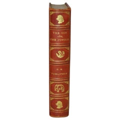
H.M. Tomlinson "The Sea and The Jungle" 1st Edition Woodcuts by Clare Leighton
By Tomlinson
Located in San Francisco, CA
H.M. Tomlinson "The Sea and The Jungle" First Edition with woodcuts by Clare Leighton, circa 1930
Rare First Edition. Very good condition. Fantastic woodcuts by noted artist Clare...
Category
Early 20th Century American American Classical Books
Materials
Other
Genito-Urinary Anatomical Chart Fritz Frohse
By Fritz Frohse, Nystrom / Frohse Art
Located in Philadelphia, PA
Genito-Urinary Anatomical Chart by Fritz Frohse. Dated 1922. Paper mounted on canvas. Shows wear but still presents very well!
Category
Vintage 1920s German American Classical Prints
Materials
Canvas, Paper

Recently Viewed
View AllMore Ways To Browse
Midcentury Modern Dining Chairs Chrome And Black Leather
Modern Pouffe
Modular Bench
Moon Coffee Table
Orange And Red Glass Bowl
Outdoor Loveseat
Oval Centerpiece Bowl
Painted Kitchen Stools
Pair Of Vintage Leather Club Chairs
Pakistan Tabriz Carpet
Pakistan Tabriz Rug
Parlor Set
Paul Frankl Rattan Lounge
Pedestal Light Marble
Piero Fornasetti 1960s
Porcelain Bread Plate
Portuguese Leather Dining Room Chairs
Professor Desk