Items Similar to Large Antique Map of Guadeloupe and Antigua with Adjacent Isles, 19th Century
Want more images or videos?
Request additional images or videos from the seller
1 of 6
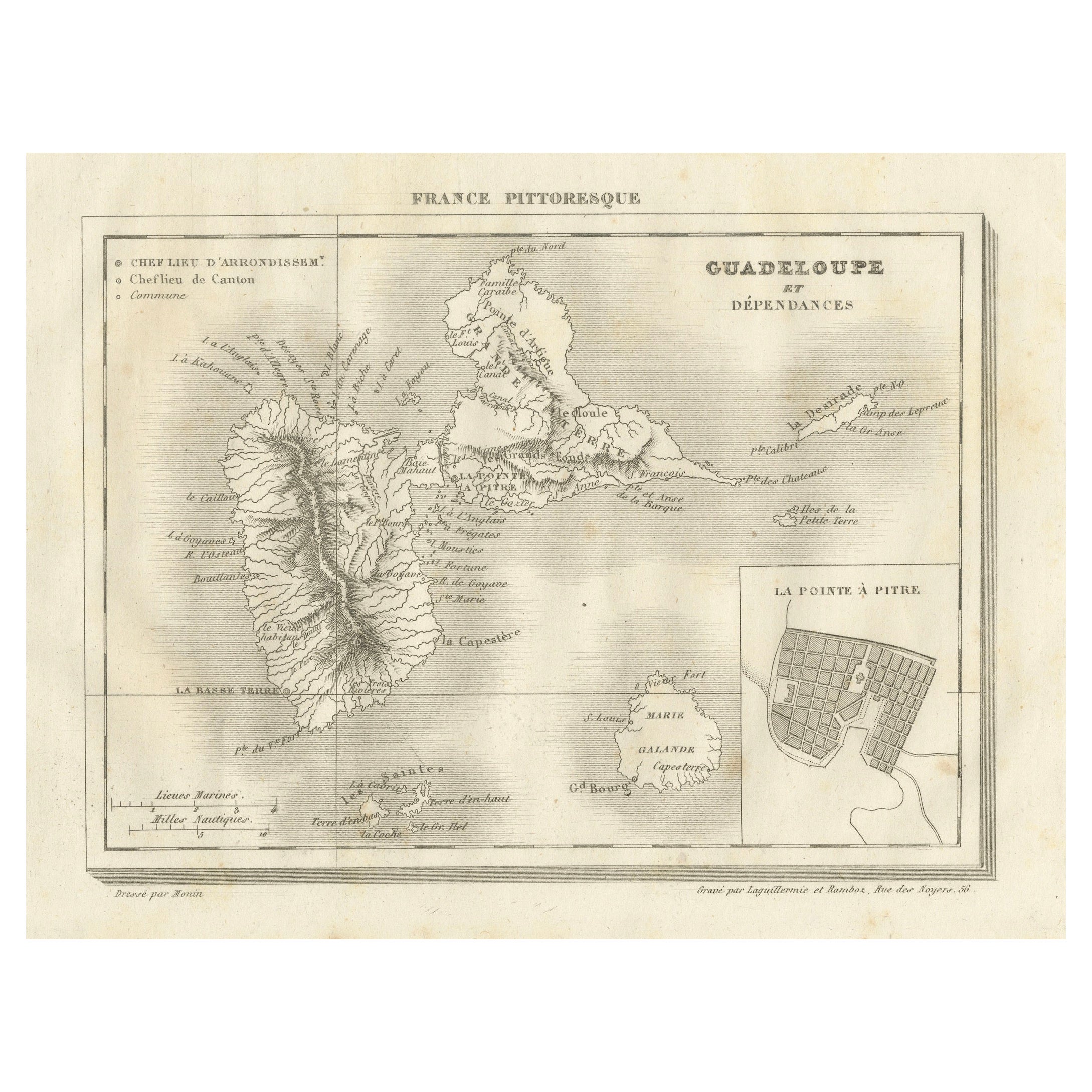
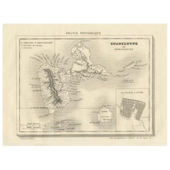
Large Antique Map of Guadeloupe and Antigua with Adjacent Isles, 19th Century
About the Item
Title: "Antique Map of Guadeloupe and Antigua with Adjacent Isles, 19th Century"
Source: New General Atlas (circa 1817), published in Edinburgh
Description: This detailed antique map presents a late 18th or early 19th-century depiction of two major Caribbean islands, Guadeloupe and Antigua, along with the smaller surrounding islets, including Marie-Galante. The mapmaker, John Thomson, has meticulously rendered the islands' topographical features such as mountain ranges, valleys, and coastline details, with hand coloring to enhance the visual distinction between land and sea.
Guadeloupe is shown in two main parts, Basse-Terre to the west and Grande-Terre to the east, reflecting its butterfly-like shape. Marie-Galante appears to the southeast of Guadeloupe, smaller in size but still detailed. To the northeast, Antigua is depicted with its intricate coastline and elevation changes.
The cartographer's craft is evident in the precision of the engraving and the careful application of color. While the specific creator is not mentioned, the quality suggests it could be the work of a prominent mapmaker or publisher from the period, known for producing accurate and detailed charts for navigation and general education about the West Indies.
The condition of the map appears to be good, with the paper showing signs of aging and foxing that contribute to its antique character. The folds and creases are typical of maps that were used or stored in atlases. Collectors and enthusiasts of cartographic history would value this piece for both its aesthetic appeal and its representation of Caribbean geography as understood in the era it was created.
- Dimensions:Height: 21.07 in (53.5 cm)Width: 29.34 in (74.5 cm)Depth: 0 in (0.02 mm)
- Materials and Techniques:Paper,Engraved
- Period:
- Date of Manufacture:1817
- Condition:Good condition considering its age. The paper showing signs of aging and foxing that contribute to its antique character. The yellowish offset, folds and creases are typical of maps that were used or stored in atlases.
- Seller Location:Langweer, NL
- Reference Number:Seller: BG-31618-31stDibs: LU3054337731592
About the Seller
5.0
Recognized Seller
These prestigious sellers are industry leaders and represent the highest echelon for item quality and design.
Platinum Seller
Premium sellers with a 4.7+ rating and 24-hour response times
Established in 2009
1stDibs seller since 2017
2,412 sales on 1stDibs
Typical response time: 1 hour
- ShippingRetrieving quote...Shipping from: Langweer, Netherlands
- Return Policy
Authenticity Guarantee
In the unlikely event there’s an issue with an item’s authenticity, contact us within 1 year for a full refund. DetailsMoney-Back Guarantee
If your item is not as described, is damaged in transit, or does not arrive, contact us within 7 days for a full refund. Details24-Hour Cancellation
You have a 24-hour grace period in which to reconsider your purchase, with no questions asked.Vetted Professional Sellers
Our world-class sellers must adhere to strict standards for service and quality, maintaining the integrity of our listings.Price-Match Guarantee
If you find that a seller listed the same item for a lower price elsewhere, we’ll match it.Trusted Global Delivery
Our best-in-class carrier network provides specialized shipping options worldwide, including custom delivery.More From This Seller
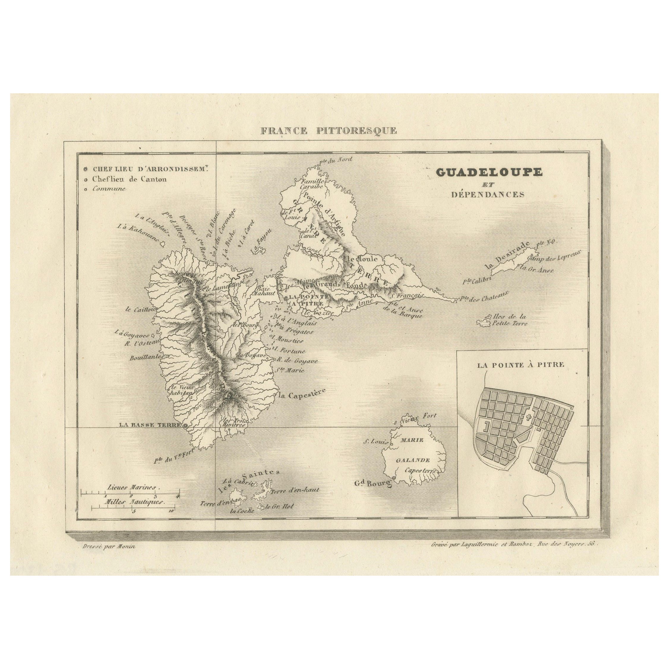
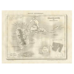
View AllAntique Map of Guadeloupe and Dependencies – France Pittoresque, c. 19th Century
Located in Langweer, NL
Antique Map of Guadeloupe and Dependencies – France Pittoresque, c. 19th Century
This finely engraved antique map of Guadeloupe and its dependencies originates from France Pittore...
Category
Antique 1830s Maps
Materials
Paper
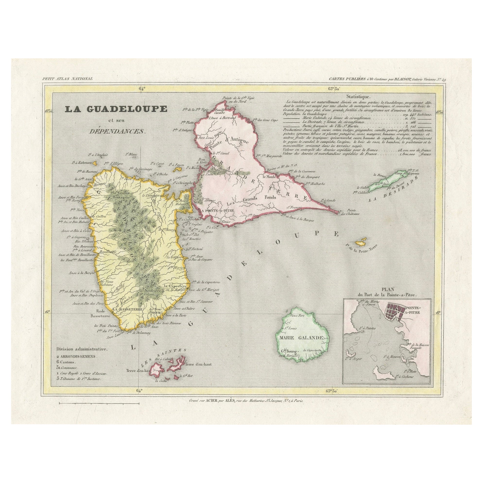
Guadeloupe and Dependencies: 19th Century French Map and Inset of Pointe-à-Pitre
Located in Langweer, NL
This map titled "La Guadeloupe et ses Dépendances" (Guadeloupe and its Dependencies) is from a Petit Atlas National series, focusing on the French Caribbean islands of Guadeloupe, Ma...
Category
Antique 1820s Maps
Materials
Paper
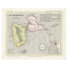
Guadeloupe and Dependencies: Mid-19th Century Map from France Pittoresque Series
Located in Langweer, NL
This map titled "Guadeloupe et Dépendances" is part of the France Pittoresque series and provides a detailed view of the island of Guadeloupe and its surrounding dependencies.
Features:
- The map shows the two main landmasses of Guadeloupe: Basse-Terre and Grande-Terre, separated by a narrow channel.
- Several smaller islands, including Marie-Galante, Les Saintes, and La Désirade, are also depicted.
- The main cities, towns, and geographical features are labeled, with emphasis on the island's mountain ranges and rivers, particularly on Basse-Terre.
- An inset at the bottom right provides a detailed plan of Pointe-à-Pitre, a major city and port on the island. The grid layout of the streets is clearly shown, reflecting urban planning of the time.
Artistic and Cartographic Details:
- The map uses clear linework to differentiate between the different islands and the sea, with significant natural features such as mountains and rivers carefully depicted.
- The map was drawn by Monin and engraved by Jacqueline and Barrière, whose names appear in the lower right corner.
- The scale in the lower left corner is measured in leagues, showing distances both by land and sea.
Historical Context:
- This map likely dates to the mid-19th century, a period when Guadeloupe was a key French colony in the Caribbean. Guadeloupe was known for its sugar and coffee plantations, which played a significant role in France's colonial economy.
- Maps like this were often used for administrative, military, and educational purposes to give a comprehensive view of France's overseas territories.
The map of Guadeloupe et Dépendances from the France Pittoresque series likely dates to the mid-19th century, around 1840 to 1860. This period corresponds to the height of French colonial influence in Guadeloupe, and the map's style, detailed urban planning, and cartographic techniques are consistent with maps produced in that era.
The specific publication date could be further narrowed down if the map was part of a known edition of the France Pittoresque atlas, but based on the cartographic style and historical context, 1840–1860 is a reasonable estimate.
Here are some relevant keywords people might use when searching for a map of Guadeloupe and its surrounding areas:
1. Guadeloupe map
2. Basse-Terre and Grande-Terre map
3. French Caribbean islands map...
Category
Antique 1850s Maps
Materials
Paper
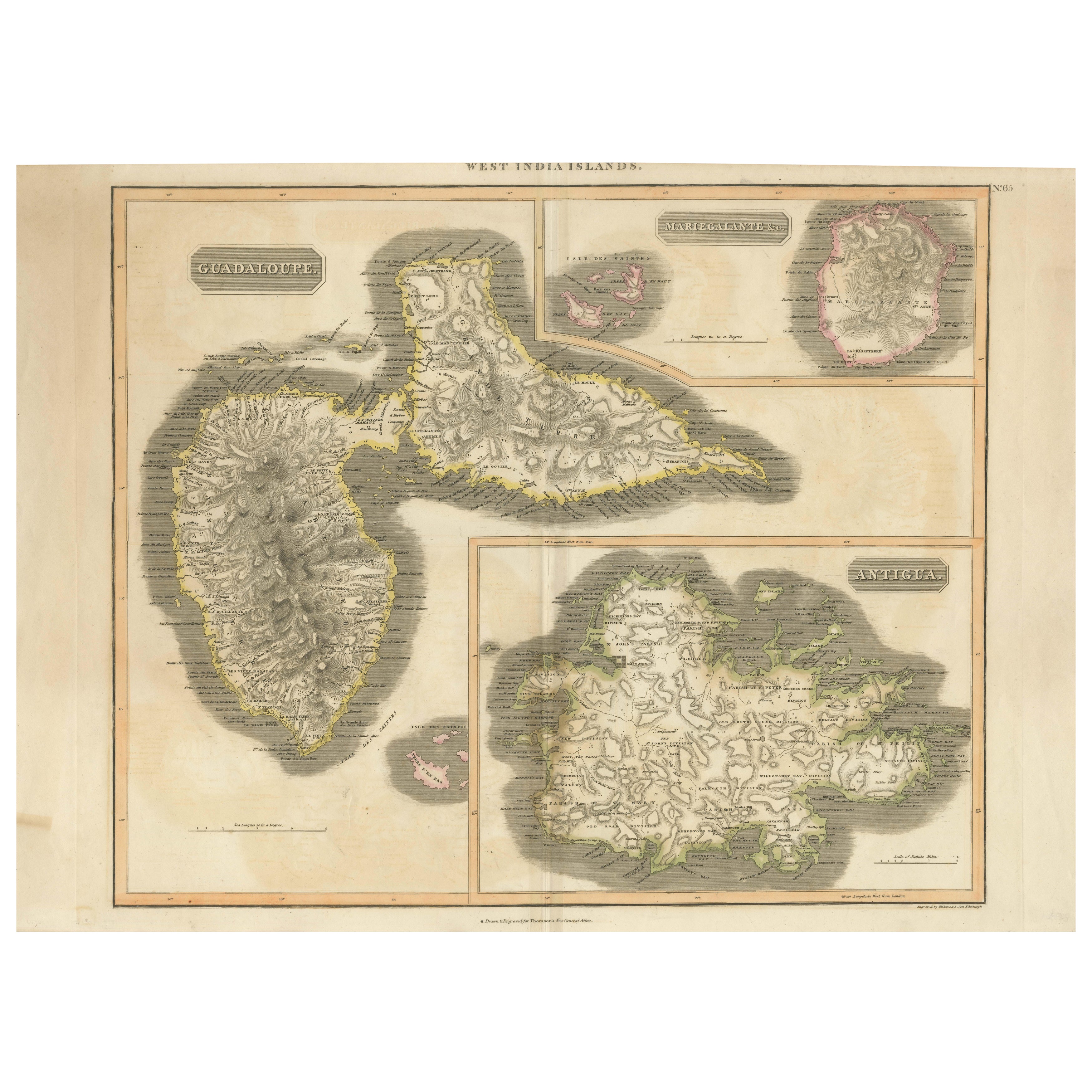
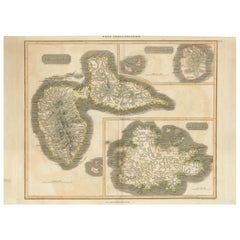
1821 Thomson Map of Guadeloupe, Marie-Galante and Antigua in the West Indies
Located in Langweer, NL
This map, published in 1821 by John Thomson, showcases Guadeloupe, Marie-Galante, and Antigua from the *West India Islands* collection. Part of Thomson's *New General Atlas*, it prov...
Category
Antique 1820s Maps
Materials
Paper
$538 Sale Price
20% Off
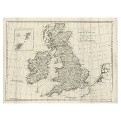
Large Antique Map of the British Isles, with inset of the Orkneys and Shetlands
Located in Langweer, NL
Antique map titled 'A Map of Great Britain and Ireland (..)'. Large antique map of the British Isles, with part of the French and Dutch coasts, and an inset of the Orkneys and Shetla...
Category
Antique Late 18th Century Maps
Materials
Paper
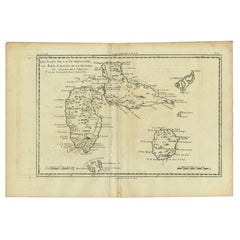
Antique Map of Guadeloupe with Les Saintes, Grand Bourg and La Désirade, c.1780
Located in Langweer, NL
Antique map titled 'Les Isles de la Guadeloupe (..).'
Map of the Caribbean Island of Guadeloupe with the surrounding islands Les Saintes, Grand Bourg and La Désirade. Source unknow...
Category
Antique 18th Century Maps
Materials
Paper
$211 Sale Price
35% Off
Free Shipping
You May Also Like
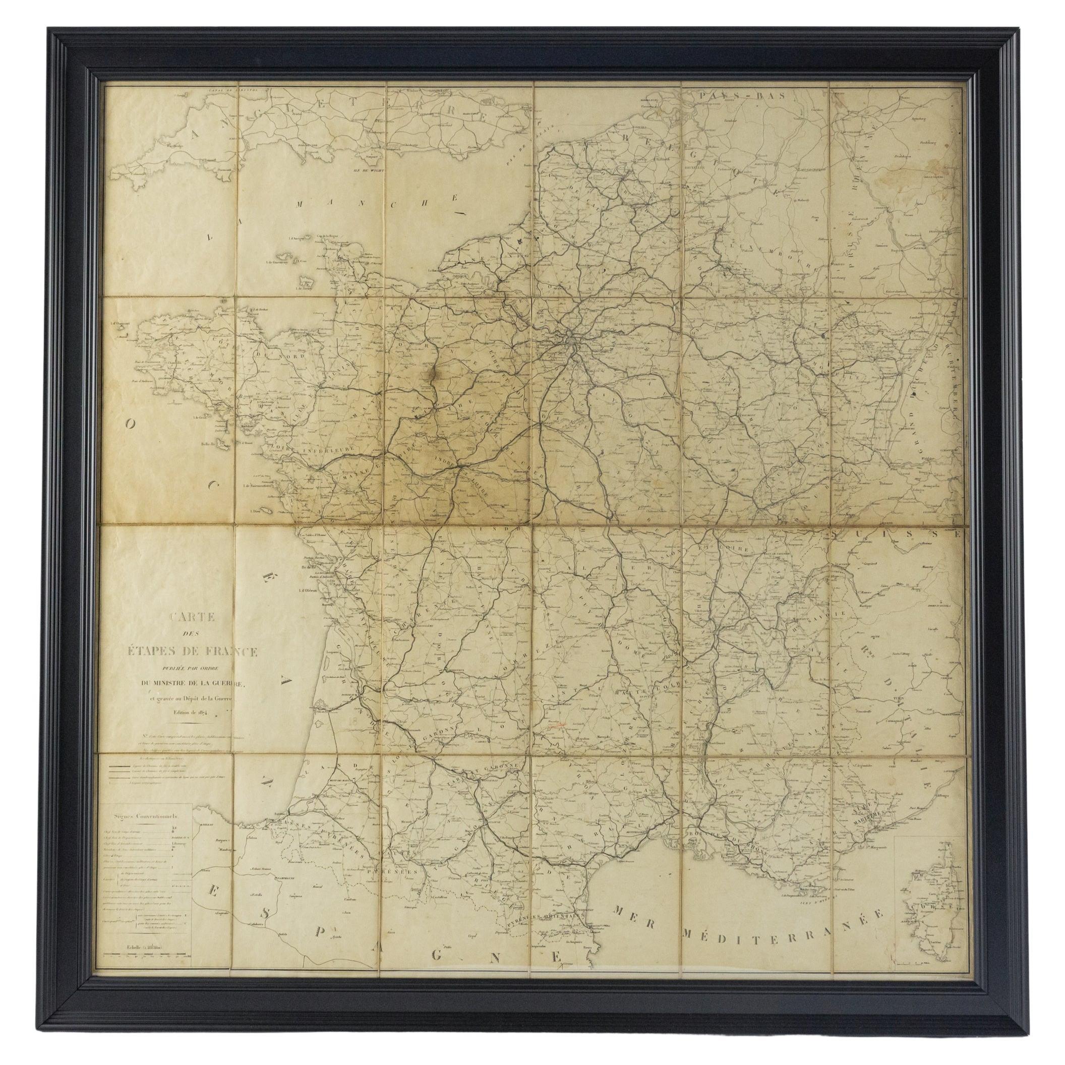
Large 19th Century Map of France
Located in Pease pottage, West Sussex
Large 19th Century Map of France.
Remarkable condition, with a pleasing age worn patina.
Recently framed.
France Circa 1874.
Category
Antique Late 19th Century French Maps
Materials
Linen, Paper

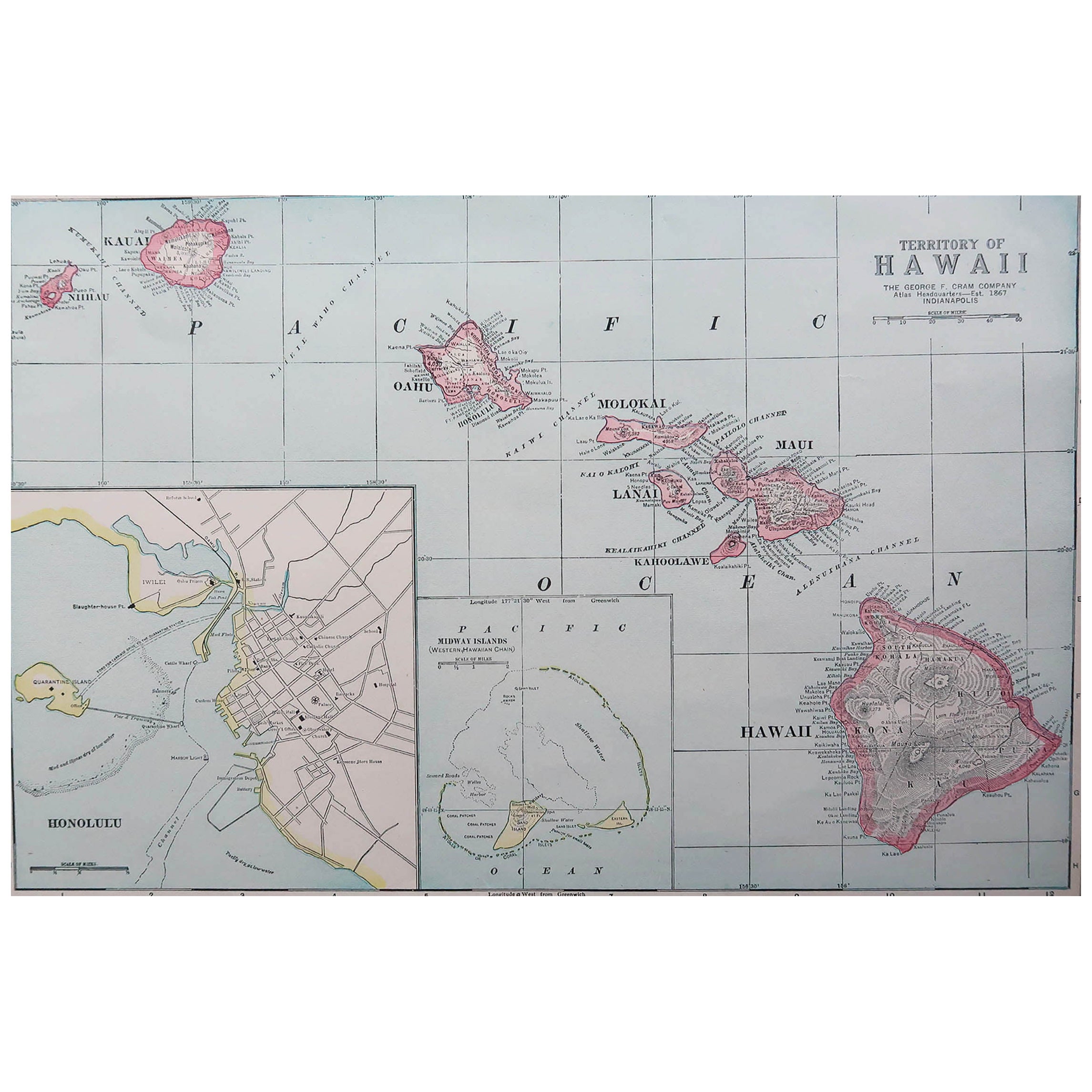
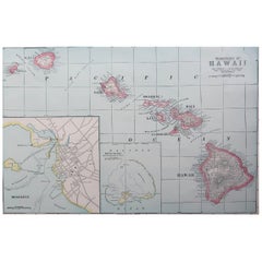
Original Antique Map of Hawaii And Adjacent Islands. C.1900
Located in St Annes, Lancashire
Fabulous map of Hawaii. With a vignette of Honolulu
Original color.
Engraved and printed by the George F. Cram Company, Indianapolis.
Published, C.1900.
Unframed.
Free shipping.
Category
Antique 1890s American Maps
Materials
Paper
Northwest Coast and Isle of Man Map
Located in Cheshire, GB
Greenville Collins Northwest Coast and Isle of Man. hand coloured chart, encased in an ebonised frame.
Dimensions
Height 26.5 Inches
Width 30 Inches
Depth 1 Inches
Category
Early 20th Century British Maps
Materials
Paper

Large 17th Century Hand Colored Map of England and the British Isles by de Wit
By Frederick de Wit
Located in Alamo, CA
A large hand colored 17th century map of England and the British Isles by Frederick de Wit entitled "Accuratissima Angliæ Regni et Walliæ Principatus", published in Amsterdam in 1680. It is a highly detailed map of England, Scotland, the Scottish Isles...
Category
Antique Late 17th Century Dutch Maps
Materials
Paper

19th Century Reprint of 16th Century Harbor Map of Copenhagen
Located in Haddonfield, NJ
This reprint of 1587 antique map of Copenhagen, Denmark retains its original mid-century mat and has been recently reframed in classic wood frame. The muted sepia colored map is a wo...
Category
Antique 1880s Danish Baroque Maps
Materials
Wood, Paper
Antique Framed Pen and Ink on Fabric Map of Cornwall from Early 19th Century
Located in Los Angeles, CA
This English fabric map of Cornwall, rendered in pen-and-ink, showcases exquisite hand-drawn details and charming faded sepia tones. Encased in a classic frame, this piece elegantly ...
Category
Antique Early 19th Century English Drawings
Materials
Walnut, Fabric

Recently Viewed
View AllMore Ways To Browse
Butterfly Studies Engraving
Red Leather Swivel Chair
Rosewood Vintage Armchair
Rush Back Armchairs
Russian Propaganda Posters
Sheep Pillow
Sheffield Tea Sets
Silver Plate Art Deco Cocktail Shaker
Silver Wine Jug
Small Dining Table With Extension
Small Round 3 Leg Table
Society Silk
Square Club Chair
Sterling Condiment
Stickley Antique Table
Sugar Creamer Tray
Swivel Ottomans
Tartan Furniture