Items Similar to Large Antique Map of Gaul under Roman Rule, ca.1760

Want more images or videos?
Request additional images or videos from the seller
1 of 5
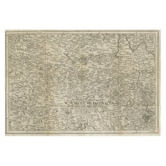
Large Antique Map of Gaul under Roman Rule, ca.1760
About the Item
Antique map titled 'Gallia Augustiniana in suas provincias divisa (..)'. Large antique map of Roman Gaul, it refers to Gaul under provincial rule in the Roman Empire from the 1st century BC to the 5th century AD.
Artists and Engravers: Mattias Seutter (1678-1756) was an engraver, globe-maker and map publisher from Augsburg. He was a pupil of J.B. Homann in Nuremberg. Seutter was awarded the title of Imperial Geographer by Karl VI in 1731, and his son-in-law T.C. Lotter took over the business in 1758. He made several atlases as a folio-atlas in two versions in 1720, the most comprehensive Atlas Geographicus counted 46 cards and was reprinted several times.
- Dimensions:Height: 21.26 in (54 cm)Width: 24.41 in (62 cm)Depth: 0 in (0.02 mm)
- Materials and Techniques:
- Period:1760-1769
- Date of Manufacture:circa 1760
- Condition:Condition: Good, original/contemporary hand coloring. General age-related toning, minor wear/defects. Please study image carefully.
- Seller Location:Langweer, NL
- Reference Number:Seller: BG-12390-371stDibs: LU3054327315102
About the Seller
5.0
Recognized Seller
These prestigious sellers are industry leaders and represent the highest echelon for item quality and design.
Platinum Seller
Premium sellers with a 4.7+ rating and 24-hour response times
Established in 2009
1stDibs seller since 2017
2,415 sales on 1stDibs
Typical response time: 1 hour
- ShippingRetrieving quote...Shipping from: Langweer, Netherlands
- Return Policy
Authenticity Guarantee
In the unlikely event there’s an issue with an item’s authenticity, contact us within 1 year for a full refund. DetailsMoney-Back Guarantee
If your item is not as described, is damaged in transit, or does not arrive, contact us within 7 days for a full refund. Details24-Hour Cancellation
You have a 24-hour grace period in which to reconsider your purchase, with no questions asked.Vetted Professional Sellers
Our world-class sellers must adhere to strict standards for service and quality, maintaining the integrity of our listings.Price-Match Guarantee
If you find that a seller listed the same item for a lower price elsewhere, we’ll match it.Trusted Global Delivery
Our best-in-class carrier network provides specialized shipping options worldwide, including custom delivery.More From This Seller
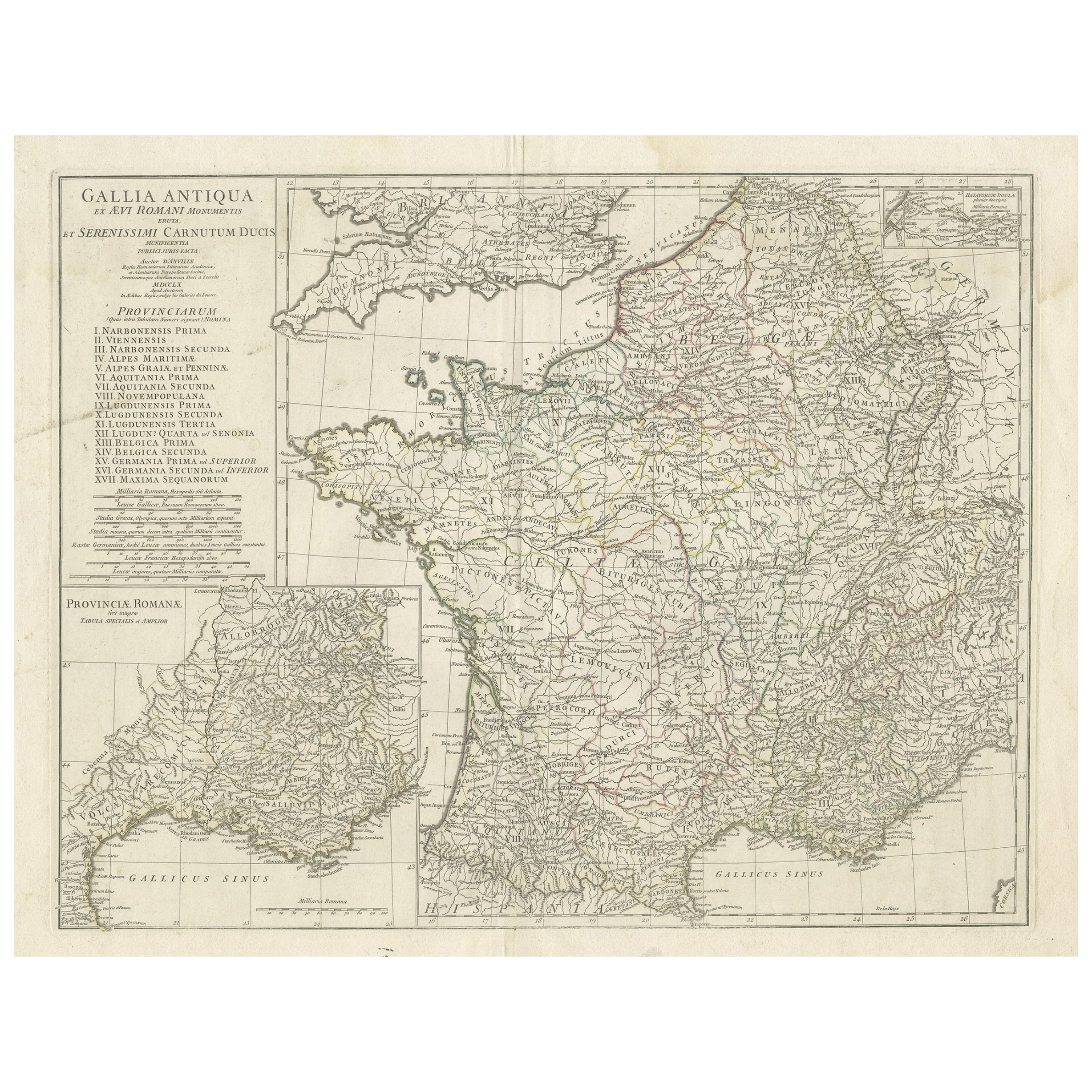
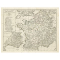
View AllLarge Antique Map of Gaul, or France in Ancient Roman Times
Located in Langweer, NL
Original antique map titled 'Gallia Antiqua ex Aevi Romani Monumentis (..)'. Large map of Gaul, or France in ancient Roman times, showing Roman provinces. Inset bottom left a detaile...
Category
Antique Mid-18th Century Maps
Materials
Paper
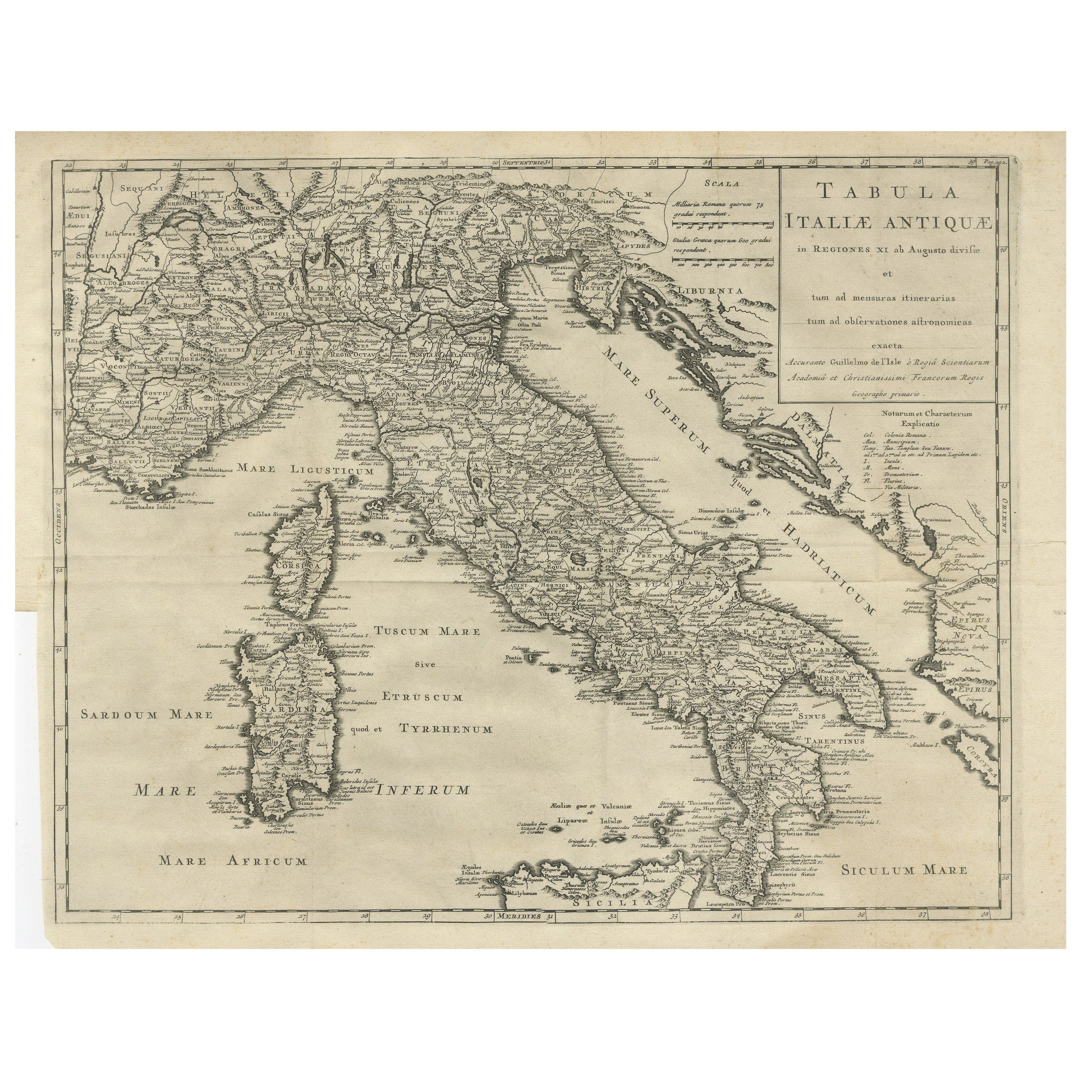
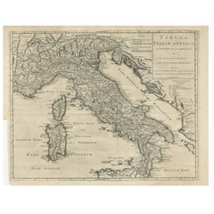
Antique Engraved Map of Italy in Roman Times, ca.1730
Located in Langweer, NL
Plain engr. map of Italy according to the division of Emperor Augustus by G. Delisle.
Title: "Tabula Italiae Antiquae In Regiones XI Ab Augusto Divisae Et Tum Ad Mensuras Itinerari...
Category
Antique 1730s Maps
Materials
Paper
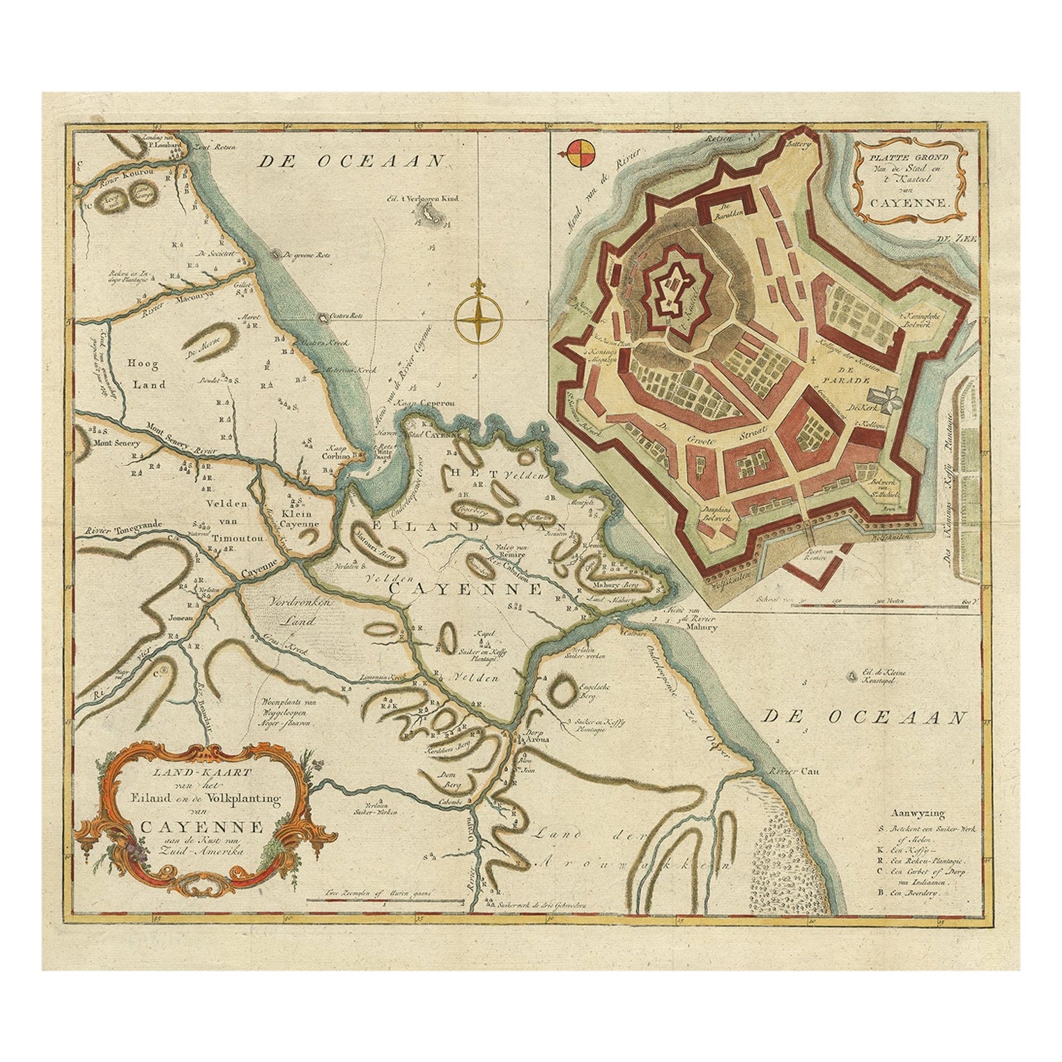
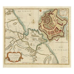
Striking Antique Map of Cayenne in French Guyana, South America, ca.1760
Located in Langweer, NL
Description: Antique map titled 'Land-kaart van het Eiland en de Volkplanting van Cayenne aan de Kust van Zuid-Amerika'.
Striking map of the island and settlement of Cayenne in F...
Category
Antique 1760s Maps
Materials
Paper
$1,247 Sale Price
20% Off
Antique Map of Asia by Tirion 'c.1760'
Located in Langweer, NL
Antique map titled 'Nuova Carta dell Asia'. Decorative map of Asia. Published by I. Tirion, circa 1760.
Category
Antique Mid-18th Century Maps
Materials
Paper

$1,016 Sale Price
20% Off
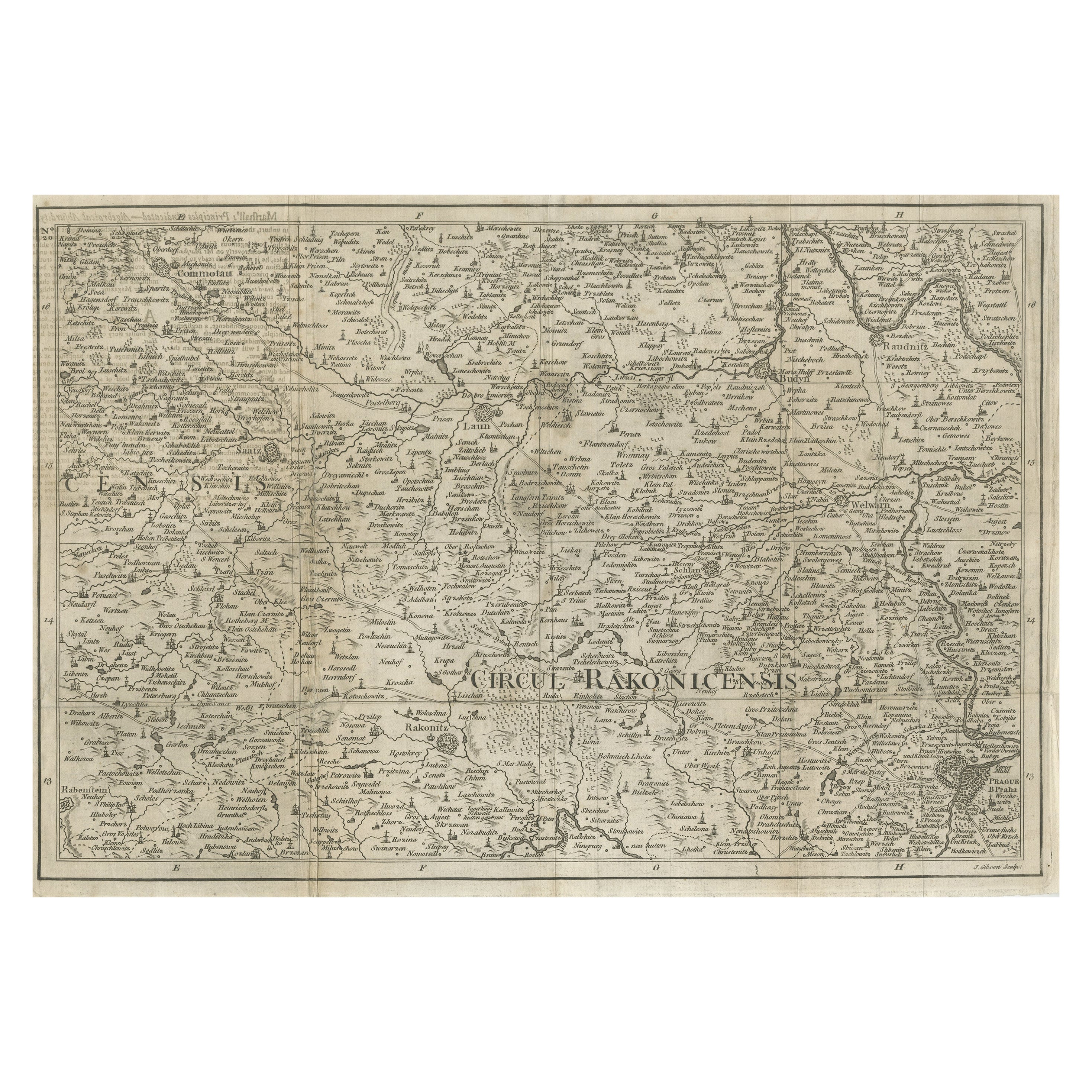
Rare Detailed Antique Map of Prague and Its North West Environs, ca.1760
Located in Langweer, NL
Description: original antique map of the environs of North West Prague. This map originates from the 'Gentlemans Magazine'. Published circa 1760.
Artists and Engravers: Engraved ...
Category
Antique 1760s Maps
Materials
Paper
$415 Sale Price
20% Off
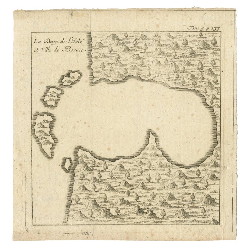
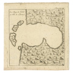
Antique Map of a Bay of Borneo, Indonesia, c.1760
Located in Langweer, NL
Antique map titled 'La Baye de l'isle et Ville de Borneo'. Small map depicting a Bay of Borneo.
Artists and Engravers: Anonymous.
Condition: Good, general age-related toning. ...
Category
Antique 18th Century Maps
Materials
Paper
You May Also Like
Antique Billiard Rules Pool Rules Pyramid Rules Victorian Framed Rules
Located in Radstock, GB
This framed and printed sheet Rule frame is very unusual because it actually
features the rules of three games Billiards, Life Pool and Pyramid pool.
Printed by the famous Glasgo...
Category
Antique Late 19th Century Scottish Victorian Sports Equipment and Memora...
Materials
Pine
Antique Map of Principality of Monaco
By Antonio Vallardi Editore
Located in Alessandria, Piemonte
ST/619 - "Old Geographical Atlas of Italy - Topographic map of ex-Principality of Monaco" -
ediz Vallardi - Milano -
A somewhat special edition ---
Category
Antique Late 19th Century Italian Other Prints
Materials
Paper

French 1930s Map of Paris à Vol d'Oiseau under Glass in Custom Iron Frame
Located in Atlanta, GA
A French map of Paris from the early 20th century, with custom iron frame. Created in Paris during the second quarter of the 20th century, this map of Paris à vol d'oiseau (as the Cr...
Category
Early 20th Century French Prints
Materials
Iron
Original Antique Map of Hungary, Arrowsmith, 1820
Located in St Annes, Lancashire
Great map of Hungary
Drawn under the direction of Arrowsmith.
Copper-plate engraving.
Published by Longman, Hurst, Rees, Orme and Brown, 1820
Unframed.
Category
Antique 1820s English Maps
Materials
Paper

Original Antique Map of Europe, Arrowsmith, 1820
Located in St Annes, Lancashire
Great map of Europe
Drawn under the direction of Arrowsmith.
Copper-plate engraving.
Published by Longman, Hurst, Rees, Orme and Brown, 1820
...
Category
Antique 1820s English Maps
Materials
Paper

Original Antique Map of South America. C.1780
Located in St Annes, Lancashire
Great map of South America
Copper-plate engraving
Published C.1780
Two small worm holes to left side of map
Unframed.
Category
Antique Early 1800s English Georgian Maps
Materials
Paper

Recently Viewed
View AllMore Ways To Browse
Antique Gallia
Brown Leather Breuer
Buckle Couch
Butterfly Lounge Chair
Button Leather Couch
Carved Root Table
Cedar Together
Chaise Lounge Recliners
Chinese Mahogany Table
Chinese Shield
Chinese Wood And Glass Table
Cityscape Table
Coffee Table Nest
Color Screen Room Divider
Crucial Trading
Curved Bar Cart
Delft Chargers
Delft Tiles Furniture