Items Similar to Large Antique Map of Bass Strait, Tasmania, Australia by Cook, 1803


Want more images or videos?
Request additional images or videos from the seller
1 of 6
Large Antique Map of Bass Strait, Tasmania, Australia by Cook, 1803
About the Item
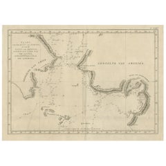
Antique map Australia titled 'Kaart van Basses Straat tusschen Nieuw Zuid Wales en van Diemensland (..)'. Large chart of Bass Strait and one of the earliest to show the discoveries made by Bass and Flinders. Van Diemensland is nowadays Tasmania. Originates from 'Reizen Rondom de Waereld door James Cook (..)'.
Artists and Engravers: Translated by J.D. Pasteur. Published by Honkoop, Allart en Van Cleef.
Condition: Very good, general age-related toning. Please study image carefully.
Date: 1803
We sell original antique maps to collectors, historians, educators and interior decorators all over the world. Our collection includes a wide range of authentic antique maps from the 16th to the 20th centuries. Buying and collecting antique maps is a tradition that goes back hundreds of years. Antique maps have proved a richly rewarding investment over the past decade, thanks to a growing appreciation of their unique historical appeal. Today the decorative qualities of antique maps are widely recognized by interior designers who appreciate their beauty and design flexibility. Depending on the individual map, presentation, and context, a rare or antique map can be modern, traditional, abstract, figurative, serious or whimsical. We offer a wide range of authentic antique maps for any budget.
- Dimensions:Height: 29.14 in (74 cm)Width: 20.87 in (53 cm)Depth: 0 in (0.01 mm)
- Materials and Techniques:
- Period:
- Date of Manufacture:1803
- Condition:Condition: Very good, general age-related toning. Please study image carefully.
- Seller Location:Langweer, NL
- Reference Number:Seller: BG-11487-101stDibs: LU3054326083402
About the Seller
5.0
Recognized Seller
These prestigious sellers are industry leaders and represent the highest echelon for item quality and design.
Platinum Seller
Premium sellers with a 4.7+ rating and 24-hour response times
Established in 2009
1stDibs seller since 2017
2,418 sales on 1stDibs
Typical response time: <1 hour
- ShippingRetrieving quote...Shipping from: Langweer, Netherlands
- Return Policy
Authenticity Guarantee
In the unlikely event there’s an issue with an item’s authenticity, contact us within 1 year for a full refund. DetailsMoney-Back Guarantee
If your item is not as described, is damaged in transit, or does not arrive, contact us within 7 days for a full refund. Details24-Hour Cancellation
You have a 24-hour grace period in which to reconsider your purchase, with no questions asked.Vetted Professional Sellers
Our world-class sellers must adhere to strict standards for service and quality, maintaining the integrity of our listings.Price-Match Guarantee
If you find that a seller listed the same item for a lower price elsewhere, we’ll match it.Trusted Global Delivery
Our best-in-class carrier network provides specialized shipping options worldwide, including custom delivery.More From This Seller
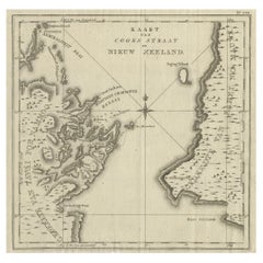
View AllAntique Map of Cook's Strait in New Zealand, 1803
Located in Langweer, NL
Antique map New Zealand titled 'Kaart van Cooks Straat in Nieuw Zeeland'. Antique map of Cook's Strait in New Zealand. Originates from 'Reizen ...
Category
Antique 19th Century Maps
Materials
Paper
$604 Sale Price
20% Off
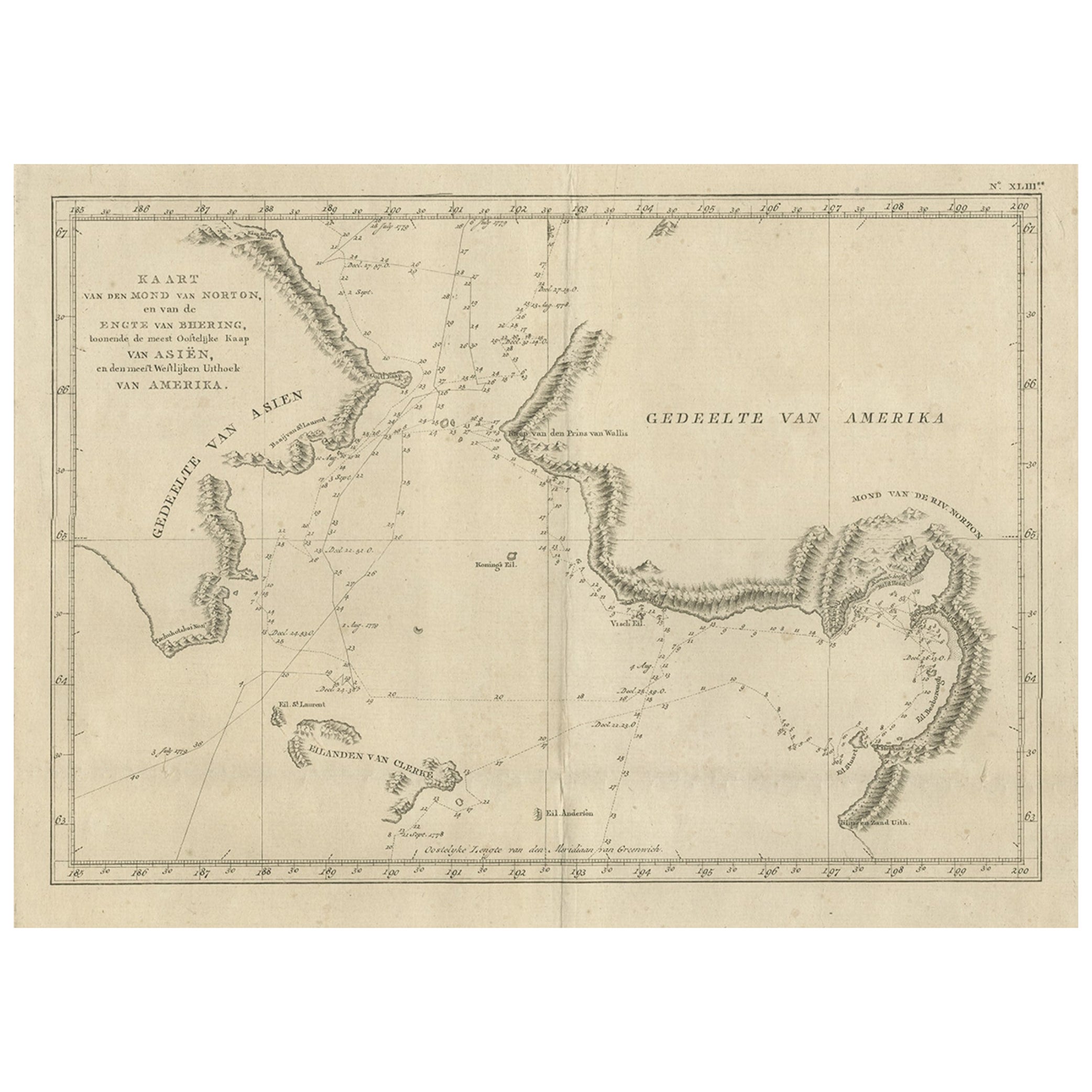
Original Copper Engraved Map of the Bering Strait by Captain Cook, 1803
Located in Langweer, NL
Antique map titled 'Kaart van den Mond van Norton, en van de Engte van Bhering, toonende de meest Oostlijke Kaap van Asien, en den meest Westlijken Urthoek van Amerika'.
Map of t...
Category
Antique Early 1800s Maps
Materials
Paper
$686 Sale Price
25% Off
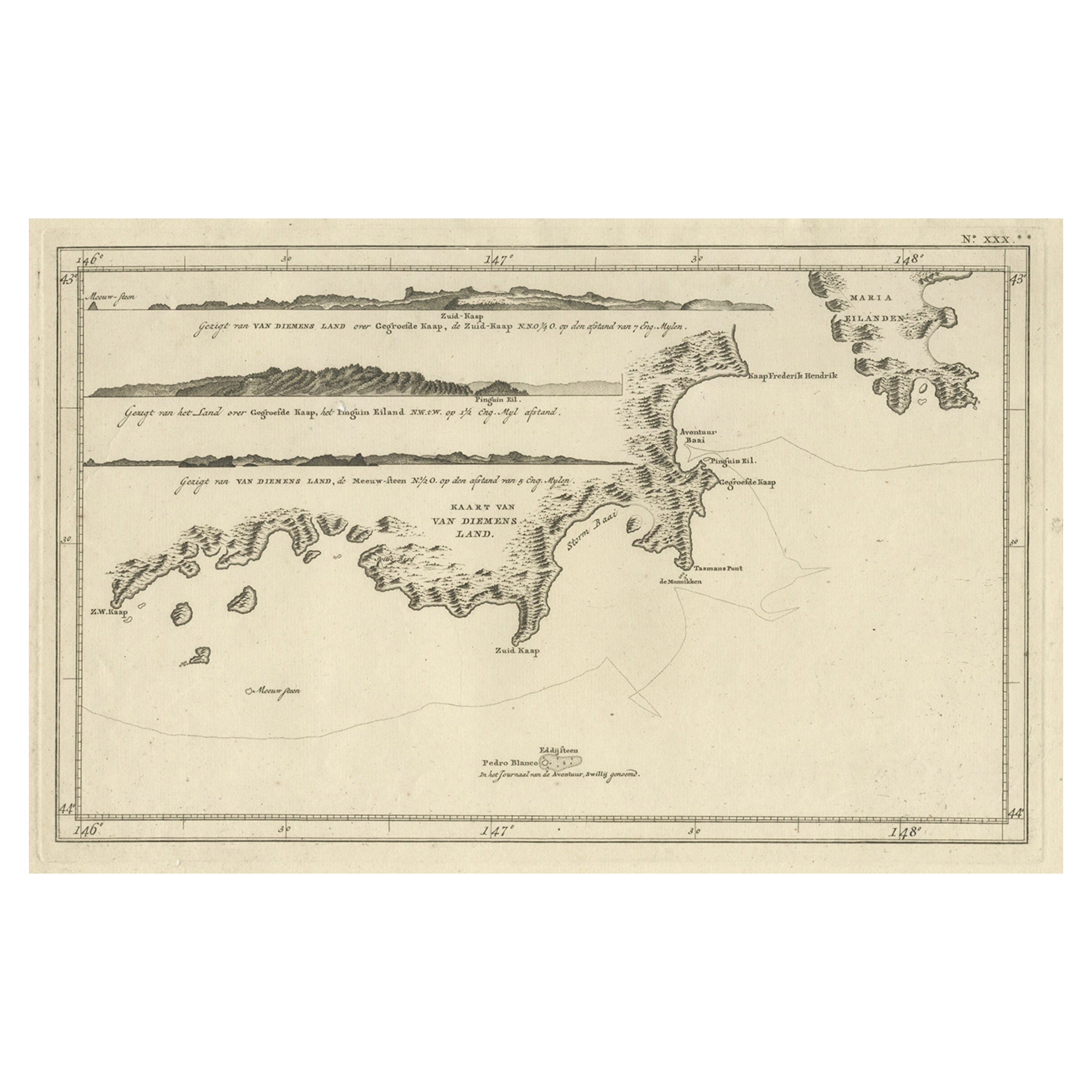
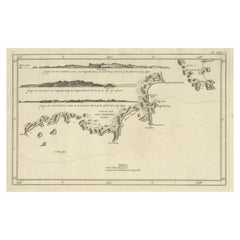
Antique Coastal Views and a Map of Van Diemens Land (Tasmania), Australia, 1803
Located in Langweer, NL
Antique map Tasmania titled 'Kaart van Diemens Land'.
Coastal views and a map of van Diemens Land (Tasmania). Originates from 'Reizen Rondom de Waereld ...
Category
Antique Early 1800s Maps
Materials
Paper
$799 Sale Price
20% Off
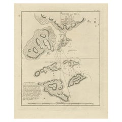
Antique Map of Suffren Island by Cook, 1803
Located in Langweer, NL
Antique map Australia titled 'Gezigt van het Eil. Suffren'. Antique map of Suffren Island. Originates from 'Reizen Rondom de Waereld door James C...
Category
Antique 19th Century Maps
Materials
Paper

Antique Map of the Harbour of Taloo by J. Cook, 1803
By James Cook
Located in Langweer, NL
Antique map French Polynesia titled 'Schets van de Havenen aan de Noord Zijde van Eimeo'. Plan of the harbour of Taloo in the Island of Moorea, one of the Society Islands, French Polynesia. Originates from 'Reize rondom de Waereld door James Cook...
Category
Antique Early 19th Century Dutch Maps
Materials
Paper

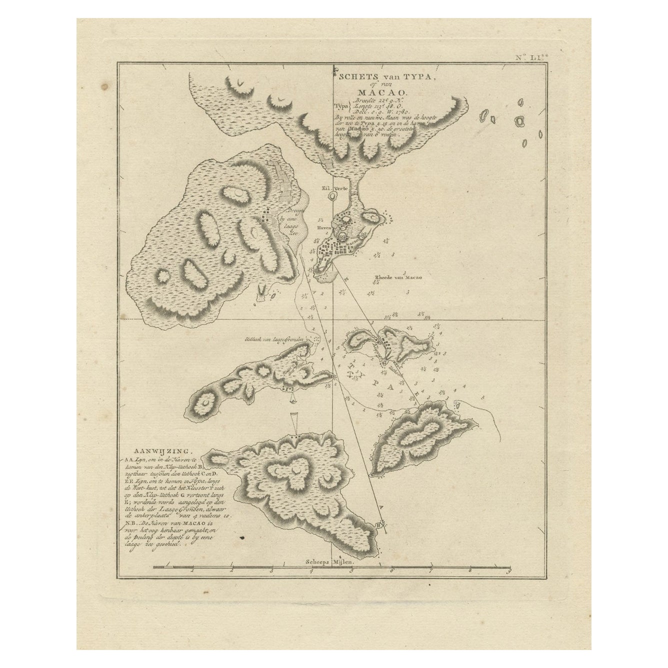
Antique Map of Macao and Surroundings by Captain Cook, 1803
Located in Langweer, NL
Antique map Macao titled 'Schets van Typa of van Macao'. Map of Macao and surrounding islands. Originates from 'Reizen Rondom de Waereld door James Cook (..)'. Artists and Engravers:...
Category
Antique 19th Century Maps
Materials
Paper
You May Also Like
Captain Cook's Exploration of Tahiti 18th C. Hand-Colored Map by Bellin
By Jacques-Nicolas Bellin
Located in Alamo, CA
This beautiful 18th century hand-colored copper plate engraved map is entitled "Carte de l'Isle de Taiti, par le Lieutenant J. Cook" was created by Jacques Nicolas Bellin and publish...
Category
Antique Mid-18th Century French Maps
Materials
Paper

Antique Map of Italy by Andriveau-Goujon, 1843
By Andriveau-Goujon
Located in New York, NY
Antique Map of Italy by Andriveau-Goujon, 1843. Map of Italy in two parts by Andriveau-Goujon for the Library of Prince Carini at Palazzo Carini i...
Category
Antique 1840s French Maps
Materials
Linen, Paper

$3,350 / set
Antique Map of Principality of Monaco
By Antonio Vallardi Editore
Located in Alessandria, Piemonte
ST/619 - "Old Geographical Atlas of Italy - Topographic map of ex-Principality of Monaco" -
ediz Vallardi - Milano -
A somewhat special edition ---
Category
Antique Late 19th Century Italian Other Prints
Materials
Paper

Original Antique Map of Sweden, Engraved by Barlow, 1806
Located in St Annes, Lancashire
Great map of Sweden
Copper-plate engraving by Barlow
Published by Brightly & Kinnersly, Bungay, Suffolk. 1806
Unframed.
Category
Antique Early 1800s English Maps
Materials
Paper

Original Antique Map of Switzerland, Engraved By Barlow, Dated 1807
Located in St Annes, Lancashire
Great map of Switzerland
Copper-plate engraving by Barlow
Published by Brightly & Kinnersly, Bungay, Suffolk.
Dated 1807
Unframed.
Category
Antique Early 1800s English Maps
Materials
Paper

Original Antique Map of The World by Thomas Clerk, 1817
Located in St Annes, Lancashire
Great map of The Eastern and Western Hemispheres
On 2 sheets
Copper-plate engraving
Drawn and engraved by Thomas Clerk, Edinburgh.
Published by Mackenzie And Dent, 1817
...
Category
Antique 1810s English Maps
Materials
Paper

Recently Viewed
View AllMore Ways To Browse
19th Century Australian Furniture
Van Cleef Unique Rare
Astrology Map
J Schwabe
Mauritius Antique Map
Tanzania Antique Map
Tartaria Map
Antique Map Puzzle
Georgetown Map
Johann Baptist Homann On Sale
John Wyld
North Carolina Native Americans 1800
Nova Hollandia
Aden Yemen
Antique Chesapeake Bay Map
Antique Town Plan Of Jerusalem
Chesapeake Bay Map
Globe Terrestre Par Felix Delamarche