Items Similar to Large Antique County Map of Warwickshire, England
Want more images or videos?
Request additional images or videos from the seller
1 of 6
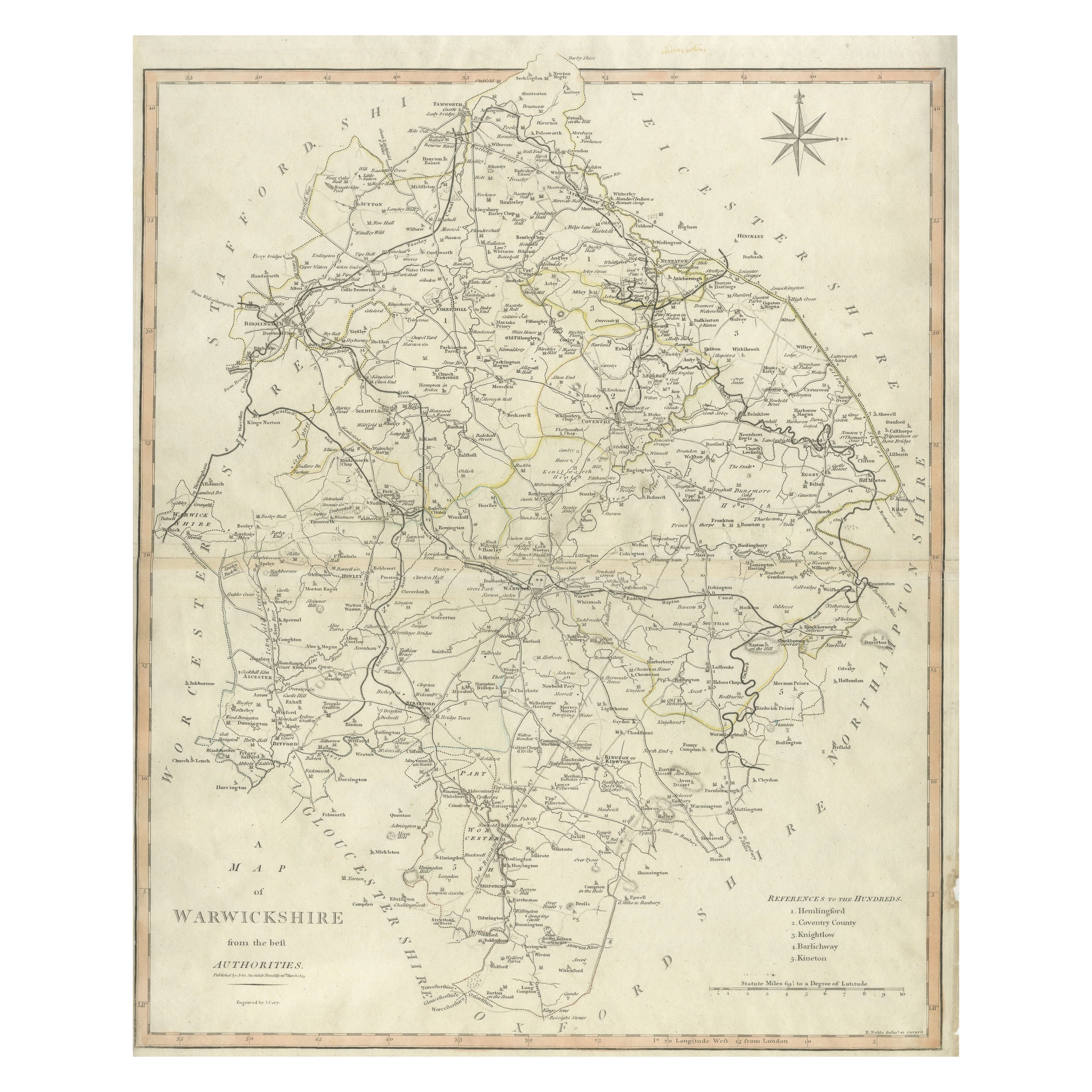
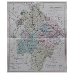
Large Antique County Map of Warwickshire, England
About the Item
Antique map titled 'A Map of Warwickshire from the best Authorities'. Original old county map of Warwickshire, England. Engraved by John Cary. Originates from 'New British Atlas' by John Stockdale, published 1805.
John Cary (1755-1835) was a British cartographer and publisher best known for his clean engraving and distinct style which influenced the entire map industry.
- Dimensions:Height: 21.11 in (53.6 cm)Width: 17.21 in (43.7 cm)Depth: 0.02 in (0.5 mm)
- Materials and Techniques:
- Period:
- Date of Manufacture:1805
- Condition:General age-related toning. Original folding lines. Minor wear and soiling, narrow margins. Please study image carefully.
- Seller Location:Langweer, NL
- Reference Number:Seller: BG-13394-61stDibs: LU3054334061432
About the Seller
5.0
Recognized Seller
These prestigious sellers are industry leaders and represent the highest echelon for item quality and design.
Platinum Seller
Premium sellers with a 4.7+ rating and 24-hour response times
Established in 2009
1stDibs seller since 2017
2,419 sales on 1stDibs
Typical response time: <1 hour
- ShippingRetrieving quote...Shipping from: Langweer, Netherlands
- Return Policy
Authenticity Guarantee
In the unlikely event there’s an issue with an item’s authenticity, contact us within 1 year for a full refund. DetailsMoney-Back Guarantee
If your item is not as described, is damaged in transit, or does not arrive, contact us within 7 days for a full refund. Details24-Hour Cancellation
You have a 24-hour grace period in which to reconsider your purchase, with no questions asked.Vetted Professional Sellers
Our world-class sellers must adhere to strict standards for service and quality, maintaining the integrity of our listings.Price-Match Guarantee
If you find that a seller listed the same item for a lower price elsewhere, we’ll match it.Trusted Global Delivery
Our best-in-class carrier network provides specialized shipping options worldwide, including custom delivery.More From This Seller
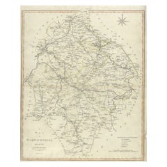
View AllLarge Antique County Map of Warwickshire, England, with Hand Coloring
Located in Langweer, NL
Antique map titled 'A Map of Warwickshire from the best Authorities'. Original old county map of Warwickshire, England. Engraved by John Cary. Originates from 'New British Atlas' by ...
Category
Antique Early 19th Century Maps
Materials
Paper
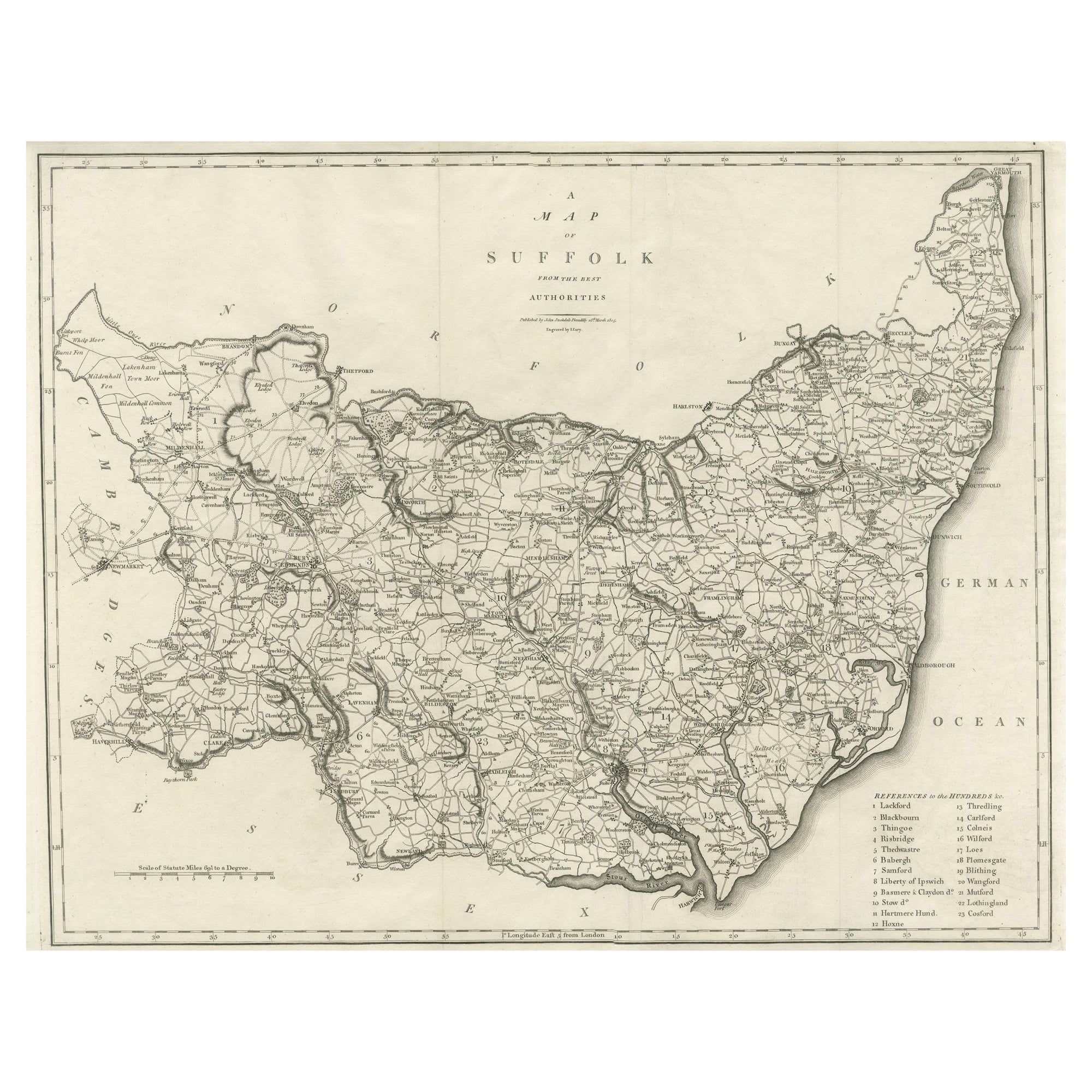
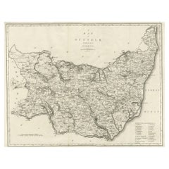
Large Antique County Map of Suffolk, England
Located in Langweer, NL
Antique map titled 'A Map of Suffolk from the best Authorities'. Original old county map of Suffolk, England. Engraved by John Cary. Originates from 'New British Atlas' by John Stock...
Category
Antique Early 19th Century Maps
Materials
Paper
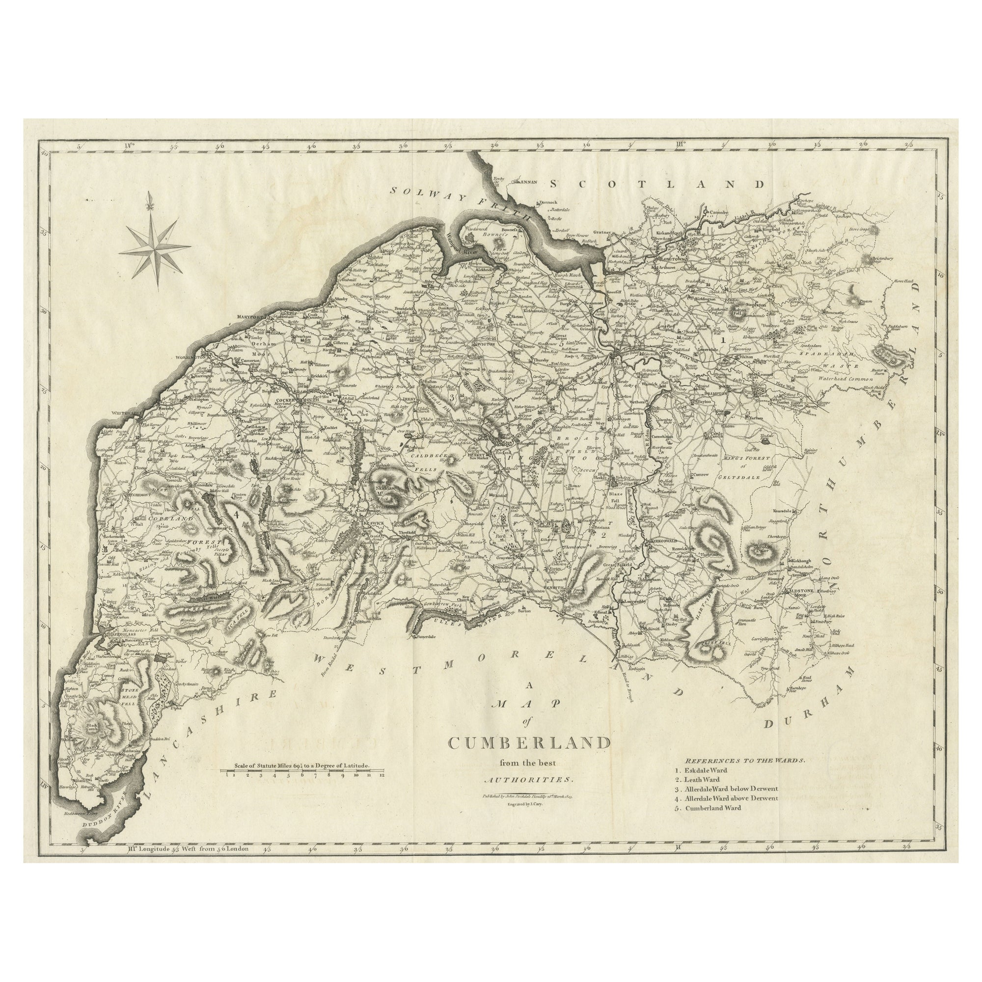
Large Antique County Map of Cumberland, England
Located in Langweer, NL
Antique map titled 'A Map of Cumberland from the best Authorities'. Original old county map of Cumberland, England. Engraved by John Cary. Originates...
Category
Antique Early 19th Century Maps
Materials
Paper
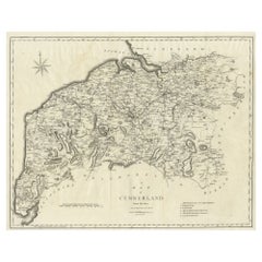
$148 Sale Price
20% Off
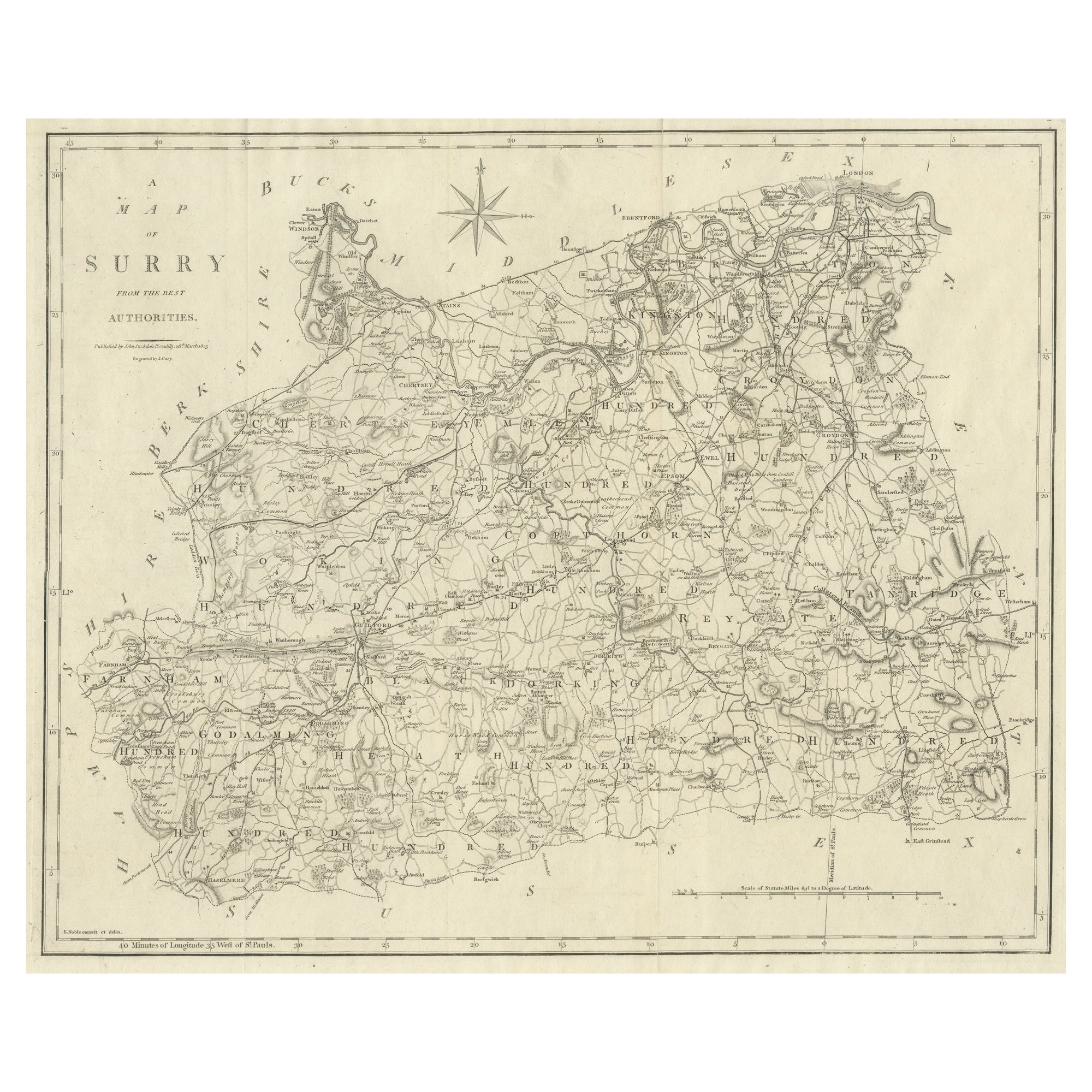
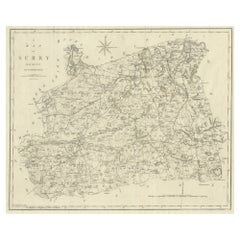
Large Antique County Map of Surrey, England
Located in Langweer, NL
Antique map titled 'A Map of Surry from the best Authorities'. Original old county map of Surrey, England. Engraved by John Cary. Originates from 'New British Atlas' by John Stockdal...
Category
Antique Early 19th Century Maps
Materials
Paper
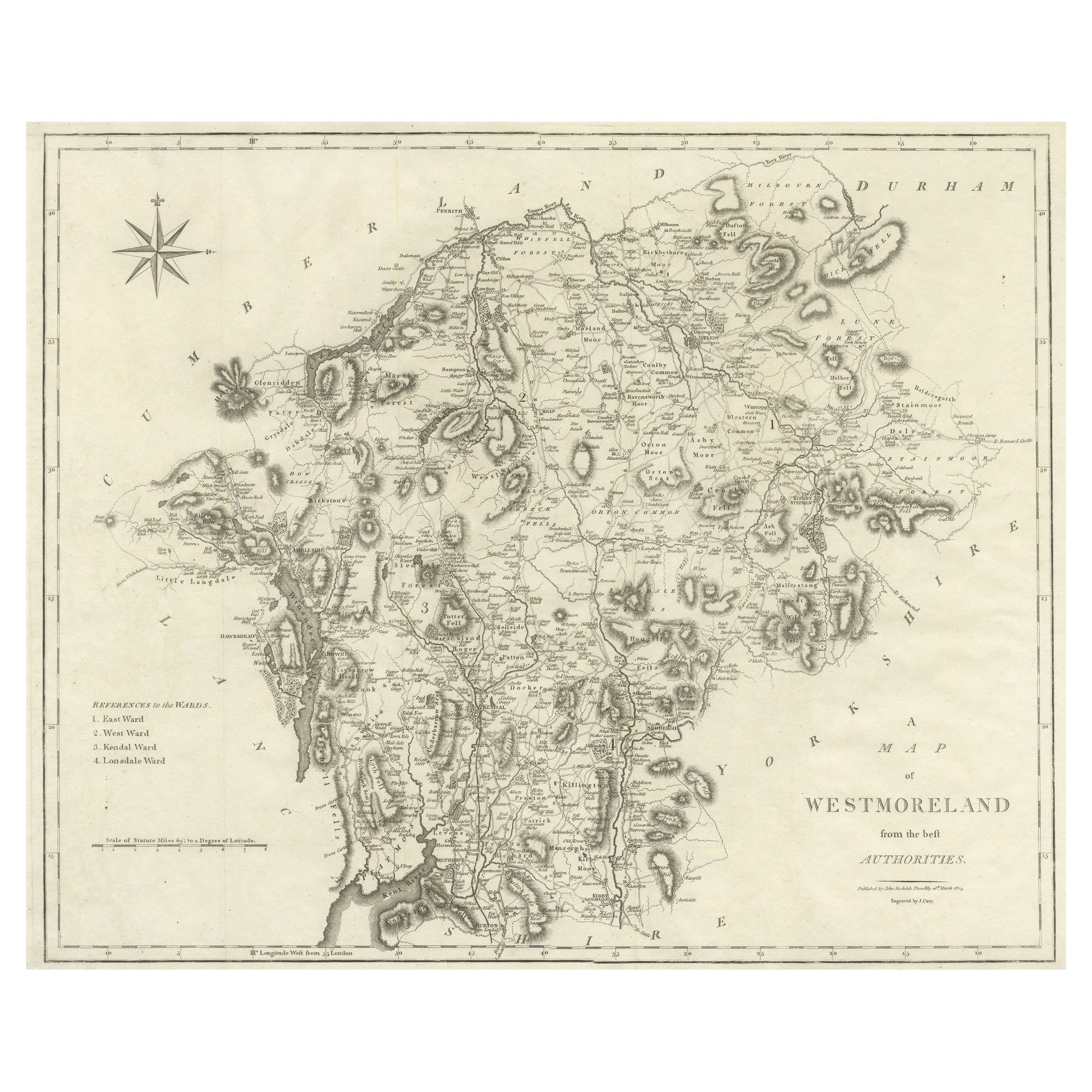
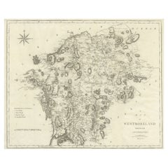
Large Antique County Map of Westmorland, England
Located in Langweer, NL
Antique map titled 'A Map of Westmoreland from the best Authorities'. Original old county map of Westmorland, England. Engraved by John Cary. Originates from 'New British Atlas' by J...
Category
Antique Early 19th Century Maps
Materials
Paper
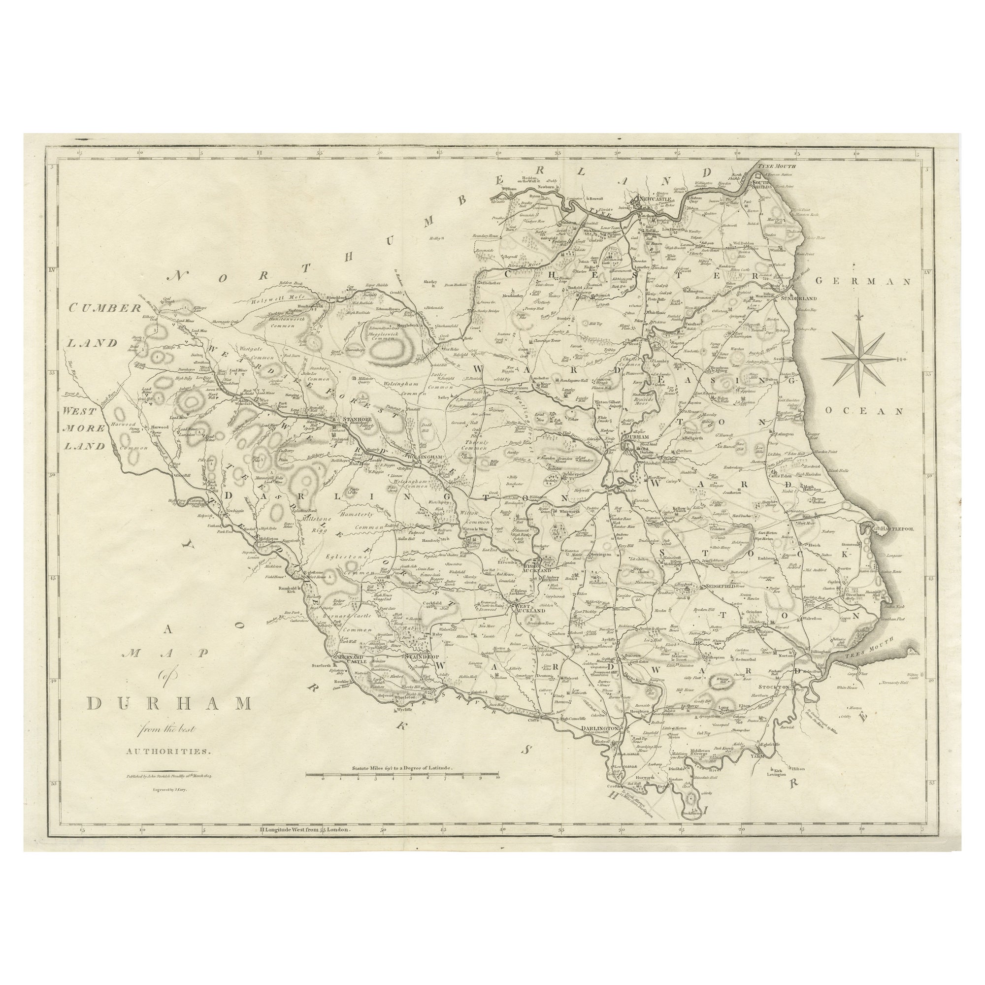
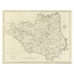
Large Antique County Map of Durham, England
Located in Langweer, NL
Antique map titled 'A Map of Durham from the best Authorities'. Original old county map of Durham, England. Engraved by John Cary. Originates from 'New ...
Category
Antique Early 19th Century Maps
Materials
Paper
You May Also Like
Original Antique English County Map, Warwickshire, J & C Walker, 1851
Located in St Annes, Lancashire
Great map of Warwickshire
Original colour
By J & C Walker
Published by Longman, Rees, Orme, Brown & Co. 1851
Unframed.
Category
Antique 1850s English Other Maps
Materials
Paper
Hampshire County, Britain/England: A Map from Camden's" Britannia" in 1607
By John Norden
Located in Alamo, CA
An early hand-colored map of Britain's Hampshire county, published in the 1607 edition of William Camden's great historical description of the British Isles, "Britannia". This map was drawn by cartographer John Norden (c. 1547-1625) and engraved by William Hole (active 1607-1624) and William Kip...
Category
Antique Early 17th Century English Maps
Materials
Paper

Original Antique English County Map, Herefordshire, J & C Walker, 1851
Located in St Annes, Lancashire
Great map of Herefordshire
Original colour
By J & C Walker
Published by Longman, Rees, Orme, Brown & Co. 1851
Unframed.
Category
Antique 1850s English Other Maps
Materials
Paper

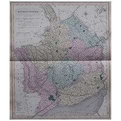
Original Antique English County Map - Monmouthshire. J & C Walker. 1851
Located in St Annes, Lancashire
Great map of Monmouthshire
Original colour
By J & C Walker
Published by Longman, Rees, Orme, Brown & Co. 1851
Unframed.
Category
Antique 1850s English Other Maps
Materials
Paper
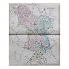
Original Antique English County Map, Derbyshire, J & C Walker, 1851
Located in St Annes, Lancashire
Great map of Derbyshire
Original colour
By J & C Walker
Published by Longman, Rees, Orme, Brown & Co. 1851
Unframed.
Category
Antique 1850s English Other Maps
Materials
Paper
Original Antique English County Map, Durham, J & C Walker, 1851
Located in St Annes, Lancashire
Great map of Durham
Original colour
By J & C Walker
Published by Longman, Rees, Orme, Brown & Co. 1851
Unframed.
Category
Antique 1850s English Other Maps
Materials
Paper

Recently Viewed
View AllMore Ways To Browse
Bjorn Wiinblad Glass
Blue Art Deco Armchair
Blue Gold Pillow
Blue Plastic Chairs
Bluish Grey
Book Form Coffee Table
Boucle Bed
Boucle Daybed
Butter Bowl
Butterfly Coffee Table
Campaign Writing Desk
Cast Iron Bench
Charles Eames Red
Chesterfield Antique Chair
Chinese Vintage Crafted Frame
Chippendale Style Desk
Chrome And Brass End Table
Cobalt Plate Flowers