Items Similar to Italian Parchment Map of the City of Pisa Dated, 1640


Want more images or videos?
Request additional images or videos from the seller
1 of 10
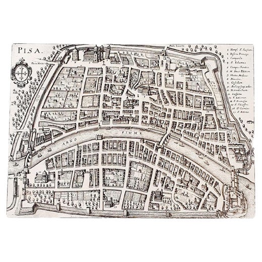
Italian Parchment Map of the City of Pisa Dated, 1640
About the Item
An antique map of the Tuscan city of Pisa engraved for The 'Itinerarium Italiæ Nov-antiquæ' by Matthäus Merian the Elder and printed in 1640. The original paper from 1640 is well preserved. We have expertly mounted the map here in Florence to protect it.
The city is depicted from a bird's eye view using extraordinarily beautiful detailed engraving which captures every detail within the ancient cities walls.
In Pisa: Detail of Piazza del Duomo with the Leaning Tower, the Arsenale built where the Arno leaves the city and the large vegetable garden areas that surround the city's medieval walls. This ancient print of Pisa includes a legend and the coat of arms of the maritime city.
Matthäus Merian the Elder (1593-1650) was a Swiss engraver born in Basel who worked in Frankfurt and illustrated many publications from the late sixteenth century.
We also have a map of Lucca by Matthäus Merian the Elder and printed in 1640 available for sale. We recommend framing these pieces under glass to preserve them for another 400 years.
Dimensions:
Uniform Mount: H43cm X W55cm
Map Pisa: H26cm X W34cm.
Matthäus Merian the Elder
Matthäus Merian is one of the most respected Swiss/German artists and engravers of the 17th century. In addition to creating a large number of illustrations and maps, he passed his knowledge and skill to his children, who followed in the family tradition. His son Matthäus Merian, the Younger was an accomplished engraver. His daughter Maria Sybella Merian in addition to becoming a prominent artist, became one of the greatest woman scientists of the 18th century as an entomologist. Her engravings of insects in their natural habitats are as sought after by collectors as are her father's illustrations.
About the Seller
5.0
Vetted Professional Seller
Every seller passes strict standards for authenticity and reliability
Established in 2019
1stDibs seller since 2023
41 sales on 1stDibs
Typical response time: 3 hours
- ShippingRetrieving quote...Shipping from: Amelia, Italy
- Return Policy
Authenticity Guarantee
In the unlikely event there’s an issue with an item’s authenticity, contact us within 1 year for a full refund. DetailsMoney-Back Guarantee
If your item is not as described, is damaged in transit, or does not arrive, contact us within 7 days for a full refund. Details24-Hour Cancellation
You have a 24-hour grace period in which to reconsider your purchase, with no questions asked.Vetted Professional Sellers
Our world-class sellers must adhere to strict standards for service and quality, maintaining the integrity of our listings.Price-Match Guarantee
If you find that a seller listed the same item for a lower price elsewhere, we’ll match it.Trusted Global Delivery
Our best-in-class carrier network provides specialized shipping options worldwide, including custom delivery.More From This Seller
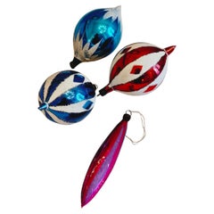
View AllSet of 4 1970s Italian Vintage Christmas Baubles
Located in Florence, Tuscany
A set of four beautifully coloured 1960s/1970s vintage glass Christmas tree baubles. These pieces are incredibly colourful and fragile.
D...
Category
Vintage 1970s Toys and Dolls
Materials
Art Glass
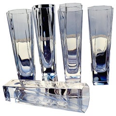
Set of 6 Octagonal `970s Italian Aperitivo Glasses
Located in Florence, Tuscany
A pretty set of 1980s high ball aperitivo glasses. With a square base they fan into an eight sided shape at the top. Found in Florence, in good condition.
Category
Vintage 1970s Italian Mid-Century Modern Pitchers
Materials
Glass, Art Glass, Blown Glass
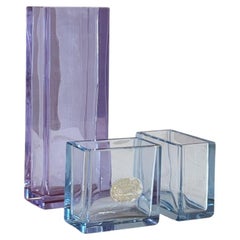
1970s Set of Three Minitaure Italian Vases
Located in Florence, Tuscany
A delightful set of 1970s miniature vases. The largest vase is in lilac and the two smaller in pale blue glass with original sticker still in place. All in good condition.
Dimension...
Category
Vintage 1970s Italian Vases
Materials
Crystal
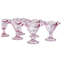
Set of 1970s Italian Glass Lilac Gelato Bowls
Located in Florence, Tuscany
Quite possibly the prettiest way to eat ice cream or fruit salad. Classic 1970s pale lilac glass Italian Gelato bowls. I have left the original price stic...
Category
Vintage 1970s Italian Sheffield and Silverplate
Materials
Glass
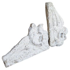
Pair of 17th Century Italian Travertine Mantles
Located in Florence, Tuscany
A pair of 300 year old travertine mantles salvaged from a 17th century church in Le Marche. The stone is absolutely beautiful and the pieces have aged allowing for us still to see th...
Category
Antique 17th Century Italian Abstract Sculptures
Materials
Travertine
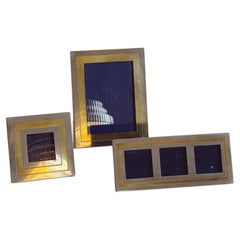
Set of Three 1970s Romeo Rega Italian Photo Frames
By Romeo Rega
Located in Florence, Tuscany
A delightful and hard to come by set of three Romeo Rega 1970s photo frames. Each frame uses his iconic brass and white metal inlay. All in good condition,
Small: H14cm x W14cm / Lo...
Category
Mid-20th Century Italian Mid-Century Modern Picture Frames
Materials
Silver, Brass
You May Also Like
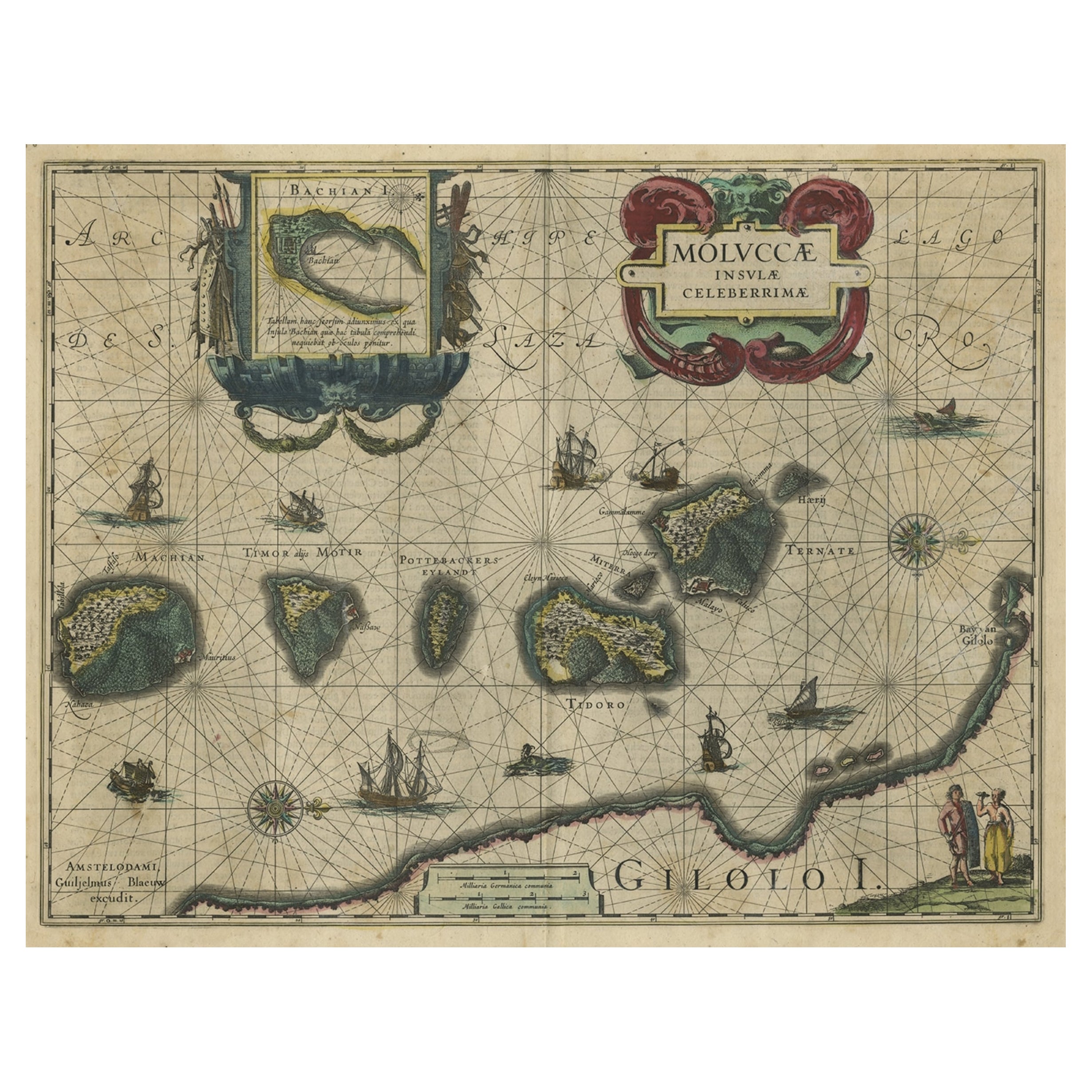
Antique Map of the Maluku Islands by Blaeu, c.1640
Located in Langweer, NL
Antique map titled 'Moluccae Insulae Celeberrimae'. Decorative map of the Maluku Islands, also known as the Moluccas or the Spice Islands. Inset of the island of Bachian (Batjan) in ...
Category
Antique 17th Century Maps
Materials
Paper

$1,253 Sale Price
20% Off
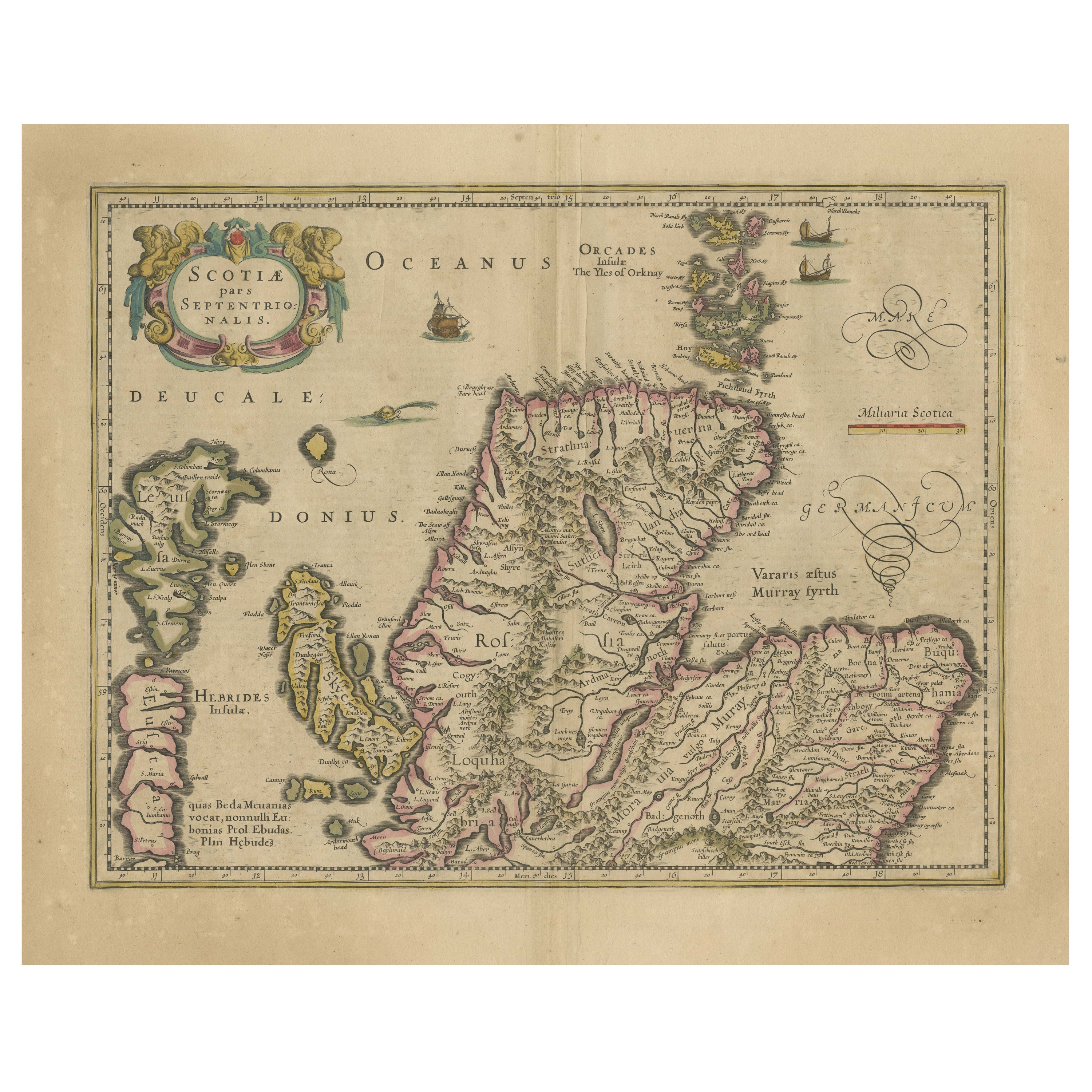
Original Antique Map of the Northern Part of Scotland, circa 1640
Located in Langweer, NL
The antique map, titled 'Scotiae pars septentrionalis,' depicts the northern part of Scotland. Crafted by Hondius around 1640, this map is a historical treasure showcasing the geogra...
Category
Antique Mid-17th Century Maps
Materials
Paper
Antique Map of the Region of Bourbonnais by Janssonius, circa 1640
Located in Langweer, NL
Antique map titled 'Bourbonois - Borbonium Ducatus'. Old map of the former region of Bourbonnais, France. It includes the cities of Bourbon, Moulins, Charenton, Brulles, Varennes and...
Category
Antique Mid-17th Century Maps
Materials
Paper

Antique Map of the Region of Blois by Janssonius, 'circa 1640'
By Johannes Janssonius
Located in Langweer, NL
Antique map titled 'Description du Blaisois'. Old map of the region of Blois, France. It shows the city of Blois, Amboise, the Loire River and more. Published by J. Janssonius, circa...
Category
Antique Mid-17th Century Maps
Materials
Paper

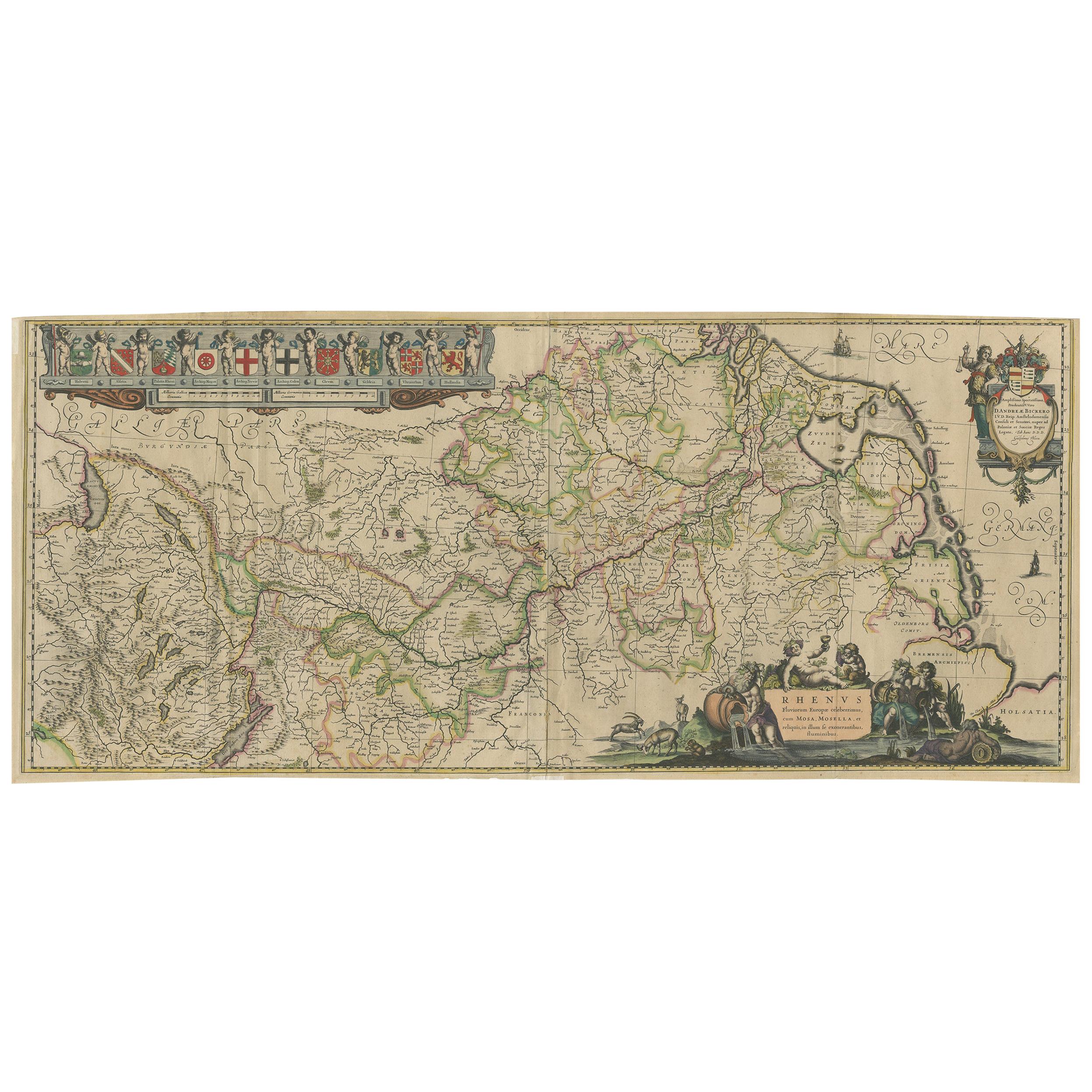
Antique Map of the Course of the Rhine River by Blaeu, circa 1640
Located in Langweer, NL
Antique map titled 'Rhenus Fluviorum Europae celeberrimus, cum Mosa, Mosella, et reliquis, in illum se exonerantibus, fluminibus'. Beautiful map of the course of the Rhine River...
Category
Antique Mid-17th Century Maps
Materials
Paper

$1,392 Sale Price
20% Off
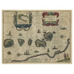
Decorative Map of the Spice Islands in the Mollucas, Indonesia, ca.1640
Located in Langweer, NL
Antique map titled 'Moluccae Insulae Celeberrimae'.
Decorative map of the Spice Islands. Inset of the Island of Bachian (Batjan) in an elaborate frame as well as a Moluccan couple in the lower right corner in Europeanized native dress.
Artists and Engravers: Willem Janszoon Blaeu (1571-1638) was a prominent Dutch geographer and publisher. Born the son of a herring merchant, Blaeu chose not fish but mathematics and astronomy for his focus. He studied with the famous Danish astronomer Tycho...
Category
Antique 1640s Maps
Materials
Paper
$789 Sale Price
28% Off
Recently Viewed
View AllMore Ways To Browse
Merian Engraving
Pisa Glasses
Antique Vegetable Prints
16th Century Antique Tapestry
18th Century Silver Spoon
1960s Vintage Club Chair
21st Century Art Deco Sofa
40 Inch Coffee Tables
70s Leather Armchair
72 Round Dining Table
9x12 Area Rug Green
Alp Chair
Antique Salt Cellars
Antique Upholstered Bed
Antique Wood Ladders
Armchair Pierre Frey
Art Deco 1920s Sofa
Art Deco Kids