Items Similar to Imperium Romanum: A Detailed Map of the Roman Empire in its Zenith, 1880

Want more images or videos?
Request additional images or videos from the seller
1 of 8
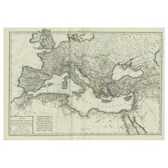
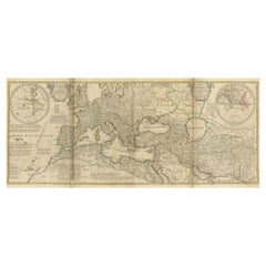
Imperium Romanum: A Detailed Map of the Roman Empire in its Zenith, 1880
About the Item
This original antique map, titled "IMPERIVM ROMANVM", is a detailed depiction of the Roman Empire at the height of its power. The main map encompasses the vast expanse of the Roman territories, stretching from the British Isles in the northwest to the deserts of Arabia and the northern fringes of Africa in the southeast.
**Key Features of the Map:**
1. **Territorial Colors**: The map uses different colors to distinguish the various provinces of the Roman Empire. These color-coded areas are to represent the administrative divisions within the Empire.
2. **Topography**: It shows a considerable amount of topographical detail, with mountain ranges, rivers, and bodies of water such as the Mediterranean Sea, prominently displayed.
3. **Cities and Settlements**: Cities are marked, with symbols indicative of their size or importance. Major cities such as Rome, Constantinople, Alexandria, and Carthage are highlighted.
4. **Road Networks**: There appear to be lines connecting various cities and towns, which could represent the famous Roman road network that facilitated trade and military movements.
5. **Latin Text and Inscriptions**: The map features Latin text, which would be consistent with the period it represents. These inscriptions may include the names of the provinces, regions, and significant geographical and man-made features.
6. **Borders**: The boundaries of the Empire are well-defined, denoting the furthest extent of Roman control and influence.
7. **Inset Maps**: Along the bottom, there are smaller inset maps, each focusing on a particular region of the Empire. These insets provide a closer look at the provincial divisions, showing how the larger territory was managed and organized.
8. **Grid and Scale**: A latitude and longitude grid overlays the map, and there's a scale on the map for distance measurement.
It is a valuable visual representation of ancient history, meticulously rendered to educate and inform.
- Dimensions:Height: 15.56 in (39.5 cm)Width: 18.51 in (47 cm)Depth: 0 in (0.02 mm)
- Materials and Techniques:
- Period:
- Date of Manufacture:1880
- Condition:Good, given age. General age-related toning, especially around the edges. Vertical folding line as issued. Please study scan carefully.
- Seller Location:Langweer, NL
- Reference Number:Seller: BG-13686-2-31stDibs: LU3054338536682
About the Seller
5.0
Recognized Seller
These prestigious sellers are industry leaders and represent the highest echelon for item quality and design.
Platinum Seller
Premium sellers with a 4.7+ rating and 24-hour response times
Established in 2009
1stDibs seller since 2017
2,419 sales on 1stDibs
Typical response time: <1 hour
- ShippingRetrieving quote...Shipping from: Langweer, Netherlands
- Return Policy
Authenticity Guarantee
In the unlikely event there’s an issue with an item’s authenticity, contact us within 1 year for a full refund. DetailsMoney-Back Guarantee
If your item is not as described, is damaged in transit, or does not arrive, contact us within 7 days for a full refund. Details24-Hour Cancellation
You have a 24-hour grace period in which to reconsider your purchase, with no questions asked.Vetted Professional Sellers
Our world-class sellers must adhere to strict standards for service and quality, maintaining the integrity of our listings.Price-Match Guarantee
If you find that a seller listed the same item for a lower price elsewhere, we’ll match it.Trusted Global Delivery
Our best-in-class carrier network provides specialized shipping options worldwide, including custom delivery.More From This Seller
View AllOriginal Antique Map of the Roman Empire
Located in Langweer, NL
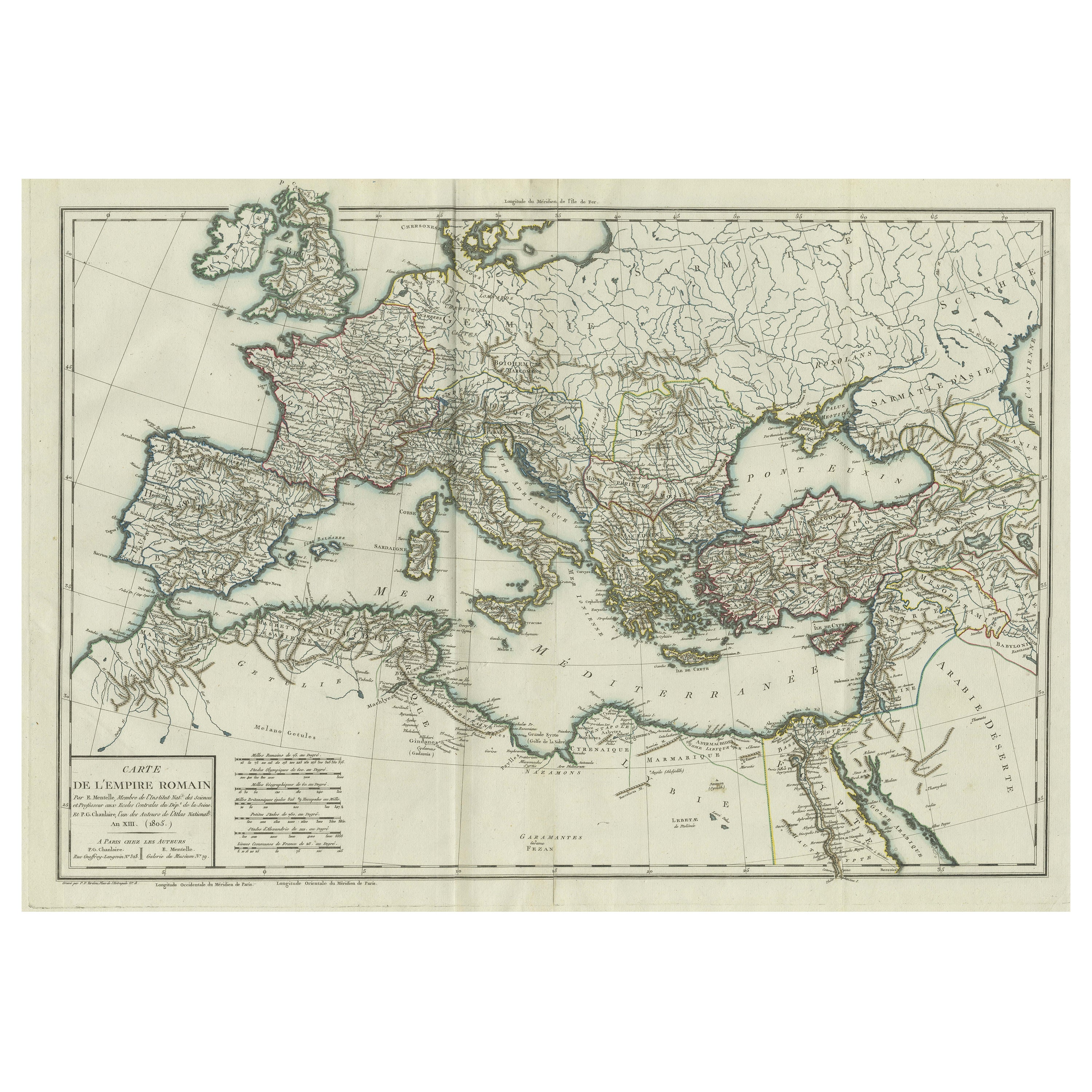
Antique map titled 'Carte de l'Empire Romain'. Original antique map of the Roman Empire, two sheets joined. Engraved by Pierre Francois Tardieu and published by Edme Mentelle, circa ...
Category
Antique Late 18th Century Maps
Materials
Paper
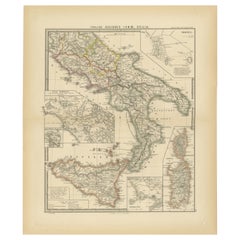
Antique Map of The Regions of Italy and Sicily during the Roman Empire, 1880
Located in Langweer, NL
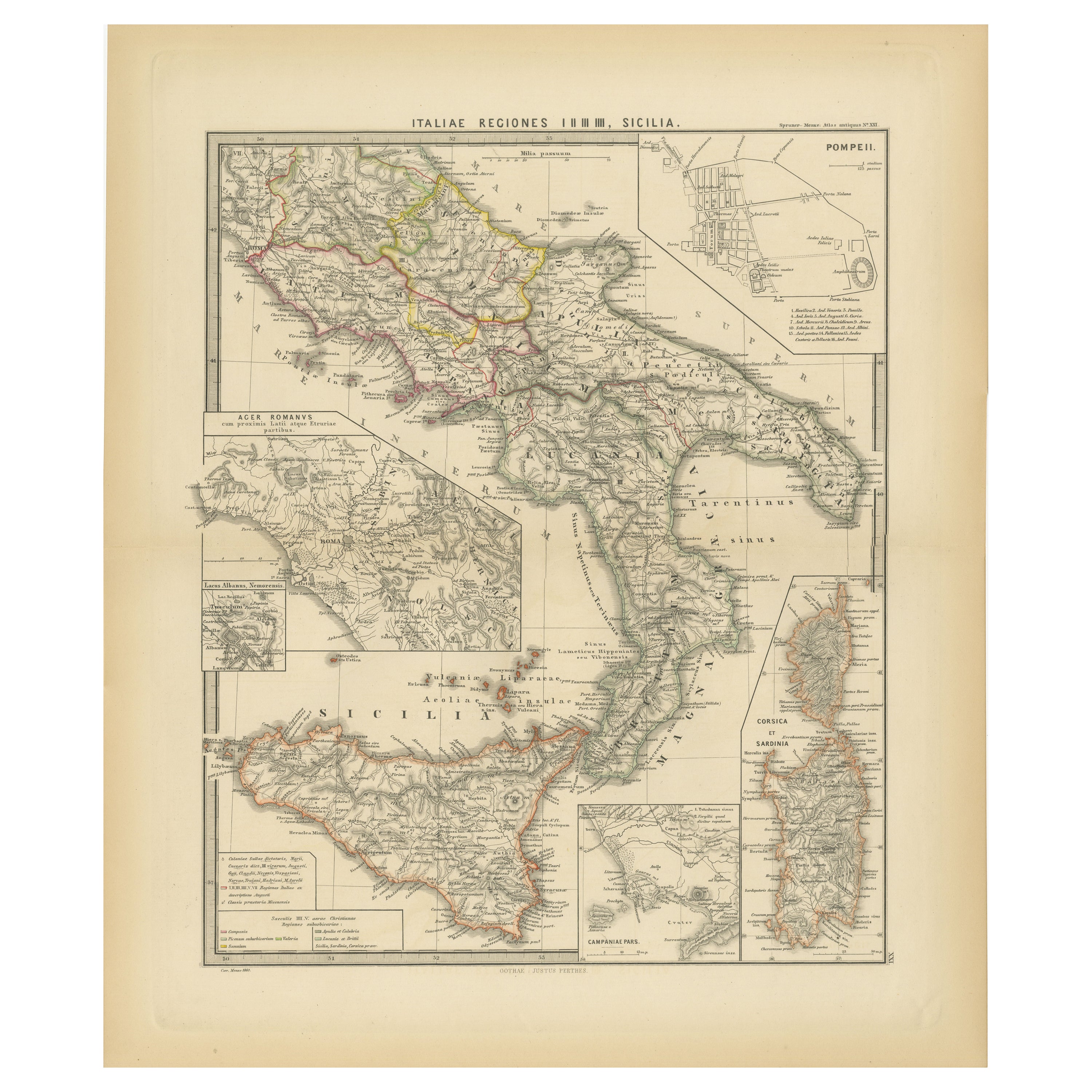
This map is an original antique engraving titled "ITALIAE REGIONES IIII SICILIA," which translates to "The Regions of Italy and Sicily." This detailed historical map portrays the reg...
Category
Antique 1880s Maps
Materials
Paper
Detailed Original Antique Map of the Russian Empire in Asia, 1750
Located in Langweer, NL
Antique map titled 'Partie Orientale de l'Empire de Russie en Asie (..)'.
Detailed map of the Russian Empire in Asia.
Artists and Engravers: Gilles Robert de Vaugondy (1688-1766) was the head of a leading family of geographers in eighteenth century France. Gilles got his start when he jointly inherited the shop of Pierre-Moullart Sanson, grandson of the famous geographer Nicholas Sanson. The inheritance included the business, its stock of plates, and a roller press...
Category
Antique 1750s Maps
Materials
Paper
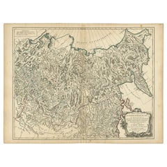
$548 Sale Price
20% Off
Rare 1730 Roman Empire Map by Moll - Detailed and Engraved Masterpiece
Located in Langweer, NL
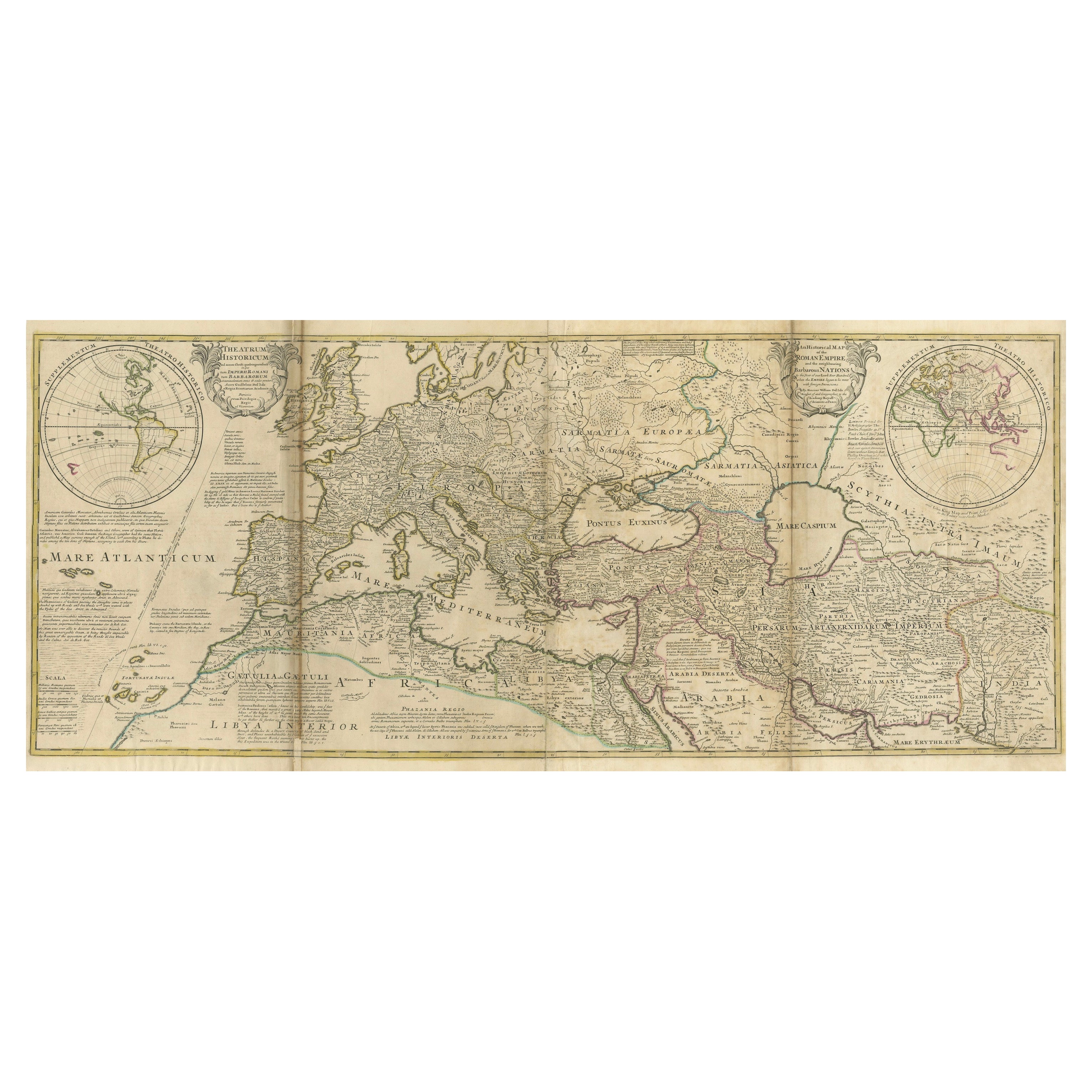
An Historical Map of the Roman Empire and the Neighbouring Barbarous Nations by Herman Moll - Circa 1730
This grand and historically significant map of the Roman Empire was create...
Category
Antique 1730s Maps
Materials
Paper
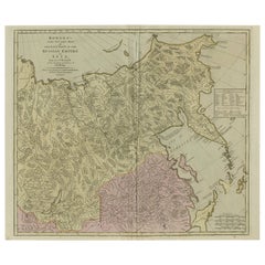
Large and Detailed Map of the Russian Empire in Asia, ca.1780
Located in Langweer, NL
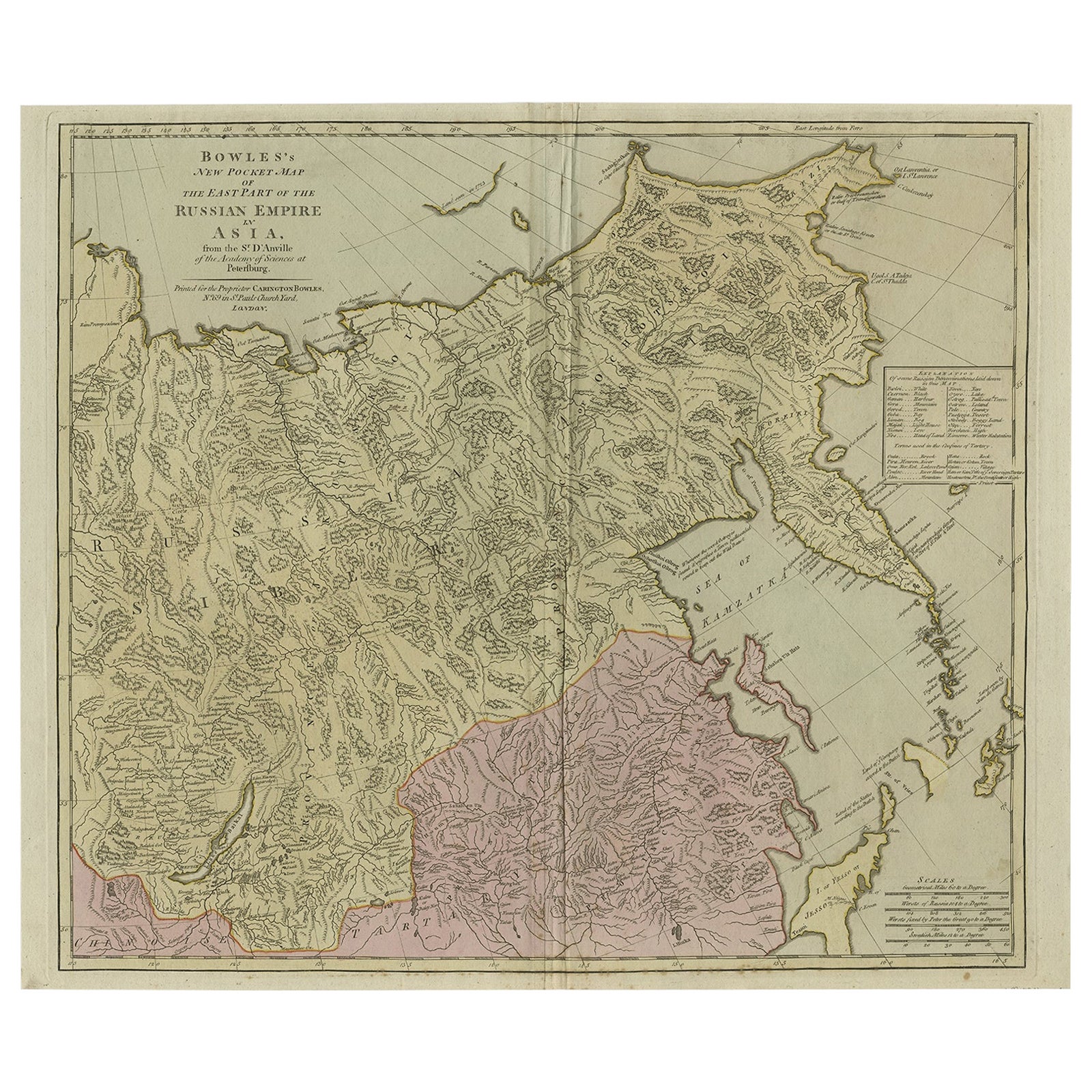
Description: Antique map titled 'Bowles's New Pocket Map of the East Part of the Russian Empire in Asia'. Large and detailed map of the Russian Empire in Asia. Source unknown, to be determined.
Artists and Engravers: Made by 'Thomas & Carington Bowles' after 'D'Anville'. Thomas Bowles, born around 1712, was map publisher and seller in London...
Category
Antique 1780s Maps
Materials
Paper
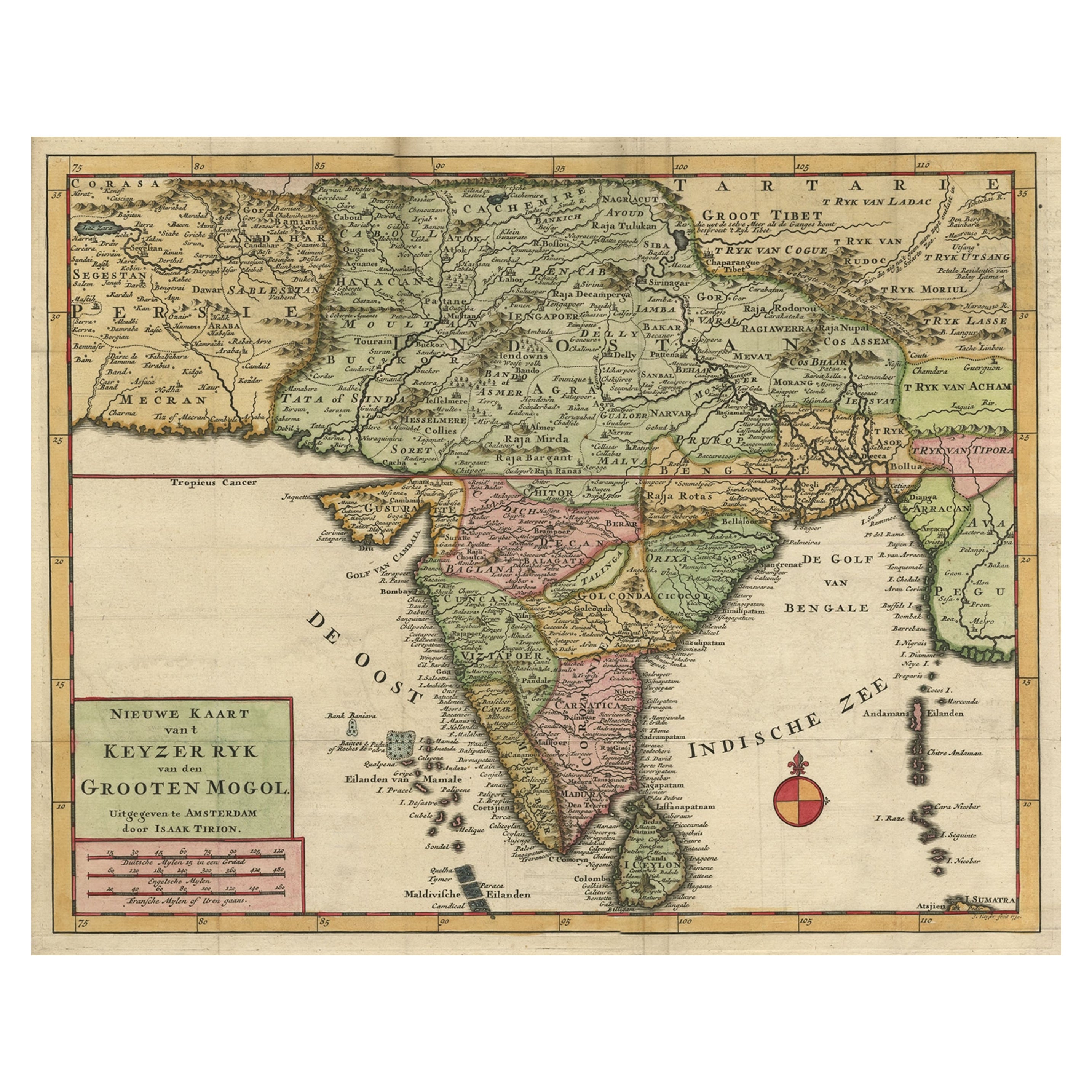
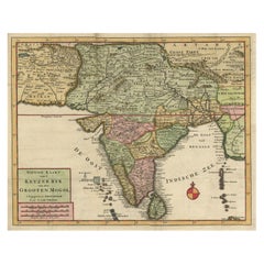
Attractive Detailed Map of the Empire of the Great Mogul, Incl India, 1731
Located in Langweer, NL
Antique map titled 'Nieuwe Kaart van t Keyzer Ryk Grooten Mogol.'
Attractive detailed map of the Empire of the Great Mogul, which included India, Sri Lanka, Pakistan and Banglade...
Category
Antique 1730s Maps
Materials
Paper
You May Also Like
Large Original Antique Map of the Environs of Cork, Ireland, circa 1880
Located in St Annes, Lancashire
Great map of The Environs of Cork
Published circa 1880
Unframed
Free shipping.
Category
Antique 1880s Scottish Maps
Materials
Paper

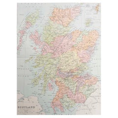
Original Antique Map of Scotland. Circa 1880
Located in St Annes, Lancashire
Great map of Scotland
Drawn and Engraved by J.Bartholomew
Published C.1880
Original colour
Unframed.
Category
Antique 1880s English Maps
Materials
Paper
Large Original Antique Map of The Environs of Dublin, Ireland, circa 1880
Located in St Annes, Lancashire
Great map of The Environs of Dublin
Published circa 1880
Unframed
Free shipping.
Category
Antique 1880s Scottish Maps
Materials
Paper

1814 Map of "Russian Empire" Ric.r032
Located in Norton, MA
1814 Map of
"Russian Empire"
Ric.r032
Russian Empire. Description: This is an 1814 John Thomson map of the Russian Empire. The map depicts the region from the Baltic Sea, Prussia, and Sweden to the Aleutian Islands and from the Arctic Ocean to the Yellow River. Highly detailed, myriad cities, towns, and villages are labeled throughout, including St. Petersburg, Moscow, Minsk, Kiev, and Kharkov. Rivers and mountain ranges are also identified, as are islands and numerous locations along the coastlines. It is important to note that the long-disputed sea between Korea and Japan is identified as the 'Sea of Japan.
Historical Context:
In 1815, Tsarist Russia emerged from the Napoleonic Wars economically insolvent and politically fearful of the Revolutionary fervor that had just swept through Europe. In order to shore up Russia's economic position, the Tsars began an aggressive series of expansions into the Caucuses and Central Asia that would vastly increase the landmass of the Russian Empire.
Publication History
Thomson maps are known for their stunning color, awe inspiring size, and magnificent detail. Thomson's work, including this map, represents some of the finest cartographic art...
Category
Antique 19th Century Unknown Maps
Materials
Paper

Super Rare Antique French Map of Chine and the Chinese Empire, 1780
Located in Amsterdam, Noord Holland
Super Rare Antique French Map of Chine and the Chinese Empire, 1780
Very nice map of Asia. 1780 Made by Bonne.
Additional information:
Type: Map
...
Category
Antique 18th Century European Maps
Materials
Paper

$584 Sale Price
31% Off
Map of the Republic of Genoa
Located in New York, NY
Framed antique hand-coloured map of the Republic of Genoa including the duchies of Mantua, Modena, and Parma.
Europe, late 18th century.
Dimension: 25...
Category
Antique Late 18th Century European Maps

Recently Viewed
View AllMore Ways To Browse
Ancient Roman Empire
Constantinople Antique
Alexandrias Antiques
Carthage Antique
Ancient Carthage
19th Century Carpet Bag
3 Piece Sterling Silver Tea Set
48 Round Coffee Table
7 Foot Sofa
Antique Cherry Chair
Antique Mason Plates
Antique Measuring Jugs
Antique Red Trunk
Antique Table 4 Drawers
Antique Work Stool
Antique Yolk
Art Nouveau Silver Overlay
Axe Table