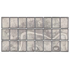
Huge John Rocque Map of London 1746, Republished By Harry Margary
View Similar Items


Want more images or videos?
Request additional images or videos from the seller
1 of 21
Huge John Rocque Map of London 1746, Republished By Harry Margary
About the Item
- Dimensions:Height: 84.06 in (213.5 cm)Width: 162.8 in (413.5 cm)Depth: 0.99 in (2.5 cm)
- Style:George II (In the Style Of)
- Materials and Techniques:
- Place of Origin:
- Period:
- Date of Manufacture:Late 20th Century
- Condition:
- Seller Location:London, GB
- Reference Number:Seller: p009121stDibs: LU984312118741
About the Seller
4.9
Vetted Professional Seller
Every seller passes strict standards for authenticity and reliability
Established in 1979
1stDibs seller since 2013
179 sales on 1stDibs
Typical response time: 9 hours
Associations
LAPADA - The Association of Arts & Antiques Dealers
Authenticity Guarantee
In the unlikely event there’s an issue with an item’s authenticity, contact us within 1 year for a full refund. DetailsMoney-Back Guarantee
If your item is not as described, is damaged in transit, or does not arrive, contact us within 7 days for a full refund. Details24-Hour Cancellation
You have a 24-hour grace period in which to reconsider your purchase, with no questions asked.Vetted Professional Sellers
Our world-class sellers must adhere to strict standards for service and quality, maintaining the integrity of our listings.Price-Match Guarantee
If you find that a seller listed the same item for a lower price elsewhere, we’ll match it.Trusted Global Delivery
Our best-in-class carrier network provides specialized shipping options worldwide, including custom delivery.More From This Seller
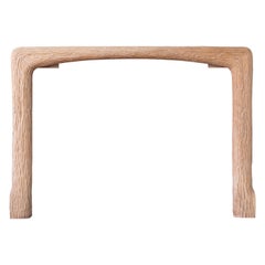
View AllCarved Oak Fire Surround by John Makepeace
By John Makepeace
Located in London, GB
1970s Carved oak fire surround by John Makepeace OBE (b.1939), of naturalistic form.
Opening width 117 cm x 91 cm high.
Category
Vintage 1970s British Fireplaces and Mantels
Materials
Oak
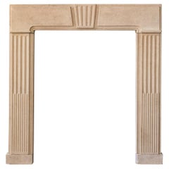
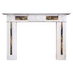
George II Clipsham Stone Fire Surround
Located in London, GB
A George II Clipsham stone fire surround, of architectural form, the paneled header centred by fluted Keystone on stop-fluted jambs, on block feet....
Category
Antique Mid-18th Century European George II Fireplaces and Mantels
Materials
Limestone
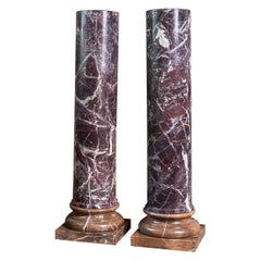
Pair of Rosso Levanto Column Pedestals
Located in London, GB
Pair of Rosso Levanto marble columns, twentieth century, each with turned socle on plinth base in Rojo Alicante marble. Italian, early twentieth century.
Dimensions: 128cm (50½") Hi...
Category
Early 20th Century Italian Pedestals and Columns
Materials
Marble
Georgian Statuary and Convent Sienna Marble Fireplace
Located in London, GB
A late Georgian Statuary and Convent Sienna marble fireplace, circa 1800,
the shelf with a simple mould above frieze with plaque centred by a female mask, the corner blocks of putti ...
Category
Antique Early 1800s British Georgian Fireplaces and Mantels
Materials
Siena Marble, Statuary Marble
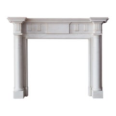
Statuary Marble Chimneypiece after Sir William Chambers
By Sir William Chambers
Located in London, GB
George III style Statuary marble Doric order chimneypiece, after a design by Sir William Chambers (1723-1796), the moulded breakfront shelf above central p...
Category
Antique 1890s British George III Fireplaces and Mantels
Materials
Marble
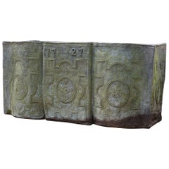
Large Antique Lead Cistern
Located in London, GB
A large antique lead cistern, of shapely serpentine form, the strapwork panels centred by flowerhead paterae, dated '1727' but likely nineteenth century,...
Category
Antique 19th Century British Georgian Planters and Jardinieres
Materials
Lead
$22,782
You May Also Like
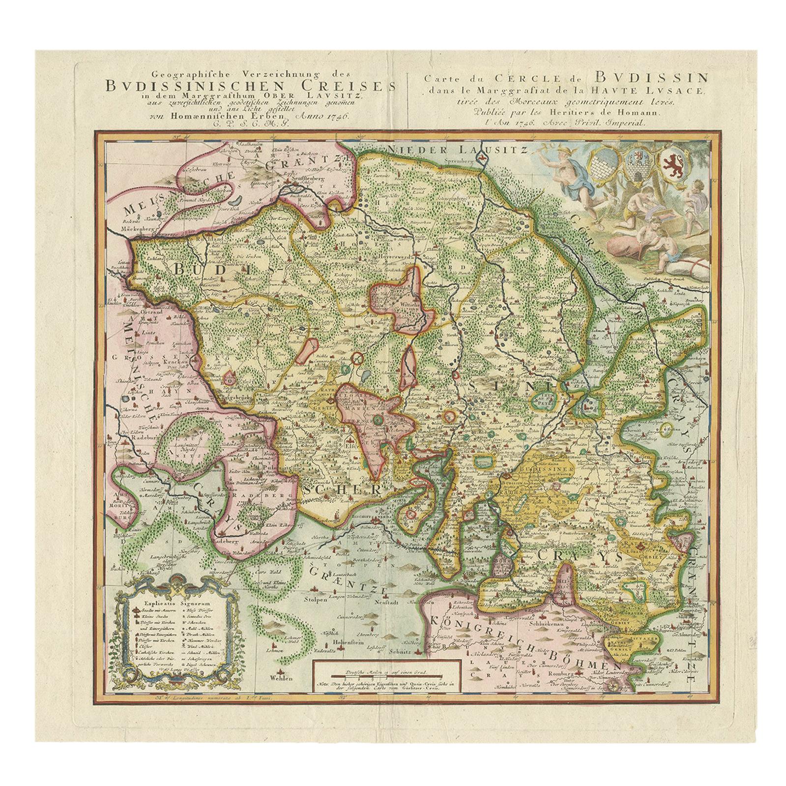
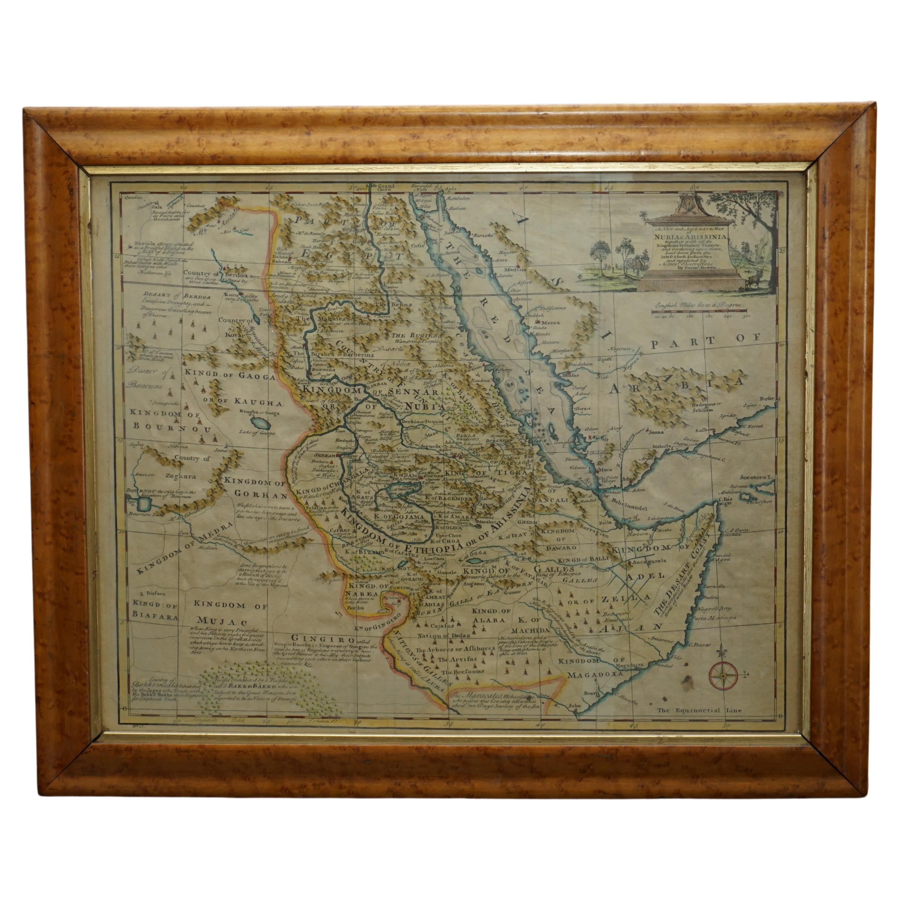
Antique Map of Oberlausitz by Homann Erben, '1746'
Located in Langweer, NL
Antique map titled 'Geographische Verzeichnung des Budissinischen Creises (..) - Carte du Cercle de Budissin (..)'. Copper engraved map of Oberlausitz, a historical region of Saxony ...
Category
Antique Mid-18th Century Maps
Materials
Paper
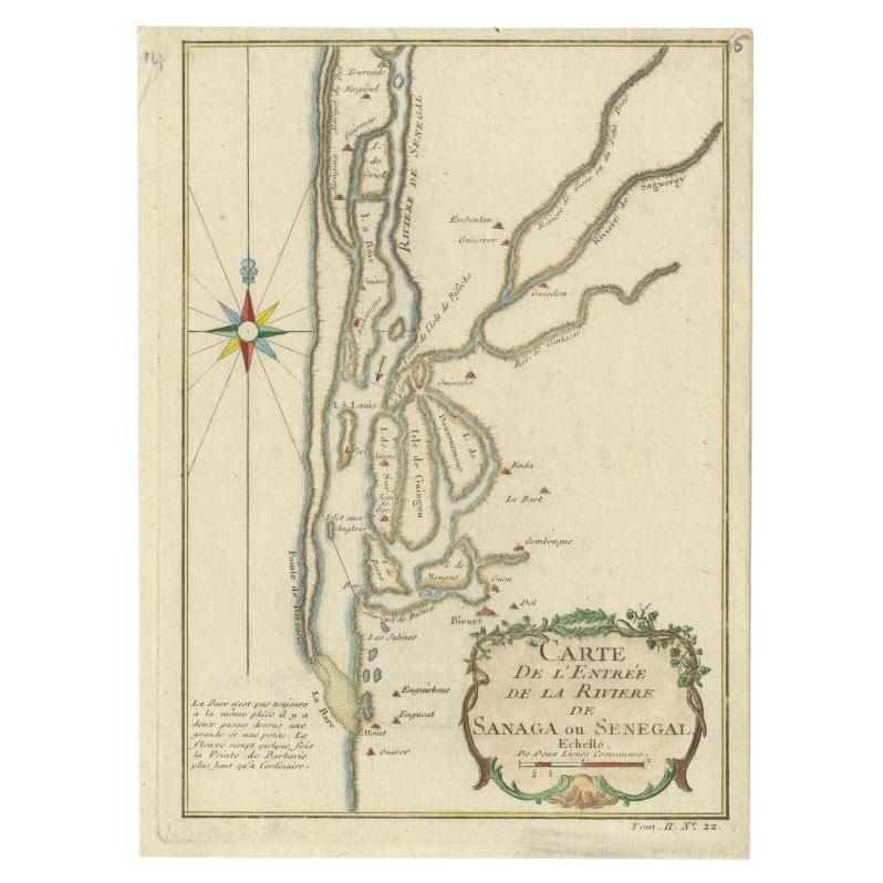
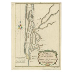
Antique Map of The Senegal River by Bellin, 1746
Located in Langweer, NL
Antique map titled 'Carte de l'Entrée de la Rivière de Sanaga ou Senegal'. Map of the mouth of the Senegal River. This map originates from Prevost's 'Histoire Generale des Voyages'. ...
Category
Antique 18th Century Maps
Materials
Paper
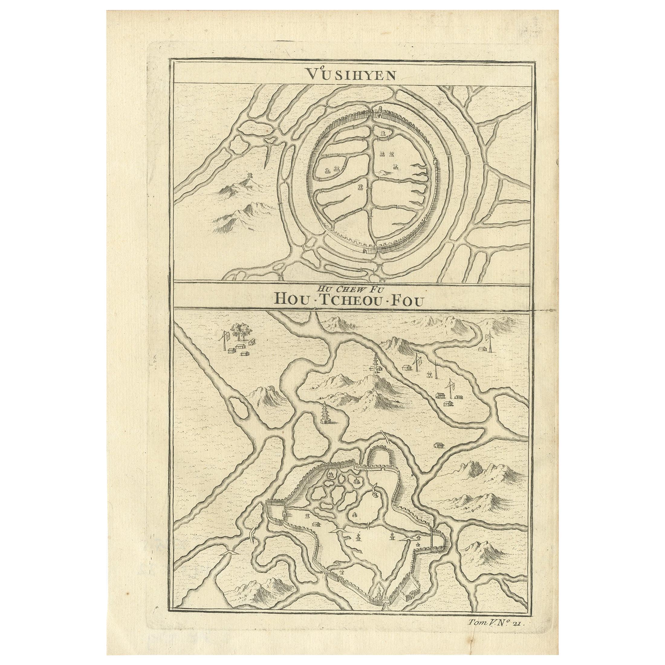
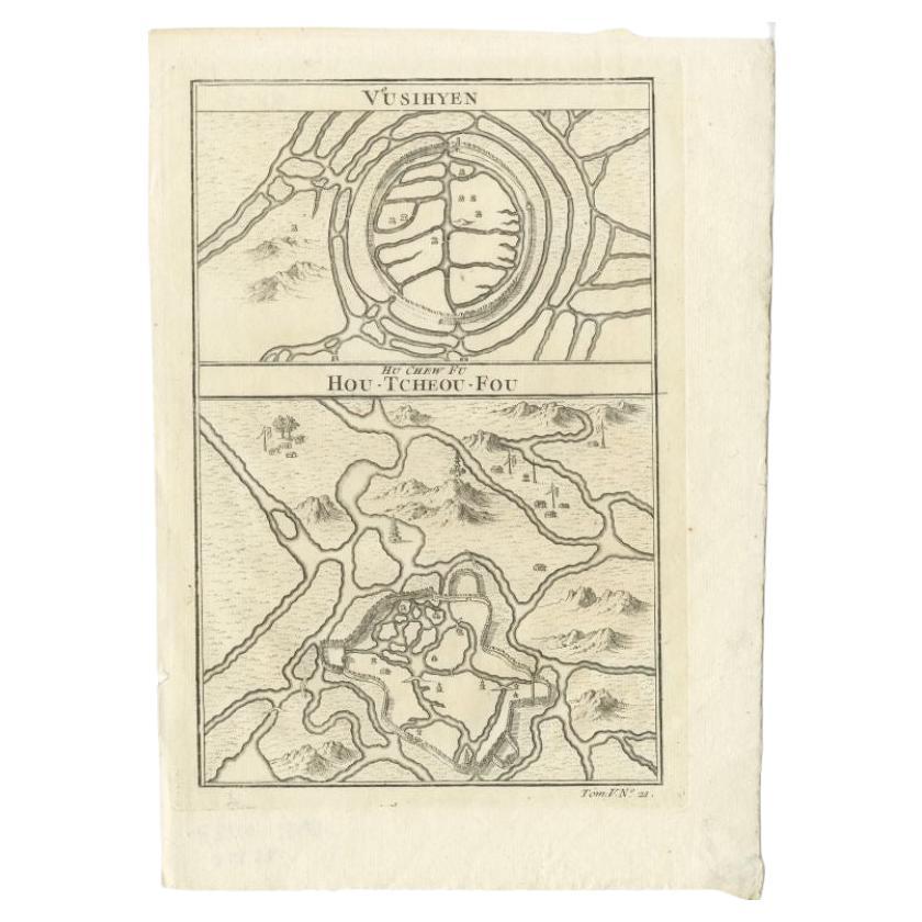
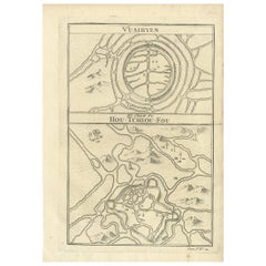
Antique Map of Wuxi and Huzhou by Prévost '1746'
Located in Langweer, NL
Antique map titled 'Vusihyen. Hu Chew Fu'. Plans of Wuxi and Huzhou, China. Originates from Prévost's 'Histoire générale des voyages'.
Category
Antique Mid-18th Century Maps
Materials
Paper
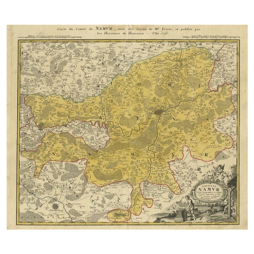
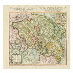
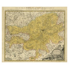
Antique Map of the Region of Namen by Homann, 1746
By Johann Baptist Homann
Located in Langweer, NL
Antique map titled 'Comitatus Namur Tabula Geographica ex mappis Frixianis'. Regional map of Namen, Belgium.
Artists and Engravers: Homann Heirs was a German publishing firm tha...
Category
Antique 18th Century Maps
Materials
Paper
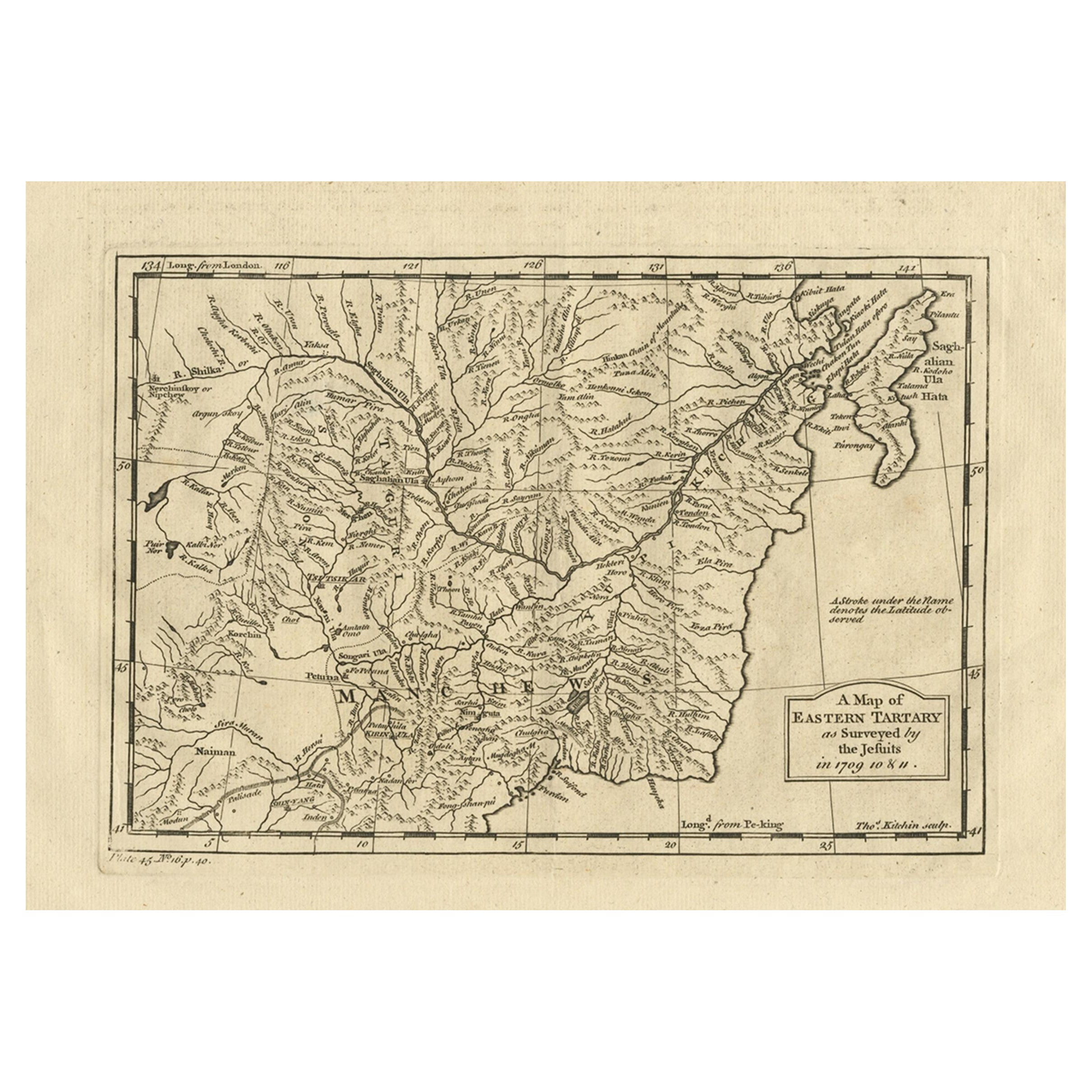
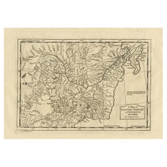
Antique Map of Eastern Tartary as Surveyed by the Jesuits, 1746
By Thomas Kitchin
Located in Langweer, NL
Antique map titled 'A Map of Eastern Tartary as Surveyed by the Jesuits in 1709, 10 & 11'. The map covers much of the course of the Amur River or Heilong Jiang, the world's tenth lon...
Category
Antique 18th Century Maps
Materials
Paper
Original Antique Map of the Cape Verde Islands, 1746
Located in Langweer, NL
Antique map titled 'Carte Des Isles Du Cap Verd.' Original antique map of the Cape Verde Islands. Decorative cartouche and compass rose. Extends from Isle d...
Category
Antique 18th Century Maps
Materials
Paper

$158 Sale Price
20% Off
Recently Viewed
View AllMore Ways To Browse
French Huguenot
Copper Printing Plate
Theodolite Used
Map Of Arabia
New Zealand Map
Map Tibet
Antique Map Of Egypt
British Empire Map
18th Century French Globe
Antique Map Ortelius
Antique Nautical Maps
Roman Empire Map
Voc Ship
16th Century Globe
Map Of Singapore
Antique Map Of Middle East
Hand Painted Antique Map
Railroad Collectibles