Items Similar to Historical Map of the Black Sea and Surrounding Regions, 1705


Want more images or videos?
Request additional images or videos from the seller
1 of 7
Historical Map of the Black Sea and Surrounding Regions, 1705
About the Item
Title: "Map of Turcomania, Georgia, and Comania"
This print presents an intricately detailed map of the Caucasus region, titled “Turcomania, Georgien Commanie,” by the esteemed cartographer Nicolas Sanson. Published in 1705, the map's dimensions are 9.3 x 7.5 inches (23.6 x 19.1 cm) and it features hand-applied coloration, enhancing both its clarity and aesthetic appeal.
The map provides a comprehensive view of the geography of the Caucasus, with a focus on the areas known historically as Georgia, Armenia, and parts of Turkey and Iran, bordered by the Black and Caspian Seas. It includes depictions of significant cities, mountain ranges, and river systems, offering insight into the region's topography and settlements during the early 18th century.
A notable artistic element of the map is the ornate strapwork cartouche that graces the piece. This feature not only serves as a decorative title space but also contributes to the map's overall grandeur, reflecting the style and artistic conventions of the period.
The legacy of Nicolas Sanson's work is evident in the fact that his maps from "L'Asie en Plusieurs Cartes," originally published in 1652 and engraved by A. Peyrounin, were widely reproduced and adapted. These reproductions were undertaken by several map publishers, such as Johann David Zunners, Johannes Ribbius, and Simon de Vries, indicating the widespread influence and demand for Sanson's accurate and detailed cartographic representations.
The map's historical context is enriched by its journey through various hands and adaptations, with the engraving plates eventually being sold to Francois Halma. The titles on these maps were altered multiple times, translated into Dutch, and later reverted to French, reflecting the international interest in and utility of Sanson's cartography.
As a part of "Algemeene Weereld-Beschryving," this map is not only a geographic document but also a piece of art, which would have been prized by scholars, navigators, and collectors alike during the time of its production and remains a valuable historical artifact today.
- Dimensions:Height: 8.67 in (22 cm)Width: 11.89 in (30.2 cm)Depth: 0 in (0.02 mm)
- Materials and Techniques:Paper,Engraved
- Period:1700-1709
- Date of Manufacture:1705
- Condition:Very good. A dark and attractive impression on a bright sheet and a narrow top margin. Middle fold as issued. Study the scans carefully.`.
- Seller Location:Langweer, NL
- Reference Number:Seller: BG-137231stDibs: LU3054338603182
About the Seller
5.0
Recognized Seller
These prestigious sellers are industry leaders and represent the highest echelon for item quality and design.
Platinum Seller
Premium sellers with a 4.7+ rating and 24-hour response times
Established in 2009
1stDibs seller since 2017
2,419 sales on 1stDibs
Typical response time: <1 hour
- ShippingRetrieving quote...Shipping from: Langweer, Netherlands
- Return Policy
Authenticity Guarantee
In the unlikely event there’s an issue with an item’s authenticity, contact us within 1 year for a full refund. DetailsMoney-Back Guarantee
If your item is not as described, is damaged in transit, or does not arrive, contact us within 7 days for a full refund. Details24-Hour Cancellation
You have a 24-hour grace period in which to reconsider your purchase, with no questions asked.Vetted Professional Sellers
Our world-class sellers must adhere to strict standards for service and quality, maintaining the integrity of our listings.Price-Match Guarantee
If you find that a seller listed the same item for a lower price elsewhere, we’ll match it.Trusted Global Delivery
Our best-in-class carrier network provides specialized shipping options worldwide, including custom delivery.More From This Seller
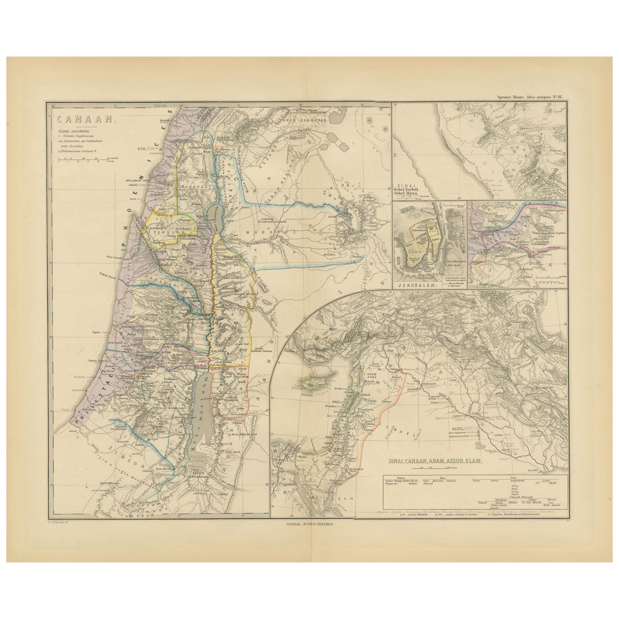
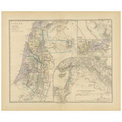
View AllHistorical Map of Canaan with Insets of Jerusalem and Surrounding Regions, 1880
Located in Langweer, NL
The map titled "CANAAN" depicts the historical region known as Canaan, located in the Levant, which corresponds to modern-day Israel, Palestinian territories, Lebanon, and parts of S...
Category
Antique 1880s Maps
Materials
Paper
Antique Map of Champagne and surrounding Regions, France
Located in Langweer, NL
Antique map titled 'Carte de la Champagne et des Pays Voisins (..)'. Detailed map of Champagne and surrounding regions of Chalons and Soissons, Reims,...
Category
Antique Mid-18th Century Maps
Materials
Paper

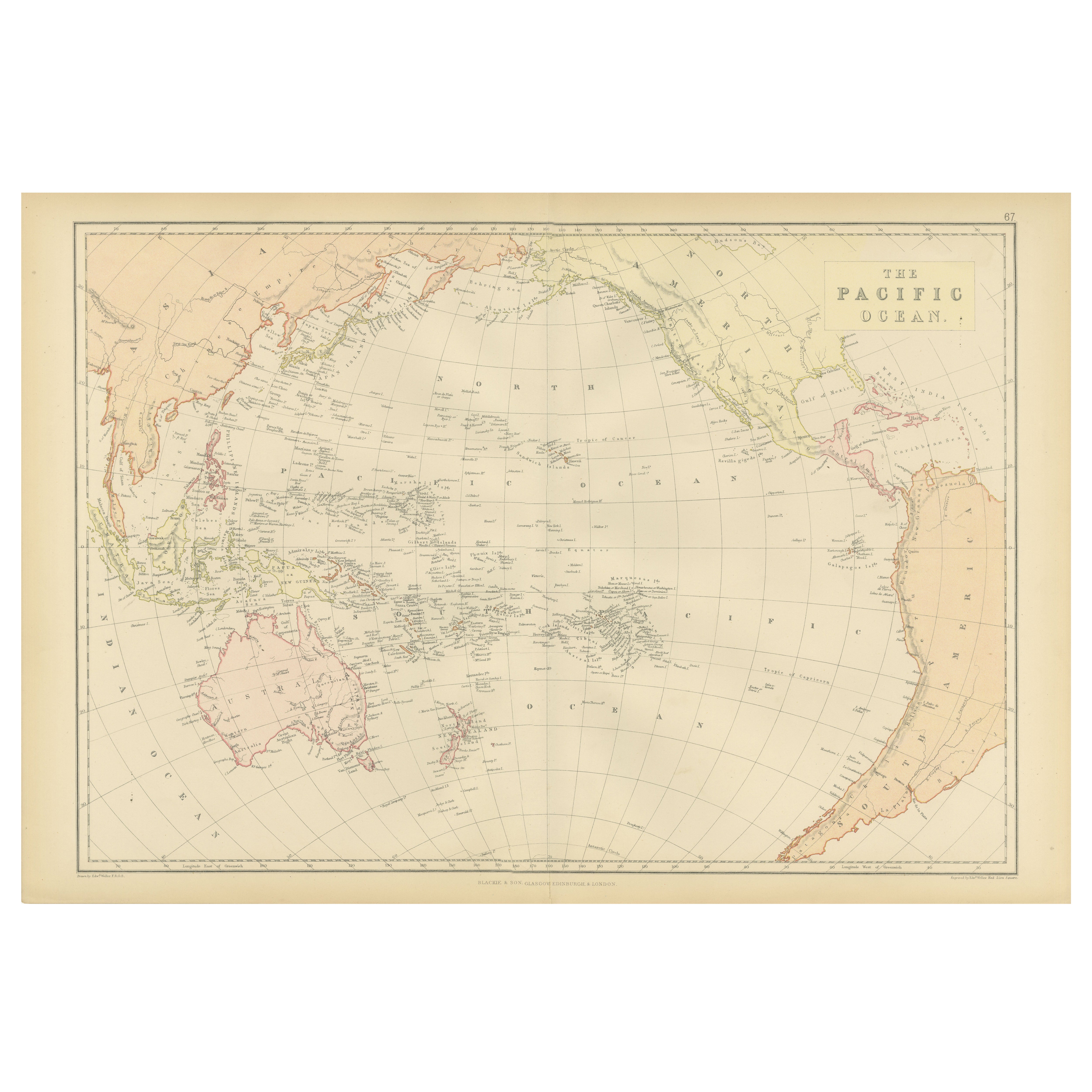
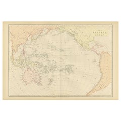
1882 Map of the Pacific Ocean Highlighting Islands and Surrounding Regions
Located in Langweer, NL
This 1882 map of the Pacific Ocean, published by Blackie and Son as part of the 'Comprehensive Atlas and Geography of the World,' presents a detailed and fascinating overview of the ...
Category
Antique 1880s Maps
Materials
Paper
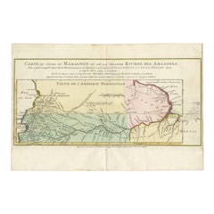
Map of the Amazon River's Course and Surrounding Regions (1743-1744)
Located in Langweer, NL
This original antique map, titled "Carte du Cours du Maragnon ou de la Grande Riviere des Amazones," illustrates the course of the Amazon River (referred to here as the Maragnon) fro...
Category
Antique 1750s Maps
Materials
Paper
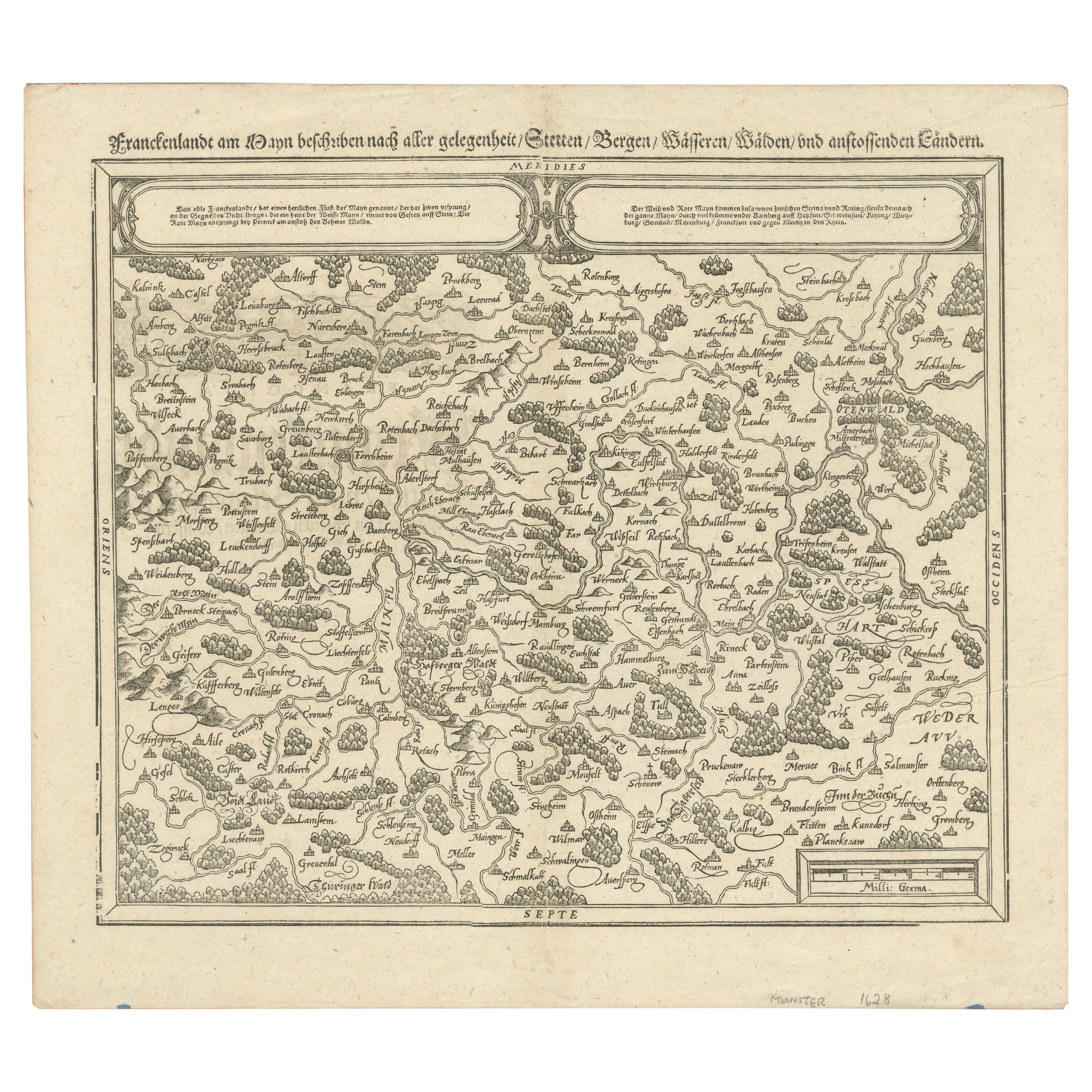
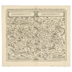
Early Woodcut Map of Franconia and Surrounding Regions, 1628
Located in Langweer, NL
Title: Early Woodcut Map of Franconia and Surrounding Regions, 1628
Franconia (Franckenlande) is a region in Germany. Historically, Franconia was a significant part of the Holy Roma...
Category
Antique 1620s Maps
Materials
Paper
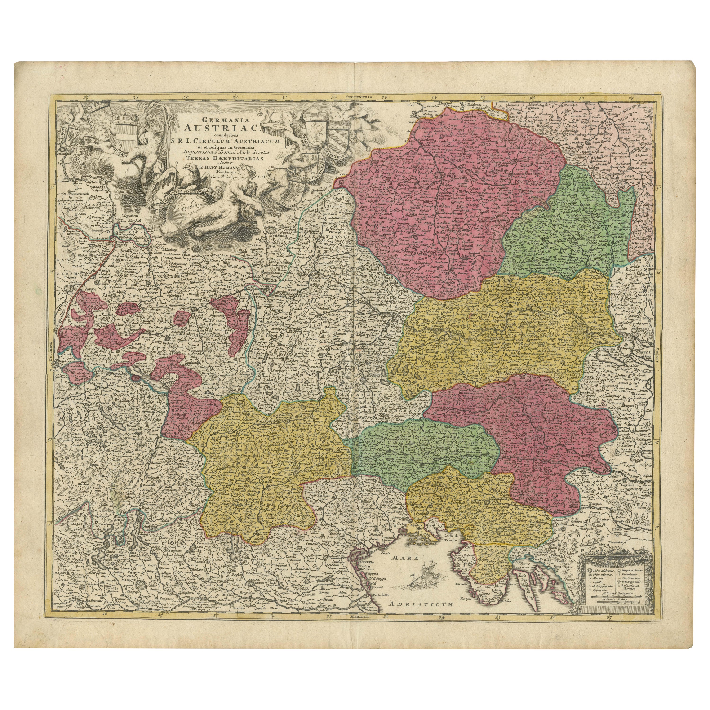
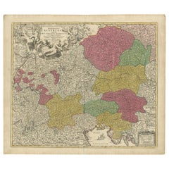
1720 Johann Baptist Homann Map of the Austrian Circle and Surrounding Regions
Located in Langweer, NL
"1720 Johann Baptist Homann Map of the Austrian Circle and Surrounding Regions"
Description of the Map:
This map, crafted by the renowned cartographer Johann Baptist Homann around...
Category
Antique 1720s Maps
Materials
Paper
You May Also Like
1705 Golfe de Mexico and Florida Framed Map
Located in Stamford, CT
Framed map of Mexico & Florida circa 1705, Paris. Small map with Mexico and the Gulf Coast. Inset text indicating Panama, Acapulco, Mexico City and the Mississippi. Extends North to ...
Category
Antique Early 1700s French Spanish Colonial Maps
Materials
Glass, Wood, Paper

Hand-Colored 18th Century Homann Map of the Black Sea, Turkey and Asia Minor
By Johann Baptist Homann
Located in Alamo, CA
An attractive original early 18th century hand-colored map of the Black Sea and Turkey entitled "Carte de L'Asie Minevre ou de la Natolie et du Pont Evxin Tiree des Voyages et des Ob...
Category
Antique Early 18th Century German Maps
Materials
Paper

Hand-Colored 18th Century Homann Map of Denmark and Islands in the Baltic Sea
By Johann Baptist Homann
Located in Alamo, CA
An 18th century copper plate hand-colored map entitled "Insulae Danicae in Mari Balthico Sitae utpote Zeelandia, Fionia, Langelandia, Lalandia, Falstria, Fembria Mona" created by Joh...
Category
Antique Early 18th Century German Maps
Materials
Paper

Antique Lithography Map, Black Sea, English, Framed, Cartography, Victorian
Located in Hele, Devon, GB
This is an antique lithography map of the Black Sea region. An English, framed atlas engraving of cartographic interest by John Rapkin, dating to the early Victorian period and later...
Category
Antique Mid-19th Century British Early Victorian Maps
Materials
Wood

Map of the Republic of Genoa
Located in New York, NY
Framed antique hand-coloured map of the Republic of Genoa including the duchies of Mantua, Modena, and Parma.
Europe, late 18th century.
Dimension: 25...
Category
Antique Late 18th Century European Maps

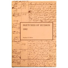
Historical Sketches of Hudson, Embracing the Settlement of the City
Located in valatie, NY
Historical Sketches of Hudson, Embracing the Settlement of the City Reprinted for the Bicentennial Celebration of the City of Hudson, New York 1785-1985 by Stephen Miller. Hendrick H...
Category
Vintage 1980s American Books
Materials
Paper
Recently Viewed
View AllMore Ways To Browse
Turkish Artifacts
Antique Turkey Plate
Antique Turkey Plates
Iranian Plates
Utility Cart
Belgian Stone Top Tables
Bench Loveseat
Black French Desk Leather Top
Brass Gallery Tray
British Raj
Brown Corduroy Furniture
Brown Herman Miller Desk Chair
Bunching Tables
Canterbury Magazine Stand
Cardboard Armchair
Ceramic Organic Side Table
Charles Hollis Jones Lucite Coffee Table
Coffee Table French 1930s