Items Similar to The Highlands and Lowlands of Scotland as Mapped in 1882


Want more images or videos?
Request additional images or videos from the seller
1 of 6
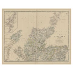
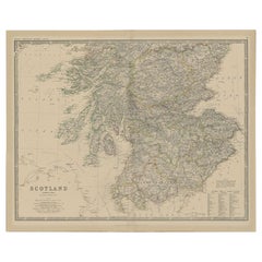
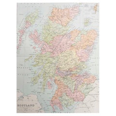
The Highlands and Lowlands of Scotland as Mapped in 1882
About the Item
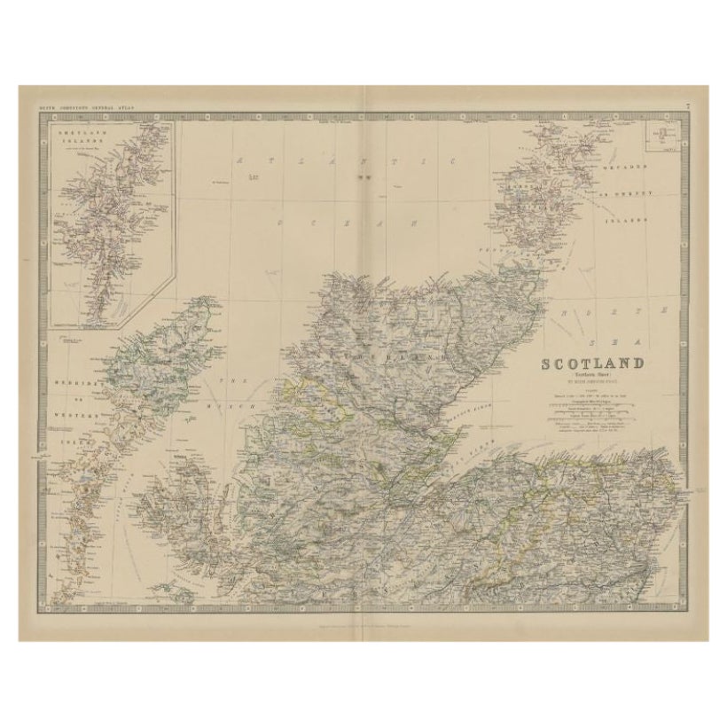
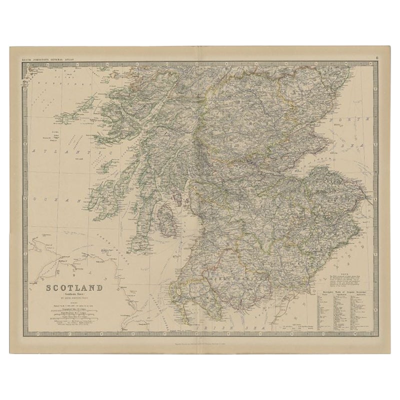
Title: 1882 Blackie Atlas Maps of Scotland: Northern and Southern Regions
Description: These two maps from the 1882 Blackie Atlas provide a detailed representation of Scotland, split into the northern and southern regions. They offer a comprehensive view of the country's geography, topography, and major settlements during the late 19th century. The maps include the rugged Highlands, the Inner and Outer Hebrides, and the Lowlands, capturing Scotland’s diverse landscapes.
The northern map focuses on the Highlands and Islands, showcasing the intricate coastline and numerous islands such as the Orkneys and Shetlands. Major features include mountain ranges, rivers, and small towns scattered across the sparsely populated region.
The southern map highlights the Lowlands, including major cities like Edinburgh and Glasgow. It also covers the borders with England and the fertile agricultural regions. The Firths of Clyde and Forth are prominent, along with other key waterways.
Both maps include clear labels of towns, rivers, mountain ranges, and political boundaries, offering a snapshot of Scotland’s historical geography.
Condition Report: The maps are in good condition for their age, with minor discoloration typical of 19th-century paper. The edges show slight wear, and there are faint fold lines, as expected from atlas use. The printed details remain sharp, and the coloring, used to distinguish regions and boundaries, is vibrant and intact.
Tips on How to Frame These Maps:
1. Choose classic wooden or metal frames with a neutral or antique finish to complement the vintage nature of the maps. Dark wood tones such as walnut or mahogany pair well with the historical theme.
2. Use acid-free matting to protect the paper from aging and ensure the maps are preserved long-term.
3. Opt for UV-protective glass to prevent fading from light exposure.
4. For a professional and polished look, float mount the maps to showcase their edges, or use a wide mat border for a clean presentation.
5. When displaying the maps together, align them vertically to maintain their regional continuity.
Recommended Matting Color:
Use neutral or earth-toned matting, such as cream, beige, or light gray, to complement the maps’ natural aged tones. A subtle green mat can also work well, reflecting the natural landscape of Scotland. Avoid bright or bold colors that may distract from the intricate details of the maps.
- Dimensions:Height: 14.97 in (38 cm)Width: 11.03 in (28 cm)Depth: 0.01 in (0.2 mm)
- Sold As:Set of 2
- Materials and Techniques:
- Period:
- Date of Manufacture:1882
- Condition:Good condition for their age. The paper has aged to a warm, creamy tone typical of late 19th-century publications. Edges show minor wear, consistent with use and age and printed text and lines remain crisp and clear. Folding lines as issued.
- Seller Location:Langweer, NL
- Reference Number:Seller: BG-13601-2-17, -181stDibs: LU3054343551742
About the Seller
5.0
Recognized Seller
These prestigious sellers are industry leaders and represent the highest echelon for item quality and design.
Platinum Seller
Premium sellers with a 4.7+ rating and 24-hour response times
Established in 2009
1stDibs seller since 2017
2,417 sales on 1stDibs
Typical response time: <1 hour
- ShippingRetrieving quote...Shipping from: Langweer, Netherlands
- Return Policy
Authenticity Guarantee
In the unlikely event there’s an issue with an item’s authenticity, contact us within 1 year for a full refund. DetailsMoney-Back Guarantee
If your item is not as described, is damaged in transit, or does not arrive, contact us within 7 days for a full refund. Details24-Hour Cancellation
You have a 24-hour grace period in which to reconsider your purchase, with no questions asked.Vetted Professional Sellers
Our world-class sellers must adhere to strict standards for service and quality, maintaining the integrity of our listings.Price-Match Guarantee
If you find that a seller listed the same item for a lower price elsewhere, we’ll match it.Trusted Global Delivery
Our best-in-class carrier network provides specialized shipping options worldwide, including custom delivery.More From This Seller
View AllAntique Map of Northern Scotland by Johnston, 1882
Located in Langweer, NL
Antique map titled 'Scotland'. Old map of Northern Scotland. This map originates from 'The Royal Atlas of Modern Geography, Exhibiting, in a Series of Entirely Original and Authentic...
Category
Antique 19th Century Maps
Materials
Paper
Antique Map of Southern Scotland by Johnston, 1882
Located in Langweer, NL
"Antique map titled 'Scotland'. Old map of Southern Scotland. This map originates from 'The Royal Atlas of Modern Geography, Exhibiting, in a Series of Entirely Original and Authenti...
Category
Antique 19th Century Maps
Materials
Paper
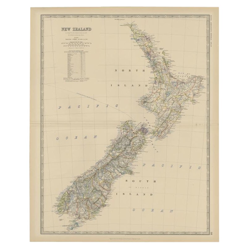
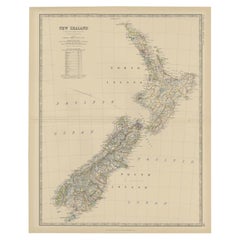
Antique Map of New Zealand by Scottish Geographer Johnston, 1882
Located in Langweer, NL
Antique map titled 'New Zealand'.
Old map of New Zealand. This map originates from 'The Royal Atlas of Modern Geography, Exhibiting, in a Series of Entirely Original and Authentic ...
Category
Antique 19th Century Maps
Materials
Paper
$297 Sale Price
20% Off
Antique Map of the European Continent, 1882
Located in Langweer, NL
Antique map titled 'Europe'. Old map of the European continent. This map originates from 'The Royal Atlas of Modern Geography, Exhibiting, in a Series of ...
Category
Antique 19th Century Maps
Materials
Paper

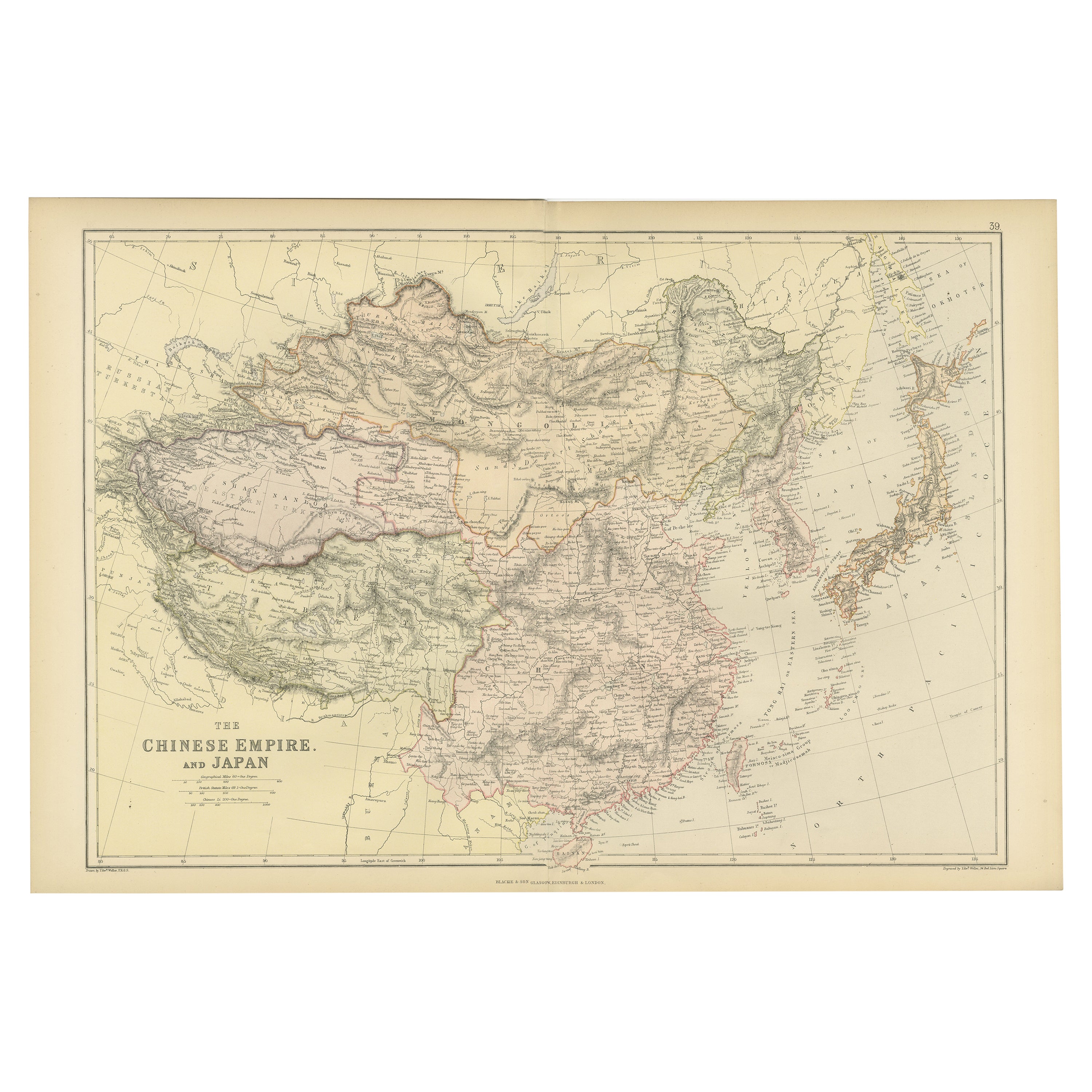
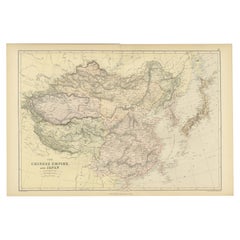
Old Map of the Chinese Empire and Japan, 1882
Located in Langweer, NL
An original antique map titled "The Chinese Empire and Japan," dating from an 1882 atlas by Blackie & Son. It is a color map with geographical features such as mountain ranges, river...
Category
Antique 1880s Maps
Materials
Paper
Antique Map of Central America and the West Indies, 1882
Located in Langweer, NL
Antique map titled 'West India Islands and Central America'. Old map of Central America and the West Indies. This map originates from 'The Royal Atlas of Modern Geography, Exhibiting...
Category
Antique 19th Century Maps
Materials
Paper

You May Also Like
Original Antique Map of Scotland. Circa 1880
Located in St Annes, Lancashire
Great map of Scotland
Drawn and Engraved by J.Bartholomew
Published C.1880
Original colour
Unframed.
Category
Antique 1880s English Maps
Materials
Paper
Map of Africa, archival. Printed in Edinburgh, Scotland, 1916. Free Delivery
Located in Madison, WI
Map of Africa from the geography classroom, 1916 edition. Printed in Edinburgh, Scotland. Mounted on pulldown wooden roller with wall mounting brackets....
Category
Early 20th Century Scottish Edwardian Maps
Materials
Wood, Paper
$180 Sale Price
20% Off
1882 The Works of Henry Fielding, Esq.
By Henry Fielding
Located in Bath, GB
A limited edition ten-volume set of the works of Henry Fielding, edited with a biography by Leslie Stephen.
A ten-volume set in half morocco bindings. All edges gilt.
No. 92 of a t...
Category
Antique 1880s British Books
Materials
Paper
Vintage World Map Mirror Based on the Original by Johnson 1882 Military Campaign
Located in West Sussex, Pulborough
We are delighted to offer for sale this lovely Antique style pictorial plan map of the globe based on the original by Johnson in 1882
This is a very interesting and decorative pie...
Category
20th Century English Campaign Maps
Materials
Mirror

$325 Sale Price
20% Off
1654 Joan Blaeu Map the Sutherland, Scotland, Entitled "Southerlandia, "Ric0007
Located in Norton, MA
1654 Joan Blaeu map of the
Sutherland, Scotland, entitled
"Southerlandia,"
Hand Colored
Ric0007
Description:
Lovely map centered on Sedan and D...
Category
Antique 17th Century Dutch Maps
Materials
Paper
Map of the Republic of Genoa
Located in New York, NY
Framed antique hand-coloured map of the Republic of Genoa including the duchies of Mantua, Modena, and Parma.
Europe, late 18th century.
Dimension: 25...
Category
Antique Late 18th Century European Maps

Recently Viewed
View AllMore Ways To Browse
Town And Country Furniture
Antique Glass Floats
Antique Print Framed Pair 19th Century
Glasgow Metal
Vintage Map Framed
Vintage Glass Map
French Coffee Bowl
French Salon Sofa
Fruit Knife
Furniture By Donghia
Genuine Sheepskin
German Colored Crystal Glass
Gilt Wall Sculpture Large
Glass Berry Bowl
Glass Mosaic Tile Wall Art
Hammock Designs
Hand Blown Glass Tumbler
Hand Blown Tumblers