Items Similar to Gascogne and Guyenne Map - Hand-Colored 17th-Century Engraving by De Wit, c.1688

Want more images or videos?
Request additional images or videos from the seller
1 of 6
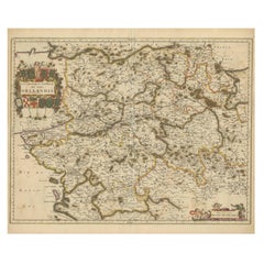
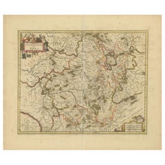
Gascogne and Guyenne Map - Hand-Colored 17th-Century Engraving by De Wit, c.1688
About the Item
Title: Gascogne and Guyenne Map - Hand-Colored 17th-Century Engraving by Frederik De Wit c. 1688
Description: This remarkable map, "Gouvernement de la Guyenne & Gascogne," captures the historic regions of Gascogne and Guyenne in southwestern France. Created by the master cartographer Frederik De Wit and published circa 1688, this map is an exquisite representation of the golden age of Dutch cartography. It features intricate engraving and vibrant original hand-coloring, illustrating towns, rivers, forests, and the regional terrain with precision and artistry.
The map is adorned with two ornate cartouches. The upper-left corner showcases a collection of coats of arms framed by cherubs, while the lower-right cartouche is richly decorated with allegorical figures and decorative motifs. These embellishments highlight the cultural and political significance of Gascogne and Guyenne during the 17th century.
Frederik De Wit was a prominent figure in the golden age of cartography, renowned for his ability to combine geographical accuracy with artistic elegance. This map, part of his renowned composite atlases, is a testament to his craftsmanship and the era's demand for both functional and visually stunning maps.
Condition Report: The map is in very good condition, with bright and vibrant original hand-coloring. Minor age-related imperfections such as light foxing and faint toning may be present. Please examine the image for further details.
Framing and Matting Tips: This map’s decorative cartouches and vibrant hand-coloring make it ideal for a classic gold-leaf or dark wood frame. Acid-free matting in a neutral tone will enhance its colors and protect the paper. For preservation, UV-protective glass is recommended to maintain the vibrancy of the original colors. This piece is a perfect addition to a gallery wall, study, or library, combining historical depth with artistic sophistication.
- Dimensions:Height: 20.83 in (52.9 cm)Width: 24.41 in (62 cm)Depth: 0.01 in (0.2 mm)
- Materials and Techniques:Paper,Engraved
- Period:1680-1689
- Date of Manufacture:circa 1688
- Condition:Condition Report: The engraving is in good to very good condition, with some offsetting or color bleeding visible. Minor age-related imperfections. Centrefold as issued. Please examine the image carefully for additional details.
- Seller Location:Langweer, NL
- Reference Number:Seller: BG-14046-111stDibs: LU3054343439302
About the Seller
5.0
Recognized Seller
These prestigious sellers are industry leaders and represent the highest echelon for item quality and design.
Platinum Seller
Premium sellers with a 4.7+ rating and 24-hour response times
Established in 2009
1stDibs seller since 2017
2,415 sales on 1stDibs
Typical response time: 1 hour
- ShippingRetrieving quote...Shipping from: Langweer, Netherlands
- Return Policy
Authenticity Guarantee
In the unlikely event there’s an issue with an item’s authenticity, contact us within 1 year for a full refund. DetailsMoney-Back Guarantee
If your item is not as described, is damaged in transit, or does not arrive, contact us within 7 days for a full refund. Details24-Hour Cancellation
You have a 24-hour grace period in which to reconsider your purchase, with no questions asked.Vetted Professional Sellers
Our world-class sellers must adhere to strict standards for service and quality, maintaining the integrity of our listings.Price-Match Guarantee
If you find that a seller listed the same item for a lower price elsewhere, we’ll match it.Trusted Global Delivery
Our best-in-class carrier network provides specialized shipping options worldwide, including custom delivery.More From This Seller
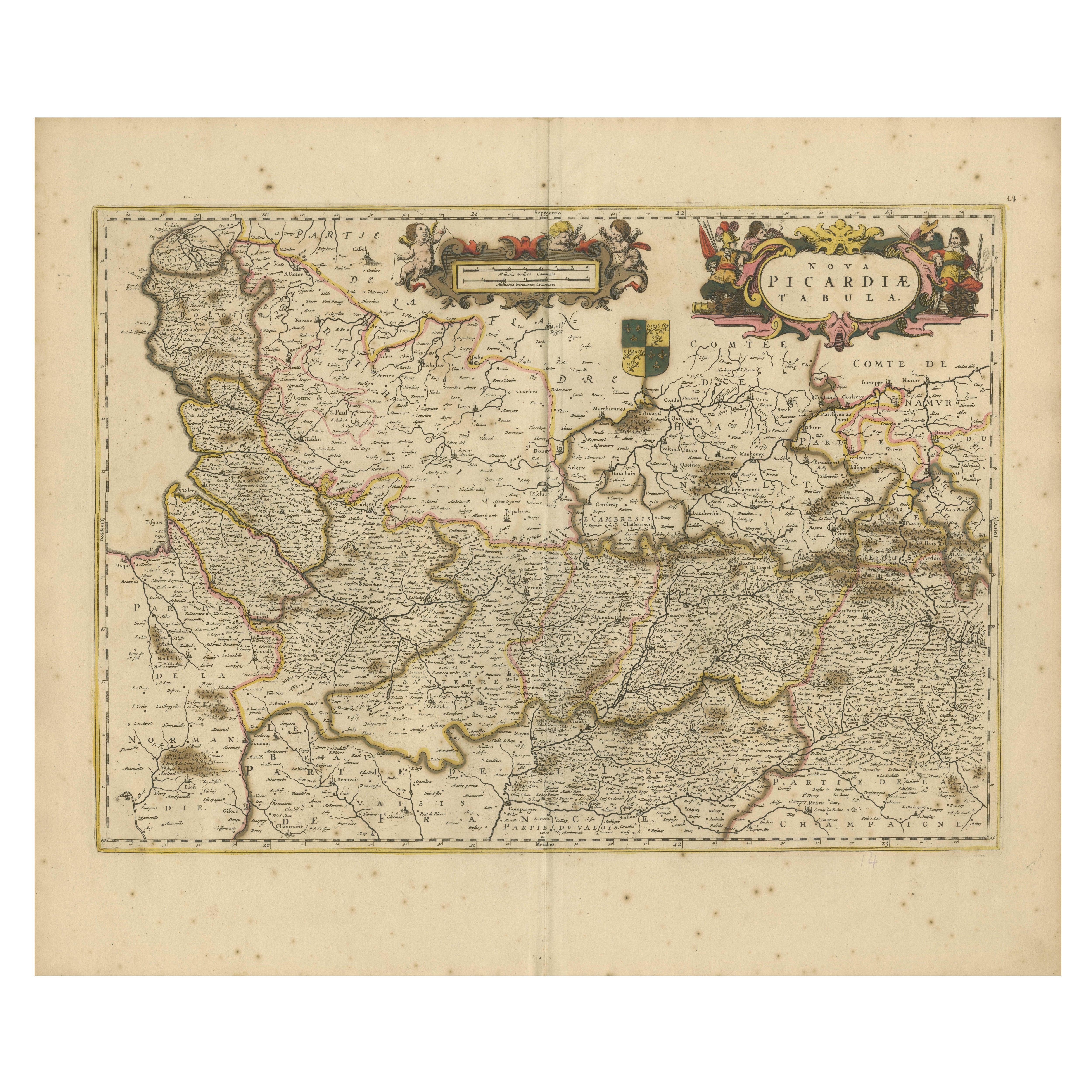
View AllPicardy Map - Hand-Colored 17th-Century Engraving by Frederik De Wit c. 1688
Located in Langweer, NL
Title: Picardy Map - Hand-Colored 17th-Century Engraving by Frederik De Wit c. 1688
Description: This beautifully detailed map, "Nova Picardiae Tabula," captures the Picardy region ...
Category
Antique 1680s Maps
Materials
Paper

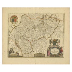
Hand-Colored 17th-Century Map of Orléanais in France by Frederik De Wit c. 1688
Located in Langweer, NL
Title: Hand-Colored 17th-Century Map of Orléanais by Frederik De Wit c. 1688
Description: This beautifully crafted map, "Gouvernement General du Pays Orléanois," illustrates the Orl...
Category
Antique 1680s Maps
Materials
Paper
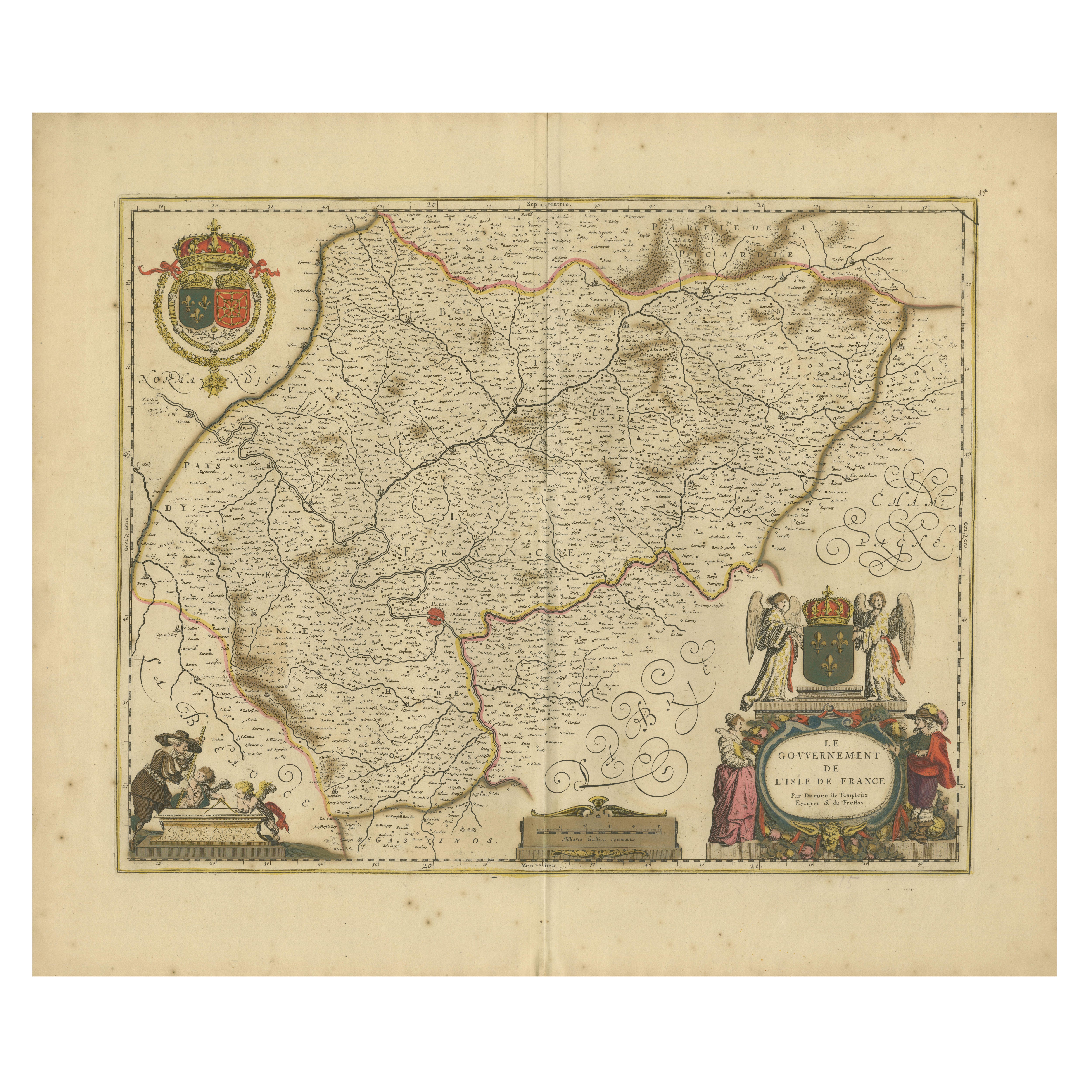
Île-de-France Map, including Paris - Hand-Colored Engraving by F. De Wit c. 1688
Located in Langweer, NL
Title: Hand-Colored 17th-Century Map of Île-de-France by Frederik De Wit c. 1688
Description: This striking map, "Le Gouvernement de l’Isle de France," showcases the Île-de-France r...
Category
Antique 1680s Maps
Materials
Paper
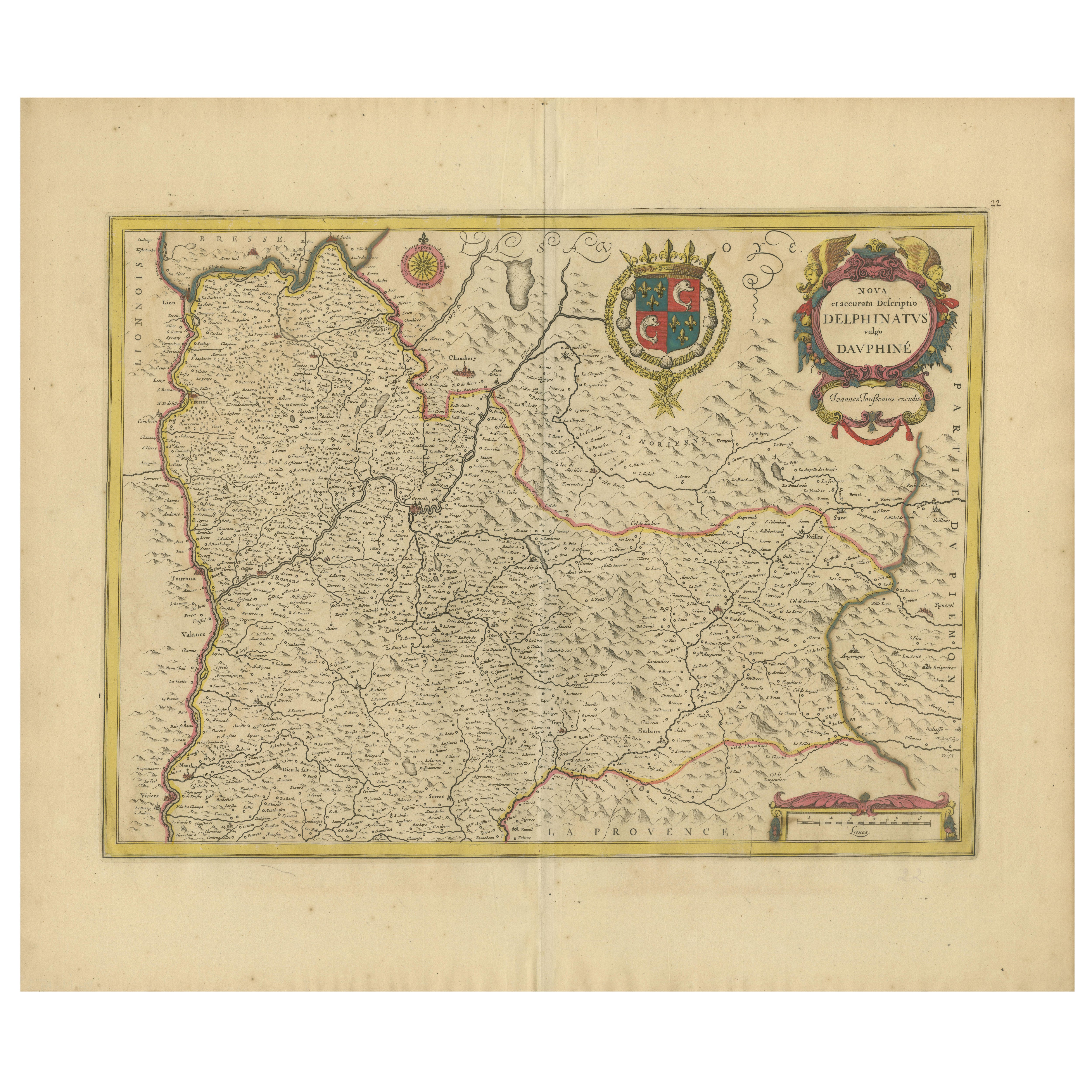
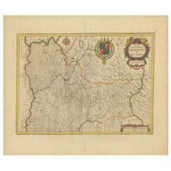
Rare 17th-Century Map of Dauphiné in Southeastern France by F. De Wit, ca.1688
Located in Langweer, NL
Title: Rare Hand-Colored 17th-Century Map of Dauphiné by Frederik De Wit c. 1688
Description: This captivating 17th-century map of Dauphiné, titled "Nova et Accurata Delphinatus Vul...
Category
Antique 1680s Maps
Materials
Paper
Rare Hand-Colored Map of Champagne and Brie, France, by Frederik De Wit c. 1688
Located in Langweer, NL
Title: Rare Hand-Colored Map of Champagne and Brie by Frederik De Wit c. 1688
Description: This exquisite 17th-century map, "Champagne et Brie," beau...
Category
Antique 1680s Maps
Materials
Paper
Rare Hand-Colored Map of Franche-Comté and Burgundy by Frederik De Wit c. 1688
Located in Langweer, NL
Title: Rare Hand-Colored Map of Franche-Comté and Burgundy by Frederik De Wit c. 1688
Description: This stunning 17th-century map, titled "Comitatus Burgundiae vulgo La Franche Comt...
Category
Antique 1680s Maps
Materials
Paper
You May Also Like
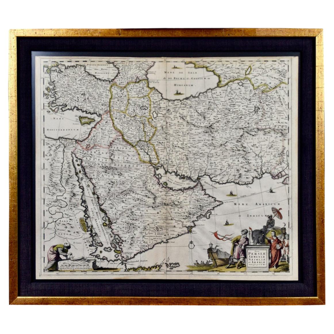
Persia, Armenia & Adjacent Regions: A 17th Century Hand-colored Map by De Wit
By Frederick de Wit
Located in Alamo, CA
A large 17th century hand colored copperplate engraved map entitled "Novissima nec non Perfectissima Scandinaviae Tabula comprehendens Regnorum Sueciae, Daniae et Norvegiae distincte...
Category
Antique Late 17th Century Dutch Maps
Materials
Paper

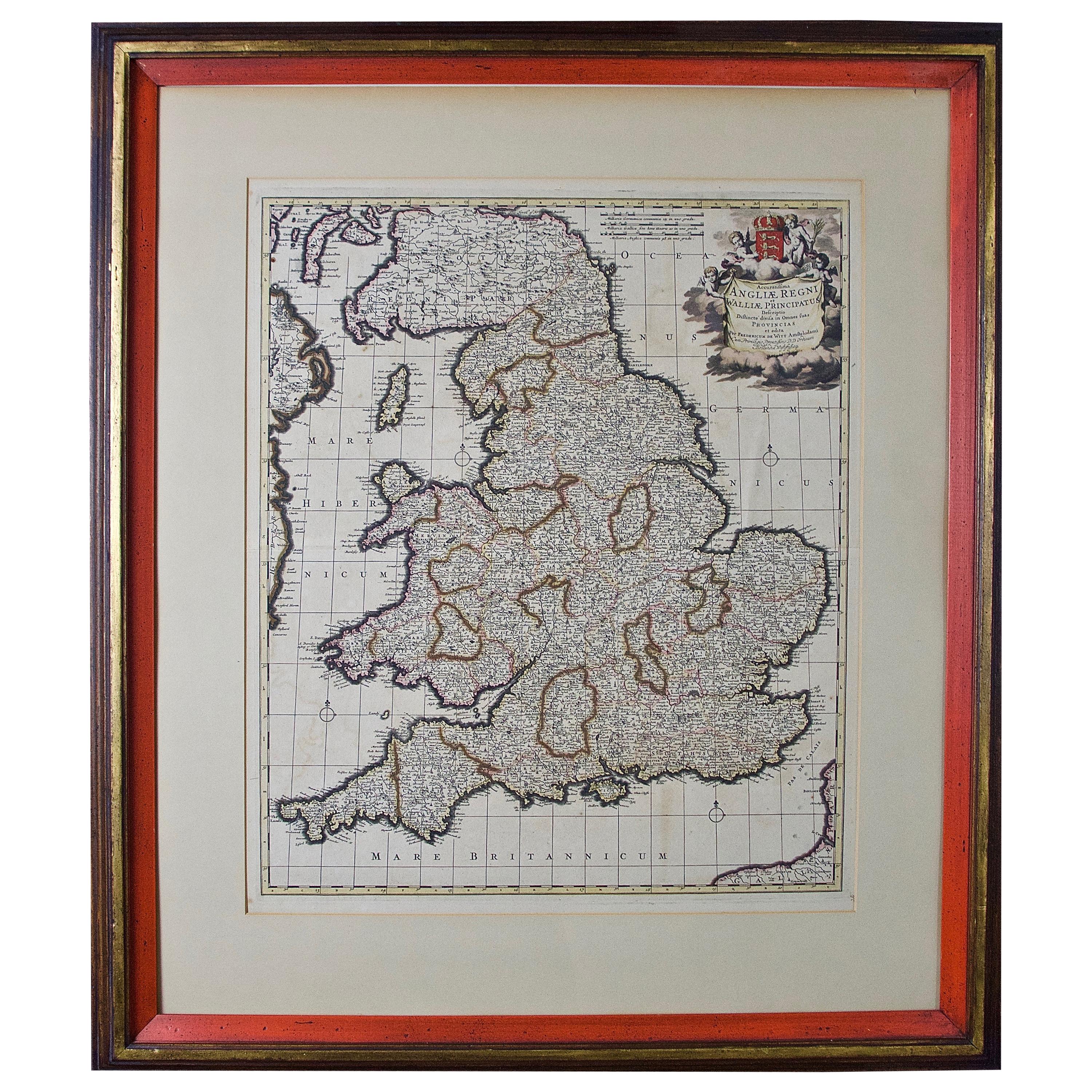
Large 17th Century Hand Colored Map of England and the British Isles by de Wit
By Frederick de Wit
Located in Alamo, CA
A large hand colored 17th century map of England and the British Isles by Frederick de Wit entitled "Accuratissima Angliæ Regni et Walliæ Principatus", published in Amsterdam in 1680. It is a highly detailed map of England, Scotland, the Scottish Isles...
Category
Antique Late 17th Century Dutch Maps
Materials
Paper

"Africa Vetus": a 17th Century Hand-Colored Map by Sanson
By Nicolas Sanson
Located in Alamo, CA
This original hand-colored copperplate engraved map of Africa entitled "Africa Vetus, Nicolai Sanson Christianiss Galliar Regis Geographi" was originally created by Nicholas Sanson d...
Category
Antique Late 17th Century French Maps
Materials
Paper

Northern Scotland: A 17th Century Hand-colored Map by Mercator
By Gerard Mercator
Located in Alamo, CA
This is a framed hand-colored 17th century map of Northern Scotland by Gerard Mercator entitled "Scotiae pars Septentrionalis", published in Amsterdam in 1636. It is a highly detailed map of the northern part of Scotland, with the northwest Highlands and the cities Inverness and Aberdeen, as well as the Orkney Islands and the Hebrides. There is a decorative title cartouche in the upper left corner.
The map is presented in an antiqued brown wood...
Category
Antique 1630s Dutch Maps
Materials
Paper

Southeastern Ireland: A 17th Century Hand Colored Map by Mercator and Hondius
By Gerard Mercator
Located in Alamo, CA
A 17th century copperplate hand-colored map entitled "The Second Table of Ireland, Udrone" by Gerard Mercator and Jodocus Hondius, published in Amsterdam in 1635 in 'Cosmographicall ...
Category
Antique Mid-17th Century Dutch Maps
Materials
Paper

Portugal: A Large 17th Century Hand-colored Map by Sanson and Jaillot
By Nicolas Sanson
Located in Alamo, CA
This large hand-colored map entitled "Le Royaume de Portugal et des Algarves Divisee en see Archeveches, Eveches et Territoires Par le Sr Sanson" was originally created by Nicholas S...
Category
Antique 1690s French Maps
Materials
Paper

Recently Viewed
View AllMore Ways To Browse
Classic Engraving
French Matting
17th Century Dutch Wood Frames
Cherub Engraving
French Coffee Bowl
French Salon Sofa
Fruit Knife
Furniture By Donghia
Genuine Sheepskin
German Colored Crystal Glass
Gilt Wall Sculpture Large
Glass Berry Bowl
Glass Mosaic Tile Wall Art
Hammock Designs
Hand Blown Glass Tumbler
Hand Blown Tumblers
Hand Painted Sugar Bowl
Industrial Sofa Three Seater