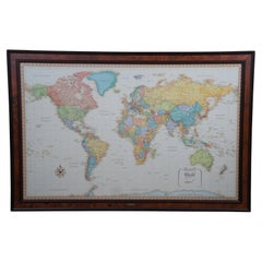
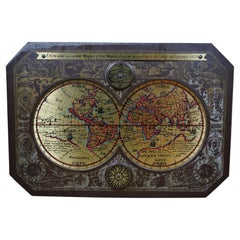
Frontgate Rand McNally World Classic Magnetic Travel Map with Burlwood Frame
View Similar Items


Want more images or videos?
Request additional images or videos from the seller
1 of 13
Frontgate Rand McNally World Classic Magnetic Travel Map with Burlwood Frame
About the Item
- Dimensions:Height: 36 in (91.44 cm)Width: 53 in (134.62 cm)Depth: 1 in (2.54 cm)
- Style:Modern (In the Style Of)
- Materials and Techniques:Burl,Paper
- Period:
- Date of Manufacture:Late 20th Century
- Condition:Wear consistent with age and use. Very Good; Gently Used (Does not include Magnets).
- Seller Location:Dayton, OH
- Reference Number:Seller: 366751stDibs: LU5343233321402

About the Seller
5.0
Platinum Seller
Premium sellers with a 4.7+ rating and 24-hour response times
Established in 2010
1stDibs seller since 2020
1,527 sales on 1stDibs
Authenticity Guarantee
In the unlikely event there’s an issue with an item’s authenticity, contact us within 1 year for a full refund. DetailsMoney-Back Guarantee
If your item is not as described, is damaged in transit, or does not arrive, contact us within 7 days for a full refund. Details24-Hour Cancellation
You have a 24-hour grace period in which to reconsider your purchase, with no questions asked.Vetted Professional Sellers
Our world-class sellers must adhere to strict standards for service and quality, maintaining the integrity of our listings.Price-Match Guarantee
If you find that a seller listed the same item for a lower price elsewhere, we’ll match it.Trusted Global Delivery
Our best-in-class carrier network provides specialized shipping options worldwide, including custom delivery.More From This Seller
View AllVincenzo Coronelli's Colored Map of the New World Western Hemisphere Framed 47"
By Vincenzo Coronelli
Located in Dayton, OH
A Framed Reproduction of Coronelli's Map of the New World, Attributed to Trevor James Company. The map shows the Western Hemisphere including the discoveries made by Abel Tasman in A...
Category
20th Century Maps
Materials
Paper

$1,080 Sale Price
20% Off
1964 Mid Century Masketeers Inc Wood & Brass Mappe of the World 1628 Map 44"
Located in Dayton, OH
Vintage 1964 wood and brass wall hanging produced by Masketeers Inc depicting "A New and accurate Mappe of the world, drawne according to the latest discoveries - 1628." Features a w...
Category
Vintage 1960s Elizabethan Decorative Art
Materials
Brass
$296 Sale Price
20% Off
20th Century Large Vintage Oval Wall Map of the World Globe Conference Table 13'
Located in Dayton, OH
Monumental oval classroom map of the world / wall globe from the second half of the 20th century. A two piece sculpture design made with heavy wood and metal trim paneling. Can be ...
Category
20th Century Maps
Materials
Metal

$2,400 Sale Price
20% Off
Antique Chicago Illinois National Map Commercial Rollup Classroom Census Map 47"
Located in Dayton, OH
Antique early to mid 20th century double sided hanging map titled the New Commercial and Census Map of Illinois, Edition 1073. Verso shows the National Map of Chicago and Suburbs - O...
Category
Early 20th Century North American Maps
Materials
Paper

$940 Sale Price
20% Off
Antique Colored Belgium Map Flandria Gallica Flanders Henricus Hondius
Located in Dayton, OH
Antique hand colored map of Flanders, Belgium, engraved by Henricus Hondius.
Sans frame - 21.25” x 18”.
Category
Antique 19th Century Renaissance Maps
Materials
Paper

$280 Sale Price
20% Off
Vintage Oversized New York City Lower Manhattan 1840s Map Print
Located in Dayton, OH
Vintage late 20th century reproduction print of New York City featuring lower Manhattan in 1840.
Category
Late 20th Century Victorian Maps
Materials
Paper

$800 Sale Price
20% Off
You May Also Like
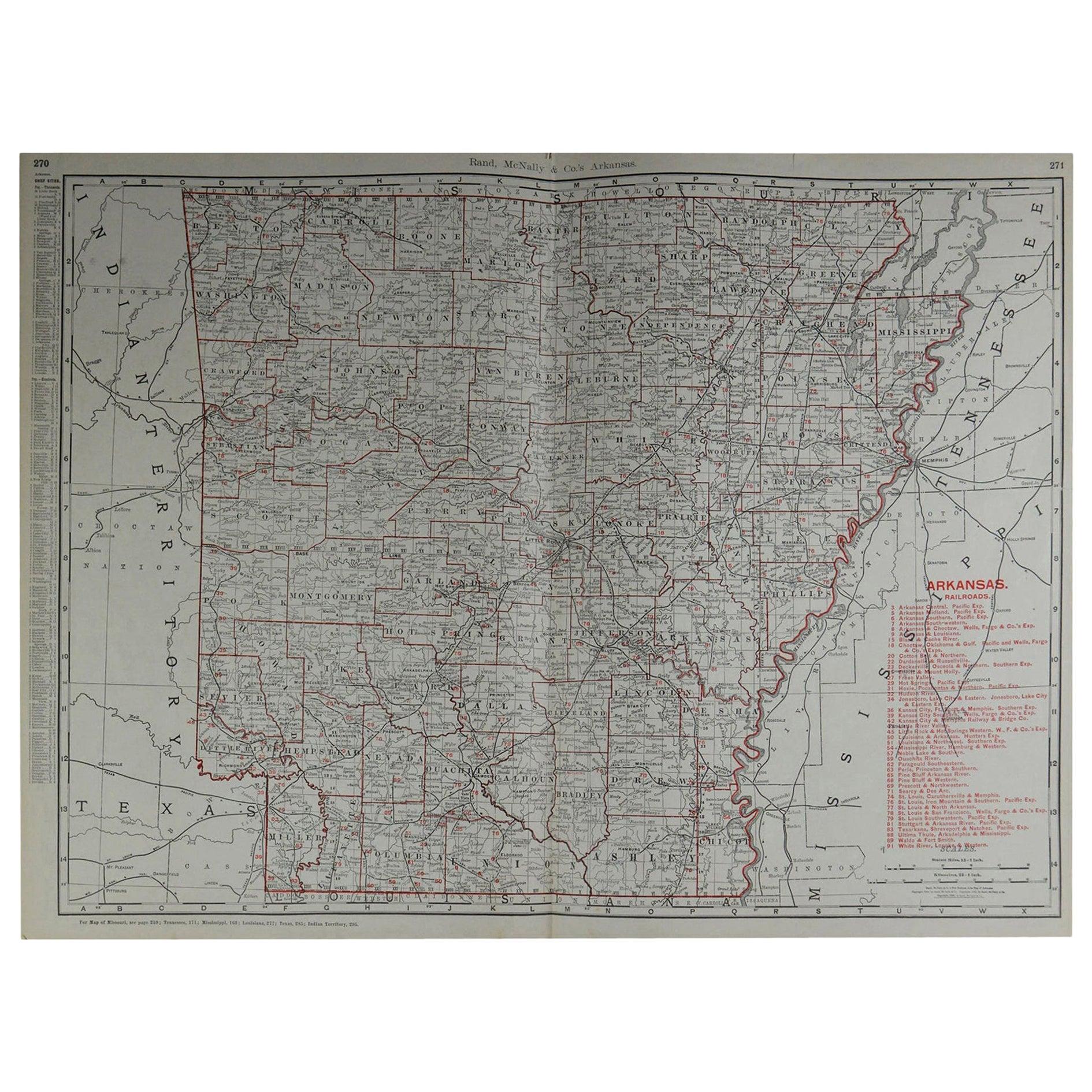
Large Original Antique Map of Arkansas by Rand McNally, circa 1900
By Rand McNally & Co.
Located in St Annes, Lancashire
Fabulous monochrome map with red outline color
Original color
By Rand, McNally & Co.
Published, circa 1900
Unframed
Minor edge tears.
Category
Antique Early 1900s American Edwardian Maps
Materials
Paper

Original Antique Map of South Dakota by Rand McNally, circa 1900
By Rand McNally & Co.
Located in St Annes, Lancashire
Fabulous monochrome map with red outline color
Original color
By Rand, McNally & Co.
Published, circa 1900
Unframed
Minor edge tears.
Category
Antique Early 1900s American Edwardian Maps
Materials
Paper

World Relief Map
Located in Antwerp, BE
Large world relief map.
Measures: Width 232 cm.
Height 158 cm.
Category
Mid-20th Century German Mid-Century Modern Maps
Materials
Acrylic

$2,079
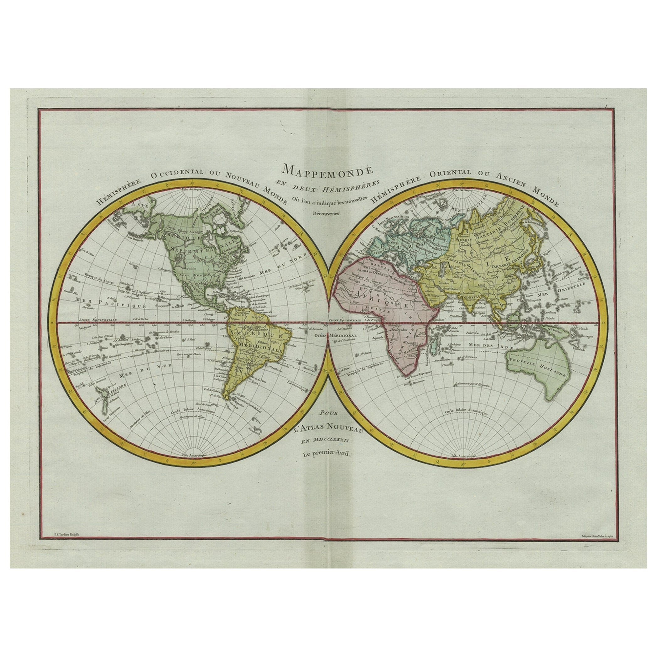
Large Original Antique Map of The World, Fullarton, C.1870
Located in St Annes, Lancashire
Great map of the World. Showing both hemispheres
From the celebrated Royal Illustrated Atlas
Lithograph. Original color.
Published by Fullarton, Edinburgh, C.1870
Unframed.
Rep...
Category
Antique 1870s Scottish Maps
Materials
Paper

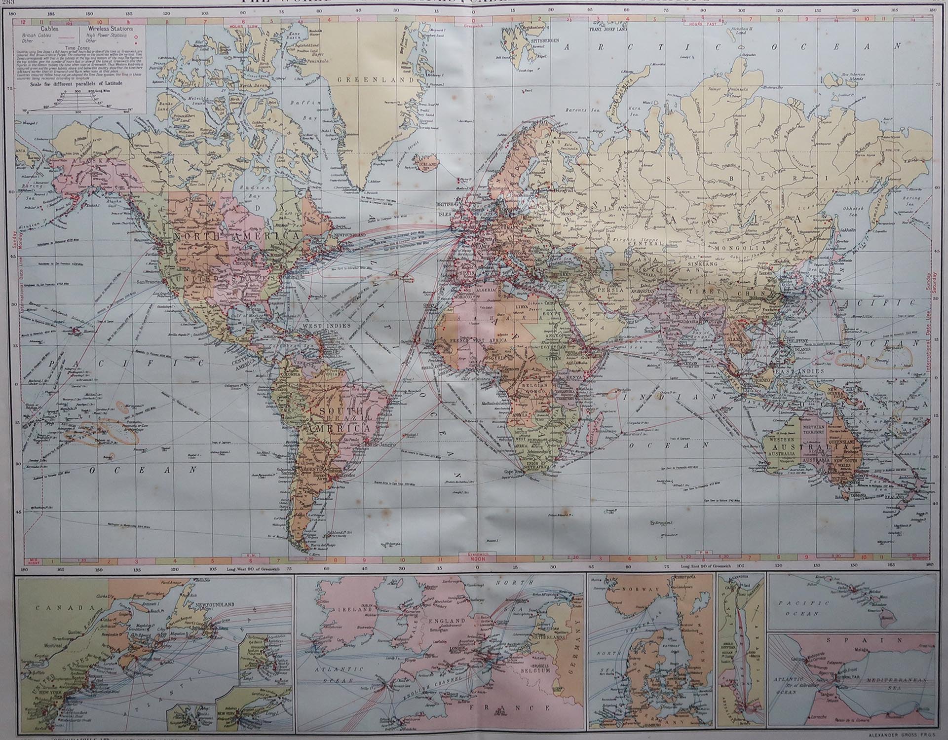
Large Original Vintage Map of The World, circa 1920
Located in St Annes, Lancashire
Great map of The World
Original color.
Good condition / minor foxing
Published by Alexander Gross
Unframed.
Category
Vintage 1920s English Maps
Materials
Paper

Large Original Antique Map of the World, Fullarton, circa 1870
Located in St Annes, Lancashire
Great map of the World.
From the celebrated Royal Illustrated Atlas
Lithograph. Original color.
Published by Fullarton, Edinburgh, circa 1870.
Unframed.
Category
Antique 1870s Scottish Maps
Materials
Paper

Recently Viewed
View AllMore Ways To Browse
Burlwood Frame
Rectangular Coffee Tables Chinese
Round Armchair Art Deco
Round Dining Table 180 Cm
Rounded Rosewood Dining Table
Safari Directors Chairs
Sculptural Barstool
Set Of 10 Mahogany Dining Chairs
Set Of 6 Woven Dining Chairs
Set Of Panton Chairs
Set Of Three Glass Nesting Tables
Settee Bench Antique
Sevres Table With Bronze
Silver Wall Plaque
Slat Stool
Slatted Stool
Square Side Table Brass Pair
Swedish Neoclassical Table