Items Similar to Early, Rare and Small Hand-Coloured Copper Engraving of Greece, ca. 1602
Want more images or videos?
Request additional images or videos from the seller
1 of 5
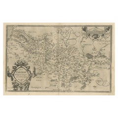
Early, Rare and Small Hand-Coloured Copper Engraving of Greece, ca. 1602
About the Item
Attractive minature map of Greece or 'Graecia"
Maker/Publisher: A. Ortelius/A. en F. Arsenius / M Coignet / J. van Keerbergen - 1601-1620
With a simple title cartouche. Over the frame it reads 'Grece' and page nr 89. Verso French text.
The accompanying text is by Michael Coignet. The map is engraved by brothers Ambrosius and Ferdinand Arsenius (Aertsen).
Published in 'L'Epitome du théatre de l 'univers' published by Johannes van Keerbergen in Antwerp in 1602.
Dimensions: map 8.5 x 11.6 cm - page: approx. 13 x 16.5 cm.
Condition: very good. Powerful print. Nice hand-colouration. Minor signs of use on the margins, outside the image.
- Dimensions:Height: 5.12 in (13 cm)Width: 6.5 in (16.5 cm)Depth: 0 in (0.02 mm)
- Materials and Techniques:
- Period:Early 17th Century
- Date of Manufacture:1602
- Condition:
- Seller Location:Langweer, NL
- Reference Number:Seller: BG-131051stDibs: LU3054326059912
About the Seller
5.0
Recognized Seller
These prestigious sellers are industry leaders and represent the highest echelon for item quality and design.
Platinum Seller
Premium sellers with a 4.7+ rating and 24-hour response times
Established in 2009
1stDibs seller since 2017
2,412 sales on 1stDibs
Typical response time: 1 hour
- ShippingRetrieving quote...Shipping from: Langweer, Netherlands
- Return Policy
Authenticity Guarantee
In the unlikely event there’s an issue with an item’s authenticity, contact us within 1 year for a full refund. DetailsMoney-Back Guarantee
If your item is not as described, is damaged in transit, or does not arrive, contact us within 7 days for a full refund. Details24-Hour Cancellation
You have a 24-hour grace period in which to reconsider your purchase, with no questions asked.Vetted Professional Sellers
Our world-class sellers must adhere to strict standards for service and quality, maintaining the integrity of our listings.Price-Match Guarantee
If you find that a seller listed the same item for a lower price elsewhere, we’ll match it.Trusted Global Delivery
Our best-in-class carrier network provides specialized shipping options worldwide, including custom delivery.More From This Seller
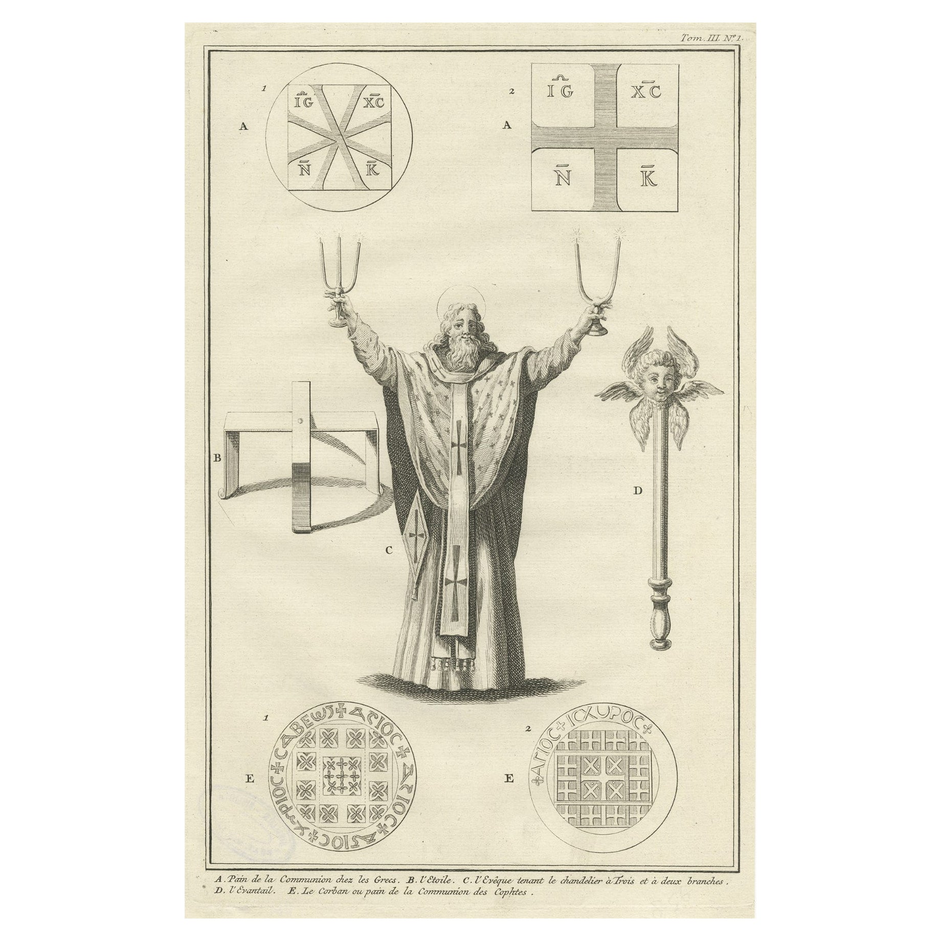
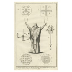
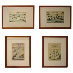
View AllAntique Engraving of Greek Religious Ceremonies, ca.1730
Located in Langweer, NL
Antique print of various Greek religious ceremonies. With French description.
Artists and Engravers: Anonymous
Condition: Very good. Stamp on ...
Category
Antique 1730s Prints
Materials
Paper
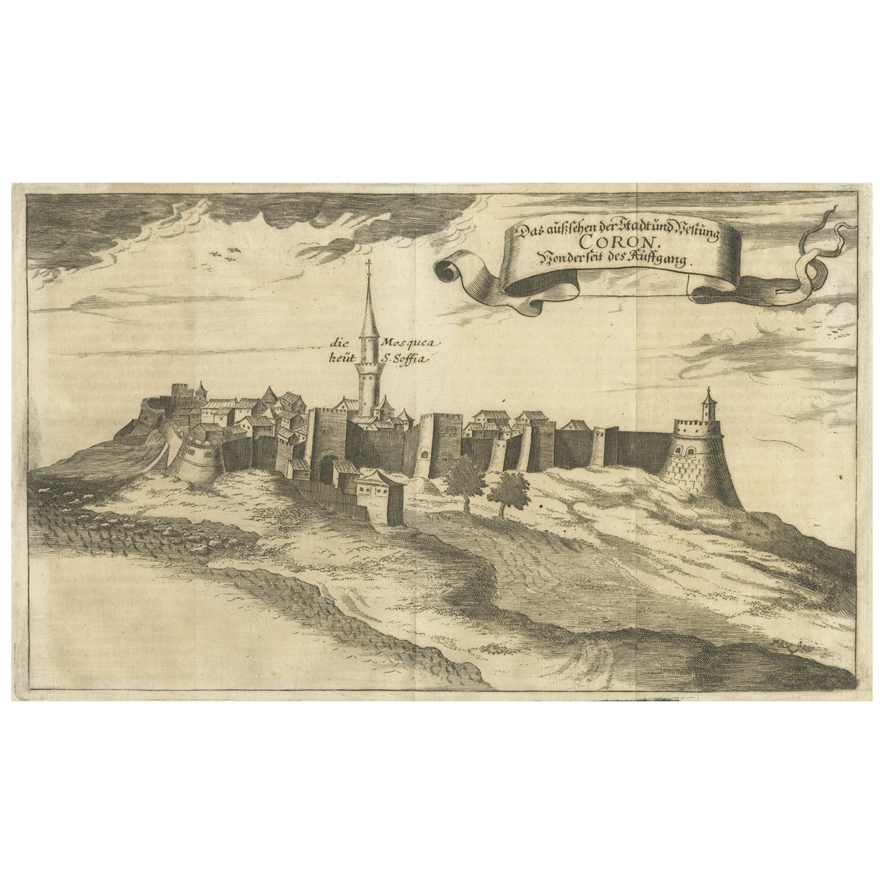
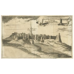
Original Copper Engraving of Koroni 'or Corone', Greece, 1688
Located in Langweer, NL
Antique print titled 'Das Aussehen der Stadt und Vestung Coron von der Seit des Auffgang'.
Copper engraving of Koroni (or Corone), Greece. This print originates from 'Ruhm-belorb...
Category
Antique 1680s Maps
Materials
Paper
$240 Sale Price
20% Off
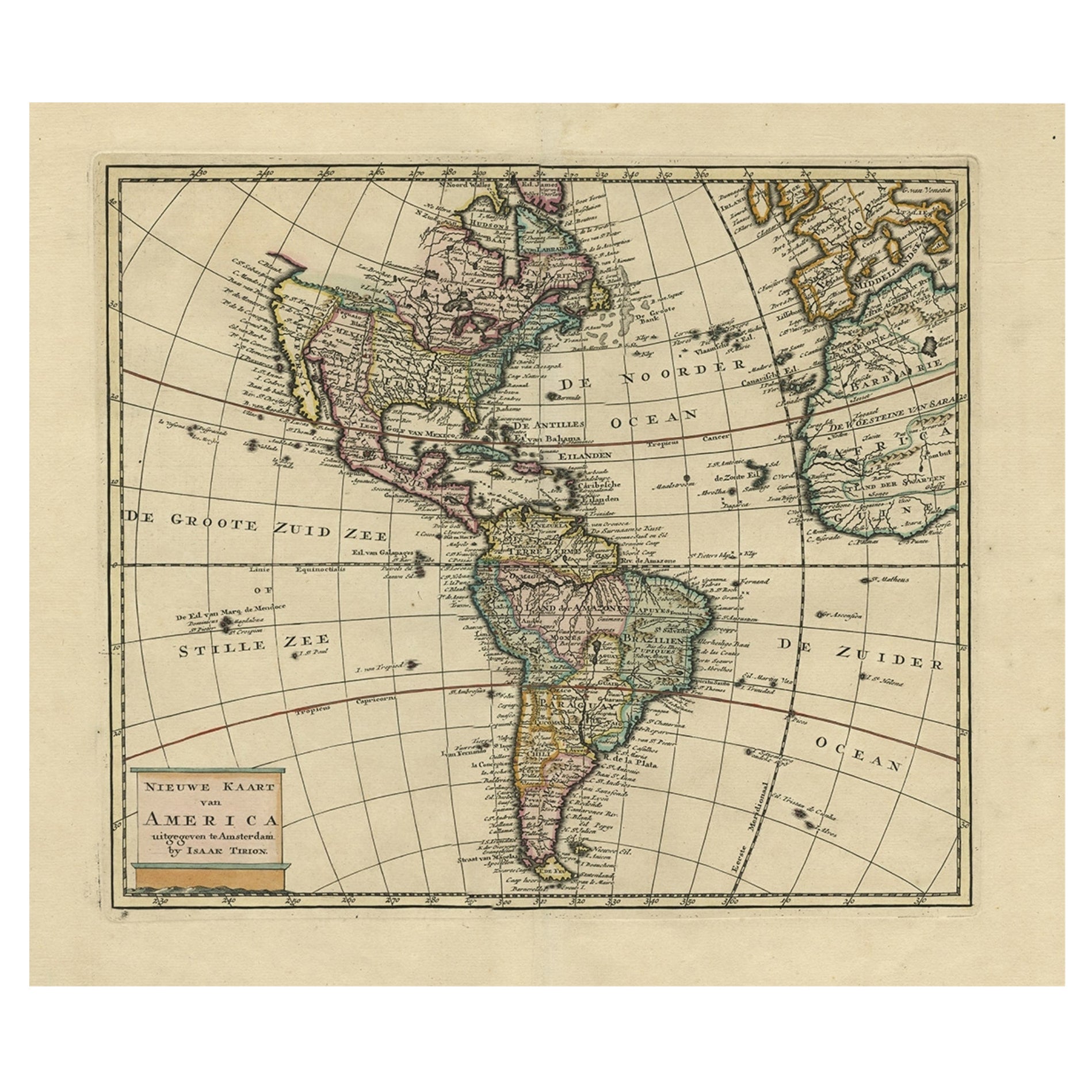
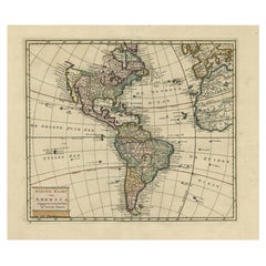
Antique Hand-Coloured Map of North and South America, ca.1765
Located in Langweer, NL
Description: Antique map titled 'Nieuwe Kaart van Amerika.' Attractive map of North and South America, the western part of Africa and south west Europe. Source unknown, to be determi...
Category
Antique 1760s Maps
Materials
Paper
$1,156 Sale Price
20% Off
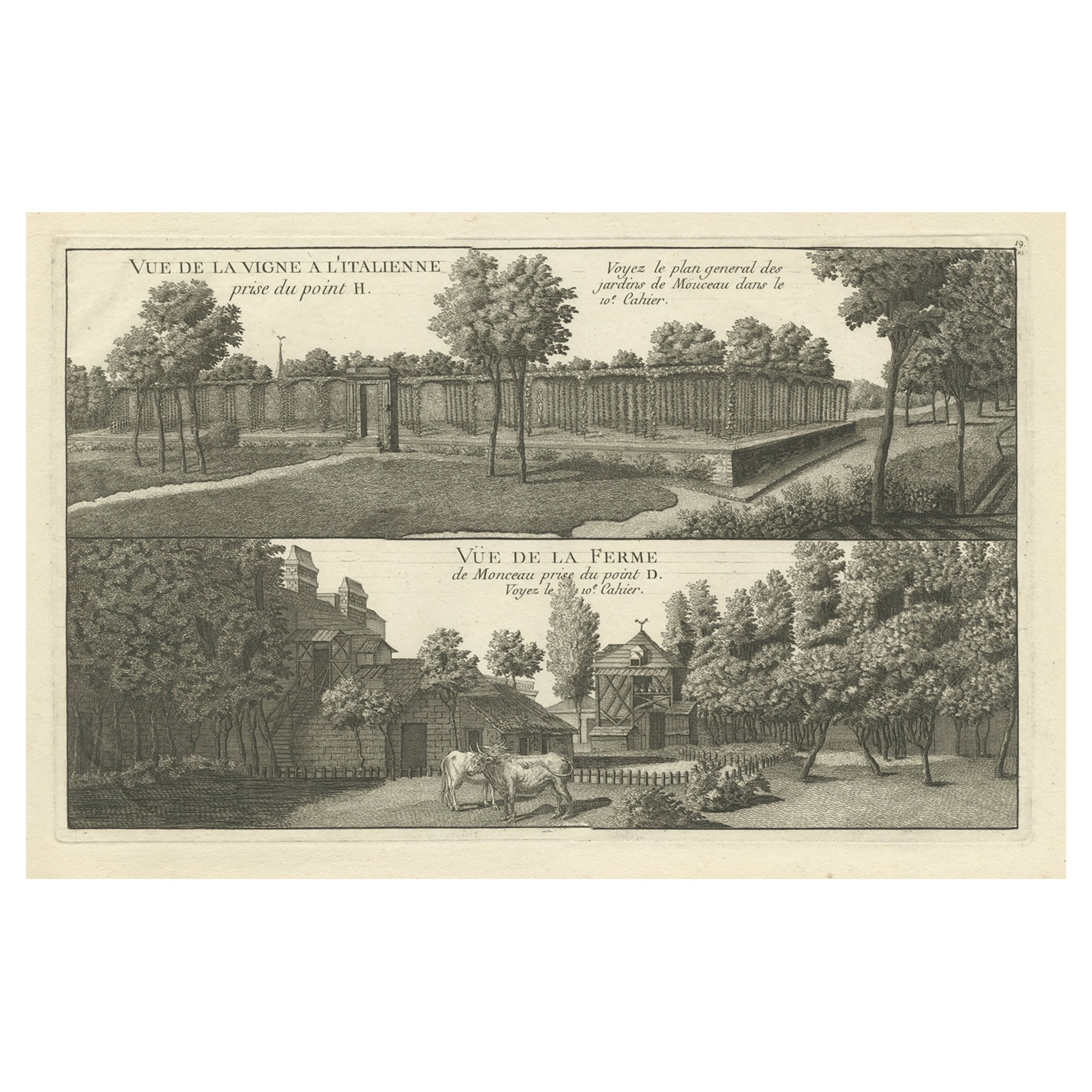
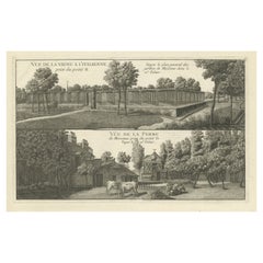
Antique Copper Engraving of an Italian Vineyard and a Farm, ca.1785
Located in Langweer, NL
Antique print titled 'Vue de la Vigne a l'Italienne (..)'.
Copper engraving of an Italian vineyard and a farm. This print originates from 'Jardins ...
Category
Antique 1780s Architectural Models
Materials
Paper
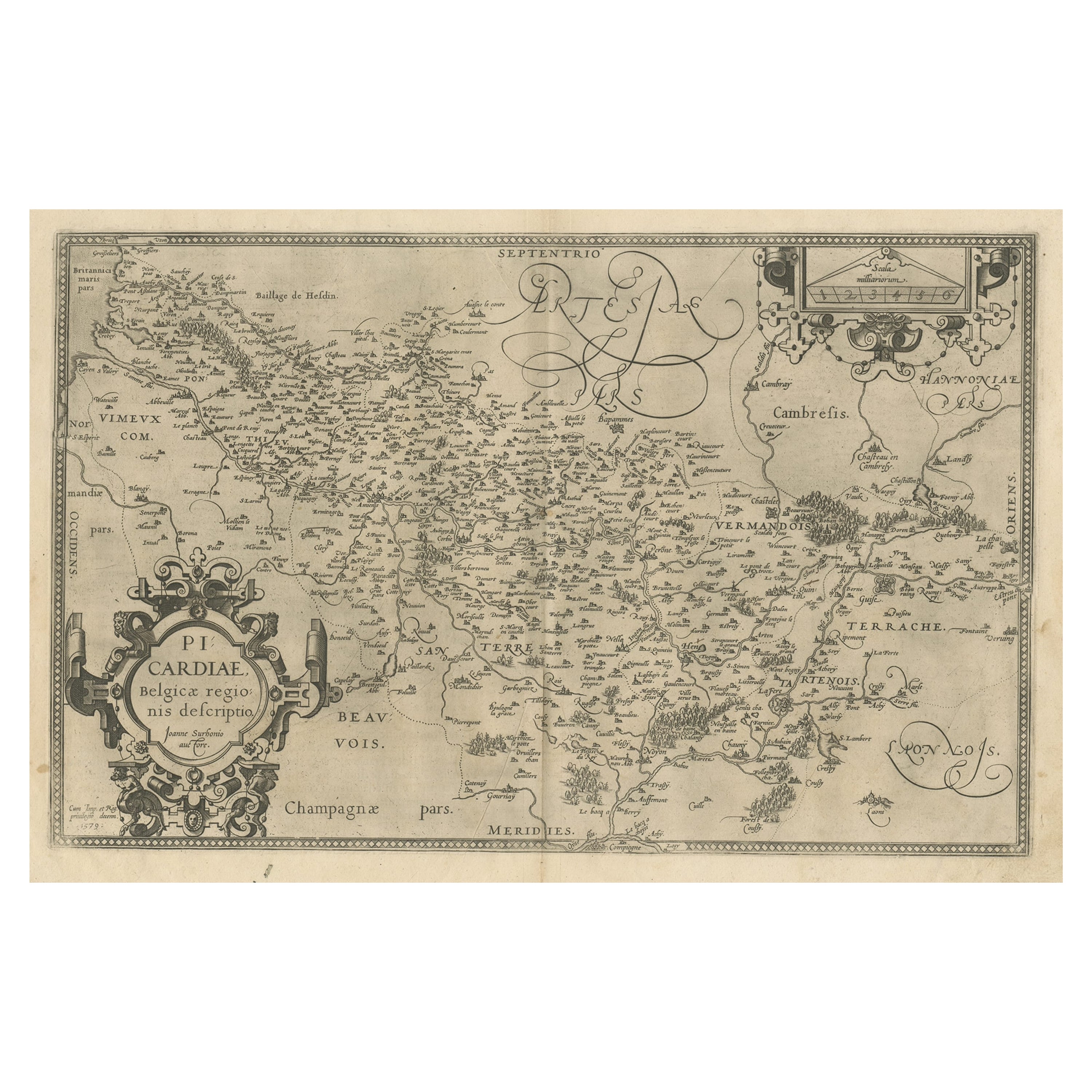
Original Antique Map of the Region of Picardy, France, ca.1602
Located in Langweer, NL
Antique map titled 'Picardiae Belgicae regionis descriptio'.
Original antique map of the region of Picardy, France. Superb example of the decorative style of Ortelius and filled ...
Category
Antique Early 1600s Maps
Materials
Paper
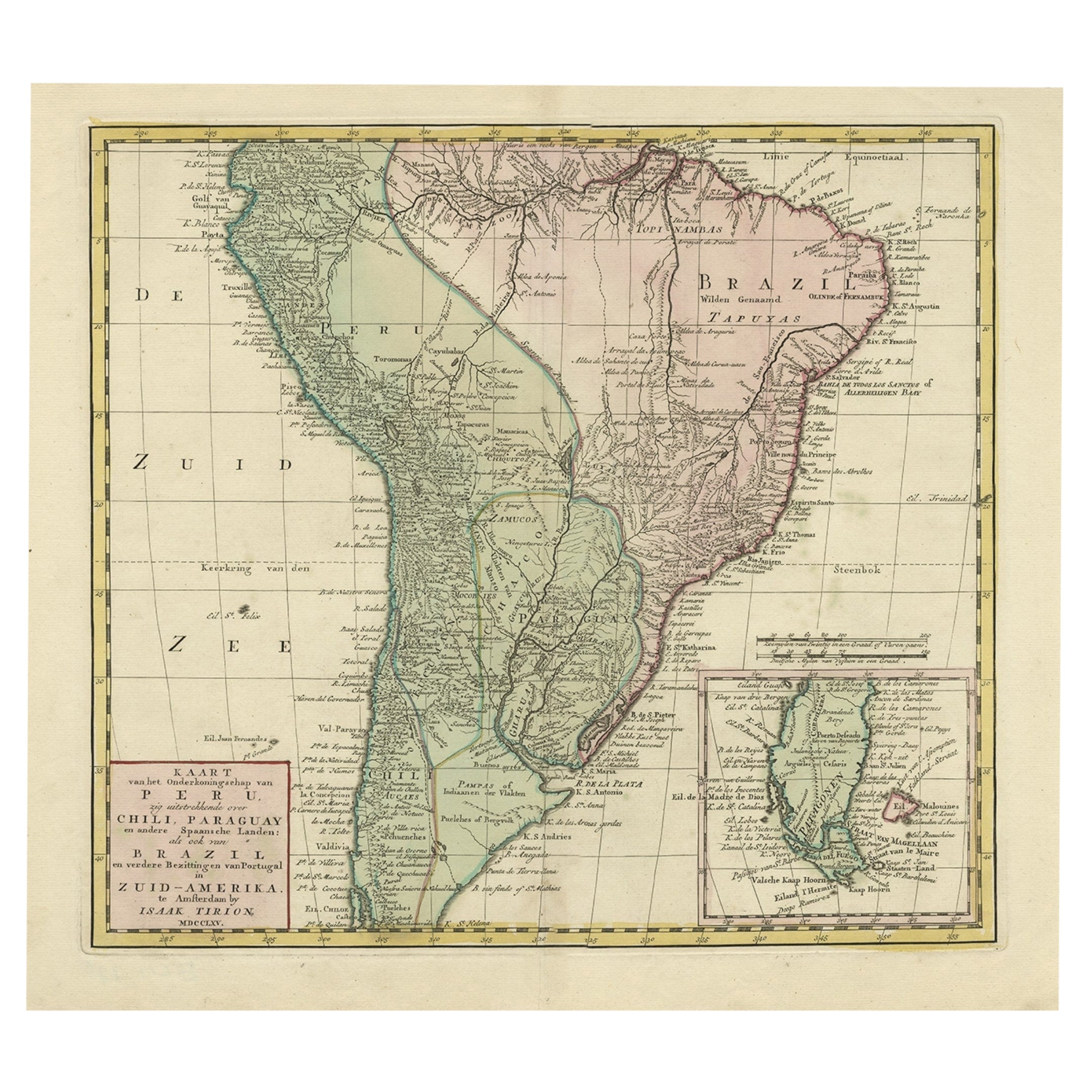
Attractive Antique Hand-Coloured Map of South America, ca.1765
Located in Langweer, NL
Antique map titled 'Kaart van het Onderkoningschap van Peru zig uitstrekkende: over Chile, Paraguay en andere Spaansche Landen als ook van Brazil en verdere Bezittingen van Portugal ...
Category
Antique 1760s Maps
Materials
Paper

$1,156 Sale Price
20% Off
You May Also Like
Rare Lynn Bogue Hunt Engraving of Ducks Unlimited, 1940
By Lynn Bogue Hunt
Located in Dallas, TX
Presenting a Rare Lynn Bogue Hunt engraving of ducks unlimited 1940.
This piece cam from a wealthy estate in Dallas, TX with the mansion being built...
Category
Mid-20th Century American Sporting Art Prints
Materials
Paper
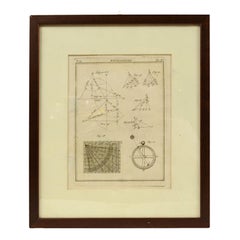
Engraving on Copper Print from the Volume Navigazione Nautical Subject 1790
Located in Milan, IT
Print by engraving on copper plate Tav III TIX fig. 17-22 from the volume Navigazione; with frame 28 x 33. Some calculations are depicted. Very good condition.
Shipping is insured by...
Category
Antique 1790s Italian Nautical Objects
Materials
Paper
Southern Greece: A Large 17th C. Hand-colored Map by Sanson and Jaillot
By Nicolas Sanson
Located in Alamo, CA
This large original hand-colored copperplate engraved map of southern Greece and the Pelopponese Peninsula entitled "La Moree Et Les Isles De Zante, Cefalonie, Ste. Marie, Cerigo & C...
Category
Antique 1690s French Maps
Materials
Paper

Hand-Colored 18th Century Homann Map of the Danube, Italy, Greece, Croatia
By Johann Baptist Homann
Located in Alamo, CA
"Fluviorum in Europa principis Danubii" is a hand colored map of the region about the Danube river created by Johann Baptist Homann (1663-1724) in his 'Atlas Novus Terrarum', publish...
Category
Antique Early 18th Century German Maps
Materials
Paper

18th century Set Hand Colored Nautical Engravings
By M. Ogier
Located in Savannah, GA
Signed M. Ogier (Fecit:by), this set of four hand colored engravings is part of a larger edition of plates. These plates are numbered PL 16, 347, 365 and 386. The subject is probably...
Category
Antique 18th Century Unknown Elizabethan Prints
Materials
Glass, Wood, Paper
$1,275 Sale Price / set
50% Off
Lithographic print on paper, depicting the atlas of the hand, France 1850 ca.
Located in Milan, IT
An anatomical lithographic print on paper, depicting the anatomical atlas of the hand. Black lacquered fir wood frame with golden ramin wood batting. N. H. Ja...
Category
Antique Mid-19th Century French Prints
Materials
Glass, Wood, Paper

Recently Viewed
View AllMore Ways To Browse
Antwerp Map
Astrology Map
J Schwabe
Mauritius Antique Map
Tanzania Antique Map
Tartaria Map
Antique Map Puzzle
Georgetown Map
Johann Baptist Homann On Sale
John Wyld
North Carolina Native Americans 1800
Nova Hollandia
Aden Yemen
Antique Chesapeake Bay Map
Antique Town Plan Of Jerusalem
Chesapeake Bay Map
Globe Terrestre Par Felix Delamarche
Hydra Map