Items Similar to Detailed Map of the Madura Strait, between Java & Madura Island, Indonesia, 1825


Want more images or videos?
Request additional images or videos from the seller
1 of 6
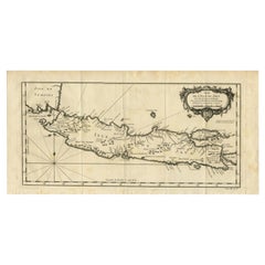
Detailed Map of the Madura Strait, between Java & Madura Island, Indonesia, 1825
About the Item
Antique map titled 'Plan du Détroit de Madura'.
Detailed map of the Madura Strait in Indonesia. The eastern part of the island Java with the city of Gresik and the western part of Pulau Madura with the city Bangkalam. In the lower part of the map a view of the strait of Madura between Java and the Fort d'Orange. This map originates from 'Journal de la navigation autour du globe de la frégate "la Thétis" et de la corvette "l'Espérance"'.
Artists and Engravers: Ambroise Tardieu ( 1788 - 1841 in Paris) was an eminent French cartographer and engraver, and is celebrated for his version of John Arrowsmith's 1806 map of the United States. Tardieu's son, Auguste Ambroise Tardieu (1818-1879), was also an artist and a famous forensic medical scholar, who supplied the illustrations for Dr. Pierre François Olive Rayer's three-volume Traité des maladies des reins (1839-41), a treatise on diseases of the kidneys.
- Dimensions:Height: 26.78 in (68 cm)Width: 19.89 in (50.5 cm)Depth: 0 in (0.02 mm)
- Materials and Techniques:
- Period:
- Date of Manufacture:1825
- Condition:Wear consistent with age and use. Condition: Fair, general age-related toning. Few marginal tears and some creasing. Please study image carefully.
- Seller Location:Langweer, NL
- Reference Number:Seller: BG-00761 1stDibs: LU3054327034252
About the Seller
5.0
Recognized Seller
These prestigious sellers are industry leaders and represent the highest echelon for item quality and design.
Platinum Seller
Premium sellers with a 4.7+ rating and 24-hour response times
Established in 2009
1stDibs seller since 2017
2,412 sales on 1stDibs
Typical response time: 1 hour
- ShippingRetrieving quote...Shipping from: Langweer, Netherlands
- Return Policy
Authenticity Guarantee
In the unlikely event there’s an issue with an item’s authenticity, contact us within 1 year for a full refund. DetailsMoney-Back Guarantee
If your item is not as described, is damaged in transit, or does not arrive, contact us within 7 days for a full refund. Details24-Hour Cancellation
You have a 24-hour grace period in which to reconsider your purchase, with no questions asked.Vetted Professional Sellers
Our world-class sellers must adhere to strict standards for service and quality, maintaining the integrity of our listings.Price-Match Guarantee
If you find that a seller listed the same item for a lower price elsewhere, we’ll match it.Trusted Global Delivery
Our best-in-class carrier network provides specialized shipping options worldwide, including custom delivery.More From This Seller
View AllAntique Map of Java, Madura, Bali and the Sunda Strait, Indonesia, c.1770
Located in Langweer, NL
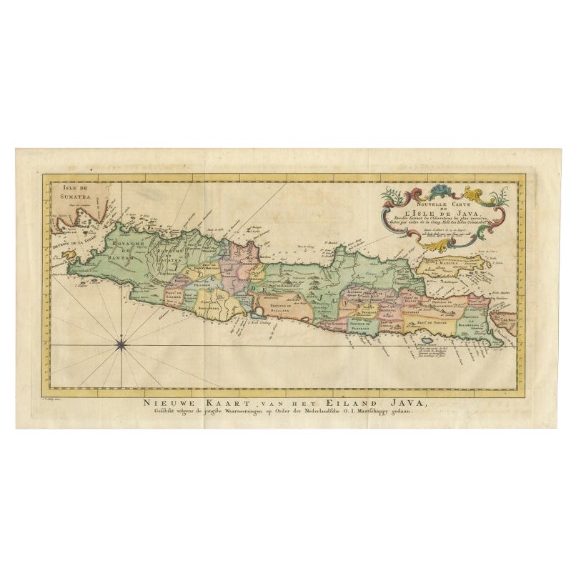
Antique map Indonesia titled 'Nouvelle Carte de l'Isle de Java - Nieuwe kaart, van het Eiland Java'. Chart of the island of Java, depicting soun...
Category
Antique 18th Century Maps
Materials
Paper
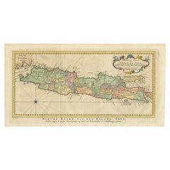
Antique Map of Java and Madura Island, Indonesia, c.1760
Located in Langweer, NL
Antique map titled 'Idee de l'Isle de Java.'
Well engraved and attractive chart of the island shows all principal harbors and coastal details, plus rivers, mountains and volcanoe...
Category
Antique 18th Century Maps
Materials
Paper
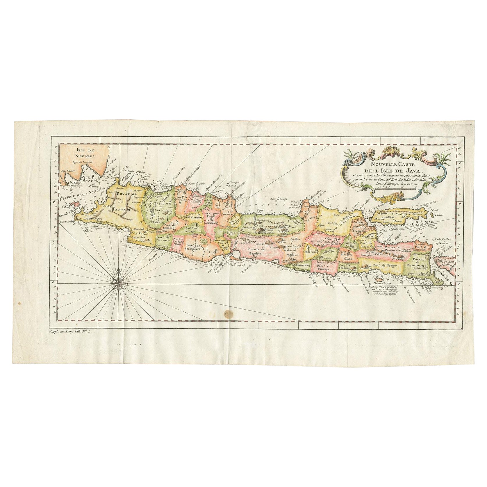
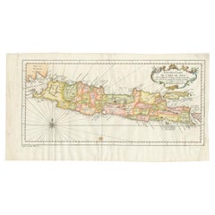
Antique Colourful Map of the Island of Java and Madura, Indonesia, C.1760
Located in Langweer, NL
Antique map titled 'Nouvelle Carte de l'Isle de Java'.
Chart of the island of Java, depicting soundings around the coast, all principal harbors, rivers and elevations, bays and p...
Category
Antique 18th Century Maps
Materials
Paper
$416 Sale Price
20% Off
Antique Map of the Island Java, Indonesia, c.1650
Located in Langweer, NL
Antique map titled 'Insulae Iavae cum parte insularum Boreno Sumatrae (..)'.
Beautiful map of the island of Java and part of Borneo, Bali, Madura and Sumatra. With decorative carto...
Category
Antique 17th Century Maps
Materials
Paper

$2,819 Sale Price
24% Off
Scarce Antique Map of the Island of Java, Indonesia
Located in Langweer, NL
Title: "Kaart van 't Eyland Groot Java: Antique Map of Java, Indonesia"
Description: This antique map, titled "Kaart van 't Eyland Groot Java," offers a rare and valuable depiction ...
Category
Antique Late 18th Century Maps
Materials
Paper

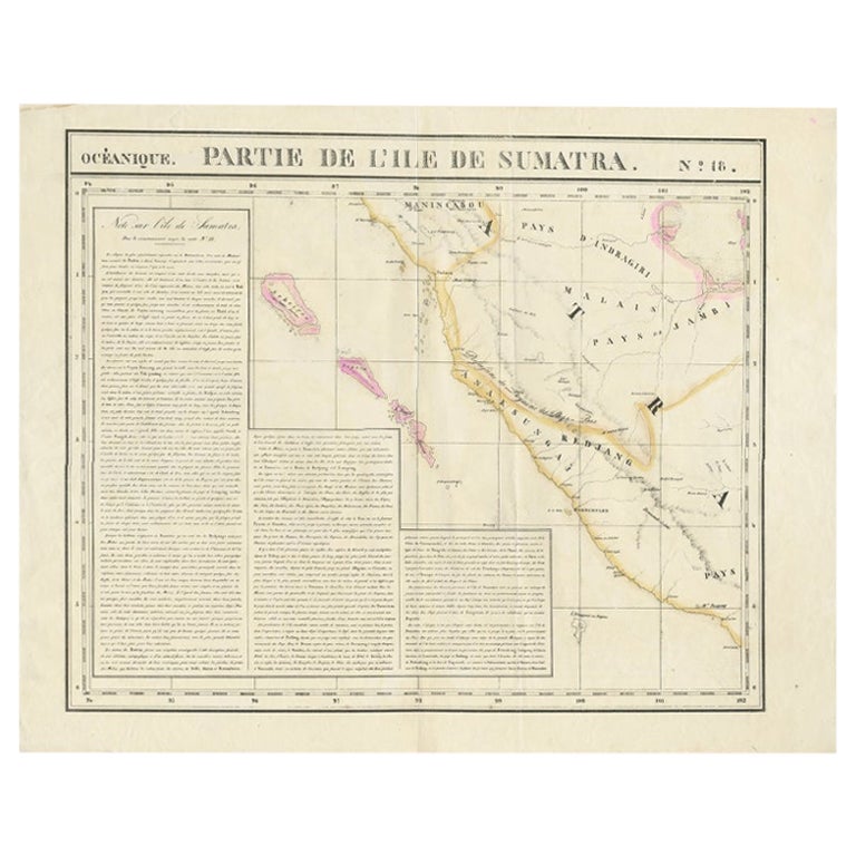
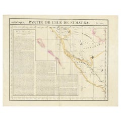
Detailed Antique Map of the Western Sumatra, Indonesia, circa 1825
Located in Langweer, NL
Antique map titled 'Partie de l'Ile de Sumatra'. Chart showing the western part of Sumatra. Originates from 'Atlas Universel' by P.M. Vandermaelen.
Artists and Engravers: Philipp...
Category
Antique 19th Century Maps
Materials
Paper
You May Also Like
Hand-Colored 18th Century Homann Map of Denmark and Islands in the Baltic Sea
By Johann Baptist Homann
Located in Alamo, CA
An 18th century copper plate hand-colored map entitled "Insulae Danicae in Mari Balthico Sitae utpote Zeelandia, Fionia, Langelandia, Lalandia, Falstria, Fembria Mona" created by Joh...
Category
Antique Early 18th Century German Maps
Materials
Paper

Map of the Republic of Genoa
Located in New York, NY
Framed antique hand-coloured map of the Republic of Genoa including the duchies of Mantua, Modena, and Parma.
Europe, late 18th century.
Dimension: 25...
Category
Antique Late 18th Century European Maps

Map "Estuary- Mouth of the Thames"
Located in Alessandria, Piemonte
ST/426 - Antique French Map of the estuary of the Thames, map dated 1769 -
"Mape of the entrance of the Thames. Designed by filing of Navy cards fo...
Category
Antique Mid-18th Century French Other Prints
Materials
Paper

Vintage "View of the Center of Paris Taken from the Air" Lithograph Map
Located in San Diego, CA
A very stylish "View of the Center of Paris Taken from the Air" lithograph map published by the Paris Ministry of Tourism, circa early 1950s. The piece measures 27" x 43" and shows...
Category
20th Century French Mid-Century Modern Prints
Materials
Paper

$680 Sale Price
20% Off
New Map of North America from the Latest Discoveries, 1763
Located in Philadelphia, PA
A fine antique 18th century map of the North American seaboard.
Entitled "A New Map of North America from the Latest Discoveries 1763".
By the Cartographer/Engraver - John Spil...
Category
Antique Mid-18th Century English Georgian Maps
Materials
Paper

Antique 18th Century Map of the Province of Pensilvania 'Pennsylvania State'
Located in Philadelphia, PA
A fine antique of the colony of Pennsylvania.
Noted at the top of the sheet as a 'Map of the province of Pensilvania'.
This undated and anonymous map is thought to be from the Gentleman's Magazine, London, circa 1775, although the general appearance could date it to the 1760's.
The southern boundary reflects the Mason-Dixon survey (1768), the western boundary is placed just west of Pittsburgh, and the northern boundary is not marked.
The map has a number of reference points that likely refer to companion text and appear to be connected to boundaries. The western and southern boundaries are marked Q, R, S, for example. A diagonal line runs from the Susquehanna R to the Lake Erie P. A broken line marked by many letters A, B, N, O, etc., appears in the east.
There are no latitude or longitude markings, blank verso.
Framed in a shaped contemporary gilt wooden frame and matted under a cream colored matte.
Bearing an old Graham Arader Gallery...
Category
Antique 18th Century British American Colonial Maps
Materials
Paper

Recently Viewed
View AllMore Ways To Browse
Medical Collectibles
Antique Furniture Detroit
Medical Curiosities
Antique Medical Collectibles
Schumacher Pillows Black
Short Bench
Silver Mustard Spoons
Smooth Stone Coffee Table
Spindle Windsor
Step Stool
Swing Leg Table
Tapered Wood Pedestal
Thayer Coggin Chair Chrome
The Couch Navone
Three Footed Bowl
Throne Cover
Travertine Italian Pedestal
Tubular Steel Coffee Table