Items Similar to Authentic Old Map of Sumatra, Malaysia and Singapore, 1745

Want more images or videos?
Request additional images or videos from the seller
1 of 6
Authentic Old Map of Sumatra, Malaysia and Singapore, 1745
About the Item
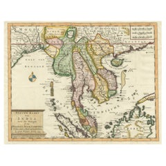
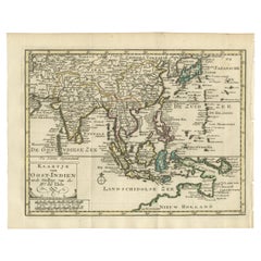
Title: "Kaartje van't Eiland Sumatra en de Maleidse Kust gelegen na de stelling van de G. de L'Isle"
Published by Jacob Keizer and by Jan de Lat
Creator: Keizer, Jacob, active 1706-1750
Size: 17.10 x 24.20cm.
The phrase "Kaartje van't Eiland Sumatra en de Maleidse Kust gelegen na de stelling van de G. de L'Isle" translates to "Map of the Island of Sumatra and the Malayan Coast based on the work of G. de L'Isle."
This indicates a map that depicts the Island of Sumatra along with the coastline of the Malay Peninsula and Singapore, based on the cartographic work of the prominent French cartographer, Guillaume de L'Isle.
Sumatra is one of the largest islands in Indonesia, known for its diverse landscapes, including tropical rainforests, volcanic terrain, and rich cultural heritage. The Malay Peninsula is a region comprising part of Malaysia and Thailand, with a long coastline along the western side of the South China Sea and Singapore at the southern tip.
This map lrepresents the geographical features, cities, rivers, and other notable landmarks of Sumatra and the coastal areas of the Malay Peninsula, reflecting the cartographic expertise and accuracy associated with the works of Guillaume de L'Isle. It serves as a historical document, offering insights into the understanding of these regions during the period when the map was created, likely showcasing the advancements in cartography and geographical knowledge of that time.
- Dimensions:Height: 6.7 in (17 cm)Width: 9.45 in (24 cm)Depth: 0 in (0.02 mm)
- Materials and Techniques:Paper,Engraved
- Period:1740-1749
- Date of Manufacture:1745
- Condition:Very Good. Three folding lines. Margin on the lower left is a bit tight, but leaves space for matting or framing. Study the image carefully.
- Seller Location:Langweer, NL
- Reference Number:Seller: BG-11488-51stDibs: LU3054337461432
About the Seller
5.0
Recognized Seller
These prestigious sellers are industry leaders and represent the highest echelon for item quality and design.
Platinum Seller
Premium sellers with a 4.7+ rating and 24-hour response times
Established in 2009
1stDibs seller since 2017
2,418 sales on 1stDibs
Typical response time: <1 hour
- ShippingRetrieving quote...Shipping from: Langweer, Netherlands
- Return Policy
Authenticity Guarantee
In the unlikely event there’s an issue with an item’s authenticity, contact us within 1 year for a full refund. DetailsMoney-Back Guarantee
If your item is not as described, is damaged in transit, or does not arrive, contact us within 7 days for a full refund. Details24-Hour Cancellation
You have a 24-hour grace period in which to reconsider your purchase, with no questions asked.Vetted Professional Sellers
Our world-class sellers must adhere to strict standards for service and quality, maintaining the integrity of our listings.Price-Match Guarantee
If you find that a seller listed the same item for a lower price elsewhere, we’ll match it.Trusted Global Delivery
Our best-in-class carrier network provides specialized shipping options worldwide, including custom delivery.More From This Seller
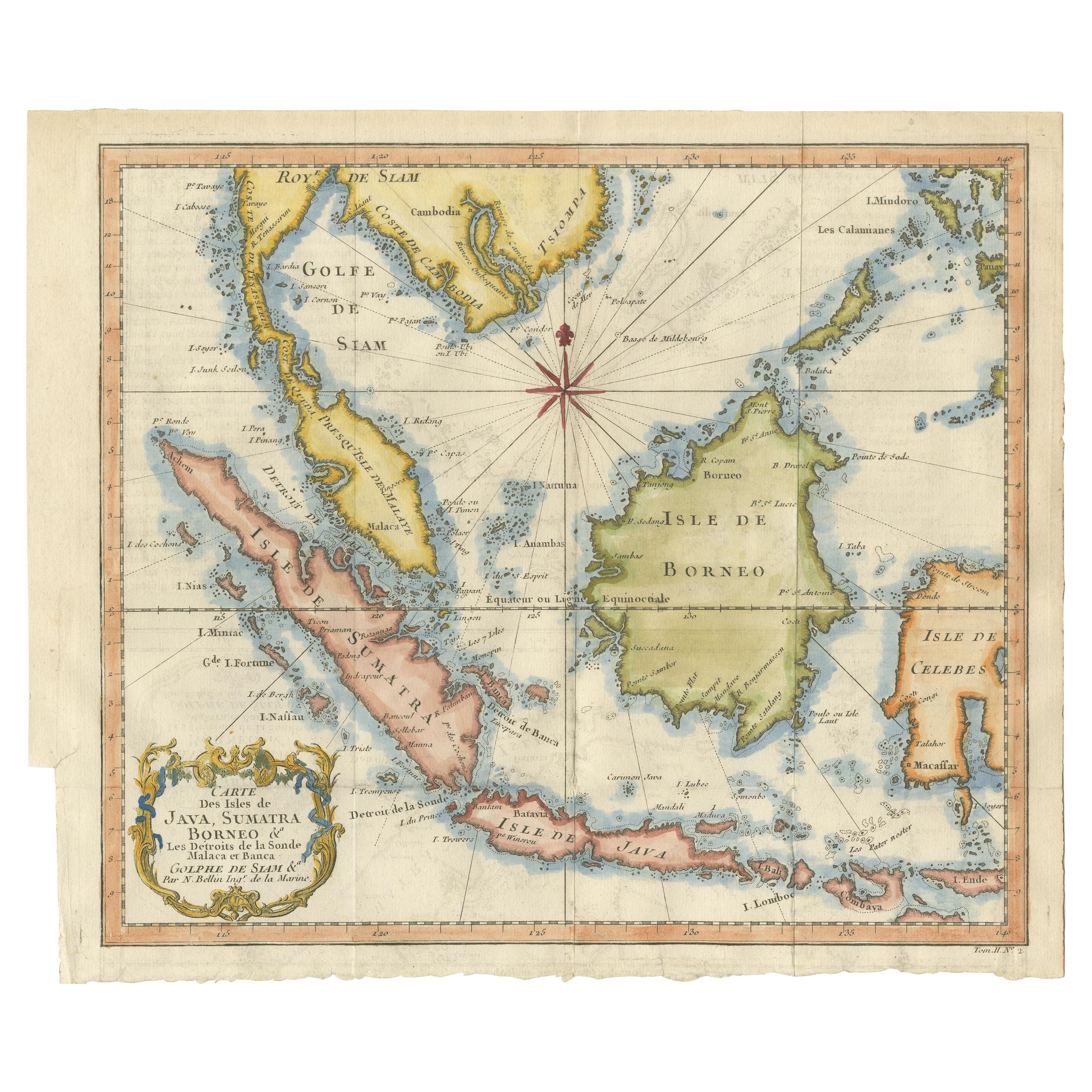
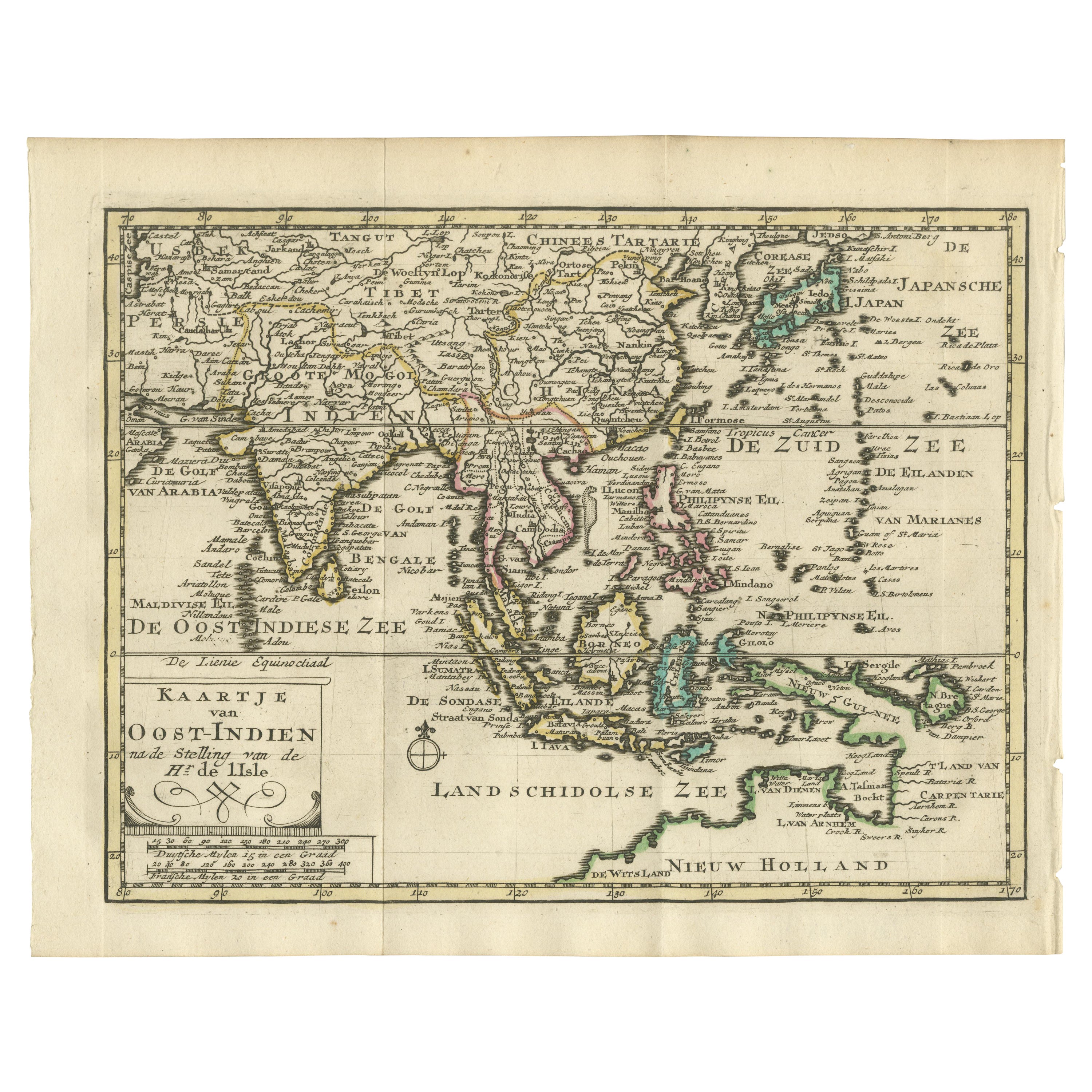
View AllAntique Engraving of Malaysia, Brunei, Singapore, Java, Borneo, Sumatra, c.1750
Located in Langweer, NL
Nice decorative and detailed map from the Gulf of Siam and Mindoro to Timo, Java and Sumatra Borneo and Roy de Siam. Large compass rose and nice cartouche.
Title: Carte des Isles ...
Category
Antique Mid-18th Century Maps
Materials
Paper

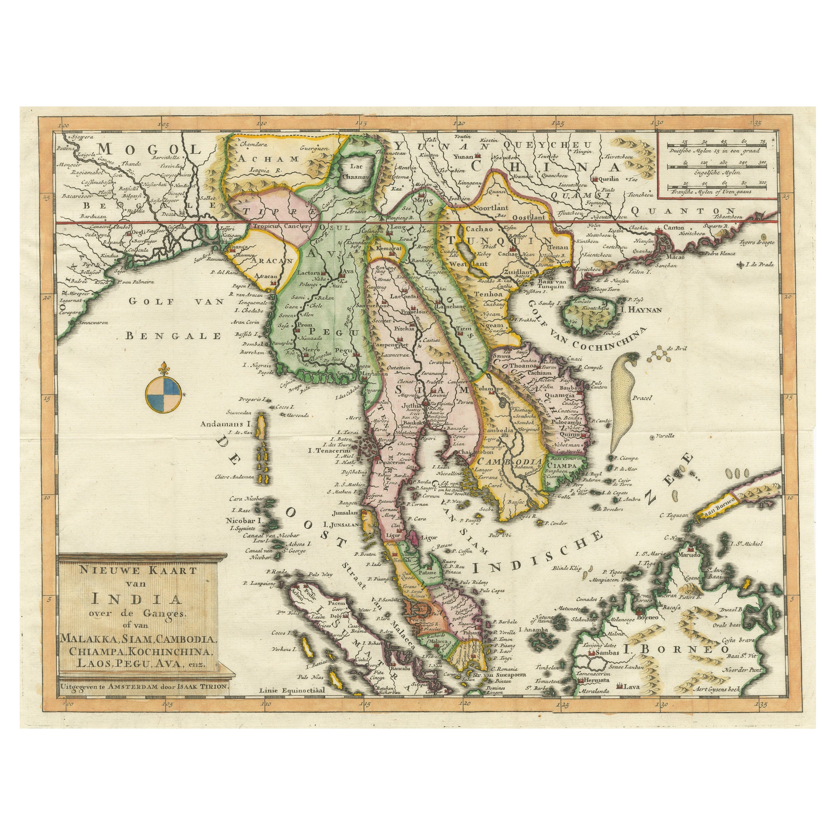
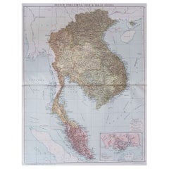
Antique Map of Indochina, the Malaysian Peninsula and Northern Sumatra
Located in Langweer, NL
Antique map titled 'Nieuwe Kaart van India over de Ganges of van Malakka, Siam, Cambodia, Chiampa, Kochinchina, Laos, Pegu, Ava, enz'. Original old map of Indochina, the Malaysian Pe...
Category
Antique Mid-18th Century Maps
Materials
Paper
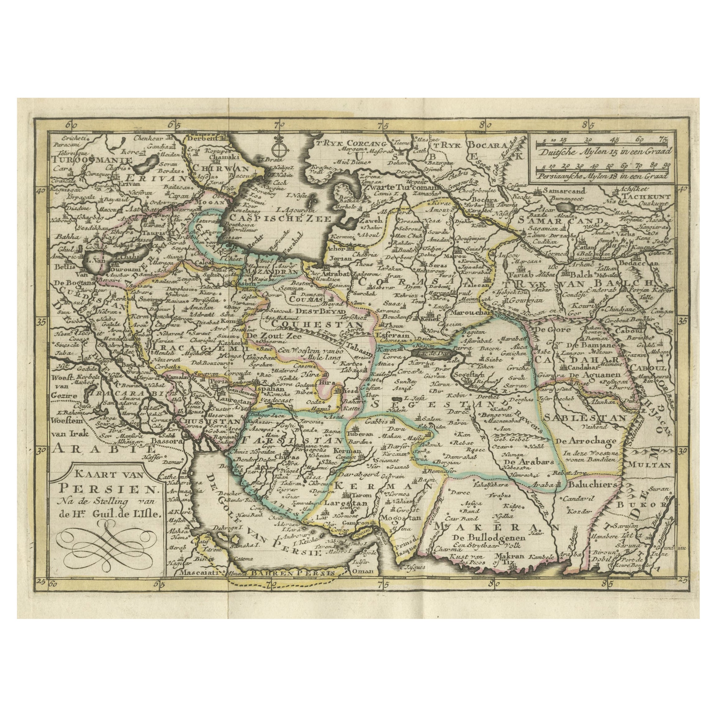
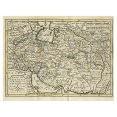
Authentic Old Map of Persia with Original Border Coloring, 1745
Located in Langweer, NL
Title: "Kaartje van Persien na de stelling van den Heer Guillaume de L'Isle"
Translates to "Map of Persia based on the work of Mr. Guillaume de L'Isle." Guillaume de L'Isle was a p...
Category
Antique 1740s Maps
Materials
Paper
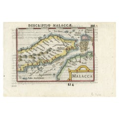
Rare Original Handcolored Miniature Map of Malaysia and Singapore, 1600
Located in Langweer, NL
Very handsome original old coloured copper engraving of Malaysia and Singapore, with parts of Sumatra, inc the island of Bangka and Bintam. Title of the map 'Description Malacca'. On...
Category
Antique Early 1600s Maps
Materials
Paper
$511 Sale Price
20% Off
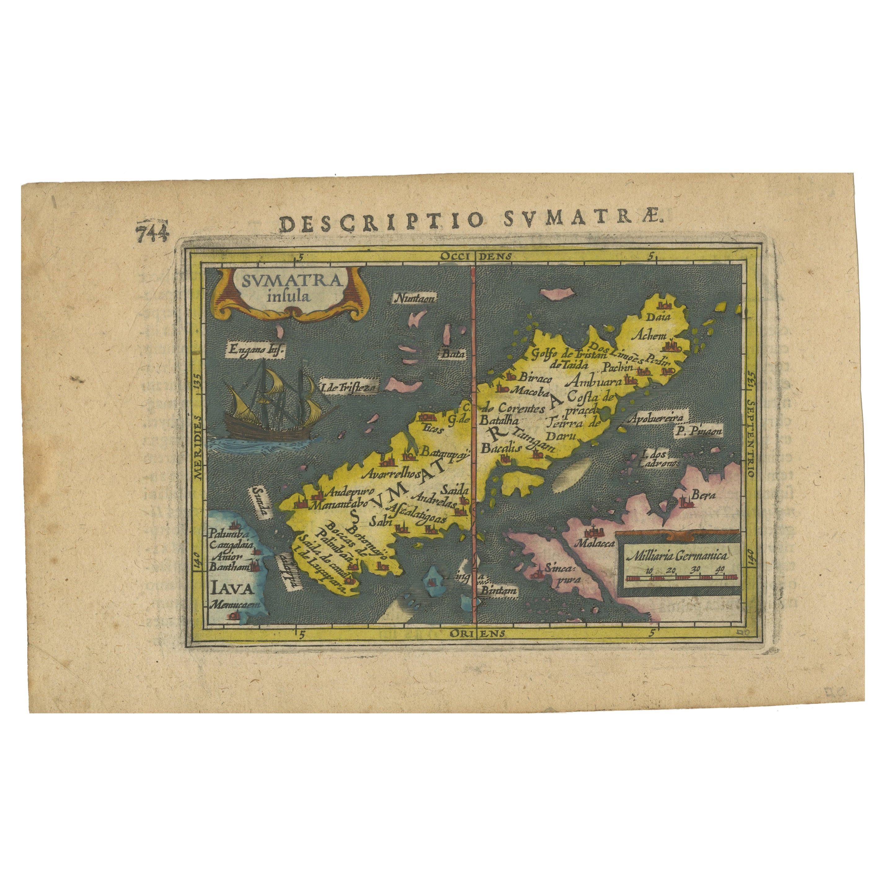
1616 Bertius Map of Sumatra, Singapore and the Straits of Malacca
Located in Langweer, NL
Title: "1616 Bertius Map of Sumatra and the Straits of Malacca"
Description: This is an exquisite 1616 original antique map by Petrus Bertius, titled "Sumatra Insula," showcasing Su...
Category
Antique Early 17th Century Maps
Materials
Paper

Authentic Old Map of Southeast Asia with Original Border Coloring, 1745
Located in Langweer, NL
Title: "Kaartje van Oost-Indien na de stelling van den Heer Guillaume de L'Isle"
Translates to "Map of the East-Indies based on the work of Mr. Guillaume de L'Isle." Guillaume de L...
Category
Antique 1740s Maps
Materials
Paper
You May Also Like
Large Original Vintage Map of S.E Asia, with a Vignette of Singapore
Located in St Annes, Lancashire
Great map of South East Asia
Original color. Good condition
Published by Alexander Gross
Unframed.
Category
Vintage 1920s English Maps
Materials
Paper
Old Horizontal Map of England
By Tasso
Located in Alessandria, Piemonte
ST/520 - Old rare Italian map of England, dated 1826-1827 - by Girolamo Tasso, editor in Venise, for the atlas of M.r Le-Sage.
Category
Antique Early 19th Century Italian Other Prints
Materials
Paper

1854 Map of Massachusetts, Connecticut and Rhode Island, Antique Wall Map
Located in Colorado Springs, CO
This striking wall map was published in 1854 by Ensign, Bridgman & Fanning and has both full original hand-coloring and original hardware. This impression is both informative and highly decorative.
The states are divided into counties, outlined in red, green, and black, and subdivided into towns. Roads, canals, and railroad lines are prominently depicted, although they are not all labeled. The mapmakers also marked lighthouses, banks, churches, and prominent buildings, with a key at right. The map is an informative and comprehensive overview of the infrastructural development of New England prior to the Civil War. Physical geographies depicted include elevation, conveyed with hachure marks, rivers and lakes. The impression features an inset map of Boston...
Category
Antique 19th Century American Maps
Materials
Paper

Map of Lancashire
Located in Cheshire, GB
Saxton Map of Lancashire hand coloured. Encased in an ebonised frame.
Dimensions
Height 21 Inches
Width 24 Inches
Depth 1 Inches
Category
Early 20th Century British Maps
Materials
Paper

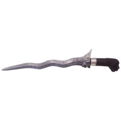
19th Century Steel and Sterling Silver Malaysian Dagger
Located in Miami, FL
19th century sterling silver Malaysian Dagger.
Original carved mahogany wood handle.
Sterting silver carved crown.
Damascene steel.
The kris is an as...
Category
Antique 15th Century and Earlier Malaysian Malayer Arms, Armor and Weapons
Materials
Mahogany
Northwest Coast and Isle of Man Map
Located in Cheshire, GB
Greenville Collins Northwest Coast and Isle of Man. hand coloured chart, encased in an ebonised frame.
Dimensions
Height 26.5 Inches
Width 30 Inches
Depth 1 Inches
Category
Early 20th Century British Maps
Materials
Paper

Recently Viewed
View AllMore Ways To Browse
Singapore Antique
Red Leather Swivel Chair
Rosewood Vintage Armchair
Rush Back Armchairs
Russian Propaganda Posters
Sheep Pillow
Sheffield Tea Sets
Silver Plate Art Deco Cocktail Shaker
Silver Wine Jug
Small Dining Table With Extension
Small Round 3 Leg Table
Society Silk
Square Club Chair
Sterling Condiment
Stickley Antique Table
Sugar Creamer Tray
Swivel Ottomans
Tartan Furniture