Items Similar to Antique Map of Tracks of Anson's Ships around South America & Cape Horn, 1749


Want more images or videos?
Request additional images or videos from the seller
1 of 6
Antique Map of Tracks of Anson's Ships around South America & Cape Horn, 1749
About the Item
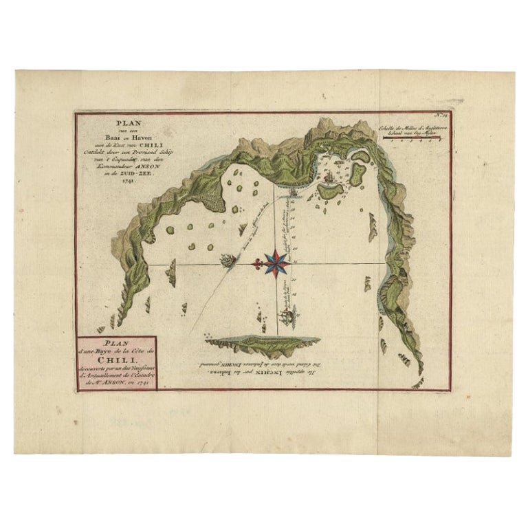
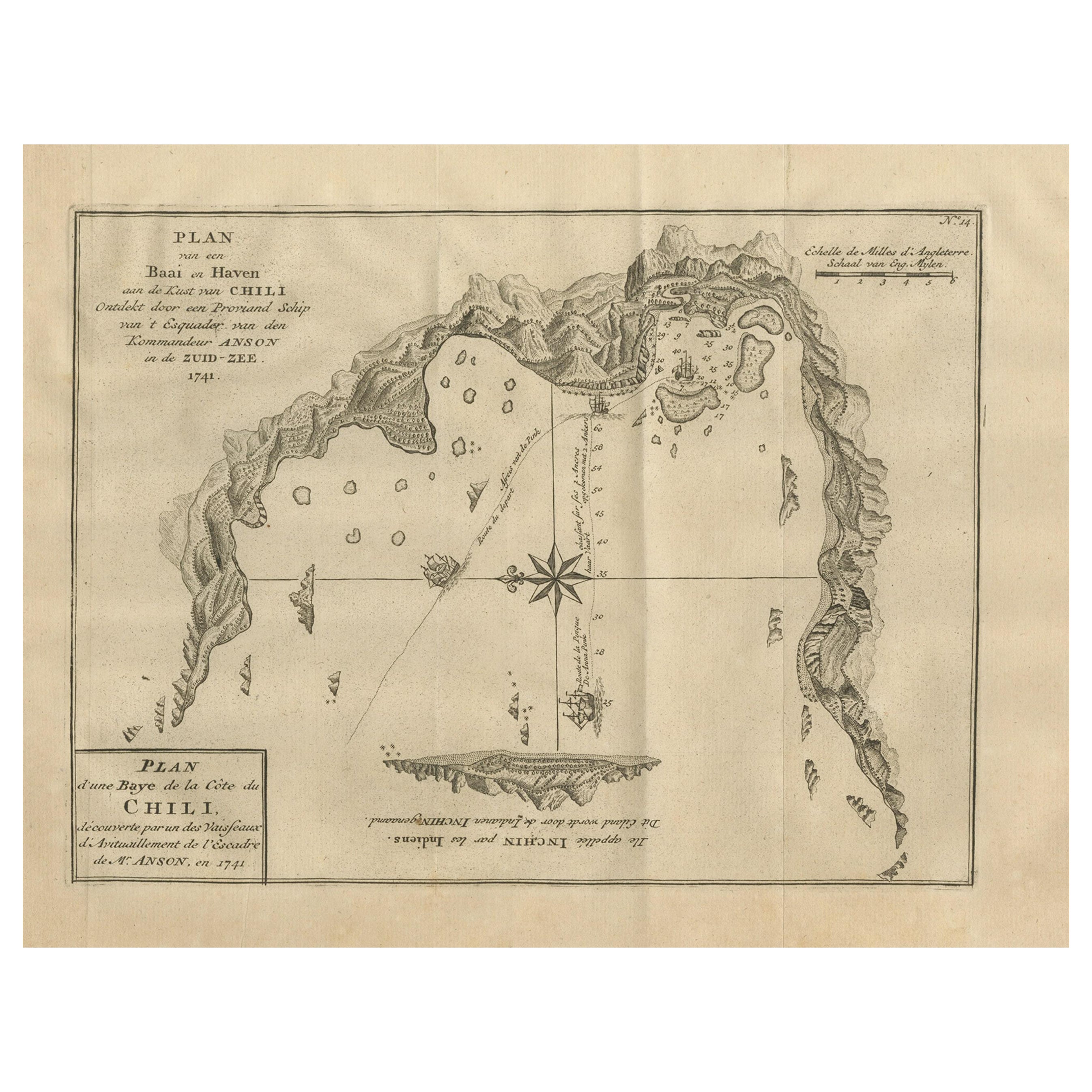
Description: Antique map titled 'Kaart van het Zuidelykste Gedeelte van Zuider Amerika (..) - Carte de la Partie Meridionale de l'Amerique Meridionale (..)'.
Detailed chart tracking the route of Capt. George Anson's ship The Centurion in 1745. The chart shows the tracks of Anson's ships around South America & Cape Horn to the Juan Fernandes Islands, with notes on currents and positions.
In 1740 Capt. George Anson (1697-1762) of the Royal Navy, was given command of a squadron of ships. As England was at war with France and Spain, Anson's task was to intercept and capture a Spanish treasure galleon trading across the Pacific from Acapulco in Mexico to the Philippines. Anson's outward journey took him to the coast of South America, around Cape Horn and up to the Juan Fernandes Islands off the coast of Peru, from whence he sailed to Mexico and then outward across the Pacific to Cape Espiritu Santo on the east coast of the Philippine Islands. In February of 1743, Anson sighted the Spanish ship, the Nuestra Seignora de Cavadonga, which he captured, and the treasure from the ship was so great it made Anson wealthy for life.
This map originates from 'Reize rondsom de Werreld (..)' by George Anson, published 1749.
Artists and Engravers: Admiral of the Fleet George Anson, 1st Baron Anson, PC, FRS (23 April 1697 – 6 June 1762) was a Royal Navy officer.
- Dimensions:Height: 21.66 in (55 cm)Width: 19.69 in (50 cm)Depth: 0 in (0.02 mm)
- Materials and Techniques:
- Period:1740-1749
- Date of Manufacture:1749
- Condition:Condition: Good, general age-related toning. Original folding lines. Minor wear, some foxing. Small repair in left margin, slightly affecting image. Blank verso, please study image carefully.
- Seller Location:Langweer, NL
- Reference Number:Seller: BG-11589-2 1stDibs: LU3054326437052
About the Seller
5.0
Recognized Seller
These prestigious sellers are industry leaders and represent the highest echelon for item quality and design.
Platinum Seller
Premium sellers with a 4.7+ rating and 24-hour response times
Established in 2009
1stDibs seller since 2017
2,417 sales on 1stDibs
Typical response time: <1 hour
- ShippingRetrieving quote...Shipping from: Langweer, Netherlands
- Return Policy
Authenticity Guarantee
In the unlikely event there’s an issue with an item’s authenticity, contact us within 1 year for a full refund. DetailsMoney-Back Guarantee
If your item is not as described, is damaged in transit, or does not arrive, contact us within 7 days for a full refund. Details24-Hour Cancellation
You have a 24-hour grace period in which to reconsider your purchase, with no questions asked.Vetted Professional Sellers
Our world-class sellers must adhere to strict standards for service and quality, maintaining the integrity of our listings.Price-Match Guarantee
If you find that a seller listed the same item for a lower price elsewhere, we’ll match it.Trusted Global Delivery
Our best-in-class carrier network provides specialized shipping options worldwide, including custom delivery.More From This Seller
View AllAntique Map of South America by G. Anson, 1749
Located in Langweer, NL
Antique map titled 'Kaart van het Zuidelykste Gedeelte van Zuider Amerika (..) - Carte de la Partie Meridionale de l'Amerique Meridionale (..)'. Detailed chart tracking the route of Capt. George Anson's ship The Centurion in 1745. The chart shows the tracks of Anson's ships around South America & Cape Horn to the Juan Fernandes Islands, with notes on currents and positions. This map originates from 'Reize rondsom de Werreld (..)' by George Anson, published 1749.
In 1740 Capt. George Anson (1697-1762) of the Royal Navy, was given command of a squadron of ships. As England was at war with France and Spain, Anson's task was to intercept and capture a Spanish treasure...
Category
Antique Mid-18th Century Dutch Maps
Materials
Paper

Antique Map of the Philippines by Anson '1749'
Located in Langweer, NL
Antique map titled 'Carte du Canal des Iles Philippines - Kaart van het Kanaal in de Filippynsche Eilanden'. Large detailed chart of the islands of the Philippines. One of the most detailed charts of the Philippines of the era. Shows Islands, bays, reefs, soundings tracks of the Manila Galleon route, etc. Includes a large compass...
Category
Antique Mid-18th Century Maps
Materials
Paper

Antique Map of Coiba Island by Anson '1749'
Located in Langweer, NL
Antique map titled 'Plan van de Oost-Zyde van het Eiland Quibo'. Original antique map of the eastside of Coiba Island (Quibo), Panama, showing the shoreline around Port de Dames indi...
Category
Antique Mid-18th Century Maps
Materials
Paper

Antique Map of Juan Fernandez Island by Anson '1749'
Located in Langweer, NL
Antique map titled 'l'Ile de Juan Fernandes dans la Mer du Sud (..) - Het Eiland Juan Fernandes in de Zuid Zee (..)'. This map depicts Juan Fernandez Island in the Southern Sea. This...
Category
Antique Mid-18th Century Maps
Materials
Paper

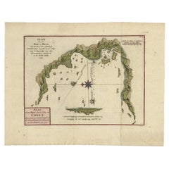
Antique Map of a Bay on the Coast of Chile by Anson, 1749
Located in Langweer, NL
Antique map titled 'Plan van een Baai en Haven aan de Kust van Chili (..) - Plan d'une Baye de la Côte du Chili (..)'. Original antique map of a bay on the coast of Chile discovered ...
Category
Antique 18th Century Maps
Materials
Paper
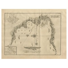
Antique Map of a Bay on the Coast of Chile, South America, c.1749
Located in Langweer, NL
Antique map titled 'Plan van een Baai en Haven aan de Kust van Chili (..) - Plan d'une Baye de la Côte du Chili (..)'. Original antique map of a bay on the coast of Chile discovered ...
Category
Antique 18th Century Maps
Materials
Paper
You May Also Like
Original Antique Map of South America. C.1780
Located in St Annes, Lancashire
Great map of South America
Copper-plate engraving
Published C.1780
Two small worm holes to left side of map
Unframed.
Category
Antique Early 1800s English Georgian Maps
Materials
Paper

Original Antique Map of South Africa, Arrowsmith, 1820
Located in St Annes, Lancashire
Great map of South Africa.
Drawn under the direction of Arrowsmith.
Copper-plate engraving.
Published by Longman, Hurst, Rees, Orme and Br...
Category
Antique 1820s English Maps
Materials
Paper

Original Antique Map of Central America / Florida, Arrowsmith, 1820
Located in St Annes, Lancashire
Great map of Central America.
Drawn under the direction of Arrowsmith.
Copper-plate engraving.
Published by Longman, Hurst, Rees, Orme and Brown, 1820
Unframed.
Category
Antique 1820s English Maps
Materials
Paper

Original Antique Map of South East Asia by Thomas Clerk, 1817
Located in St Annes, Lancashire
Great map of South East Asia
Copper-plate engraving
Drawn and engraved by Thomas Clerk, Edinburgh.
Published by Mackenzie And Dent, 1817
Unframed.
Category
Antique 1810s English Maps
Materials
Paper

South America: Hand-colored 18th Century Framed Map by Thomas Jefferys
By Thomas Jefferys
Located in Alamo, CA
This detailed hand-colored map of South America by Thomas Jefferys was published in London in 1750. The map shows countries, early colonial possessions, towns, rivers, mountains, and...
Category
Antique Mid-18th Century English Maps
Materials
Paper

North & South America: A 17th Century Hand-colored Map by Jansson & Goos
By Johannes Janssonius
Located in Alamo, CA
A 17th century hand-colored map of North & South America entitled "Americae Descriptio" by the cartographer Johannes Jansson, published in Jansson's Atlas Minor in Amsterdam in 1628....
Category
Antique 1620s Dutch Maps
Materials
Paper

Recently Viewed
View AllMore Ways To Browse
Peruvian Antiques
Spanish Santos
Spanish Filipino
Galleon Ship
Antique Furniture Centurion
Santos Philippines
Peruvian Santos
Small Pedestal Tables
Smoked Tempered Glass Table
Spanish Armchair Leather Wood
Sterling Silver Oyster
Swirl Side Table
Swiss Aluminum Chairs
Thick Glass Top Console Table
Thonet Plywood
Tripod Side Table Pair
Used Cloud Couch
Victorian Novelty