Items Similar to Antique Map of Russia in Asia and Siberia, with Frame Style Border

Want more images or videos?
Request additional images or videos from the seller
1 of 6
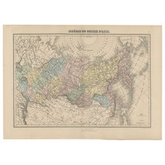
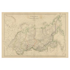
Antique Map of Russia in Asia and Siberia, with Frame Style Border
About the Item
Antique map titled 'Sibérie ou Russie d'Asie'. Attractive map of Russia in Asia and Siberia. This map originates from Maison Basset's 1852 edition of 'Atlas Illustre Destine a l'enseignement de la Geographie elementaire'.
- Dimensions:Height: 10.12 in (25.7 cm)Width: 13.31 in (33.8 cm)Depth: 0.02 in (0.5 mm)
- Materials and Techniques:
- Period:
- Date of Manufacture:1852
- Condition:General age-related toning. Shows soiling and foxing, blank verso. Please study image carefully.
- Seller Location:Langweer, NL
- Reference Number:Seller: BG-13379-171stDibs: LU3054333360332
About the Seller
5.0
Recognized Seller
These prestigious sellers are industry leaders and represent the highest echelon for item quality and design.
Platinum Seller
Premium sellers with a 4.7+ rating and 24-hour response times
Established in 2009
1stDibs seller since 2017
2,415 sales on 1stDibs
Typical response time: 1 hour
- ShippingRetrieving quote...Shipping from: Langweer, Netherlands
- Return Policy
Authenticity Guarantee
In the unlikely event there’s an issue with an item’s authenticity, contact us within 1 year for a full refund. DetailsMoney-Back Guarantee
If your item is not as described, is damaged in transit, or does not arrive, contact us within 7 days for a full refund. Details24-Hour Cancellation
You have a 24-hour grace period in which to reconsider your purchase, with no questions asked.Vetted Professional Sellers
Our world-class sellers must adhere to strict standards for service and quality, maintaining the integrity of our listings.Price-Match Guarantee
If you find that a seller listed the same item for a lower price elsewhere, we’ll match it.Trusted Global Delivery
Our best-in-class carrier network provides specialized shipping options worldwide, including custom delivery.More From This Seller
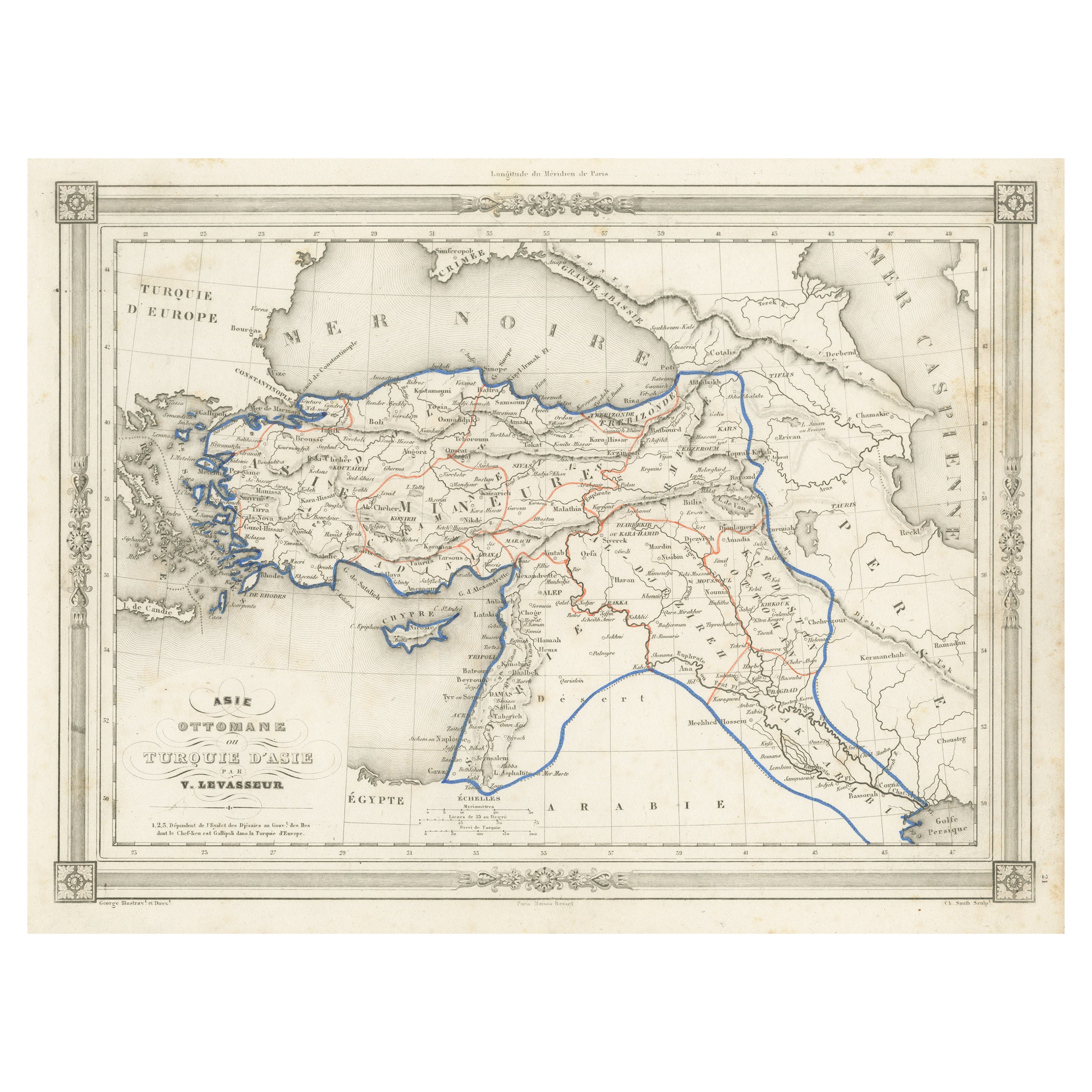
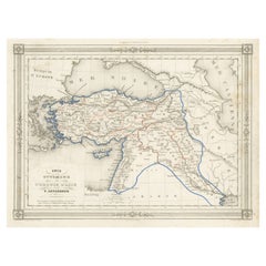
View AllAntique Map of Turkey in Asia, with Frame Style Border
Located in Langweer, NL
Antique map titled 'Asie Ottomane ou Turquie d'Asie'. Attractive map of Turkey in Asia. The map covers the Asian territories claimed by the Turkish Ottoman Empire c.1850 from the Bla...
Category
Antique Mid-19th Century Maps
Materials
Paper
$153 Sale Price
30% Off
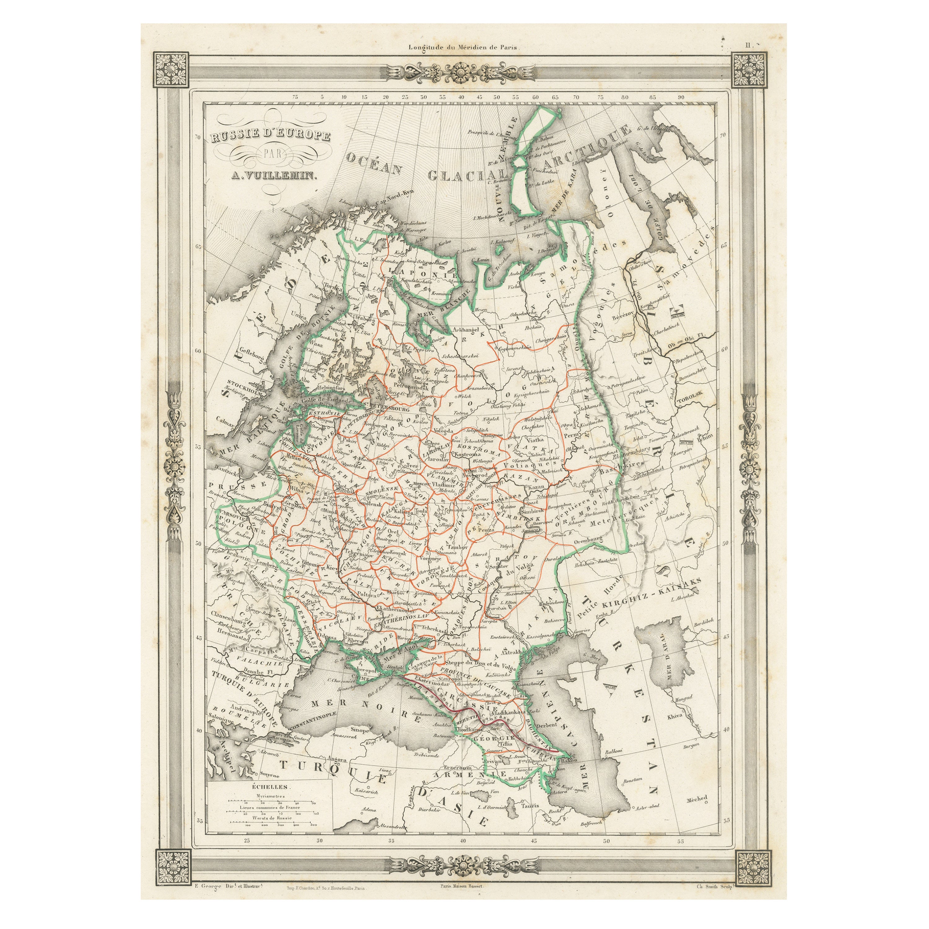
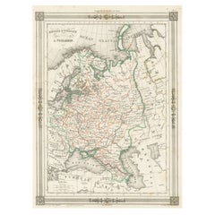
Antique Map of Russia in Europe, with Frame Style Border
Located in Langweer, NL
Antique map titled 'Russie d'Europe'. Attractive map of Russia in Europe, covers the European portions of Russia from the Arctic Sea south to the Black Sea and Caspian Sea. This map ...
Category
Antique Mid-19th Century Maps
Materials
Paper
Antique Map of Siberia and Russia, c.1885
Located in Langweer, NL
Antique map titled 'Siberie ou Russie d?Asie'. This is a fine example of J. Migeon's map of Russia in Asia. Migeon's map covers the Russian empire in Asia from european Russia and th...
Category
Antique 19th Century Maps
Materials
Paper
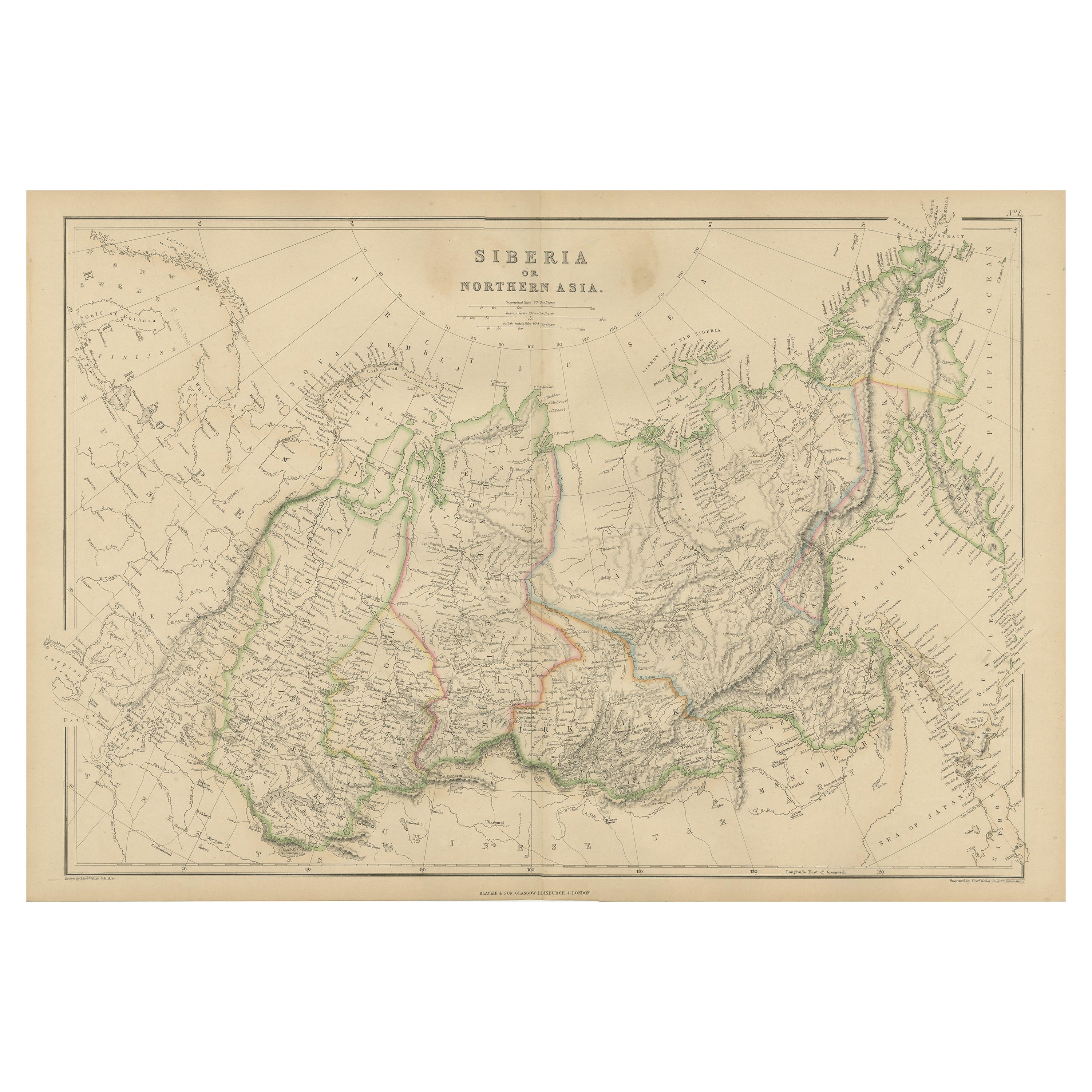
Antique Map of Siberia, Russia, 1859
Located in Langweer, NL
Antique map titled 'Siberia or Northern Asia'. Original antique map of Siberia or Northern Asia. This map originates from ‘The Imperial Atlas of Modern Geography’. Published by W. G....
Category
Antique Mid-19th Century Maps
Materials
Paper
$231 Sale Price
20% Off
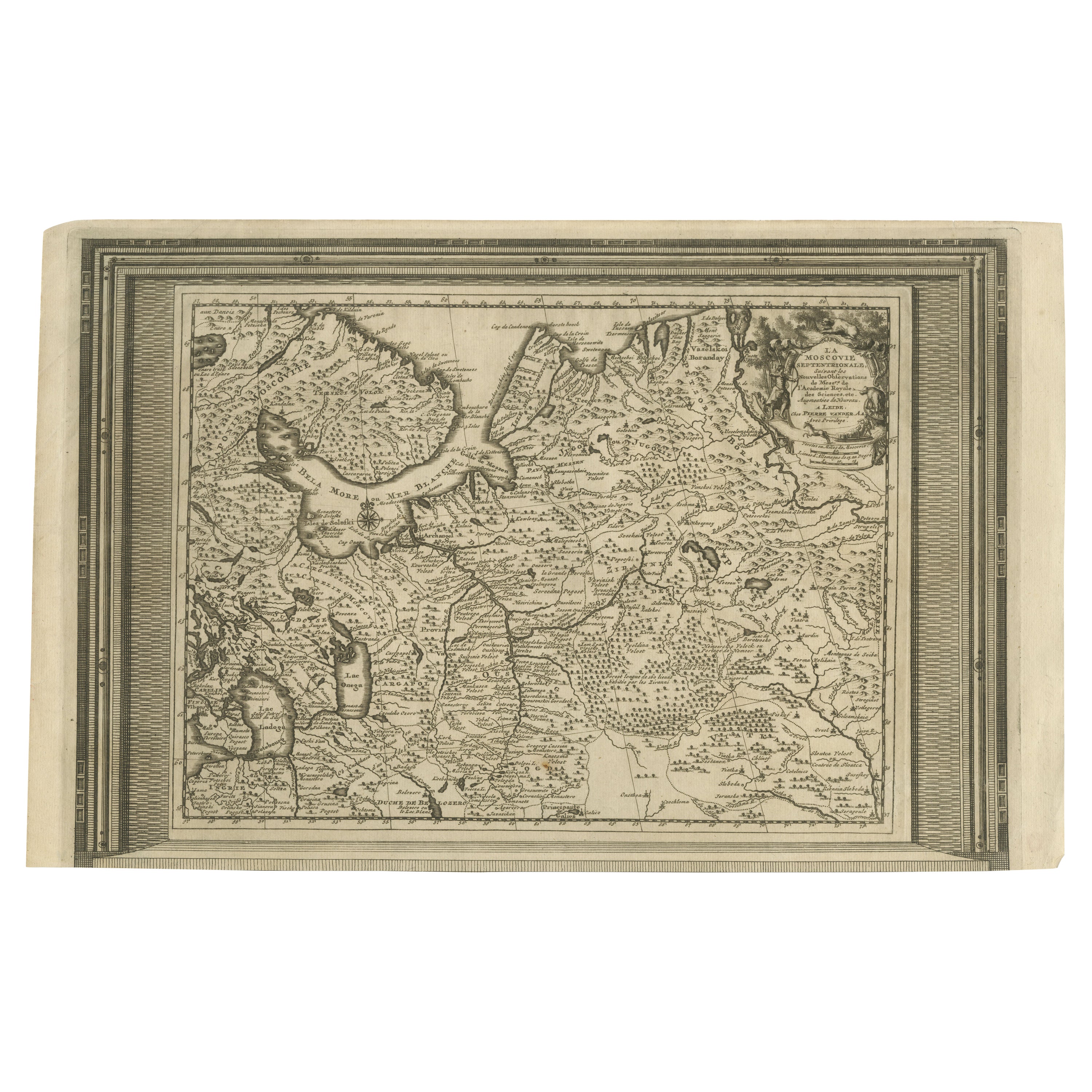
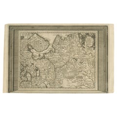
Antique Map of European Russia with Picture Frame Border
Located in Langweer, NL
Antique map titled 'La Moscovie Septentrionale (..)'. Decorative example of van der Aa's map of the northern part of European Russia. With the picture frame border, which appeared in...
Category
Antique Early 18th Century Maps
Materials
Paper
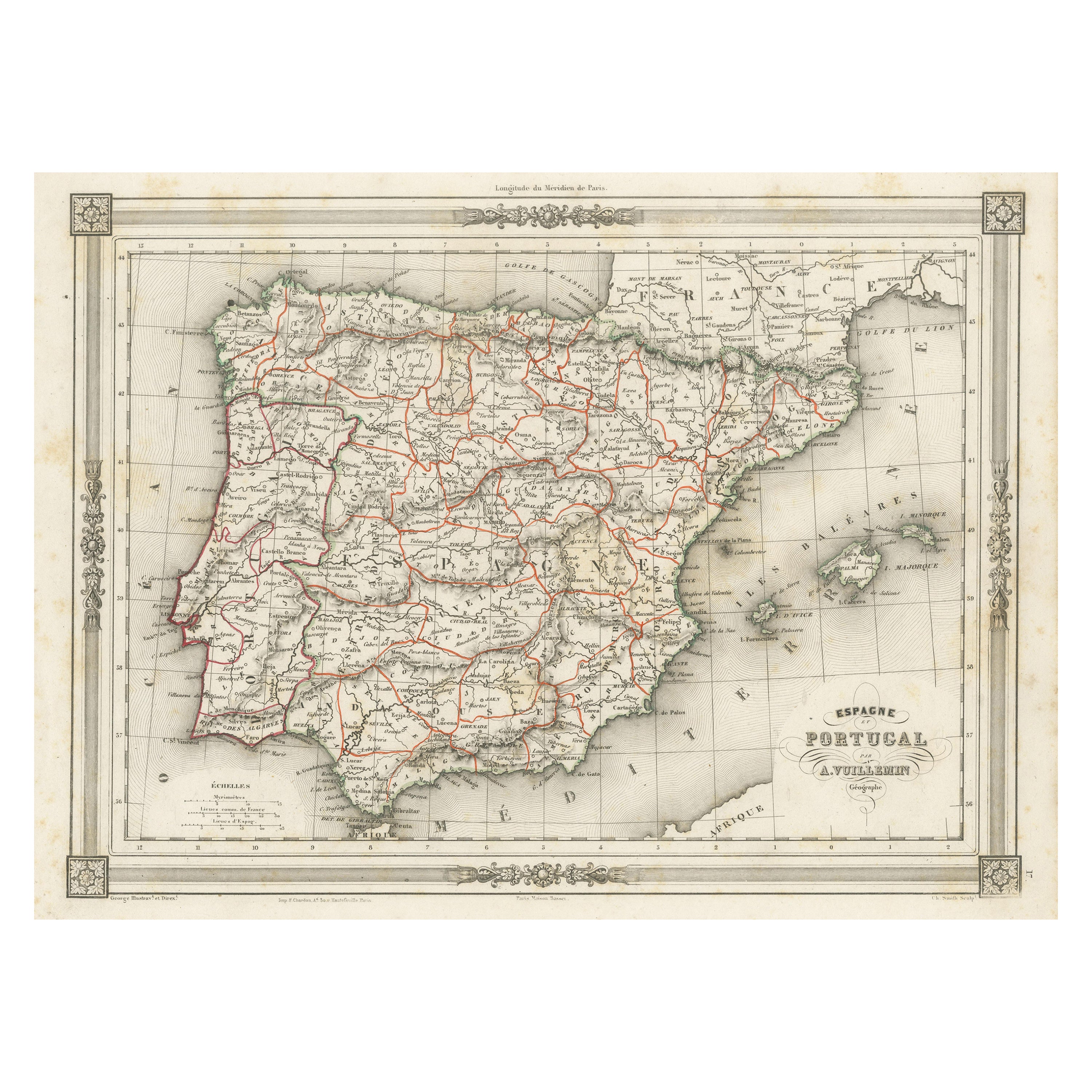
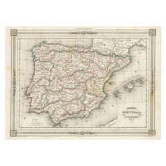
Antique Map of Spain and Portugal, with Frame Style Border
Located in Langweer, NL
Antique map titled 'Espagne et Portugal'. Attractive map of Spain and Portugal. The map covers all of Spain and Portugal from France to the Mediterranean Sea and includes the Baleari...
Category
Antique Mid-19th Century Maps
Materials
Paper
You May Also Like
Original Antique Map of South East Asia by Thomas Clerk, 1817
Located in St Annes, Lancashire
Great map of South East Asia
Copper-plate engraving
Drawn and engraved by Thomas Clerk, Edinburgh.
Published by Mackenzie And Dent, 1817
Unframed.
Category
Antique 1810s English Maps
Materials
Paper

Antique Map of Principality of Monaco
By Antonio Vallardi Editore
Located in Alessandria, Piemonte
ST/619 - "Old Geographical Atlas of Italy - Topographic map of ex-Principality of Monaco" -
ediz Vallardi - Milano -
A somewhat special edition ---
Category
Antique Late 19th Century Italian Other Prints
Materials
Paper

Original Antique Map of Spain and Portugal, circa 1790
Located in St Annes, Lancashire
Super map of Spain and Portugal
Copper plate engraving by A. Bell
Published, circa 1790.
Unframed.
Category
Antique 1790s English Other Maps
Materials
Paper

Original Antique Map of Ireland- Tipperary and Waterford. C.1840
Located in St Annes, Lancashire
Great map of Tipperary and Waterford
Steel engraving
Drawn under the direction of A.Adlard
Published by How and Parsons, C.1840
Unframed.
Category
Antique 1840s English Maps
Materials
Paper

Hand-Colored 18th Century Homann Map of the Black Sea, Turkey and Asia Minor
By Johann Baptist Homann
Located in Alamo, CA
An attractive original early 18th century hand-colored map of the Black Sea and Turkey entitled "Carte de L'Asie Minevre ou de la Natolie et du Pont Evxin Tiree des Voyages et des Ob...
Category
Antique Early 18th Century German Maps
Materials
Paper

Original Antique Map of United States, Grattan and Gilbert, 1843
Located in St Annes, Lancashire
Great map of United States
Drawn and engraved by Archer
Published by Grattan and Gilbert. 1843
Original colour
Unframed.
Category
Antique 1840s English Maps
Materials
Paper

Recently Viewed
View AllMore Ways To Browse
Mid Century Basset
Rectangular Coffee Tables Chinese
Round Armchair Art Deco
Round Dining Table 180 Cm
Rounded Rosewood Dining Table
Safari Directors Chairs
Sculptural Barstool
Set Of 10 Mahogany Dining Chairs
Set Of 6 Woven Dining Chairs
Set Of Panton Chairs
Set Of Three Glass Nesting Tables
Settee Bench Antique
Sevres Table With Bronze
Silver Wall Plaque
Slat Stool
Slatted Stool
Square Side Table Brass Pair
Swedish Neoclassical Table