Items Similar to Antique Map of the region of Siberia, Mongolia and Manchuria


Want more images or videos?
Request additional images or videos from the seller
1 of 6
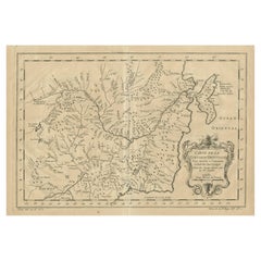
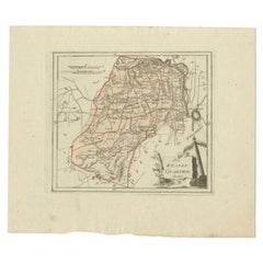
Antique Map of the region of Siberia, Mongolia and Manchuria
About the Item
Antique map titled 'Siberia and Chinese Tartary'. Detailed antique map of the region of Siberia, Mongolia and Manchuria. Engraved by J. & C. Walker. Published 1838.
- Dimensions:Height: 13.63 in (34.6 cm)Width: 16.46 in (41.8 cm)Depth: 0.02 in (0.5 mm)
- Materials and Techniques:
- Period:
- Date of Manufacture:1838
- Condition:Strong toning. Shows some wear and creasing. Blank verso. Please study image carefully.
- Seller Location:Langweer, NL
- Reference Number:Seller: BG-13512-41stDibs: LU3054335846482
About the Seller
5.0
Recognized Seller
These prestigious sellers are industry leaders and represent the highest echelon for item quality and design.
Platinum Seller
Premium sellers with a 4.7+ rating and 24-hour response times
Established in 2009
1stDibs seller since 2017
2,417 sales on 1stDibs
Typical response time: <1 hour
- ShippingRetrieving quote...Shipping from: Langweer, Netherlands
- Return Policy
Authenticity Guarantee
In the unlikely event there’s an issue with an item’s authenticity, contact us within 1 year for a full refund. DetailsMoney-Back Guarantee
If your item is not as described, is damaged in transit, or does not arrive, contact us within 7 days for a full refund. Details24-Hour Cancellation
You have a 24-hour grace period in which to reconsider your purchase, with no questions asked.Vetted Professional Sellers
Our world-class sellers must adhere to strict standards for service and quality, maintaining the integrity of our listings.Price-Match Guarantee
If you find that a seller listed the same item for a lower price elsewhere, we’ll match it.Trusted Global Delivery
Our best-in-class carrier network provides specialized shipping options worldwide, including custom delivery.More From This Seller
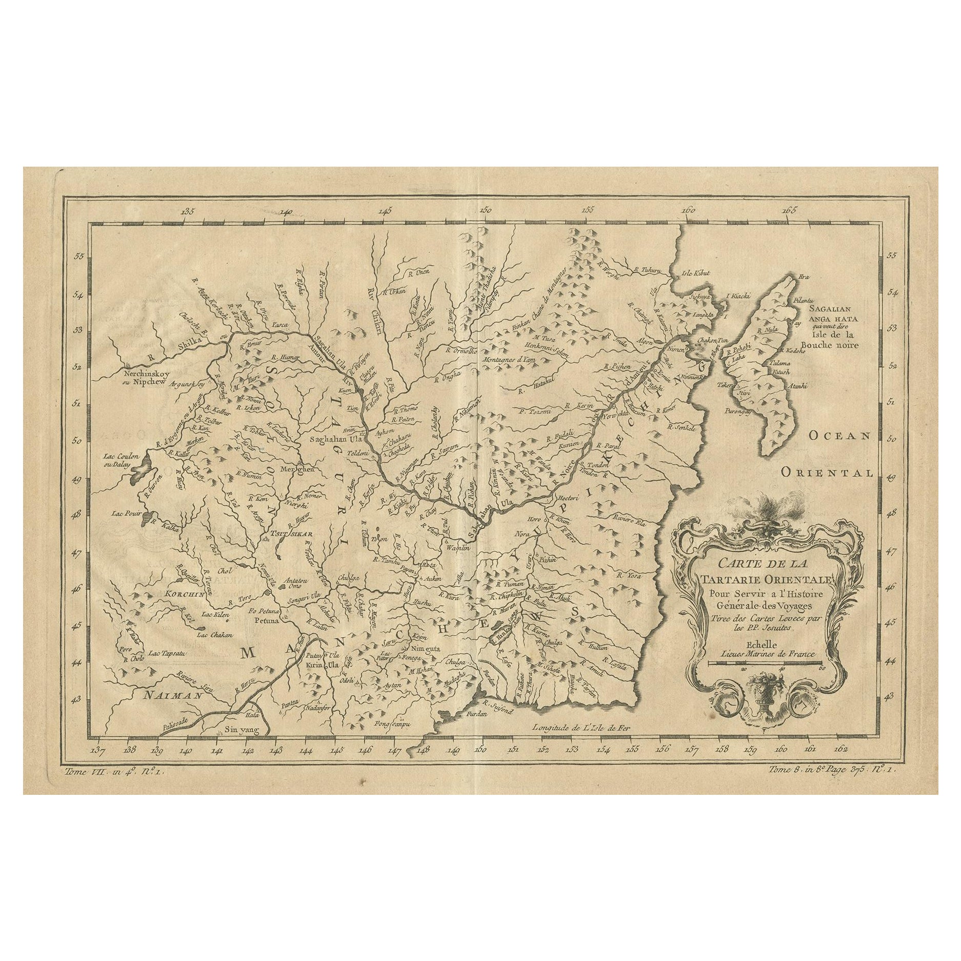
View AllAntique Map of Manchuria and the Northeast Portion of Tartary
Located in Langweer, NL
Antique map titled 'Carte de la Tartarie Orientale (..)'. Detailed map of Manchuria and the Northeast portion of Tartary, including Sagallan Anga Hata--Isle de la Bouche...
Category
Antique Mid-18th Century Maps
Materials
Paper
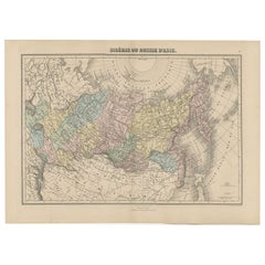
Antique Map of Siberia and Russia, c.1885
Located in Langweer, NL
Antique map titled 'Siberie ou Russie d?Asie'. This is a fine example of J. Migeon's map of Russia in Asia. Migeon's map covers the Russian empire in Asia from european Russia and th...
Category
Antique 19th Century Maps
Materials
Paper
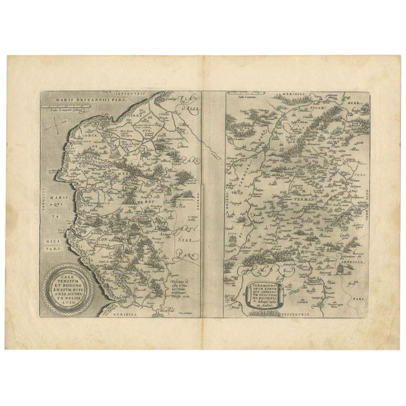
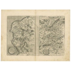
Antique Map of the Region of Calais and The Vermandois Region by Ortelius
Located in Langweer, NL
Antique map titled 'Caletensium et Bononiensium (..) - Veromandorum eorum que confinium (..)'. Two detailed regional maps by Ortelius. The first map shows Belgian and French Coastal ...
Category
Antique 17th Century Maps
Materials
Paper
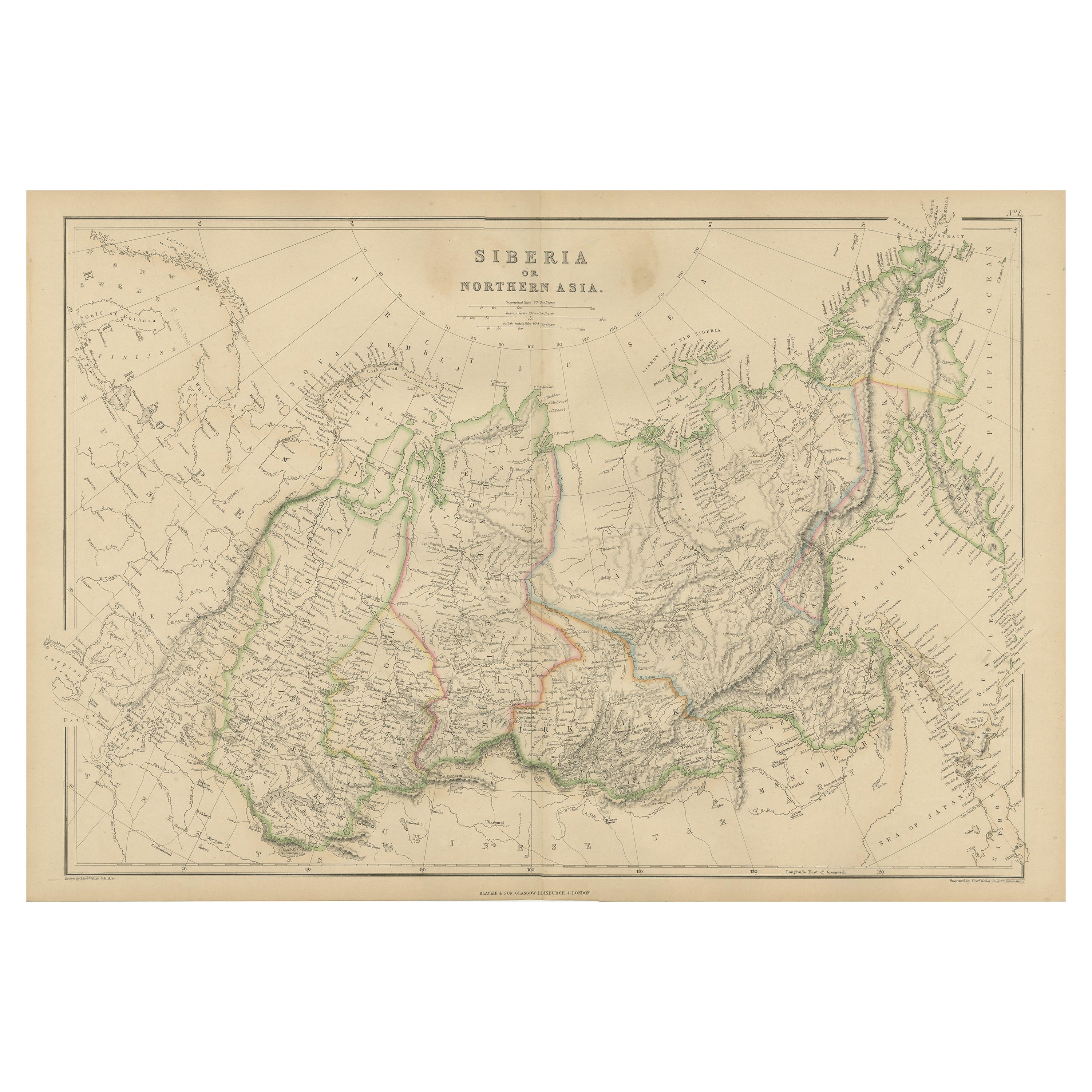
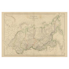
Antique Map of Siberia, Russia, 1859
Located in Langweer, NL
Antique map titled 'Siberia or Northern Asia'. Original antique map of Siberia or Northern Asia. This map originates from ‘The Imperial Atlas of Modern Geography’. Published by W. G....
Category
Antique Mid-19th Century Maps
Materials
Paper
$231 Sale Price
20% Off
Antique Map of the Lorraine Region, c.1760
Located in Langweer, NL
Untitled antique map of the Lorraine region, France. A cultural and historical region in north-eastern France, now located in the administrative region of Grand Est. Lorraine's name ...
Category
Antique 18th Century Maps
Materials
Paper

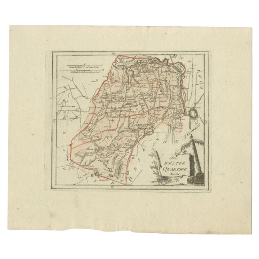
Antique Map of the Westerkwartier Region, a Region in Groningen, 1791
Located in Langweer, NL
Antique map titled 'Das Wester Quartier'. Original antique map of Westerkwartier, a region in the province of Groningen, the Netherlands. This map orginates from 'Schauplatz der fünf...
Category
Antique 18th Century Maps
Materials
Paper
You May Also Like
1594 Maurice Bouguereau Map of the Region Limoges, France, Ric0015
Located in Norton, MA
1594 Maurice Bouguereau map of the region Limoges, France, entitled
"Totivs Lemovici et Confinium Pro Uinciarum Quantum ad Dioecefin Lemo Uicenfen Fpectant,"
Hand Colored
Ric0015
Jean IV Le Clerc...
Category
Antique 16th Century Dutch Maps
Materials
Paper

The Normandy Region of France: A 17th C. Hand-colored Map by Sanson and Jaillot
By Nicolas Sanson
Located in Alamo, CA
This large hand-colored map entitled "Le Duché et Gouvernement de Normandie divisée en Haute et Basse Normandie en divers Pays; et par evêchez, avec le Gouvernement General du Havre ...
Category
Antique 1690s French Maps
Materials
Paper

Original Antique Map of The Philippines. C.1900
Located in St Annes, Lancashire
Fabulous map of The Philippines
Original color.
Engraved and printed by the George F. Cram Company, Indianapolis.
Published, C.1900.
Unframed.
Free shipping.
Category
Antique 1890s American Maps
Materials
Paper

17th Century Hand Colored Map of the Liege Region in Belgium by Visscher
By Nicolaes Visscher II
Located in Alamo, CA
An original 17th century map entitled "Leodiensis Episcopatus in omnes Subjacentes Provincias distincté divisusVisscher, Leodiensis Episcopatus" by Nicolaes Visscher II, published in Amsterdam in 1688. The map is centered on Liege, Belgium, includes the area between Antwerp, Turnhout, Roermond, Cologne, Trier and Dinant.
This attractive map is presented in a cream-colored mat measuring 30" wide x 27.5" high. There is a central fold, as issued. There is minimal spotting in the upper margin and a tiny spot in the right lower margin, which are under the mat. The map is otherwise in excellent condition.
The Visscher family were one of the great cartographic families of the 17th century. Begun by Claes Jansz Visscher...
Category
Antique Late 17th Century Dutch Maps
Materials
Paper

Large Original Antique Map of The Bahamas. 1894
Located in St Annes, Lancashire
Superb Antique map of The Bahamas
Published Edward Stanford, Charing Cross, London 1894
Original colour
Good condition
Unframed.
Free shipping
Category
Antique 1890s English Maps
Materials
Paper

Large Original Antique Map of the The Windward Islands. 1894
Located in St Annes, Lancashire
Superb Antique map of The Windward Islands
Published Edward Stanford, Charing Cross, London 1894
Original colour
Good condition
Unframed.
Free shipping
Category
Antique 1890s English Maps
Materials
Paper

Recently Viewed
View AllMore Ways To Browse
Mongolian Antique
Masculine Rug
Matching Curved Sofas
Meditation Carpet
Metal Gio Ponti Chair
Mid Century Denmark Cord Chairs
Mid Century Modern Octagon Dining Table
Mid Century Modern Octagonal Dining Table
Mid Century Spices
Mid Century Wine Rack
Ming Dynasty Table
Modern Creamer Midcentury
Moroccan Game Table
Naive Chair
Needlepoint Seat Chair
Ng Design
Niels Moller Teak Dining Chairs
Off White Cocktail Table