Items Similar to Antique Map of the Region of Plauen by Schreiber '1749'

Want more images or videos?
Request additional images or videos from the seller
1 of 5
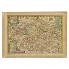
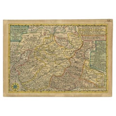
Antique Map of the Region of Plauen by Schreiber '1749'
About the Item
Antique map titled 'Die Aemter Plauen und Pausa (..)'. Map of the region of Plauen, Germany. This map originates from 'Atlas Selectus von allen Konigreichen und Landern der Welt' by Johann Georg Schreiber.
Artists and Engravers: Johann Georg Schreiber, a German cartographer and geographer, was born 1676 and lived in Leipzig. His only work was the Atlas Selectus published first 1740 and reissued 1749. He died in 1745.
Condition: Fair, original/contemporary hand coloring. Strong toning, minor wear. Blank verso, please study image carefully.
Date: 1749
Overall size: 27 x 19 cm.
Image size: 24 x 17 cm.
We sell original antique maps to collectors, historians, educators and interior decorators all over the world. Our collection includes a wide range of authentic antique maps from the 16th to the 20th centuries. Buying and collecting antique maps is a tradition that goes back hundreds of years. Antique maps have proved a richly rewarding investment over the past decade, thanks to a growing appreciation of their unique historical appeal. Today the decorative qualities of antique maps are widely recognized by interior designers who appreciate their beauty and design flexibility. Depending on the individual map, presentation, and context, a rare or antique map can be modern, traditional, abstract, figurative, serious or whimsical. We offer a wide range of authentic antique maps for any budget.
- Creator:Schreiber (Artist)
- Dimensions:Height: 7.49 in (19 cm)Width: 10.63 in (27 cm)Depth: 0 in (0.01 mm)
- Materials and Techniques:
- Period:
- Date of Manufacture:1749
- Condition:
- Seller Location:Langweer, NL
- Reference Number:Seller: JAK-12431stDibs: LU3054327927152
About the Seller
5.0
Recognized Seller
These prestigious sellers are industry leaders and represent the highest echelon for item quality and design.
Platinum Seller
Premium sellers with a 4.7+ rating and 24-hour response times
Established in 2009
1stDibs seller since 2017
2,419 sales on 1stDibs
Typical response time: <1 hour
- ShippingRetrieving quote...Shipping from: Langweer, Netherlands
- Return Policy
Authenticity Guarantee
In the unlikely event there’s an issue with an item’s authenticity, contact us within 1 year for a full refund. DetailsMoney-Back Guarantee
If your item is not as described, is damaged in transit, or does not arrive, contact us within 7 days for a full refund. Details24-Hour Cancellation
You have a 24-hour grace period in which to reconsider your purchase, with no questions asked.Vetted Professional Sellers
Our world-class sellers must adhere to strict standards for service and quality, maintaining the integrity of our listings.Price-Match Guarantee
If you find that a seller listed the same item for a lower price elsewhere, we’ll match it.Trusted Global Delivery
Our best-in-class carrier network provides specialized shipping options worldwide, including custom delivery.More From This Seller
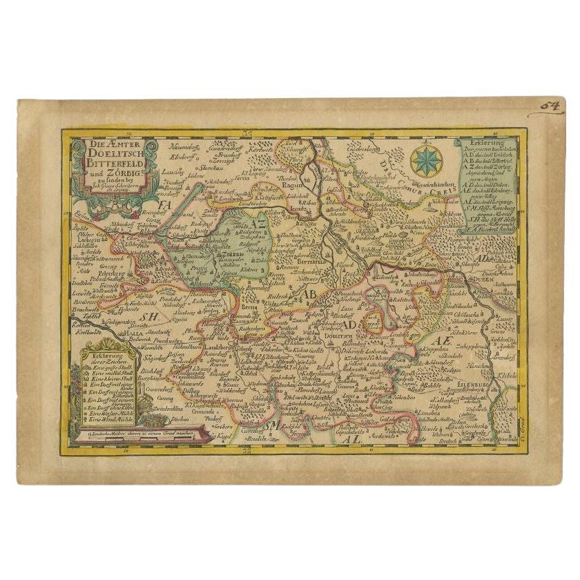
View AllAntique Map of the Region of Dölitzsch by Schreiber, 1749
By Schreiber
Located in Langweer, NL
Antique map titled 'Die Aemter Doelitsch, Bitterfeld und Zörbig'. Map of the region of Dölitzsch, Germany. This map originates from 'Atlas Selectus von allen Konigreichen und Landern...
Category
Antique 18th Century Maps
Materials
Paper
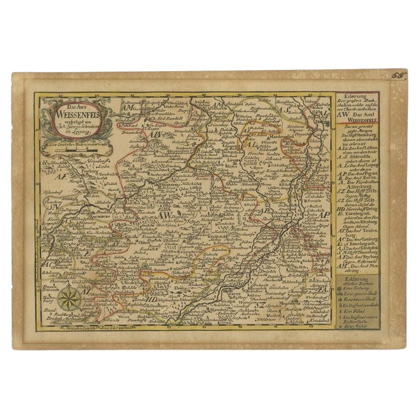
Antique Map of the Region of Weißenfels by Schreiber, 1749
By Schreiber
Located in Langweer, NL
Antique map titled 'Das Amt Weissenfels (..)'. Map of the region of Weißenfels, Germany. This map originates from 'Atlas Selectus von allen Konigreichen und Landern der Welt' by Joha...
Category
Antique 18th Century Maps
Materials
Paper
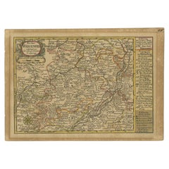
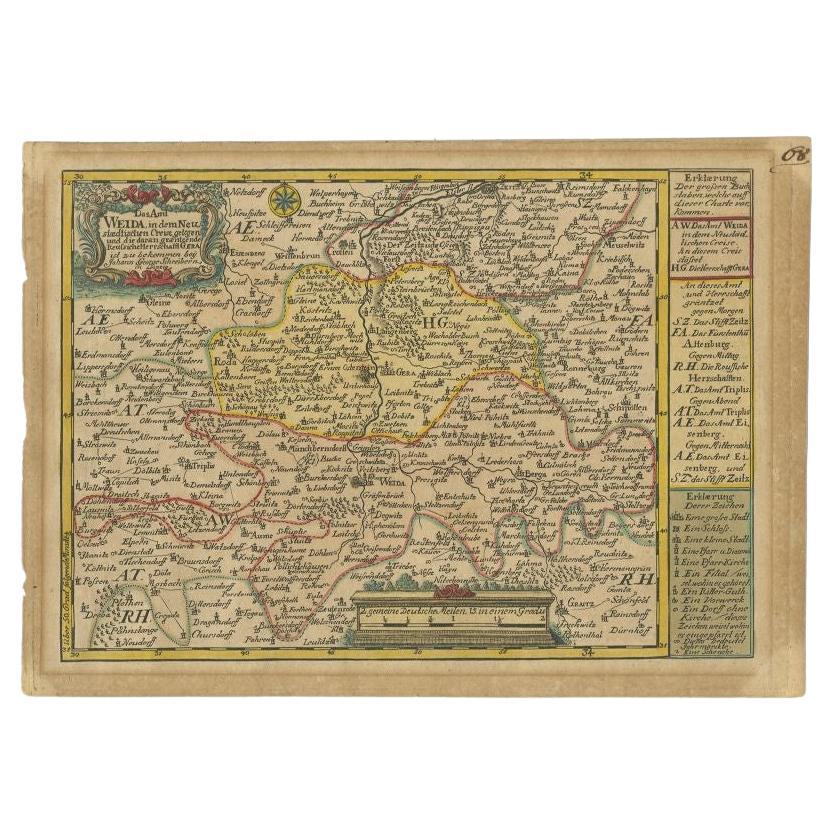
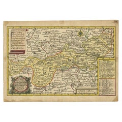
Antique Map of the Region of Weida by Schreiber, 1749
By Schreiber
Located in Langweer, NL
Antique map titled 'Das Amt Weida (..)'. Map of the region of Weida, Germany. This map originates from 'Atlas Selectus von allen Konigreichen und Landern der Welt' by Johann Georg Sc...
Category
Antique 18th Century Maps
Materials
Paper
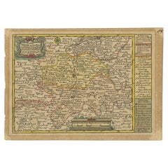
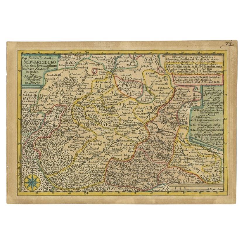
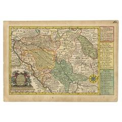
Antique Map of the Region of Schwarzburg by Schreiber, 1749
By Schreiber
Located in Langweer, NL
Antique map titled 'Die Südliche Fürstenthum Schwartzburg (..)'. Map of the region of Schwarzburg, Germany. This map originates from 'Atlas Selectus von allen Konigreichen und Lander...
Category
Antique 18th Century Maps
Materials
Paper
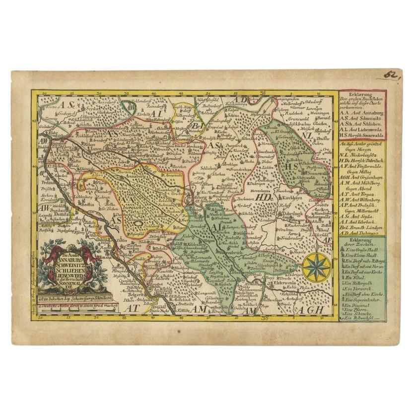
Antique Map of the Region of Annaburg by Schreiber, 1749
By Schreiber
Located in Langweer, NL
Antique map titled 'Die Aemter Annaburg, Schweinitz (..)'. Map of the region of Annaburg, Germany. This map originates from 'Atlas Selectus von allen Konigreichen und Landern der Wel...
Category
Antique 18th Century Maps
Materials
Paper
Antique Map of the Region of Weißensee by Schreiber, 1749
By Schreiber
Located in Langweer, NL
Antique map titled 'Die Chursaechsischen Aemter in Thüringen gelegen Sachsenburg, Weissensee (..)'. Map of the region of Weißensee, Germany. This map originates from 'Atlas Selectus von allen...
Category
Antique 18th Century Maps
Materials
Paper
You May Also Like
Map Kyle Carrick Aireshire Thomas Kitchen 1749
By Thomas Kitchin
Located in BUNGAY, SUFFOLK
A Map of Kyle & Carrick Aireshire Thomas Kitchen 1749
In original black and gold frame
Just purchased more information to follow
MAKER Thomas Kitchin (1718-1784) English engrave...
Category
Antique 18th Century English Georgian Maps
Materials
Paper

1594 Maurice Bouguereau Map of the Region Limoges, France, Ric0015
Located in Norton, MA
1594 Maurice Bouguereau map of the region Limoges, France, entitled
"Totivs Lemovici et Confinium Pro Uinciarum Quantum ad Dioecefin Lemo Uicenfen Fpectant,"
Hand Colored
Ric0015
Jean IV Le Clerc...
Category
Antique 16th Century Dutch Maps
Materials
Paper

The Normandy Region of France: A 17th C. Hand-colored Map by Sanson and Jaillot
By Nicolas Sanson
Located in Alamo, CA
This large hand-colored map entitled "Le Duché et Gouvernement de Normandie divisée en Haute et Basse Normandie en divers Pays; et par evêchez, avec le Gouvernement General du Havre ...
Category
Antique 1690s French Maps
Materials
Paper

17th Century Hand Colored Map of the Liege Region in Belgium by Visscher
By Nicolaes Visscher II
Located in Alamo, CA
An original 17th century map entitled "Leodiensis Episcopatus in omnes Subjacentes Provincias distincté divisusVisscher, Leodiensis Episcopatus" by Nicolaes Visscher II, published in Amsterdam in 1688. The map is centered on Liege, Belgium, includes the area between Antwerp, Turnhout, Roermond, Cologne, Trier and Dinant.
This attractive map is presented in a cream-colored mat measuring 30" wide x 27.5" high. There is a central fold, as issued. There is minimal spotting in the upper margin and a tiny spot in the right lower margin, which are under the mat. The map is otherwise in excellent condition.
The Visscher family were one of the great cartographic families of the 17th century. Begun by Claes Jansz Visscher...
Category
Antique Late 17th Century Dutch Maps
Materials
Paper

Original Antique Map of The Philippines. C.1900
Located in St Annes, Lancashire
Fabulous map of The Philippines
Original color.
Engraved and printed by the George F. Cram Company, Indianapolis.
Published, C.1900.
Unframed.
Free shipping.
Category
Antique 1890s American Maps
Materials
Paper

Original Antique Map of The World by Thomas Clerk, 1817
Located in St Annes, Lancashire
Great map of The Eastern and Western Hemispheres
On 2 sheets
Copper-plate engraving
Drawn and engraved by Thomas Clerk, Edinburgh.
Published by Mackenzie And Dent, 1817
...
Category
Antique 1810s English Maps
Materials
Paper

Recently Viewed
View AllMore Ways To Browse
Baroque Silk Rug
Bear In A Suit
Blossom Bowl
Brass Tray India
Bread Bowl
Breton Dining
Buffalo Artist
Button Back Leather Armchairs
By Blasco
Cane Seat Bench
Canterbury Magazine Rack
Chrome Vinyl Chair
Classicism Tables
Coasters Italian
Collectible Spoons
Colorful Dining Chairs
Console Table Small Small Sofa Table
Coral Armchair