Items Similar to Antique Map of Preble County 'Ohio' by Titus, 1871
Want more images or videos?
Request additional images or videos from the seller
1 of 5
Antique Map of Preble County 'Ohio' by Titus, 1871
About the Item
Antique map titled 'Outline Plan of Prble County, Ohio'. Original antique map of Preble County, Ohio. This map originates from 'Atlas of Preble County Ohio' by C.O. Titus. Published 1871.
- Dimensions:Height: 14.97 in (38 cm)Width: 12.41 in (31.5 cm)Depth: 0.02 in (0.5 mm)
- Materials and Techniques:
- Period:
- Date of Manufacture:1871
- Condition:Original folding lines. Shows some wear and foxing. General age-related toning. Few small defects in margins. Please study images carefully.
- Seller Location:Langweer, NL
- Reference Number:Seller: BG-11874-231stDibs: LU3054321717932
About the Seller
5.0
Recognized Seller
These prestigious sellers are industry leaders and represent the highest echelon for item quality and design.
Platinum Seller
Premium sellers with a 4.7+ rating and 24-hour response times
Established in 2009
1stDibs seller since 2017
2,417 sales on 1stDibs
Typical response time: <1 hour
- ShippingRetrieving quote...Shipping from: Langweer, Netherlands
- Return Policy
Authenticity Guarantee
In the unlikely event there’s an issue with an item’s authenticity, contact us within 1 year for a full refund. DetailsMoney-Back Guarantee
If your item is not as described, is damaged in transit, or does not arrive, contact us within 7 days for a full refund. Details24-Hour Cancellation
You have a 24-hour grace period in which to reconsider your purchase, with no questions asked.Vetted Professional Sellers
Our world-class sellers must adhere to strict standards for service and quality, maintaining the integrity of our listings.Price-Match Guarantee
If you find that a seller listed the same item for a lower price elsewhere, we’ll match it.Trusted Global Delivery
Our best-in-class carrier network provides specialized shipping options worldwide, including custom delivery.More From This Seller
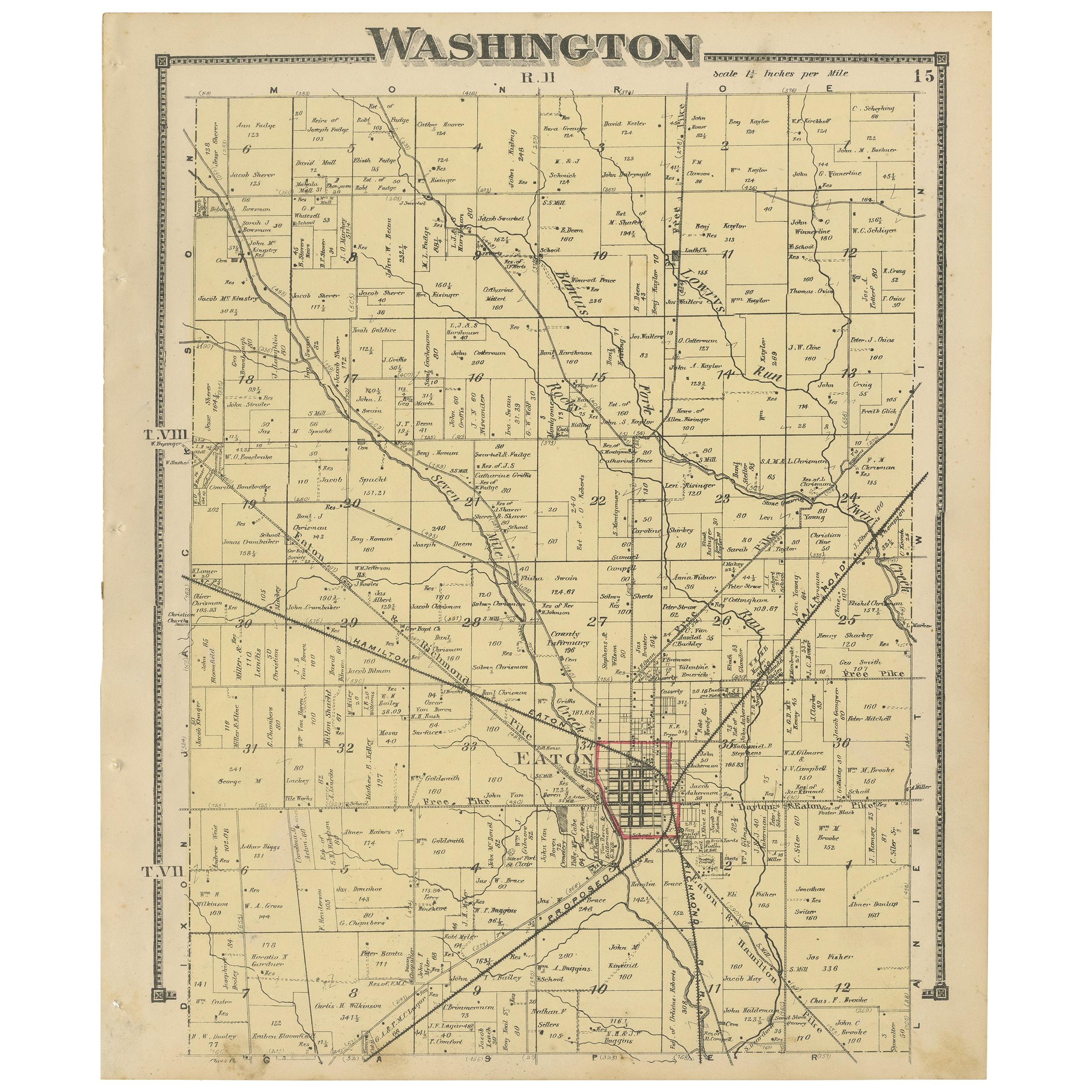
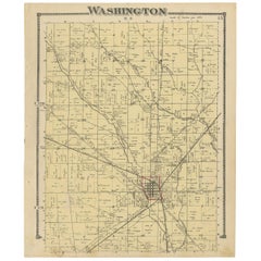
View AllAntique Map of Washington County 'Ohio' by Titus, 1871
Located in Langweer, NL
Antique map titled 'Washington'. Original antique map of Washington, Ohio. This map originates from 'Atlas of Preble County Ohio' by C.O. Titus. Published, 1871.
Category
Antique Late 19th Century Maps
Materials
Paper
$218 Sale Price
24% Off
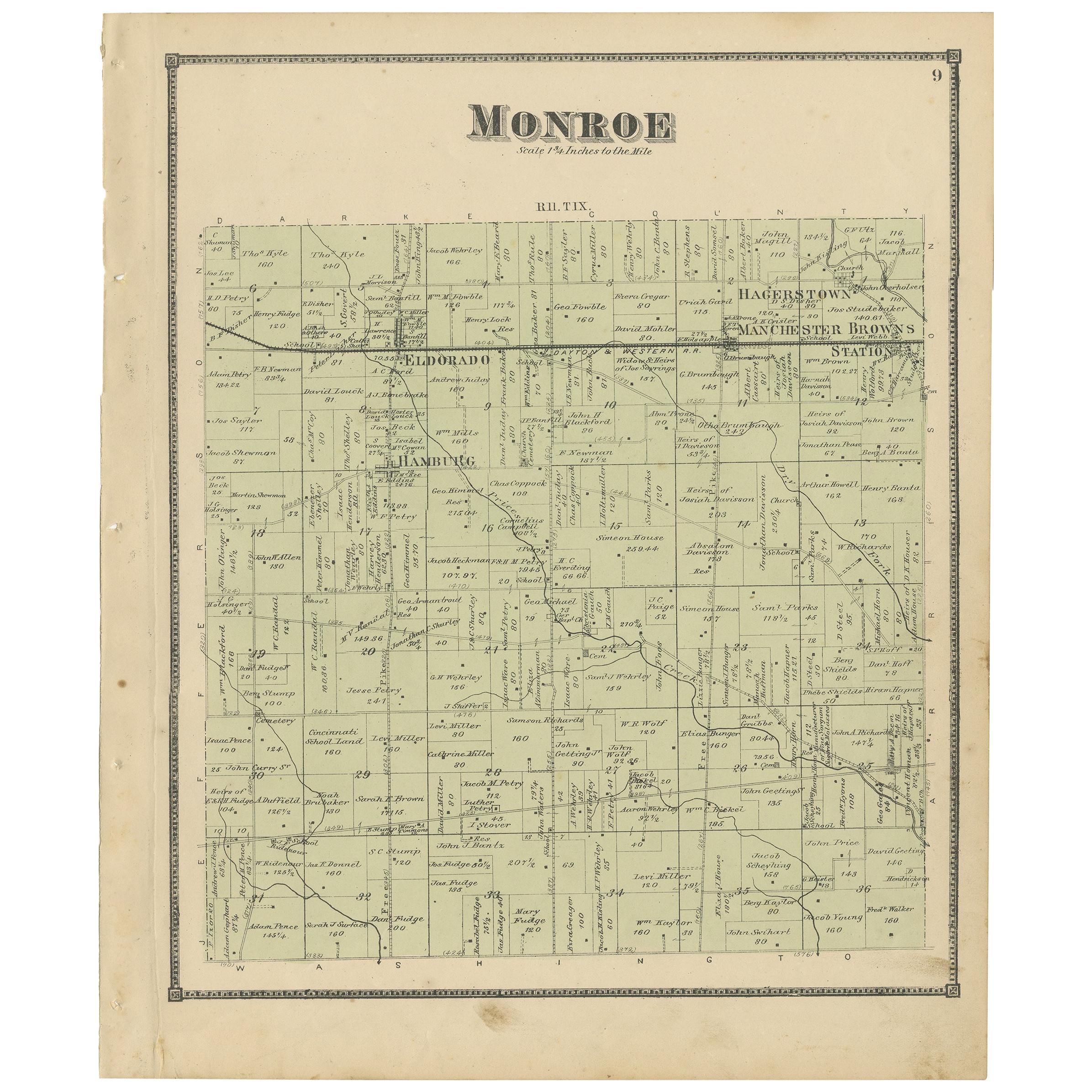
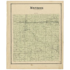
Antique Map of Monroe County 'Ohio' by Titus '1871'
Located in Langweer, NL
Antique map titled 'Monroe'. Original antique map of Monroe, Ohio. This map originates from 'Atlas of Preble County Ohio' by C.O. Titus. Published 1871.
Category
Antique Late 19th Century Maps
Materials
Paper
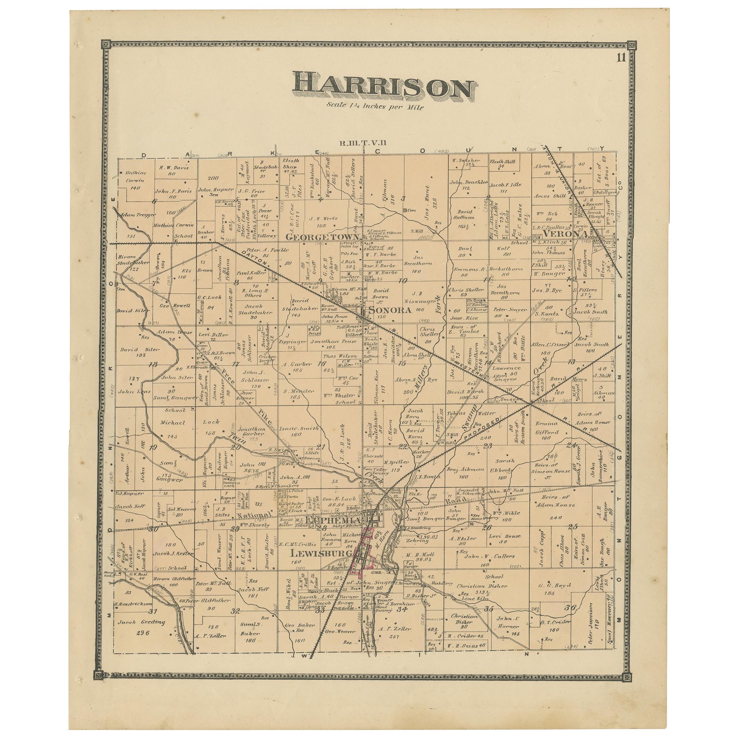
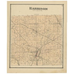
Antique Map of Harrison County 'Ohio' by Titus, 1871
Located in Langweer, NL
Antique map titled 'Harrison'. Original antique map of Harrison, Ohio. This map originates from 'Atlas of Preble County Ohio' by C.O. Titus. Published, 1871.
Category
Antique Late 19th Century Maps
Materials
Paper
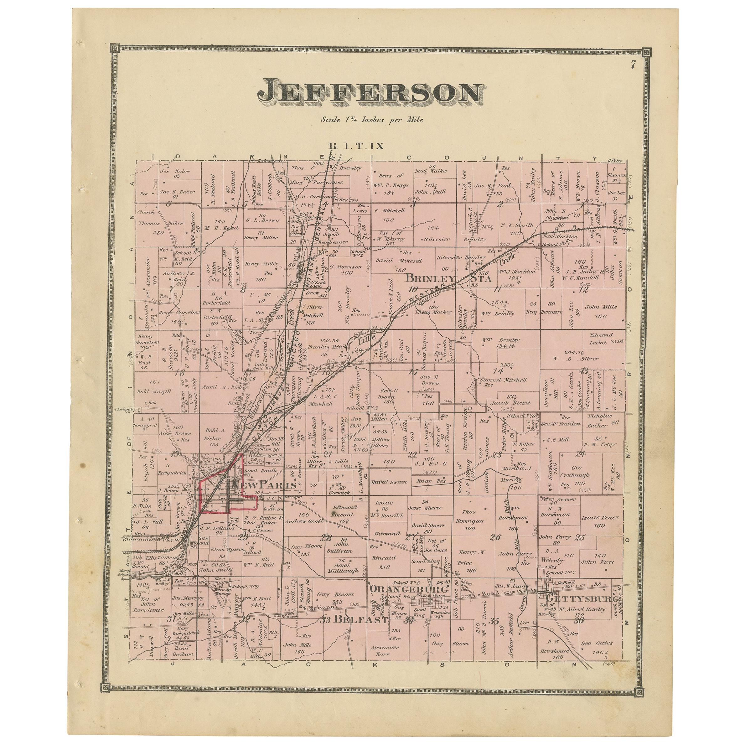
Antique Map of Jefferson County 'Ohio' by Titus, 1871
Located in Langweer, NL
Antique map titled 'Jefferson'. Original antique map of Jefferson, Ohio. This map originates from 'Atlas of Preble County Ohio' by C.O. Titus. Published 1871.
Category
Antique Late 19th Century Maps
Materials
Paper
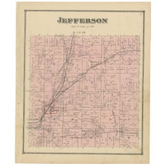
$231 Sale Price
20% Off
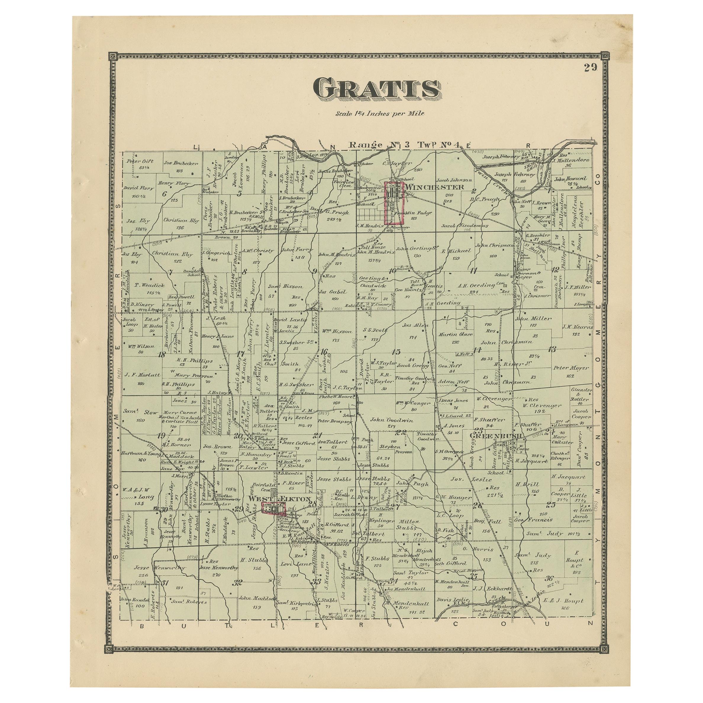
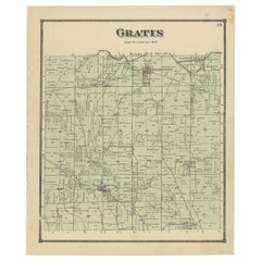
Antique Map of Gratis 'Ohio' by Titus '1871'
Located in Langweer, NL
Antique map titled 'Gratis'. Original antique map of Gratis, Ohio. This map originates from 'Atlas of Preble County Ohio' by C.O. Titus. Published 1871.
Category
Antique Late 19th Century Maps
Materials
Paper
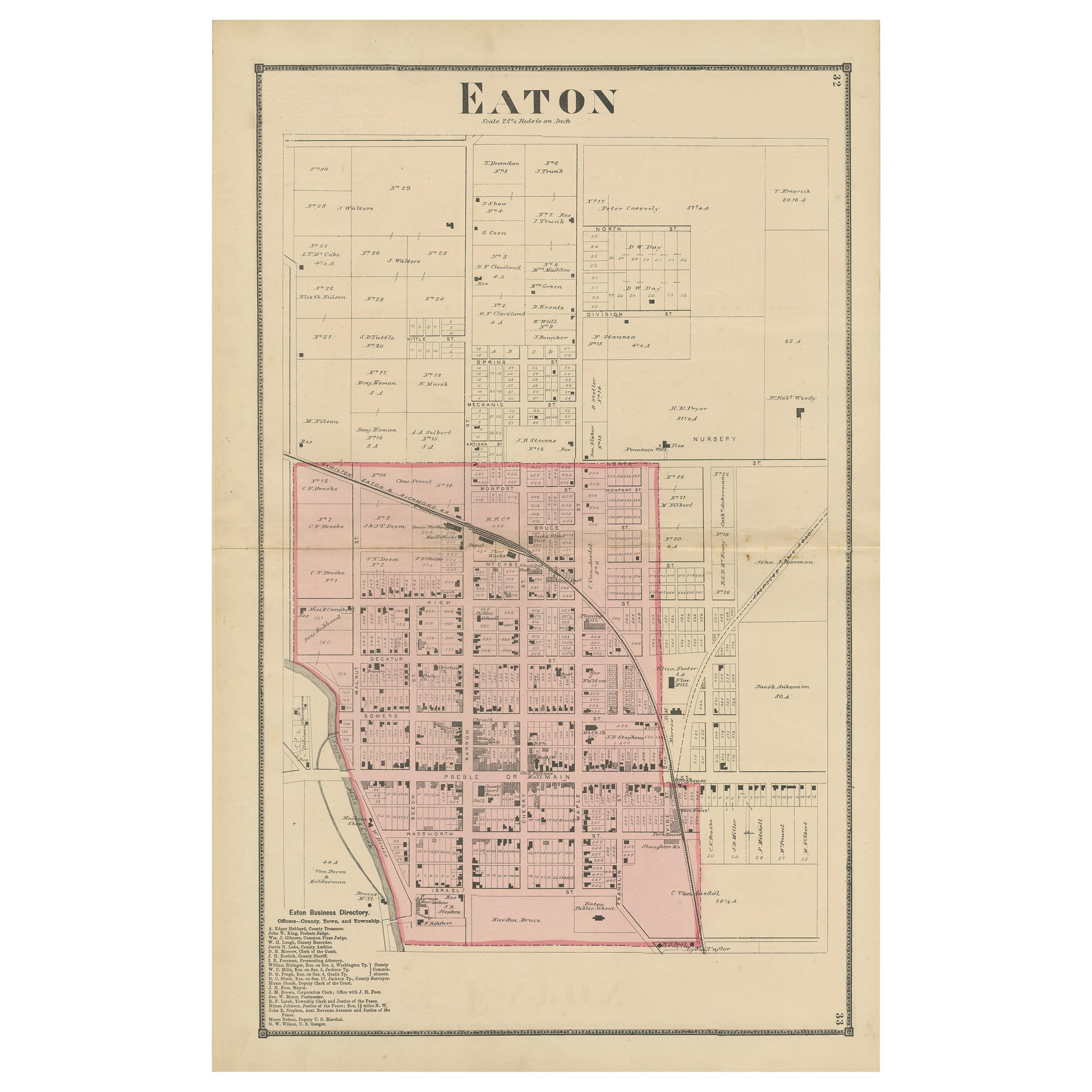
Antique Map of Eaton 'Ohio' by Titus, 1871
Located in Langweer, NL
Antique map titled 'Eaton'. Original antique map of Eaton, Ohio. This map originates from 'Atlas of Preble County Ohio' by C.O. Titus. Published 1871.
Category
Antique Late 19th Century Maps
Materials
Paper

You May Also Like
Original Antique English County Map, Staffordshire, J & C Walker, 1851
Located in St Annes, Lancashire
Great map of Staffordshire
Original colour
By J & C Walker
Published by Longman, Rees, Orme, Brown & Co. 1851
Unframed.
Category
Antique 1850s English Other Maps
Materials
Paper
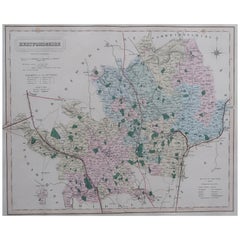
Original Antique English County Map, Herefordshire, J & C Walker, 1851
Located in St Annes, Lancashire
Great map of Herefordshire
Original colour
By J & C Walker
Published by Longman, Rees, Orme, Brown & Co. 1851
Unframed.
Category
Antique 1850s English Other Maps
Materials
Paper

Original Antique English County Map, Huntingdonshire, J & C Walker, 1851
Located in St Annes, Lancashire
Great map of Huntingdonshire
Original colour
By J & C Walker
Published by Longman, Rees, Orme, Brown & Co. 1851
Unframed.
Category
Antique 1850s English Other Maps
Materials
Paper
Original Antique English County Map, Durham, J & C Walker, 1851
Located in St Annes, Lancashire
Great map of Durham
Original colour
By J & C Walker
Published by Longman, Rees, Orme, Brown & Co. 1851
Unframed.
Category
Antique 1850s English Other Maps
Materials
Paper

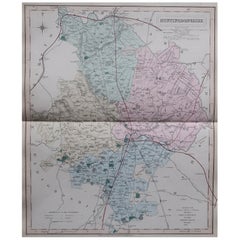
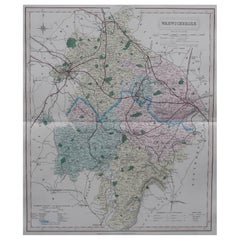
Original Antique English County Map, Warwickshire, J & C Walker, 1851
Located in St Annes, Lancashire
Great map of Warwickshire
Original colour
By J & C Walker
Published by Longman, Rees, Orme, Brown & Co. 1851
Unframed.
Category
Antique 1850s English Other Maps
Materials
Paper
Original Antique English County Map, Hertfordshire. J & C Walker, 1851
Located in St Annes, Lancashire
Great map of Hertfordshire
Original colour
By J & C Walker
Published by Longman, Rees, Orme, Brown & Co. 1851
Unframed.
Category
Antique 1850s English Other Maps
Materials
Paper
Recently Viewed
View AllMore Ways To Browse
1871 Atlas Of Preble County
Antique Babylon
Atlas Map Relief
Hyde Park Antiques
Map Of Madrid
Mughal Map
Old Turkey Map
Portuguese Colonial Brazilian
Antique Vineyard Map
French School Map
Hemisphere Antiques
17th Century Pirate
1871 Atlas Of Preble County
Antique Map By Coronelli
Antique Maps Singapore
Armenia Map
Charles Landseer
Chinese Wall Pocket