Items Similar to Antique Map of the Port of Zihuatanejo in Mexico, c.1740

Want more images or videos?
Request additional images or videos from the seller
1 of 5
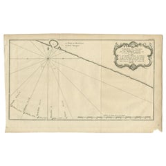
Antique Map of the Port of Zihuatanejo in Mexico, c.1740
About the Item
Antique map titled 'Plan du Port de Chequetan ou Seguataneo'. Map of the Mexican port of Zihuatanejo. This area was originally named Cihuatlán in Aztec, which means 'Place of Women,' referring to the matriarchal society that dominated the region in pre-Columbian times. Source unknown, to be determined.
Artists and Engravers: Admiral of the Fleet George Anson, 1st Baron Anson, PC, FRS (23 April 1697 – 6 June 1762) was a Royal Navy officer.
We sell original antique maps to collectors, historians, educators and interior decorators all over the world. Our collection includes a wide range of authentic antique maps from the 16th to the 20th centuries. Buying and collecting antique maps is a tradition that goes back hundreds of years. Antique maps have proved a richly rewarding investment over the past decade, thanks to a growing appreciation of their unique historical appeal. Today the decorative qualities of antique maps are widely recognized by interior designers who appreciate their beauty and design flexibility. Depending on the individual map, presentation, and context, a rare or antique map can be modern, traditional, abstract, figurative, serious or whimsical. We offer a wide range of authentic antique maps for any budget.
- Dimensions:Height: 9.97 in (25.3 cm)Width: 15.75 in (40 cm)Depth: 0 in (0.01 mm)
- Materials and Techniques:
- Period:
- Date of Manufacture:circa 1740
- Condition:Condition: Very good, please study image carefully.
- Seller Location:Langweer, NL
- Reference Number:Seller: BG-112901stDibs: LU3054327872612
About the Seller
5.0
Recognized Seller
These prestigious sellers are industry leaders and represent the highest echelon for item quality and design.
Platinum Seller
Premium sellers with a 4.7+ rating and 24-hour response times
Established in 2009
1stDibs seller since 2017
2,417 sales on 1stDibs
Typical response time: <1 hour
- ShippingRetrieving quote...Shipping from: Langweer, Netherlands
- Return Policy
Authenticity Guarantee
In the unlikely event there’s an issue with an item’s authenticity, contact us within 1 year for a full refund. DetailsMoney-Back Guarantee
If your item is not as described, is damaged in transit, or does not arrive, contact us within 7 days for a full refund. Details24-Hour Cancellation
You have a 24-hour grace period in which to reconsider your purchase, with no questions asked.Vetted Professional Sellers
Our world-class sellers must adhere to strict standards for service and quality, maintaining the integrity of our listings.Price-Match Guarantee
If you find that a seller listed the same item for a lower price elsewhere, we’ll match it.Trusted Global Delivery
Our best-in-class carrier network provides specialized shipping options worldwide, including custom delivery.More From This Seller
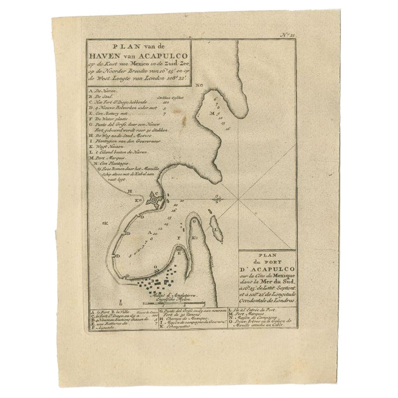
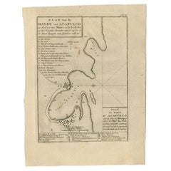
View AllAntique Map of the Port of Acapulco in Mexico, 1749
Located in Langweer, NL
Antique map titled 'Plan van de Haven van Acapulco (..) - Plan du Port d'Acapulco (..)'. Original antique map of the Port of Acapulco on the coast of Mexico in the Southern Sea, at 1...
Category
Antique 18th Century Maps
Materials
Paper
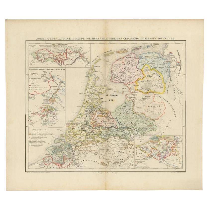
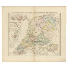
Antique Map of the Netherlands in 1740 by Mees, 1857
Located in Langweer, NL
Antique map titled 'Noord-Nederland in 1740 met de Politieke veranderingen gedurende de 18e eeuw tot in 1795'. Map of the Netherlands in 1740. This map originates from 'Historische A...
Category
Antique 19th Century Maps
Materials
Paper
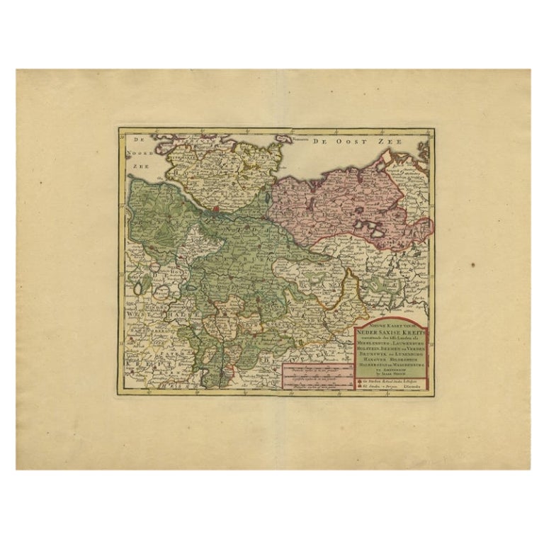
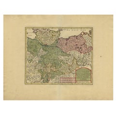
Antique Map of Lower Saxony in Germany, c.1740
Located in Langweer, NL
Antique map titled 'Nieuwe Kaart van de Neder Saxise Kreits (..).' Attractive detailed map showing Lower Saxony, Germany, including Mekelenburg, Lauwenburg, Holstein, Bremen, Verden ...
Category
Antique 18th Century Maps
Materials
Paper
Antique Map of the Arabian Peninsula by Bellin 'c.1740'
Located in Langweer, NL
Antique map titled 'Carte de la Coste d'Arabie, Mer Rouge et Golfe de Perse'. Original antique map of the Arabian Peninsula, labes both Mecca and Med...
Category
Antique Mid-18th Century Maps
Materials
Paper

$464 Sale Price
20% Off
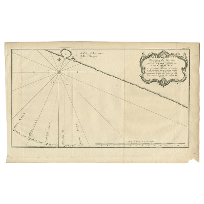
Antique Map of the Coast of Acapulco by Anson, c.1740
Located in Langweer, NL
Antique map titled 'Disposition des Vaisseaux de l'Escadre commandée par Mr. Anson croisant vis à vis d'Acapulco en 1742'. This map depicts the coast of Acapulco in Mexico with a decorative cartouche and windrose. Acapulco and its port were important to the Mission of Commodore George Anson, who captured a Spanish treasure...
Category
Antique 18th Century Maps
Materials
Paper
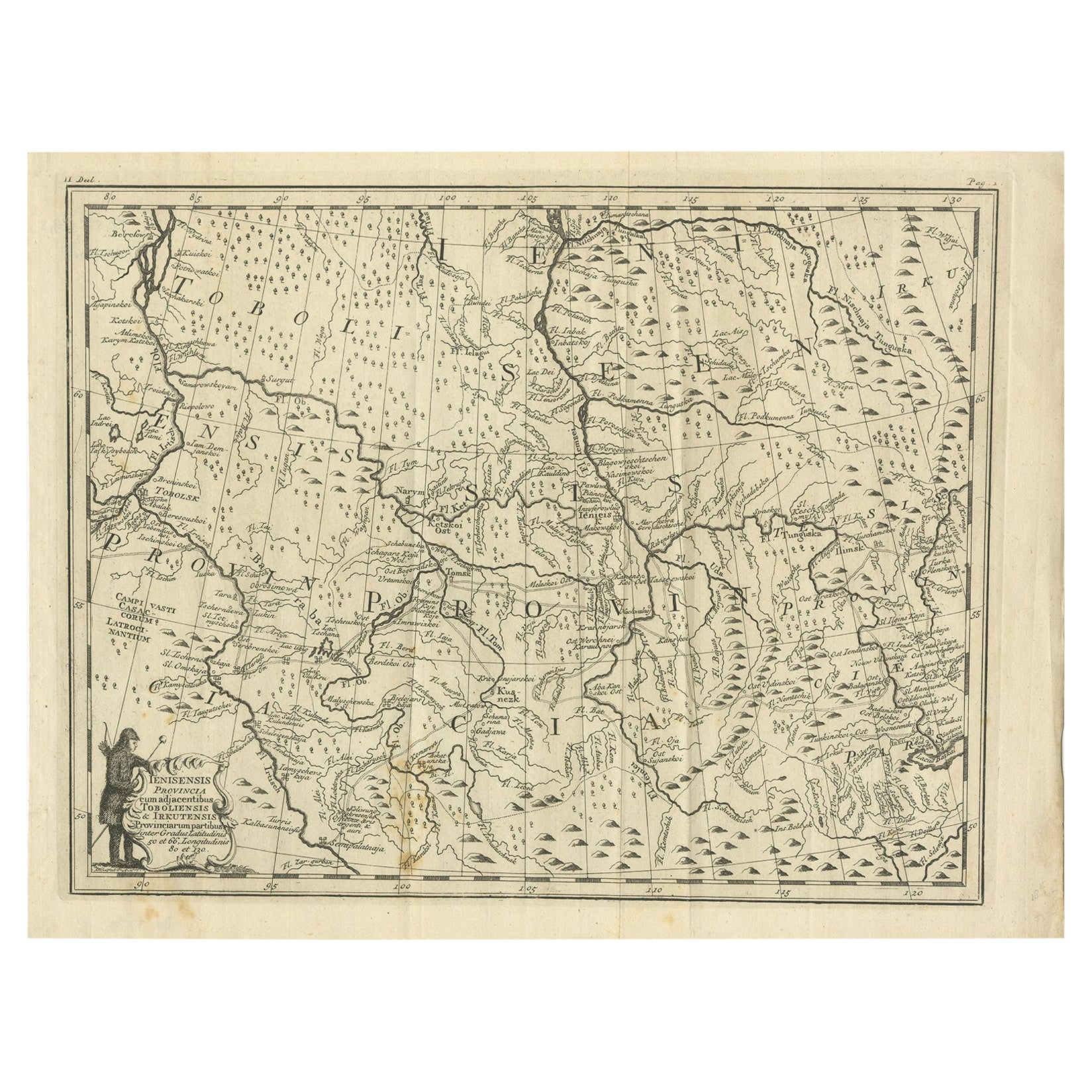
Antique Map of Part of Russia, c.1740
Located in Langweer, NL
Antique map titled 'Ienisensis Provinicia cum adjacentibus Toboliensis & Irkutensis'. Old map of part of Russia including the city of Tobolsk and others. Source unknown, to be determ...
Category
Antique 18th Century Maps
Materials
Paper
You May Also Like
Original Antique Map of the American State of Arizona & New Mexico, 1903
Located in St Annes, Lancashire
Antique map of Arizona and New Mexico
Published By A & C Black. 1903
Original colour
Good condition
Unframed.
Free shipping
Category
Antique Early 1900s English Maps
Materials
Paper

Framed 1838 Mexico & Gulf of Mexico Map
Located in Stamford, CT
Framed 1838 Mexico & Gulf of Mexico map. Printed by Fisher, Son & Co. of London in 1838. As found framed condition. Map has not been examined outside of th...
Category
Antique 1830s English American Classical Maps
Materials
Glass, Wood, Paper

1847 Ornamental Map of the United States & Mexico by H. Phelps
Located in Colorado Springs, CO
Offered is an original 1847 ornamental map of the U.S. entitled "Ornamental Map of the United States & Mexico" by Humphrey Phelps. The map was issued as an act of Congress by Phelps on Fulton Street, New York. The broadside is elaborately hand-colored.
This is a very detailed and graphic propaganda map of the United States expressing U.S. dominance of the North American continent. The hand-colored map proclaims the Manifest Destiny, with the recent acquisition of Upper California and Texas at the conclusion of the Mexican-American War. The newly acquired land is boldly colored, standing in stark contrast to the rest of the U.S. The map details a potential route for a railroad running from New York City, to Buffalo, to Chicago, then west along the Oregon Trail to Oregon City. This route anticipates the construction of the transcontinental railroad by nearly 20 years.
The map includes elaborately detailed renderings of George Washington, Hernan Cortez, and Montezuma at top to represent European expansion to the Americas. At bottom are four inset designs with text showing the following: a chronological history of the U.S. beginning from settlement to the U.S. victory in the Mexican-American war; an illustration of General Zachary Taylor with details on the Oregon Territory; an illustration of the Aztec Temple of the Sun in Tenochtitlan and a chronology of the Conquest of the Aztec Empire under Cortez; a portrait of General Antonio Lopez de Santa Anna...
Category
Antique 1840s American Maps
Materials
Paper

18th Century Emanuel Bowen Map of County of York, c.1740
By Emanuel Bowen
Located in Royal Tunbridge Wells, Kent
Antique 18th century British rare and original Emanuel Bowen (1694-1767) map of the County of York divided into its Ridings and subdivided into wapontakes, mounted in solid wood fram...
Category
Antique Early 18th Century British Maps
Materials
Paper

Original Antique Map of The Philippines. C.1900
Located in St Annes, Lancashire
Fabulous map of The Philippines
Original color.
Engraved and printed by the George F. Cram Company, Indianapolis.
Published, C.1900.
Unframed.
Free shipping.
Category
Antique 1890s American Maps
Materials
Paper

1847 Antique Map of Mexico, Texas and California by Samuel Augustus Mitchell
By Samuel Augustus Mitchell 1
Located in Colorado Springs, CO
Presented is the second edition of Samuel Augustus Mitchell's Map of Mexico, Including Yucatan & Upper California, an important map showing the progress of the Mexican-American War. ...
Category
Antique 1840s American Maps
Materials
Paper

Recently Viewed
View AllMore Ways To Browse
Antique Aztec
Vintage Tuareg Rug
Walter Nichols Rug
Wavy Table Legs
White Plastic Coffee Table
Will Coggin
Wooden Bar Cart
18 Oak Side Table
18th Century Swedish Chairs
1970s Lucite Chairs
19th Century Italian Straw Chairs
90s Desk
Adrian Pearsall Couch
Antique Hand Painted Tapestry
Antique Mixing Table
Antique Pull Out Dining Table
Antique Silver Salvers
Antique Walnut Dressing Table