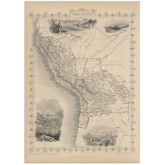
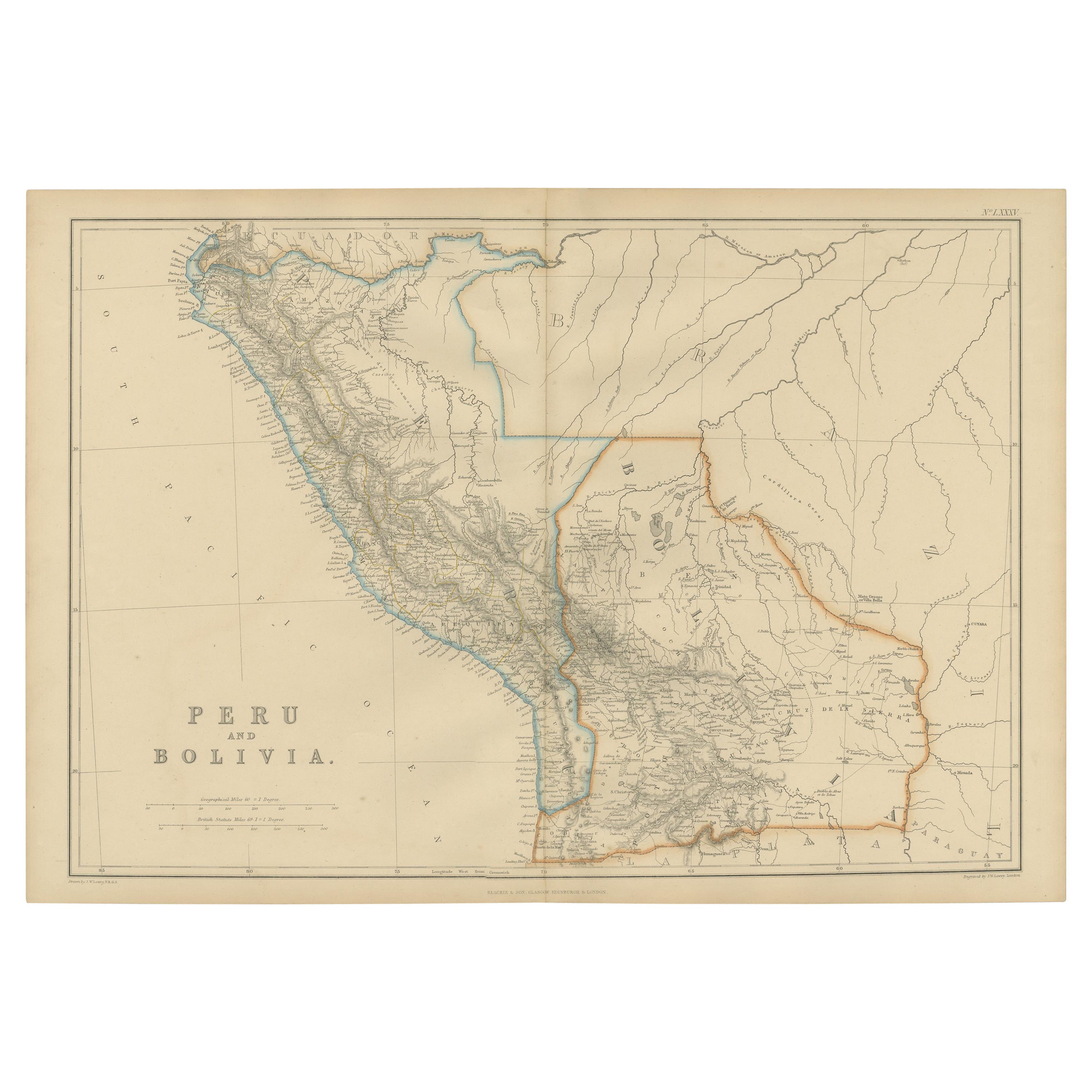
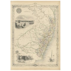
Antique Map of Peru and Bolivia by J. Tallis, circa 1851
View Similar Items


Want more images or videos?
Request additional images or videos from the seller
1 of 5
Antique Map of Peru and Bolivia by J. Tallis, circa 1851
About the Item
- Dimensions:Height: 14.65 in (37.2 cm)Width: 10.44 in (26.5 cm)Depth: 0.02 in (0.5 mm)
- Materials and Techniques:
- Period:
- Date of Manufacture:circa 1851
- Condition:Please study image carefully.
- Seller Location:Langweer, NL
- Reference Number:Seller: BG-034381stDibs: LU305439442853
About the Seller
5.0
Recognized Seller
These prestigious sellers are industry leaders and represent the highest echelon for item quality and design.
Platinum Seller
Premium sellers with a 4.7+ rating and 24-hour response times
Established in 2009
1stDibs seller since 2017
2,412 sales on 1stDibs
Typical response time: 1 hour
Authenticity Guarantee
In the unlikely event there’s an issue with an item’s authenticity, contact us within 1 year for a full refund. DetailsMoney-Back Guarantee
If your item is not as described, is damaged in transit, or does not arrive, contact us within 7 days for a full refund. Details24-Hour Cancellation
You have a 24-hour grace period in which to reconsider your purchase, with no questions asked.Vetted Professional Sellers
Our world-class sellers must adhere to strict standards for service and quality, maintaining the integrity of our listings.Price-Match Guarantee
If you find that a seller listed the same item for a lower price elsewhere, we’ll match it.Trusted Global Delivery
Our best-in-class carrier network provides specialized shipping options worldwide, including custom delivery.More From This Seller
View AllAntique Map of Belgium by J. Tallis, circa 1851
Located in Langweer, NL
A highly decorative and detailed mid-19th century map of Belgium which was drawn and engraved by J. Rapkin (vignettes by J. Marchant and J. B. Allen) an...
Category
Antique Mid-19th Century Maps
Materials
Paper

$231 Sale Price
20% Off
Antique Map of Switzerland by J. Tallis, circa 1851
Located in Langweer, NL
A decorative and detailed mid-19th century map of Switzerland which was drawn and engraved by J. Rapkin (vignettes by A. H. Wray & J. B. Allen) and published in John Tallis's Illustr...
Category
Antique Mid-19th Century Maps
Materials
Paper

$254 Sale Price
20% Off
Antique Map of Northern Italy by J. Tallis, circa 1851
Located in Langweer, NL
A highly decorative mid-19th century map of Northern Italy which was drawn and engraved by John Rapkin (vignettes by A. H. Wray & J. B. Allen) and published in John Tallis & co.'s Th...
Category
Antique Mid-19th Century Maps
Materials
Paper

$166 Sale Price
47% Off
Antique Map of Southern Italy by J. Tallis, circa 1851
Located in Langweer, NL
Decorative and detailed mid-19th century map of Southern Italy which was drawn and engraved by John Rapkin (vignettes by A. H. Wray and J. Rogers...
Category
Antique Mid-19th Century Maps
Materials
Paper

$254 Sale Price
20% Off
Antique Map of Asia Minor by J. Tallis, circa 1851
Located in Langweer, NL
A highly decorative mid-19th century map of 'Asia Minor' (modern day Turkey) which was drawn and engraved by J. Rapkin and published in John Tallis's Illust...
Category
Antique Mid-19th Century Maps
Materials
Paper

$254 Sale Price
20% Off
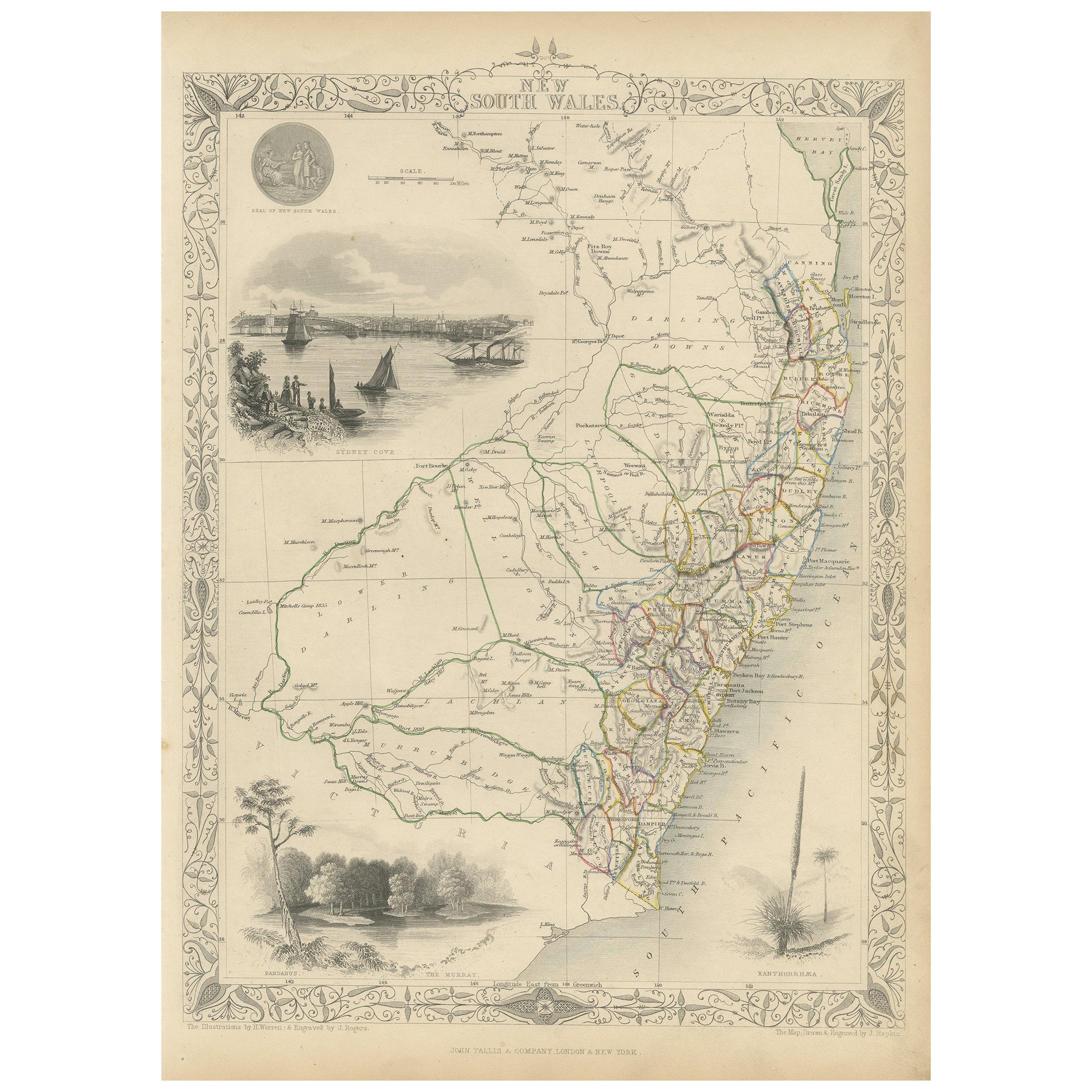
Antique Map of New South Wales by Tallis, circa 1851
Located in Langweer, NL
Antique map titled 'New South Wales'. Decorative and detailed map of New South Wales which was drawn and engraved by J. Rapkin (vignettes by H. Warren ...
Category
Antique Mid-19th Century Maps
Materials
Paper
$323 Sale Price
20% Off
You May Also Like
"San Francisco, Upper California” 1851 Antique Map of San Francisco
Located in Colorado Springs, CO
This is a pictorial lettersheet view of the city and harbor of San Francisco. This lithograph was printed on grey wove paper, across a double sheet, by famed lithographers Britton & ...
Category
Antique 1850s American Prints
Materials
Paper

$1,200 Sale Price
20% Off
Original Antique English County Map, Herefordshire, J & C Walker, 1851
Located in St Annes, Lancashire
Great map of Herefordshire
Original colour
By J & C Walker
Published by Longman, Rees, Orme, Brown & Co. 1851
Unframed.
Category
Antique 1850s English Other Maps
Materials
Paper

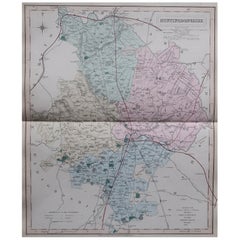
Original Antique English County Map, Huntingdonshire, J & C Walker, 1851
Located in St Annes, Lancashire
Great map of Huntingdonshire
Original colour
By J & C Walker
Published by Longman, Rees, Orme, Brown & Co. 1851
Unframed.
Category
Antique 1850s English Other Maps
Materials
Paper
Original Antique English County Map, Durham, J & C Walker, 1851
Located in St Annes, Lancashire
Great map of Durham
Original colour
By J & C Walker
Published by Longman, Rees, Orme, Brown & Co. 1851
Unframed.
Category
Antique 1850s English Other Maps
Materials
Paper

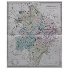
Original Antique English County Map, Warwickshire, J & C Walker, 1851
Located in St Annes, Lancashire
Great map of Warwickshire
Original colour
By J & C Walker
Published by Longman, Rees, Orme, Brown & Co. 1851
Unframed.
Category
Antique 1850s English Other Maps
Materials
Paper
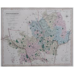
Original Antique English County Map, Hertfordshire. J & C Walker, 1851
Located in St Annes, Lancashire
Great map of Hertfordshire
Original colour
By J & C Walker
Published by Longman, Rees, Orme, Brown & Co. 1851
Unframed.
Category
Antique 1850s English Other Maps
Materials
Paper
Recently Viewed
View AllMore Ways To Browse
1960s Metal Benches
1960s Swivel Chairs Pair
54 Round Dining Table
7 Chair Fritz
70s Console Table
Aluminum Group Desk Chairs By Charles Eames
Antique American Silver Pitchers
Antique Ottoman Silk
Antique Wooden Armchair 20th Century
Art Deco Sterling Silver Silverware
Baker Cocktail Coffee Table
Bent Stainless Steel
Bird Sofa
Black And Gold Lacquer Console
Black And White Tableware
Black Minimal Bench
Blue And Orange Chinese Porcelain
Blue Glass Ormolu