Items Similar to Antique Map of the Maluku Islands or Moluccas, Indonesia

Want more images or videos?
Request additional images or videos from the seller
1 of 6
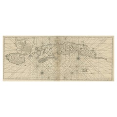
Antique Map of the Maluku Islands or Moluccas, Indonesia
About the Item
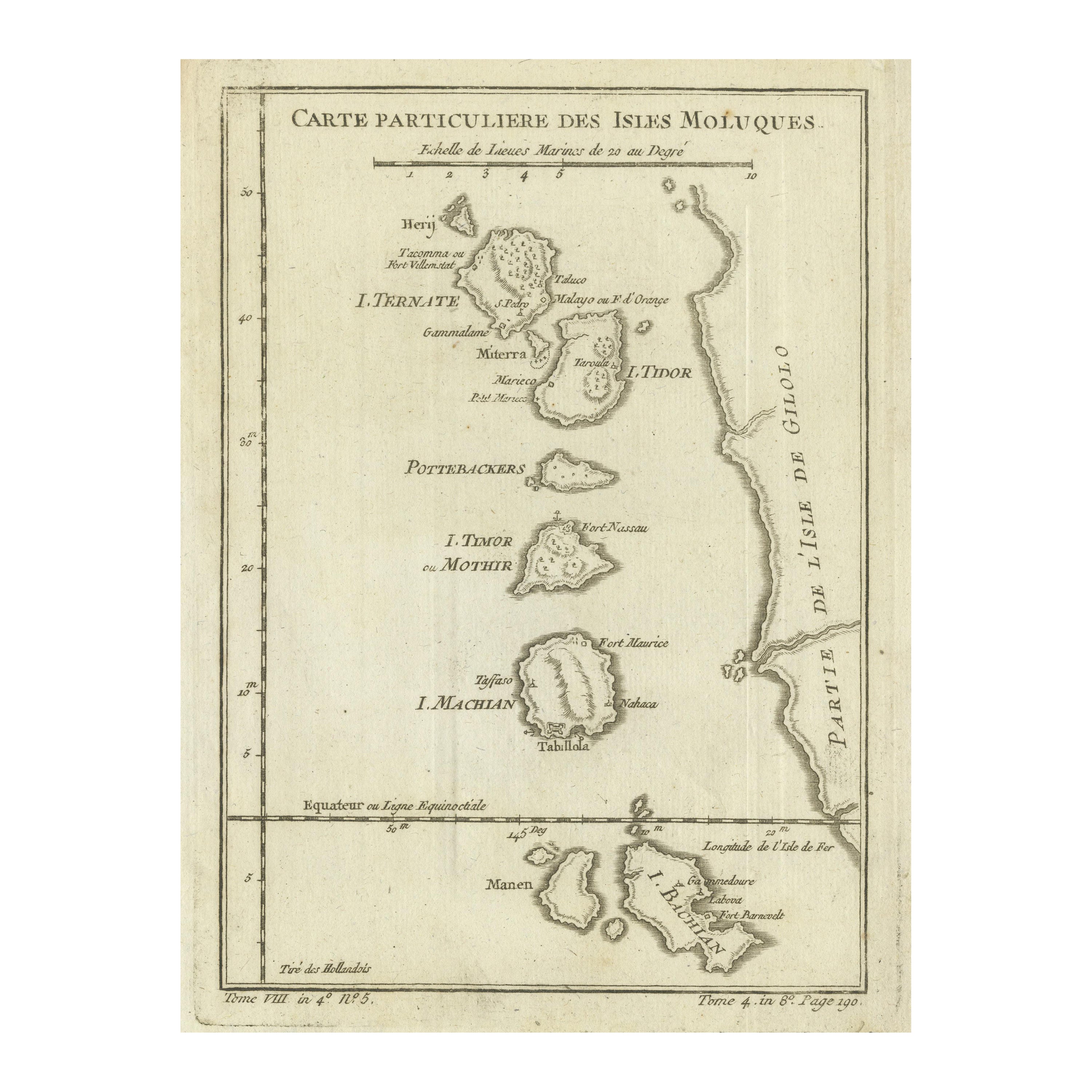
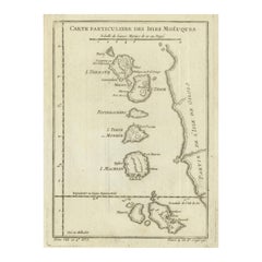
Antique map titled 'Carte Particuliere des Isles Moluques'. This map depicts the islands of Herij, Ternate, Tidor, Pottebackers, Timor, Machian and Bachian. The Moluccan islands were once part of the Dutch East Indies. Today the Moluccas are part of Indonesia. This map originates from Prevost’s ‘Histoire Generale des Voyages (..)’ Engraved by J.N. Bellin.
Jacques-Nicolas Bellin (1703 - 1772) was one of the most important cartographers of the 18th century. With a career spanning some 50 years, Bellin is best understood as geographe de cabinet and transitional mapmaker spanning the gap between 18th and early 19th century cartographic styles. His long career as Hydrographer and Ingénieur Hydrographe at the French Dépôt des cartes et plans de la Marine resulted in hundreds of high quality nautical charts of practically everywhere in the world. A true child of the Enlightenment Era, Bellin's work focuses on function and accuracy tending in the process to be less decorative than the earlier 17th and 18th century cartographic work. Unlike many of his contemporaries, Bellin was always careful to cite his references and his scholarly corpus consists of over 1400 articles on geography prepared for Diderot's Encyclopedie. Bellin, despite his extraordinary success, may not have enjoyed his work, which is described as "long, unpleasant, and hard." In addition to numerous maps and charts published during his lifetime, many of Bellin's maps were updated (or not) and published posthumously. He was succeeded as Ingénieur Hydrographe by his student, also a prolific and influential cartographer, Rigobert Bonne.
- Dimensions:Height: 10.08 in (25.6 cm)Width: 7.17 in (18.2 cm)Depth: 0.02 in (0.5 mm)
- Materials and Techniques:
- Period:
- Date of Manufacture:circa 1760
- Condition:Replacements made: Left margin extended. General age-related toning. Left margin extended. Shows wear and soiling. Blank verso. Please study image carefully.
- Seller Location:Langweer, NL
- Reference Number:Seller: BG-12707-681stDibs: LU3054334606012
About the Seller
5.0
Recognized Seller
These prestigious sellers are industry leaders and represent the highest echelon for item quality and design.
Platinum Seller
Premium sellers with a 4.7+ rating and 24-hour response times
Established in 2009
1stDibs seller since 2017
2,418 sales on 1stDibs
Typical response time: <1 hour
- ShippingRetrieving quote...Shipping from: Langweer, Netherlands
- Return Policy
Authenticity Guarantee
In the unlikely event there’s an issue with an item’s authenticity, contact us within 1 year for a full refund. DetailsMoney-Back Guarantee
If your item is not as described, is damaged in transit, or does not arrive, contact us within 7 days for a full refund. Details24-Hour Cancellation
You have a 24-hour grace period in which to reconsider your purchase, with no questions asked.Vetted Professional Sellers
Our world-class sellers must adhere to strict standards for service and quality, maintaining the integrity of our listings.Price-Match Guarantee
If you find that a seller listed the same item for a lower price elsewhere, we’ll match it.Trusted Global Delivery
Our best-in-class carrier network provides specialized shipping options worldwide, including custom delivery.More From This Seller
View AllOriginal Antique Map of the Maluku Islands or Moluccas, Indonesia
Located in Langweer, NL
Antique map titled 'Carte Particuliere des Isles Moluques'. This map depicts the islands of Herij, Ternate, Tidor, Pottebackers, Timor, Machian and Bachian. The Moluccan islands were...
Category
Antique Mid-18th Century Maps
Materials
Paper
$102 Sale Price
20% Off
Original Antique Map of the Maluku Islands or Moluccas
Located in Langweer, NL
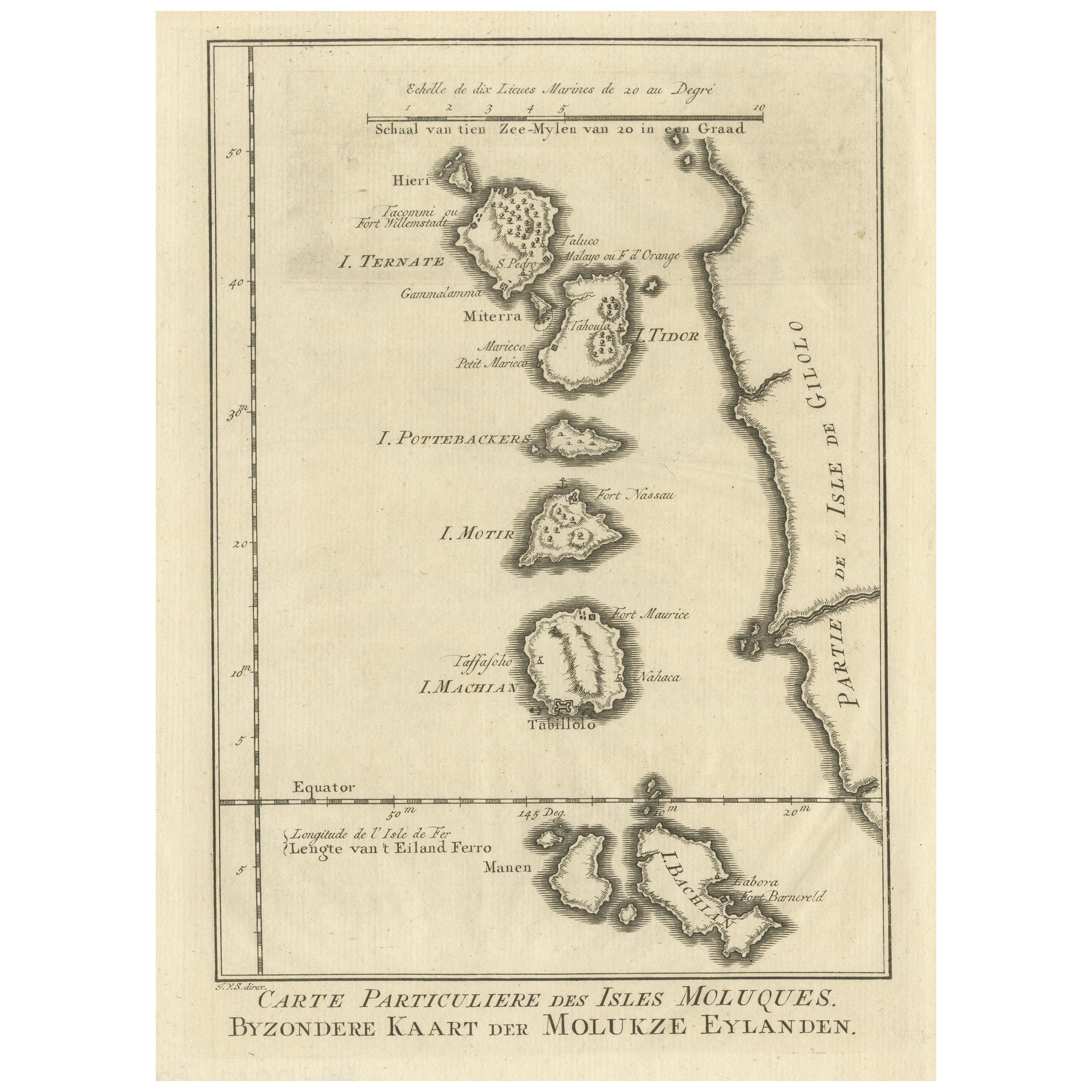
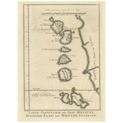
Antique map titled 'Carte Particuliere des Isles Moluques - Byzondere Kaart der Molukze Eylanden'. This map depicts the islands of Herij, Ternate, Tidor, Pottebackers, Timor, Machian...
Category
Antique Mid-18th Century Maps
Materials
Paper
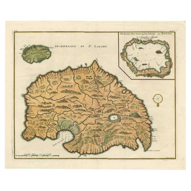
Antique Map of Ambelau and Buru Island, Maluku or Moluccas in Indonesia, 1726
Located in Langweer, NL
Antique map titled 'Boero - Amblauw (..).' Detailed map of the Island Ambelau and Buru, Maluku Islands, Indonesia, by Francois Valentyn. With an inset of the lake on the Buru mountai...
Category
Antique 18th Century Maps
Materials
Paper

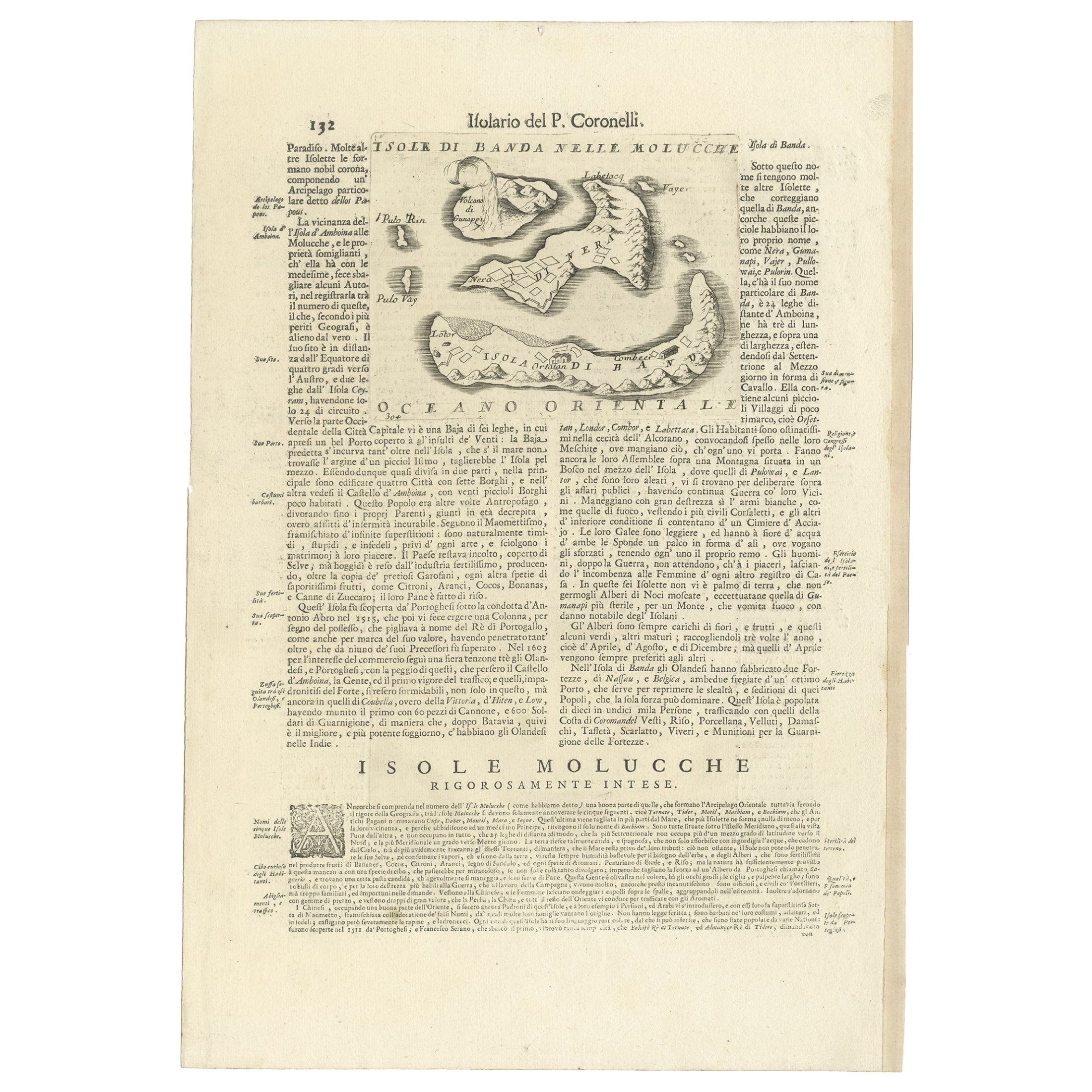
Antique Map of the Banda Islands or Spice Islands, Moluccas, Indonesia, 1697
Located in Langweer, NL
Antique map titled 'Isole di Banda Nelle Molucche'.
Engraved map of Isola di Banda, Nelle, Molucche. On verso: 'Isola di Solor'.
Artists and Engravers: Vincenzo Maria (Padre)...
Category
Antique 17th Century Maps
Materials
Paper
Antique Map of the Moluccas or the Famed Spice Islands of Indonesia, 1724
Located in Langweer, NL
Antique map Spice Islands titled 'De landvoogdy van Amboina met de elf onderhoorige Eylanden'.
This map depicts the central islands of the Maluku Arc...
Category
Antique 1720s Maps
Materials
Paper
$827 Sale Price
20% Off
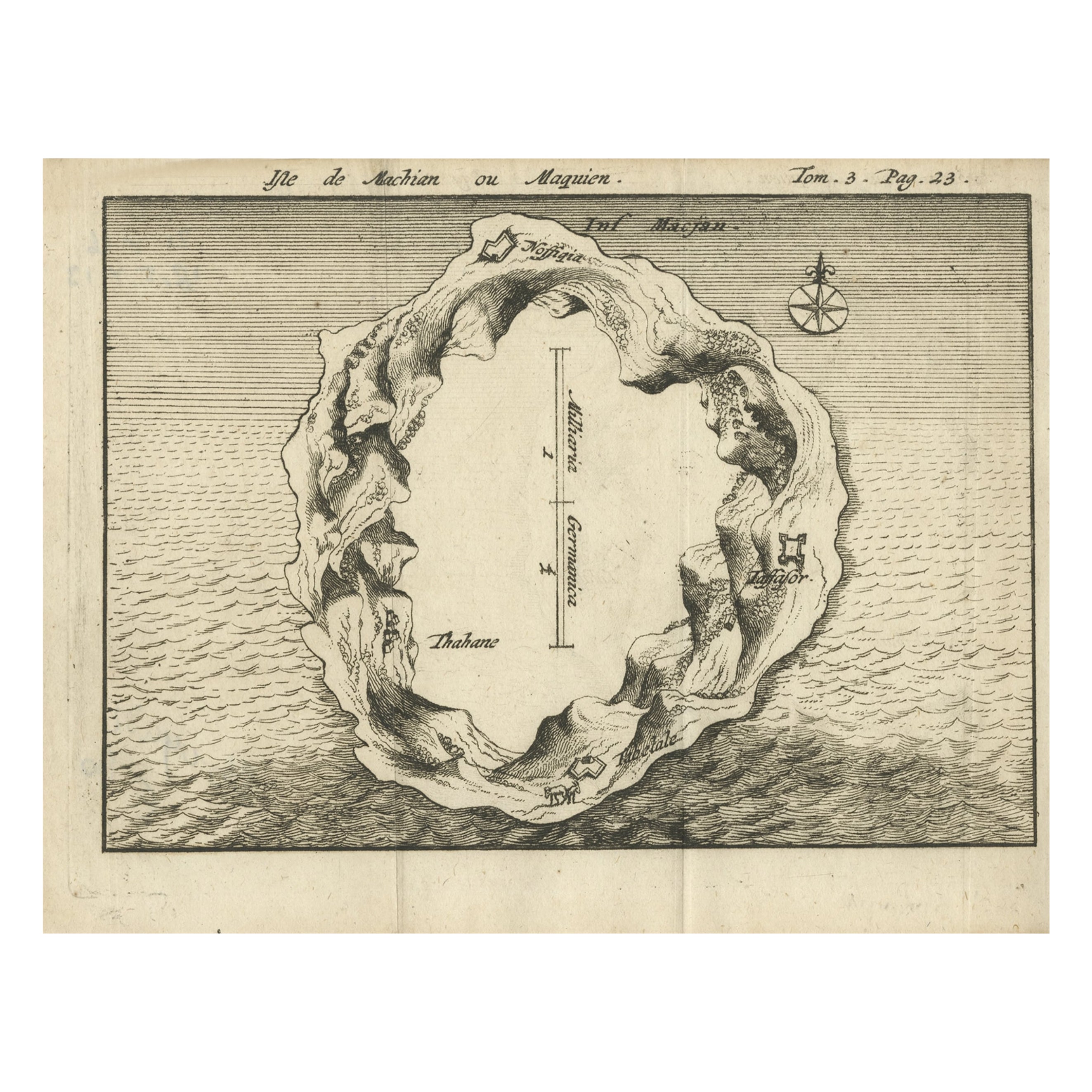
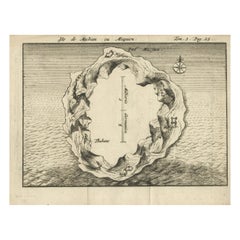
Antique Map of Macjan or Makian Island in the Moluccas, Indonesia, c.1740
Located in Langweer, NL
Antique map titled 'Isle de Machian ou Maquien'. Map of the island of Macjan, Moluccas. Source unknown, to be determined. Artists and Engravers: Anonymous.
Artist: Anonymous.
Con...
Category
Antique 18th Century Maps
Materials
Paper
You May Also Like
Large Original Antique Map of the The Windward Islands. 1894
Located in St Annes, Lancashire
Superb Antique map of The Windward Islands
Published Edward Stanford, Charing Cross, London 1894
Original colour
Good condition
Unframed.
Free shipping
Category
Antique 1890s English Maps
Materials
Paper

Large Original Antique Map of The Greek Islands. 1894
Located in St Annes, Lancashire
Superb Antique map of The Greek Islands
Published Edward Stanford, Charing Cross, London 1894
Original colour
Good condition
Unframed.
Free shipping
Category
Antique 1890s English Maps
Materials
Paper

Large Original Antique Map of The Leeward Islands. 1894
Located in St Annes, Lancashire
Superb Antique map of The Leeward Islands
Published Edward Stanford, Charing Cross, London 1894
Original colour
Good condition
Unframed.
Free shipping
Category
Antique 1890s English Maps
Materials
Paper

Large Original Antique Map of The Falkland Islands. 1894
Located in St Annes, Lancashire
Superb Antique map of The Falkland Islands
Published Edward Stanford, Charing Cross, London 1894
Original colour
Good condition
Unframed.
Free shipping
Category
Antique 1890s English Maps
Materials
Paper

Large Original Antique Map of The Canary Islands. 1894
Located in St Annes, Lancashire
Superb Antique map of The Canary Islands
Published Edward Stanford, Charing Cross, London 1894
Original colour
Good condition
Unframed.
Free shipping
Category
Antique 1890s English Maps
Materials
Paper

Original Antique Map of the American State of Connecticut & Rhode Island, 1903
Located in St Annes, Lancashire
Antique map of Connecticut and Rhode Island
Published By A & C Black. 1903
Original colour
Good condition
Unframed.
Free shipping
Category
Antique Early 1900s English Maps
Materials
Paper

Recently Viewed
View AllMore Ways To Browse
Encyclopedie Diderot
Faience Oyster
Faux Stone Table
Folding Leather Dining Chairs
Four Louis Xvi Chairs
French Coupe Glass
French Library Chairs
French Silver Coffee Pot
French Style Dressing Table
Glass Knife Rest
Hanging Console Table
Hanging Tile
Hollis Lucite Coffee Table
Hollywood Regency French Chairs
Irish Cut Glass
Italian Leather Folding Chairs
Italian Liquor
Jensen Silver In Copenhagen