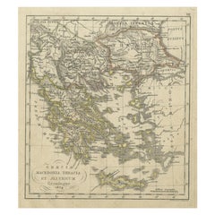
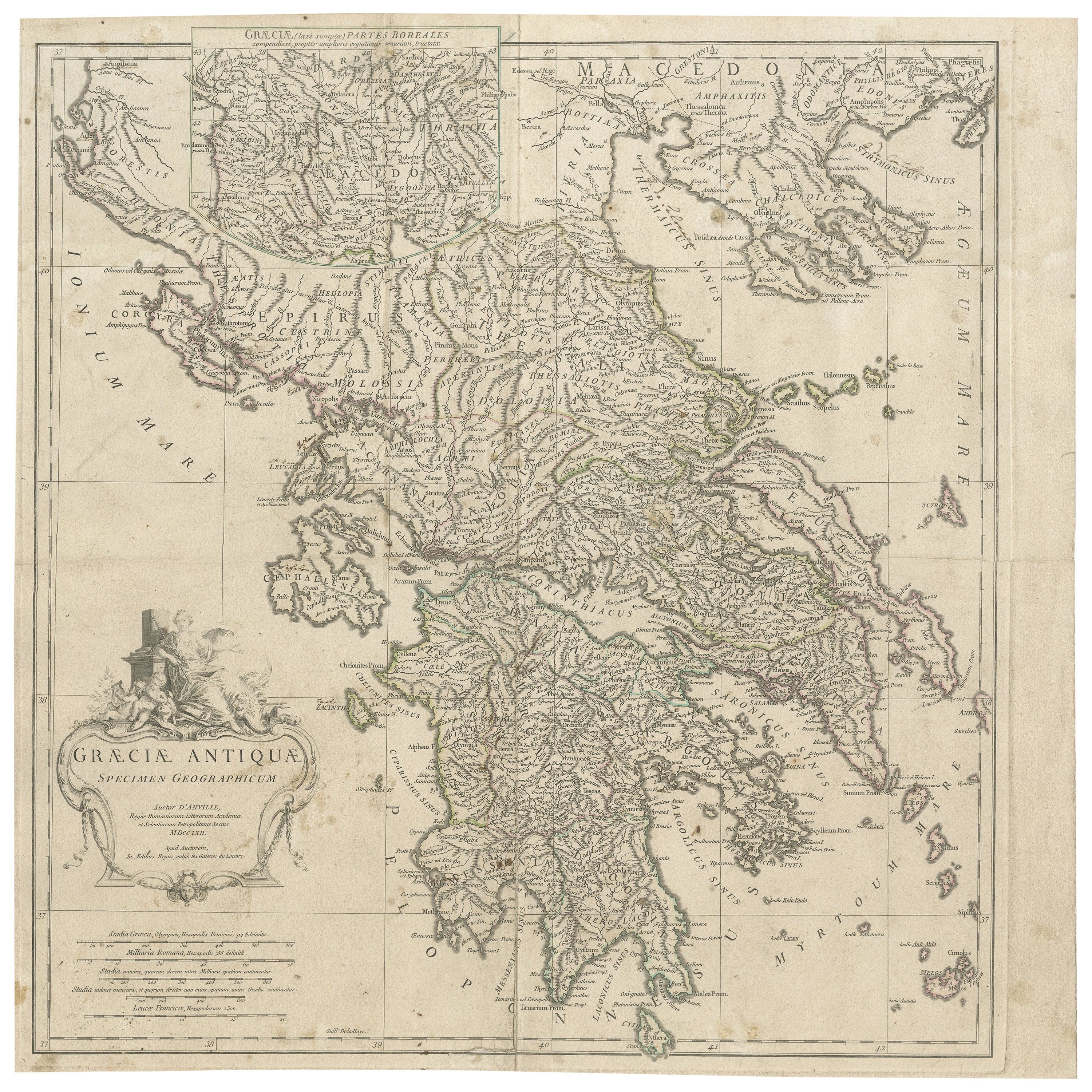
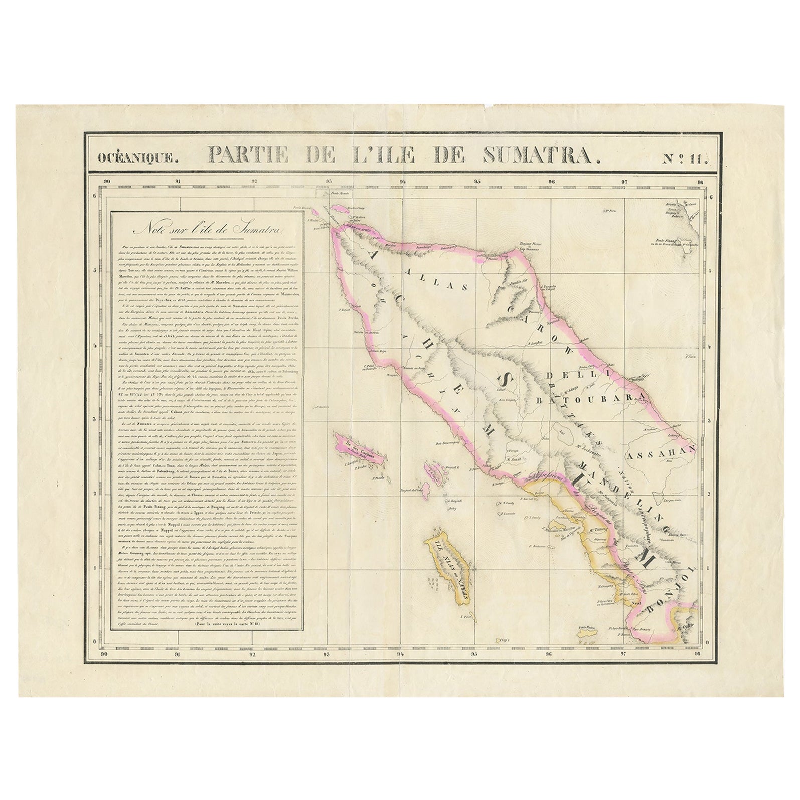
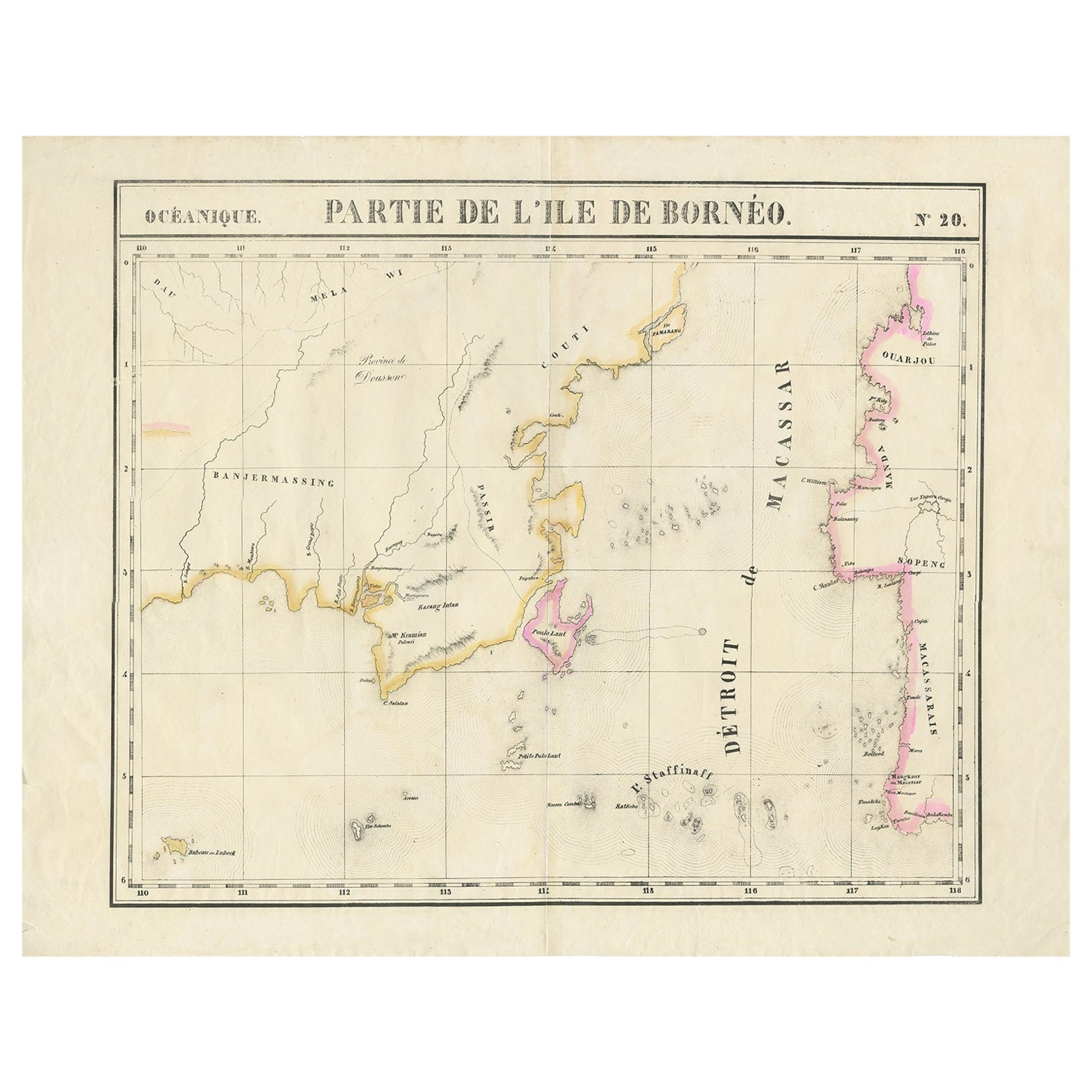
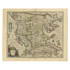
Antique Map of Greece and Macedonia, 1825
View Similar Items


Want more images or videos?
Request additional images or videos from the seller
1 of 5
Antique Map of Greece and Macedonia, 1825
About the Item
- Dimensions:Height: 9.85 in (25 cm)Width: 8.59 in (21.8 cm)Depth: 0 in (0.01 mm)
- Materials and Techniques:
- Period:
- Date of Manufacture:1825
- Condition:
- Seller Location:Langweer, NL
- Reference Number:Seller: BG-11204-2-61stDibs: LU3054326300122
About the Seller
5.0
Recognized Seller
These prestigious sellers are industry leaders and represent the highest echelon for item quality and design.
Platinum Seller
Premium sellers with a 4.7+ rating and 24-hour response times
Established in 2009
1stDibs seller since 2017
2,412 sales on 1stDibs
Typical response time: 1 hour
Authenticity Guarantee
In the unlikely event there’s an issue with an item’s authenticity, contact us within 1 year for a full refund. DetailsMoney-Back Guarantee
If your item is not as described, is damaged in transit, or does not arrive, contact us within 7 days for a full refund. Details24-Hour Cancellation
You have a 24-hour grace period in which to reconsider your purchase, with no questions asked.Vetted Professional Sellers
Our world-class sellers must adhere to strict standards for service and quality, maintaining the integrity of our listings.Price-Match Guarantee
If you find that a seller listed the same item for a lower price elsewhere, we’ll match it.Trusted Global Delivery
Our best-in-class carrier network provides specialized shipping options worldwide, including custom delivery.More From This Seller
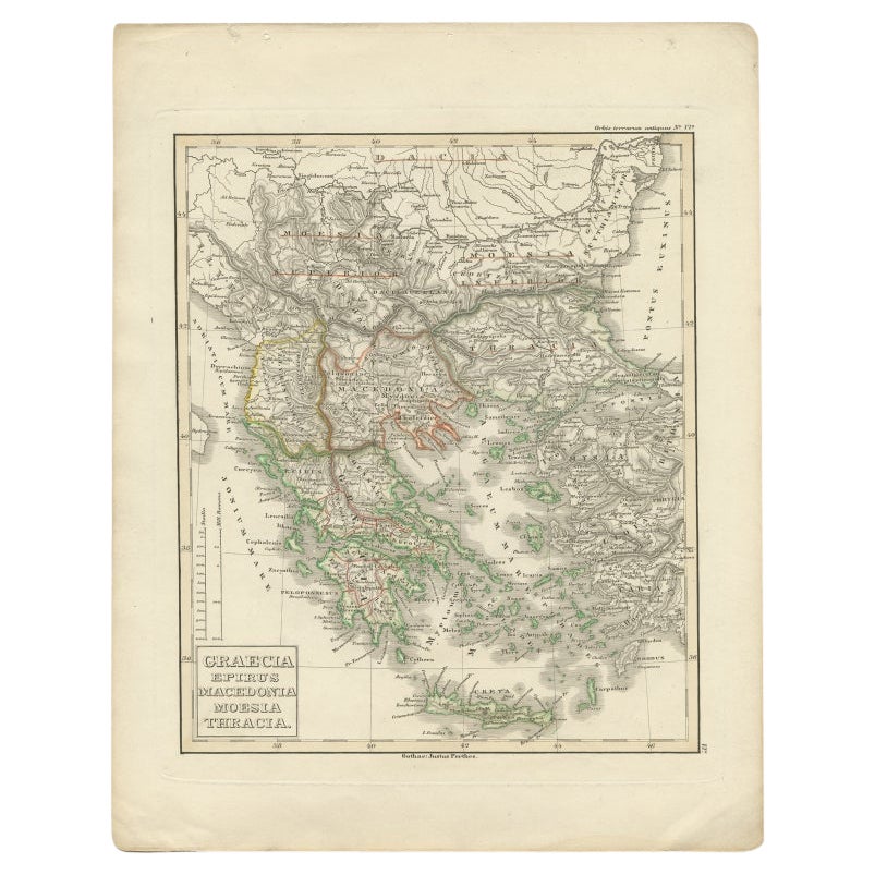
View AllAntique Map of Greece and Macedonia, 1848
Located in Langweer, NL
Antique map titled 'Graecia Epirus Macedonia Moesia Thracia'. Old map of Greece originating from 'Orbis Terrarum Antiquus in usum Scholarum'. Artists and Engravers: Published by Just...
Category
Antique 19th Century Maps
Materials
Paper

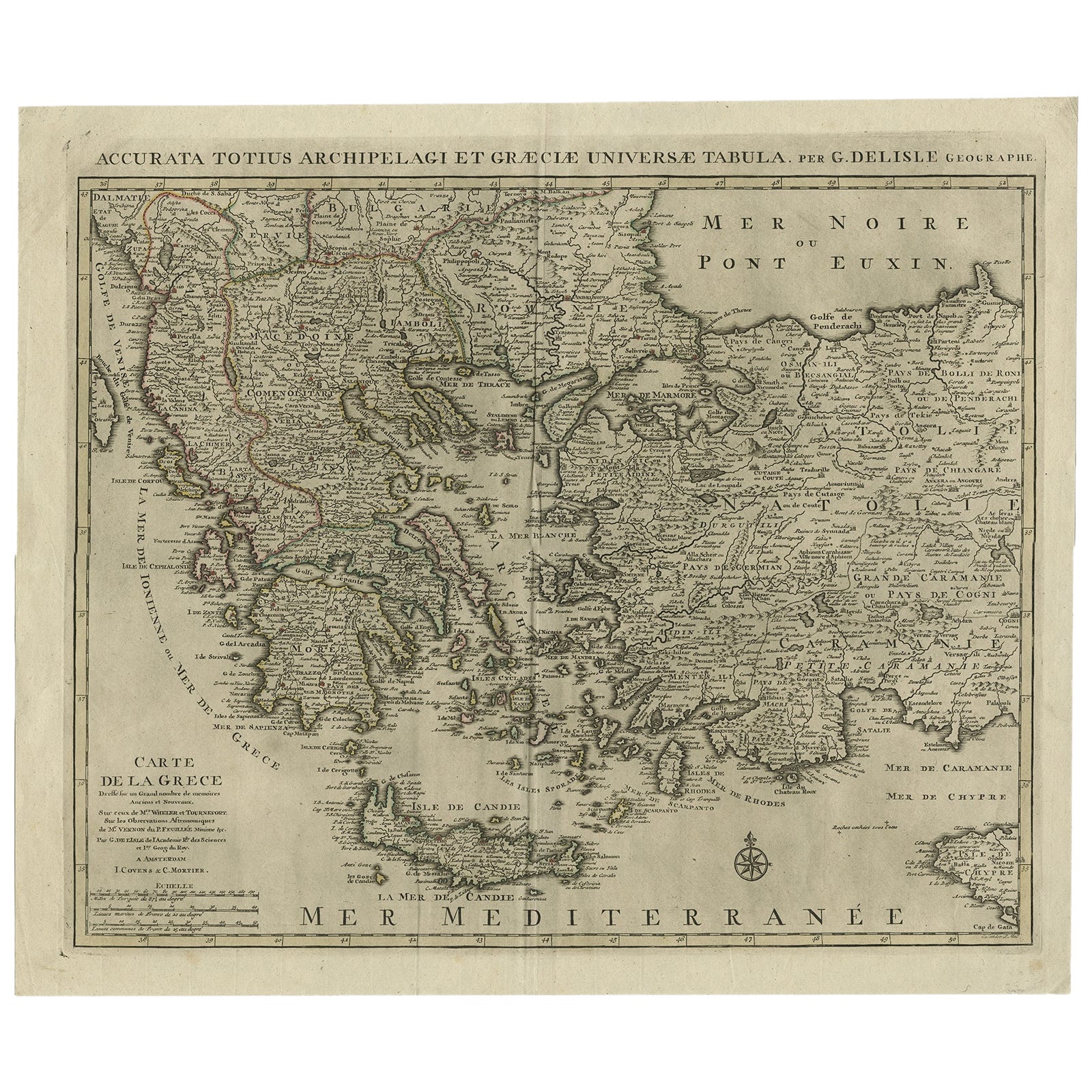
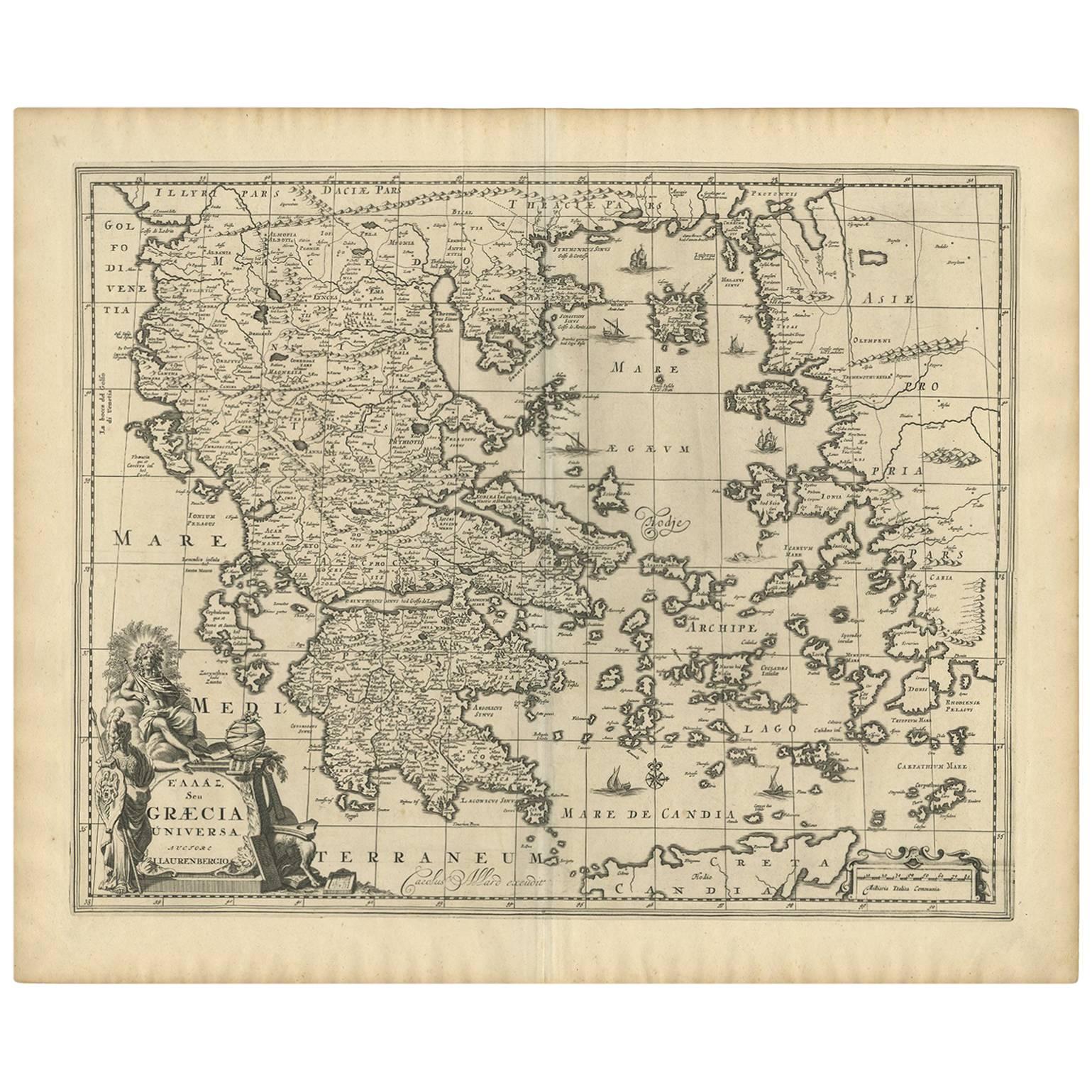
Antique Map of Greece, Albania, Macedonia and Parts of Turkey and Cyprus, c.1745
Located in Langweer, NL
Antique map titled 'Accurata Totius Archipelagi Et Graeciae Universae Tabula'.
Detailed map of Greece. Includes Albania, Macedonia and parts of Turkey and Cyprus. With compass rose...
Category
Antique 18th Century Maps
Materials
Paper
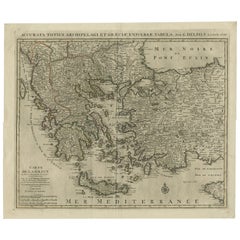
$786 Sale Price
20% Off
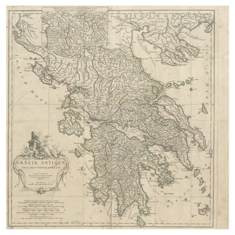
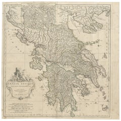
Large Scale Map of Greece with Inset Map of Macedonia, c.1786
Located in Langweer, NL
Antique map titled 'Graeciae Antiquae'. Large scale map of Greece, extends south to the island of Cythera. Inset map shows details of Macedonia. Publis...
Category
Antique 18th Century Maps
Materials
Paper

Large Scale Map of Greece, Extending to Cythera with Inset of Macedonia, ca.1786
Located in Langweer, NL
Antique map titled 'Graeciae Antiquae'.
Large scale map of Greece, extends south to the island of Cythera. Inset map shows details of Macedonia. Pu...
Category
Antique 1780s Maps
Materials
Paper
Antique Map of Polynesia and Australasia by Neele, 1825
Located in Langweer, NL
Antique map titled 'Polynesia and Australasia'. It shows Australia (New Holland), part of Asia, New Zealand and many islands. This map originates from 'Encyclopedia Londinensis'.
Category
Antique Early 19th Century Maps
Materials
Paper

$110 Sale Price
20% Off
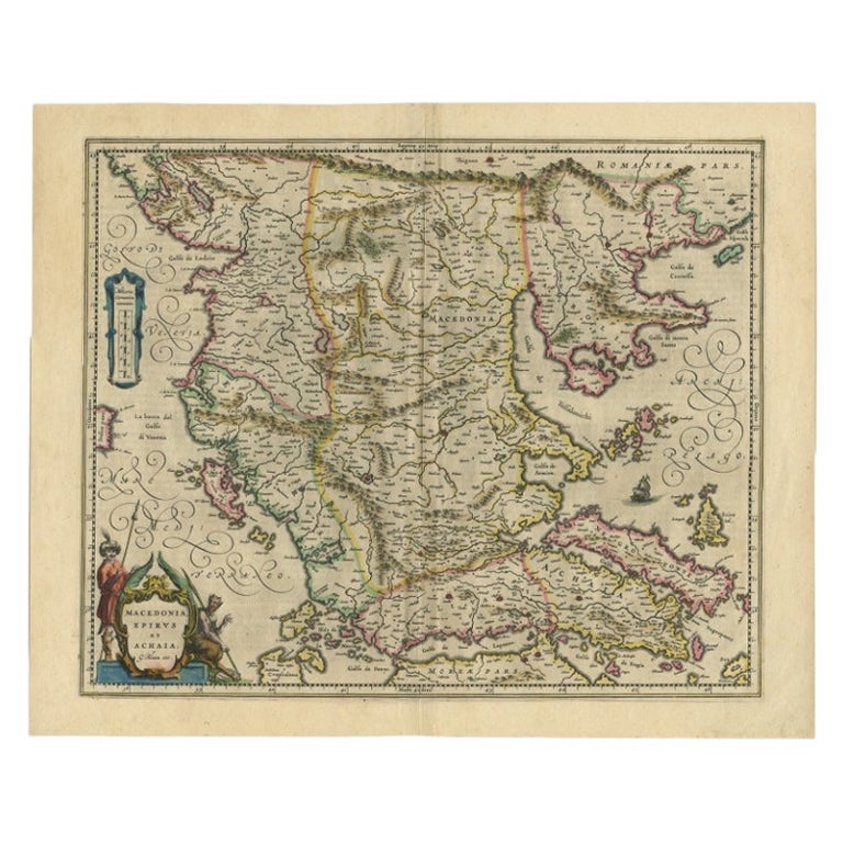
Antique Map of Macedonia by the Famous Mapmaker Blaeu, c.1650
Located in Langweer, NL
Antique map titled 'Macedonia, Epirus et Achaia'.
Ornated with a nice allegoric cartouche, one ship and a milage scale. Macedonia is shown in the centre of the map. With many detai...
Category
Antique 17th Century Maps
Materials
Paper
$1,062 Sale Price
20% Off
You May Also Like
Original Antique Map of Ancient Greece, Achaia, Corinth, 1786
Located in St Annes, Lancashire
Great map of Ancient Greece. Showing the region of Thessaly, including Mount Olympus
Drawn by J.D. Barbie Du Bocage
Copper plate engraving by P.F Tardieu
Original hand color...
Category
Antique 1780s French Other Maps
Materials
Paper

Original Antique Map of Ancient Greece- Boeotia, Thebes, 1787
Located in St Annes, Lancashire
Great map of Ancient Greece. Showing the region of Boeotia, including Thebes
Drawn by J.D. Barbie Du Bocage
Copper plate engraving by P.F T...
Category
Antique 1780s French Other Maps
Materials
Paper

Antique Map of Principality of Monaco
By Antonio Vallardi Editore
Located in Alessandria, Piemonte
ST/619 - "Old Geographical Atlas of Italy - Topographic map of ex-Principality of Monaco" -
ediz Vallardi - Milano -
A somewhat special edition ---
Category
Antique Late 19th Century Italian Other Prints
Materials
Paper

Original Antique Map of Spain and Portugal, circa 1790
Located in St Annes, Lancashire
Super map of Spain and Portugal
Copper plate engraving by A. Bell
Published, circa 1790.
Unframed.
Category
Antique 1790s English Other Maps
Materials
Paper

Original Antique Map of Ireland- Tipperary and Waterford. C.1840
Located in St Annes, Lancashire
Great map of Tipperary and Waterford
Steel engraving
Drawn under the direction of A.Adlard
Published by How and Parsons, C.1840
Unframed.
Category
Antique 1840s English Maps
Materials
Paper

Southern Greece: A Large 17th C. Hand-colored Map by Sanson and Jaillot
By Nicolas Sanson
Located in Alamo, CA
This large original hand-colored copperplate engraved map of southern Greece and the Pelopponese Peninsula entitled "La Moree Et Les Isles De Zante, Cefalonie, Ste. Marie, Cerigo & C...
Category
Antique 1690s French Maps
Materials
Paper

Recently Viewed
View AllMore Ways To Browse
Antique Konya Rugs
Marble Top 2 Leg Console Table
Mcguire Rattan Table
Mcm Lounge Chair
Mcm Lounge Chairs
Metamorphic Table
Mid Century Hexagon Side Table
Mid Century Tub Chairs
Midcentury Modern Brutalist Wall Art
Midcentury Modern Oval Dining Room Set
Milla Milli
Milo Baughman Light
Modular Sofa Cassina
Moroccan Velvet
Movie Posters 1950
Natural Fiber Couches
Oil Paintings 1930s Deco
Organic Cotton Sofa