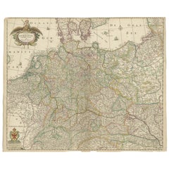
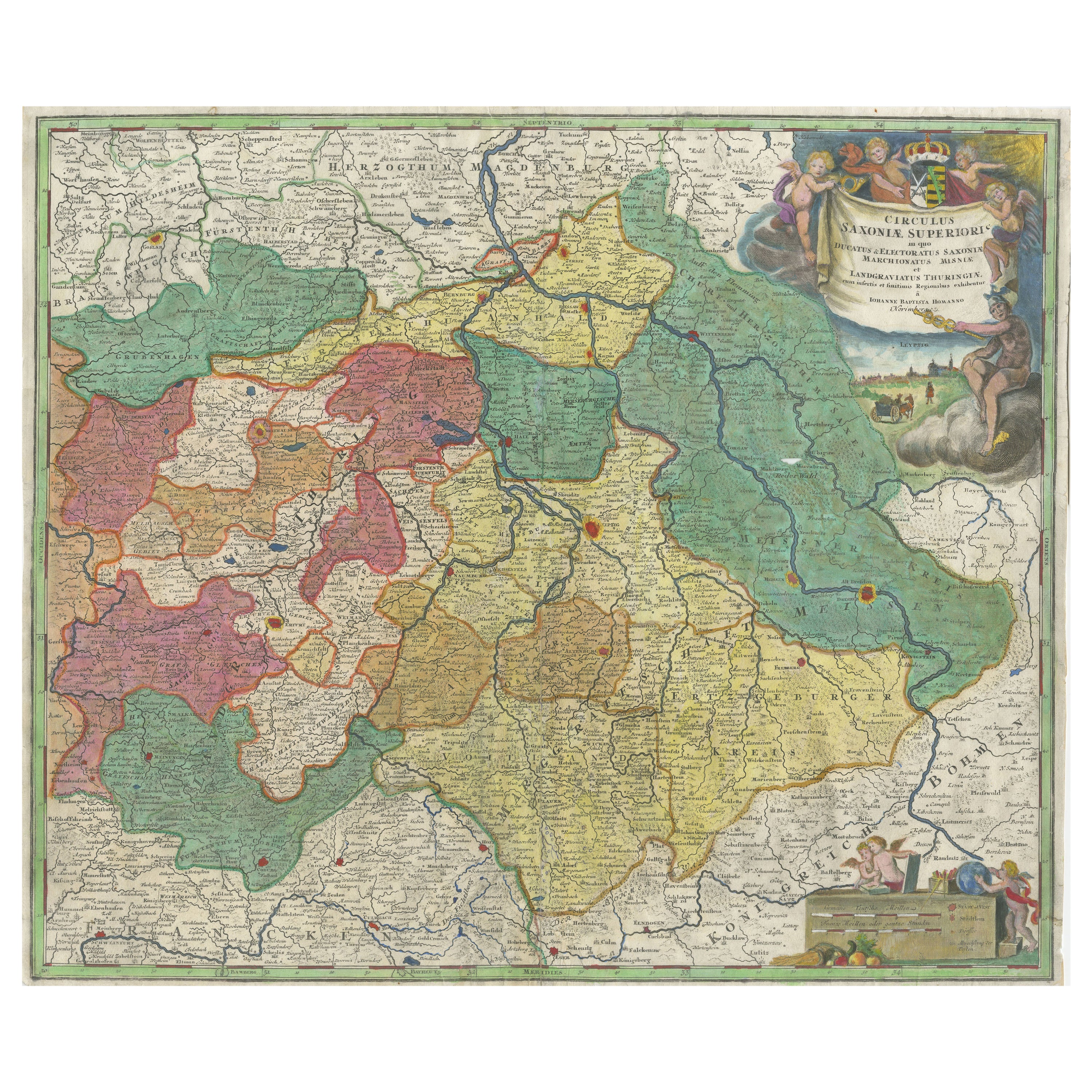
Antique Map of Germany including surrounding countries
View Similar Items


Want more images or videos?
Request additional images or videos from the seller
1 of 6
Antique Map of Germany including surrounding countries
About the Item
- Dimensions:Height: 18.71 in (47.5 cm)Width: 23 in (58.4 cm)Depth: 0.02 in (0.5 mm)
- Materials and Techniques:
- Period:Mid-17th Century
- Date of Manufacture:c.1650
- Condition:General age-related toning. Original folding line. Narrow margins. Shows wear and minor soiling. Blank verso. Please study image carefully.
- Seller Location:Langweer, NL
- Reference Number:Seller: BG-13441-61stDibs: LU3054335788702
About the Seller
5.0
Recognized Seller
These prestigious sellers are industry leaders and represent the highest echelon for item quality and design.
Platinum Seller
Premium sellers with a 4.7+ rating and 24-hour response times
Established in 2009
1stDibs seller since 2017
2,418 sales on 1stDibs
Authenticity Guarantee
In the unlikely event there’s an issue with an item’s authenticity, contact us within 1 year for a full refund. DetailsMoney-Back Guarantee
If your item is not as described, is damaged in transit, or does not arrive, contact us within 7 days for a full refund. Details24-Hour Cancellation
You have a 24-hour grace period in which to reconsider your purchase, with no questions asked.Vetted Professional Sellers
Our world-class sellers must adhere to strict standards for service and quality, maintaining the integrity of our listings.Price-Match Guarantee
If you find that a seller listed the same item for a lower price elsewhere, we’ll match it.Trusted Global Delivery
Our best-in-class carrier network provides specialized shipping options worldwide, including custom delivery.More From This Seller
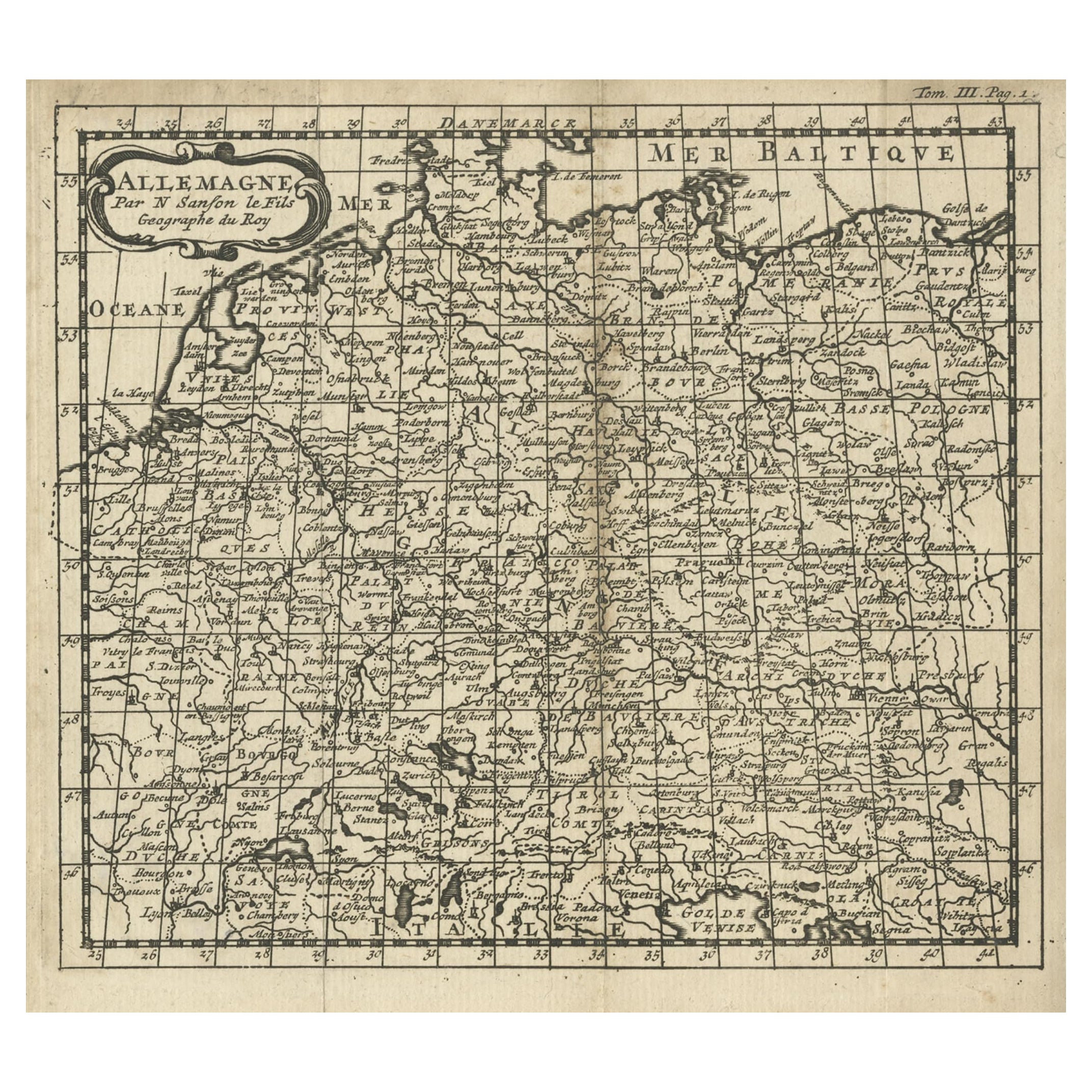
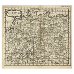
View AllFrench Antique Miniature Map of Germany and Surrounding Countries, 1721
Located in Langweer, NL
Antique map Germany titled 'Allemagne Par N. Sanson le Fils Geographe du Roy'. Minitaure map of Germany and surroundings. Originates from 'Introduc...
Category
Antique 18th Century Maps
Materials
Paper
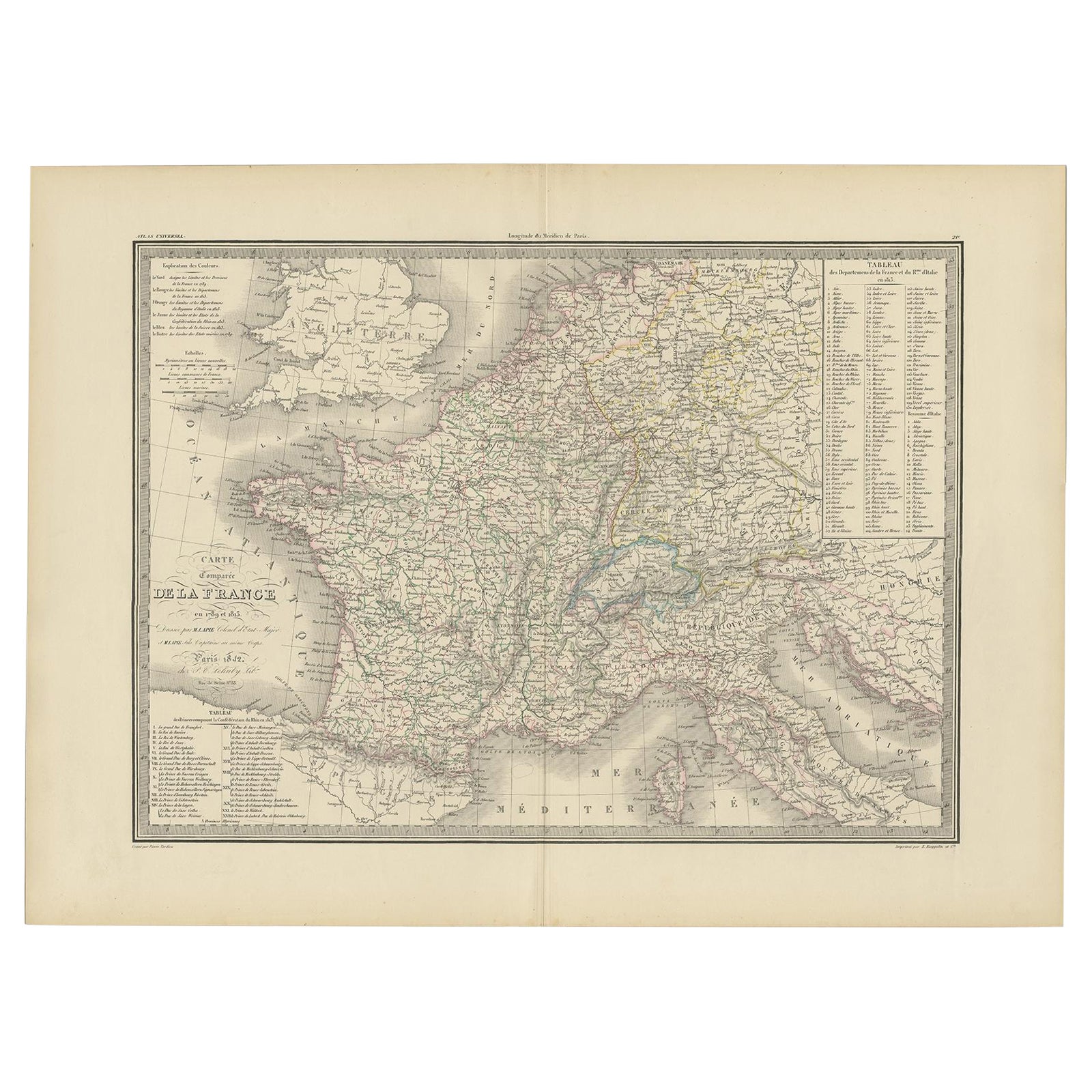
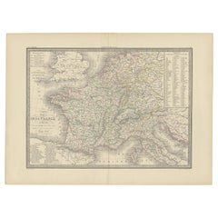
Antique Map of France with Surrounding Countries, 1842
Located in Langweer, NL
Antique map titled 'Carte comparée de la France en 1789 et 1813'. Map of France. This map originates from 'Atlas universel de géographie ancienne et moderne (..)' by Pierre M. Lapie ...
Category
Antique 19th Century Maps
Materials
Paper
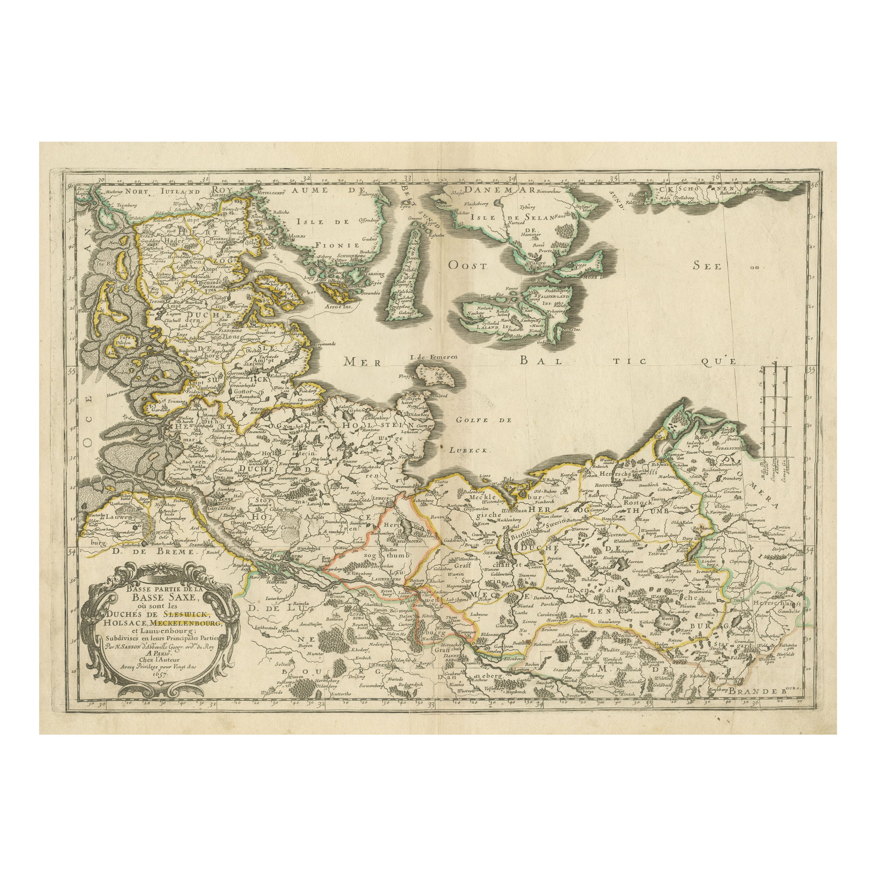
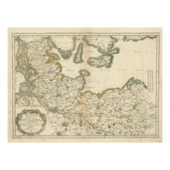
Antique Map of Northern Germany, Including Schleswig-Holstein and Hamburg
Located in Langweer, NL
Antique map titled 'Basse Partie de la Basse Saxe ou sont les Duchés de Sleswick, Holsace, Meckelenbourg et Lauvenbourg (..)'. Original old map of northern Germany, including Schlesw...
Category
Antique Mid-17th Century Maps
Materials
Paper
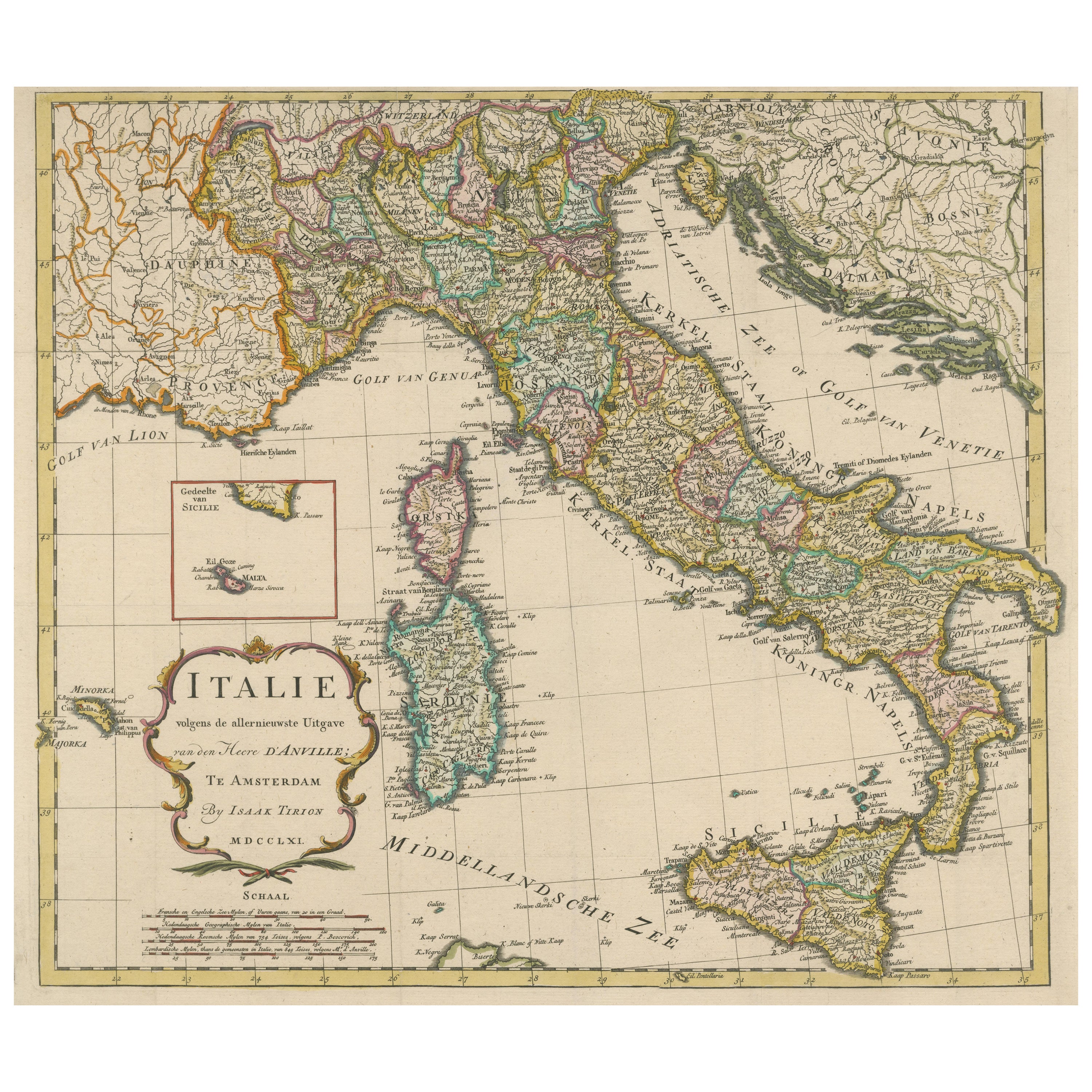
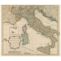
Detailed Antique Map of Italy and surrounding Islands
Located in Langweer, NL
Antique map titled 'Italie volgens de allernieuwste Uitgave van den Heere d'Anville'. Very detailed antique map, based on D'Anville's important map of It...
Category
Antique Mid-18th Century Maps
Materials
Paper
Antique Map of Champagne and surrounding Regions, France
Located in Langweer, NL
Antique map titled 'Carte de la Champagne et des Pays Voisins (..)'. Detailed map of Champagne and surrounding regions of Chalons and Soissons, Reims,...
Category
Antique Mid-18th Century Maps
Materials
Paper

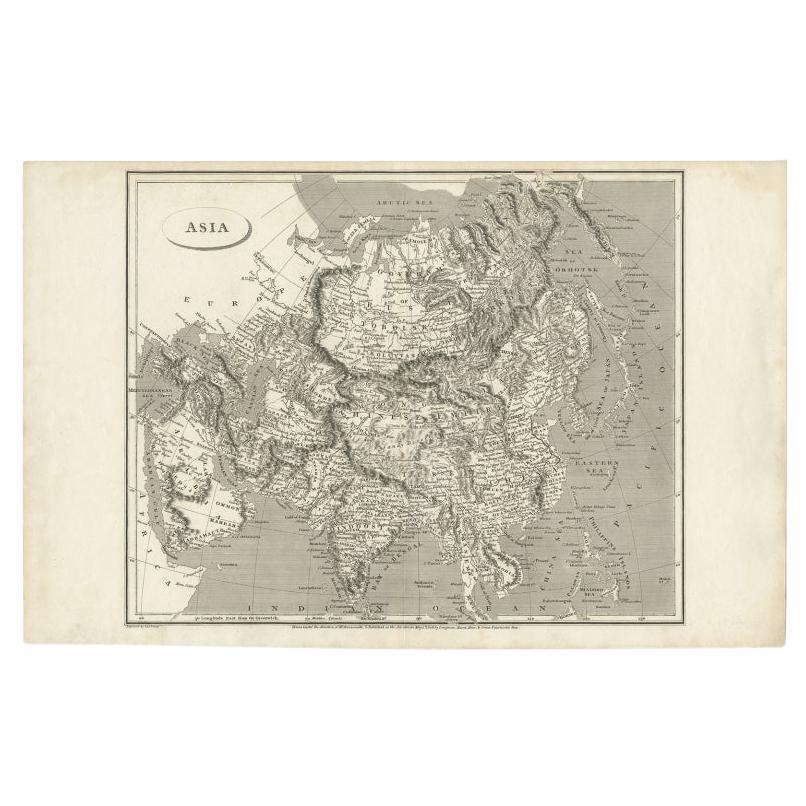
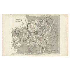
Antique Map of Asia including Arabia, 1806
Located in Langweer, NL
Antique map titled 'Asia'. Original antique map of the Asian continent engraved by E. Jones.
Artists and Engravers: Drawn under the direction of Mr. Arrowsmith. Published in 1806...
Category
Antique 19th Century Maps
Materials
Paper
You May Also Like
Antique 1803 Italian Map of Asia Including China Indoneseia India
Located in Amsterdam, Noord Holland
Antique 1803 Italian Map of Asia Including China Indoneseia India
Very nice map of Asia. 1803.
Additional information:
Type: Map
Country of Manufacturing: Europe
Period: 19th centu...
Category
Antique 19th Century European Maps
Materials
Paper

$584 Sale Price
20% Off
Antique French Map of Asia Including China Indoneseia India, 1783
Located in Amsterdam, Noord Holland
Very nice map of Asia. 1783 Dedie au Roy.
Additional information:
Country of Manufacturing: Europe
Period: 18th century Qing (1661 - 1912)
Condition: Overall Condition B (Good Used)...
Category
Antique 18th Century European Maps
Materials
Paper

$648 Sale Price
20% Off
18th Century Hand-Colored Homann Map of Germany, Including Frankfurt and Berlin
By Johann Baptist Homann
Located in Alamo, CA
An 18th century hand-colored map entitled "Tabula Marchionatus Brandenburgici et Ducatus Pomeraniae quae sunt Pars Septentrionalis Circuli Saxoniae Superioris" by Johann Baptist Homa...
Category
Antique Early 18th Century German Maps
Materials
Paper

1853 Map of "Russia in Europe Including Poland" Ric.r016
Located in Norton, MA
Description
Russia in Europe incl. Poland by J Wyld c.1853
Hand coloured steel engraving
Dimension: Paper: 25 cm W x 33 cm H ; Sight: 22 cm W x 28 cm H
Condition: Good ...
Category
Antique 19th Century Unknown Maps
Materials
Paper

Large Original Vintage Map of The Pacific Islands Including Hawaii
Located in St Annes, Lancashire
Great map of The Pacific Islands
Unframed
Original color
By John Bartholomew and Co. Edinburgh Geographical Institute
Published, circa 1...
Category
Vintage 1920s British Maps
Materials
Paper

East German Map
By VEB Hermann Haack
Located in Baltimore, MD
A brilliantly colourful map of the Leipzig, Karl Marx Stadt and Dresden area in the former German Democratic Republic by VEB Hermann Haack of Gotha.
Category
Vintage 1970s German Maps

$295 Sale Price
25% Off
Recently Viewed
View AllMore Ways To Browse
Italian Leather Folding Chairs
Kashmir Woven Rugs
Kohn Vienna Secession
Lamb Antique Furniture
Laminate Kitchen Table
Large Drop Leaf Table
Large Ice Bucket
Large Jewellery Chest
Limestone And Wood Table
Luxury Safari Lodge
Mahogany Side Table With Black Top
Marble Coffee Table Danish
Marble Mosaic Tile
Marble Plinth Side Table
Mario Bellini Blue
Masculine Rug
Matching Curved Sofas
Mdf Italia