Items Similar to Antique Map of the Coast of Zanguebar and Madagascar 'Africa' by J. van Schley


Want more images or videos?
Request additional images or videos from the seller
1 of 5
Antique Map of the Coast of Zanguebar and Madagascar 'Africa' by J. van Schley
About the Item
Decorative map of the area between the east coast of South Africa, the Seychelles, Mauritius and Madagascar. It was made by Jacob van der Schley for the Dutch edition of Histoire Générale Des Voyages by Antoine François Prévost d'Exiles.
- Dimensions:Height: 10.24 in (26 cm)Width: 12.8 in (32.5 cm)Depth: 0.02 in (0.5 mm)
- Materials and Techniques:
- Period:
- Date of Manufacture:circa 1750
- Condition:Please study image carefully.
- Seller Location:Langweer, NL
- Reference Number:Seller: BG-054651stDibs: LU305439780721
About the Seller
5.0
Recognized Seller
These prestigious sellers are industry leaders and represent the highest echelon for item quality and design.
Platinum Seller
Premium sellers with a 4.7+ rating and 24-hour response times
Established in 2009
1stDibs seller since 2017
2,412 sales on 1stDibs
Typical response time: 1 hour
- ShippingRetrieving quote...Shipping from: Langweer, Netherlands
- Return Policy
Authenticity Guarantee
In the unlikely event there’s an issue with an item’s authenticity, contact us within 1 year for a full refund. DetailsMoney-Back Guarantee
If your item is not as described, is damaged in transit, or does not arrive, contact us within 7 days for a full refund. Details24-Hour Cancellation
You have a 24-hour grace period in which to reconsider your purchase, with no questions asked.Vetted Professional Sellers
Our world-class sellers must adhere to strict standards for service and quality, maintaining the integrity of our listings.Price-Match Guarantee
If you find that a seller listed the same item for a lower price elsewhere, we’ll match it.Trusted Global Delivery
Our best-in-class carrier network provides specialized shipping options worldwide, including custom delivery.More From This Seller
View AllAntique Map of the Coast of Cape Verde by J. Van Der Schley, circa 1750
Located in Langweer, NL
An early map of what is now the coast of the capital city of Dakar, Senegal. What is now a dense, bustling city was at this time a uninhabited coast. Shows the overall contours of th...
Category
Antique Mid-18th Century Maps
Materials
Paper

$145 Sale Price
21% Off
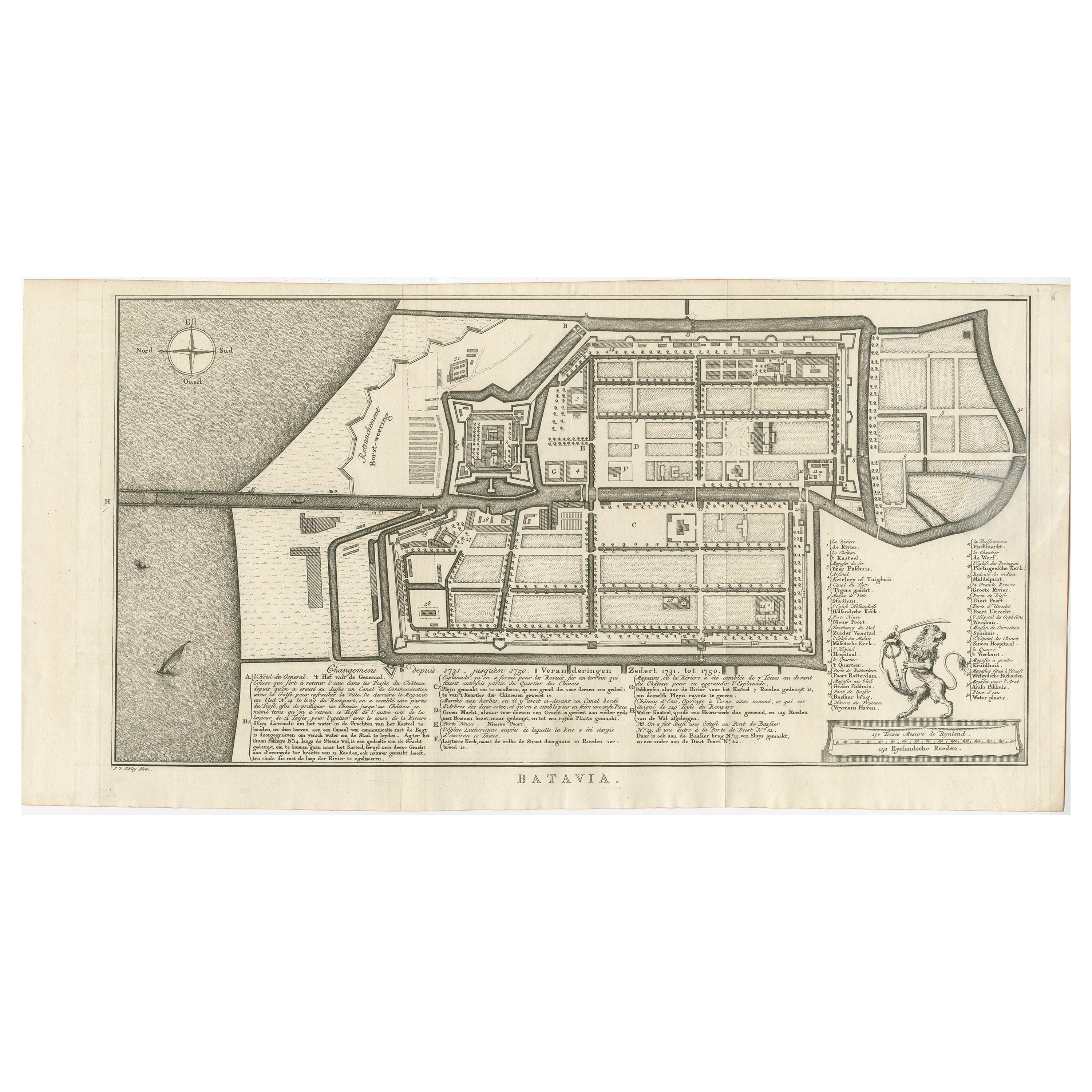
Antique Map of Batavia by Van Schley 'c.1750'
Located in Langweer, NL
Antique map titled 'Batavia'. Original antique map of Batavia, Jakarta, Indonesia. This print originates from the Dutch edition of Prevost's 'Histoire Generale des Voyages' (Paris 17...
Category
Antique Mid-18th Century Prints
Materials
Paper
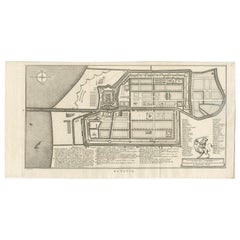
$417 Sale Price
20% Off
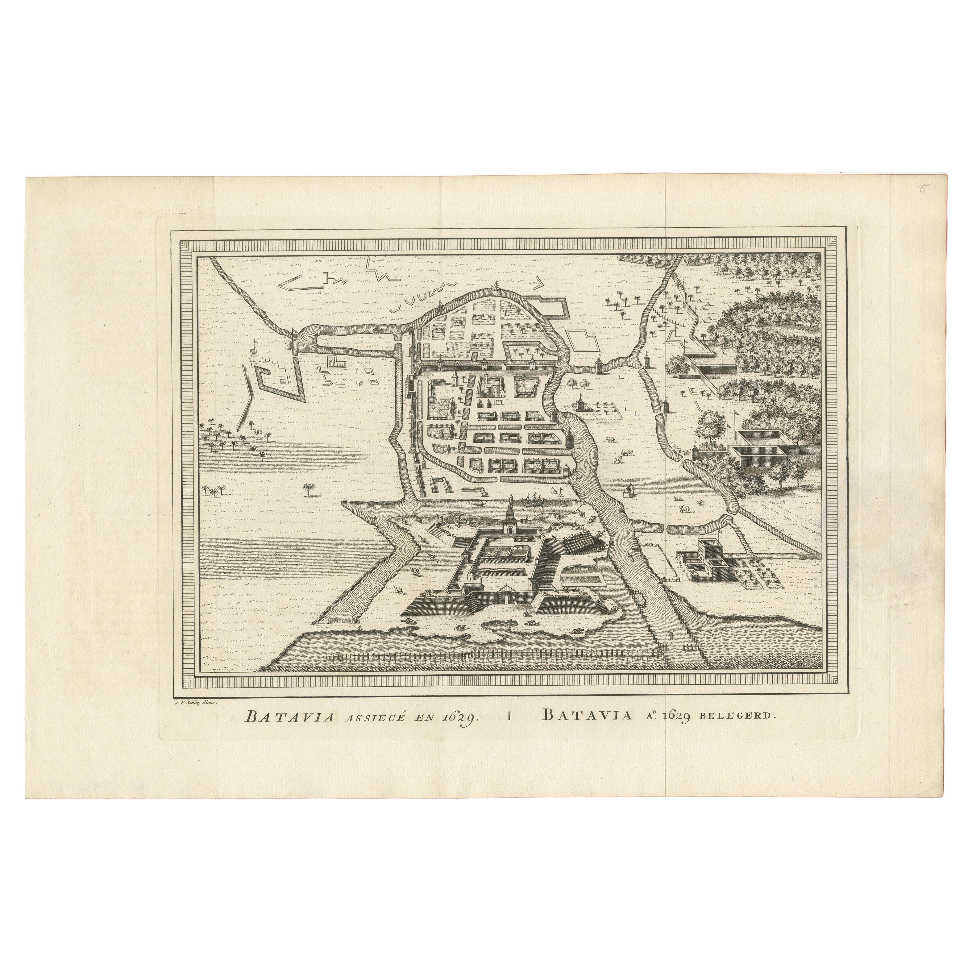
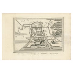
Antique Map of the Siege of Batavia by Van Schley 'c.1750'
Located in Langweer, NL
Antique map titled 'Batavia assiecé en 1629 - Batavia 1629 belegerd'. Bird's eye view map of the siege of Batavia in 1629, Jakarta, Indonesia. This print originates from the Dutch ed...
Category
Antique Mid-18th Century Prints
Materials
Paper
Antique Map of the Tunquin River and Bay by Van Schley 'c.1750'
Located in Langweer, NL
Antique map titled ‘Kaart van den Loop der Rivier van Tonkin van Cacho tot aan de Zee / Carte du Cours de la Riviere de Tunquin Depuis Cacho jusqu'à la Mer J. v. Schley direx.’ Detai...
Category
Antique Mid-18th Century Prints
Materials
Paper
Antique Map of the Gambia River by J. Van Schley, circa 1750
Located in Langweer, NL
"Carte de la Riviere de Gambra ou Gambie. Depuis son Embouchure Jusqu a Eropina". Orig. copper-engraving after Capt. J. Leach's map of the region from 1732. With ornamental title cartouche and Dutch...
Category
Antique Mid-18th Century Maps
Materials
Paper

$290 Sale Price
31% Off
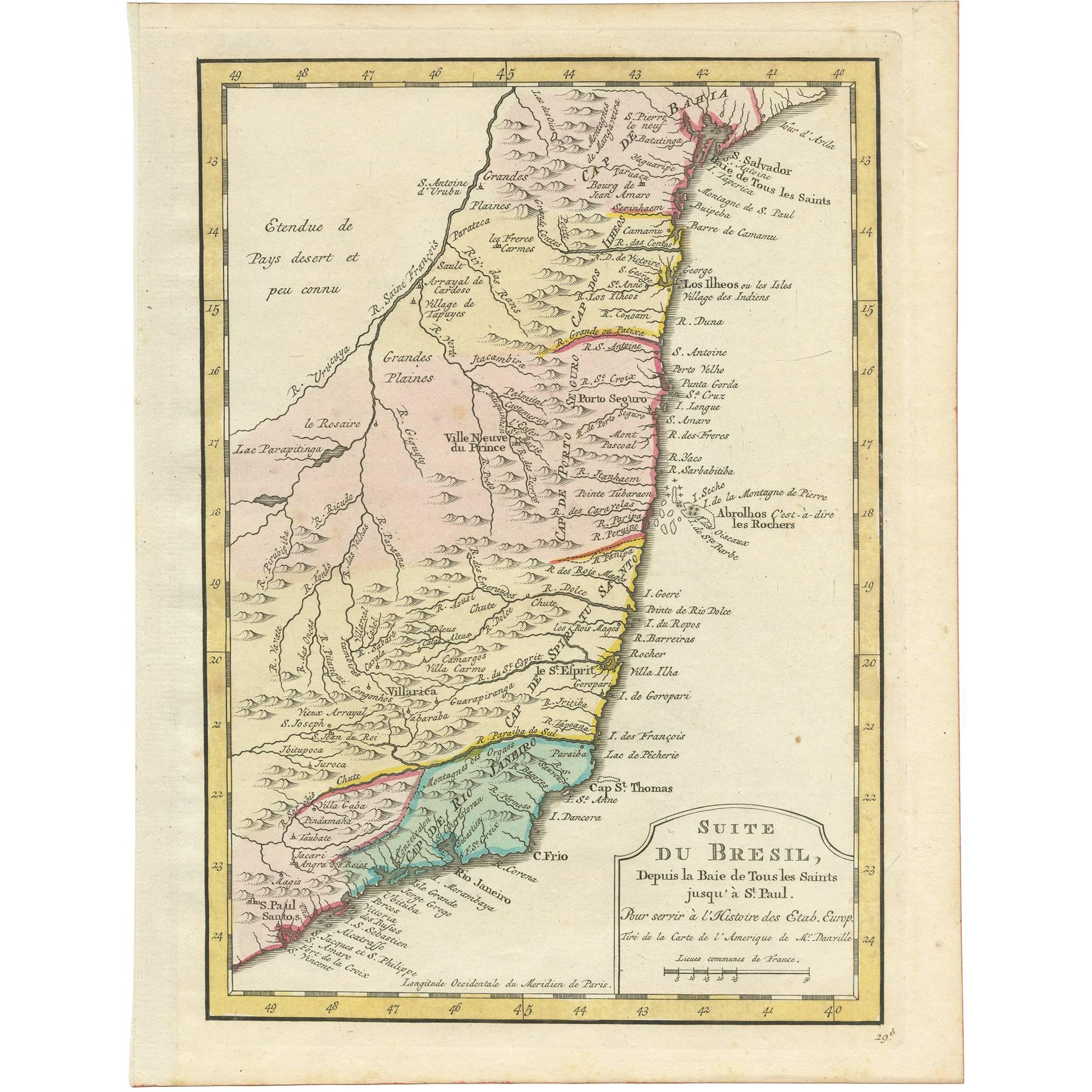
Antique Map of the Brazilian Coast by A. Van Krevelt
Located in Langweer, NL
Uncommon edition of this accurate map of part of Brazil, from San Salvador till Rio de Janeiro and S.Paulo. In lower right engraved "29b." Originates from 'Atlas Portatif pour servir...
Category
Antique Late 18th Century Brazilian Maps
Materials
Paper
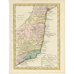
$224 Sale Price
22% Off
You May Also Like
West Coast of Africa, Guinea & Sierra Leone: An 18th Century Map by Bellin
By Jacques-Nicolas Bellin
Located in Alamo, CA
Jacques Bellin's copper-plate map entitled "Partie de la Coste de Guinee Dupuis la Riviere de Sierra Leona Jusquau Cap das Palmas", depicting the coast of Guinea and Sierra Leone in ...
Category
Antique Mid-18th Century French Maps
Materials
Paper

Original Antique Map of South Africa, Arrowsmith, 1820
Located in St Annes, Lancashire
Great map of South Africa.
Drawn under the direction of Arrowsmith.
Copper-plate engraving.
Published by Longman, Hurst, Rees, Orme and Br...
Category
Antique 1820s English Maps
Materials
Paper

Original Antique Map of The World by Thomas Clerk, 1817
Located in St Annes, Lancashire
Great map of The Eastern and Western Hemispheres
On 2 sheets
Copper-plate engraving
Drawn and engraved by Thomas Clerk, Edinburgh.
Published by Mackenzie And Dent, 1817
...
Category
Antique 1810s English Maps
Materials
Paper

Map of the Republic of Genoa
Located in New York, NY
Framed antique hand-coloured map of the Republic of Genoa including the duchies of Mantua, Modena, and Parma.
Europe, late 18th century.
Dimension: 25...
Category
Antique Late 18th Century European Maps

Antique Map of Italy by Andriveau-Goujon, 1843
By Andriveau-Goujon
Located in New York, NY
Antique Map of Italy by Andriveau-Goujon, 1843. Map of Italy in two parts by Andriveau-Goujon for the Library of Prince Carini at Palazzo Carini i...
Category
Antique 1840s French Maps
Materials
Linen, Paper

$3,350 / set
Antique Map of Principality of Monaco
By Antonio Vallardi Editore
Located in Alessandria, Piemonte
ST/619 - "Old Geographical Atlas of Italy - Topographic map of ex-Principality of Monaco" -
ediz Vallardi - Milano -
A somewhat special edition ---
Category
Antique Late 19th Century Italian Other Prints
Materials
Paper

Recently Viewed
View AllMore Ways To Browse
Blue Pillow Square
Blue Turkish Cushion
Book Tray
Boucle Chair And Ottoman
Brass Ashtray Italy
Brighton Pavilion
Brutalist Marble Table
Cane Round Tables
Carved Wooden Bar Stool
Cedar Bench
Champagne Bowl
Chinese Large Platter
Chrome Nesting Tables
Coat Rack Denmark
Cowhide Rug Grey
Creamy Moroccan Rug
Curvy Sofa
Dining Chair Stainless Leg