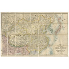
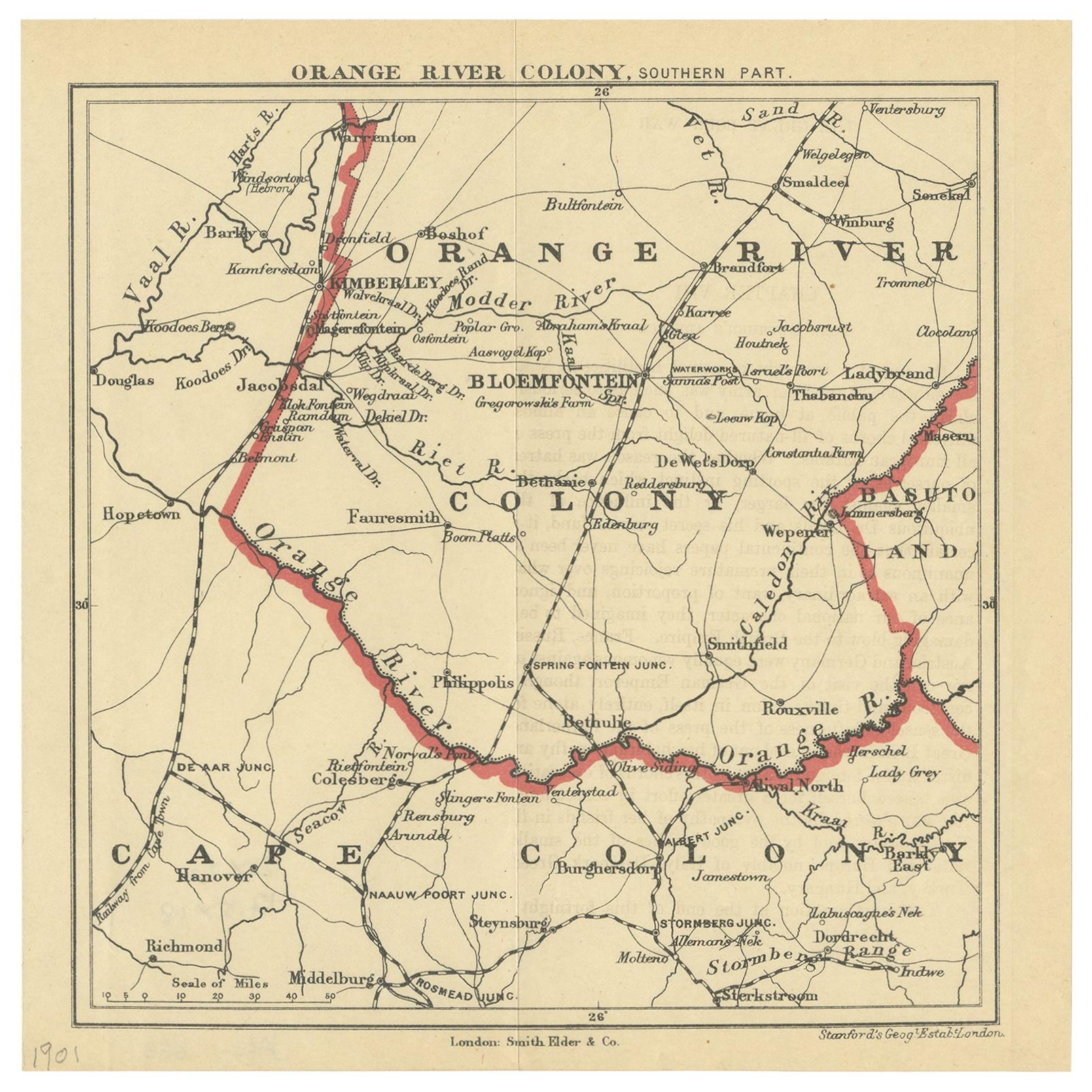
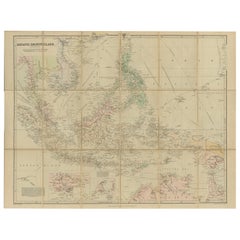
Antique Map of China and Japan by E. Stanford, 1900
View Similar Items


Want more images or videos?
Request additional images or videos from the seller
1 of 7
Antique Map of China and Japan by E. Stanford, 1900
About the Item
- Creator:E. Stanford (Artist)
- Dimensions:Height: 26.58 in (67.5 cm)Width: 40.56 in (103 cm)Depth: 0.02 in (0.5 mm)
- Materials and Techniques:
- Place of Origin:
- Period:
- Date of Manufacture:1900
- Condition:Folding map, mounted on linen. Original green cloth boards. Please study image carefully.
- Seller Location:Langweer, NL
- Reference Number:Seller: BG-113251stDibs: LU3054312177443
About the Seller
5.0
Recognized Seller
These prestigious sellers are industry leaders and represent the highest echelon for item quality and design.
Platinum Seller
Premium sellers with a 4.7+ rating and 24-hour response times
Established in 2009
1stDibs seller since 2017
2,412 sales on 1stDibs
Typical response time: 1 hour
Authenticity Guarantee
In the unlikely event there’s an issue with an item’s authenticity, contact us within 1 year for a full refund. DetailsMoney-Back Guarantee
If your item is not as described, is damaged in transit, or does not arrive, contact us within 7 days for a full refund. Details24-Hour Cancellation
You have a 24-hour grace period in which to reconsider your purchase, with no questions asked.Vetted Professional Sellers
Our world-class sellers must adhere to strict standards for service and quality, maintaining the integrity of our listings.Price-Match Guarantee
If you find that a seller listed the same item for a lower price elsewhere, we’ll match it.Trusted Global Delivery
Our best-in-class carrier network provides specialized shipping options worldwide, including custom delivery.More From This Seller
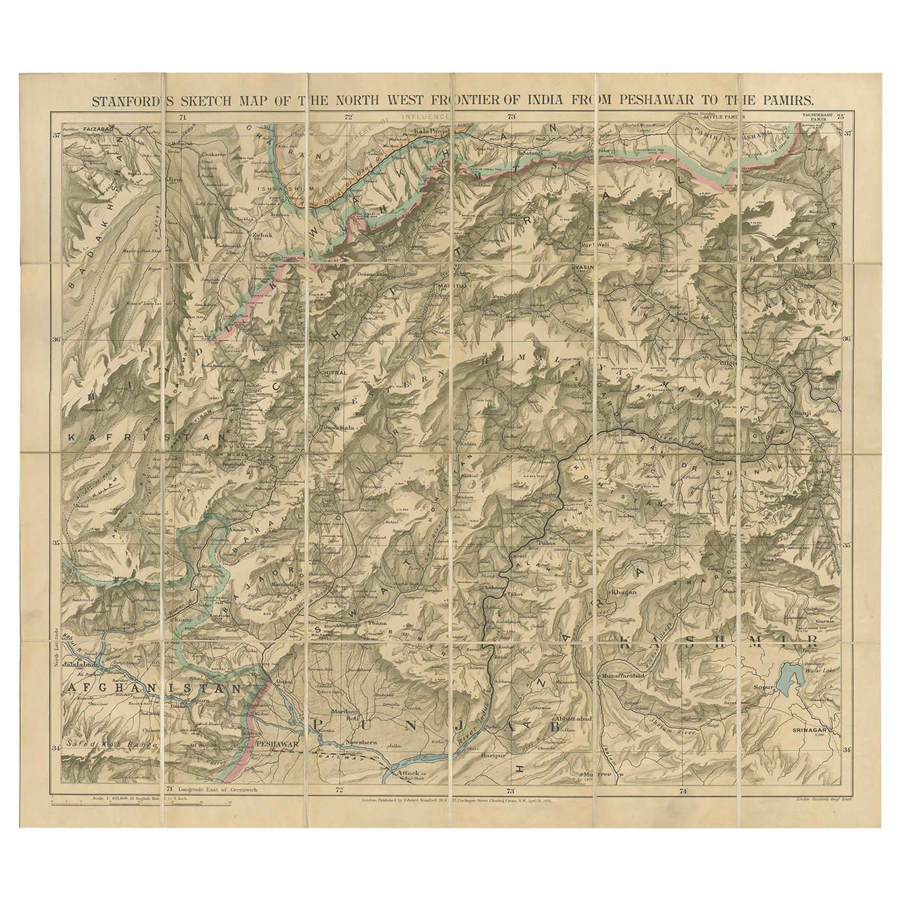
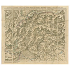
View AllAntique Map of the North-West Frontier by Stanford, 1895
By E. Stanford
Located in Langweer, NL
Antique map titled 'Stanford's Sketch Map of the North West Frontier of India from Peshawar to the Pamirs'. Linen backed folding map of the North-West Frontier of India from Peshawar...
Category
Antique Late 19th Century Maps
Materials
Linen, Paper
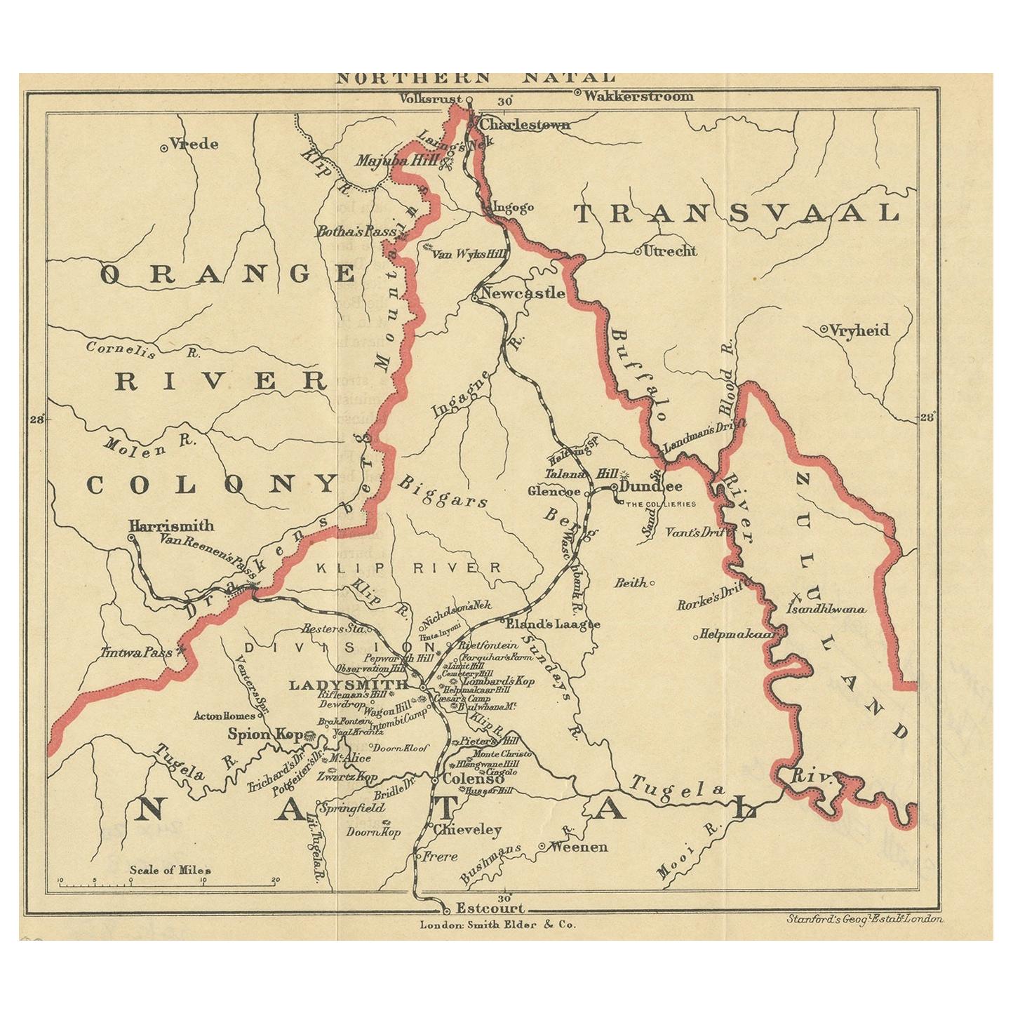
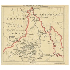
Antique Map of Northern Natal by Stanford, 1900
Located in Langweer, NL
Antique map titled 'Northern Natal'. Lithograph of Northern Natal. The Colony of Natal was a British colony in south-eastern Africa. It was proclaimed a British colony on 4 May 1843 ...
Category
Early 20th Century Maps
Materials
Paper
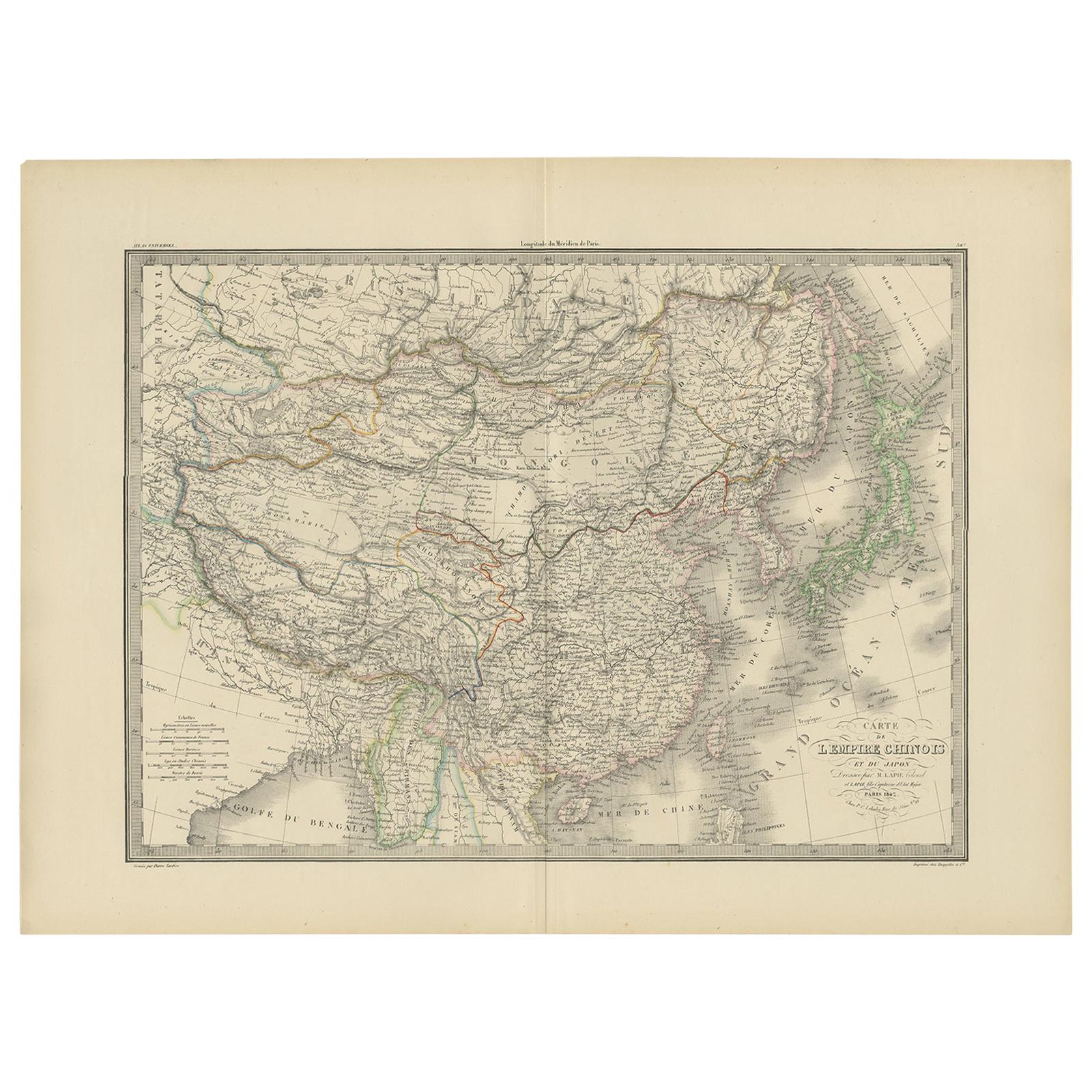
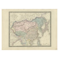
Antique Map of China and Japan by Johnson, 1872
Located in Langweer, NL
Antique map titled 'Johnson's China and Japan'. Map of China and Japan, with an inset map of the vicinity of Canton and Hong Kong. This map originates from 'Johnson's New Illustrated...
Category
Antique Late 19th Century Maps
Materials
Paper

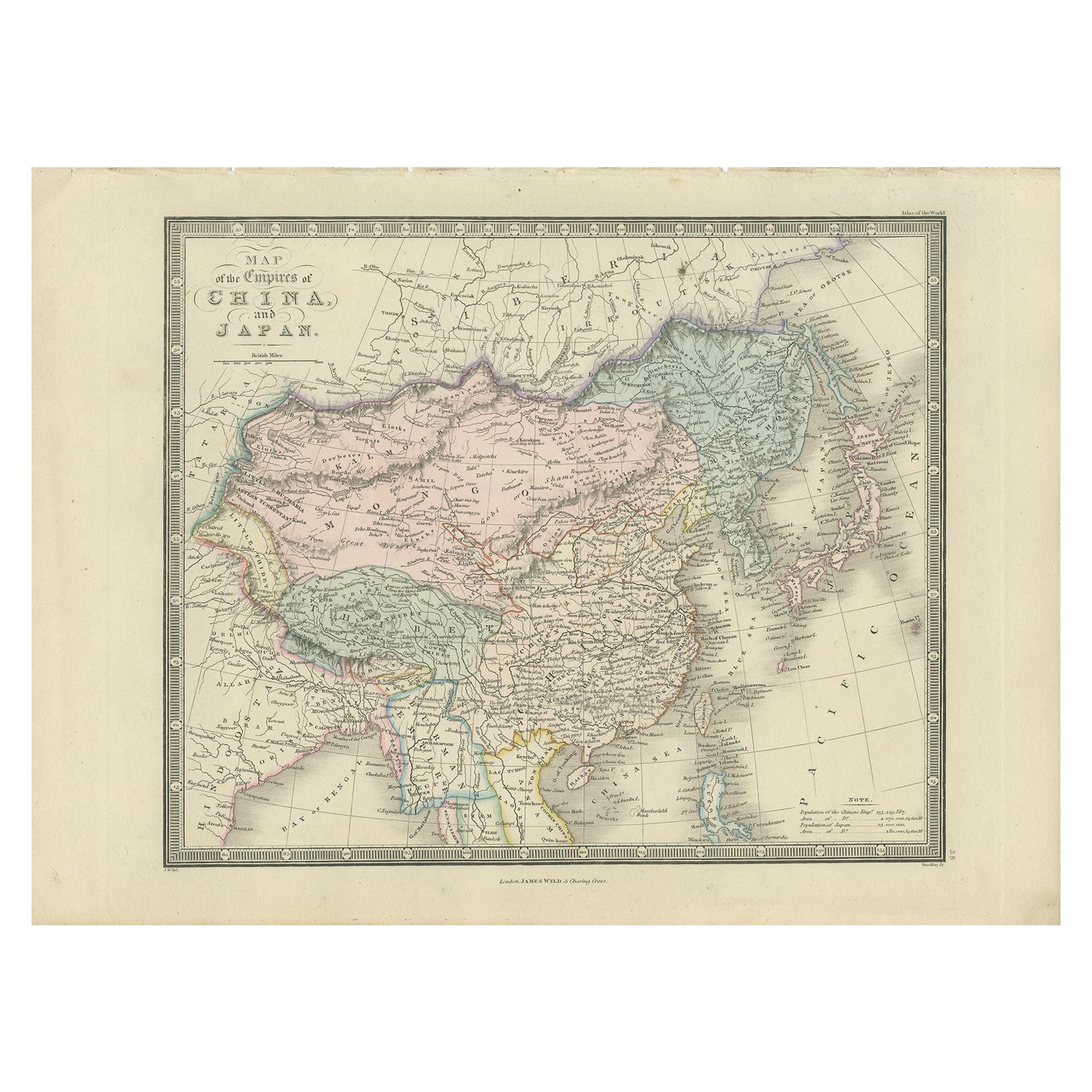
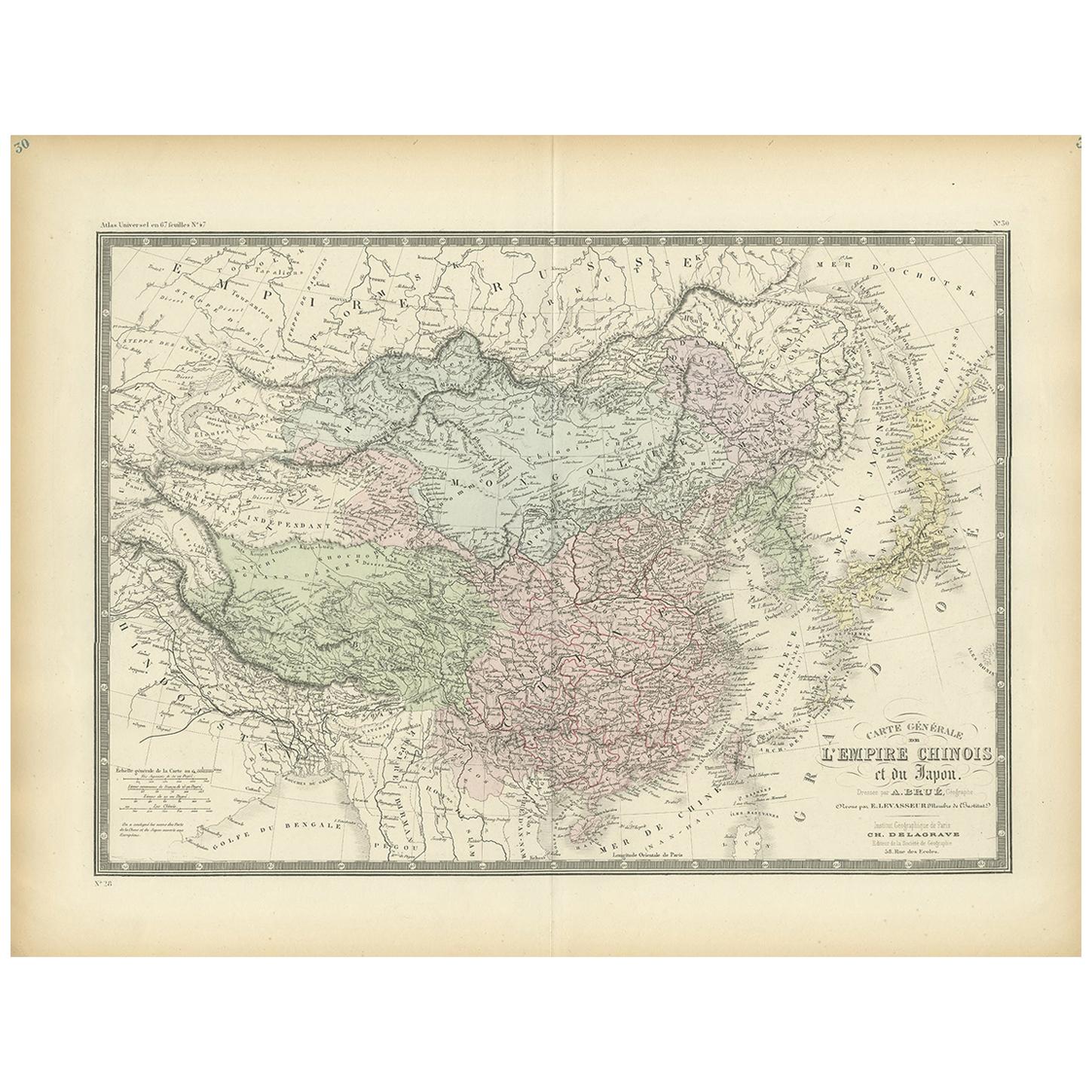
Antique Map of China and Japan by Wyld '1845'
Located in Langweer, NL
Antique map titled 'Map of the Empires of China and Japan'. Original antique map of China and Japan. This map originates from 'An Atlas of the World, Comprehending Separate Maps of i...
Category
Antique Mid-19th Century Maps
Materials
Paper
$208 Sale Price
40% Off
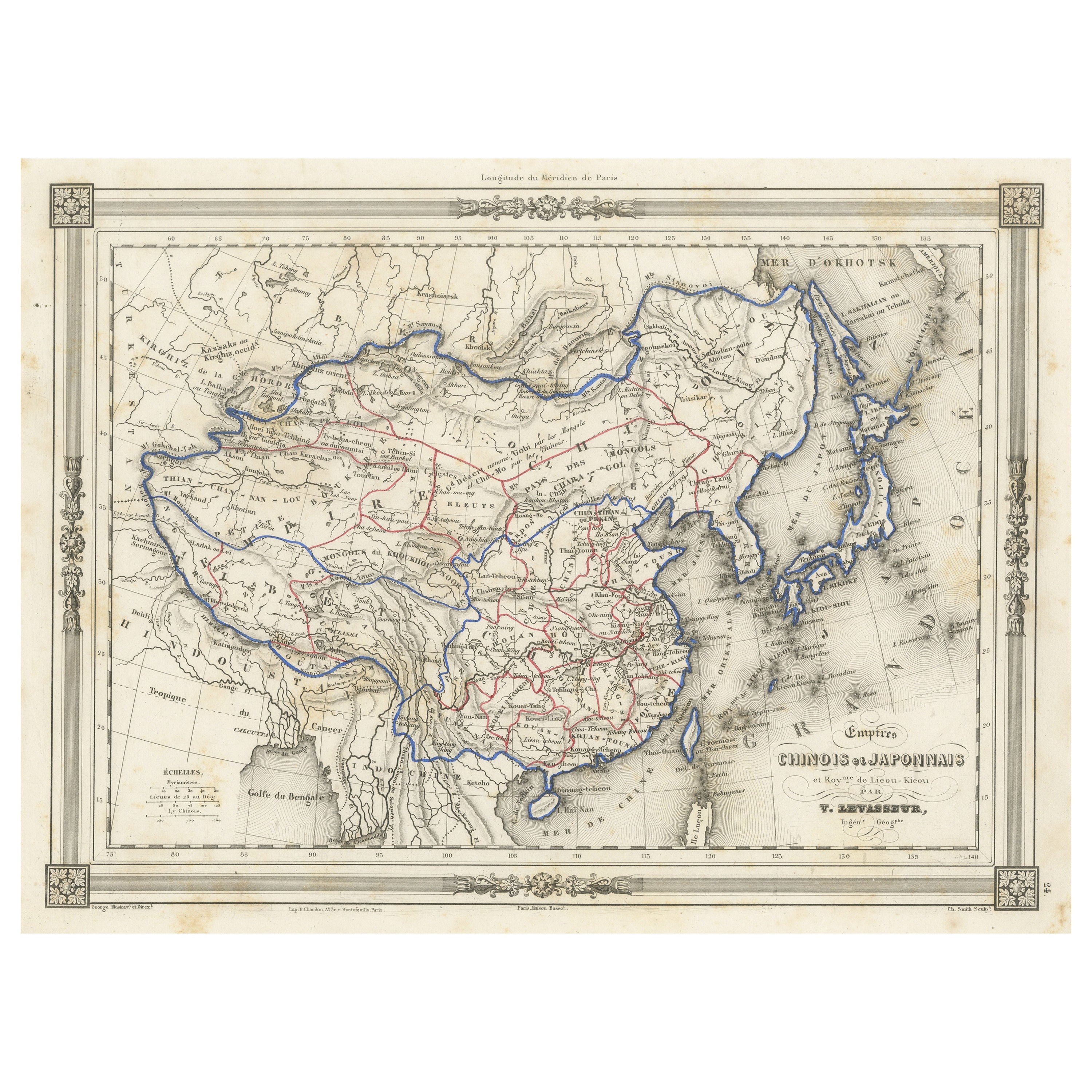
Antique Map of China and Japan by A.K. Johnston, 1865
Located in Langweer, NL
Antique map titled 'China and Japan'. Depicting Eastern China, the Islands of Japan and more. This map originates from the ‘Royal Atlas of Modern Geography’ by Alexander Keith Johnst...
Category
Antique Mid-19th Century Maps
Materials
Paper

$254 Sale Price
26% Off
Antique Map of the Asiatic Archipelago by E. Stanford, circa 1910
Located in Langweer, NL
Antique folding map titled 'London Atlas Map of the Asiatic Archipelago'. Centered on the Philippines and Borneo, the map shows a number of different seasonal passages through the region to Hong Kong and Macao. With inset maps of Singapore...
Category
20th Century Maps
Materials
Paper
$925 Sale Price
20% Off
You May Also Like
Original Antique Map of China, Arrowsmith, 1820
Located in St Annes, Lancashire
Great map of China
Drawn under the direction of Arrowsmith
Copper-plate engraving
Published by Longman, Hurst, Rees, Orme and Brown, 1820
Unfr...
Category
Antique 1820s English Maps
Materials
Paper

Antique Map of Italy by Andriveau-Goujon, 1843
By Andriveau-Goujon
Located in New York, NY
Antique Map of Italy by Andriveau-Goujon, 1843. Map of Italy in two parts by Andriveau-Goujon for the Library of Prince Carini at Palazzo Carini i...
Category
Antique 1840s French Maps
Materials
Linen, Paper

$3,350 / set
Antique Map of Principality of Monaco
By Antonio Vallardi Editore
Located in Alessandria, Piemonte
ST/619 - "Old Geographical Atlas of Italy - Topographic map of ex-Principality of Monaco" -
ediz Vallardi - Milano -
A somewhat special edition ---
Category
Antique Late 19th Century Italian Other Prints
Materials
Paper

Original Antique Map of Spain and Portugal, circa 1790
Located in St Annes, Lancashire
Super map of Spain and Portugal
Copper plate engraving by A. Bell
Published, circa 1790.
Unframed.
Category
Antique 1790s English Other Maps
Materials
Paper

Original Antique Map of Ireland- Tipperary and Waterford. C.1840
Located in St Annes, Lancashire
Great map of Tipperary and Waterford
Steel engraving
Drawn under the direction of A.Adlard
Published by How and Parsons, C.1840
Unframed.
Category
Antique 1840s English Maps
Materials
Paper

Original Antique Map of Sweden, Engraved by Barlow, 1806
Located in St Annes, Lancashire
Great map of Sweden
Copper-plate engraving by Barlow
Published by Brightly & Kinnersly, Bungay, Suffolk. 1806
Unframed.
Category
Antique Early 1800s English Maps
Materials
Paper

Recently Viewed
View AllMore Ways To Browse
Antique Linen Map
Antique Maps Of Russian Empire
Stanford Antique Furniture
Map Of Arabia
New Zealand Map
Map Tibet
Antique Map Of Egypt
British Empire Map
18th Century French Globe
Antique Map Ortelius
Antique Nautical Maps
Roman Empire Map
Voc Ship
16th Century Globe
Map Of Singapore
Antique Map Of Middle East
Hand Painted Antique Map
Railroad Collectibles