Items Similar to Antique Map of the Cape of Good Hope by W. G. Blackie, 1859

Want more images or videos?
Request additional images or videos from the seller
1 of 6
Antique Map of the Cape of Good Hope by W. G. Blackie, 1859
About the Item
Antique map titled 'Cape of Good Hope'. Original antique map of the Cape of Good Hope. This map originates from ‘The Imperial Atlas of Modern Geography’. Published by W. G. Blackie, 1859.
- Dimensions:Height: 14.57 in (37 cm)Width: 21.26 in (54 cm)Depth: 0.02 in (0.5 mm)
- Materials and Techniques:
- Period:
- Date of Manufacture:1859
- Condition:Wear consistent with age and use. General age-related toning. some foxing, Please study image carefully.
- Seller Location:Langweer, NL
- Reference Number:Seller: BG-12685-1-641stDibs: LU3054325242782
About the Seller
5.0
Recognized Seller
These prestigious sellers are industry leaders and represent the highest echelon for item quality and design.
Platinum Seller
Premium sellers with a 4.7+ rating and 24-hour response times
Established in 2009
1stDibs seller since 2017
2,417 sales on 1stDibs
Typical response time: <1 hour
- ShippingRetrieving quote...Shipping from: Langweer, Netherlands
- Return Policy
Authenticity Guarantee
In the unlikely event there’s an issue with an item’s authenticity, contact us within 1 year for a full refund. DetailsMoney-Back Guarantee
If your item is not as described, is damaged in transit, or does not arrive, contact us within 7 days for a full refund. Details24-Hour Cancellation
You have a 24-hour grace period in which to reconsider your purchase, with no questions asked.Vetted Professional Sellers
Our world-class sellers must adhere to strict standards for service and quality, maintaining the integrity of our listings.Price-Match Guarantee
If you find that a seller listed the same item for a lower price elsewhere, we’ll match it.Trusted Global Delivery
Our best-in-class carrier network provides specialized shipping options worldwide, including custom delivery.More From This Seller
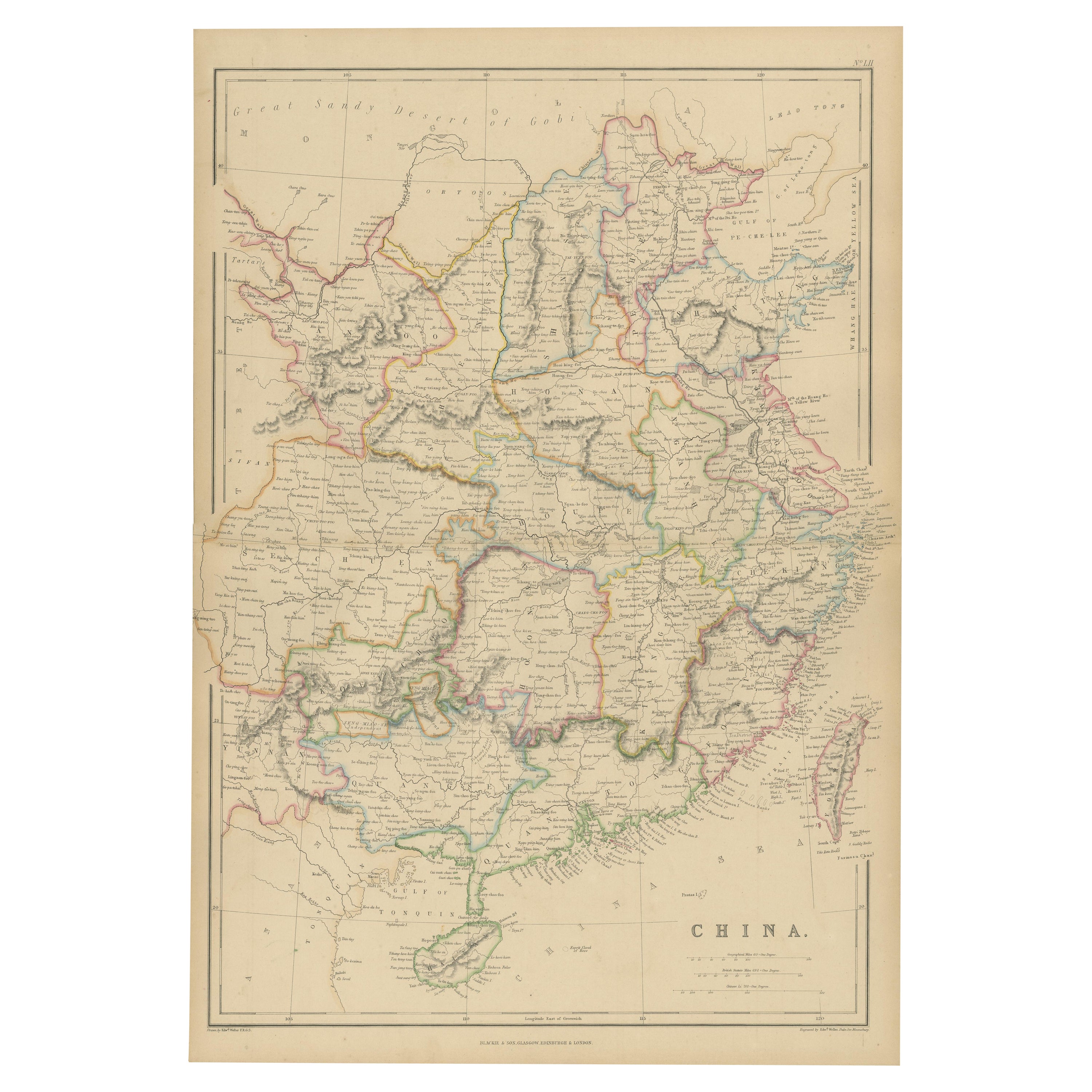
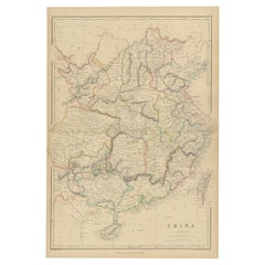
View AllAntique Map of China by W. G. Blackie, 1859
Located in Langweer, NL
Antique map titled 'China'. Original antique map of China. This map originates from ‘The Imperial Atlas of Modern Geography’. Published by W. G. Blackie, 1859.
Category
Antique Mid-19th Century Maps
Materials
Paper
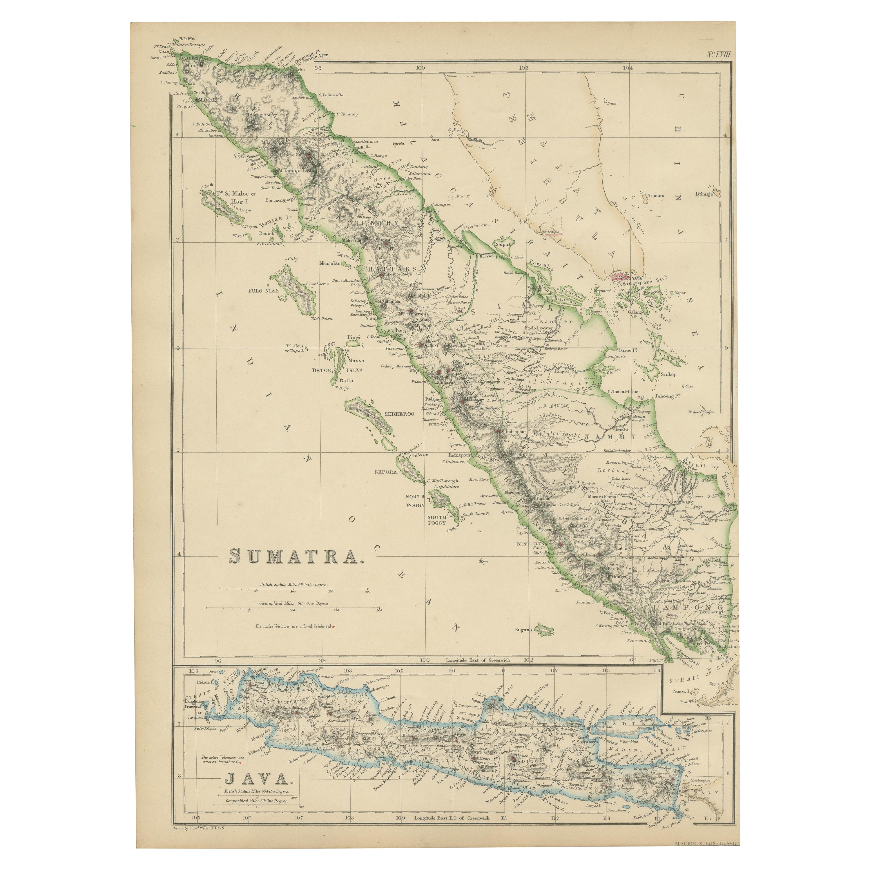
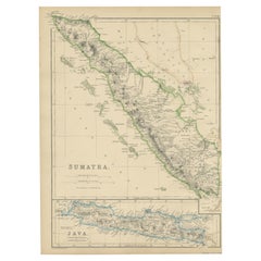
Antique Map of Sumatra by W. G. Blackie, 1859
Located in Langweer, NL
Antique map titled 'Sumatra'. Original antique map of Sumatra with inset map of Java. This map originates from ‘The Imperial Atlas of Modern Geography’. Published by W. G. Blackie, 1...
Category
Antique Mid-19th Century Maps
Materials
Paper
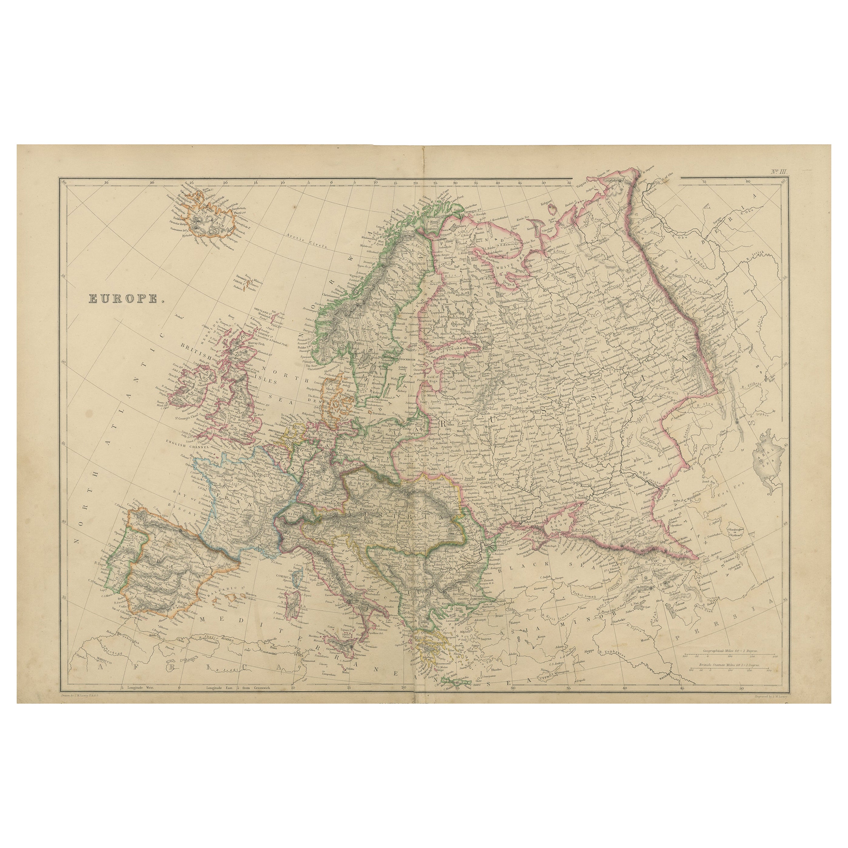
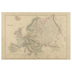
Antique Map of Europe by W. G. Blackie, 1859
Located in Langweer, NL
Antique map titled 'Europe'. Original antique map of Europe. This map originates from ‘The Imperial Atlas of Modern Geography’. Published by W. G. Blackie, 1859.
Category
Antique Mid-19th Century Maps
Materials
Paper
Antique Map of Japan by W. G. Blackie, 1859
Located in Langweer, NL
Antique map titled 'Japan'. Original antique map of Japan. This map originates from ‘The Imperial Atlas of Modern Geography’. Published by W. G. B...
Category
Antique Mid-19th Century Maps
Materials
Paper
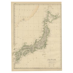
$174 Sale Price
25% Off
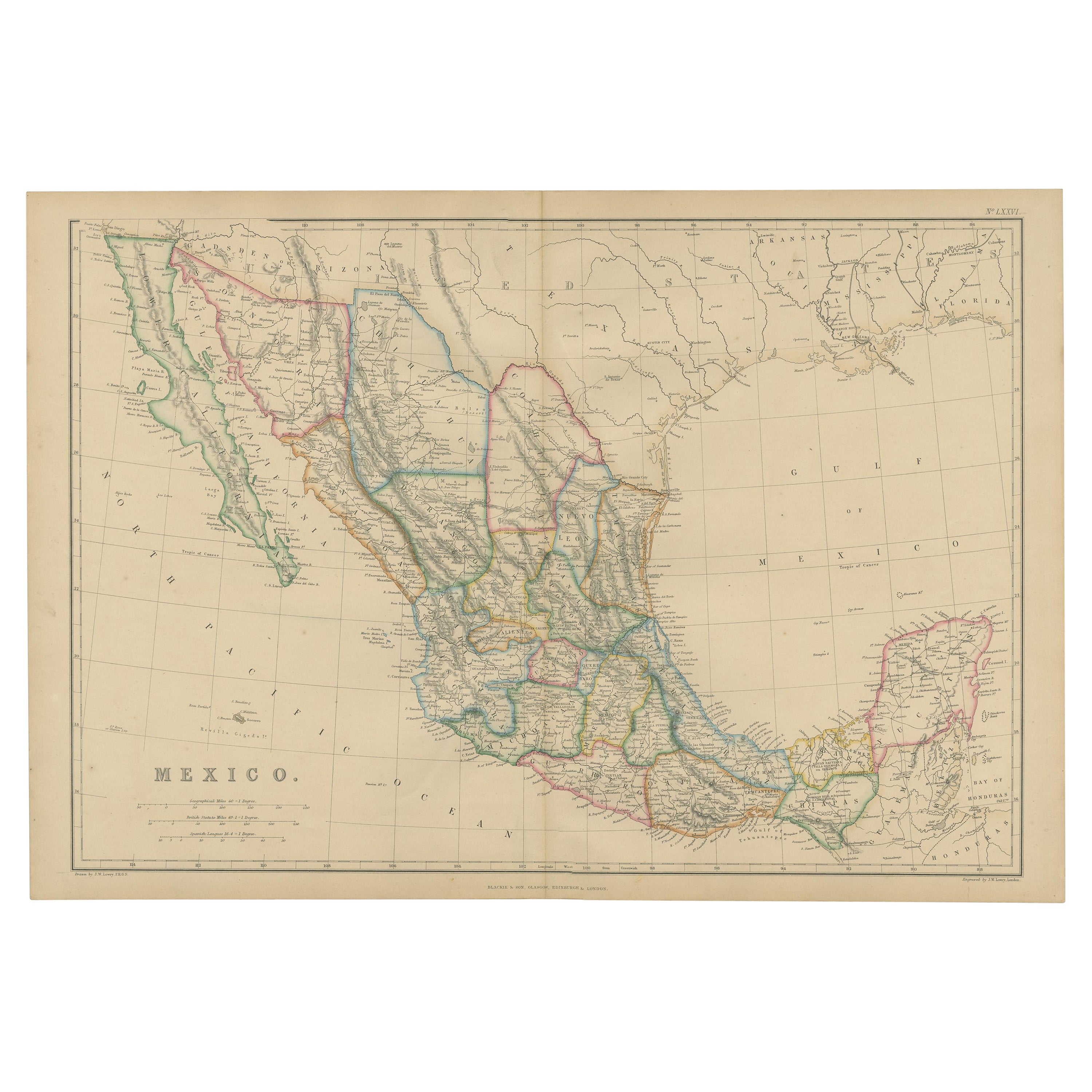
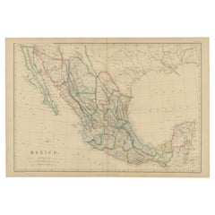
Antique Map of Mexico by W. G. Blackie, 1859
Located in Langweer, NL
Antique map titled 'Mexico'. Original antique map of Mexico. This map originates from ‘The Imperial Atlas of Modern Geography’. Published by W. G. Blackie, 1859.
Category
Antique Mid-19th Century Maps
Materials
Paper
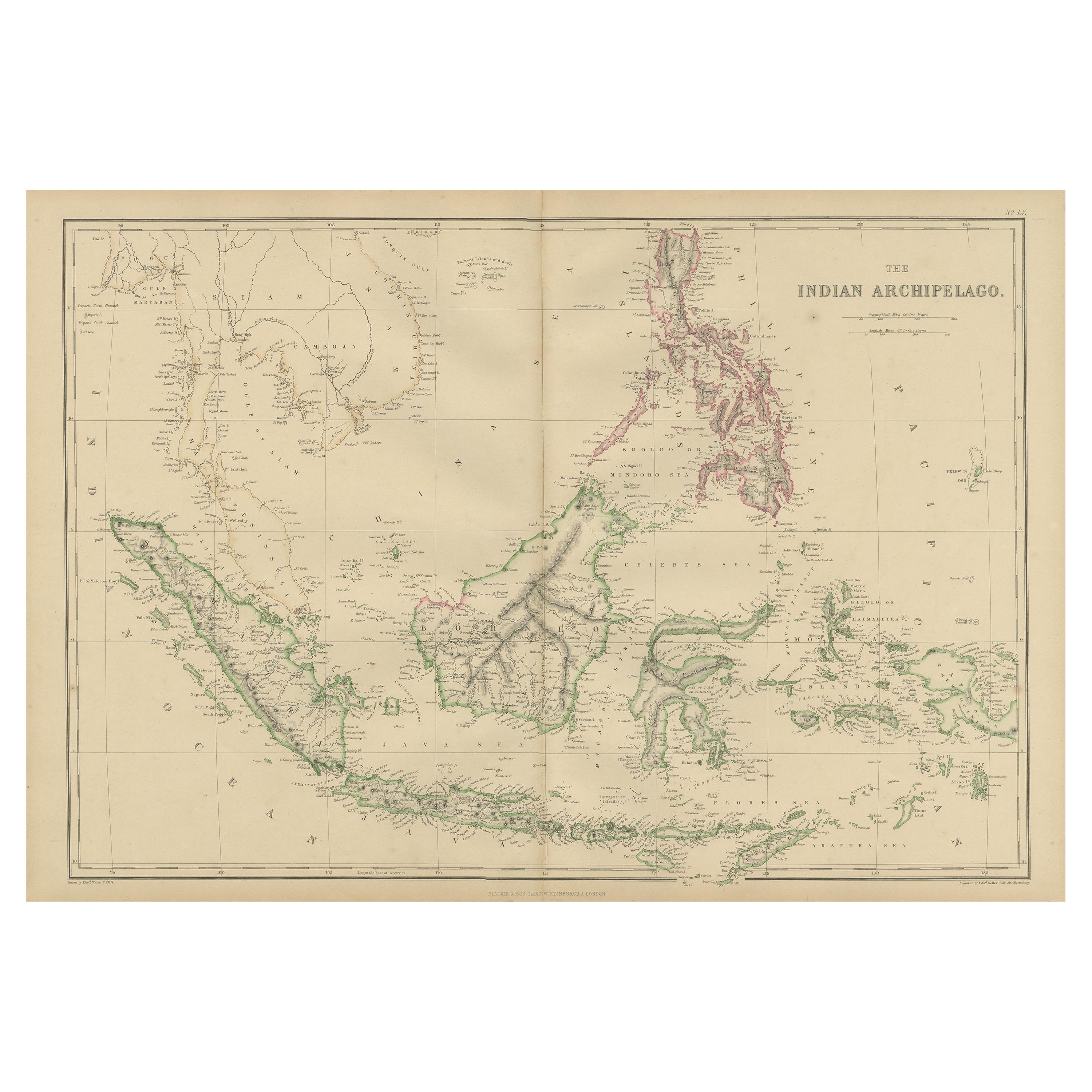
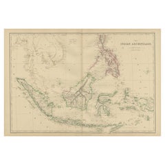
Antique Map of the East Indies by W. G. Blackie, 1859
Located in Langweer, NL
Antique map titled 'The Indian Archipelago'. Original antique map of the East Indies. This map originates from ‘The Imperial Atlas of Modern Geography’. Published by W. G. Blackie, 1...
Category
Antique Mid-19th Century Maps
Materials
Paper
You May Also Like
Original Antique Map of The World by Thomas Clerk, 1817
Located in St Annes, Lancashire
Great map of The Eastern and Western Hemispheres
On 2 sheets
Copper-plate engraving
Drawn and engraved by Thomas Clerk, Edinburgh.
Published by Mackenzie And Dent, 1817
...
Category
Antique 1810s English Maps
Materials
Paper

Map of the Republic of Genoa
Located in New York, NY
Framed antique hand-coloured map of the Republic of Genoa including the duchies of Mantua, Modena, and Parma.
Europe, late 18th century.
Dimension: 25...
Category
Antique Late 18th Century European Maps

Antique Map of Italy by Andriveau-Goujon, 1843
By Andriveau-Goujon
Located in New York, NY
Antique Map of Italy by Andriveau-Goujon, 1843. Map of Italy in two parts by Andriveau-Goujon for the Library of Prince Carini at Palazzo Carini i...
Category
Antique 1840s French Maps
Materials
Linen, Paper

$3,350 / set
Antique Map of Principality of Monaco
By Antonio Vallardi Editore
Located in Alessandria, Piemonte
ST/619 - "Old Geographical Atlas of Italy - Topographic map of ex-Principality of Monaco" -
ediz Vallardi - Milano -
A somewhat special edition ---
Category
Antique Late 19th Century Italian Other Prints
Materials
Paper

Voyage to the Cape of Good Hope, First Edition, c1785
Located in valatie, NY
Voyage to the Cape of Good Hope, towards the Antarctic polar circle, and round the world, but chiefly into the country of the Caffres, from the year ...
Category
Antique 18th Century Irish Books
Materials
Leather, Paper
Antique 18th Century Map of the Province of Pensilvania 'Pennsylvania State'
Located in Philadelphia, PA
A fine antique of the colony of Pennsylvania.
Noted at the top of the sheet as a 'Map of the province of Pensilvania'.
This undated and anonymous map is thought to be from the Gentleman's Magazine, London, circa 1775, although the general appearance could date it to the 1760's.
The southern boundary reflects the Mason-Dixon survey (1768), the western boundary is placed just west of Pittsburgh, and the northern boundary is not marked.
The map has a number of reference points that likely refer to companion text and appear to be connected to boundaries. The western and southern boundaries are marked Q, R, S, for example. A diagonal line runs from the Susquehanna R to the Lake Erie P. A broken line marked by many letters A, B, N, O, etc., appears in the east.
There are no latitude or longitude markings, blank verso.
Framed in a shaped contemporary gilt wooden frame and matted under a cream colored matte.
Bearing an old Graham Arader Gallery...
Category
Antique 18th Century British American Colonial Maps
Materials
Paper

Recently Viewed
View AllMore Ways To Browse
Cornwall Map
Migeon Et Migeon
Patagonia Map
Shepherd And Hedger
Vintage Bartholomew Maps
Antique Iowa Map
Antique Map Of Cornwall
Antique Map Of Michigan
Bass Strait
Coronelli Globe
Jerusalem Old Maps
Marie Galante
Moravia Map
Antique Alabama Map
Antique Maps Of Kentucky
Antique Maps San Diego
Antique Planisphere
Dutch Malacca