Items Similar to Antique 1830 Map of Southern Scotland with Edinburgh, Berwick, Ayr, and Dumfries

Want more images or videos?
Request additional images or videos from the seller
1 of 8
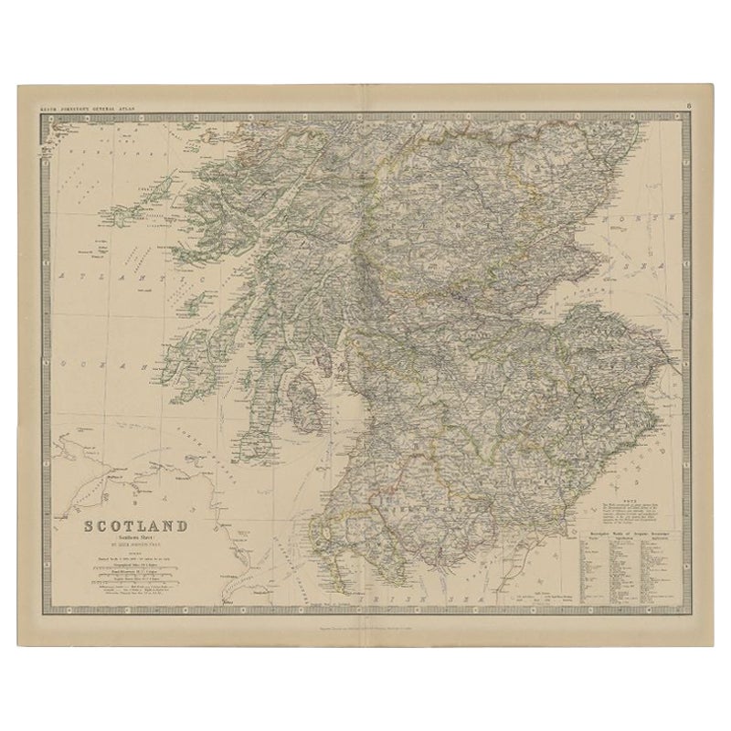
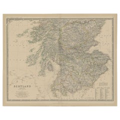
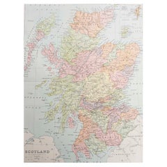
Antique 1830 Map of Southern Scotland with Edinburgh, Berwick, Ayr, and Dumfries
About the Item
Title: Antique 1830 Map of Southern Scotland with Edinburgh, Berwick, Ayr, and Dumfries
Description: This 1830 German-language map, titled Britisches Reich – B. Kon Scotland, focuses on southern Scotland and highlights counties such as Edinburgh, Linlithgow, Haddington, Berwick, Roxburgh, Selkirk, Peebles, Dumfries, Kirkcudbright, Wigtown, Ayr, and Lanark. The map was published in Leipzig by Georg Joachim Goschen as part of the Atlas von Europa nebst den Kolonien, designed for businesspeople, newspaper readers, and owners of the Conversations-Lexicon. It was lithographed by O. Hermann and edited by W. E. A. von Schlieben.
Each county is outlined in hand-applied color, and major cities, rivers, and roads are clearly marked. The map also includes portions of northern England and the coastline along the Irish Sea and the Firth of Forth. The fine detailing of topographical features and settlements reflects the precision of early 19th-century German cartography.
Condition Report:
Paper Quality: 19th-century laid paper with natural toning.
Engraving: Crisp lithographic print with sharp details.
Coloring: Original hand-applied outline coloring, well-preserved.
Margins: Wide margins with light foxing and minor discoloration.
Overall Condition: Very good, with no significant tears or defects.
Framing Tips:
Matting: Use an acid-free off-white mat to highlight the map’s aged character.
Glass: Museum-grade UV-protective glass to prevent fading.
Frame Style: A simple dark wood or gilt frame complements its antique style.
Mounting: Archival backing for long-term preservation.
This map is a fine example of German-published 19th-century cartography, ideal for collectors of Scottish and European maps.
- Dimensions:Height: 10.44 in (26.5 cm)Width: 12.88 in (32.7 cm)Depth: 0.01 in (0.2 mm)
- Materials and Techniques:Paper,Engraved
- Period:
- Date of Manufacture:1830
- Condition:Overall Condition: Very good, with no significant tears or defects.
- Seller Location:Langweer, NL
- Reference Number:Seller: BG-13711-51stDibs: LU3054343840372
About the Seller
5.0
Recognized Seller
These prestigious sellers are industry leaders and represent the highest echelon for item quality and design.
Platinum Seller
Premium sellers with a 4.7+ rating and 24-hour response times
Established in 2009
1stDibs seller since 2017
2,418 sales on 1stDibs
Typical response time: <1 hour
- ShippingRetrieving quote...Shipping from: Langweer, Netherlands
- Return Policy
Authenticity Guarantee
In the unlikely event there’s an issue with an item’s authenticity, contact us within 1 year for a full refund. DetailsMoney-Back Guarantee
If your item is not as described, is damaged in transit, or does not arrive, contact us within 7 days for a full refund. Details24-Hour Cancellation
You have a 24-hour grace period in which to reconsider your purchase, with no questions asked.Vetted Professional Sellers
Our world-class sellers must adhere to strict standards for service and quality, maintaining the integrity of our listings.Price-Match Guarantee
If you find that a seller listed the same item for a lower price elsewhere, we’ll match it.Trusted Global Delivery
Our best-in-class carrier network provides specialized shipping options worldwide, including custom delivery.More From This Seller
View AllAntique Map of Southern Scotland by Johnston, 1882
Located in Langweer, NL
"Antique map titled 'Scotland'. Old map of Southern Scotland. This map originates from 'The Royal Atlas of Modern Geography, Exhibiting, in a Series of Entirely Original and Authenti...
Category
Antique 19th Century Maps
Materials
Paper
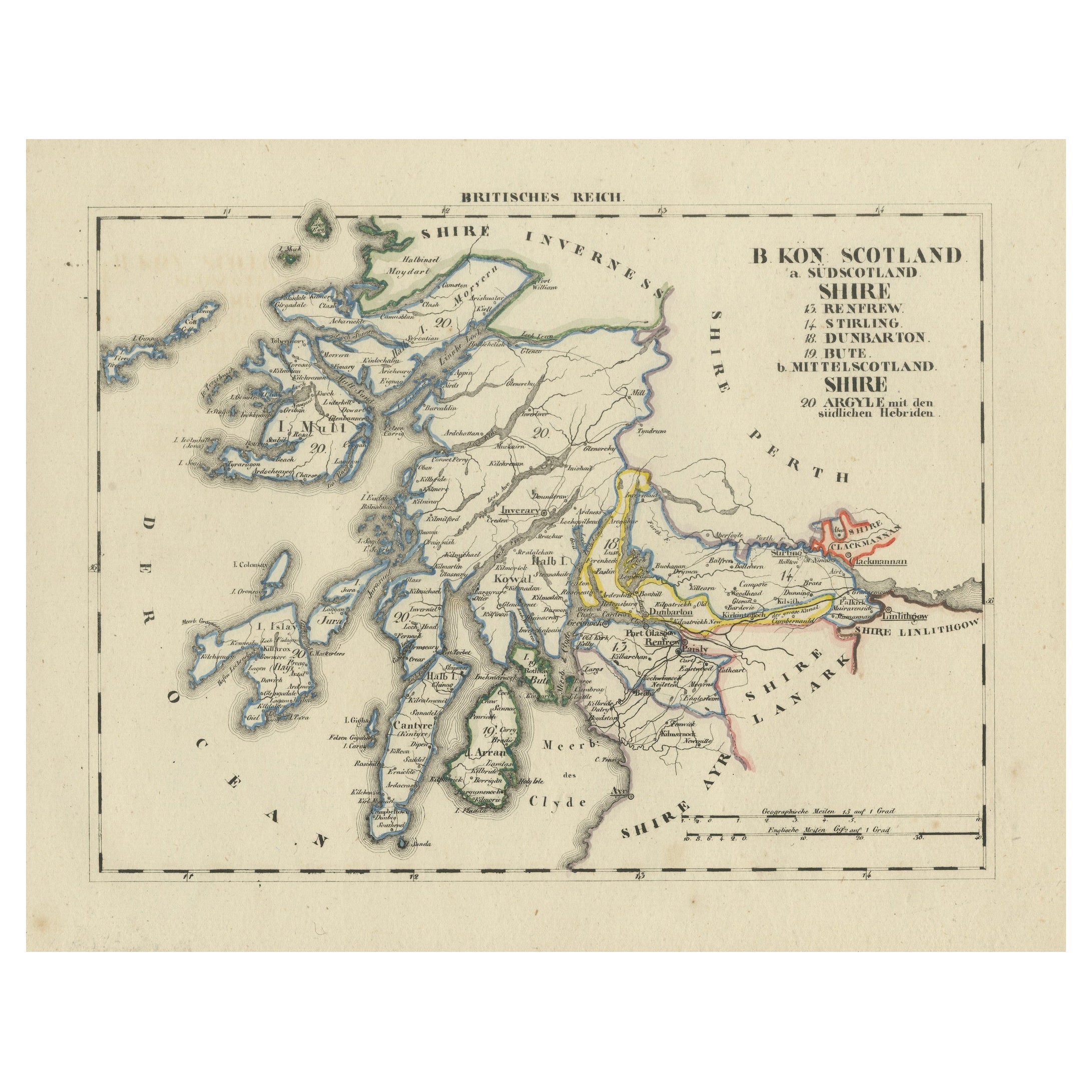
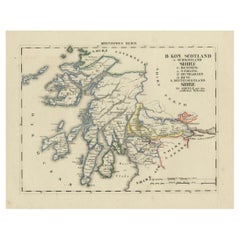
Antique 1830 Map of Scotland with Counties Renfrew, Stirling, Dumbarton and Bute
Located in Langweer, NL
Title: Antique 1830 Map of Scotland with Counties Renfrew, Stirling, Dumbarton, and Bute
Description:
This 1830 German-language map, titled Britisches Reich – B. Kon Scotland, ...
Category
Antique 1830s Maps
Materials
Paper
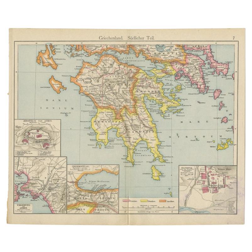
Antique Map of Southern Greece, 1892
Located in Langweer, NL
Antique map of Greece titled 'Griechenland. Südlicher Theil'. Old map of Southern Greece with inset maps of the Acropolis of Athens, the region of Athens, Thermopylae and Olympia. So...
Category
Antique 19th Century Maps
Materials
Paper

Antique Map of Denmark and Southern Sweden, c.1658
Located in Langweer, NL
Antique map titled 'Royaume de Danemarq.' Map centered on Sjaelland and covers all of Denmark and part of southern Sweden where a dramatic title cartouche obscures the interior. Sour...
Category
Antique 17th Century Maps
Materials
Paper

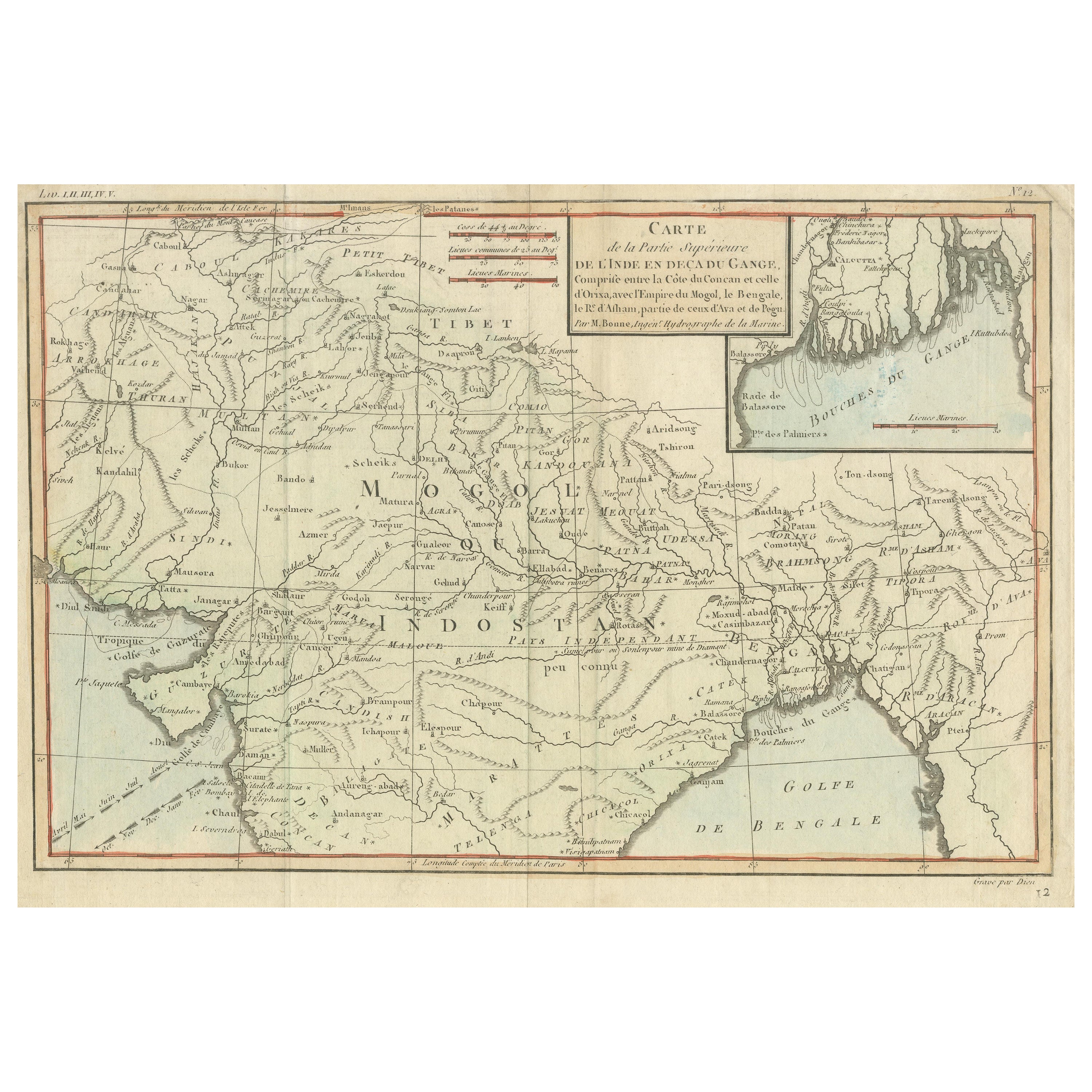
Antique Map of part of Central and Southern Asia
Located in Langweer, NL
Antique map titled 'Carte de la Partie Superieure de l'Inde en deca du Gange. Comprise entre la Cote du Concan et celle d'Orixa, avec l'Empire du Mogol, le Bengale, le R. d'Asham, pa...
Category
Antique Late 18th Century Maps
Materials
Paper

$362 Sale Price
20% Off
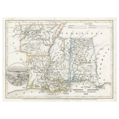
Antique Map of the Southern United States with Inset Map of New Orleans
Located in Langweer, NL
Antique map titled 'Die Staaten von Arkansas Mississippi, Louisiana & Alabama'. Detailed map of the region, which includes the Florida Panhandle. Shows many roads, rivers, forts, etc...
Category
Antique Mid-19th Century Maps
Materials
Paper
You May Also Like
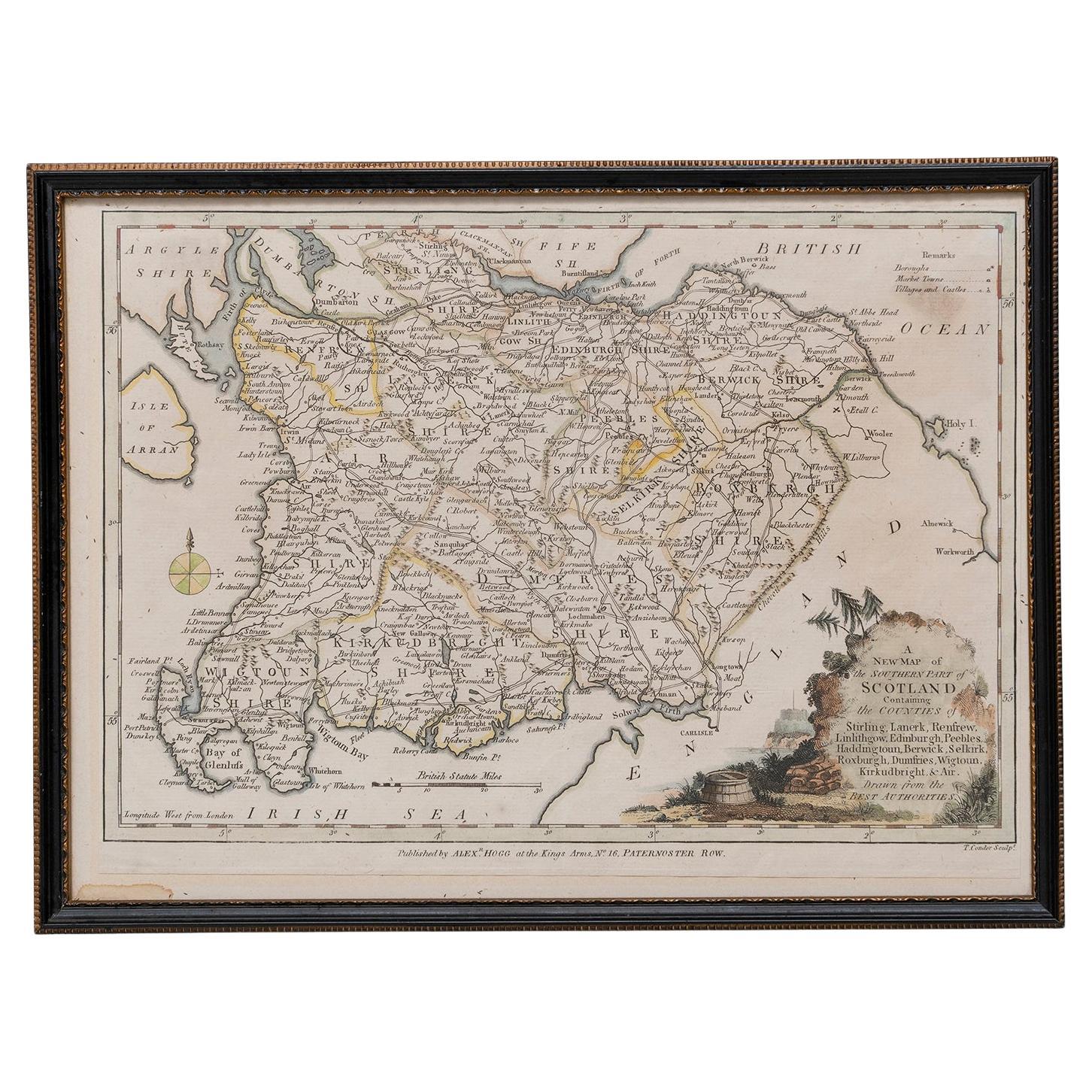
Map Southern Scotland Thomas Conder Alex Hogg 1795
Located in BUNGAY, SUFFOLK
A new map of the southern part of Scotland containing the counties of Stirling, Lanerk, Renfrew, Linlithgow, Edinburgh, Peebles, Haddingtoun, Berwick, Selkirk, Roxburgh, Dumfries, Wigtoun, Kirkudbright & Air
Published by Alex Hogg at the Kings Arms...
Category
Antique 18th Century English Georgian Maps
Materials
Paper

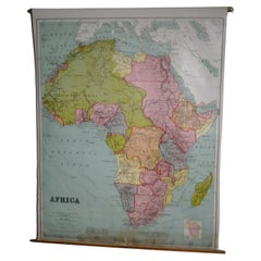
Map of Africa, archival. Printed in Edinburgh, Scotland, 1916. Free Delivery
Located in Madison, WI
Map of Africa from the geography classroom, 1916 edition. Printed in Edinburgh, Scotland. Mounted on pulldown wooden roller with wall mounting brackets....
Category
Early 20th Century Scottish Edwardian Maps
Materials
Wood, Paper
$180 Sale Price
20% Off
Original Antique Map of Scotland. Circa 1880
Located in St Annes, Lancashire
Great map of Scotland
Drawn and Engraved by J.Bartholomew
Published C.1880
Original colour
Unframed.
Category
Antique 1880s English Maps
Materials
Paper
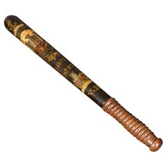
Antique Decorative Truncheon, Scottish, Beech, Edinburgh Police Baton, Victorian
Located in Hele, Devon, GB
This is an antique decorative truncheon. A Scottish, beech Edinburgh police baton with handpainted detail, dating to the Victorian period, circa 1850.
Fa...
Category
Antique 1850s British Victorian Historical Memorabilia
Materials
Beech
Original Antique Map of the American State of California ( Southern Part ), 1903
Located in St Annes, Lancashire
Antique map of California ( Southern part )
Published By A & C Black. 1903
Original colour
Good condition
Unframed.
Free shipping
Category
Antique Early 1900s English Maps
Materials
Paper

Original Antique Map of the American State of Illinois ( Southern Part ), 1903
Located in St Annes, Lancashire
Antique map of Illinois ( Southern part )
Published By A & C Black. 1903
Original colour
Good condition
Unframed.
Free shipping
Category
Antique Early 1900s English Maps
Materials
Paper

Recently Viewed
View AllMore Ways To Browse
Antique Furniture Northern Ireland
Reich Glass
Original Canada Travel Poster
Outdoor Corner Table
Outdoor Dining Tables Seat 6
Patricia Wood Chair
Piano Desk
Pinnacle Dining Table
Poland Antique Silver
Polished Stainless Steel Bench
Porcelain Bears
Pouf Brass Base
Provence French Chairs
Qashqai Kilim
Rattan Italian Lounge
Reception Chair
Red Leather Top Desks
Renaissance Style Armchair