Items Similar to Ancient Italy: Regions and Rome in the Roman Empire, Published in 1880
Want more images or videos?
Request additional images or videos from the seller
1 of 9
Ancient Italy: Regions and Rome in the Roman Empire, Published in 1880
About the Item
This print is an original detailed map titled "ITALIAE REGIONES I VII VIII IX XI," representing the regions of ancient Italy.
Key Features of the Print:
1. **Regional Demarcations**: The map is divided into several regions, each likely numbered according to the Roman administrative divisions, such as Regio I (Latium and Campania), Regio VII (Etruria), and so on.
2. **Topography**: It shows the varied topography of Italy, from the mountainous areas, indicated by shaded relief, to the plains and coastal areas. Rivers, such as the Tiber (Tiberis Fluvius) and the Po (Padus Fluvius), are prominently marked.
3. **Inset Map of Rome (ROMA)**: There is an inset map of ancient Rome, with color-coding to highlight different districts and significant landmarks such as the Roman Forum, the Colosseum, and the Circus Maximus.
4. **Infrastructure**: The map includes Roman roads, aqueducts, and possibly the locations of significant military or trading sites.
5. **Latin Names**: Locations are labeled with their Latin names, providing historical context and emphasizing the map's educational and scholarly intent.
6. **Borders**: It outlines the borders of Italy with neighboring seas - the Ligusticum Sinus (Ligurian Sea) to the northwest and the Tuscum Sinus (Tyrrhenian Sea) to the west.
7. **Legend and Scale**: A legend is included with explanations for symbols and color-coding used throughout the map, and there is likely a scale to indicate distances.
This map would be highly valued for its historical and educational content, providing a comprehensive overview of the geography of ancient Italy. It would be particularly useful for those studying the Roman era, offering insights into the organization, infrastructure, and urban planning of the time.
This map is interesting for several reasons:
1. **Detailed Representation of Ancient Italy**: It meticulously outlines the regions of ancient Italy, providing an in-depth look at the landscape, including the division into the Roman administrative regions, which were known as "regiones" during the Imperial period.
2. **Historical Geography**: The map illustrates the geographical features, such as the Apennine Mountains and major rivers like the Tiber, which played crucial roles in the development of Roman civilization.
3. **Urban Centers**: The detailed inset of Rome is particularly noteworthy. It shows the city's layout during the Roman Empire, including key landmarks that are of significant historical and archaeological interest.
4. **Roman Infrastructure**: The depiction of the road networks, aqueducts, and possibly the defensive structures highlights the Romans' engineering prowess and their ability to organize and control vast territories.
5. **Cultural and Political Insight**: Through the regional divisions and the naming of places in Latin, the map provides insight into the cultural and political landscape of the period it represents.
6. **Educational Value**: As a historical document, the map serves as an educational resource for understanding the complexities of ancient Rome's urban planning and regional administration.
The period depicted is likely to be during the height of the Roman Empire, specifically after the administrative reforms of Emperor Augustus, who reorganized Italy into 11 regions around the end of the 1st century BC. This period is characterized by great prosperity and stability, known as the Pax Romana, which lasted until the 2nd century AD. The map would be a valuable tool for those studying this particular era of Roman history, offering a visual representation of Italy's ancient divisions and the grandeur of Rome itself.
The map is from the "Spruner-Menke Atlas Antiquus," which is a historical atlas created by Karl Spruner von Merz, and later edited by Theodorus Menke. The atlas is known for its detailed maps of historical geographic regions, rendered with great precision and accompanied by scholarly research. These maps were particularly designed for educational use, providing a visual aid for the study of historical and ancient geography. The "Spruner-Menke Atlas Antiquus" is considered a significant work in the field of historical cartography and was published in the late 19th century.
- Dimensions:Height: 15.56 in (39.5 cm)Width: 18.51 in (47 cm)Depth: 0 in (0.02 mm)
- Materials and Techniques:
- Period:
- Date of Manufacture:1880
- Condition:Good, given age. General age-related toning, especially around the edges. Vertical folding line as issued. Light offset on the left border, outside the image. Please study scan carefully.
- Seller Location:Langweer, NL
- Reference Number:Seller: BG-13686-2-121stDibs: LU3054338540392
About the Seller
5.0
Recognized Seller
These prestigious sellers are industry leaders and represent the highest echelon for item quality and design.
Platinum Seller
Premium sellers with a 4.7+ rating and 24-hour response times
Established in 2009
1stDibs seller since 2017
2,419 sales on 1stDibs
Typical response time: <1 hour
- ShippingRetrieving quote...Shipping from: Langweer, Netherlands
- Return Policy
Authenticity Guarantee
In the unlikely event there’s an issue with an item’s authenticity, contact us within 1 year for a full refund. DetailsMoney-Back Guarantee
If your item is not as described, is damaged in transit, or does not arrive, contact us within 7 days for a full refund. Details24-Hour Cancellation
You have a 24-hour grace period in which to reconsider your purchase, with no questions asked.Vetted Professional Sellers
Our world-class sellers must adhere to strict standards for service and quality, maintaining the integrity of our listings.Price-Match Guarantee
If you find that a seller listed the same item for a lower price elsewhere, we’ll match it.Trusted Global Delivery
Our best-in-class carrier network provides specialized shipping options worldwide, including custom delivery.More From This Seller
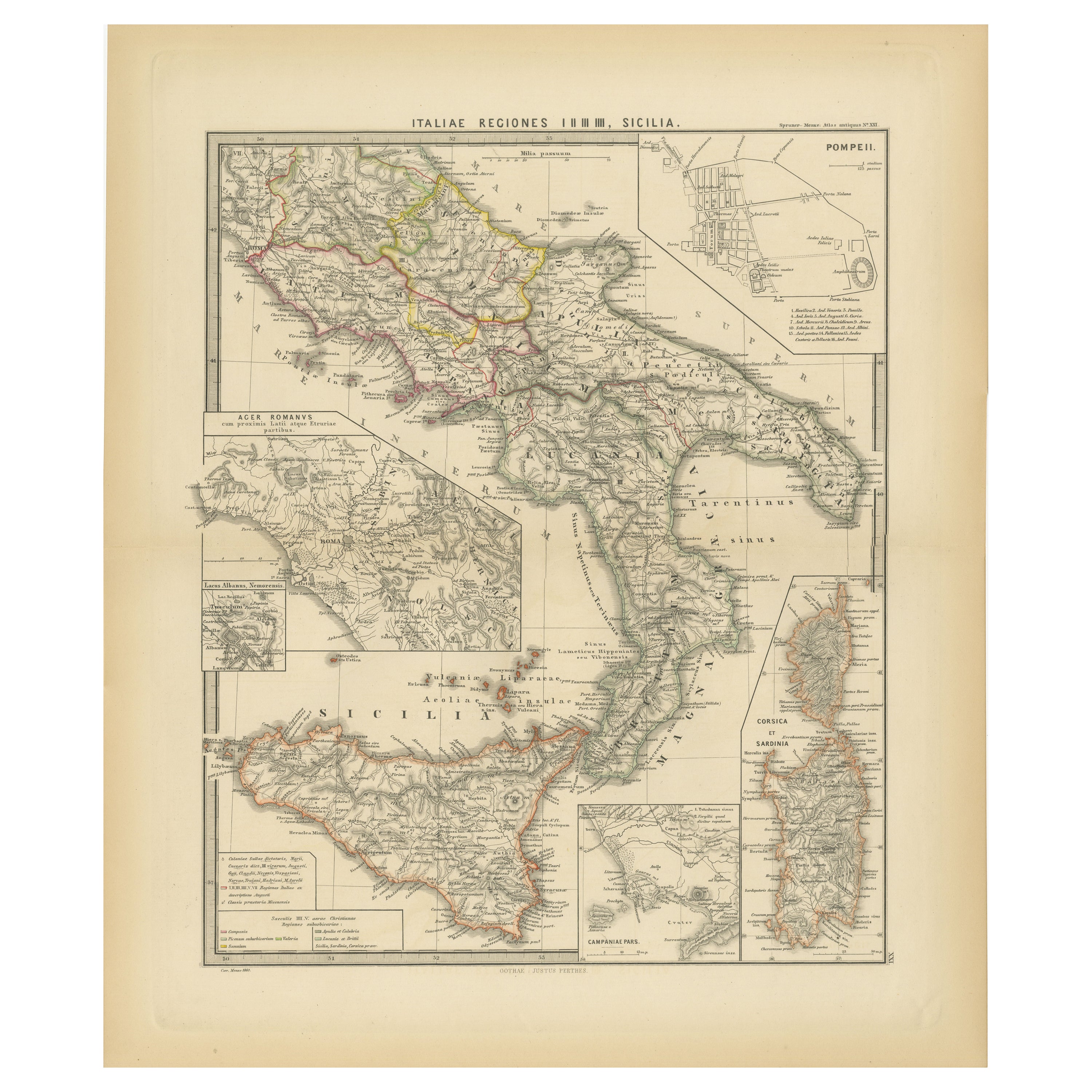
View AllAntique Map of The Regions of Italy and Sicily during the Roman Empire, 1880
Located in Langweer, NL
This map is an original antique engraving titled "ITALIAE REGIONES IIII SICILIA," which translates to "The Regions of Italy and Sicily." This detailed historical map portrays the reg...
Category
Antique 1880s Maps
Materials
Paper
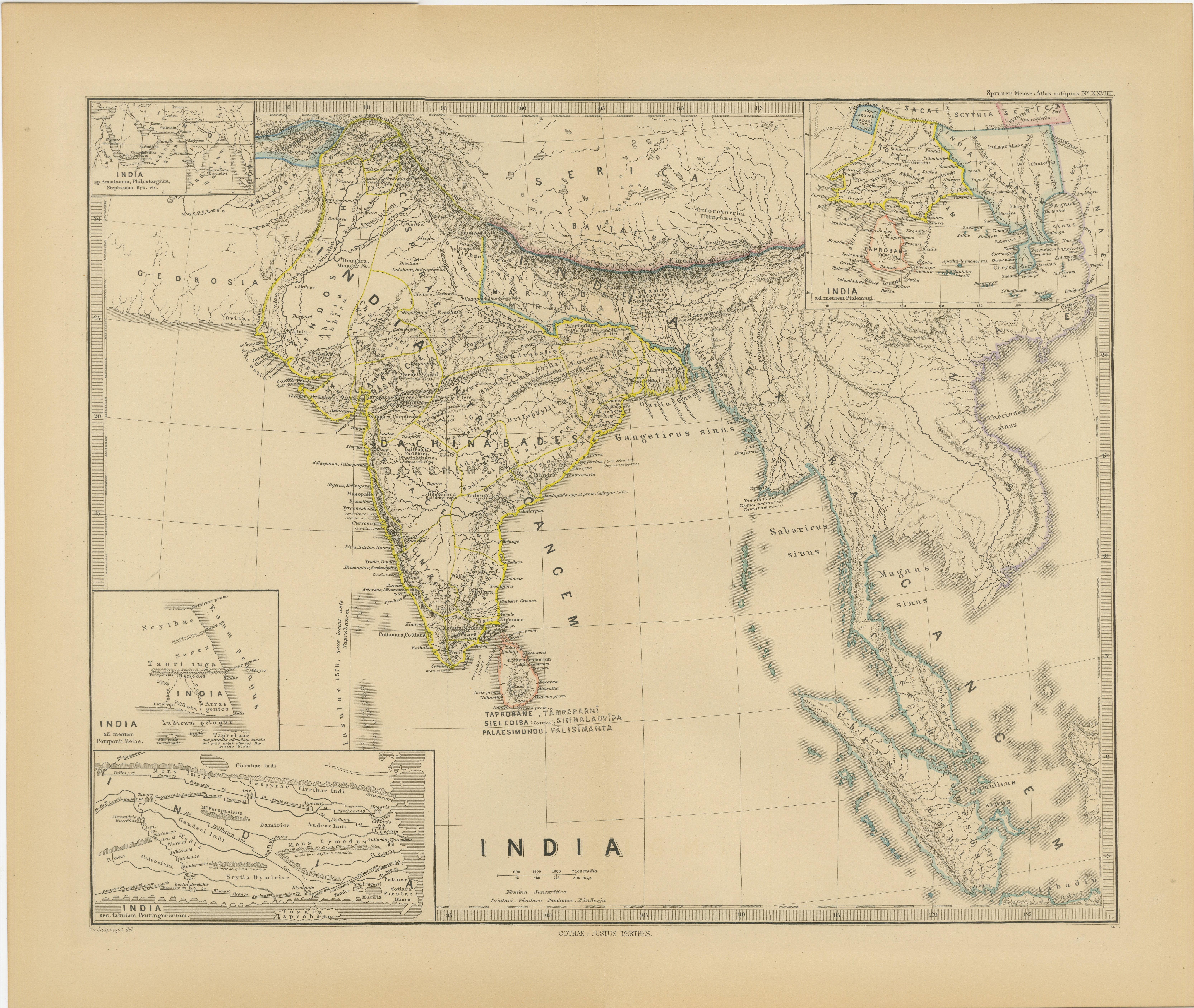
Ancient Cartography of the Indian Subcontinent, Published in 1880
Located in Langweer, NL
This map is titled "INDIA," and it provides a detailed view of the Indian subcontinent with various inset maps that offer additional historical and geographical context.
The main ma...
Category
Antique 1880s Maps
Materials
Paper

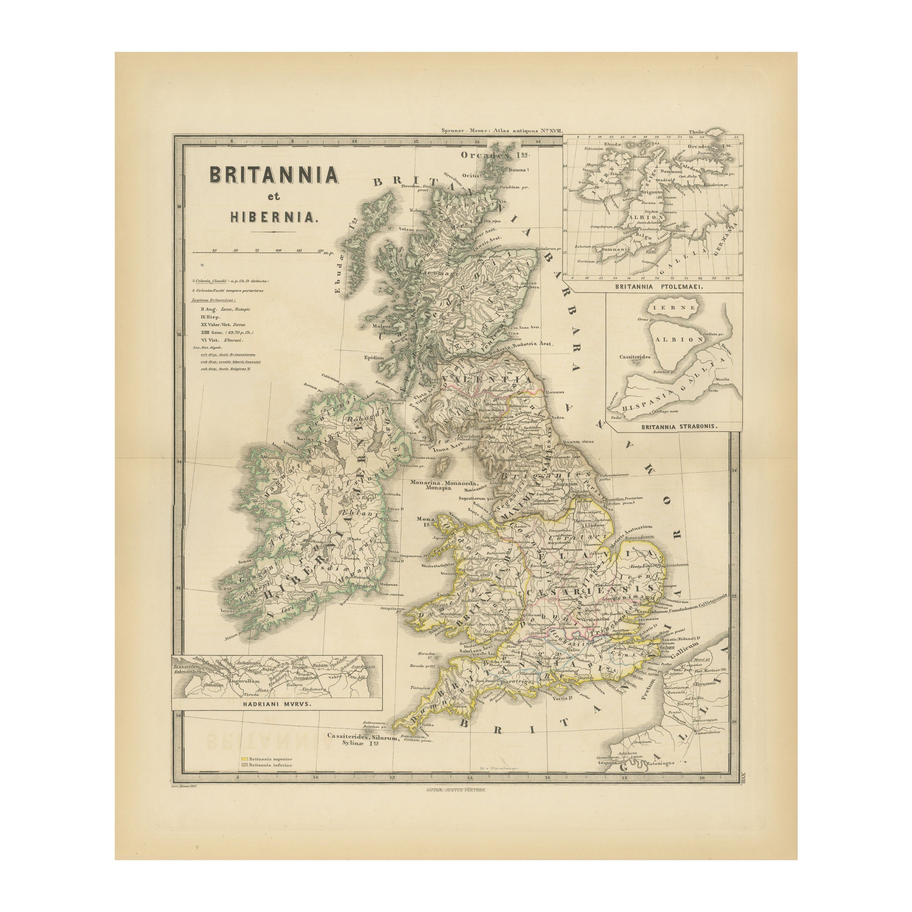
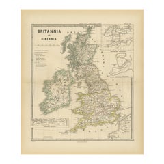
Ancient Cartography of Britannia and Hibernia, Published in 1880
Located in Langweer, NL
This map depicts the geographical area of Great Britain and Ireland, labeled "BRITANNIA et HIBERNIA." It is a historical map, as indicated by the Latin titles and the classical names of regions and tribes.
In the main section of the map, Great Britain is depicted in fine detail, with topographical features such as mountains and rivers. The map is color-coded, to differentiate political or tribal boundaries. Various Roman place names are indicated, such as "Londinium" for London.
To the left of Great Britain is Ireland, referred to as "Hibernia," similarly detailed with its own topographical features and ancient...
Category
Antique 1880s Maps
Materials
Paper
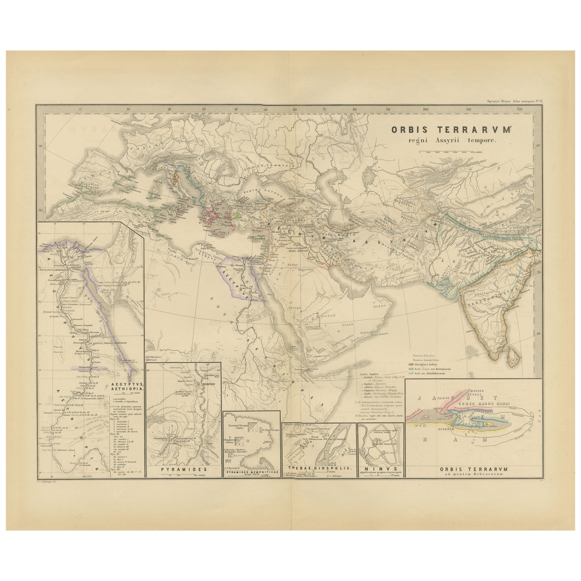
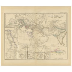
The World in the Assyrian Empire's Era: A Historical Map, Published in 1880
Located in Langweer, NL
This map from the "Spruner-Menke Atlas Antiquus" is titled "ORBIS TERRARVM regni Assyrii tempore," which translates to "The World at the Time of the Assyrian Kingdom." It depicts the...
Category
Antique 1880s Maps
Materials
Paper
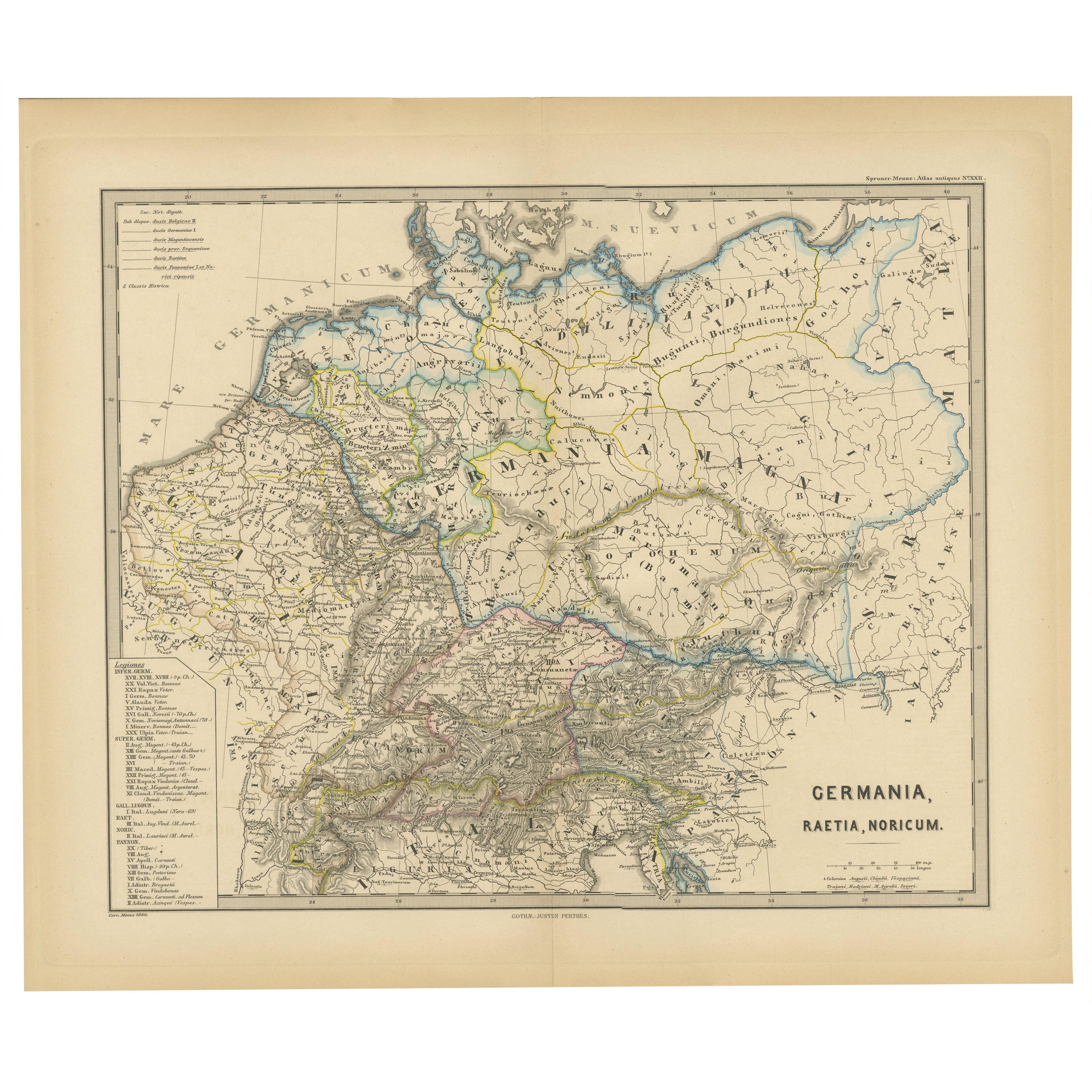
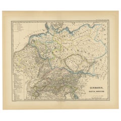
Roman Frontiers Engraved: Germania, Raetia, and Noricum, Published in 1880
Located in Langweer, NL
The map, titled "GERMANIA, RAETIA, NORICUM," depicts the regions of Germania, Raetia, and Noricum, which correspond to parts of modern-day Central and Eastern Europe, including areas of Germany, Austria, Switzerland, and the Balkans.
Features of the map include:
1. **Regional Divisions**: The map is divided into the regions of Germania, Raetia, and Noricum, each likely differentiated by color or shading.
2. **Topography**: It details the mountain ranges, rivers, and other geographical features of the region. The Alps, which are central to Raetia, are prominently displayed.
3. **Roman Settlements and Roads**: The map likely marks Roman...
Category
Antique 1880s Maps
Materials
Paper
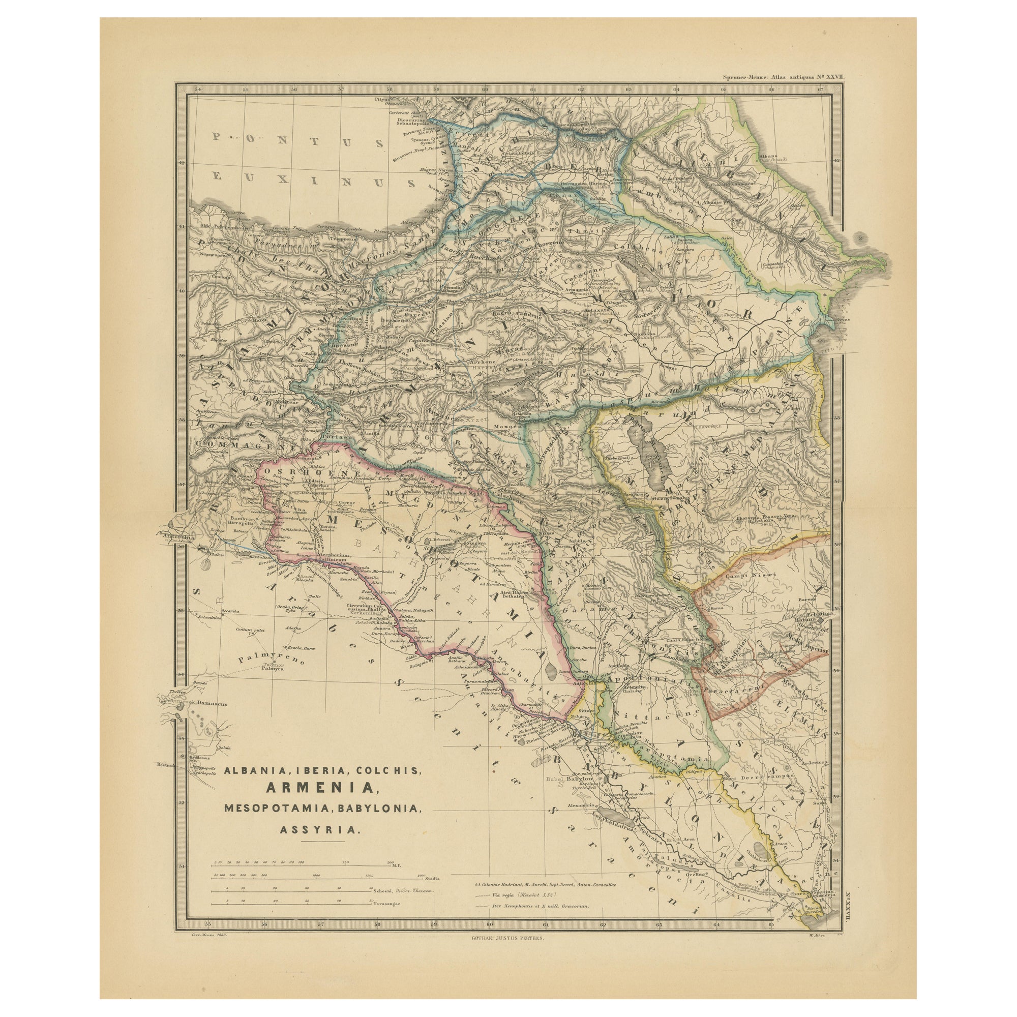
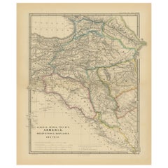
Ancient Crossroads: Albania to Assyria in Antiquity, Published in 1880
Located in Langweer, NL
The map titled "ALBANIA, IBERIA, COLCHIS, ARMENIA, MESOPOTAMIA, BABYLONIA, ASSYRIA" portrays the ancient regions that would encompass parts of modern-day Eastern Turkey, Armenia, Aze...
Category
Antique 1880s Maps
Materials
Paper
You May Also Like
Ancient Roman Glass
Located in Delray Beach, FL
Beautiful original ancient Roman glass embedded in Lucite cube, was used for containing perfume. Exceptional object of art for display.
Category
Antique 15th Century and Earlier Israeli Glass
Materials
Murano Glass
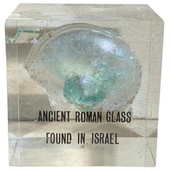
$395 Sale Price
71% Off
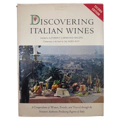
Discovering Italian wines food travel through the 19 producing regions of Italy
Located in North Hollywood, CA
Discovering Italian wines;: An authoritative compendium of wines, food, and travel through the nineteen producing regions of Italy Unbound.
Balzar, Robert Lawrence (Introduction) & R...
Category
Late 20th Century Italian Expressionist Books
Materials
Paper
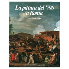
The painting of the 1700s in Rome
By Non-Standard Furniture and Lighting
Located in Milano, IT
Exemplar in good condition, in slipcase with yellowing and signs of wear. Dust jacket with yellowing, evident on spine; dust spots and signs of wear at edges and corners. Yellowed an...
Category
Vintage 1980s Italian Mid-Century Modern Books
Materials
Paper
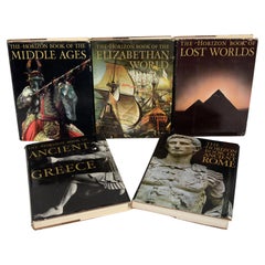
Set 5, Ancient Rome, Ancient Greece, Lost Worlds, Middle Ages, Elizab, World
Located in valatie, NY
Set of 5 Books: Ancient Rome, Ancient Greece, Lost Worlds, Middle Ages, Elizabethan World. New York: American Heritage Publishing Co. Ancient Rome: in an age when Latin has become ra...
Category
Vintage 1960s American Books
Materials
Paper
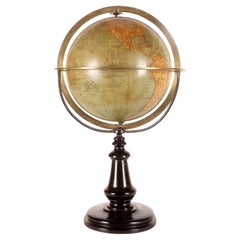
A terrestral globe signed Périgot, published by Delagrave, Paris 1880.
Located in Milan, IT
A Medium-sized terrestrial globe, made of papier-mâché, finished with pastille and completed by the application of paper spindles imprinted with intaglio printing. Color touch-ups. T...
Category
Antique Late 19th Century French Scientific Instruments
Materials
Brass
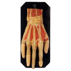
Ancient anatomical model of the hand, Italy 1900.
Located in Milan, IT
Anatomical model for schools, educational use, depicting the hand swinging on a fork supported by a black lacquered wooden base.
Made of plaster and finished entirely in colour. Ital...
Category
Early 20th Century Italian Scientific Instruments
Materials
Plaster, Wood
Recently Viewed
View AllMore Ways To Browse
Ancient Roman Empire
Antique Ancient Key
2nd Empire Furniture
Circus Collectibles
19th Century Carpet Bag
3 Piece Sterling Silver Tea Set
48 Round Coffee Table
7 Foot Sofa
Antique Cherry Chair
Antique Mason Plates
Antique Measuring Jugs
Antique Red Trunk
Antique Table 4 Drawers
Antique Work Stool
Antique Yolk
Art Nouveau Silver Overlay
Axe Table
Ball And Claw Chippendale Chair