Items Similar to 1891 Map of Norfolk County Massachusetts
Want more images or videos?
Request additional images or videos from the seller
1 of 5
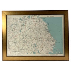
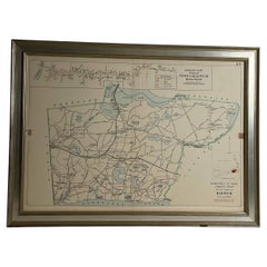
1891 Map of Norfolk County Massachusetts
About the Item
1891 map of Norfolk county Massachusetts including the towns of Wrentham, Franklin, Medfield, Sherborn, Norwood etc., measures: 23 x 31.
- Dimensions:Height: 23 in (58.42 cm)Width: 31 in (78.74 cm)Depth: 1 in (2.54 cm)
- Period:
- Date of Manufacture:Unknown
- Condition:
- Seller Location:Norwell, MA
- Reference Number:Seller: 1031180701stDibs: LU1741212547401
About the Seller
5.0
Vetted Professional Seller
Every seller passes strict standards for authenticity and reliability
Established in 1967
1stDibs seller since 2015
392 sales on 1stDibs
Typical response time: 1 hour
- ShippingRetrieving quote...Shipping from: Norwell, MA
- Return Policy
Authenticity Guarantee
In the unlikely event there’s an issue with an item’s authenticity, contact us within 1 year for a full refund. DetailsMoney-Back Guarantee
If your item is not as described, is damaged in transit, or does not arrive, contact us within 7 days for a full refund. Details24-Hour Cancellation
You have a 24-hour grace period in which to reconsider your purchase, with no questions asked.Vetted Professional Sellers
Our world-class sellers must adhere to strict standards for service and quality, maintaining the integrity of our listings.Price-Match Guarantee
If you find that a seller listed the same item for a lower price elsewhere, we’ll match it.Trusted Global Delivery
Our best-in-class carrier network provides specialized shipping options worldwide, including custom delivery.More From This Seller
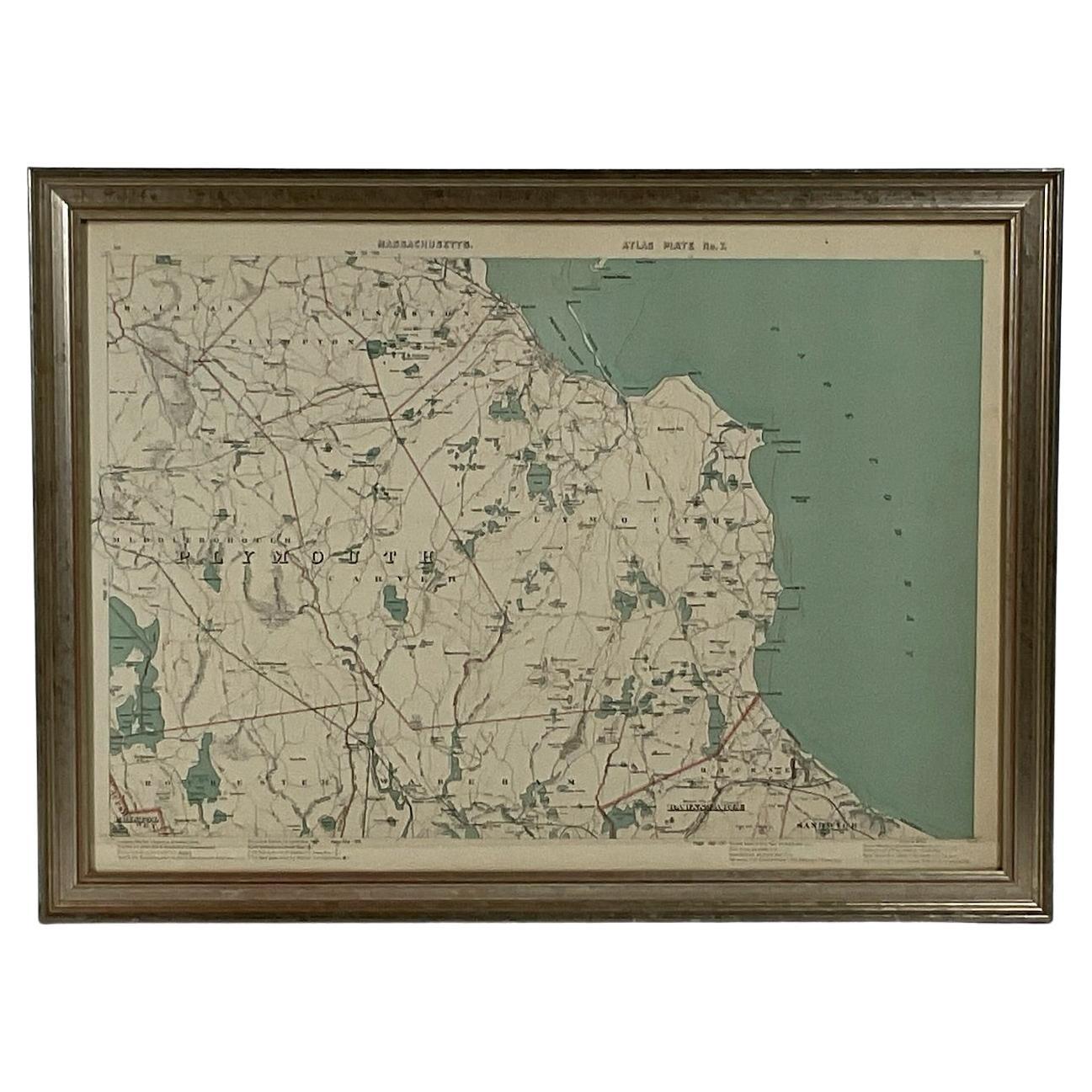
View All1891 Map of Plymouth County Mass
Located in Norwell, MA
Original 1891 map showing Sandwich, Bourne, Plymouth Carver, Middleborough, Plympton and Kingston. Showing Long Beach in Plymouth also as well as all shore points. Cape Cod Bay is ma...
Category
Antique 1890s North American Maps
Materials
Paper
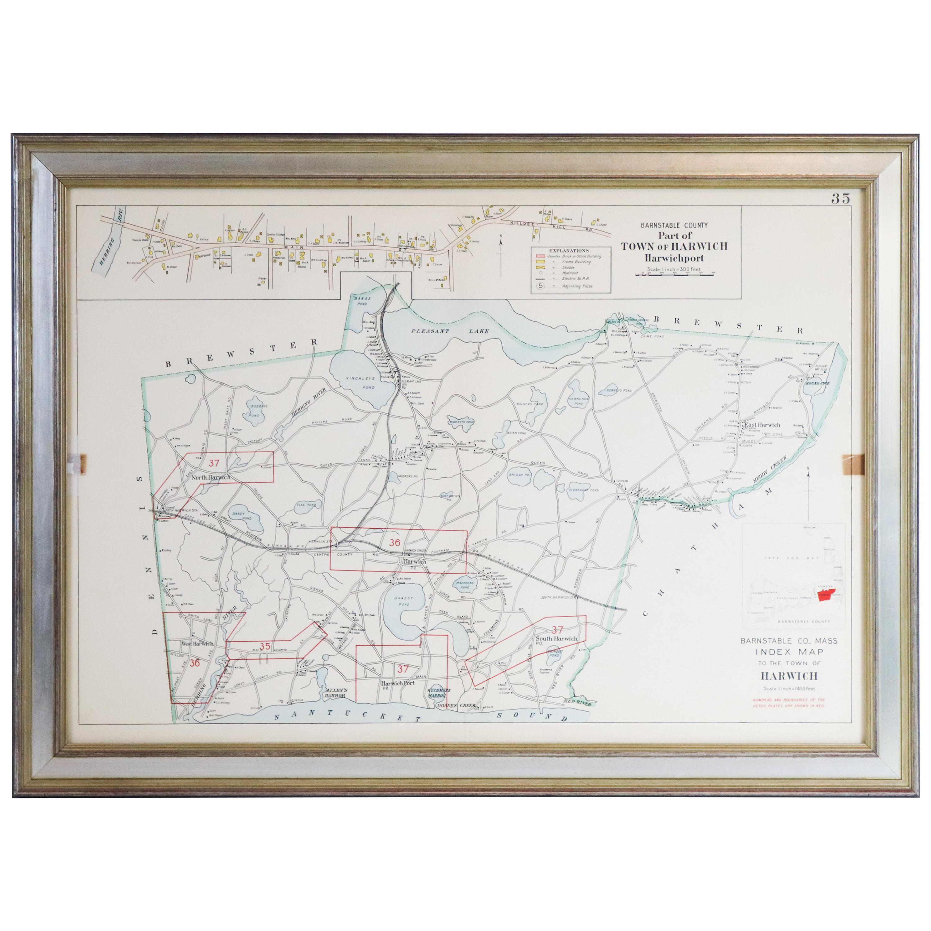
Map of Harwich, Massachusetts
Located in Norwell, MA
Turn of the century map of Harwich, Massachusetts. Plate from a Cape Cod County Map book showing the Barnstable county town of Harwich including Allens Harbor, Pleasant Lake, Harwich...
Category
20th Century Maps

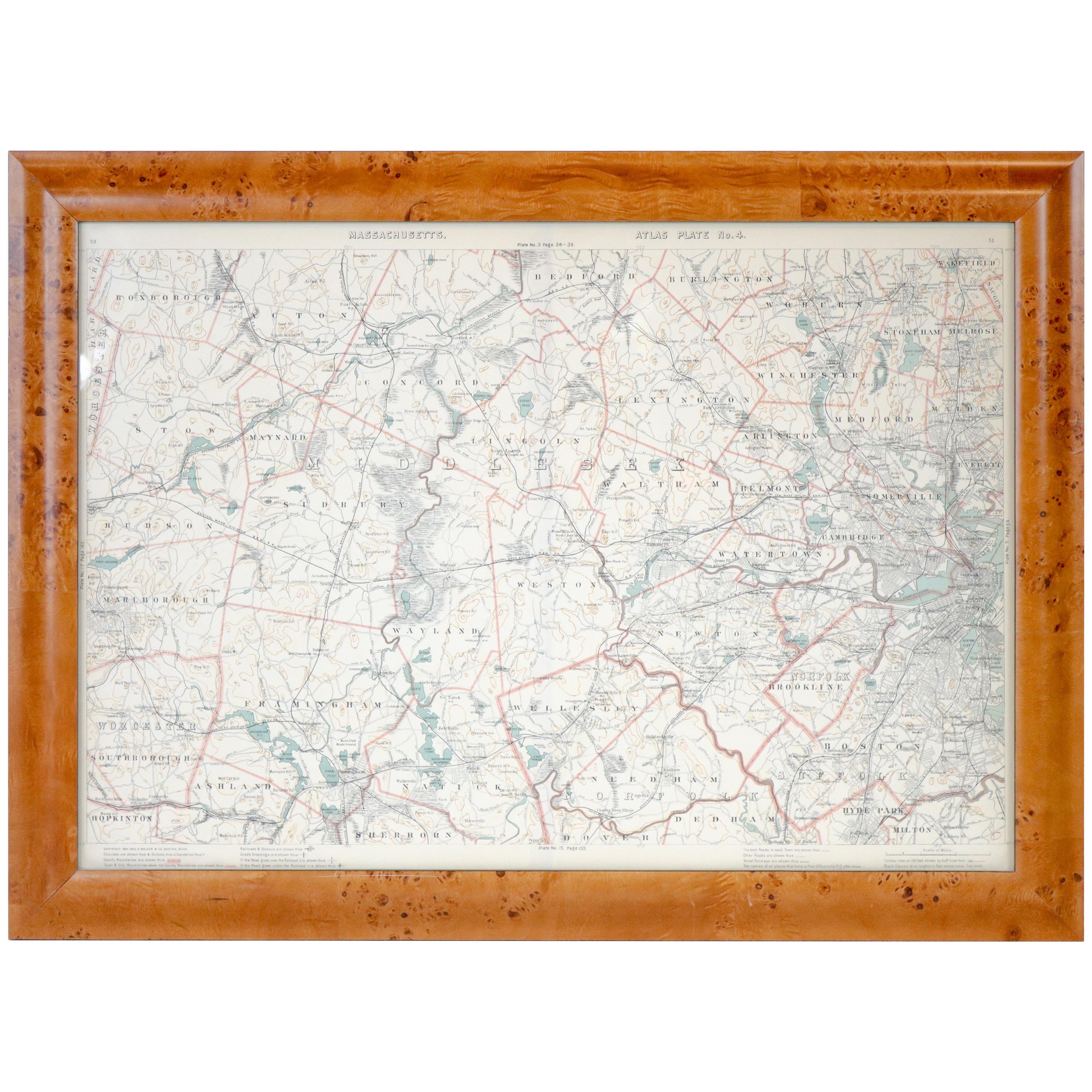
Original 1891 Walker Map
Located in Norwell, MA
Original 1891 map of Massachusetts by Walker. Towns include Cambridge, Boston, Dedham, Ashland, Brookline, Newton etc... burl wood frame. Measures...
Category
Antique 19th Century Maps

1891 Map of South Shore of Boston
Located in Norwell, MA
Original 1891 map showing Cohasset, Scituate, Marshfield, Duxbury, Kingston, Norwell, Hanover, Hingham, Hull, Holbrook, Weymouth, Hanson, Pembroke, etc. Framed with glass. Circa 1891.
Category
Antique 1890s North American Prints
Materials
Paper
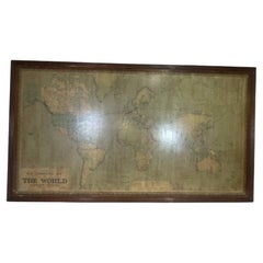
8 Foot Framed World Map by Philips
Located in Norwell, MA
1951 map of the world by George Philip and Son. Large beautiful map as it was in 1951. Nice patina mounted to a sturdy wood frame. Overall good condition. Very large in size. 90" W x...
Category
Vintage 1950s North American Maps
Materials
Paper
Wychmere Harbor Allens Harbor Map Circa 1890
Located in Norwell, MA
Map of Harwich Mass showing Wychmere Harbor, Doane's Creek, Allens Harbor, Herring River, Pleasant Lake, Grassy Pond, Paddocks Pond, Hinkleys Pond, etc., This is an original period m...
Category
Antique 1890s North American Maps
Materials
Paper
You May Also Like
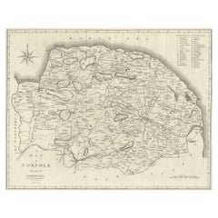
Large Antique County Map of Norfolk, England
Located in Langweer, NL
Antique map titled 'A Map of Norfolk from the best Authorities'. Original old county map of Norfolk, England. Engraved by John Cary. Originates from 'N...
Category
Antique Early 19th Century Maps
Materials
Paper
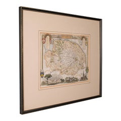
Antique County Map, Norfolk, English, Framed Lithography, Cartography, Victorian
Located in Hele, Devon, GB
This is an antique lithography map of Norfolk. An English, framed atlas engraving of cartographic interest, dating to the mid 19th century and later.
Superb lithography of Norfolk a...
Category
Antique Mid-19th Century British Victorian Maps
Materials
Glass, Wood
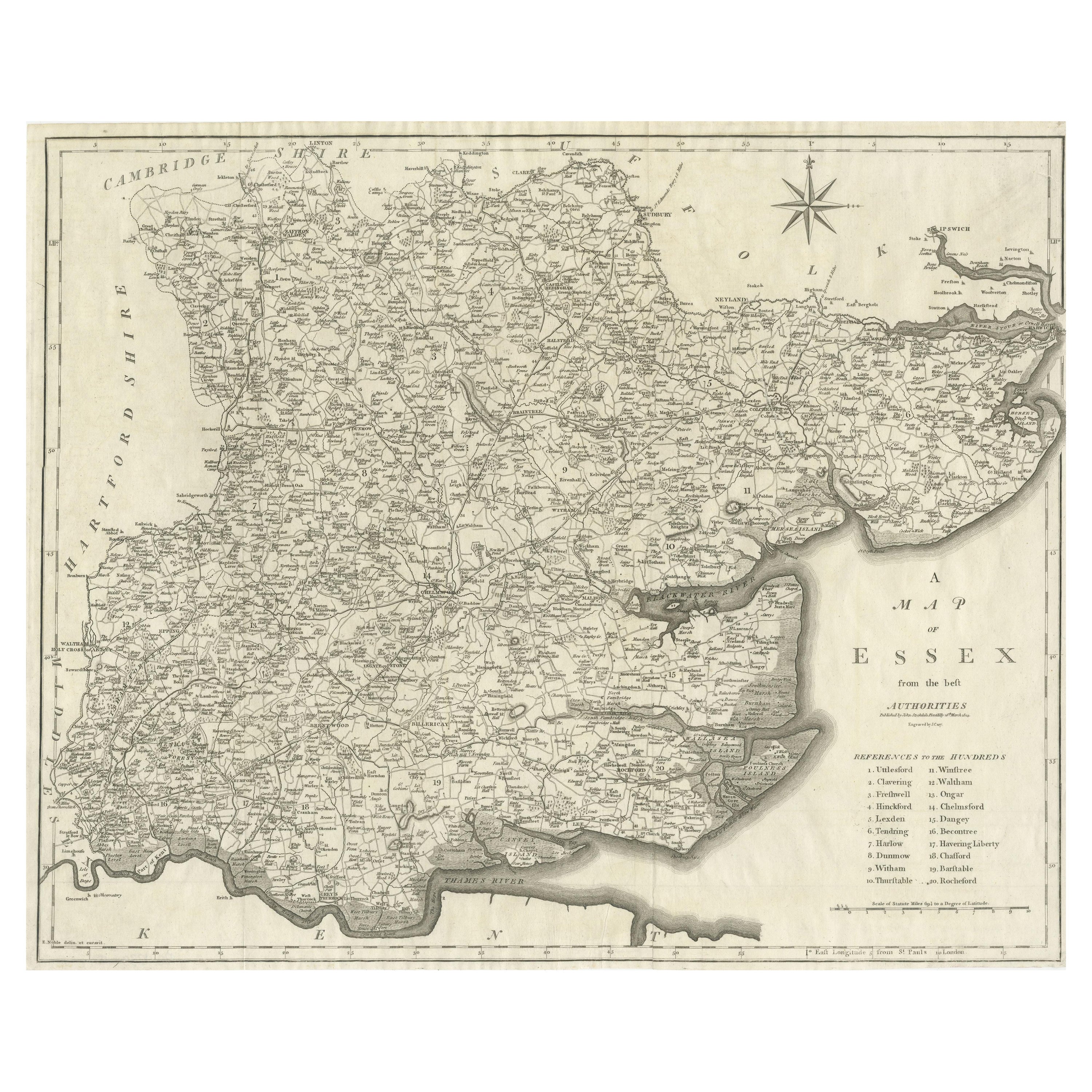
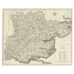
Large Antique County Map of Essex, England
Located in Langweer, NL
Antique map titled 'A Map of Essex from the best Authorities'. Original old county map of Essex, England. Engraved by John Cary. Originates from 'New Brit...
Category
Antique Early 19th Century Maps
Materials
Paper
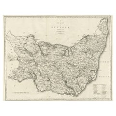
Large Antique County Map of Suffolk, England
Located in Langweer, NL
Antique map titled 'A Map of Suffolk from the best Authorities'. Original old county map of Suffolk, England. Engraved by John Cary. Originates from 'New British Atlas' by John Stock...
Category
Antique Early 19th Century Maps
Materials
Paper
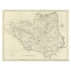
Large Antique County Map of Durham, England
Located in Langweer, NL
Antique map titled 'A Map of Durham from the best Authorities'. Original old county map of Durham, England. Engraved by John Cary. Originates from 'New ...
Category
Antique Early 19th Century Maps
Materials
Paper
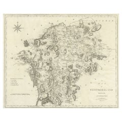
Large Antique County Map of Westmorland, England
Located in Langweer, NL
Antique map titled 'A Map of Westmoreland from the best Authorities'. Original old county map of Westmorland, England. Engraved by John Cary. Originates from 'New British Atlas' by J...
Category
Antique Early 19th Century Maps
Materials
Paper
Recently Viewed
View AllMore Ways To Browse
Antique Maps Massachusetts
Map Of Arabia
New Zealand Map
Map Tibet
Antique Map Of Egypt
British Empire Map
18th Century French Globe
Antique Map Ortelius
Antique Nautical Maps
Roman Empire Map
Voc Ship
16th Century Globe
Map Of Singapore
Antique Map Of Middle East
Hand Painted Antique Map
Railroad Collectibles
An Accurate Map Of Europe
Marine Charts