Items Similar to 1788 Map of Europe - France, Italy, Spain, Germany, Great Britain & Ireland


Want more images or videos?
Request additional images or videos from the seller
1 of 9
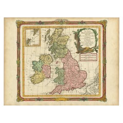
1788 Map of Europe - France, Italy, Spain, Germany, Great Britain & Ireland
About the Item
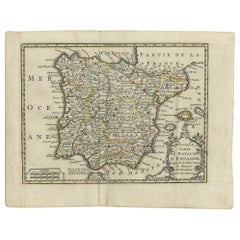
Title: "1788 Map of Europe - France, Italy, Spain, Germany, Great Britain & Ireland by D'Anville"
Description:
This detailed map of Europe, titled "First Part of the Map of Europe, Containing France, Italy, Spain, Germany, Great Britain & Ireland," was published in 1788. The map was based on the original work by renowned French cartographer Jean Baptiste Bourguignon d'Anville and was produced under the patronage of the Duke of Orleans. The map was drawn and engraved for J. Harrison, London, as stated in the lower margin, with the publishing date marked as December 1st, 1788.
This map reflects the high level of cartographic skill during the late 18th century, showcasing intricate details of the various regions, including boundaries, cities, and geographical features. D'Anville was known for his meticulous research and was one of the most respected geographers of his time, often recognized for his contributions to geographical accuracy. This particular map shows the political divisions of Europe during a tumultuous period just prior to the French Revolution.
The map has an attractive decorative cartouche, typical of maps from this era, which adds an artistic element to the presentation. It remains an important historical document, providing a glimpse into how Europe was perceived and divided just before significant political changes shaped the continent.
Condition: The map is in very good condition for its age, with general age-related toning and some light scattered foxing typical of maps from the late 18th century. The hand coloring is well-preserved and enhances the details of the various regions. There is a faint horizontal crease near the center, but it does not detract significantly from the visual appeal of the piece. The margins are wide, and there are no tears or significant stains, making this a well-preserved example of an 18th-century cartographic work.
- Dimensions:Height: 31.5 in (80 cm)Width: 21.07 in (53.5 cm)Depth: 0.01 in (0.2 mm)
- Materials and Techniques:Paper,Engraved
- Period:1780-1789
- Date of Manufacture:1788
- Condition:The map is in very good condition for its age, with general age-related toning and some light scattered foxing typical of maps from the late 18th century. The hand coloring is well-preserved.
- Seller Location:Langweer, NL
- Reference Number:Seller: BG-13840-61stDibs: LU3054342585372
About the Seller
5.0
Recognized Seller
These prestigious sellers are industry leaders and represent the highest echelon for item quality and design.
Platinum Seller
Premium sellers with a 4.7+ rating and 24-hour response times
Established in 2009
1stDibs seller since 2017
2,417 sales on 1stDibs
Typical response time: <1 hour
- ShippingRetrieving quote...Shipping from: Langweer, Netherlands
- Return Policy
Authenticity Guarantee
In the unlikely event there’s an issue with an item’s authenticity, contact us within 1 year for a full refund. DetailsMoney-Back Guarantee
If your item is not as described, is damaged in transit, or does not arrive, contact us within 7 days for a full refund. Details24-Hour Cancellation
You have a 24-hour grace period in which to reconsider your purchase, with no questions asked.Vetted Professional Sellers
Our world-class sellers must adhere to strict standards for service and quality, maintaining the integrity of our listings.Price-Match Guarantee
If you find that a seller listed the same item for a lower price elsewhere, we’ll match it.Trusted Global Delivery
Our best-in-class carrier network provides specialized shipping options worldwide, including custom delivery.More From This Seller
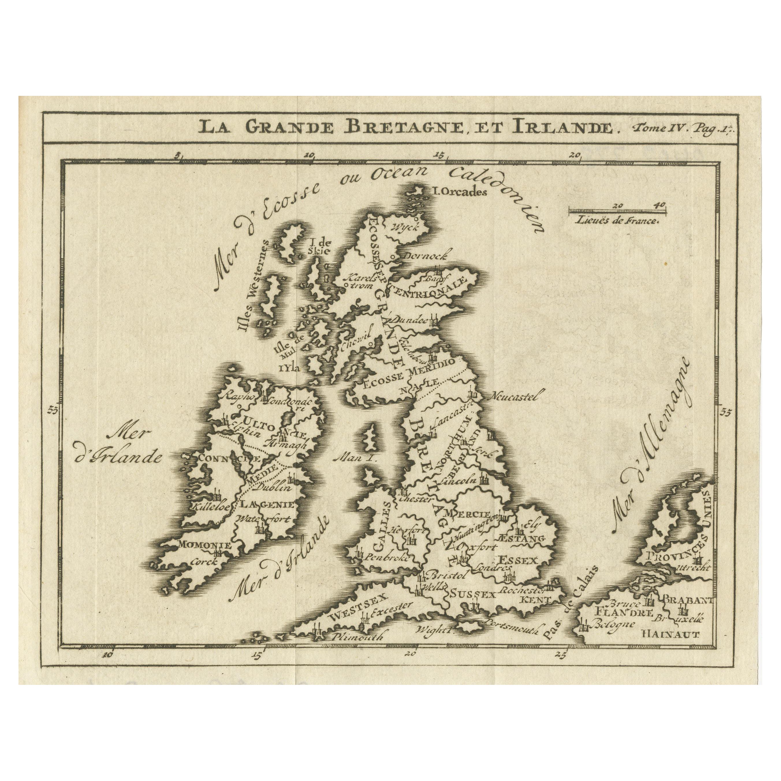
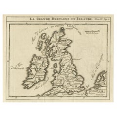
View AllRare Small Antique Map of Great Britain and Ireland
Located in Langweer, NL
Antique map titled 'La Grande Bretagne et Irlande'. Small antique map of Great Britain and Ireland. Source unknown, to be determined. Publ...
Category
Antique Mid-18th Century Maps
Materials
Paper
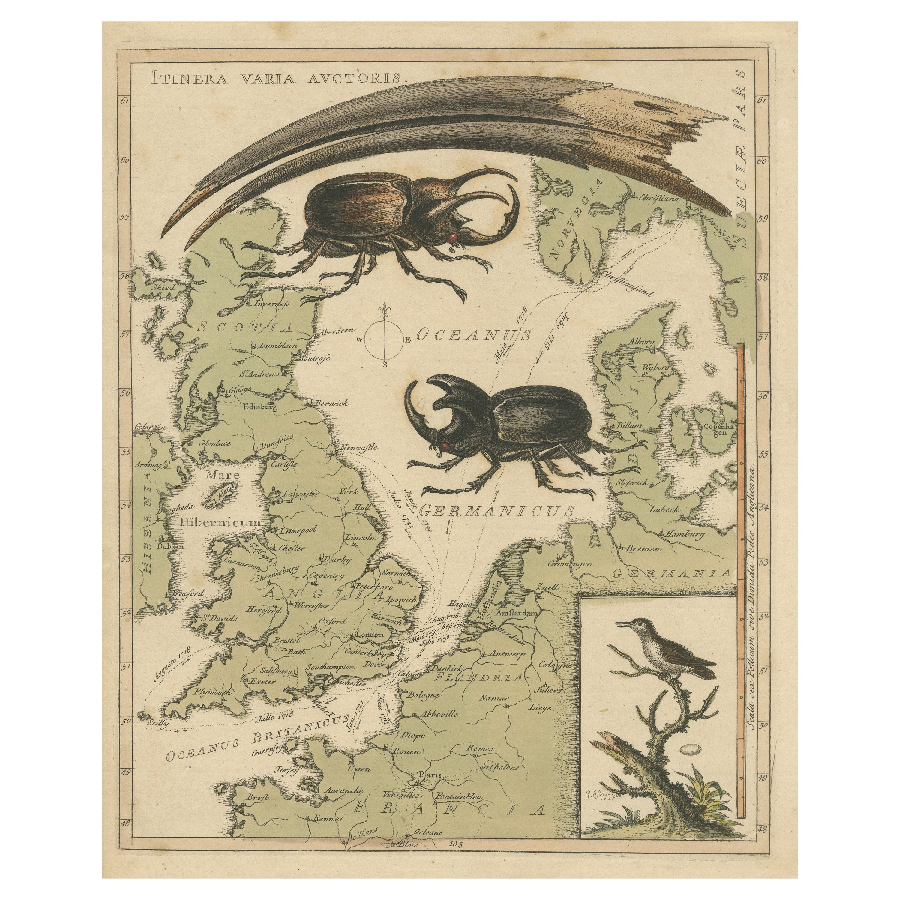
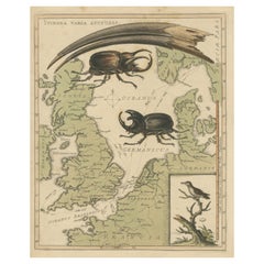
Interesting Map of Great Britain and Northern Europe with various Illustrations
Located in Langweer, NL
Antique map titled 'Itinera Varia Auctoris'. Very interesting map of Great Britain and Northern Europe. The map shows Edwards' journeys between 1716-1730 to study his beloved birds a...
Category
Antique Mid-18th Century Maps
Materials
Paper
Antique Map of Europe by Keizer & de Lat, 1788
Located in Langweer, NL
Antique map titled 'Kaartje van Europa (..)'. Uncommon original antique map of Europe. This map originates from 'Nieuwe Natuur- Geschied- en Handelkundige Zak- en Reisatlas' by Gerri...
Category
Antique Late 18th Century Maps
Materials
Paper

Antique Map of Great Britain and Ireland by Brion de la Tour, 1766
Located in Langweer, NL
Antique map titled 'Les Isles Britanniques (..).'
Attractive map of Great Britain surrounded by an engraved border printed from a separate coppe...
Category
Antique 18th Century Maps
Materials
Paper
$509 Sale Price
20% Off
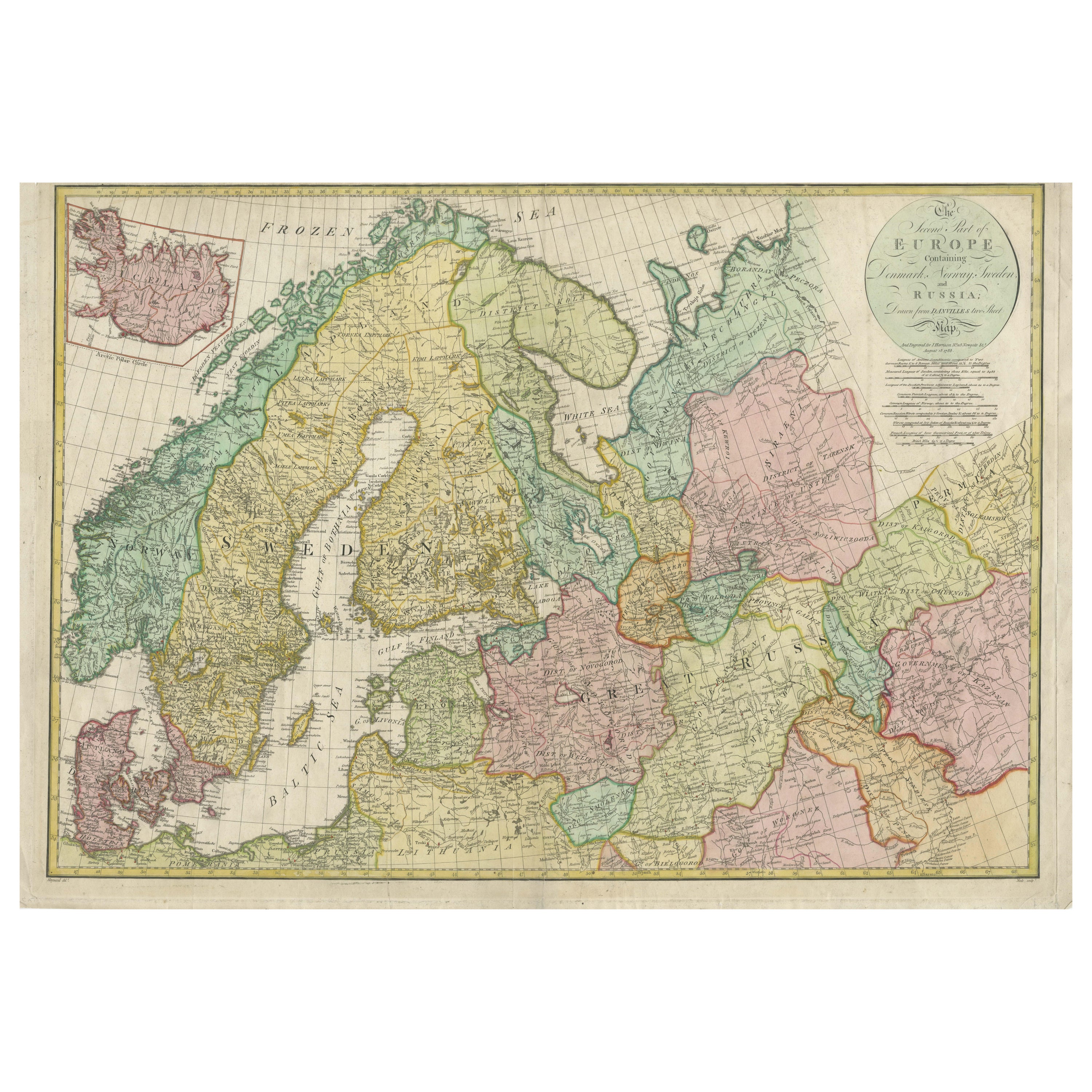
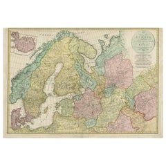
Historical Map of Northern Europe and Russia - Engraved for I. Harrison, 1788
Located in Langweer, NL
Historical Map of Northern Europe and Russia - Engraved for I. Harrison, 1788
This impressive historical map titled A New Map of Europe Containing Denmark, Norway, Sweden and Russ...
Category
Antique 1780s Maps
Materials
Paper
Antique Map of Spain and Portugal by Keizer & de Lat, 1788
Located in Langweer, NL
Antique map titled 'Nouvelle Carte du Royaume d'Espagne (..)'. Uncommon original antique map of Spain and Portugal. This map originates from 'Nieuwe Natuur- Geschied- en Handelkundig...
Category
Antique Late 18th Century Maps
Materials
Paper
You May Also Like
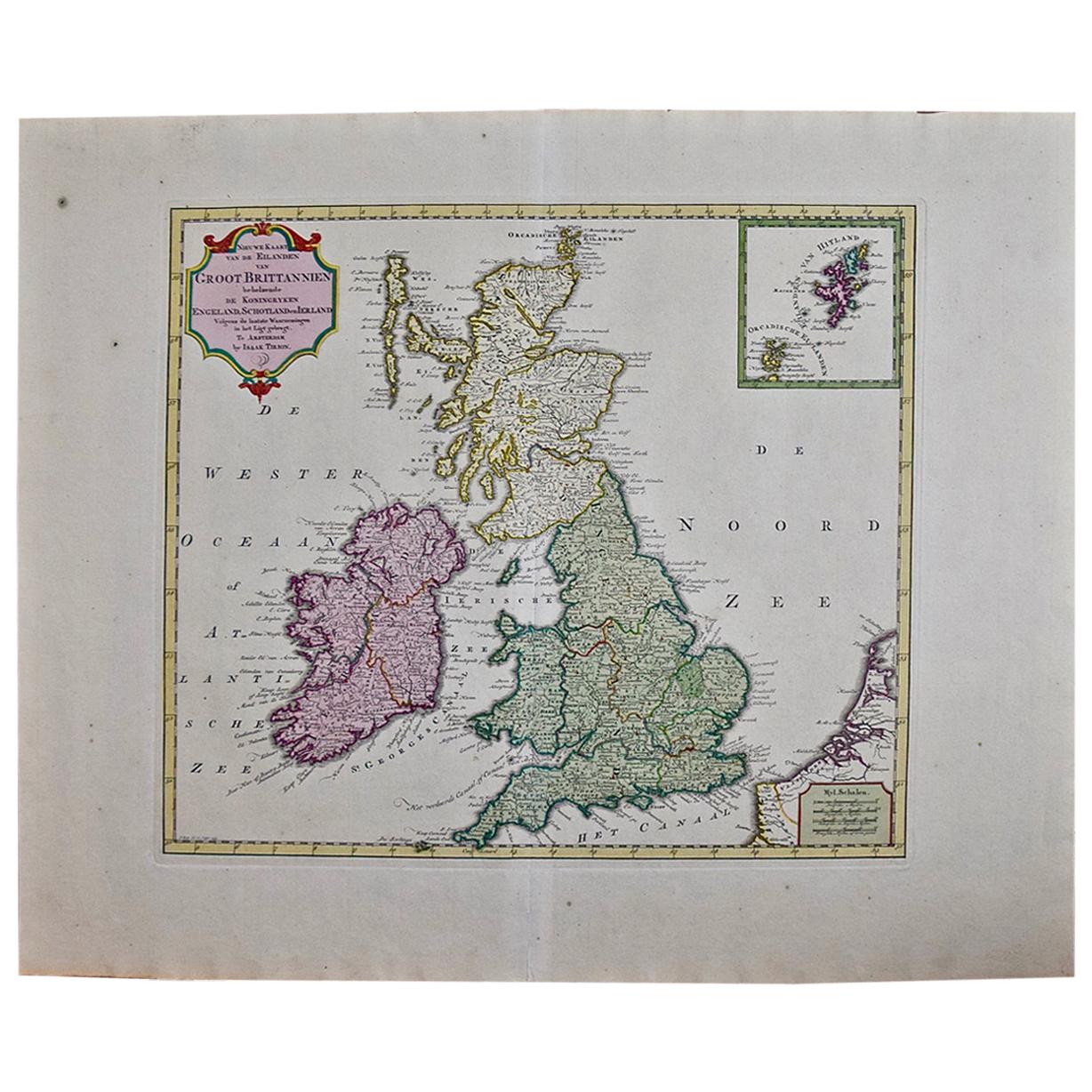
England, Scotland & Ireland: A Hand Colored Map of Great Britain by Tirion
By Isaak Tirion
Located in Alamo, CA
This is a hand-colored double page copperplate map of Great Britain entitled "Nieuwe Kaart van de Eilanden van Groot Brittannien Behelzende de Kon...
Category
Antique Mid-18th Century Dutch Maps
Materials
Paper

County Seats of the Noblemen & Gentlemen of Great Britain & Ireland (Book)
Located in North Yorkshire, GB
A set of seven beautifully bound volumes in morocco red leather with gilt decorations and crest to front and rear. A stunning collection of this pictorial work of British and Irish c...
Category
Antique 19th Century English Books
Materials
Paper
20thC Leather Cased Collection Of Bartholomew Maps Of Great Britain c.1920
Located in Royal Tunbridge Wells, Kent
Antique 20th Century leather-cased collection of Bartholomew British road maps by Edward Stanford Ltd of London. One volume features a map of the entire British Isles, divided into n...
Category
20th Century British Other Maps
Materials
Leather, Paper

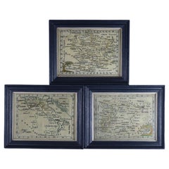
Rare Set of 3 Map Samplers by A Charles. Italy, Spain & France
Located in Chelmsford, Essex
Set of 3 Map Samplers by A Charles. All depict countries, cities, seas and landmarks of the respective countries. The first entitled, 'SPAIN and PORTUGAL'. The second, 'MAP OF FRANCE...
Category
Antique Early 19th Century English Tapestries
Materials
Linen
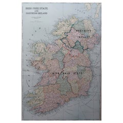
Large Original Antique Map of Ireland. C.1900
Located in St Annes, Lancashire
Fabulous map of Ireland
Original color.
Engraved and printed by the George F. Cram Company, Indianapolis.
Published, C.1900.
Unframed.
Free shipping.
Category
Antique 1890s American Maps
Materials
Paper
Original Antique Map of Ireland- Kerry. C.1840
Located in St Annes, Lancashire
Great map of Kerry
Steel engraving
Drawn under the direction of A.Adlard
Published by How and Parsons, C.1840
Unframed.
Category
Antique 1840s English Maps
Materials
Paper

Recently Viewed
View AllMore Ways To Browse
Antique Japanese Carpets
Antique Meissen Patterns
Antique Side Table With Claw Feet
Antique Silver And Glass Jewelry Box
Antique Silver Glass Jewelry Box
Antique Spiral Leg Table
Antique Table 4 Chairs
Arabia 1970
Ashtray Italy Crystal
Barber Poles
Bauhaus Plant Stand
Bench Public Furniture
Birch Dining Chairs Mid Century
Black Lacquer Wall Panels
Bright Yellow Chairs
Cantilever Leather Dining Chairs
Chinese Lacquer Cocktail Tables
Chinese Lacquered Cocktail Table