Items Similar to 1767 D’Anville Map of the Holy Land: Ancient Divisions and Biblical Geography
Want more images or videos?
Request additional images or videos from the seller
1 of 7
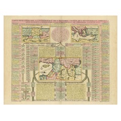
1767 D’Anville Map of the Holy Land: Ancient Divisions and Biblical Geography
About the Item
Ancient Map of Palestine or the Holy Land by D'Anville (1767)
This detailed map, created by the renowned French cartographer Jean Baptiste Bourguignon d'Anville in 1767, depicts the ancient geography of Palestine or the Holy Land. It focuses on biblical and historical features, highlighting the divisions among the Twelve Tribes of Israel, key biblical cities, and significant regions such as Judea, Samaria, and Galilee. Insets include a detailed plan of ancient Jerusalem and the encampments of the Israelites.
The map showcases D’Anville’s characteristic precision and scholarly rigor, reflecting his efforts to provide an accurate representation of ancient territories based on historical and biblical sources. Rivers, mountains, and cities are intricately drawn, with annotations explaining their historical significance.
Condition report: Map is well-preserved with minor edge wear and slight age toning; hand-colored borders intact. Clean surface, no visible tears or significant creases.
- Dimensions:Height: 20.67 in (52.5 cm)Width: 27.76 in (70.5 cm)Depth: 0.01 in (0.2 mm)
- Materials and Techniques:Paper,Engraved
- Period:1670-1679
- Date of Manufacture:1767
- Condition:Condition report: An excellent map that is well-preserved with minor edge wear and slight age toning; hand-colored borders intact. Clean surface, no visible tears or significant creases.
- Seller Location:Langweer, NL
- Reference Number:Seller: BG-13844-21stDibs: LU3054342637962
About the Seller
5.0
Recognized Seller
These prestigious sellers are industry leaders and represent the highest echelon for item quality and design.
Platinum Seller
Premium sellers with a 4.7+ rating and 24-hour response times
Established in 2009
1stDibs seller since 2017
2,418 sales on 1stDibs
Typical response time: <1 hour
- ShippingRetrieving quote...Shipping from: Langweer, Netherlands
- Return Policy
Authenticity Guarantee
In the unlikely event there’s an issue with an item’s authenticity, contact us within 1 year for a full refund. DetailsMoney-Back Guarantee
If your item is not as described, is damaged in transit, or does not arrive, contact us within 7 days for a full refund. Details24-Hour Cancellation
You have a 24-hour grace period in which to reconsider your purchase, with no questions asked.Vetted Professional Sellers
Our world-class sellers must adhere to strict standards for service and quality, maintaining the integrity of our listings.Price-Match Guarantee
If you find that a seller listed the same item for a lower price elsewhere, we’ll match it.Trusted Global Delivery
Our best-in-class carrier network provides specialized shipping options worldwide, including custom delivery.More From This Seller
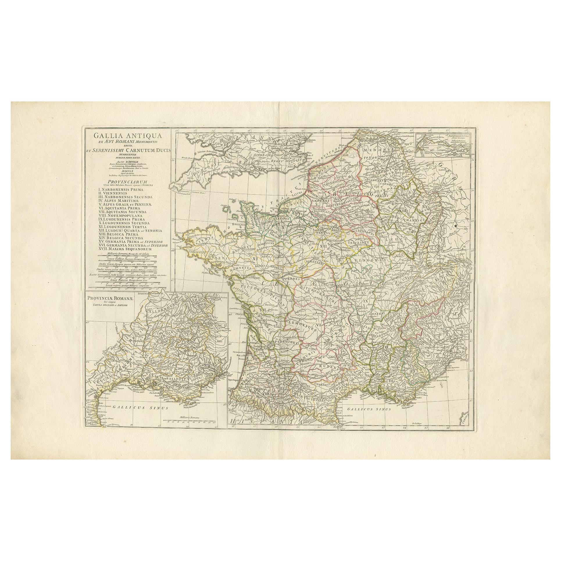
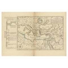
View AllAntique Map of France in Ancient Roman Times by d'Anville 'c.1795'
Located in Langweer, NL
Antique map titled 'Gallia Antiqua ex Aevi Romani Monumentis (..)'. Original, large, map of France in ancient Roman times. Bottom left, a large inset shows Gallia's southern most Rom...
Category
Antique Late 18th Century Maps
Materials
Paper

$650 Sale Price
30% Off
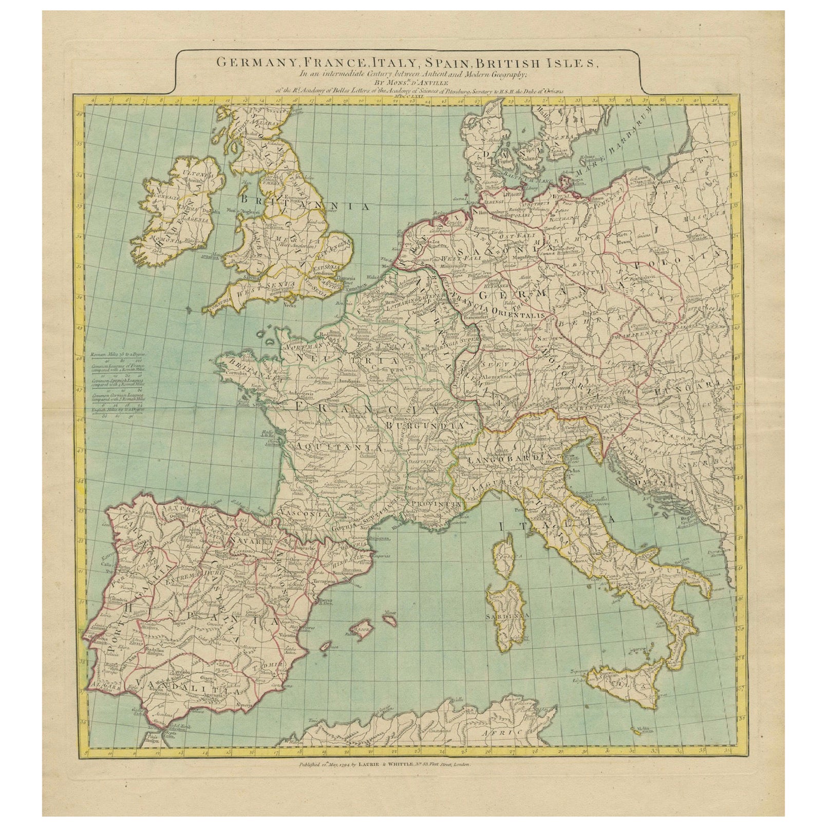
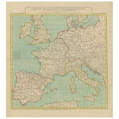
Map of Europe Highlighting Ancient and Modern Geographical Divisions (1794)
Located in Langweer, NL
Map of Europe Highlighting Ancient and Modern Geographical Divisions (1794). Germany, France, Italy, Spain, and the British Isles – Map by D’Anville (1794).
This detailed 18th-cent...
Category
Antique 1790s Maps
Materials
Paper
$1,570 Sale Price
20% Off
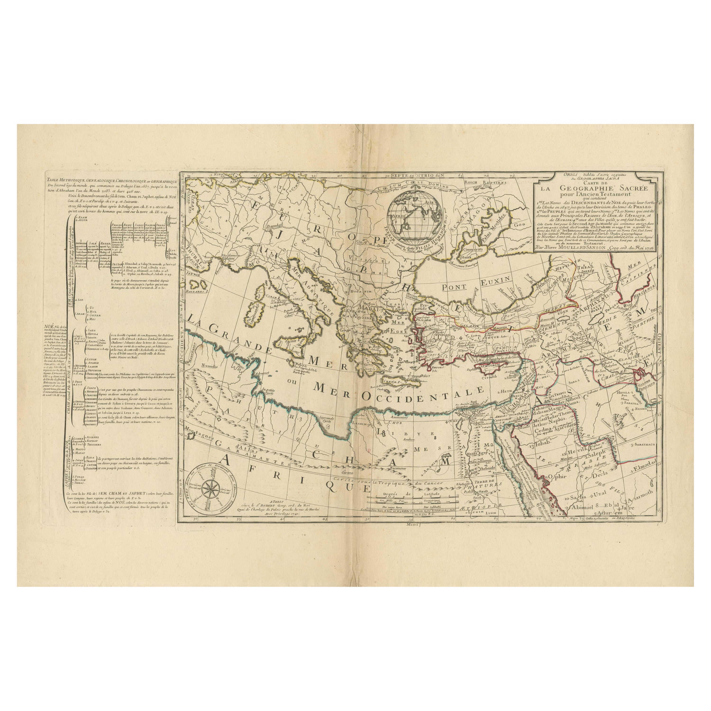
Moullart-Sanson Map of the Holy Land and Sacred Geography of the Old Testament
Located in Langweer, NL
"1716 Moullart-Sanson Map of the Holy Land and Sacred Geography of the Old Testament"
This engraved map, created by Pierre Moullart-Sanson and reissued by Robert de Vaugondy in 1740...
Category
Antique 1710s Maps
Materials
Paper
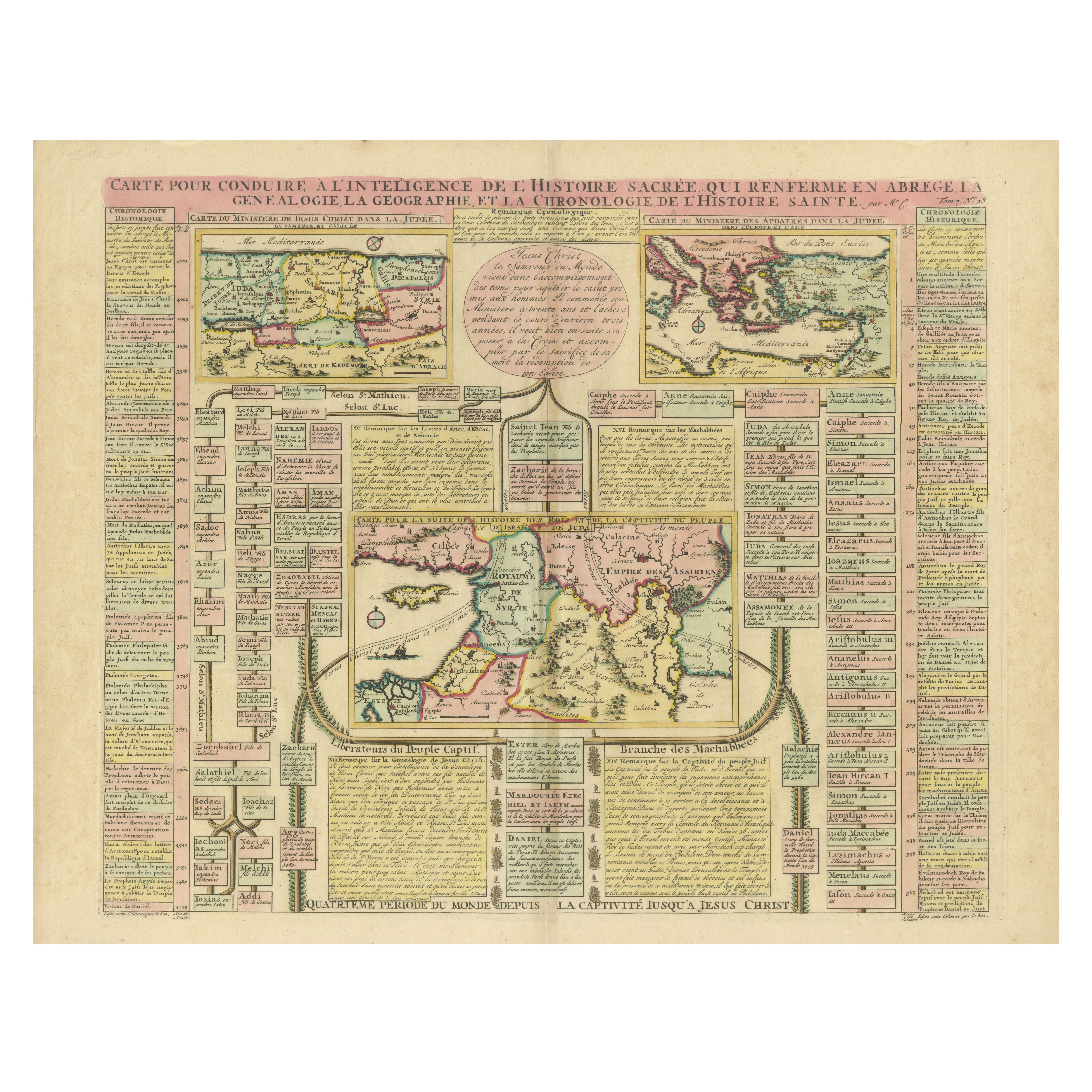
Biblical Map and Family Trees of the Holy Land by Chatelain, ca. 1720
Located in Langweer, NL
Title: 1720 Chatelain Map of the Holy Land with Biblical Family Trees and Chronology
Description:
This fascinating 18th-century folio map by Henry Abraham Chatelain combines geo...
Category
Antique 1710s Maps
Materials
Paper
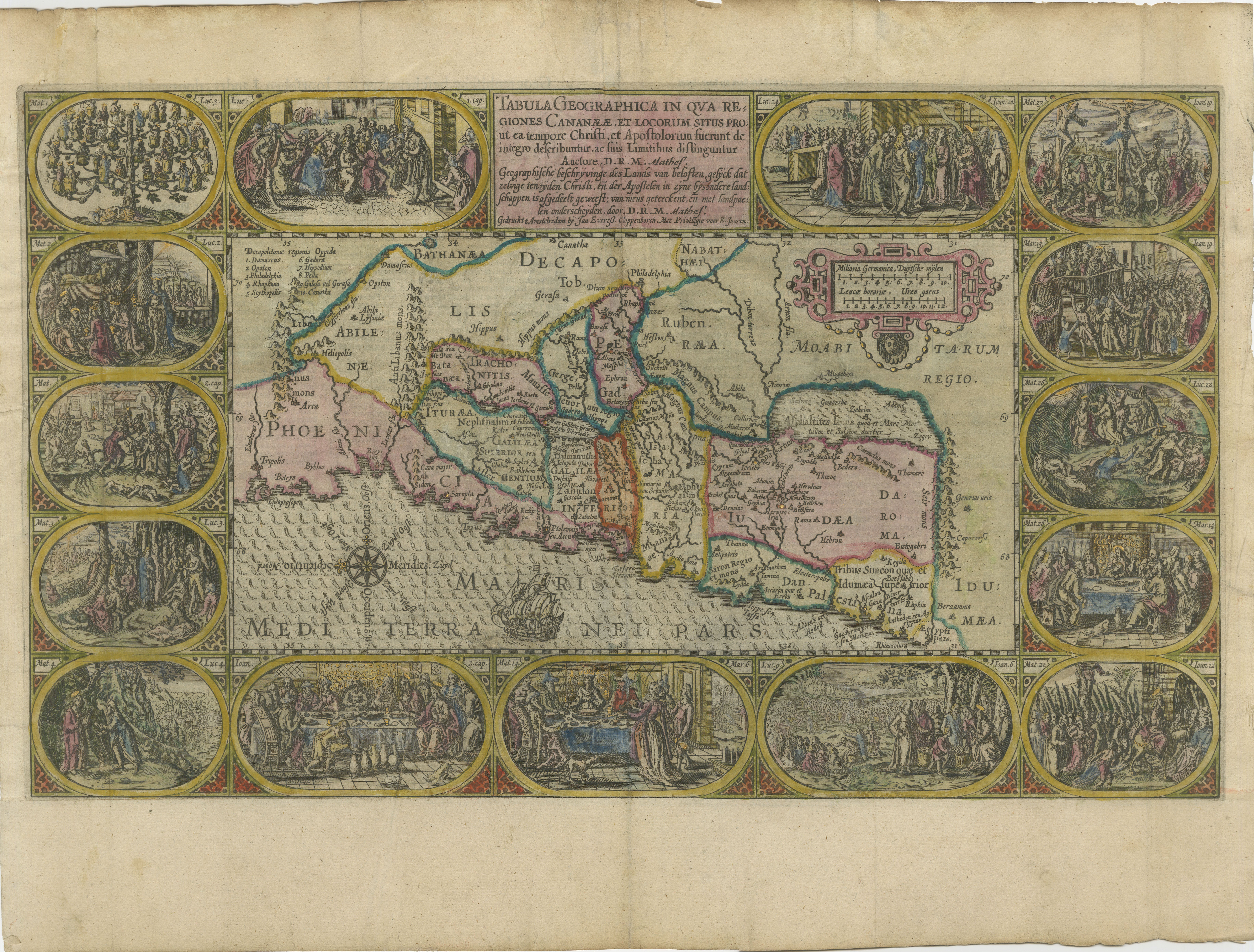
1625 Petrus Plancius / Cloppenburg Map of the Holy Land with Biblical Vignettes
Located in Langweer, NL
1625 Petrus Plancius / Johannes Cloppenburg Map of the Holy Land with Biblical Vignettes
This exquisite 1625 map by Petrus Plancius and Johannes Cloppenburg represents the Holy Lan...
Category
Antique 1620s Maps
Materials
Paper
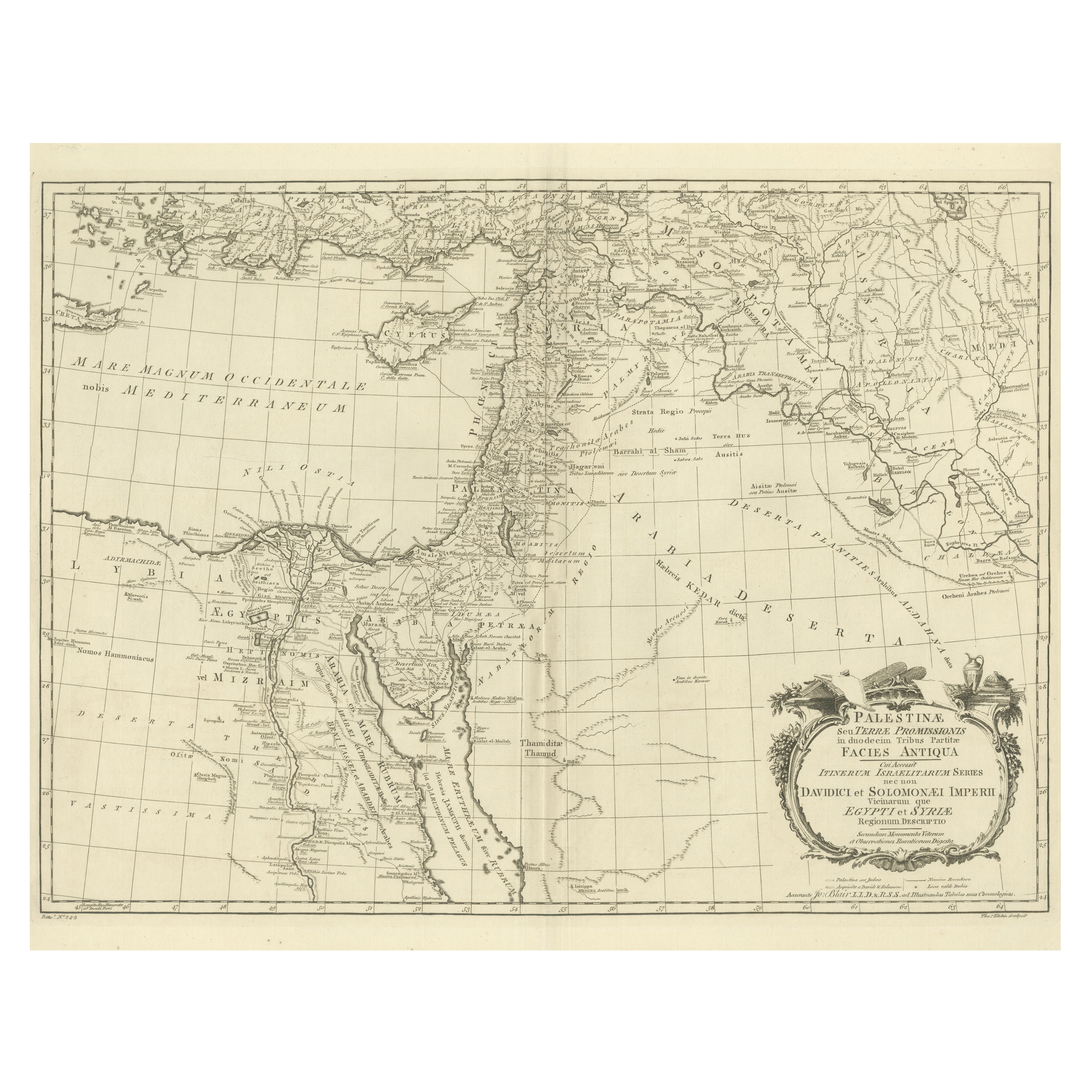
1773 John Blair Map of the Ancient Holy Land: Tribes, Journeys, and Empires
Located in Langweer, NL
Title: 1773 John Blair Map of the Ancient Holy Land: Tribes, Journeys, and Empires
This exceptional map by John Blair, published in London in 1773, offers a richly detailed view o...
Category
Antique 1770s Maps
Materials
Paper
You May Also Like
The Holy Land at the Time of Jesus: A 17th Century Dutch Map by Visscher
By Nicolaes Visscher II
Located in Alamo, CA
This detailed Dutch map entitled "Het Beloofe de Landt Canaan door wandelt van onsen Salichmaecker Iesu Christo, nessens syne Apostelen" by Nicolaes Visscher was published in Amsterd...
Category
Antique Mid-17th Century Dutch Maps
Materials
Paper

The History of the Crusades for the Recovery and Possession of the Holy Land
Located in Middletown, NY
Charles Baudelaire: Souvenirs, Correspondances, Bibliographie, suivie de pièces inédites
Paris: René Pincebourde, 1872.
FIRST LIMITED EDITION - EXTRA ILLUSTRATED
Small 8vo 8 12 x 5...
Category
Antique Early 19th Century French Books
Materials
Gold Leaf
Geographical Antique Map of Principality of Monaco
By Bruno Santini
Located in Alessandria, Piemonte
ST/609 - Interesting antique color map of Monaco Principality in French language : "Carte qui contient le Principauté de Piémont, le Monferrat et la comté de...
Category
Antique Late 18th Century Italian Other Maps
Materials
Paper

Map of the Holy Land "Carte de la Syrie et de l'Egypte" by Pierre M. Lapie
By Pierre M. Lapie
Located in Alamo, CA
An early 19th century map of ancient Syria and Egypt entitled "Carte de la Syrie et de l'Egypte anciennes/dressée par M. Lapie, Colonel d'Etat Major, et...
Category
Antique Early 19th Century French Maps
Materials
Paper

Map Holy Promise Land Canaan Richard Palmer Richard Blome 1687 Joseph Moxon
Located in BUNGAY, SUFFOLK
Canaan comonly called the Holy Land or the Land of Promise, being the Possesion of the Israelites & travelled through by Our Lord & Saviour Iesus Christ and his Apostles. Engraven by Richard Palmer for Richard Blome. 1687
Blome, Richard, 1641-1705. London. 283 x 452 mm. Copperplate.
Probably from an English Bible...
Category
Antique 17th Century British Baroque Maps
Materials
Paper

19th Century Holy Land Mother-of-Pearl Icon
Located in London, GB
This fantastic mother-of-pearl icon was made in Jerusalem at the end of the 19th century, and is beautifully carved with mother-of-pearl and set with abalon...
Category
Antique Late 19th Century Israeli Religious Items
Materials
Mother-of-Pearl
Recently Viewed
View AllMore Ways To Browse
Antique Japanese Carpets
Antique Meissen Patterns
Antique Side Table With Claw Feet
Antique Silver And Glass Jewelry Box
Antique Silver Glass Jewelry Box
Antique Spiral Leg Table
Antique Table 4 Chairs
Arabia 1970
Ashtray Italy Crystal
Barber Poles
Bauhaus Plant Stand
Bench Public Furniture
Birch Dining Chairs Mid Century
Black Lacquer Wall Panels
Bright Yellow Chairs
Cantilever Leather Dining Chairs
Chinese Lacquer Cocktail Tables
Chinese Lacquered Cocktail Table